July 15, 2018 – A long hike culminating with minor scrambling to the summit of the highest peak in the Castle Wilderness.
Though it lacks the dramatic, rocky profile of Victoria Peak, Loaf Mountain is actually the tallest peak within the Castle Wilderness with a summit elevation of 2640 m. There are multiple possible routes to the summit, but I decided to keep things simple. When I visited Bovin Lake last year, I noticed that there was a clearly visible trail that continued past the lake towards the saddle between Loaf Mountain and an un-named high point overlooking Bovin Lake. From the saddle, it looked like a straightforward walk up the ridge to the summit of Loaf Mountain.
Based on my experience last year hiking to Bovin Lake, I was confident that I would be able to drive to the well site beyond the Shell Waterton Gas Plant where the trail would begin. Unfortunately, things had changed in the intervening year, and gates that had previously been unlocked to allow public access after June 15 were now kept locked. I don’t know whether this is a permanent change or not. Long story short, the closest I would be able to park my car was 4 km from where the trail began. Given that I hadn’t been expecting this, I hadn’t brought my bike. I didn’t want to lose the day, though, so I submitted myself to the 120m of extra elevation gain and 8 km of trudging along the road which were now added to the round-trip.
To access the trail from Pincher Creek head south on Hwy 6, turn onto the Shell Waterton Complex Road and drive past the complex. Where the road branches, turn left (Forest Reserve sign) – this is Twp Rd 4-3. Follow this about 3.8 km to Butcher Lake and turn left onto Rge. Rd 1-2a. Drive 1.4 km and turn left onto Twp. Rd. 4-2. Follow that 5km and then turn right. You’ll immediately be faced with the locked gate. Park here and walk or bike 4 km to the trail head. On foot this took me 43 minutes. My firm suggestion is to bike if you can. If you enter these coordinates into Google Maps: 49.248828, -114.059942 it’ll drop a pin on the well site where the trail begins.
The first 5 km of the route follows the trail to Bovin Lake. It’s a very clear trail, out in the open with gradual elevation gain. The views in the valley bottom are pleasant since there are no portions of the trail going through treed areas. At about 5 km, there’s a wide, low fence in place across the trail to prevent motorized traffic beyond that point. Shortly afterward, the trail splits in two, with a double-track heading left, and a single track continuing forward and directly up towards the lake. Take the track heading left, and watch for another, less obvious fork 100m beyond that. Here, it will seem like the path leading directly forward will join the path up to the saddle that you can see in the distance. However, that’s not the case – it will soon veer right and head towards Bovin Lake. Instead, look for the faint trail heading left which immediately crosses over a small creek. This will veer back in line again with the visible trail in the distance that leads to the saddle.
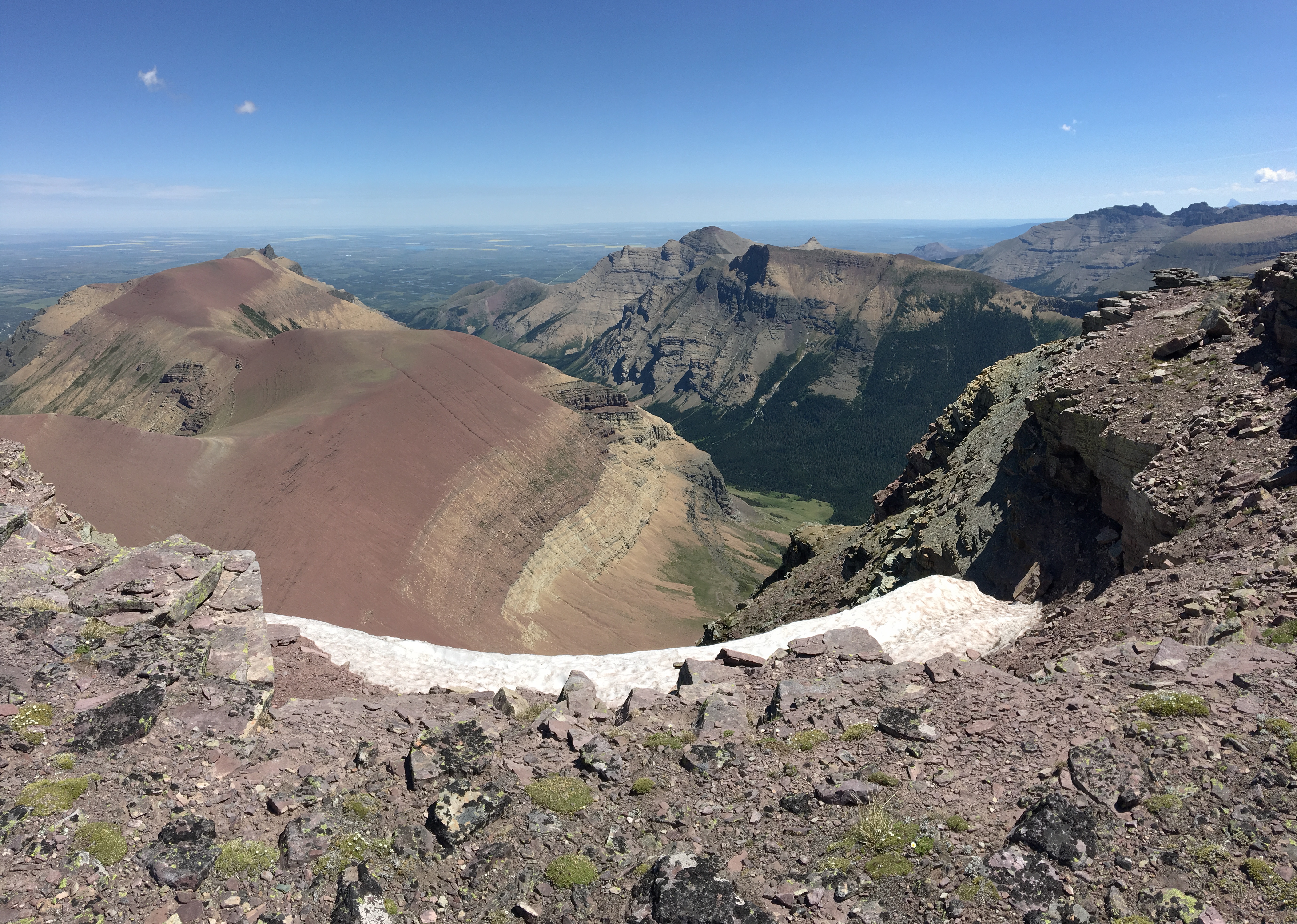
As the trail climbs to the saddle, the grade increases somewhat. Now, in a cut-line on a treed slope, there are neither views nor shade. It’s a short-lived section, though, and the saddle is soon gained along with the first glimpses of the amazing views to come. From my car, parked on the other side of the locked gate, the saddle was 11.2 km distant with 726 m elevation gain. It took 2h 40m to reach there. There were nice views of Sage Mountain on the other side of a broad valley. More impressive were the towering peaks in the far distance to the south, which I realized were in Montana’s Glacier National Park.
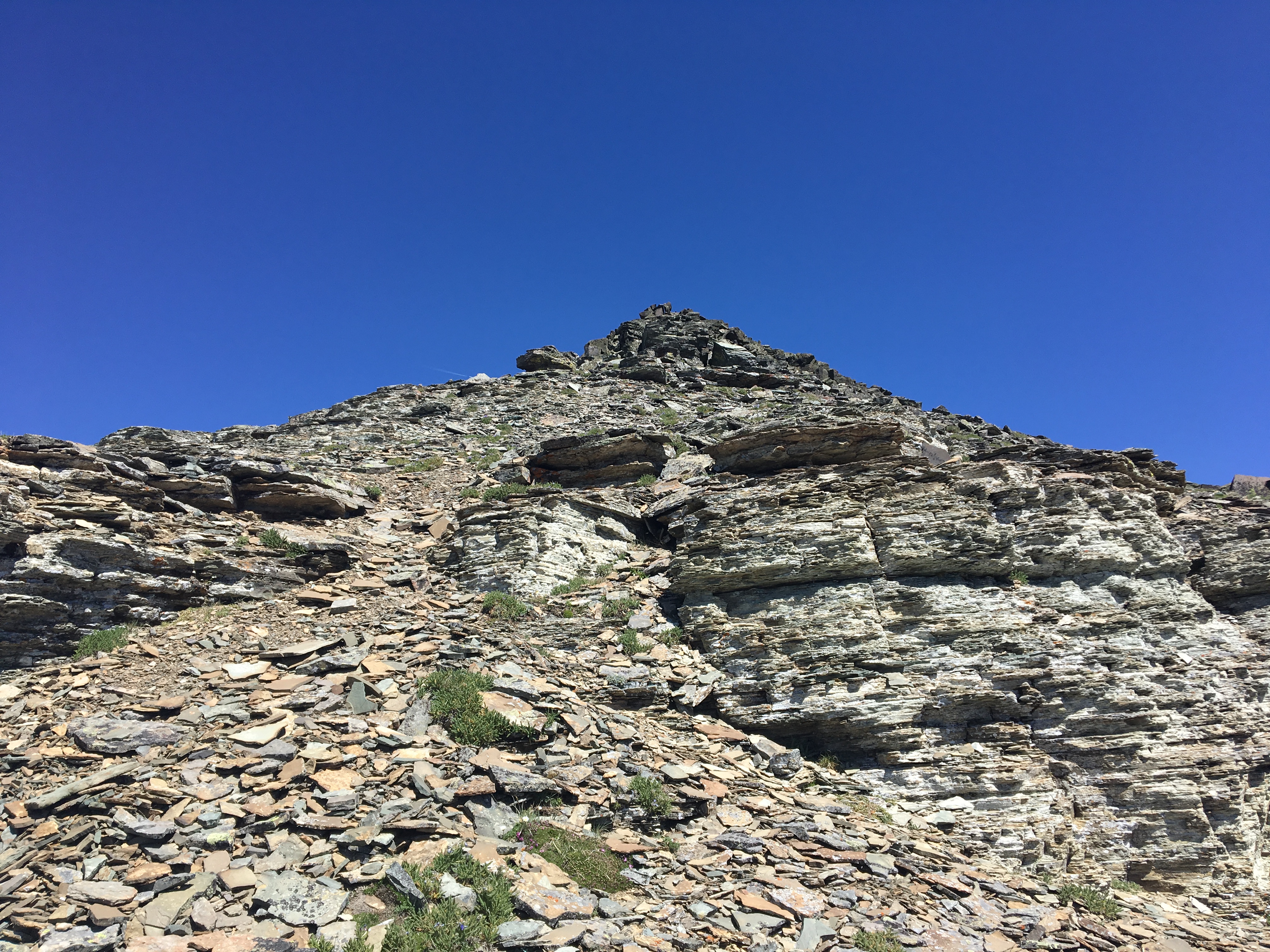
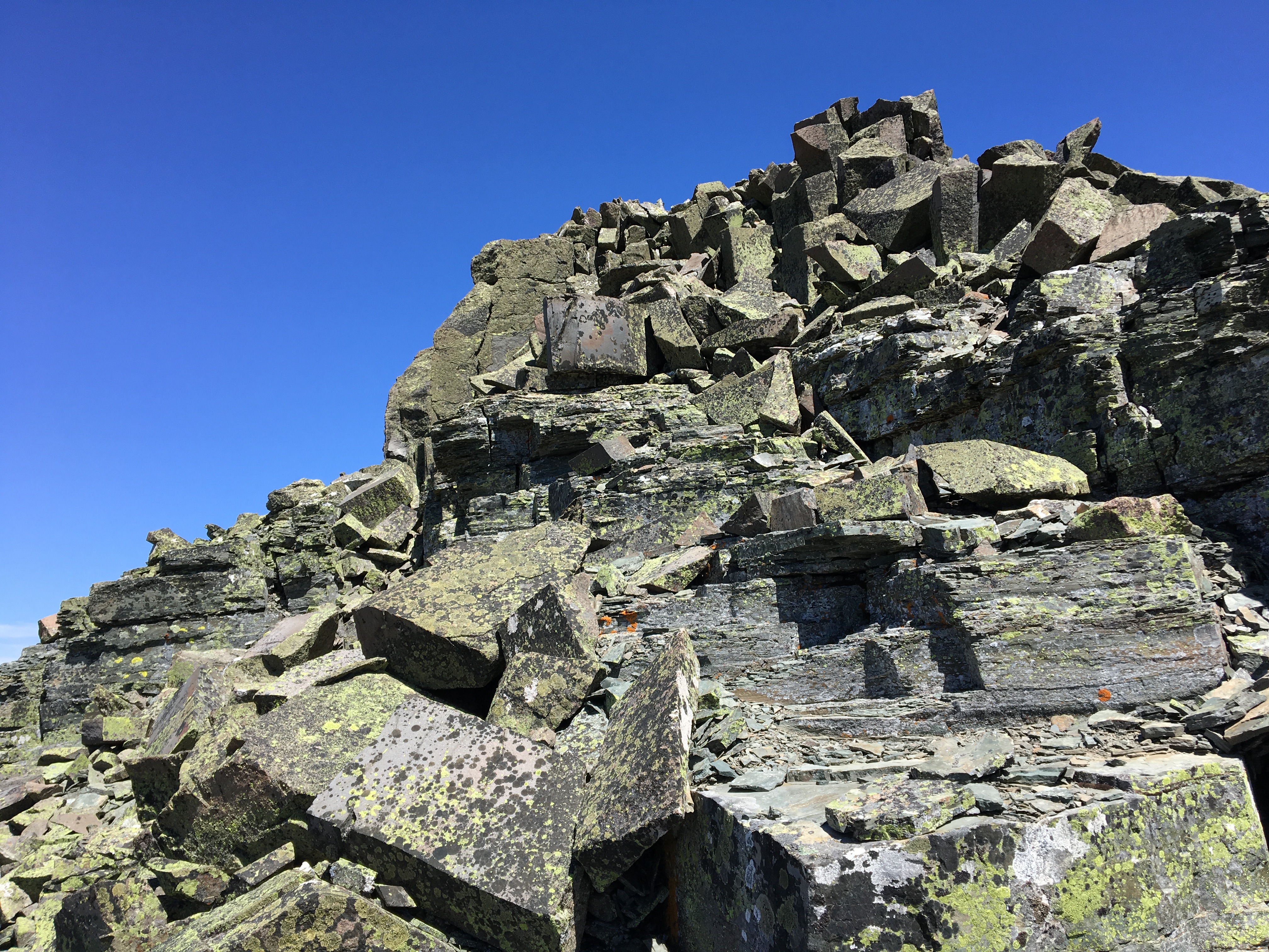
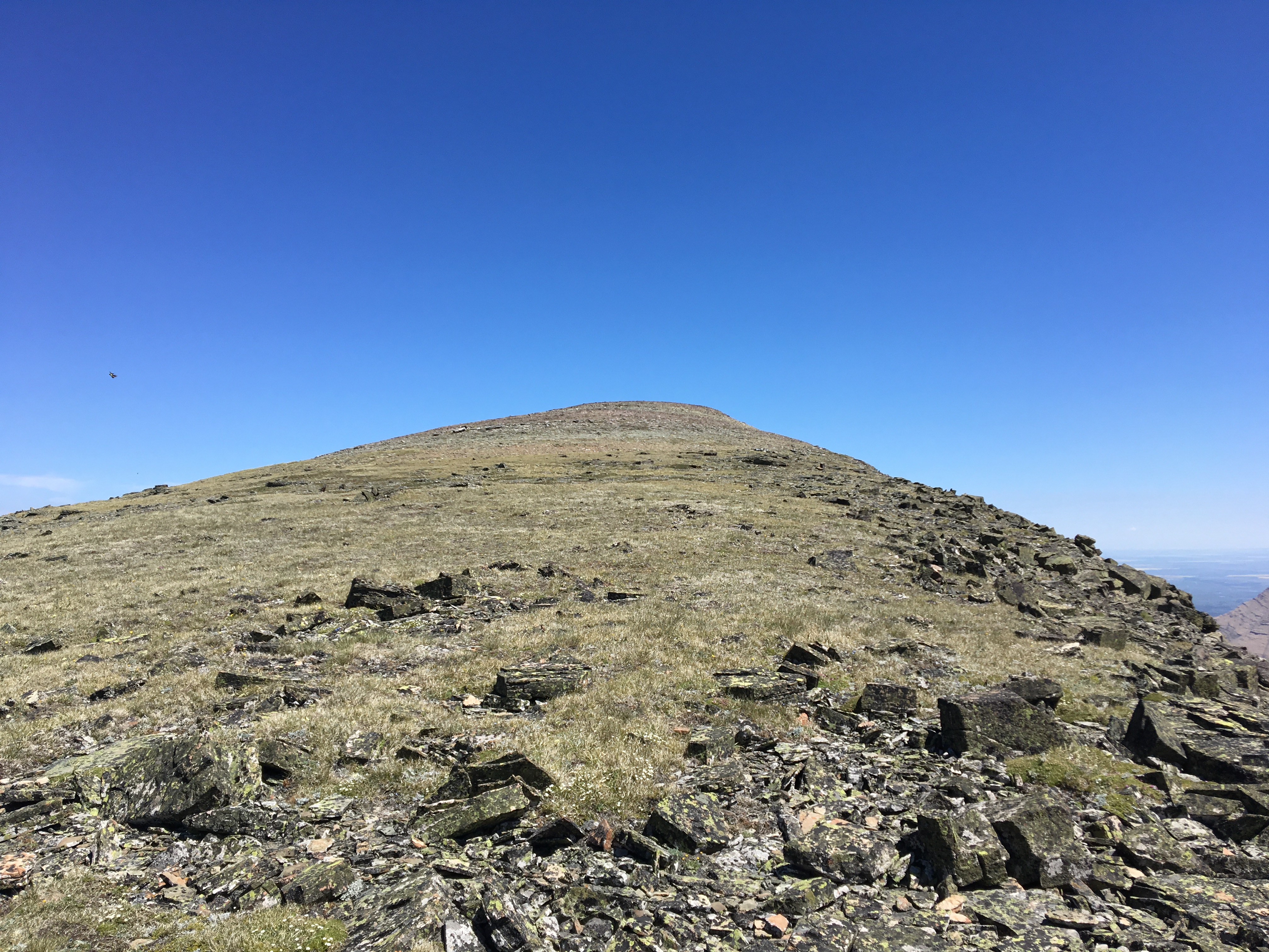
Up on the saddle, there is an evident trail following the ridge line in both directions, with the summit of Loaf Mountain off to the left. Along the way to the summit there is a steep climb up scree to a prominent shoulder, then a short scramble up some boulders to reach the false summit. Finally, there’s a gentle uphill walk to reach the true summit. On the summit, there’s a survey marker, along with 2 small cairns. The omnipresent mascots of the Canadian Rockies, chipmunks, were waiting for me there, as well as clouds of fat black flies. As I huffed and puffed my way up, some mountain sheep nonchalantly came up the sheer face on the far side of the summit. It took 3h 42m to reach the summit.
The day was clear and sunny, so I had great views in all directions. The colourful rock bands characteristic of the Castle mountains looked great. The peaks of Waterton and Glacier stood to the south. To the north and west were more peaks from the Castle region, with the mountains of the Crowsnest Pass visible beyond. Bovin Lake was a small blue jewel cupped in its basin. After a short stay on top, I returned via the same route. The day was hot, and I cursed the bad luck of the locked gate. I was glad to have spent the day outside, but if I’d had a bike with me I’d have been in a better mood by the time I made it back to my car.
The round-trip time was 6h 57m. Total distance 27.8 km. Total ascent was 1,246 m.
Click on the pictures below for full-sized images.


I really enjoy your hiking blog. I’m more on the hiking rather than scrambling end of the spectrum, but your trips have been inspiring, particularly those in Castle. We did this hike this year following something like explor8ion’s route. I didn’t consider any of it scrambling and there wasn’t any true exposure, I suppose, but it still had me nervous in some parts — I am afraid of heights, despite loving the mountains 🙂 Thanks for blogging.
LikeLike
Thank you for your feedback! Glad to hear that you’re enjoying the blog.
LikeLike