May 27, 2018. A bike-and-hike to a backcountry mountain lake in the Crowsnest Pass.
- Region: Crowsnest Pass. Traditional territory of the Ktunaxa, Tsuu T’ina and Blackfoot First Nations.
- Distance: 22 km round-trip (18 km biking, 4 km hiking round-trip distance from the signed trailhead)
- Total Ascent: 632 m (includes a some significant gain and loss during the bike ride); 210m elevation gain on foot from the signed trailhead
- Elevation of Objective: 1980 m
- Total Time: 3h 34m

Window Mountain Lake is mentioned by Joey Ambrosi in the Southern Rockies Trail Guide as one of the best hiking destinations in the Crowsnest Pass area. I’ve previously researched the hike, and did a bit of a reconnaissance of the access road last year. The actual hike can be quite short if you have a vehicle capable of travelling the rough and rutted Atlas Road for 16.6 km from Highway 3 to the turn-off for the lake. The hike’s even shorter if your vehicle is capable of driving the additional 2 km up the much rougher road after the turn, which leads to a small parking area and a sign which marks the official trail-head.
My car is capable of neither of these feats. It’s too bad, since the hike to the lake from the trail-head doesn’t take too long and Mount Ward, which looms above Window Mountain Lake, would be a good scrambling destination to make a longer day of the hike (2020 UPDATE: I would later return and climb Mount Ward. You can find the report here). Because of my vehicular limitations, I decided to throw my mountain bike into my car and turn this excursion into my first hike ‘n bike. From my prior exploration of the Atlas Road, I knew that I could comfortably make it to the parking area for the Crowsnest Mountain scramble, about 9.7 km from Highway 3. From there I could bike the rest of the way to the trail-head.
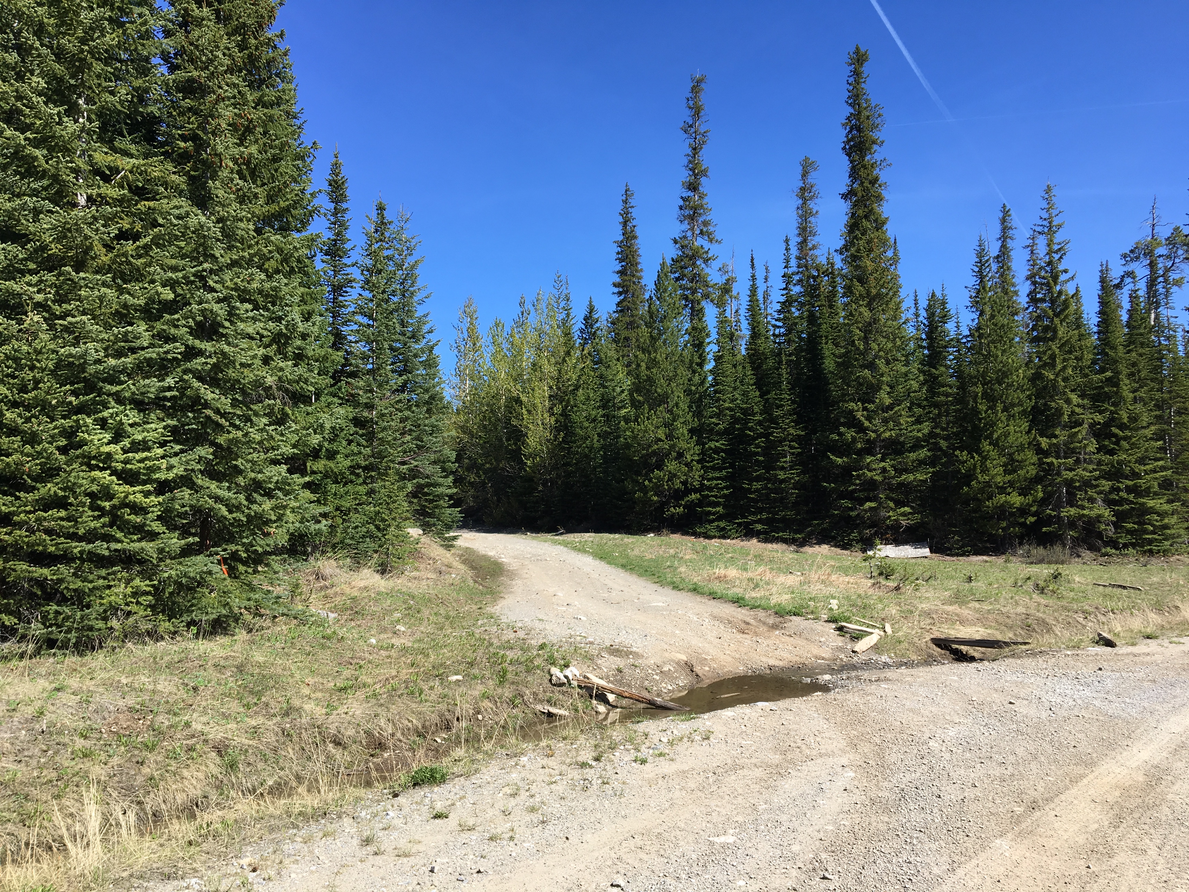
Access to the area is via Highway 3. If you’re coming in from the east, follow the highway 4 km west past Coleman then turn north onto Alison Creek Road. This is 0 km for the distances I reference in the paragraphs above. The road is paved for a short distance, then becomes a rough, unmaintained road. If you have a capable off-road vehicle and the skill to drive it, you can carry on all the way to the “official” parking area. It’s at 49.7682948, -114.6144461. Google Maps can drop a pin right on it and give precise directions. I pulled over and parked at the small pull-out at the start of the Crowsnest Mountain scramble (at about 49.712188, -114.606488) and started peddling my bike.
The bike ride was a lot of fun. A crappy rough road for a car makes for a wide, easy-to-follow bike trail. The roughness of the road did mean that I had to pay close attention to the line I was taking but, nevertheless, biking gave me a chance to enjoy the mountain ambiance much better than driving would have. The views along Atlas Road are amazing. I’m a little surprised that nobody else was biking that road. I didn’t see any wildlife, but there were plentiful elk tracks and droppings as well as one set of bear tracks in the mud. On my return ride I saw some fresh bear scat.
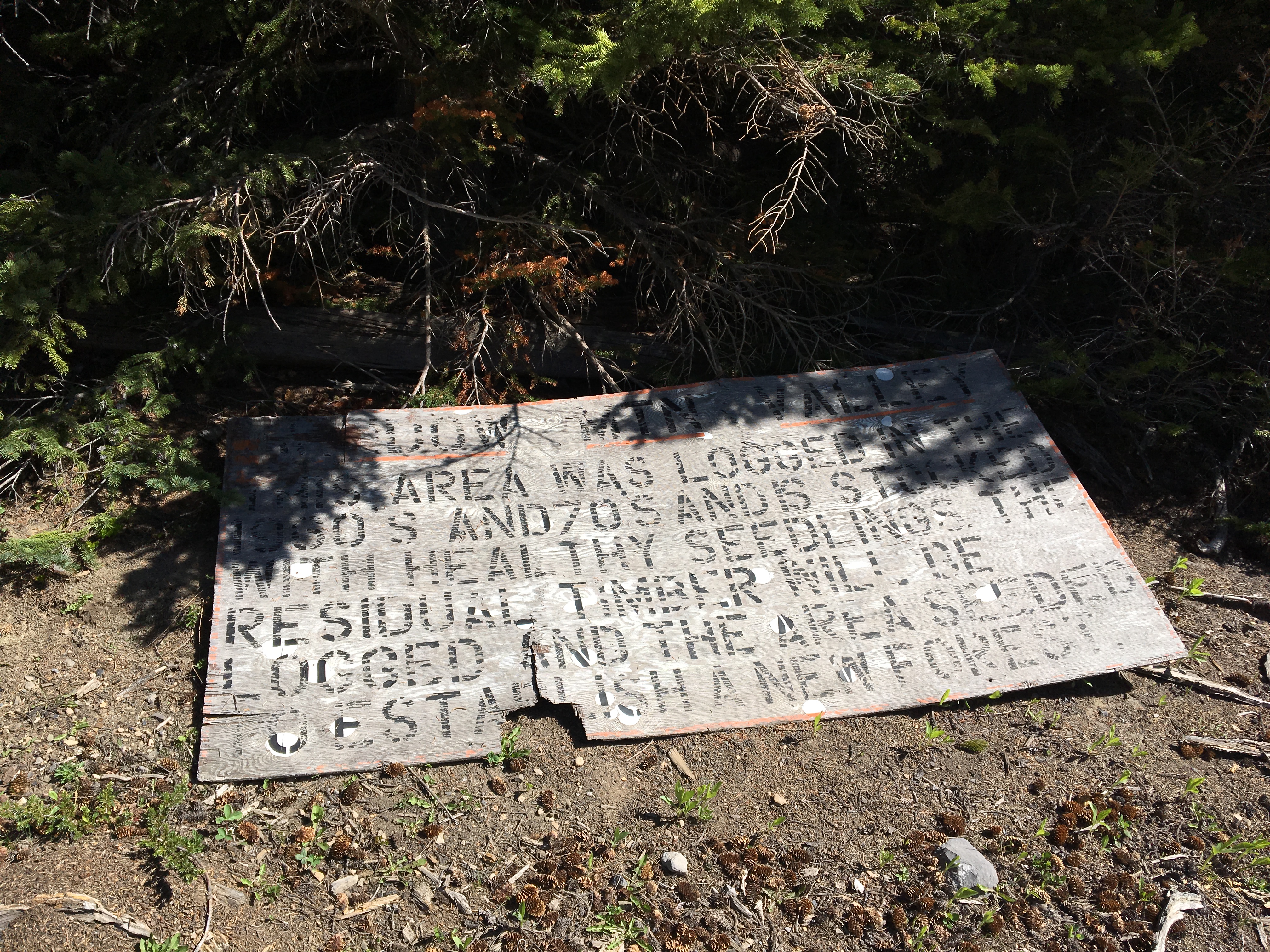
The ride involved a little over 170 meters of elevation gain, followed by some very welcome down-hill riding. After about 7 km of cycling from my parking spot (16.6 km total distance from Hwy 3) I found the turn-off onto the rough dirt road heading towards Window Mountain Lake. This road was manageable on a bike though there was steady climbing. I eventually encountered a huge puddle, draining off the side of the road, being fed by a steady broad stream of water coming right down the road above. 2 km from the turn-off I found the parking area along with a nice sign with information and directions for Window Mountain Lake. I stashed my bike and traded my helmet for a hat, then I started up the hiking trail.
The water was coming down the trail very steadily. It was like walking up a creek bed. The cool splashing water and the bright sun made for a great ambiance. Eventually the trail dried out and reached a fork. The route to the lake requires bearing right at this point. Helpful hikers have lined up some rocks across the mouth of the leftward branch to cue you not to go that way. There are also several rocks with “WML” spray painted on them to show you the proper way to go.
Not long after, the wide and rocky trail turns into a narrow dirt trail and begins a fairly steep climb through some trees. The climb isn’t too drawn out, but is steep and has a couple areas with tricky footing. The trail eventually levels and descends slightly as it nears the lake. There was still a fair amount of snow on this final stretch. It was thigh-deep in places, but it was early enough in the day that it hadn’t warmed too much so, for the most part, it would support my weight. I did have some trouble figuring out the proper way to proceed through a wide snow-filled depression just before the lake. After a bit of wandering I figured it out and found where the trail emerged beyond that point. The trail then passed to the right of a shallow pond before finally arriving at Window Mountain Lake.
The hike is a popular one. Very soon after I arrived several more parties turned up. The lake is popular for anglers, and it looks like back-country camping is permitted there. There were signs pointing towards a bivy, but I didn’t investigate it.
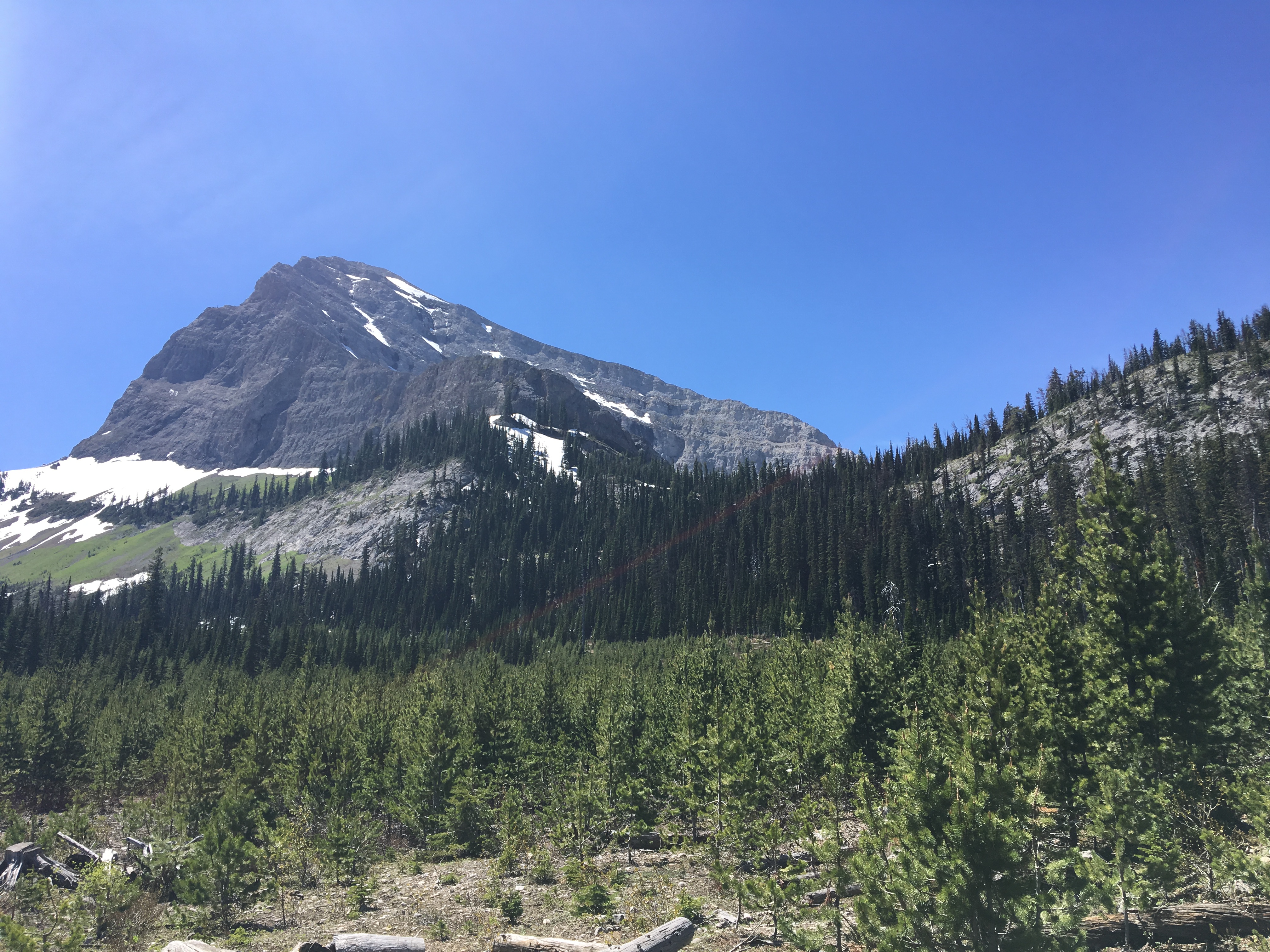
The lake had broken ice chunks along the shore, but was mostly thawed. There is a trail that goes all the way around, but I didn’t make the full circle because of steep slopes of snow extending all the way to the water’s edge that were visible on the far side of the lake. The scrambling route to Mount Ward starts off at the far end of the lake. On that day there looked to be too much snow to attempt it. To be honest, even if there hadn’t been any snow I wouldn’t have tried it. Bicycling on mountain roads uses a different set of muscles than hiking. My legs were tired! Instead, I enjoyed the ambiance and ate my lunch before returning back the way I came.
Click on the pictures below for full-sized images.


Nice post but it is hard to believe that you didn’t include a picture of the hole in the mountain, you know, Window Mountain Lake.
LikeLike
It’s not so hard to believe…the “hole in the mountain” isn’t visible from the lake. You need to ascend to the ridge west of Mount Ward before it’s visible. There are several pictures in my Mount Ward post.
LikeLike
Yes, that’s true, but the hole is clearly visible from the road on the way up to the mountain. Of course you would be viewing it from the other side of the lake but you wouldn’t have had to hike at all.
LikeLike