August 24, 2019. A journey to one of the gems of the Crowsnest Pass.
- Region: Crowsnest Pass. Traditional territory of the Ktunaxa and Blackfoot First Nations
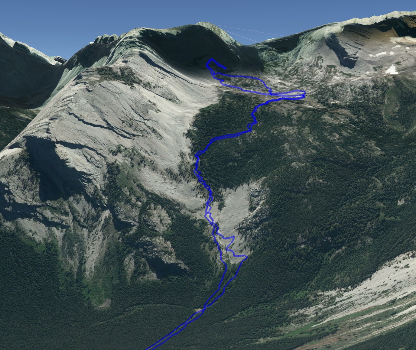
- Distance: 7.5 km one-way to the lip of the hanging valley, 19 km round-trip including exploring in the valley
- Total ascent: 710 m to the lip of the hanging valley, 900 m including exploring in the valley
- Elevation of objective: 2100 m at the lip of the hanging valley, 2265 m at viewpoint near Cleft Cave
- Time: 2h 12m to the hanging valley, 5h 35m round-trip
- Safety and Disclaimer

About 10 km south of Highway 3, just before the highway crosses from Alberta in to BC, there’s an area which locals refer to as The Promised Land. I’ve seen it referred to as the Ptolemy Plateau as well, but it’s not really a plateau – it’s more of a hanging valley, or cirque. In any event, it’s an amazing place. About 19 years ago I went up there with two friends to check out one of the caves. The cave was fun to explore, but it was the beauty of the valley which left a bigger impression. I decided it was time to go back and explore it again.
I haven’t found any good explanation as to the origin of the name. My guess is that, if you’ve never been there before, you need a good reason to slog along a valley bottom for 6 km before abruptly climbing 500 m in 1.5 km. I can imagine friends prodding their companions along with the promise of the amazing landscape that awaits.
Access is via Highway 3, west of Coleman. If you’re driving from the Alberta side, there’ll be a sign pointing to the “Ptolemy Trailhead” just before reaching the BC border. Find the intersection by using Google Maps to drop a pin on 49.626550, -114.671854. After the turn, there’s a gravel road that heads south. The road is a little rough, but it’s an amazingly smooth surface as compared to the awful Atlas Road, which leads to Crowsnest Mountain and Window Mountain Lake. I had no problem driving it in my car. Roughly 3 km from the turn, a small sign marks the trailhead on the south side of the road. The road is the same which I snowshoed up to ascend the south slopes of Island Ridge in 2018.
The route is quite obvious over its entire length. The first 6 km it involves only a gentle ascent. The walk is a bit tedious, but it’s punctuated by no less than 9 crossings of Ptolemy Creek, the first of which happens immediately at the trail head. There are no bridges. During my trip the creek wasn’t particularly high. I was able to walk across rocks in most cases, although some of the rocks were a little slimy and I ended up sliding into the water. Most of the crossings had some tree trunks lying across the creek a short way upstream or downstream. Most were several feet above the water. I avoided most of those – I didn’t mind getting my boots a little wet, I really didn’t want to fall any distance if I slipped off a log.
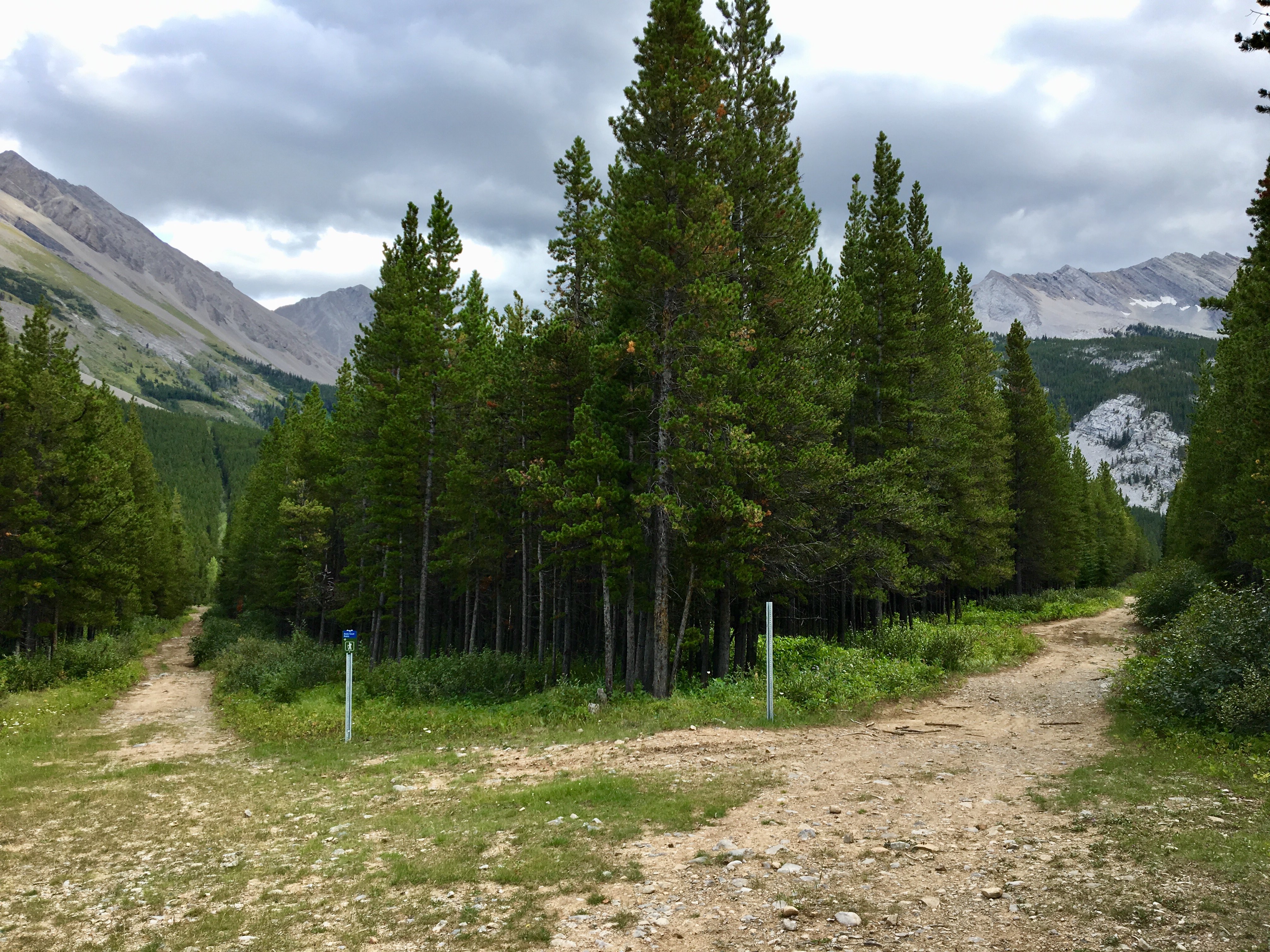
At about 5 km along the trail, there’s a small clearing which is sometimes used as a campsite. The trail splits here, with a branch heading left (south-east) towards the Andy Good Basin – there’s a little sign point the way. The route to The Promised Land carries on straight ahead. There’s a sign post next to that trail, too, but there’s no sign on it at present. The trail eventually reaches another small clearing with a little orange hiking trail sign pointing the way onto a narrow trail in the trees.
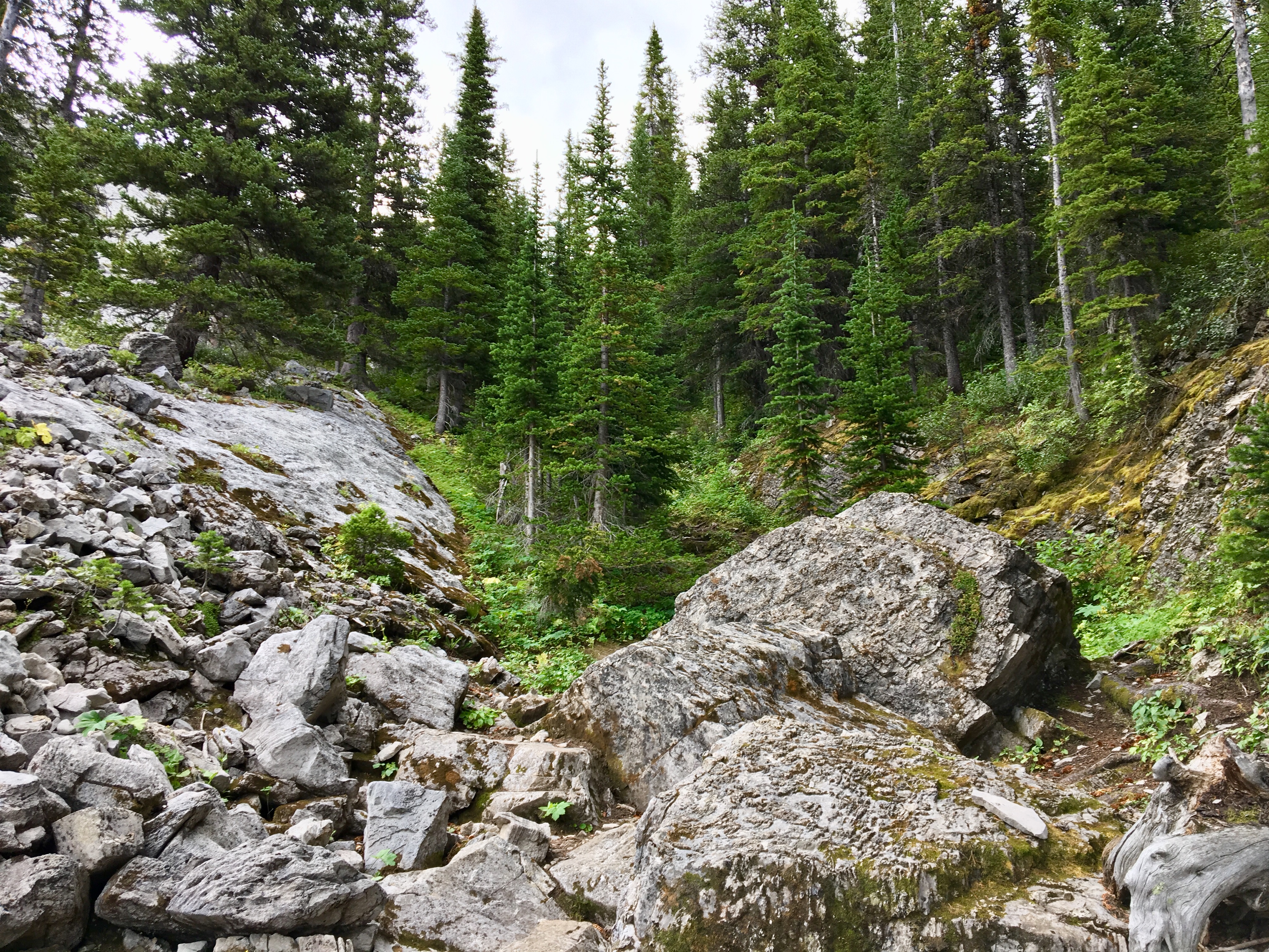
Hereafter the trail starts to ascend steeply for the next 1.5 km, before finally levelling out again at the lip of a hanging valley. From there the views into the Promised Land start to open up.
It’s hard to come up with appropriate adjectives to describe the place – it’s sufficient to say that it’s amazing. The terrain is irregular and rubble-strewn. There are small caves and sinkholes at the valley bottom, and entrances to larger cave complexes (Cleft and Gargantua) up on the steep valley walls. I encountered at least one “skylight” on the valley floor, a dark hole dropping down 10 meters or more to a cave below. It’s important to watch where you’re stepping, and snow-cover could make the place dangerous.
I saw a high-point on the valley wall which was nearby the mouth of Cleft cave. I decided to make that my objective for the day. The high-point proved to be a moss-covered ledge which provided an excellent view of the whole area.
On my way down I encountered a party of cavers on their way up to Cleft. Aside from that I had the place entirely to myself. The long approach up the valley is probably the biggest reason this place isn’t swarmed by visitors. That’s probably a good thing.
Click on the pictures in the gallery below to access full-sized images.


Would this be considered the Alberta or BC route?
LikeLike
This route is entirely within Alberta.
LikeLike
Many thanks for this! Your photos provide an excellent aide memoire for me. The son of Canadian karst geomorphologist Professor Derek Ford, I remember spending a summer camping on the plateau in the 1970s while he and his team explored the caves in the region. I was in the party that discovered the Yorkshire Pot – deepest cave in Canada at the time – and also joined in exploring Gargantua, another find of ours. Beautiful country and a treat to reminisce all the incredible hiking we did throughout the area. Thanks again, Owen Ford
LikeLiked by 1 person
Thanks for the message! It’s amazing to hear from someone who was involved with the early exploration of the area.
LikeLike
Wow thank you for this! Just did it. Will go back for more exploration and Andy Good. Have you been that way?
LikeLiked by 1 person
Thanks for reading! Haven’t been back in years but I’m planning to eventually do the loop through the Andy Good plateau
LikeLike
Way cool! I’d love to do that also. Going to Andy good basin today. Smoke in fernie is horrific. Towards the pass isn’t bad.
LikeLike
Is there any water up on the plateau? Lakes? Streams? Ponds?
LikeLike
None that I recall (it’s been a few years since I went up there). No water sources after the final creek crossing.
LikeLike
Great looking place! In your opinion, would the first 5km up to the fork in the trail be navigable by bike?
LikeLike
It has been a few years since I was up that way, so this isn’t current knowledge, but I think a strong cyclist could probably be biking most of the time.
LikeLike