September 12, 2018. Two easy hikes connected by an picturesque village stroll near St. John’s Newfoundland.
- Region: Signal Hill National Historic Site. Traditional territory of the Beothuk people
- Distance: N/A
- Total ascent: N/A
- Elevation of Objective: 160 m (the max elevation, attained at Ladies Lookout)
- Hiking time: N/A
(My usual route-mapping apps weren’t working on this day)
I had never been to Newfoundland before this September. I had looked at it as a summer vacation destination a few times, but getting to Canada’s most easterly province from Alberta is a time-consuming and expensive matter. This year, though, I had a conference in St. John’s. I registered and booked flights to get me there early so I could do some exploring.
Of course, the province of Newfoundland and Labrador (the official name, for you non-Canadians) is gigantic. It’s bigger than Norway, and just a little smaller than Sweden. Any proper exploration will have to wait until some distant day when I have a lot more free time. I did have a good chance to get to know the harbour-side area of St. John’s, though, and I managed to do a bit of hiking. For my first outing, I made my way to a pair of easy hiking trails. One climbed up to the summit of Signal Hill National Historic Site. The other was a portion of the East Coast Trail, leading to a rocky precipice overlooking the entrance to Quidi Vidi harbour.
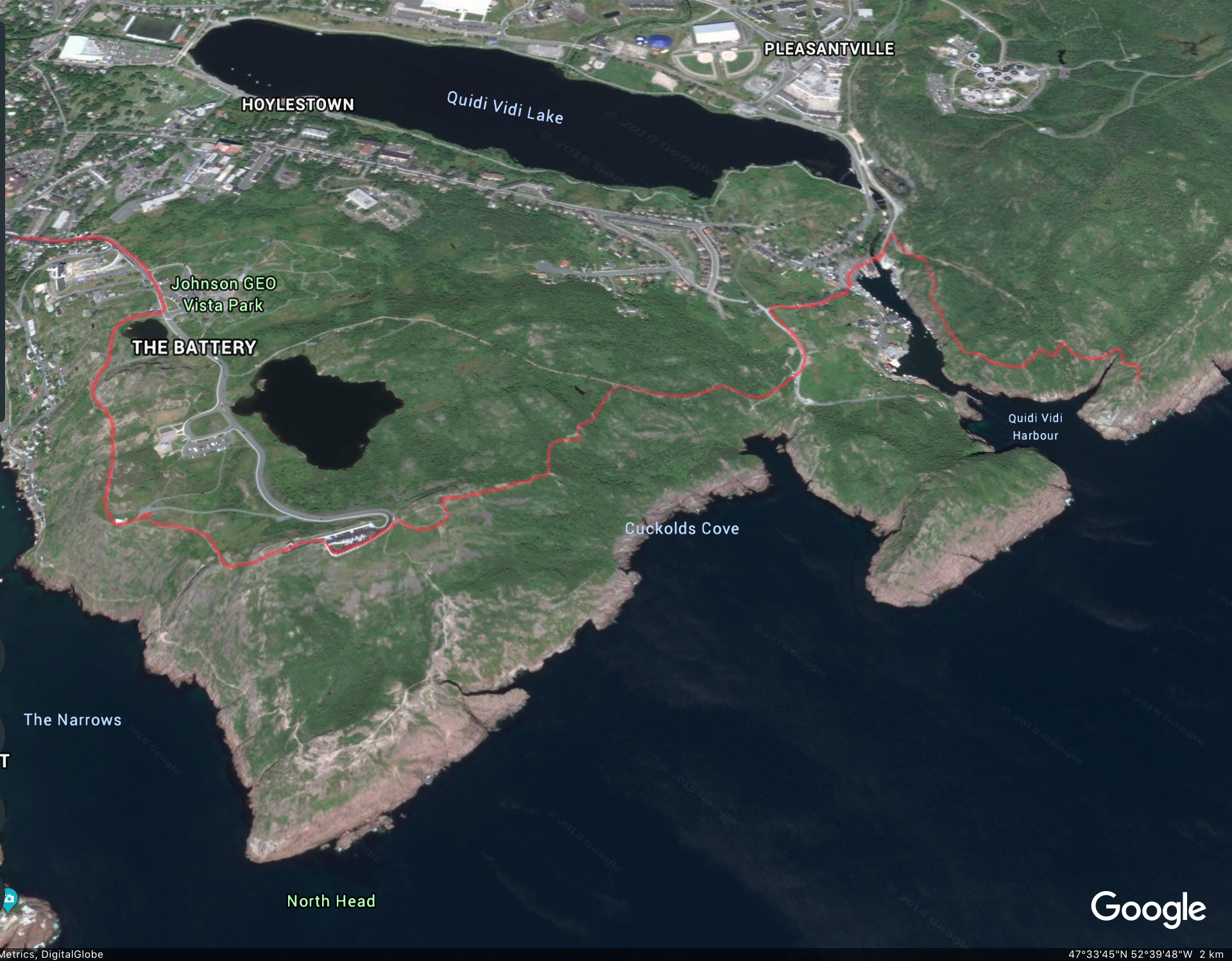
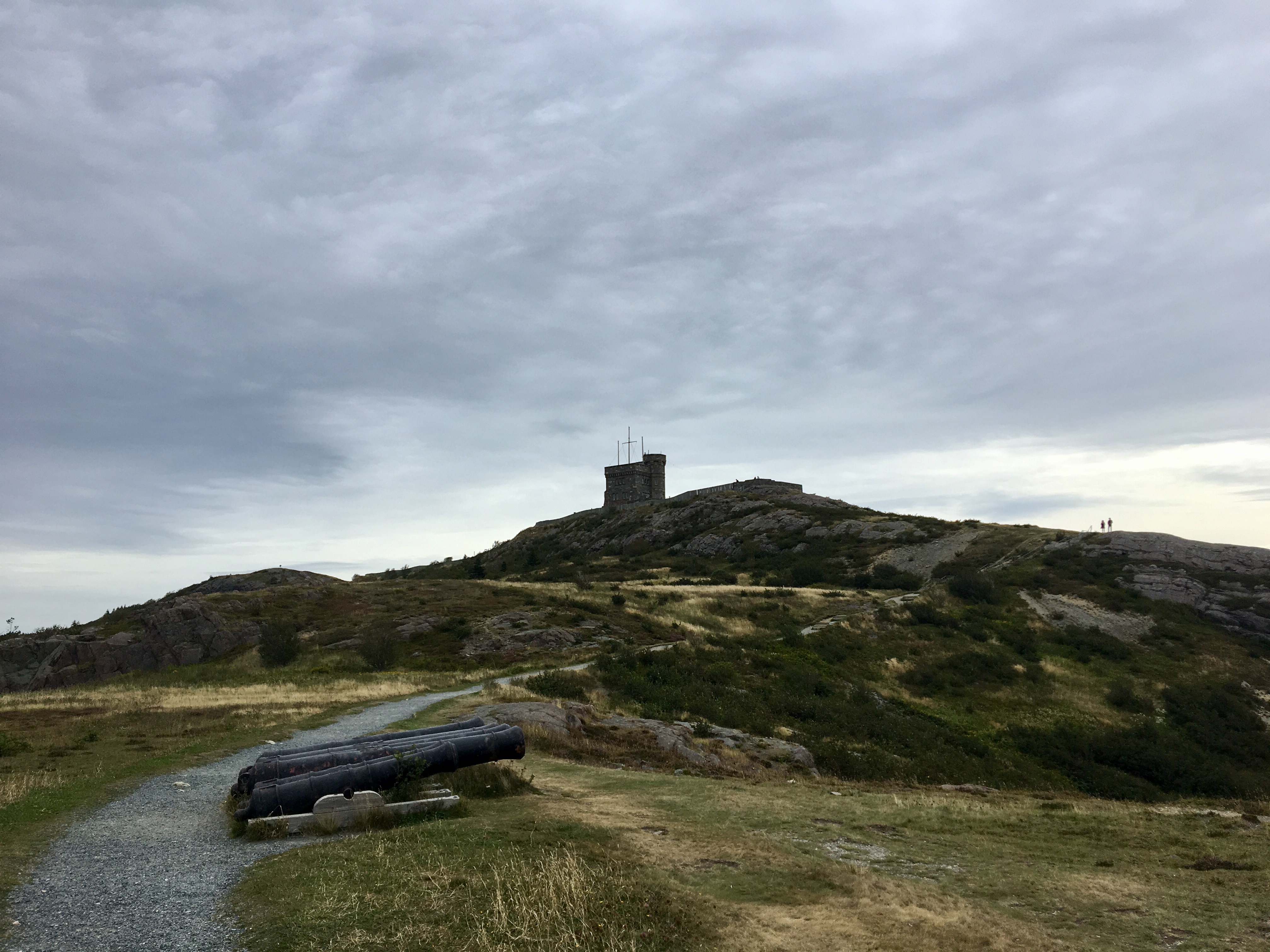
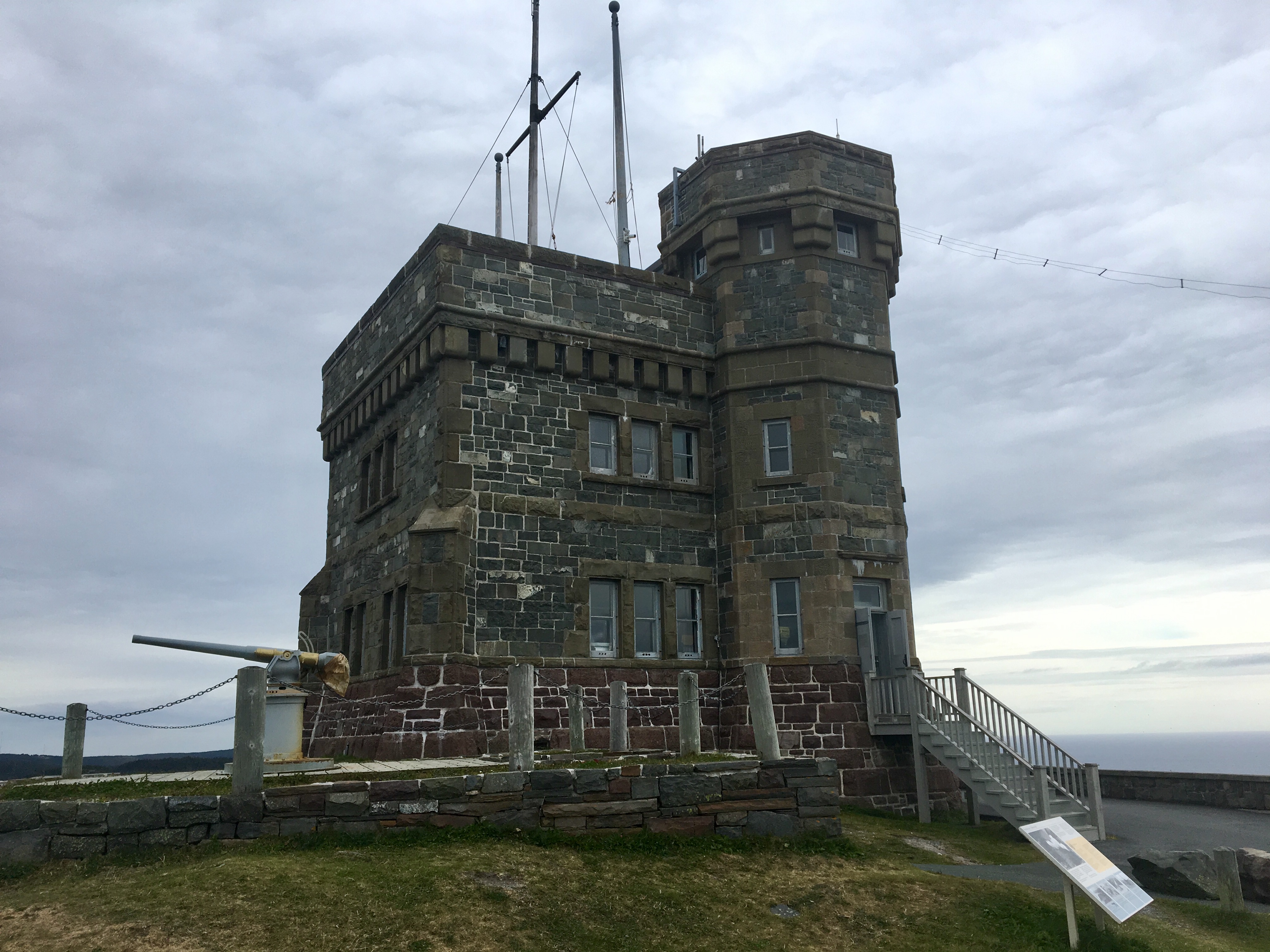
Signal Hill is the name of the rocky promontory overlooking the inlet to St. John’s harbour from the north. Almost as soon as there was permanent European settlement in the area, the strategic importance of the hill was evident and it has been the site of military activity for centuries. In 1898, Cabot Tower was built atop the hill to commemorate the 400th anniversary of John Cabot’s arrival in Newfoundland. There’s a plaque inside the tower speaking of Cabot’s “discovery” of Newfoundland. But, given that the Vikings had arrived about 500 years before him, and the the First Peoples about 9000 years before that, he only “discovered” it in the same sense that I “discovered” David Bowie in the early 2000s.
The hill and tower are visible throughout the city of St. John’s, and there are a few different ways up to the top. A road goes all the way up, and you can walk along that. There are also a number of trails going to the top. I followed the road to a place called “Deadman’s Pond” then I left the road, picked a trail and climbed up.
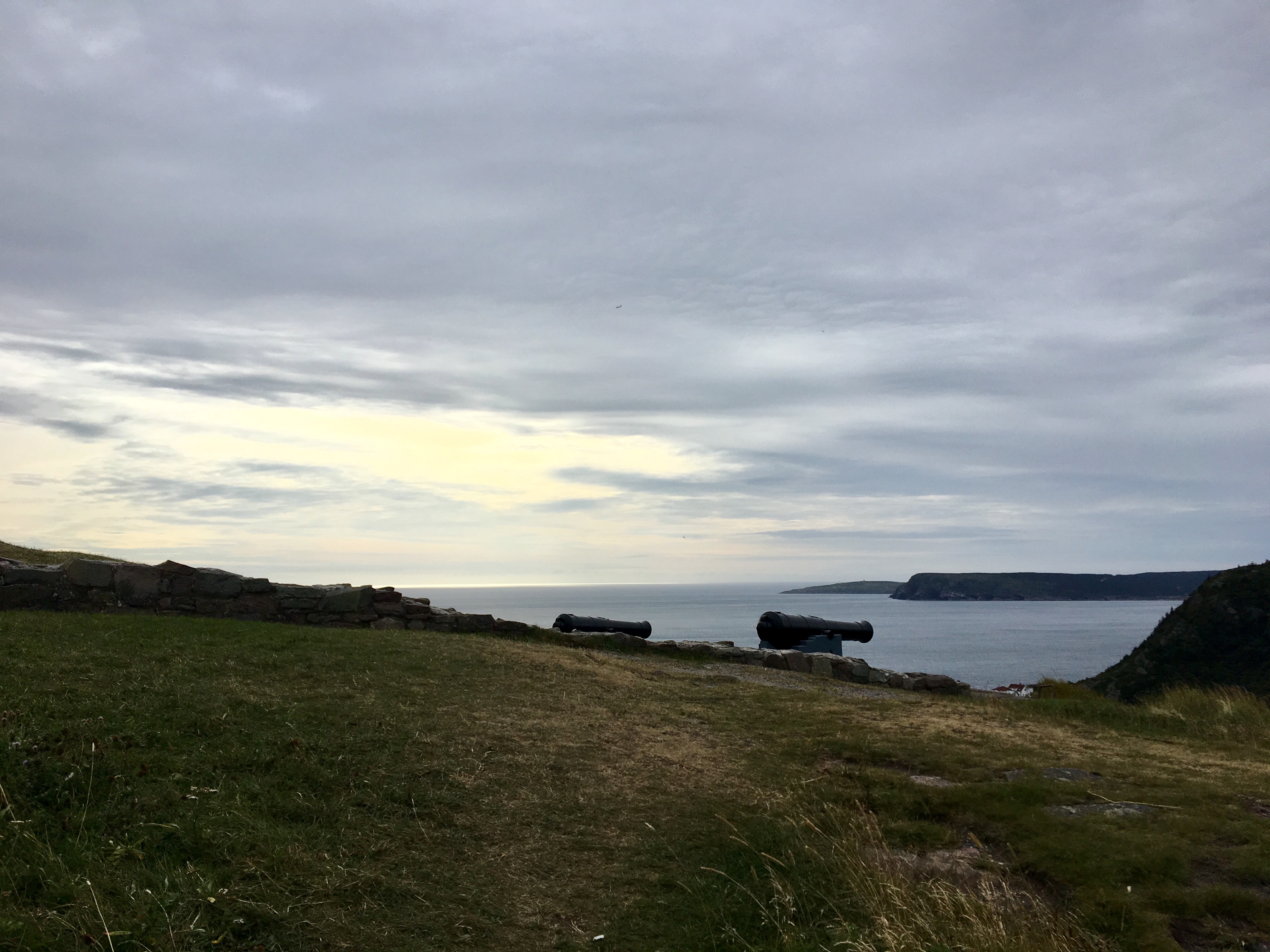
There are numerous criss-crossing footpaths in the area. I took one that hooked around the southern end of “Gibbet Hill”. Once around the hill, the Queen’s Battery Baracks building came into view. This is where the soldiers manning the cannons overlooking the harbour used to live. From there, an obvious official trail leads up to Cabot Tower and a viewing platform. On that day there was a “special weather advisory” for heavy rain. It was due to strike a few hours after I got to the top. Although the skies were overcast, there was no mist or fog obscuring a fantastic view of St. John’s Harbor.
I briefly stepped into Cabot Tower, which is now a gift shop, then continued past the parking lot (again, you could drive all the way up if you were so inclined). The start of North Head Trail can be found near the parking lot. It takes a scenic route between the summit and the level of the harbour. For some reason, all the material I found regarding this trail described it only as a descent. I briefly considered descending there, but decided instead to descend the other side of Signal Hill and head towards Quidi Vidi.
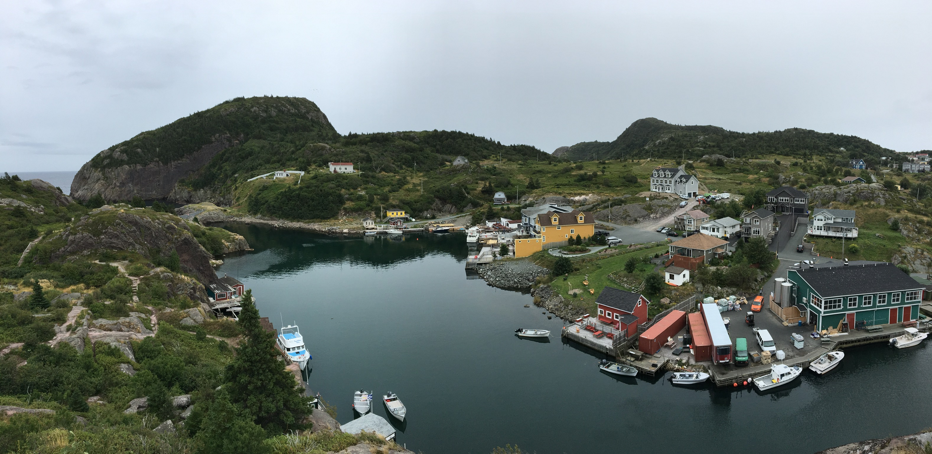
Quidi Vidi is a tiny fishing village situated on a picturesque harbour just outside St. John’s. From the top of Signal Hill, one can follow the Ladies’ Lookout trail down the north side of the hill towards the colourfully named Cuckold’s Cove. The Ladies’ Lookout trail then meets another official trail called Burma Road, which can be followed down past the cove and on to street level. I descended along this route. Then a brief consultation with Google Maps told me which streets to follow and I found myself in Quidi Vidi.
Like many places that I had read about in Newfoundland, Quidi Vidi features a sign discussing the fact that people aren’t sure why the place is called Quidi Vidi. There is, however, consensus that it is pronounced “kiddie viddie”. It features a serene harbour, quaint buildings and a brewery. The brewery offers tours and serves beer (but no food) starting a 12 daily. I made use of that at the end of my hike.
Ascending the rocky hills to the north of the harbour is a portion of the East Coast Trail. There’s a helpful sign situated where the trail ascends out of Quidi Vidi. That particular segment is called the Sugarloaf Path and connects Quidi Vidi to Logy Bay, to the north. Interestingly, the path goes past yet another place called Cuckold’s Cove. I only know what that word means because of the recent pre-eminence of awful people on the internet. I guess Newfoundlanders were always in the know.
This trail was great fun, and on a sunny day I think I would have wandered well into the afternoon. The forecasted rain had started rolling in by that time, though. I decided to make for high-point at the head of the harbour, a spot marked by a distinctive cubic boulder. The trail was easy to follow, with black and white posts marking the way. I reached the boulder in short order. The weather had definitely turned by that time, and I took in the view of the rainy North Atlantic.
I stood for a while in the cold wind as it blew the rain in off the ocean. There’s an interesting sensation that arises when you stand in the face of something vast and powerful, and just feel it. After a short while, I heard a helicopter roar overhead and head out into the gloom over the ocean. Then I saw a Coast Guard ship following suit, heading out to sea from St. John’s harbour. Taking this as a cue not to romanticize storms on the ocean, I headed back into Quidi Vidi.
Click on the pictures below for full-sized images.


One thought on “Signal Hill & Quidi Vidi Harbor”