June 9, 2019. An easy hike around a waterfall in the Crowsnest Pass. Perfect for young kids. (Updated April 30, 2021 after I confirmed the loop-route and checked out the route up the canyon)
- Region: Crowsnest Pass, Traditional Territory of the Tsuu T’ina, Ktunaxa, and Blackfoot First Nations
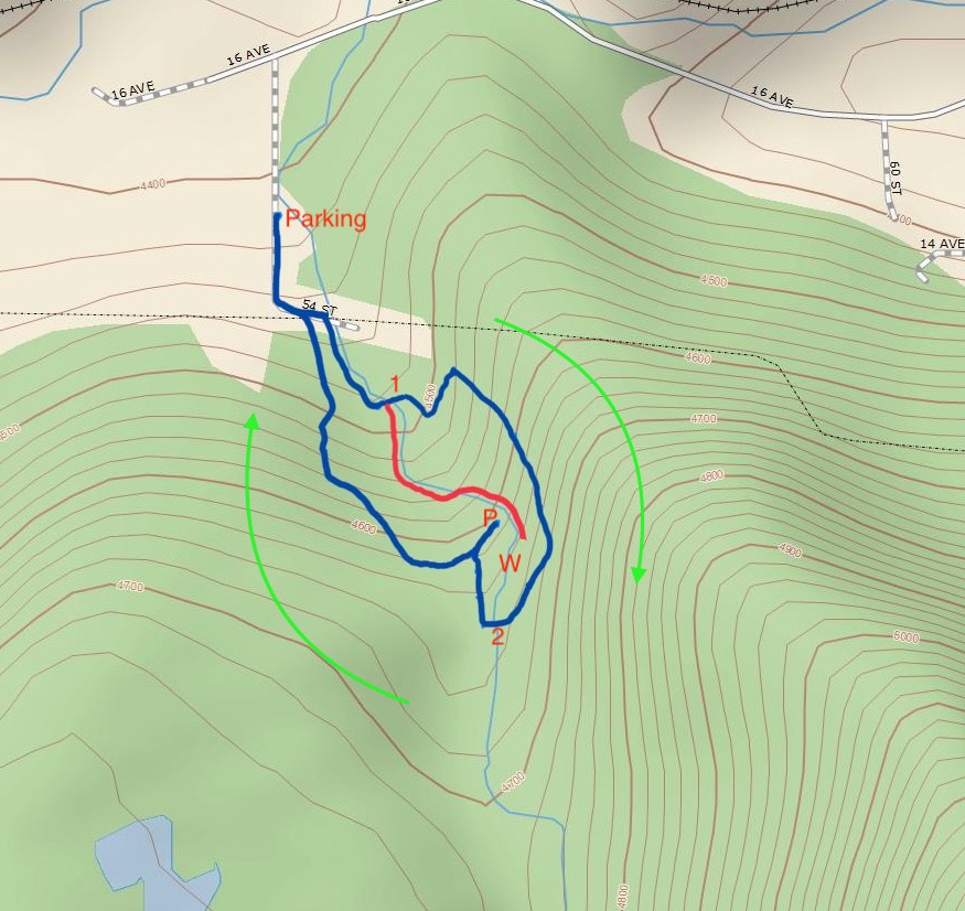
- Distance: 1 km one-way from the parking area to the best views of the waterfall, option for a ~2.5km loop
- Total ascent: Approximately 90 m
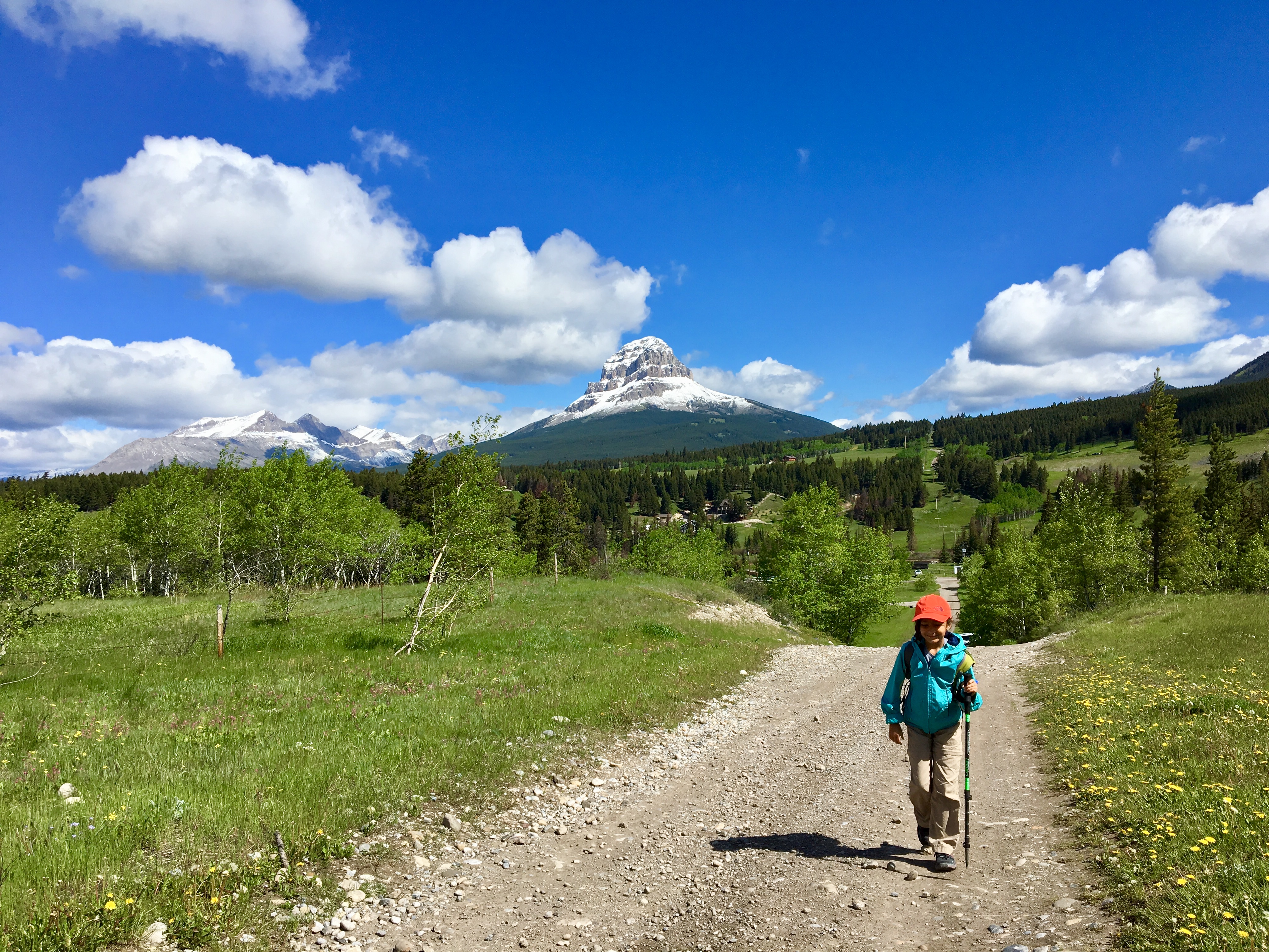
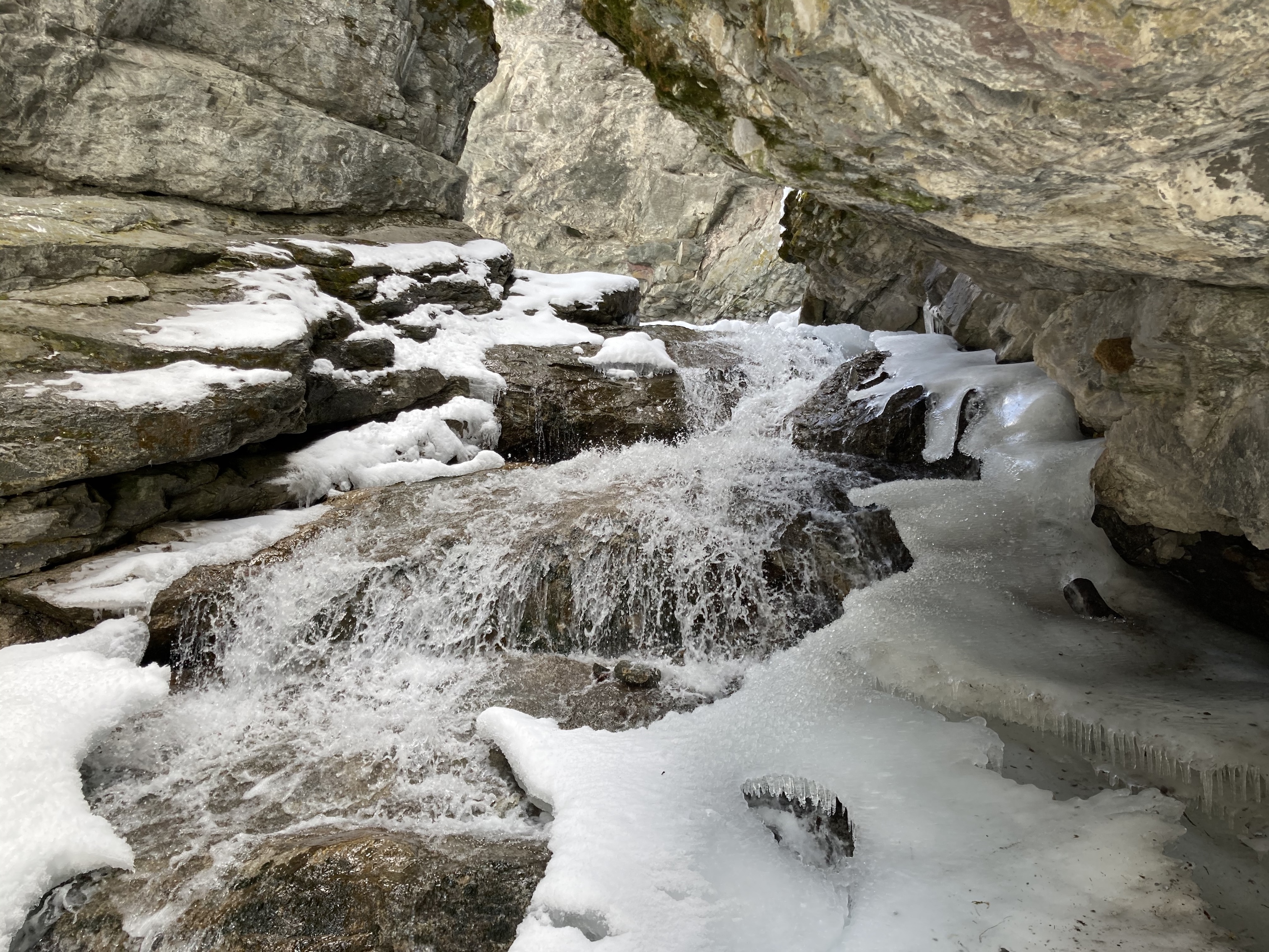
Star Creek Falls is a picturesque waterfall accessible by a short trail. There’s a satisfying loop route – which I suspected during my first visit with my daughter, and confirmed during a 2nd visit on a snowy spring day. The trip is featured in Nugara’s 2021 Popular Day Hikes: The Castle and Crowsnest. His description doesn’t include the loop route, likely because the bridges making the loop possible are relatively new. There’s also the option of following Star Creek up the canyon to the foot of the waterfall itself. This is a trickier path to follow and not for little kids, but it’s popular enough that someone has fixed a chain in place to help hikers along their way.
This waterfall seems to be reasonably well known – but it’s in the Crowsnest Pass, meaning that you need to find your own way there. Nobody is putting up signs to help you. Access is via a gravel road – 54 Street in Coleman, Alberta. Getting to it is mildly convoluted. Ask Google Maps to drop a pin here: 49°37’48.9″N 114°32’35.1″W and follow the directions provided. Or, click here.
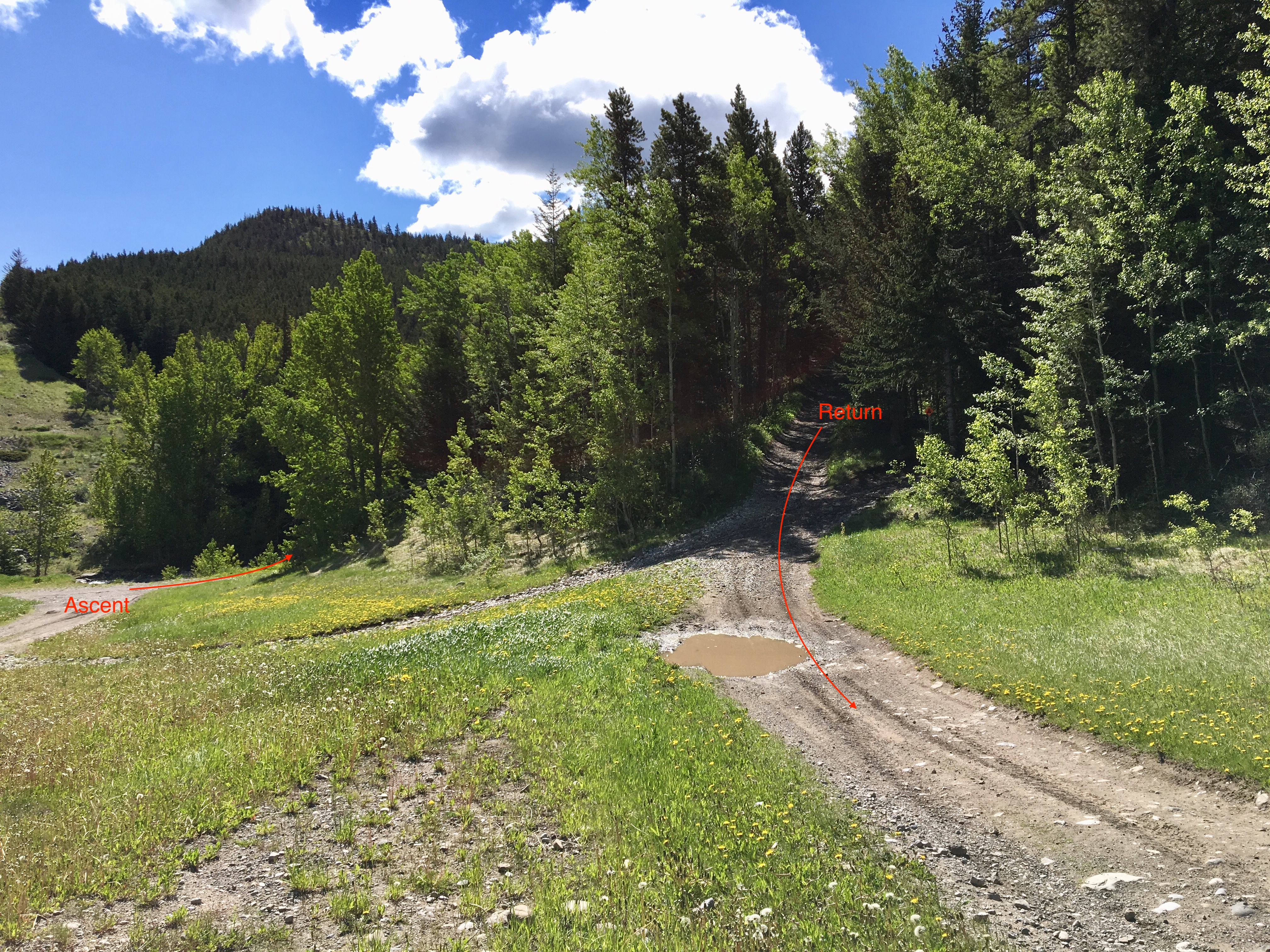
The road abruptly rises and becomes very rough at around this place. Serious 4×4 vehicles with good clearance can carry on, but we pulled off and parked in a small cleared area and started to walk. First we climbed up the hill and then followed the road as it veered sharply left and descended. Star Creek sits at the bottom of this broad path, and two evident routes set off to the right from there, one nearer to you and one farther down the hill – right on the creek. Either can be used, since the route can be done as a loop, but I learned that it’s best to start off down by the creek. It gets you to the best waterfall views the quickest.
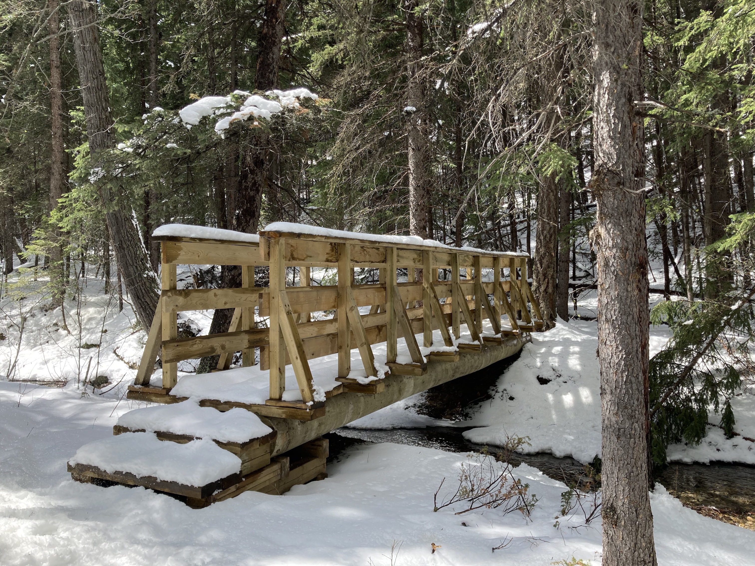
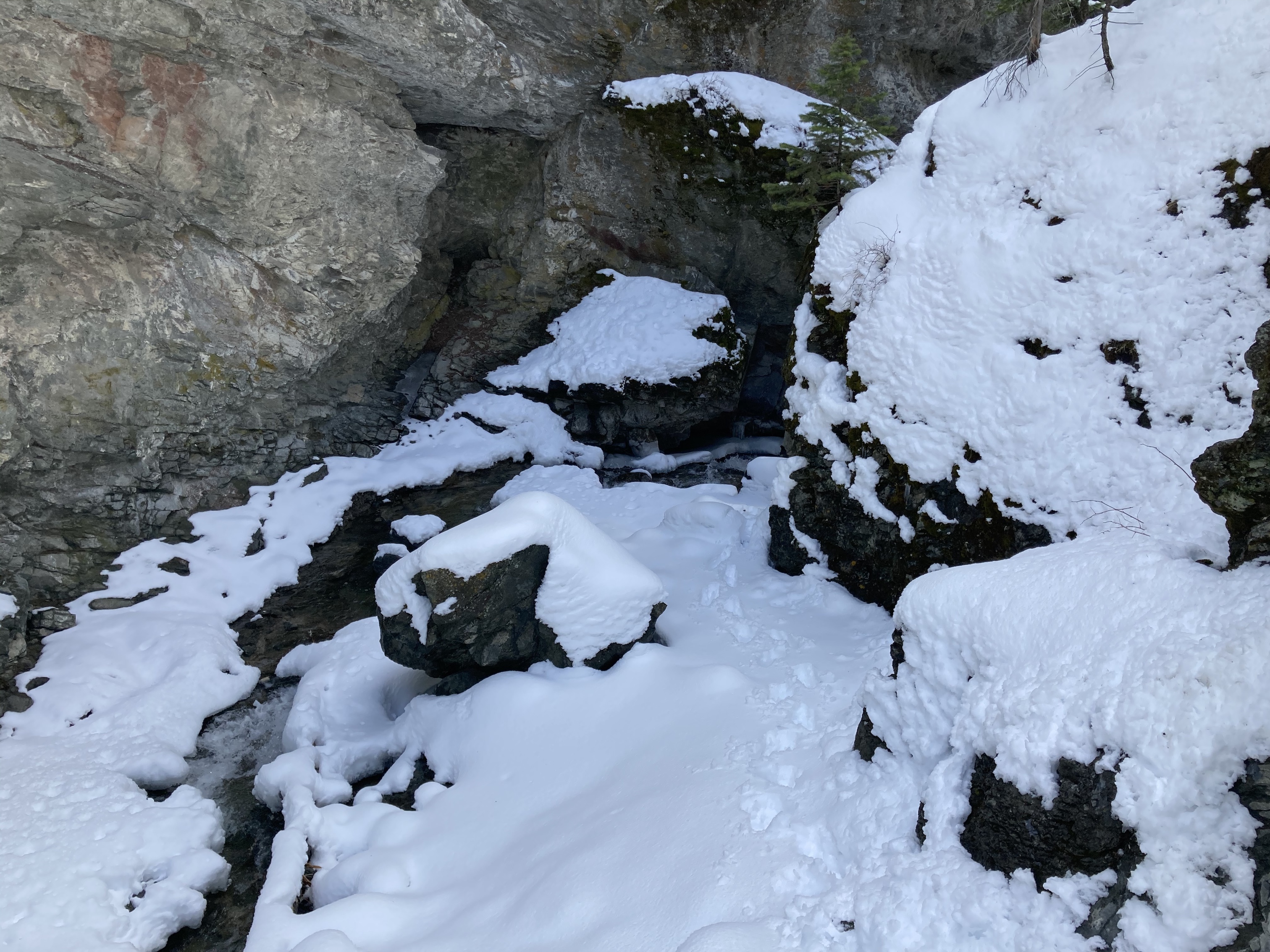
Down by the creek, a path sets off along the right bank. In short order there’s a sturdy wooden bridge over the creek. After crossing the bridge, there’s a steeply ascending, switchbacked dirt path through the woods. This path soon joins a broad path heading off to the right towards the waterfall viewpoints. Going left at this point would follow a broad rocky trail descending to the level of the creek – presumably the site of a former bridge or commonly used fording point.
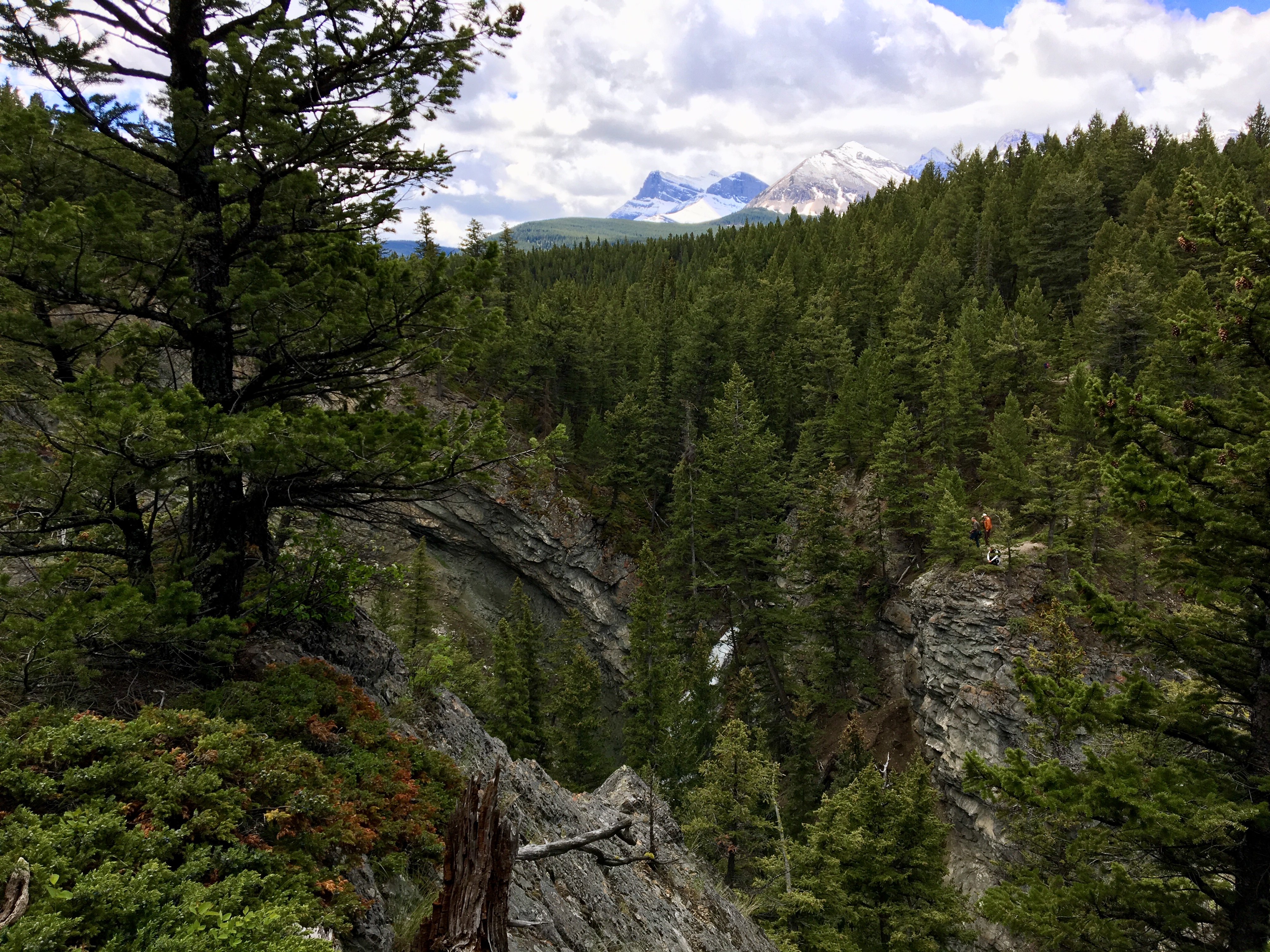
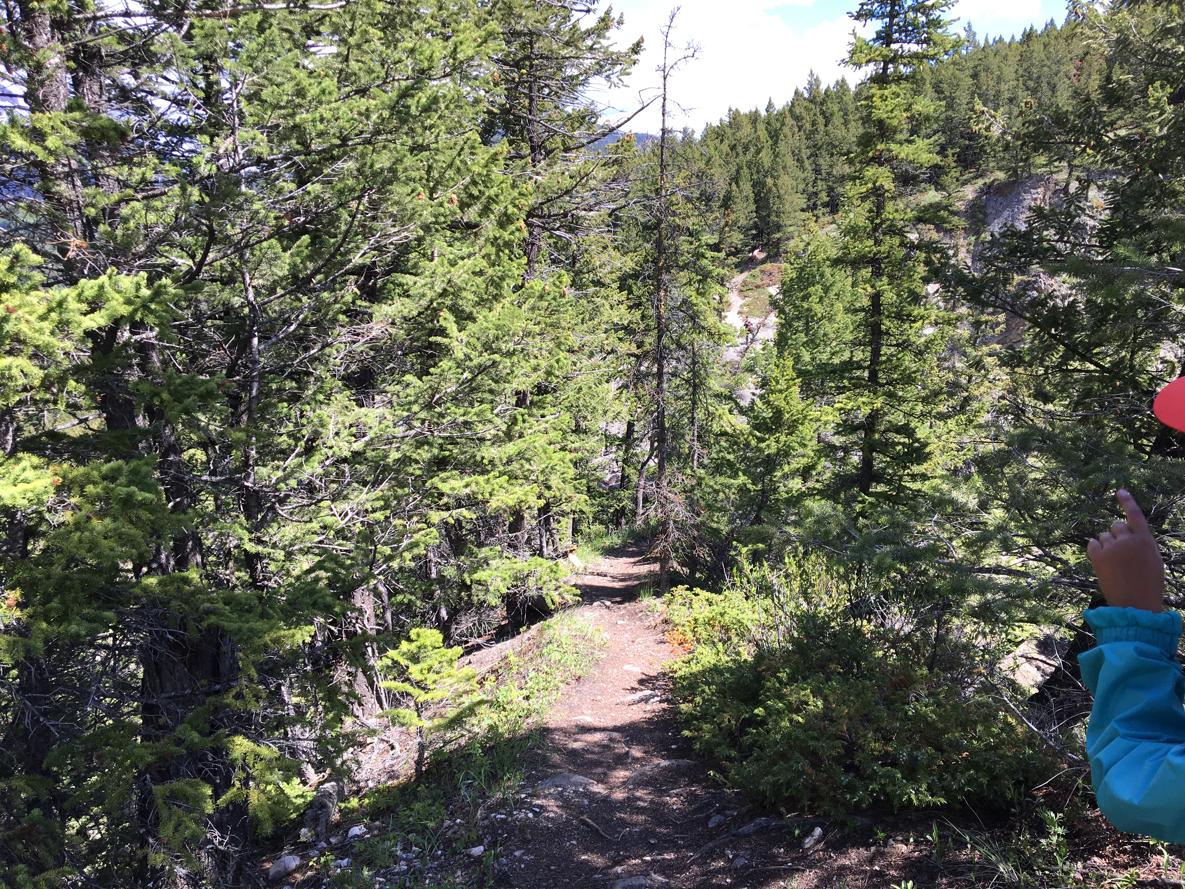
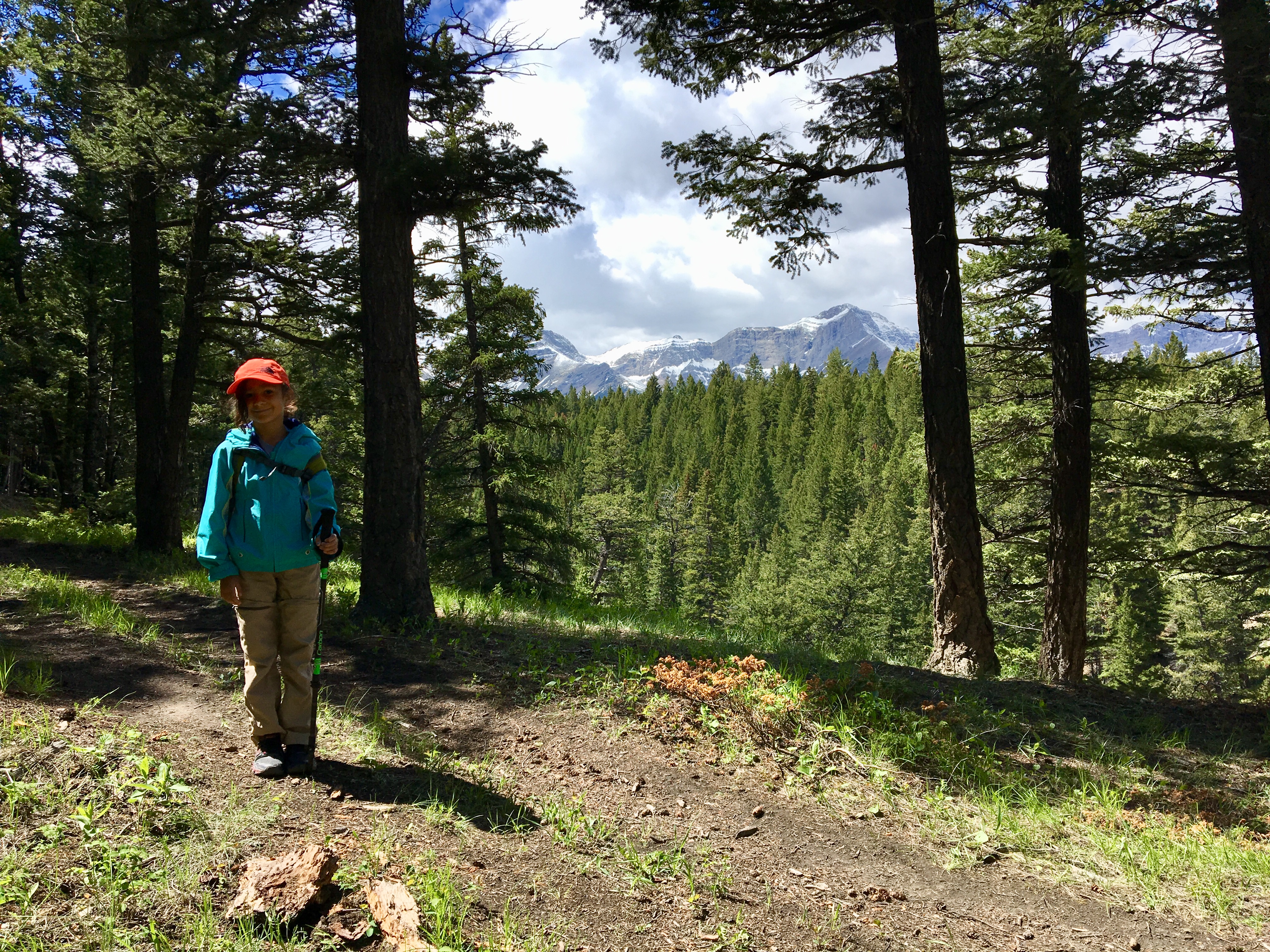
A bit more climbing from this point brings the path to the edge of the canyon, above the waterfall. Across the canyon there’s a rocky precipice which can be accessed if the loop route is followed (more on that below). As the path continues, there are several places to peer down and enjoy views of the falls. Eventually the trail descends and encounters the creek above the level of the falls. Another bridge sits here at the apex of the loop route. Beyond here trail ascends a bit then intersects some ATV trails which descend back to the clearing at the start of the route. Along the way, there’s a branch of the trail that descends steeply to a small rocky precipice. This was a neat little area, but only gives a partial view of the falls. It was a little nerve-wracking for my 7 year-old daughter, though. We stayed well off of the edges and were perfectly safe. However, hikers with an instinct to go right to the edge of the precipice shouldn’t – a slip and fall (or a collapse of the rock on the edges) from that spot could lead to a death fall.
This trip was a great day out with my daughter, and I think kids would really enjoy this area. A one-way distance of 1km to get to nice waterfall views is reasonable for young hikers. More adventurous hikers could also try following the creek up the canyon to the waterfall itself. This option is dependent of the state of water flow in the creek. There’s one difficult spot that requires ascending a steep area of smoothed rock to the left of the creek. A chain has been fixed in that area to help, and I was definitely glad to use it, especially on the way back down.
Click on the pictures below for full-sized images.


Thanks for the directions and description! Great family hike. Dog friendly too.
LikeLiked by 1 person