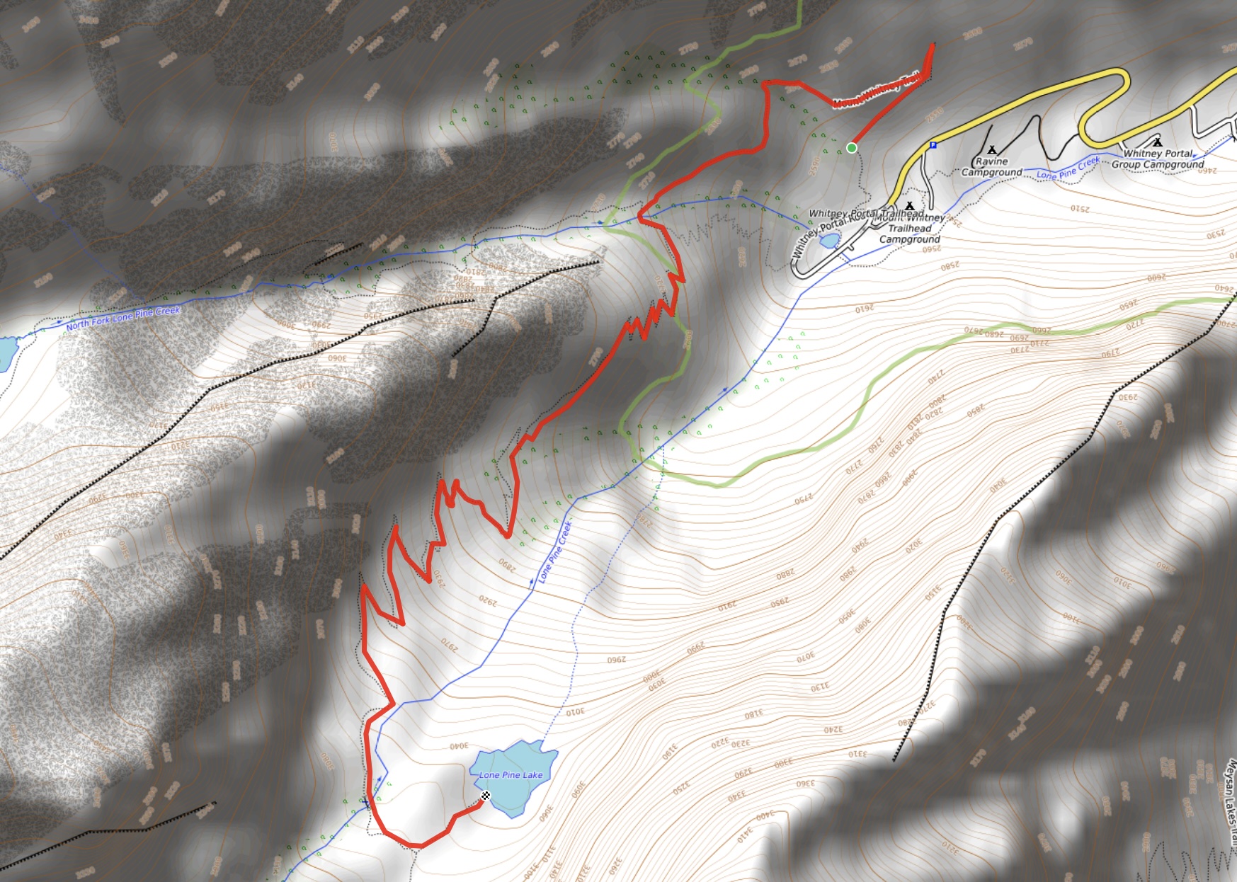
I was lucky enough to be invited along on another of Bhaskar’s adventures to finish off the 2024 hiking season. He managed to get a coveted permit to hike to the summit of Mount Whitney, the highest peak in the contiguous United States. Joining us on this trip were Valentina and Doug. We flew to Las Vegas and drove to the town of Lone Pine, CA on September 30. The permit was for October 2 and the Mount Whitney trail requires an early morning (long before sunrise) start. We therefore decided to use October 1 to drive up to Whitney Portal and take a look around at where to park and where the trailhead was. While we were up there we decided to do a short hike up the lower portion of the Mount Whitney trail to Lone Pine Lake, which sits outside the permit zone. We figured it would be good to acclimatize a bit to the high altitude and also see some of what we’d be hiking through in the dark. It ended up being a very enjoyable hike and Lone Pine Lake was definitely worth a visit.
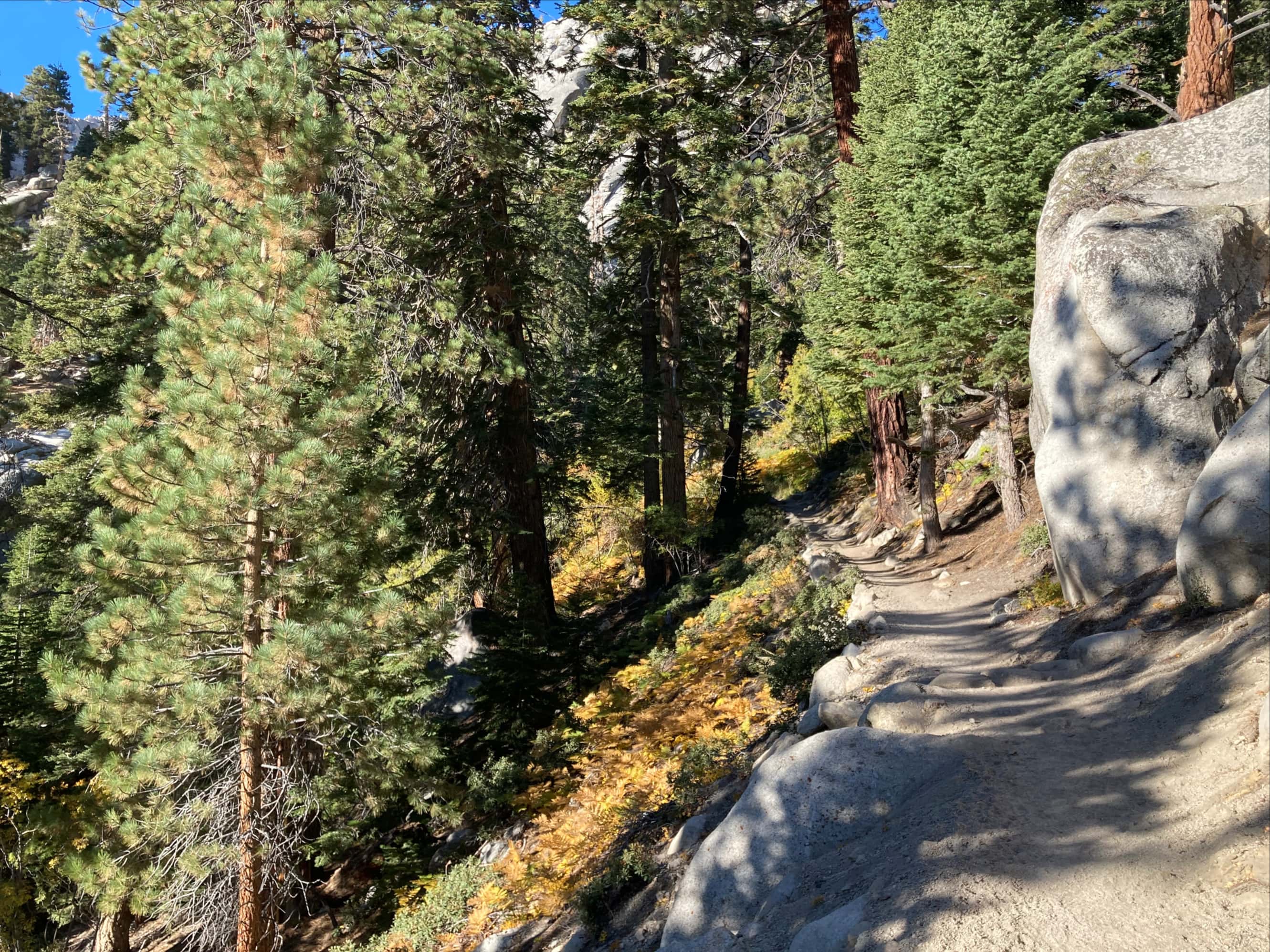
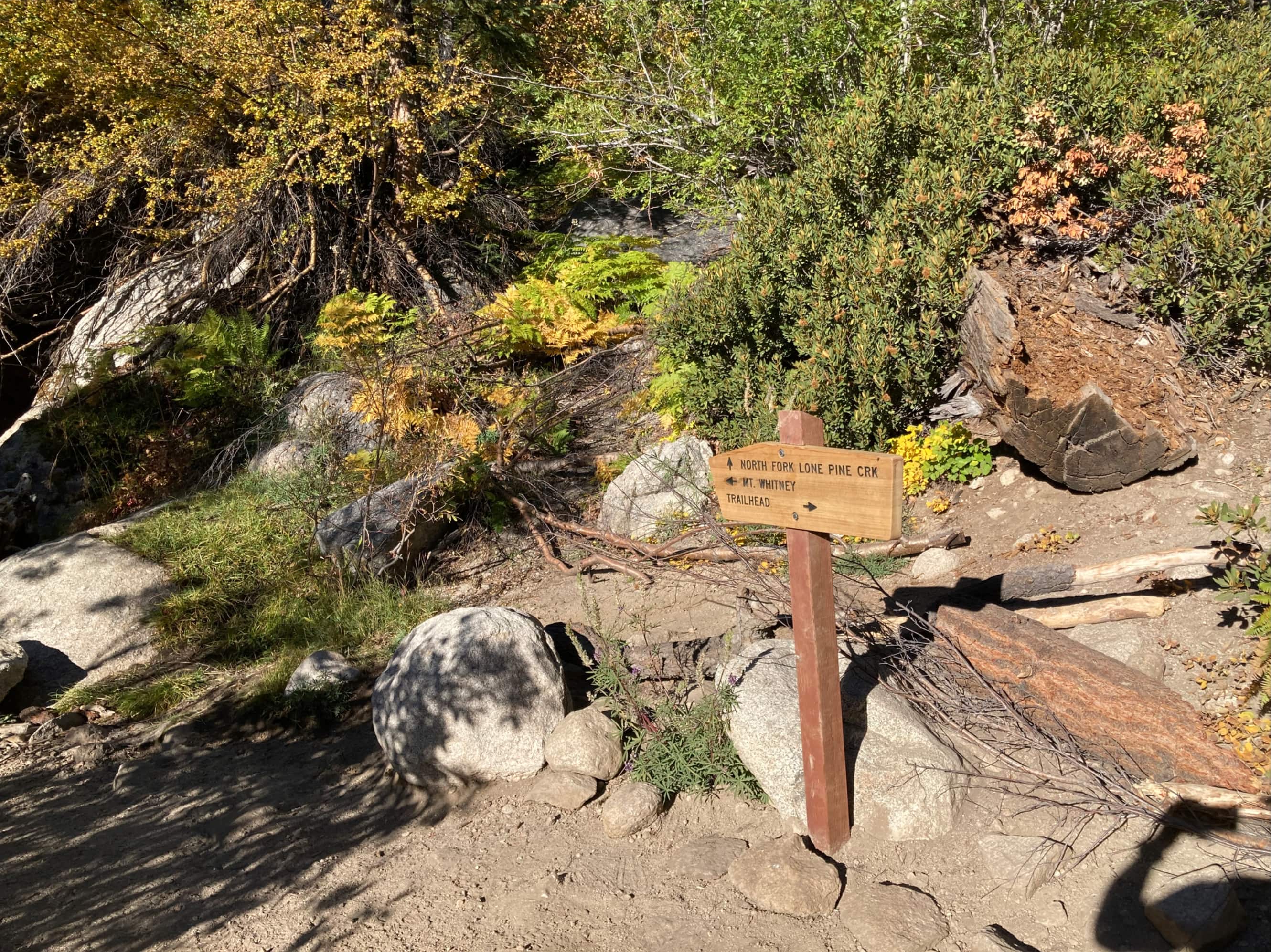
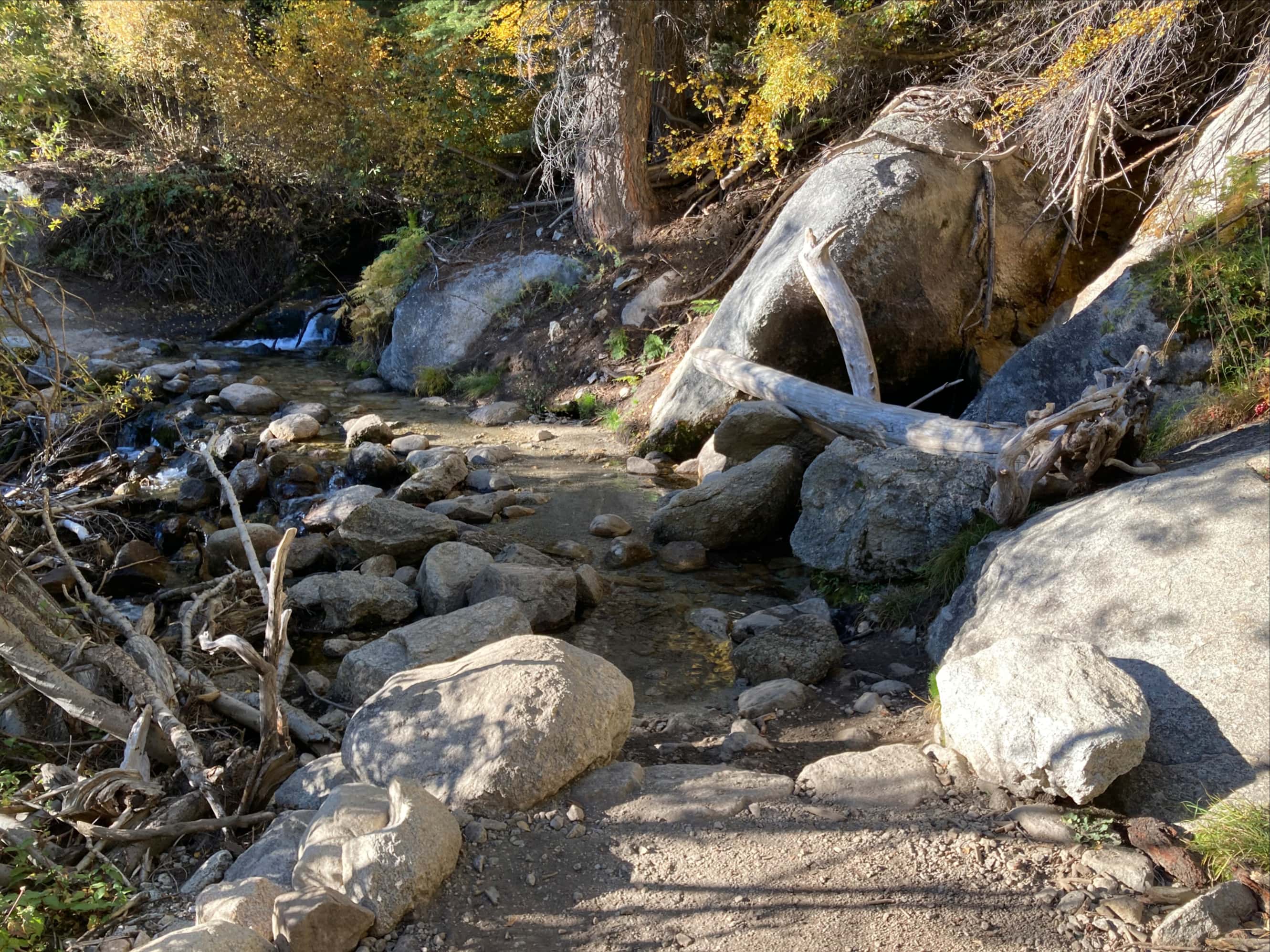
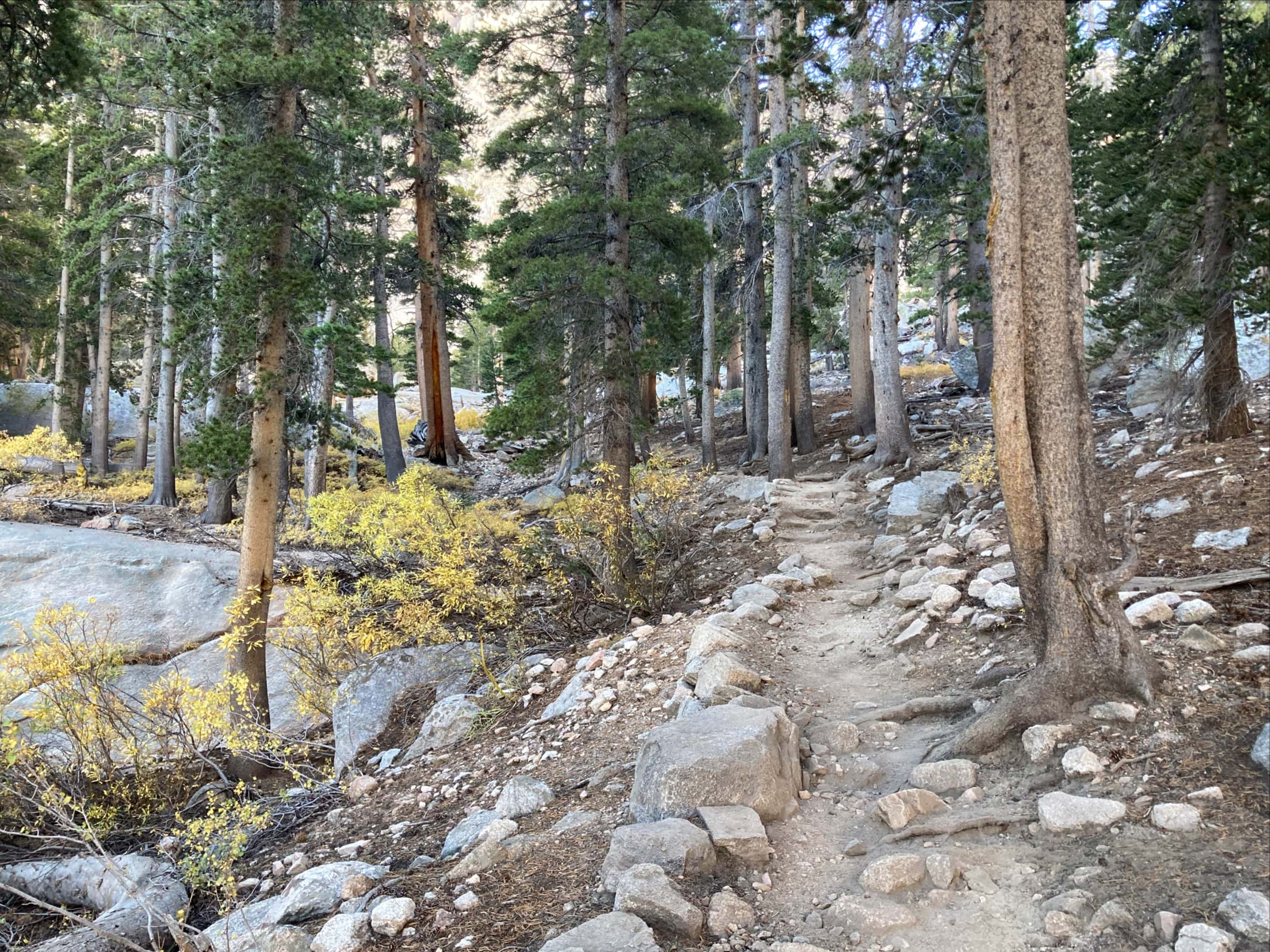
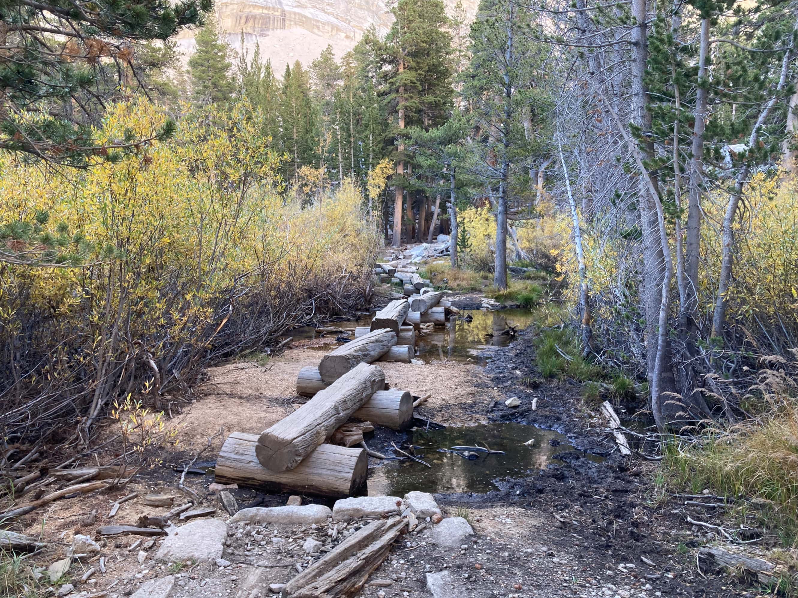
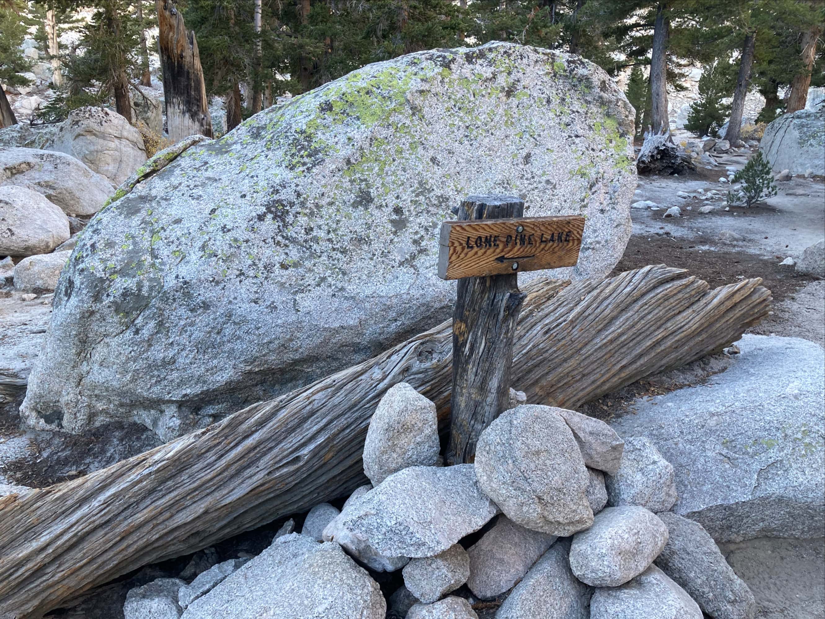
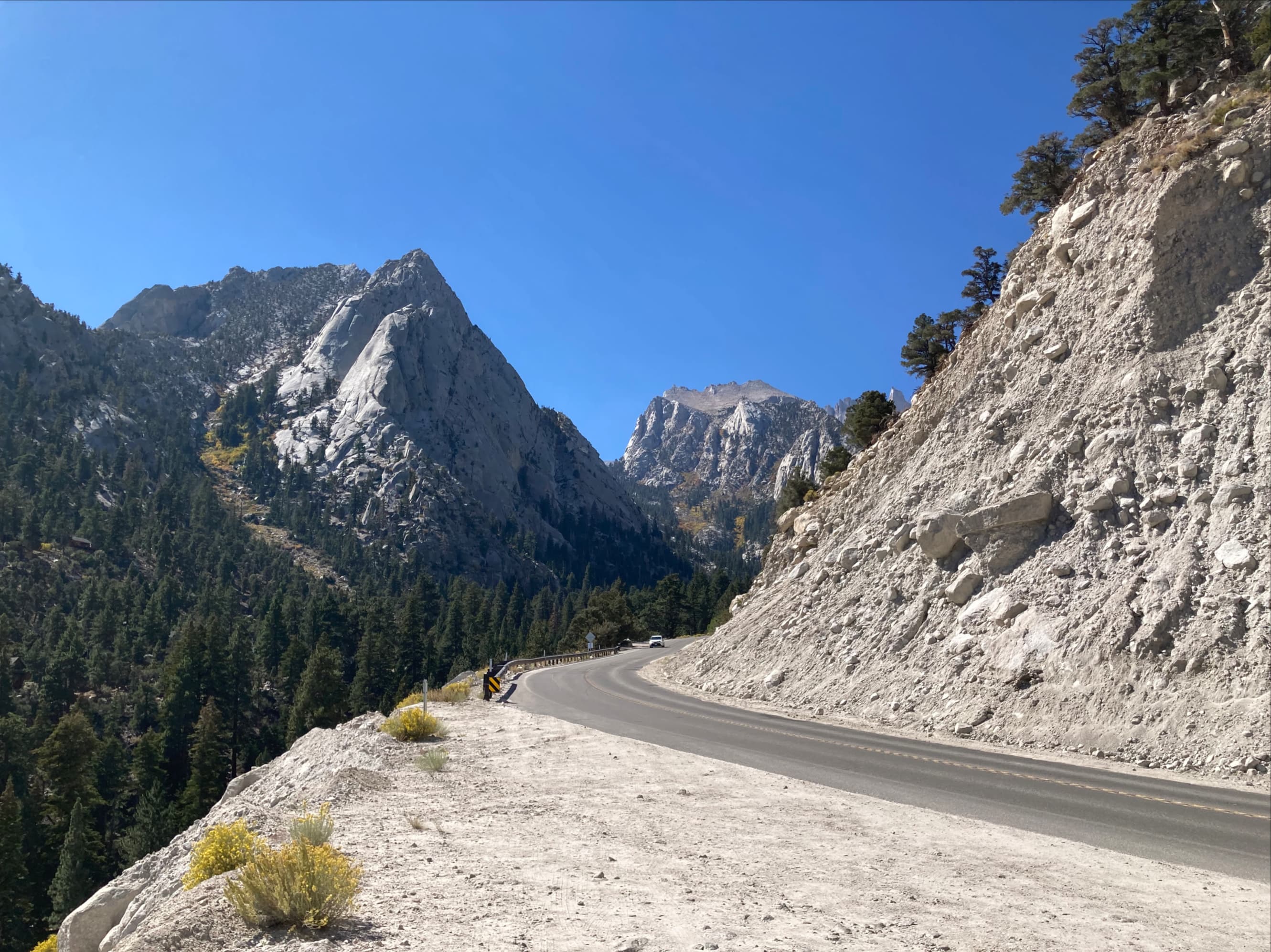
Access is from the Whitney Portal area. This is a fairly busy place featuring a campground, picnic area, pit toilets, a potable water tap, and a small store. We found trailhead parking easily, but keep in mind that we visited during shoulder season. The trailhead is next to the store and clearly marked. The trail itself is broad and well-maintained, ascending at a remarkably consistent grade along switchbacks and traverses. It initially heads northeast, away from the lake, before swinging around in a scenic traverse above Whitney Portal and heading southwest up switchbacks towards the lake. Shortly before reaching the side-trail leading to Lone Pine Lake the trail crosses small log bridges over a creek and pool. Not far beyond there is a sign pointing the way off the main trail to Lone Pine Lake.
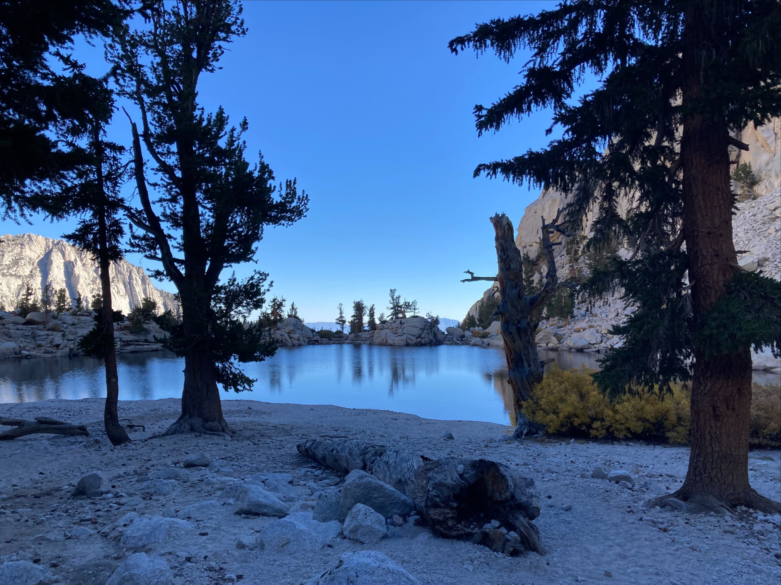
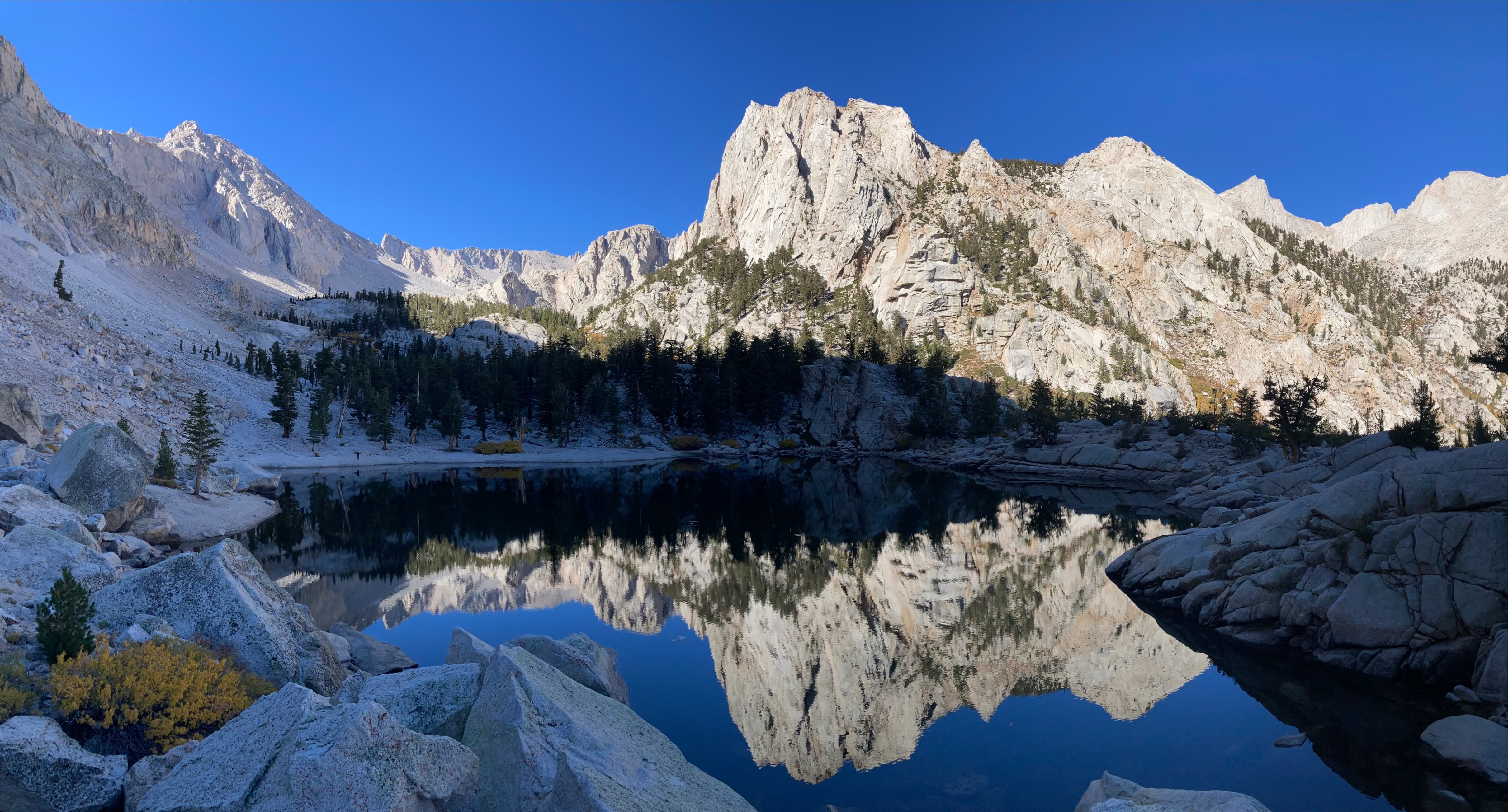
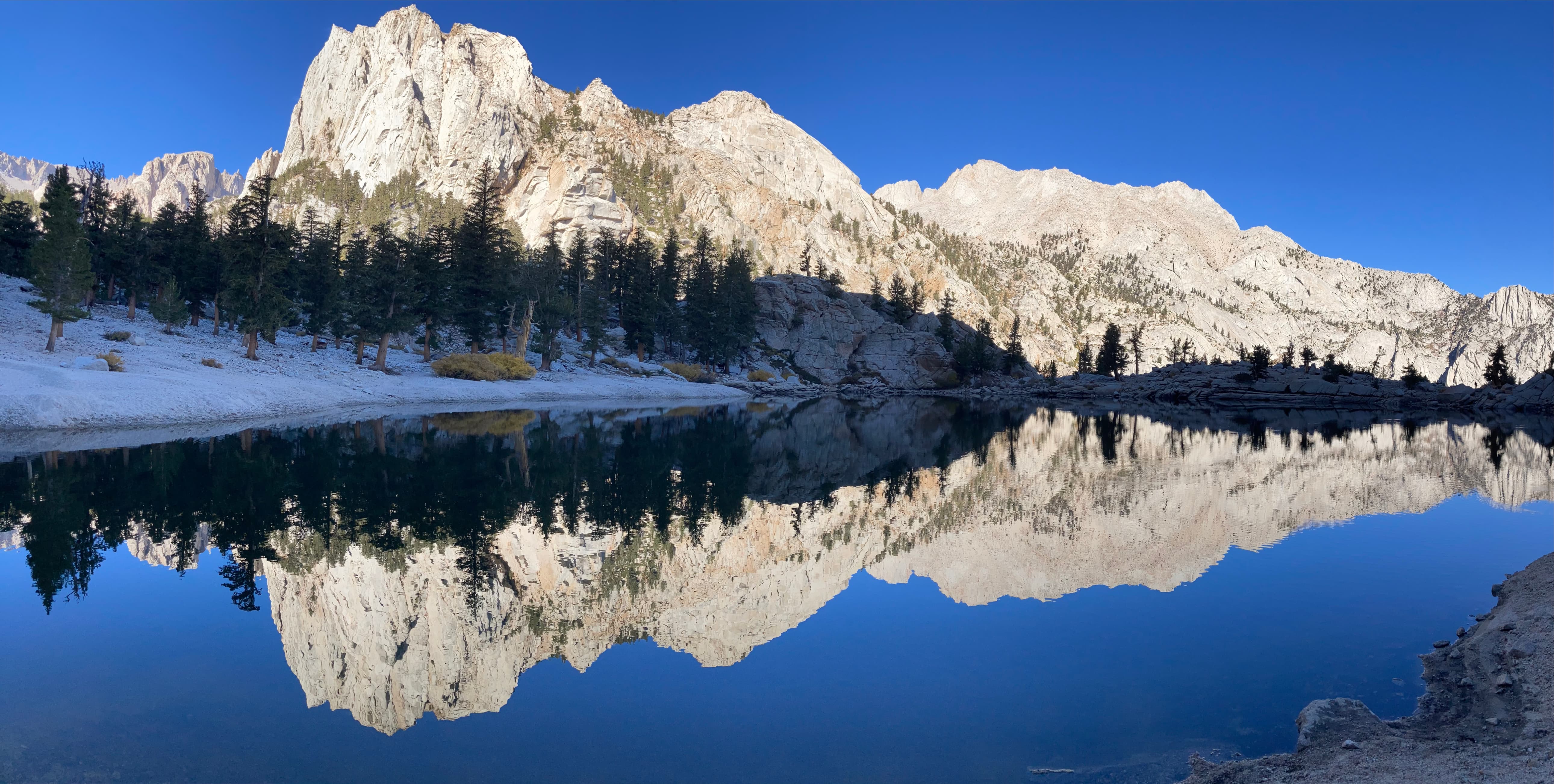
The lake itself is a serene place. It’s not too big and fairly easy to travel around. The best views are from the northeast side where one can look up towards the high valley below the 4000 m peaks and pinnacles south of Mount Whitney. The summit of Whitney itself is not visible from the lake. After circumnavigating the lake and taking a lot of pictures we called it a day. We would return to the trailhead at about 1:30 the next morning to begin climbing Mount Whitney.
Even if you’re not planning to climb Mount Whitney, I think this hike is worthwhile if you’re in the area. The lake is beautiful and the trail scenery is interesting. There’s also an distinct ambiance at Whitney Portal – you can somehow feel that you’re in the presence of something vast. Visit if you get the chance.
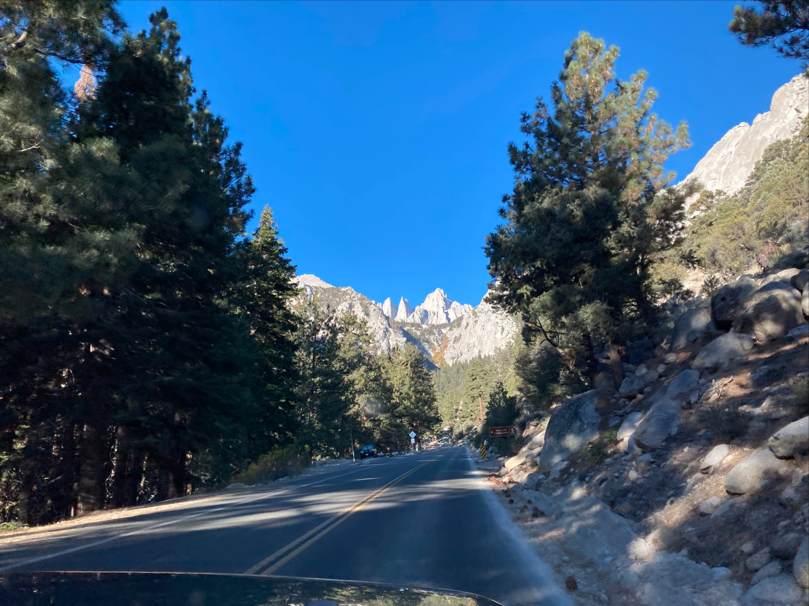
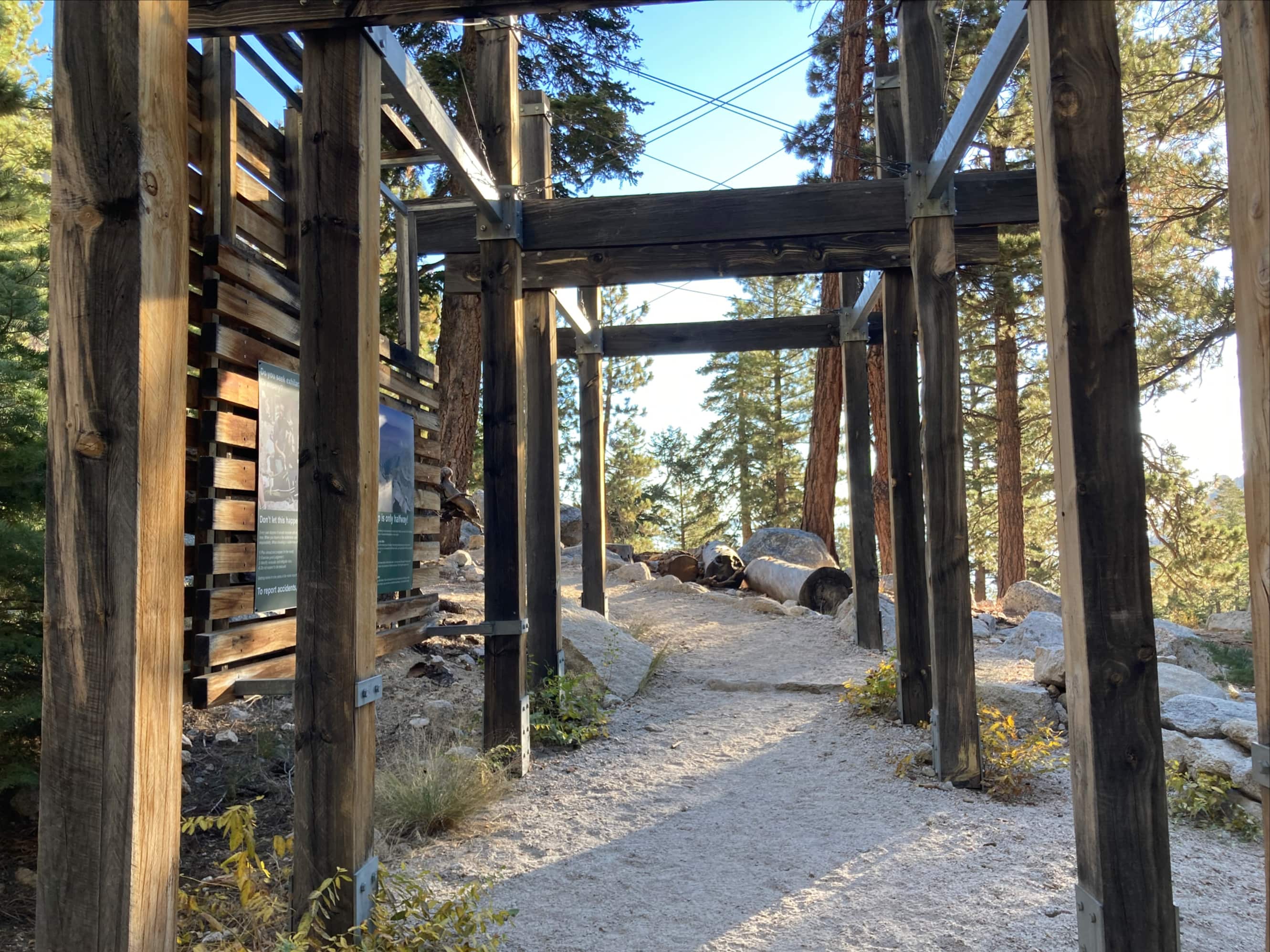
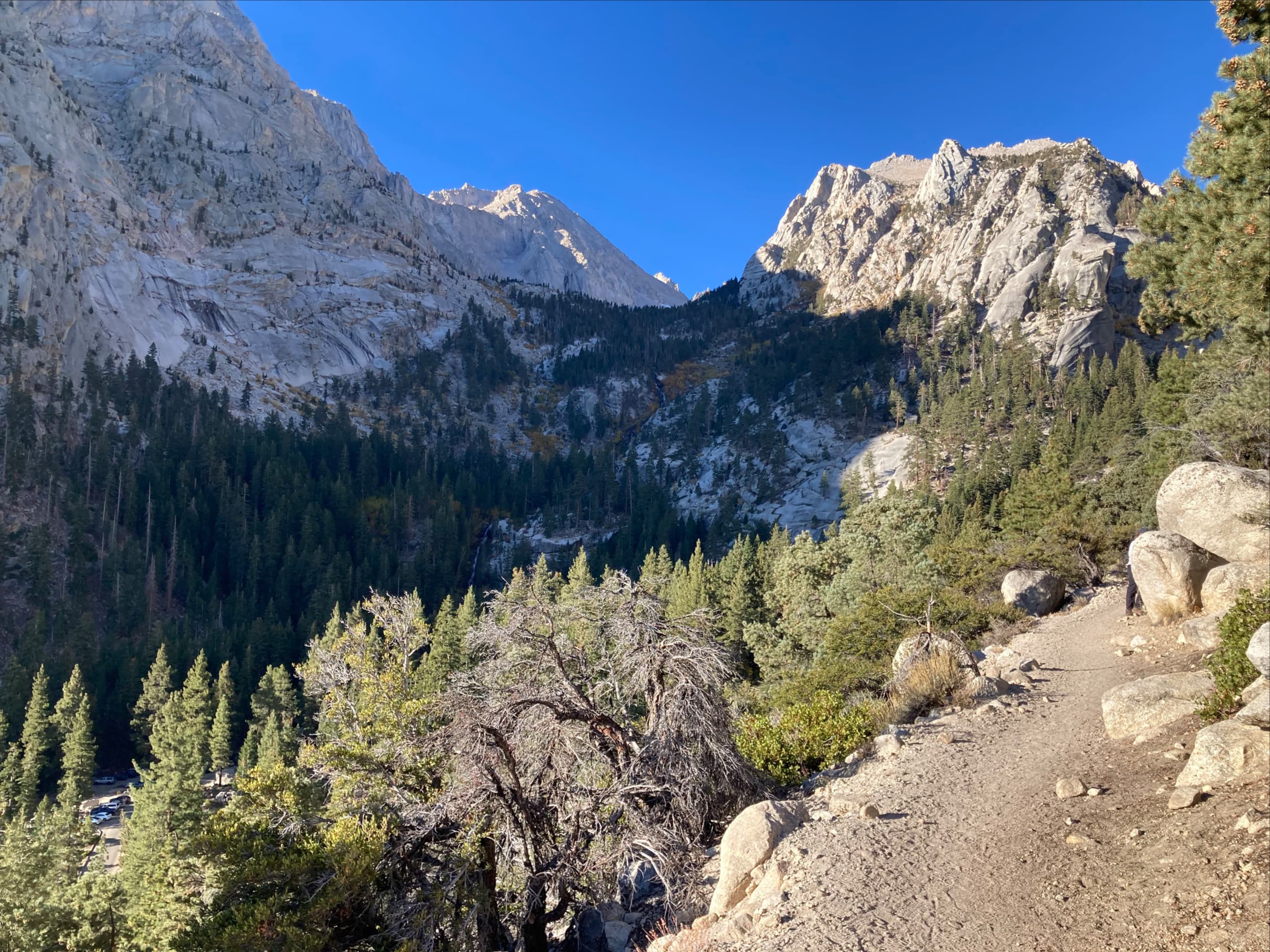
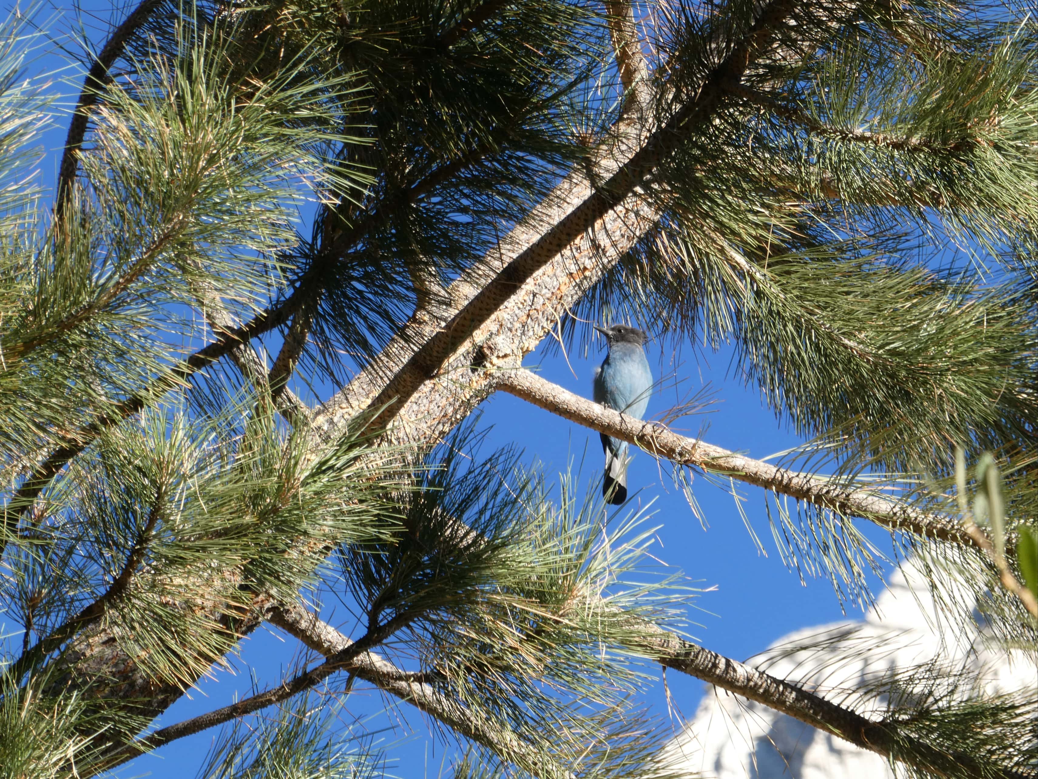
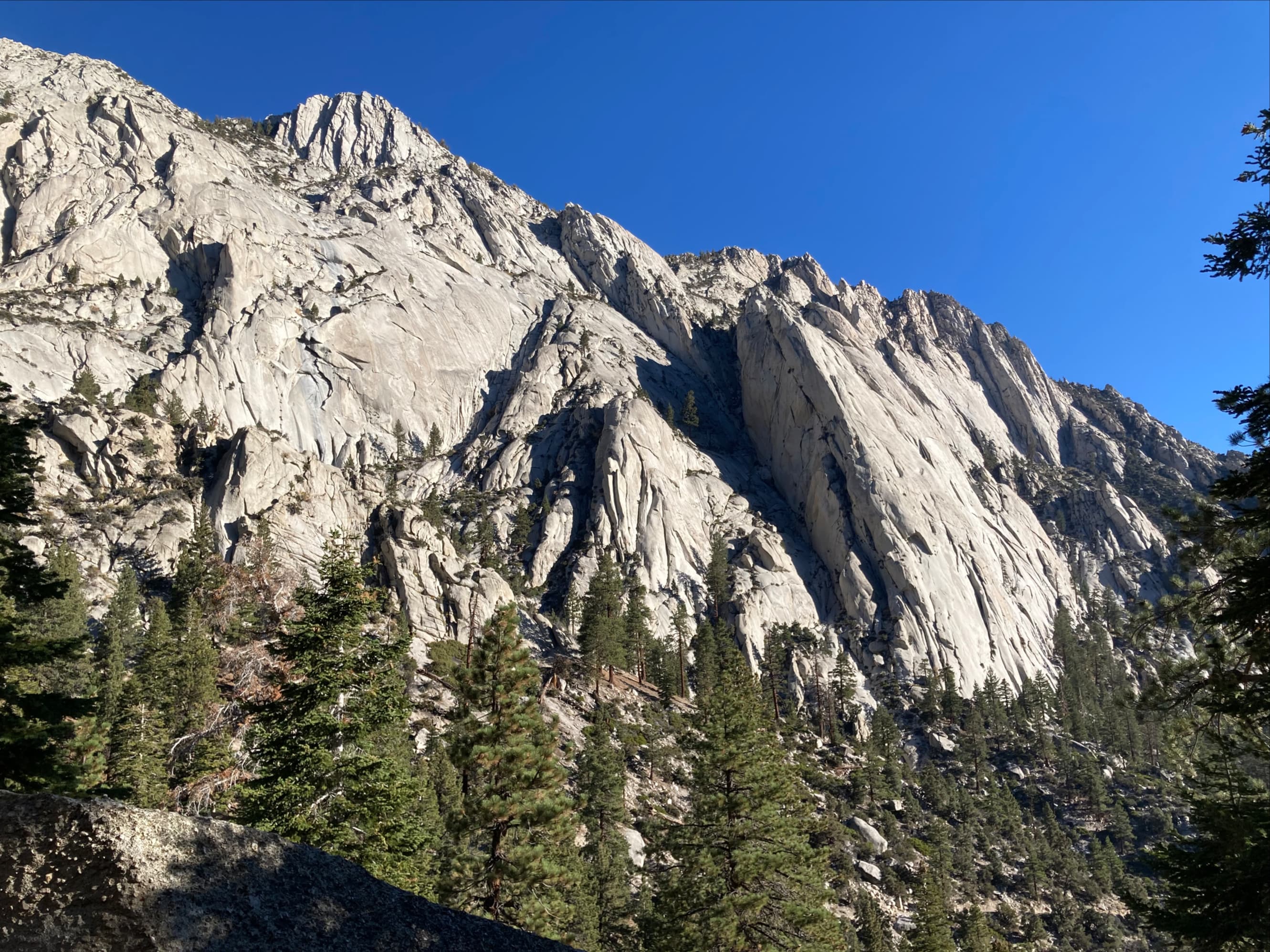
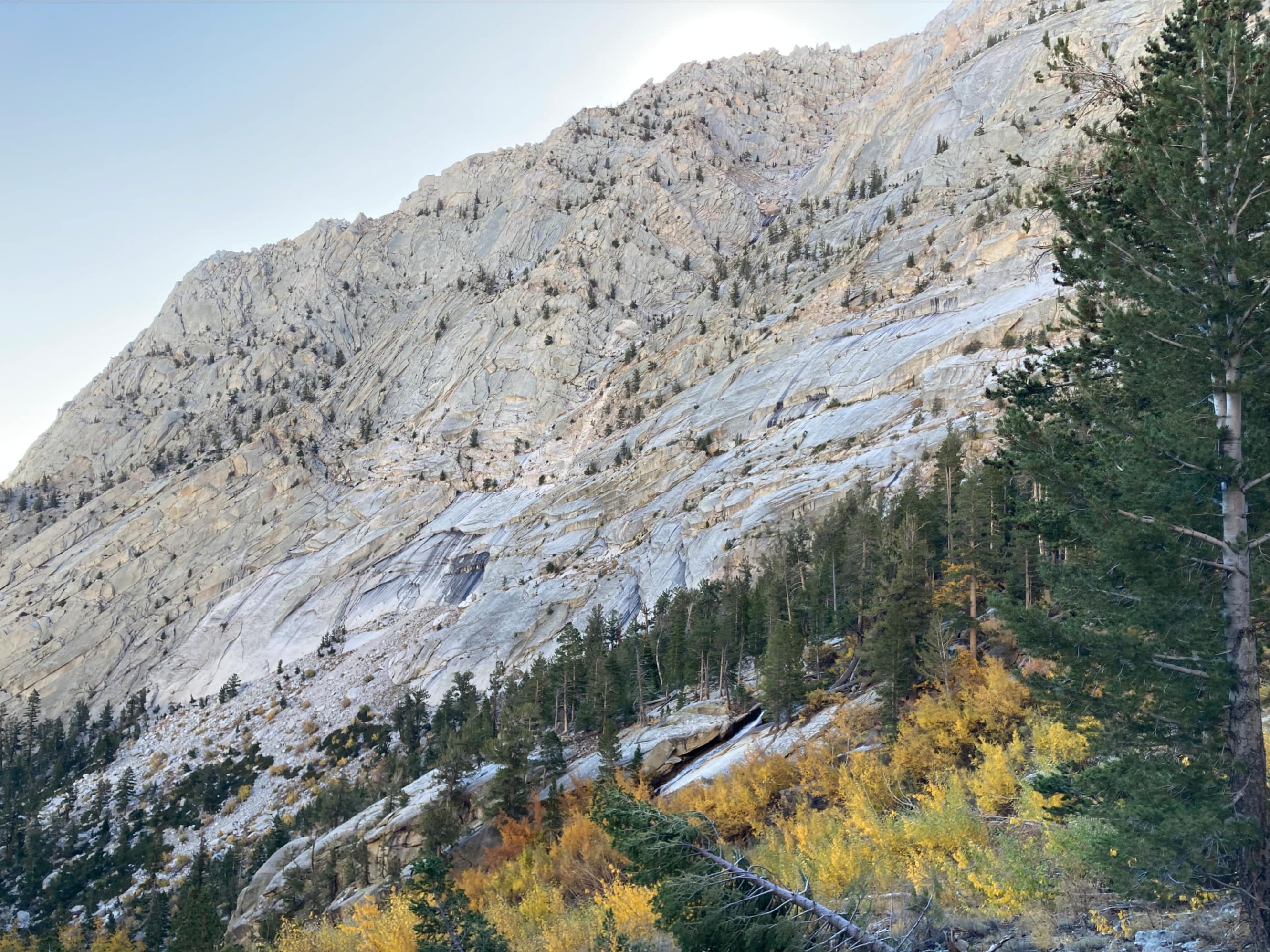
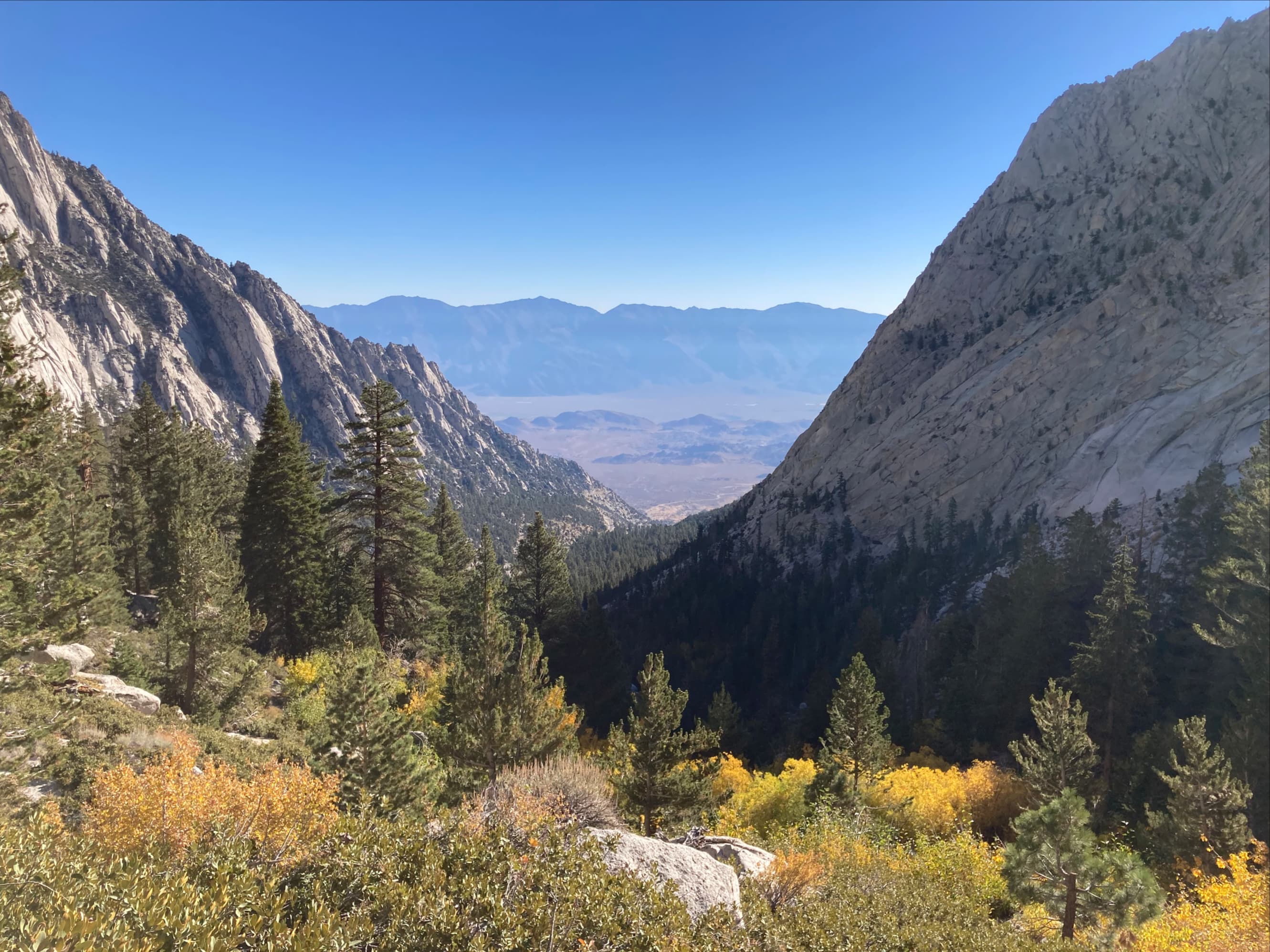
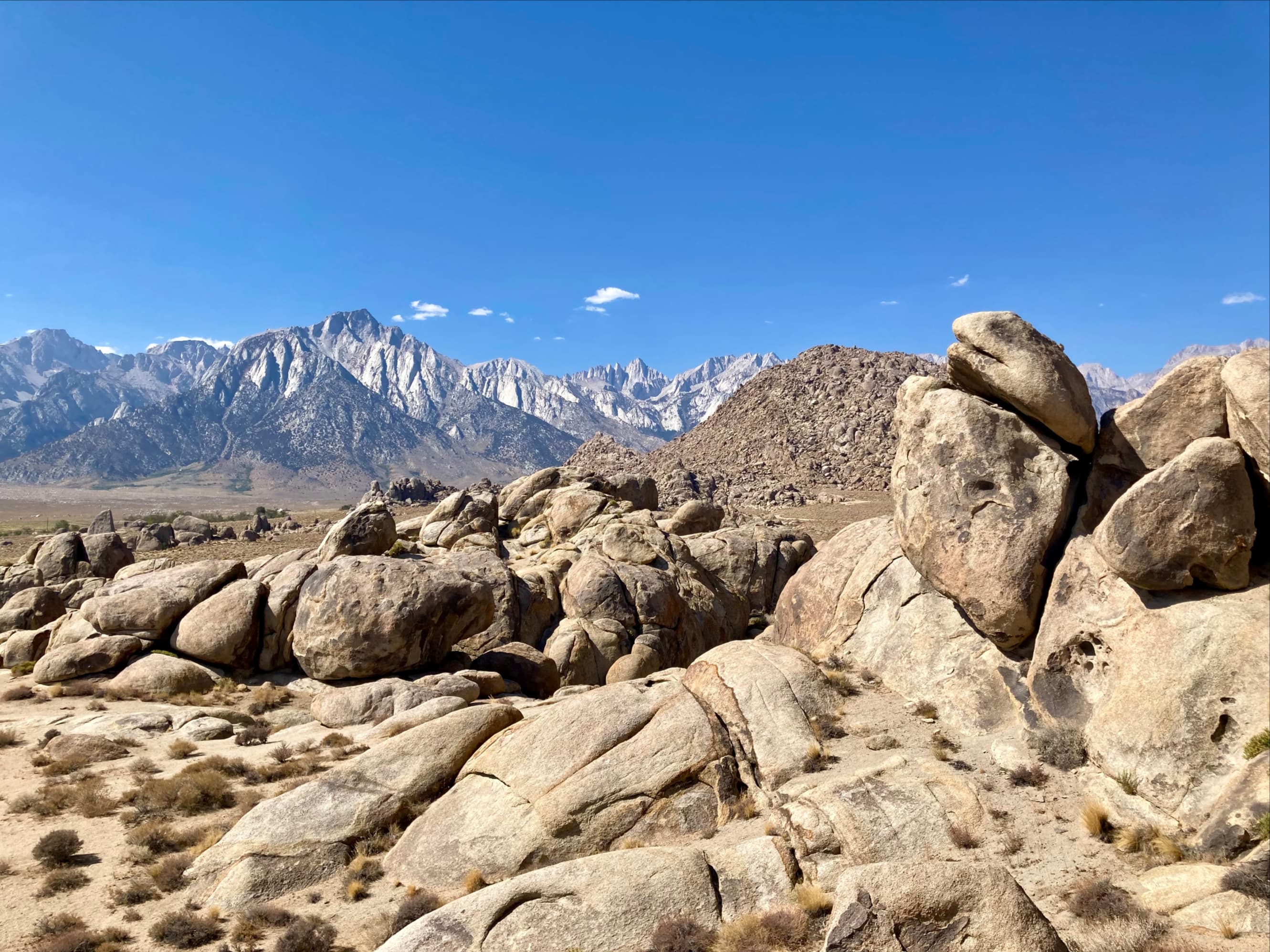
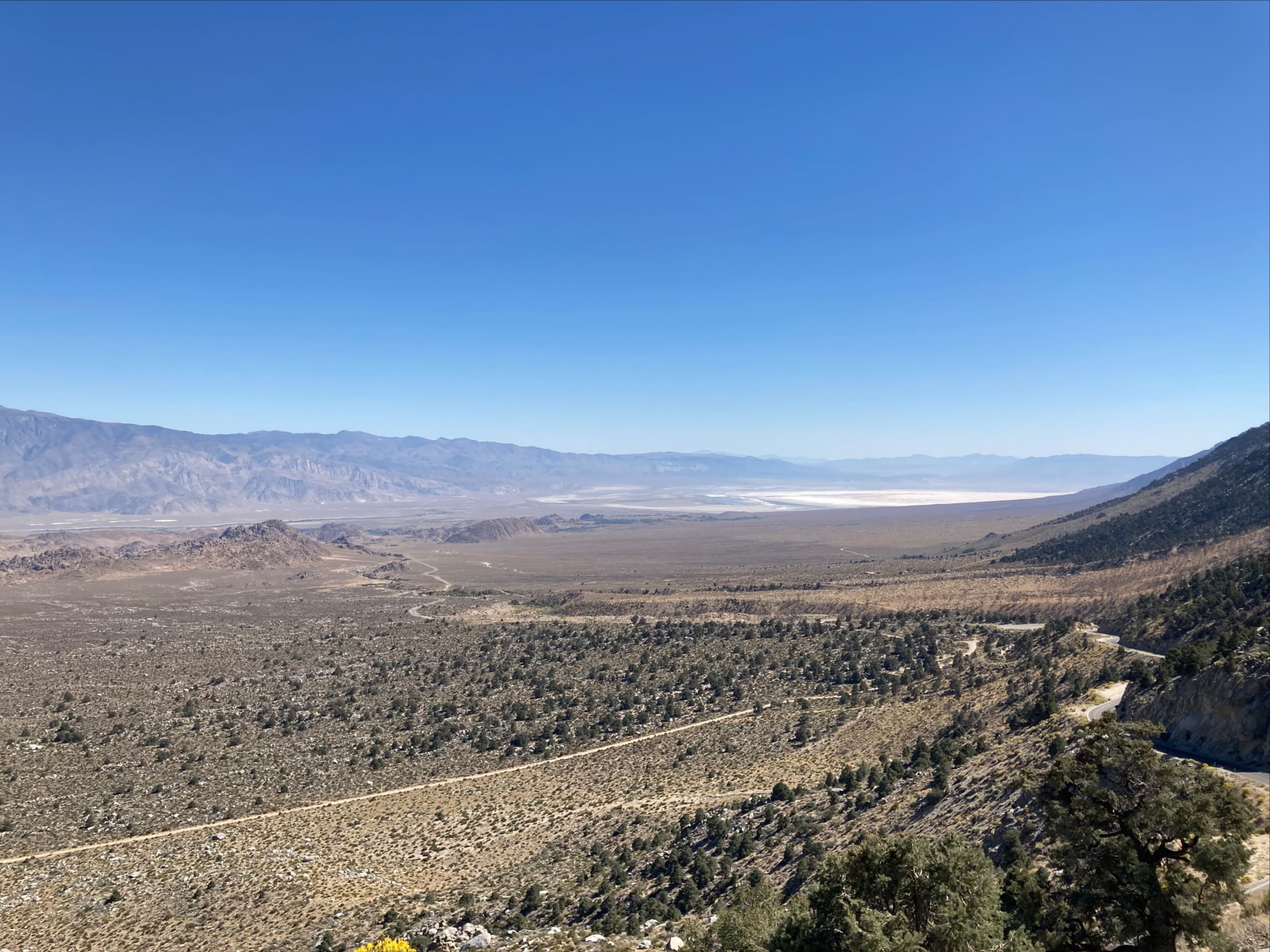
On the road to Whitney Portal. The switchback road is visible heading into the valley. Mount Whitney’s summit is roughly dead centre.Driving into the Whitney Portal area. There are campgrounds, a picnic area, and a small store. There are a couple of parking areas near the trailhead as well as overflow parking a short distance away.The Mount Whitney Trail goes past Lone Pine Lake. A permit is required to enter the “Whitney Zone” but that doesn’t start until after Lone Pine Lake, so there’s no need to worry about being fined.The trail starts off by travelling though this structure with information signs, warnings, and a place to pick up and drop off un-used Wag Bags (look it up).The trail initially climbs northeast before swinging around to the southwest and traversing above Whitney Portal. The route will eventually head to switchbacks which ascend the headwall at the centre of this picture and into to the hanging valley.The trail was broad and well-maintained. Our early October hike treated us to some nice yellows and oranges.There’s one fork in the trail just before a short creek crossing. The branch leading to North Fork Lone Pine Creek is used for the mountaineer’s route up Mount Whitney. It can be followed to diminutive Lower Boy Scout Lake without a pass, but beyond there the trail enters the Whitney permit zone.The creek crossing beyond the trail fork. Easy rock walking.We saw several of these lovely blue birds in the pines.The trail then crosses into the John Muir Wilderness. I was a little confused about all of the designations, but basically Inyo National Forest is a large area of federally managed land while the John Muir Wilderness is an area within Inyo and neighbouring Sierra National Forest subject to additional rules and protections.The morphology of the granite cliffs above the trail was very interesting – quite different from the Alberta Rockies.Some more fall colours, this time from the switchbacks heading up the headwall. There’s a creek that tumbles down the rocks adjacent to the switchbacks. It’s visible here sliding down the smooth rocks beyond the yellow bushes.The view back down the valley from near the top of the switchbacks. On the floor of the large valley between the mountain ranges are the Alabama Hills, distinctive rocky hills that have been used as a filming location for generations of movies. The mountains in the distance are part of the Inyo Mountain Range.Just to give an idea of what the Alabama Hills look like up close, here’s a shot from the Alabama Hills looking towards Mount Whitney and the valley where the previous picture was taken.At the top of the switchbacks the trail becomes remarkably level.The log bridges. I was glad we hiked the trail in the daylight before hiking it in the dark the following morning. There’s nothing difficult here, but first encountering it in the dark might have been confusing.Trout were clearly visible in the clear water.Soon after crossing the logs we found the little sign pointing the way to Lone Pine Lake.Arriving at the shores of Lone Pine Lake. We proceeded to circle the lake clockwise. The best views were from the far end.At the far side of the lake, looking back. The summit of Mount Whitney is not visible from here. Directly across the lake is Thor Peak.The view towards Thor Peak from a slightly different vantage. Another view of Thor Peak – After descending and driving part way down the Whitney Portal Road we stopped to take more pictures…the unusually-shaped flat-topped mountain in the background is Thor Peak.Heading back down to Lone Pine. We’d return at 1:30 the next morning to climb Mount Whitney.


One thought on “Lone Pine Lake”