February 7, 2020. A trip to K-country’s most famous accessible waterfall, followed by an exploration of a new trail to the less frequently visited Upper Falls.
- Region: Kananaskis Country. Traditional territory of the Stoney-Nakoda, Ktunaxa, and Blackfoot First Nations.
- Distance: 5.4 km round-trip
- Total Ascent: 100 m
- Elevation of Objective: 1,538 m
- Hiking time: 1h 30m
- Safety and Disclaimer
Virtually every hiking book, map, or blog detailing the Kananaskis area features Troll Falls. It’s easy to get to, accessible year-round and a satisfying objective when hiking with young kids. Above Troll Falls, there’s the “Upper” falls on Marmot Creek. Over the years a number of trails have been trod into the forest heading up to this less-visited objective. Some of these trails were of dubious safety and the province recently took steps to barricade some of them, and simultaneously marked and cleared a recommended route to the upper falls. My daughter and I took the opportunity to visit an old favourite and also try out the new trail this winter.
Access to the trailhead is easy. From Hwy 1, take Hwy 40 south into Kananaskis. At 23 km there is the very well-signed turn-off west towards Nakiska Ski Resort and Kananaskis Village. Take this road and after 1 km turn right into the parking lot for Troll Falls. This parking lot is sometimes also referred to as the Stoney Trailhead. There’s ample parking. The area features a small network of trails used by snowshoers and crosscountry skiers. Maps are found at most trail intersections. I’ve visited a number of times over a number of winters, and I’ve never needed snowshoes. The snow quality is variable, but there’s also the fact that the trail to Troll Falls is so popular that the snow is invariably packed down. Microspikes may be a good idea.
The hike to Troll falls is pleasant and not particularly strenuous. Aside from passing through one wide cut-line, the trail is in the trees so don’t expect any big views. The final part of the route parallels Marmot Creek below Troll Falls. At this point, and again at the waterfall itself, new signage points the way to the marked trail to the upper falls.
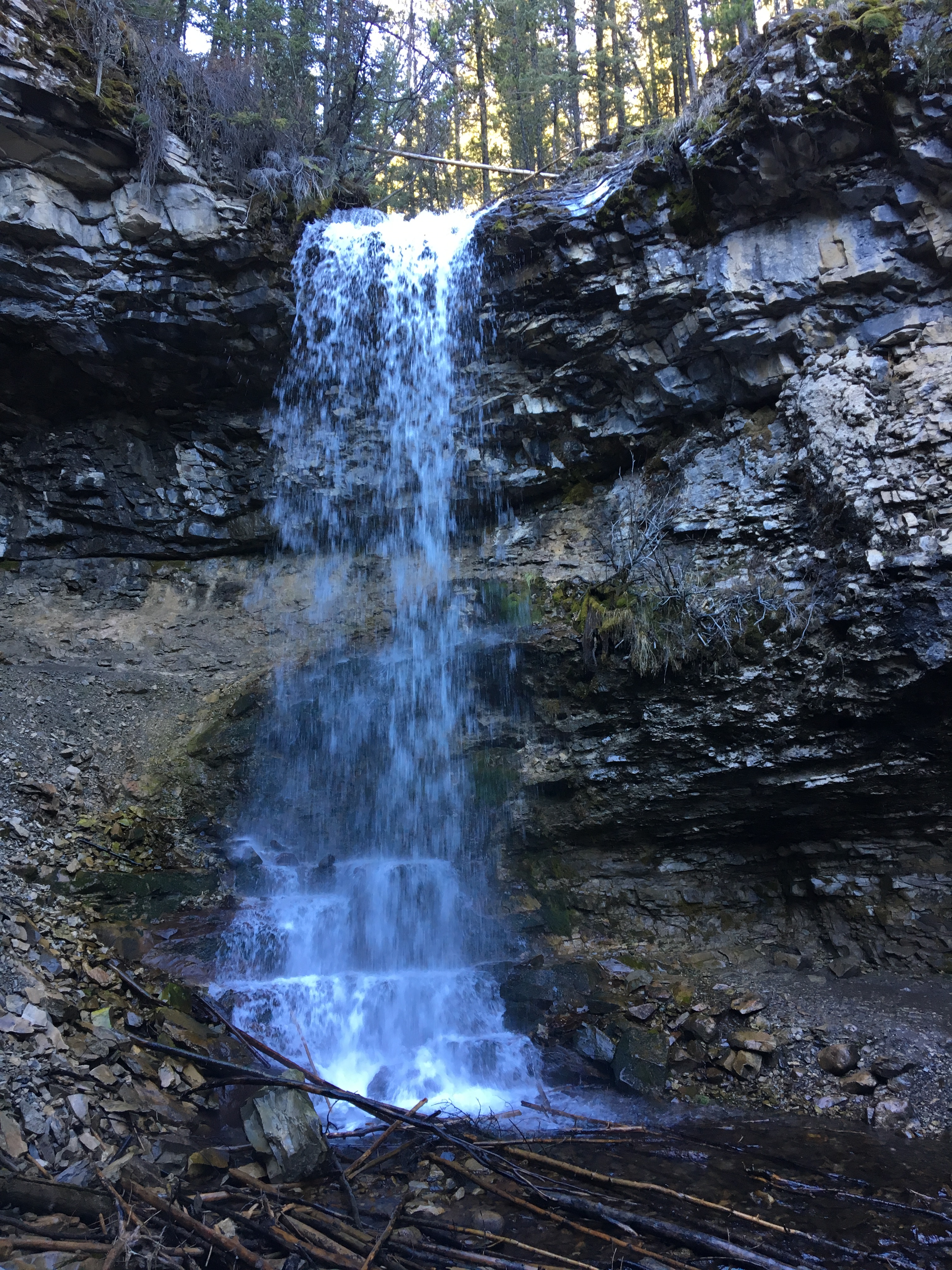
We went to Troll Falls first. In the winter it’s a spectacular frozen pillar. Climbing up and around beside and behind the falls reveals additional frozen rivulets and also the distinctive stone “face” of the Troll. Over the years people have taken to leaving little Troll dolls here and there among the rocks and along the route. I’m not too enthusiastic about that, but maybe I’m in the minority.
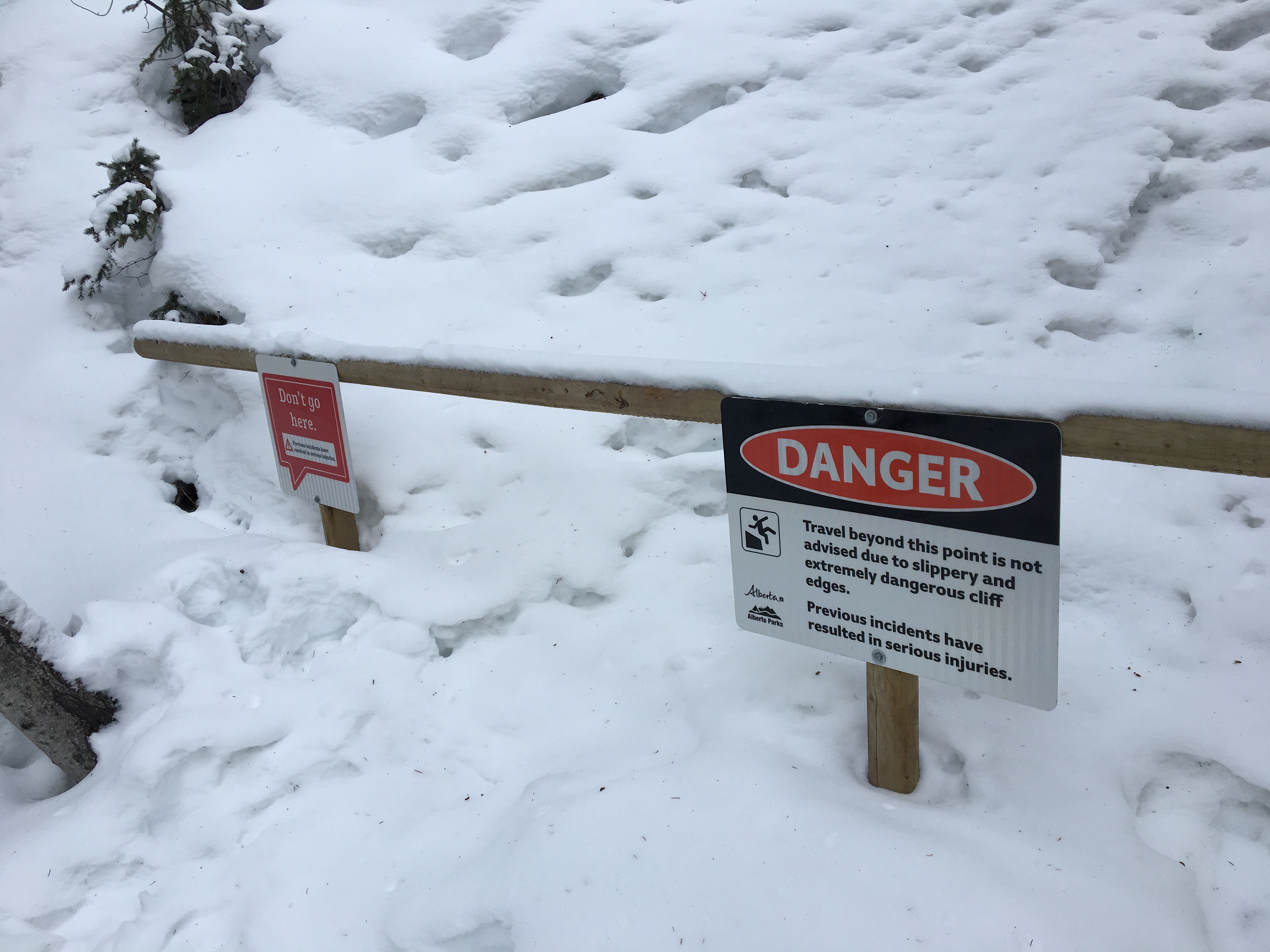
A number of barricades have recently been erected, gently reminding people not to take certain trails that go around and beyond the site of the waterfall. However, there’s also some new signage and marker posts leading the way to the recommended route to the Upper Falls. This route involves a bit of a concentrated climb, but nothing prolonged. It eventually rejoins Marmot Creek above Troll Falls and there’s some fun hiking over and around rocks along the way. We eventually reached the frozen upper falls. These don’t quite have the charisma of Troll Falls, but they do have their own charm and the trip was definitely more engaging than the walk to Troll Falls.
Click on the pictures in the gallery below for full-sized images.


Very nice pictures and descriptions of your hike and the terrain. Wish I was there too!
LikeLike