For my second outing in Canmore this month the objective was Middle Sister, the central peak of Canmore’s iconic Three Sisters. The route is known to be a grind. Following the 2013 floods the approach trail along Stewart Creek was destroyed. Instead of a walk along a trail, the approach now involves navigating boulders and rubble along a creek bed for 3-4 km. There’s no way to do this quickly going up or coming down and it has been characterized as a slog. On the other hand, the views from the top are known to be excellent. The weather forecast called for rain in the morning with clearing near noon. We decided to go for it. It was, indeed, a slog. But the views really were excellent.
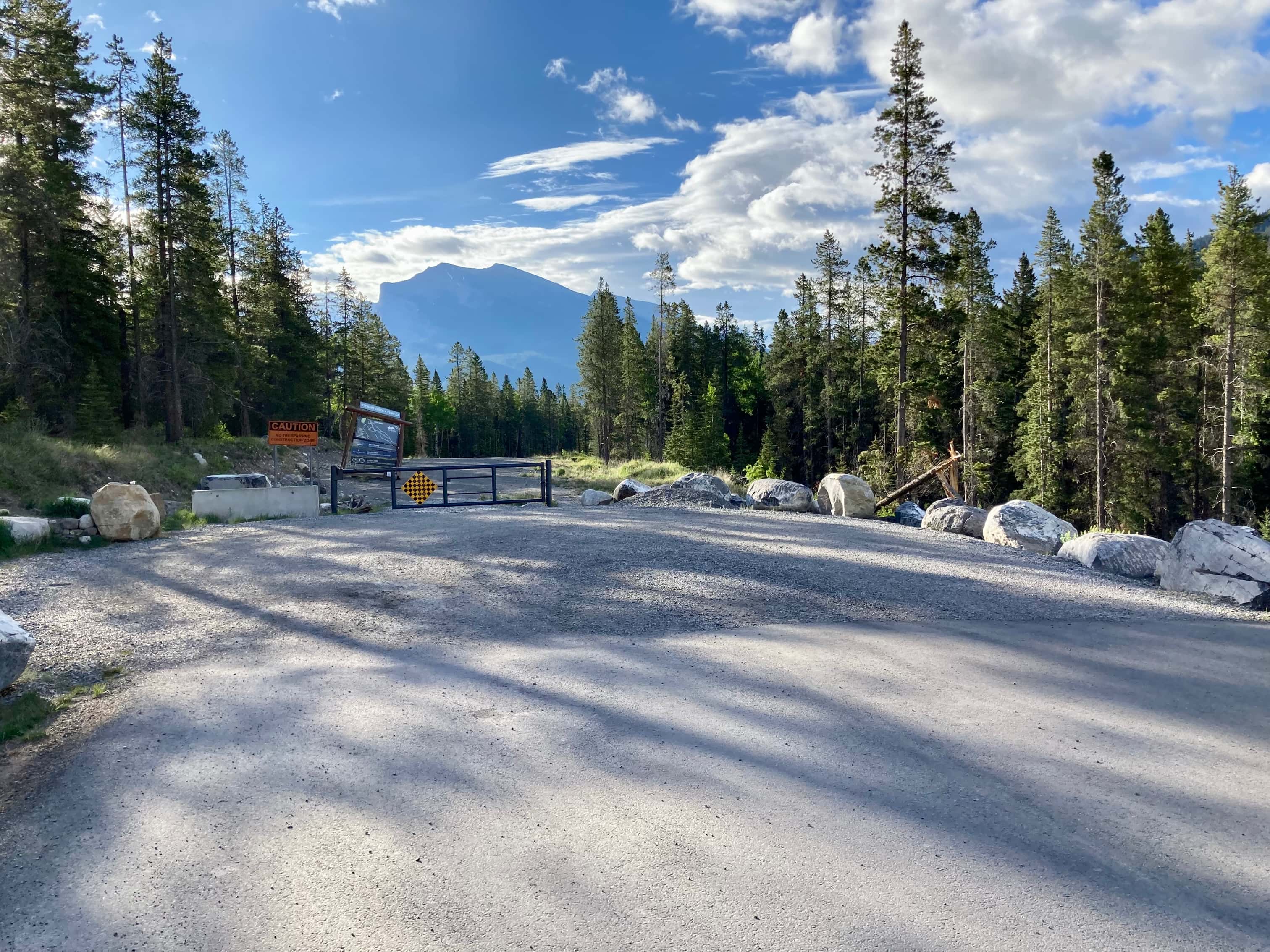
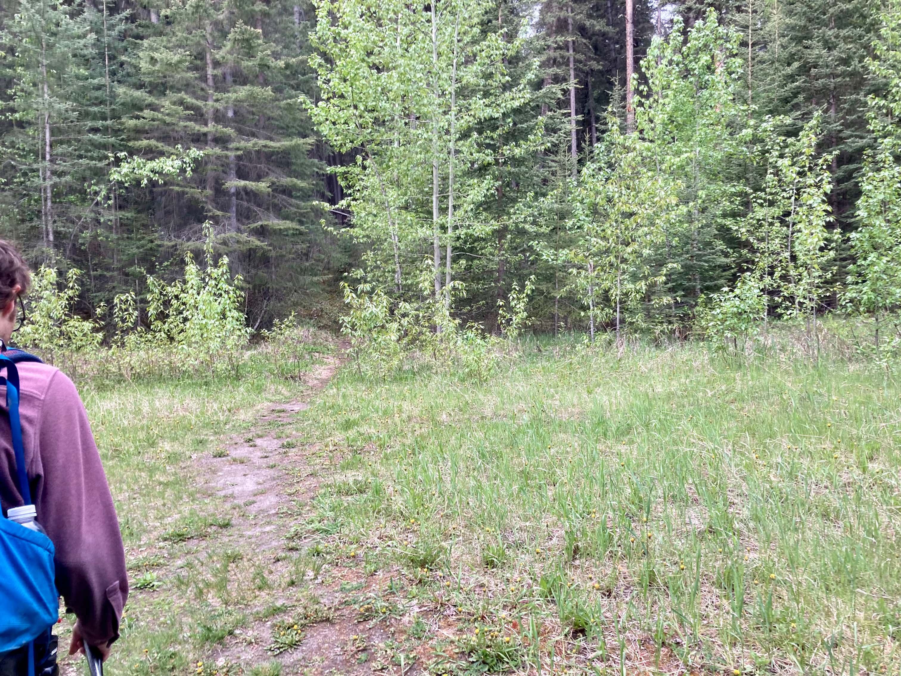
The route starts just east of an area of active housing development next to Stewart Creek Golf and Country Club. We parked where the Three Sisters Parkway ends. Click here for the Google map. We followed the gravel road southeast for a little over a kilometre, until we passed a roped-off fork heading west. Just past there, in a small clearing, a trail headed off into the trees to the west. We followed this path until it intersected Stewart Creek. This area of the creek bed had been cleared of rubble and there was a small dam across the creek. We crossed over the creek onto a well defined trail on the north side. This trail went through the trees then very soon led us to the rubble and boulders of the creek bed upstream of the cleared area.
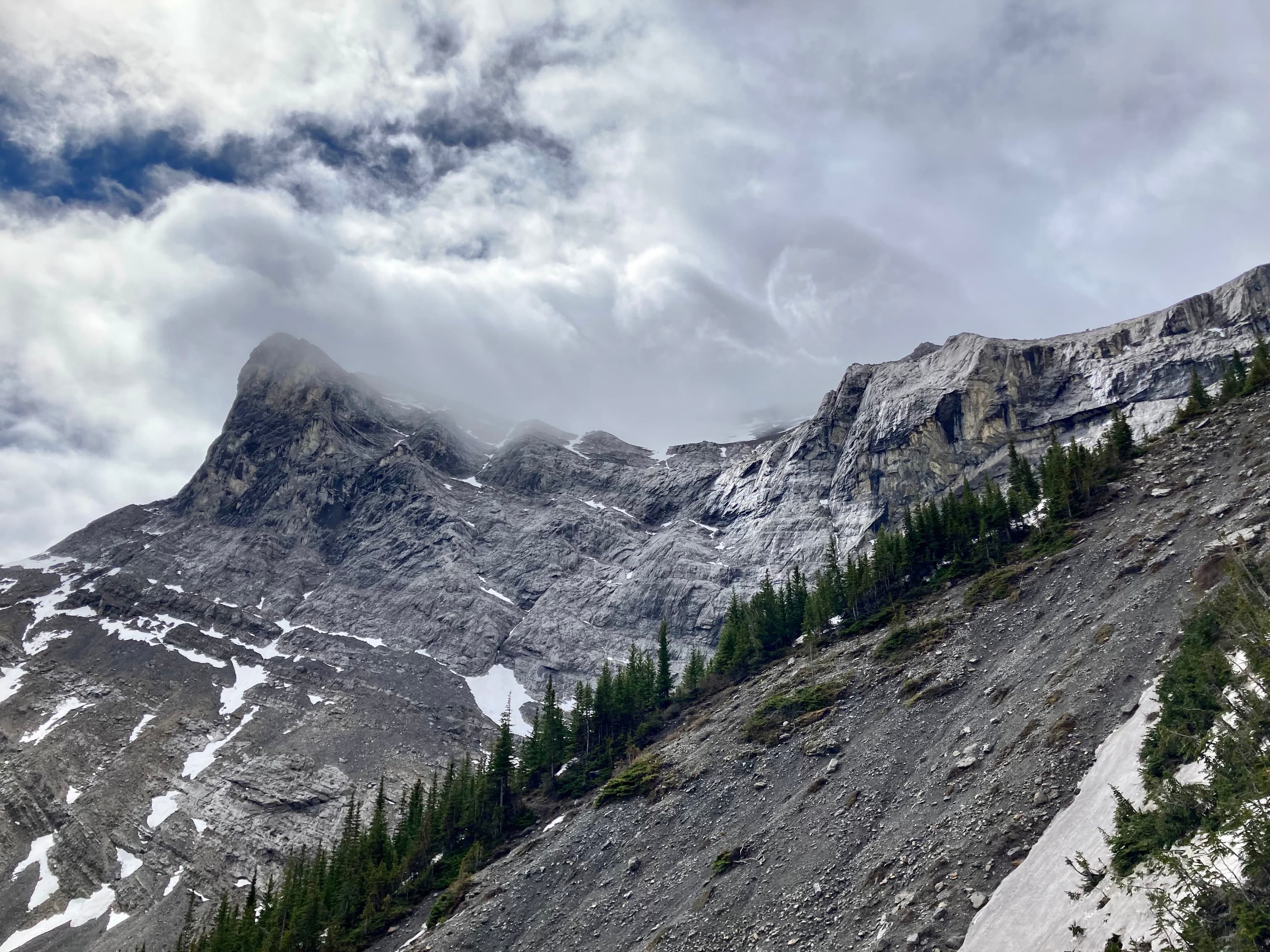
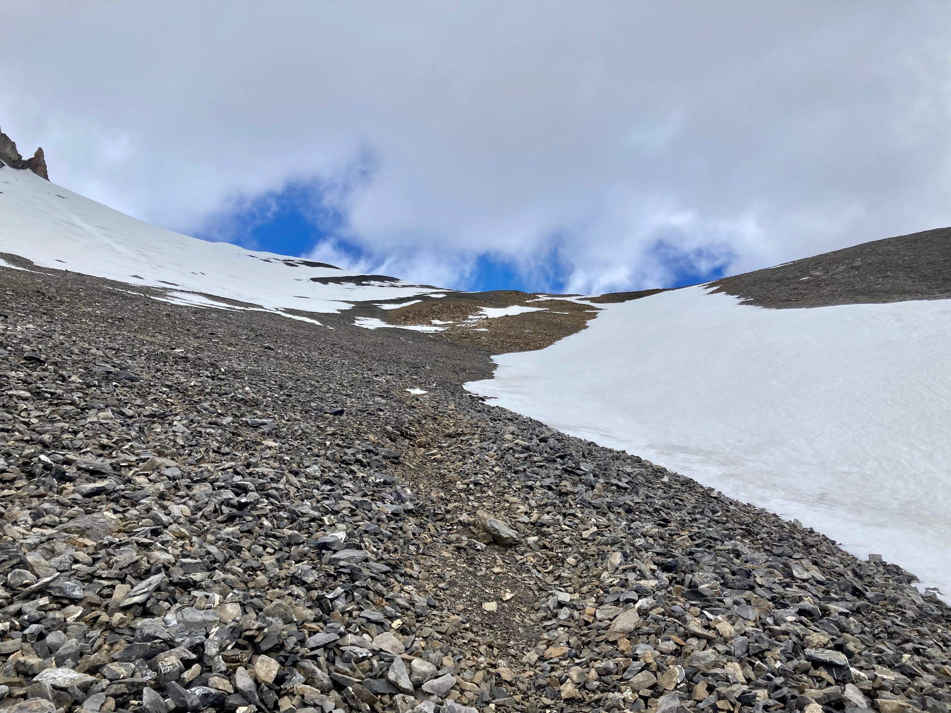
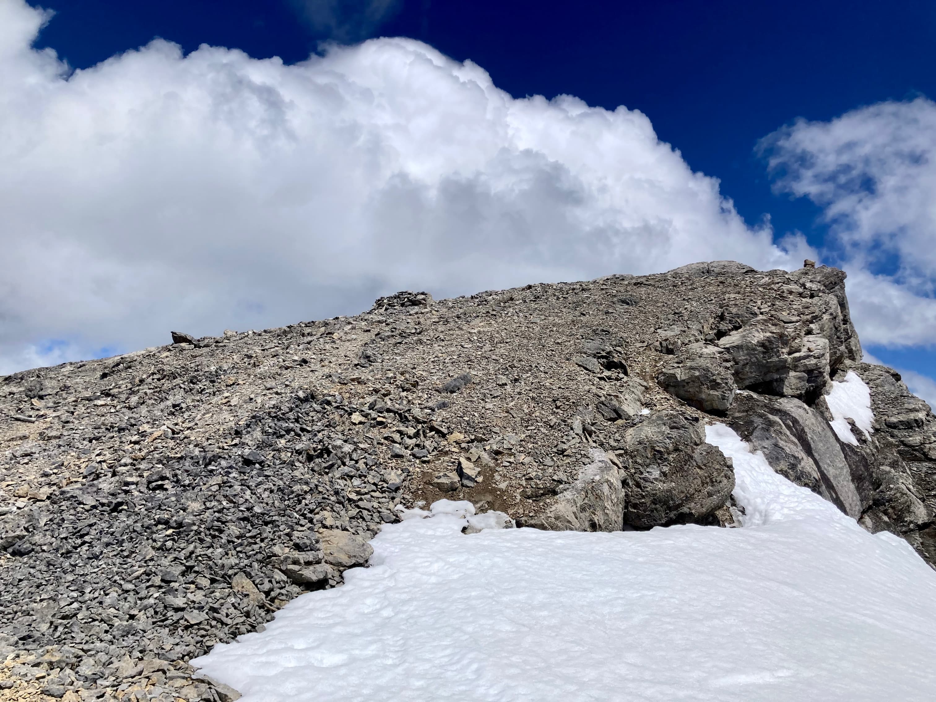
From there we followed the creek. Here and there were bits of trail marked by flagging in the trees next to the creek, but most of the trip was in the creek bed. It started to rain on us, eventually getting to the point where we were soaked. There wasn’t much shelter to be found but we did find a boulder that afforded us some relief from the rain. Eventually the rain let up and we were able to continue. We eventually made it up into the rocky bowl below the south face of Big Sister. From there we hooked around the end of a cliff band and ascended north east until we reached the col between Big and Middle Sister. Beyond there we continued to the summit. No scrambling was involved, just a laborious uphill hike.
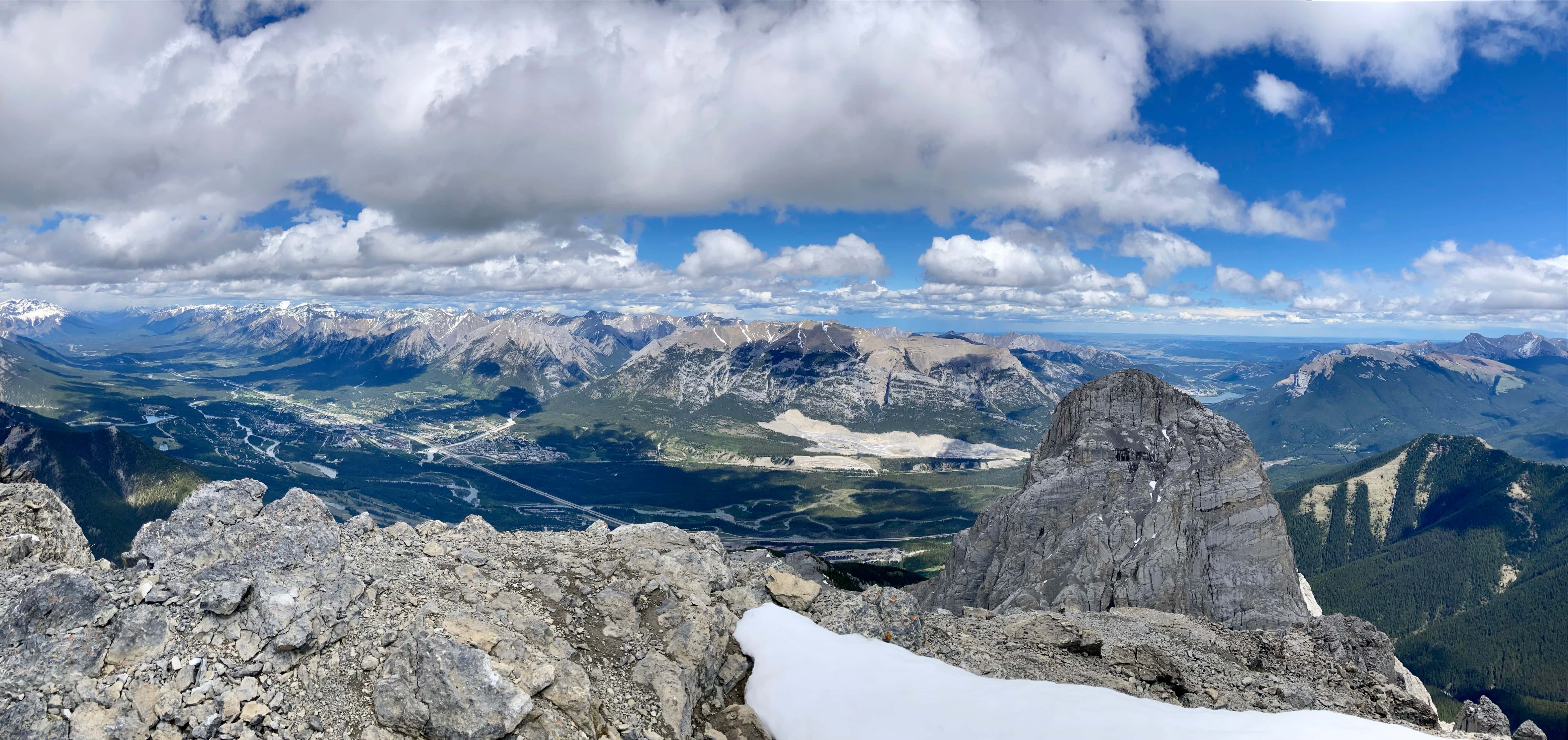
The views from the top were excellent. The rain clouds had moved away by the time we reached the summit and the wind had picked up a bit. Despite having appropriate gear, we were all still damp from the rain so we were very cold during our time on the summit. After taking in the views for a while I was happy to descend and get out of the wind. Between the weather, the long, challenging day, and the views from the top this trip felt somewhat epic. We definitely felt like we’d accomplished something. It’s just not something I’d want to do again.
Click on the pictures in the gallery below to access higher resolution images.
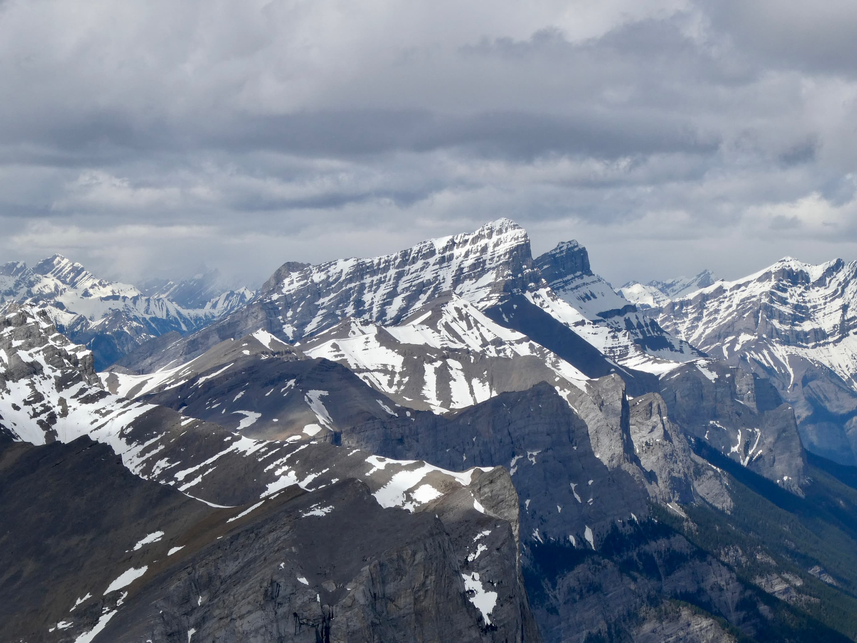
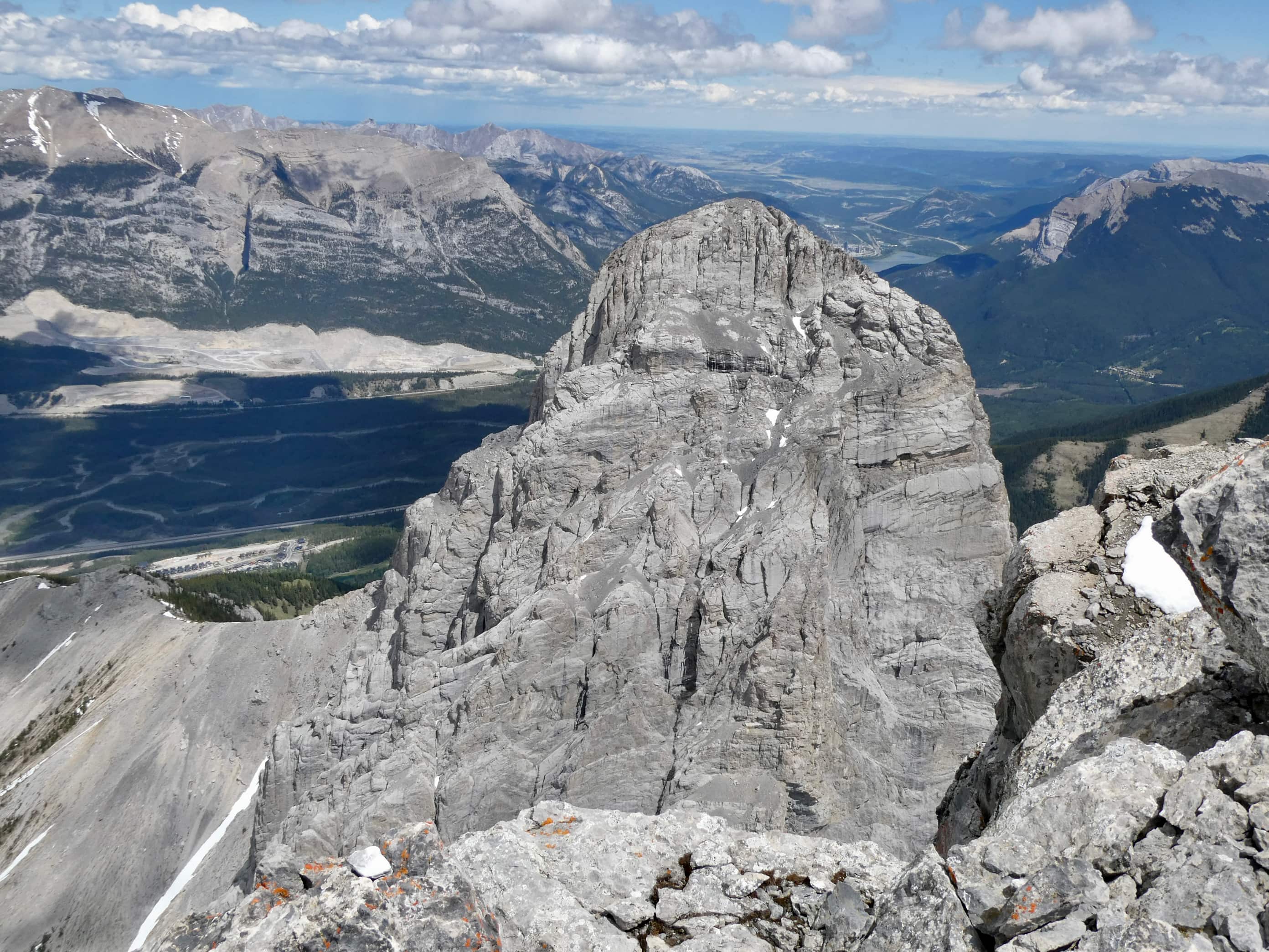
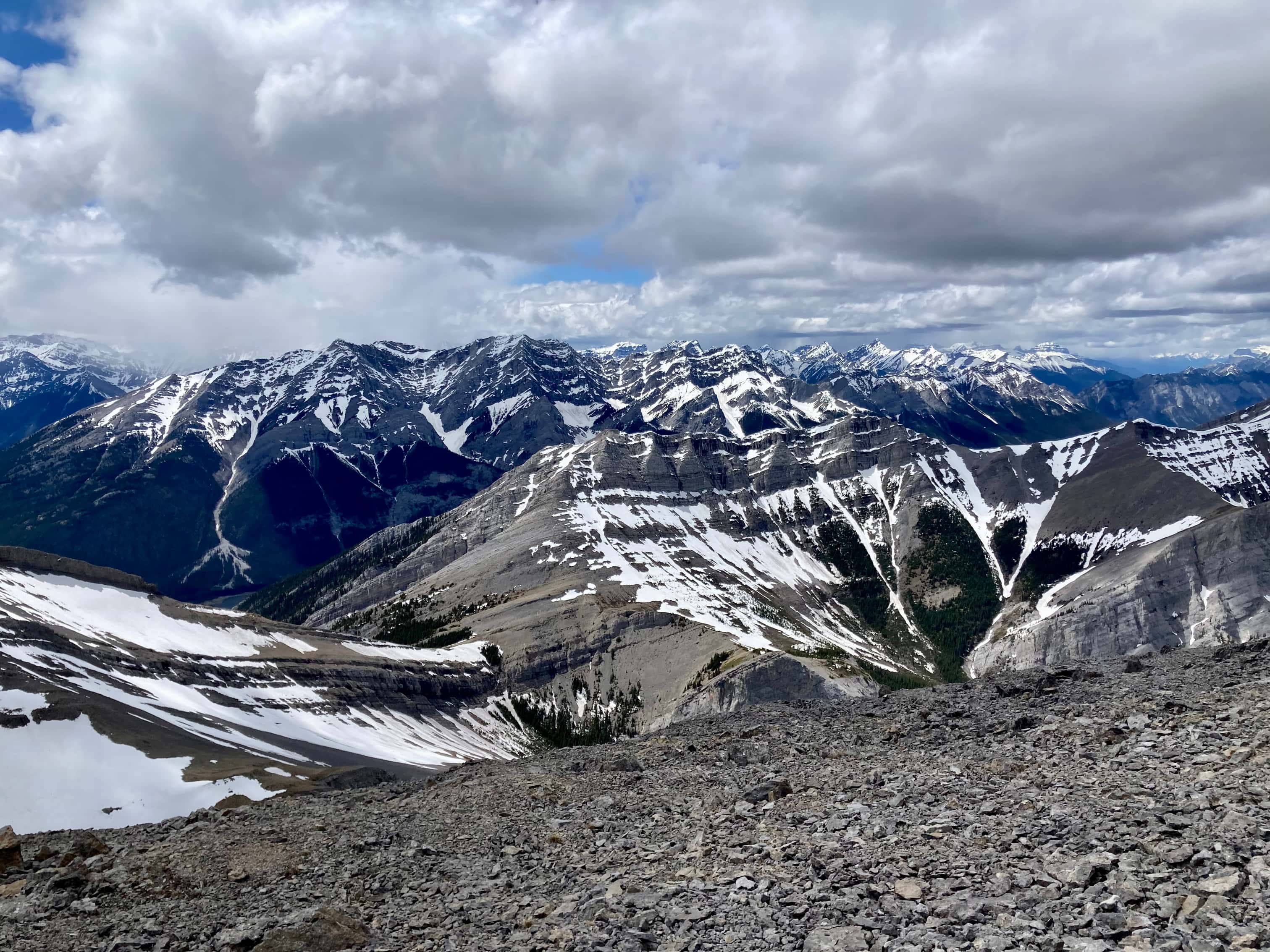
Route overview looking northwestThree Sisters as seen from Canmore. Our ascent of Middle Sister would be from the far side.The parking area – where Three Sisters Parkway ends. We headed out along that road, dodging dog poop that owners did not feel obliged to pick up.The start of the footpath through the woods. Just before this clearing there was a more substantial trail/road splitting off and heading west from the main road but it was roped off.The path through the woods eventually led us to the cleared creek bed featuring this dam. A 2×8 sitting across the top seems to be intended as a bridge. An actual bridge was sitting on the gravel some distance left of this frame. I’m guessing that someone eventually intends to properly place it. After crossing over the creek we followed a trail through the woods until it brought us back to the creek bed.Typical terrain in the creek bed.Taking shelter during the worst of the rain under a big boulder with an overhang.Once the sky cleared a bit we pressed on with navigating the rubble.The clouds cleared enough for us to get our first clear views of Middle Sister and Little Sister.The summit of The Orphan appears from out of the clouds.As we started the climb up to the bowl beneath Big Sister we encountered some snow. In places this complicated the ascent but it did speed our descent at the end of the day. We couldn’t glissade, and we had to watch out for snow bridges over running water, but there were several places we could safely boot ski.Higher up now, looking north while clouds roll through. Middle Sister’s cliffs are at centre. We had to ascend left until those cliffs petered out below the face of Big Sister, then hook around the end and start ascending. Big Sister is hidden in the clouds to the left. Little Sister is off to the right.Little waterfalls coming down from the cliffs of Middle Sister.The spot where Middle Sister’s cliffs end.In the cirque south of Big Sister. The cliffs ahead close off the valley and connect to Rimwall W2 and The Orphan.After hooking around the end of the cliffs we ascended northeast towards the col between Big and Middle Sister.Looking back from part way up.Nearing the col. False summit on the right.The first sight upon reaching the col – Ship’s Prow Mountain across the valley to the north, the taller peaks of the Goat Range beyond that.Big Sister seen from a short distance above the col.The summit finally came into sight.The summit of Middle Sister.Looking down at Canmore in the Bow Valley.Looking eastLooking southLooking westLooking northMount Rundle and Cascade MountainA closer look at Mount Rundle.I think this is Mount Temple.Mount Inglismaldie, Mount Girouard, and Mount PeecheeLittle SisterRimwall Summit, which we had climbed the day before, in the foreground. Mount Lougheed’s peaks are in the clouds beyond.Another look towards Ship’s Prow Mountain and the Goat Range. The clouds kept shifting. You can see precipitation incoming in a few spots.Heading down.During the descent was the first time we had Big Sister’s southern aspect full in view.Back down to the bowl. Sunshine, rain, waterfalls. There were even some marmots.A rainbow welcomed us back to the valley.
Nice pics, and good description of “the slog” Par. I went up Middle Sister solo many years before the flood, and I thought that it was a fairly tough hike back then. A friend wants to try it this weekend (Oct 12th/24). I doubt that we will actually summit; but it should prove interesting, in any case. Thanks for the description of the route!


Hi,
Do you have the GPX tracks of Middle Sister?
LikeLike
We went more or less the same route as the GPX track in the Topo Maps Canada app.
LikeLike
Very nice views!
Bal Boora
>
LikeLiked by 1 person
Beautiful views
LikeLiked by 1 person
Nice pics, and good description of “the slog” Par. I went up Middle Sister solo many years before the flood, and I thought that it was a fairly tough hike back then. A friend wants to try it this weekend (Oct 12th/24). I doubt that we will actually summit; but it should prove interesting, in any case. Thanks for the description of the route!
LikeLiked by 1 person
Glad you liked the post :). The weather’s promising this weekend – hope it’s a great day on the mountain!
LikeLike