October 2, 2020. Scrambling on one of Waterton’s most exciting and accessible peaks.
- Region: Waterton Lakes National Park. Traditional Territory of the Blackfoot, Tsuu T’ina and Ktunaxa First Nations
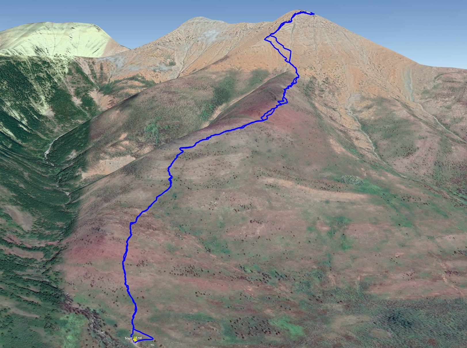
- Distance: 6 km round-trip
- Total Ascent: 960 m
- Elevation of Objective: 2367 m
- Total Time: 4h 2m
- Safety and Disclaimer

The last time I climbed Mount Galwey, I carried a film camera with me. I’ll estimate that was a little over 20 years ago. I found the pictures not too long ago, and reminisced about a time when you had to try to make every picture count, but couldn’t view any of what you’d shot until you returned to civilization and had the film developed. You may have an amazing day on the mountain only to find out, as I did, that the camera lens had a smudge on it and all your pictures were slightly blurry.
Mount Galwey has been featured in Kane’s Scrambles in the Canadian Rockies since the first edition. Its famous traverse on small ledges above a dramatic drop is depicted on the cover photo of the 3rd edition of the book. It’s an appealing objective for a few reasons aside from its exciting rocky terrain: access is easy, there’s no prolonged approach, and the route is simple to follow.
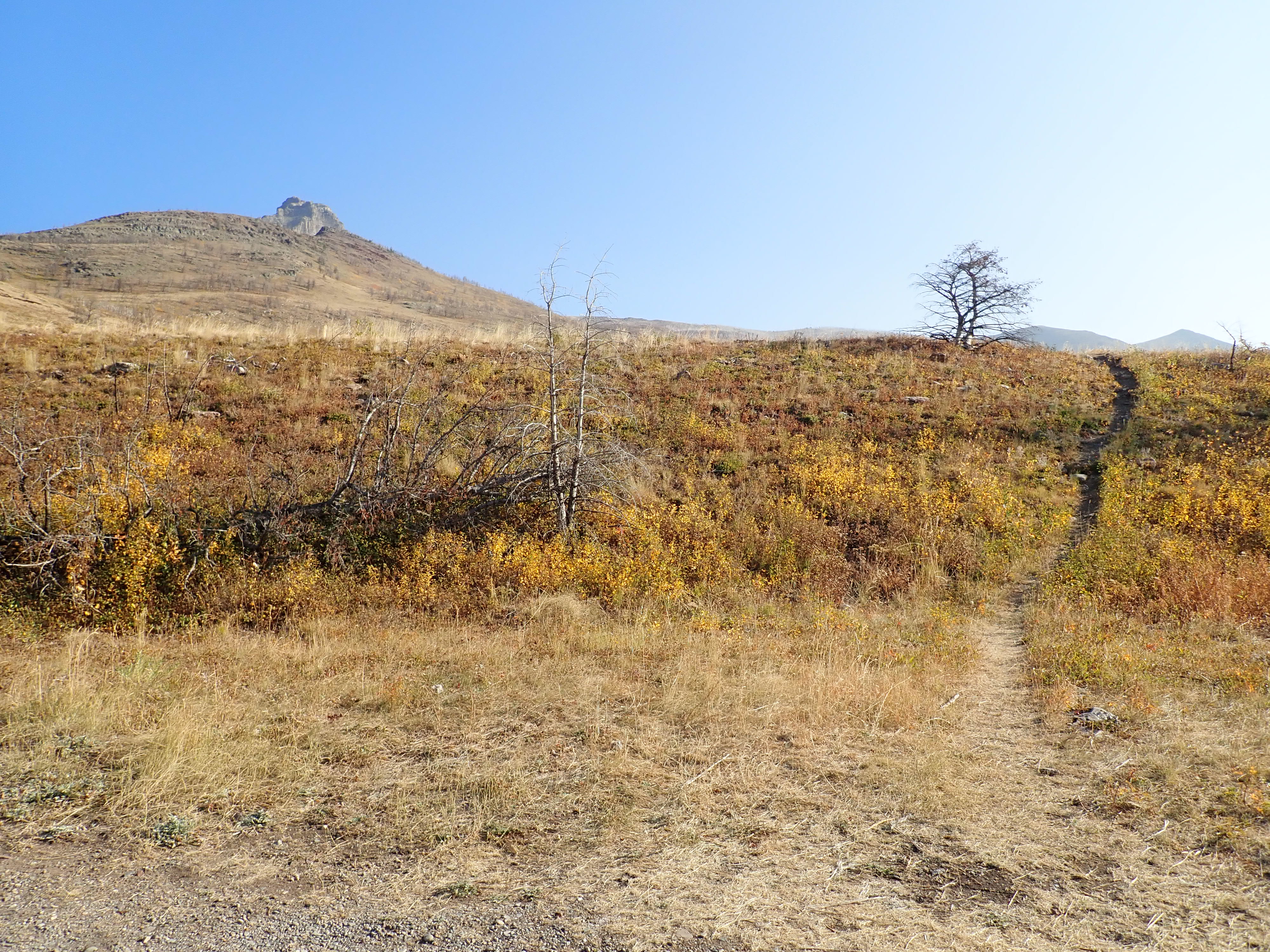
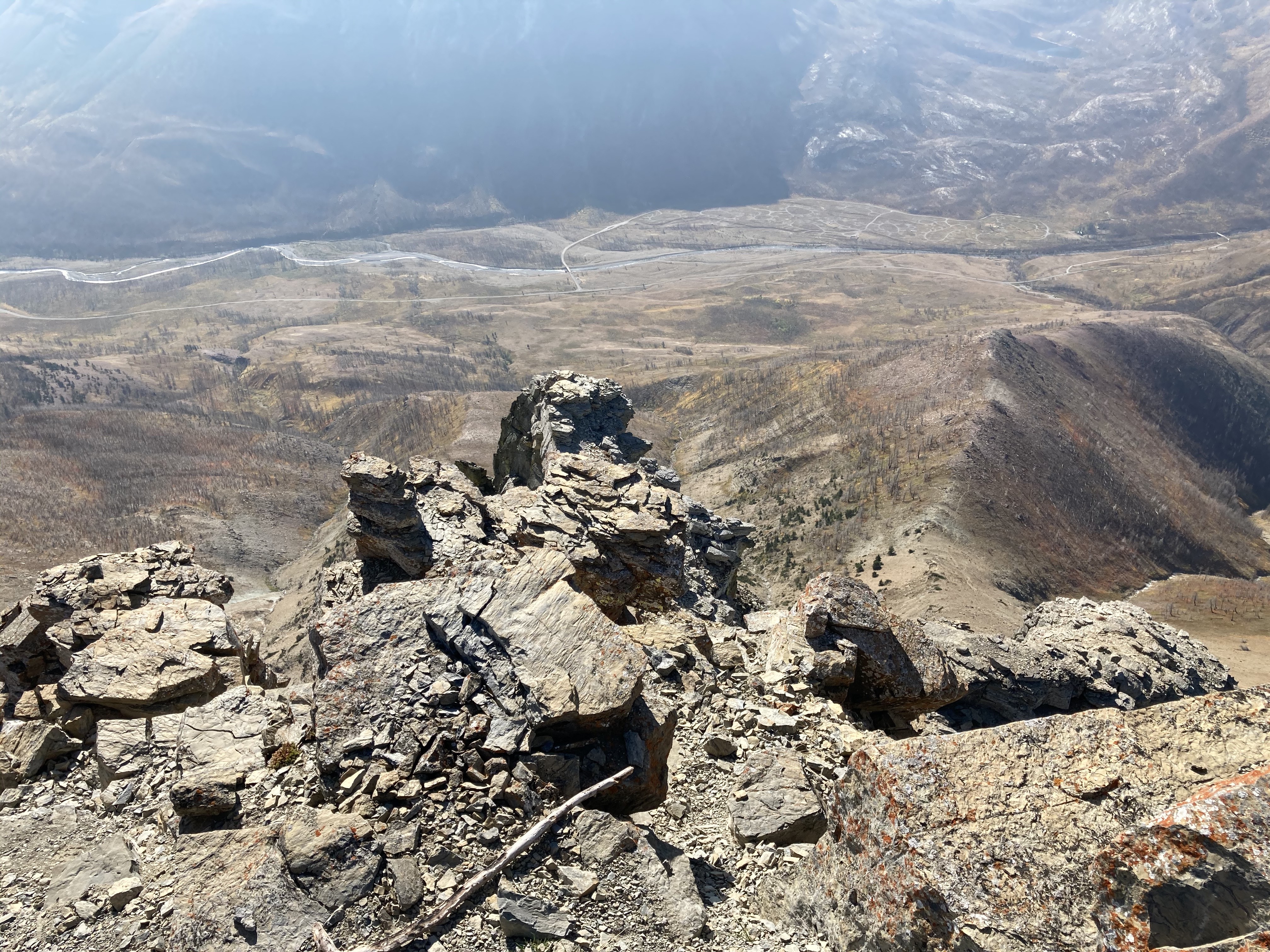
The route begins at the Coppermine picnic area in Waterton Lakes National Park. This is accessed along the Red Rock Parkway, the first right hand turn-off from the access road to the park. Coppermine is about 8 km along the road. Ask Google Maps to drop a pin here: 49.103620, -113.958334. All of the structures in the area burned in the fire of 2017, so as of this writing there are no picnic or toilet facilities at the trailhead. There are two open gravel areas, one right by the turn-off and one slightly further in. Parking at the second area will put you right where the trail begins. From the parking area, the summit of Galwey is visible to the northeast, poking up from behind the contour of its southwestern spur.
The initial portion of the ascent involves following a very obvious trail along the top of this spur. Eventually, I reached the connection between the spur and the main mass of the mountain. Here, the trail diagonally ascends left across a scree field on the southwest face, eventually gaining the western ridge. It crosses a drainage of blue-grey rock, which I decided to ascend for a while for a bit of fun before leaving it and traversing back to the obvious trail.
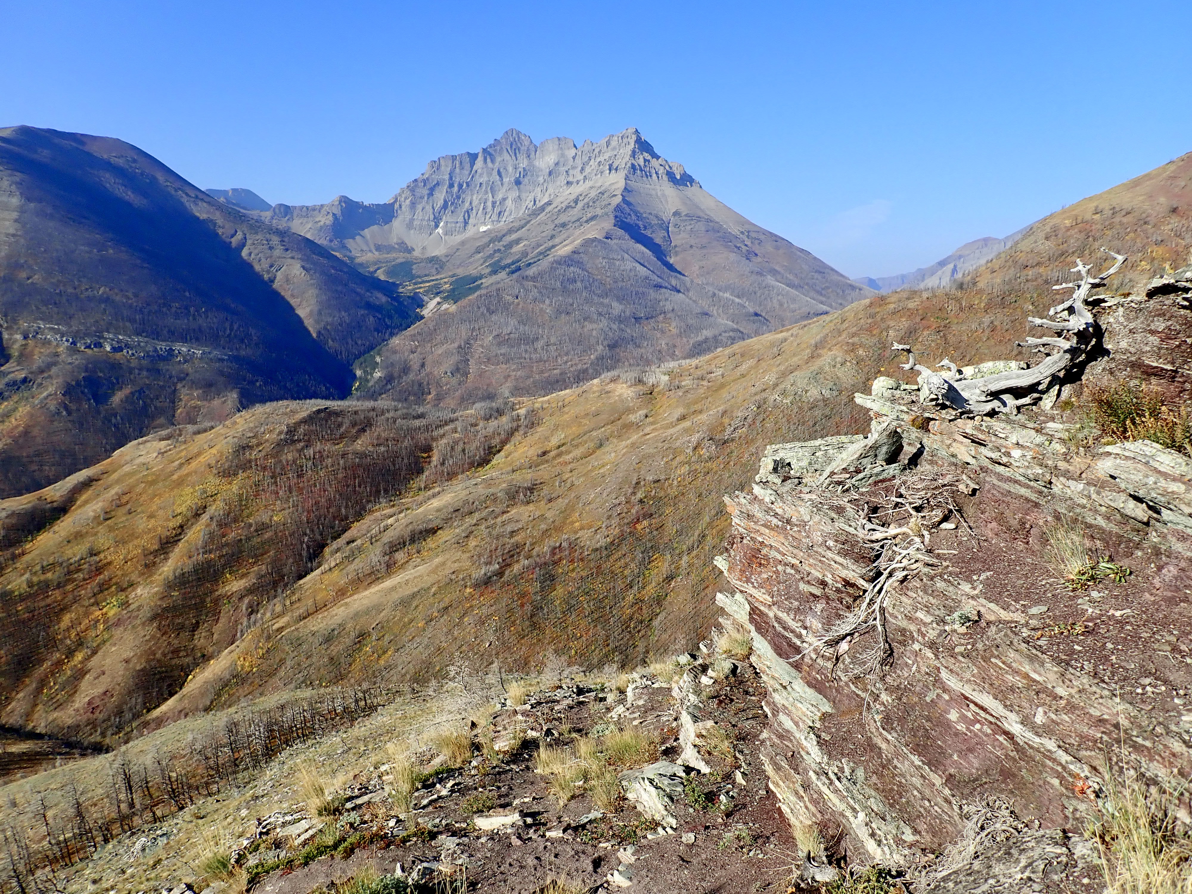
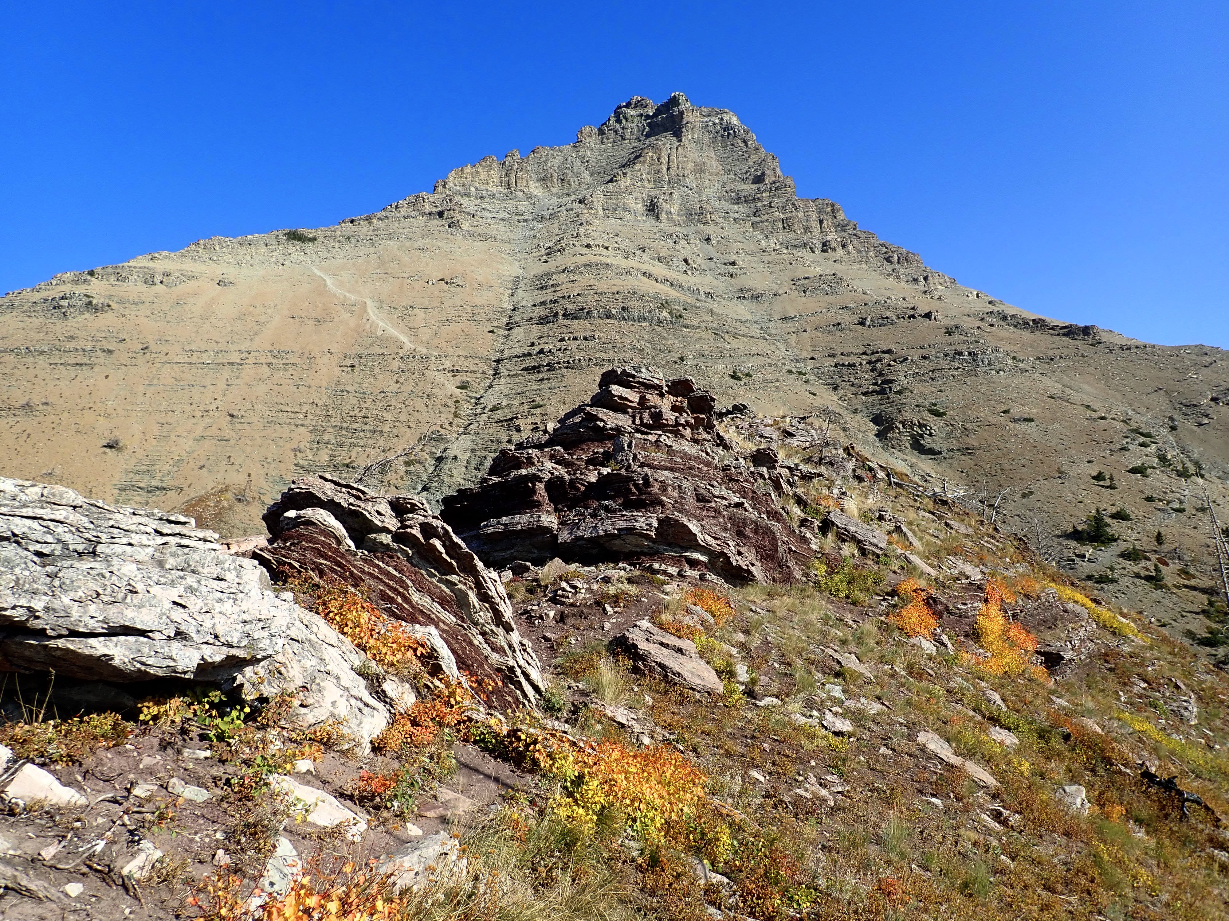
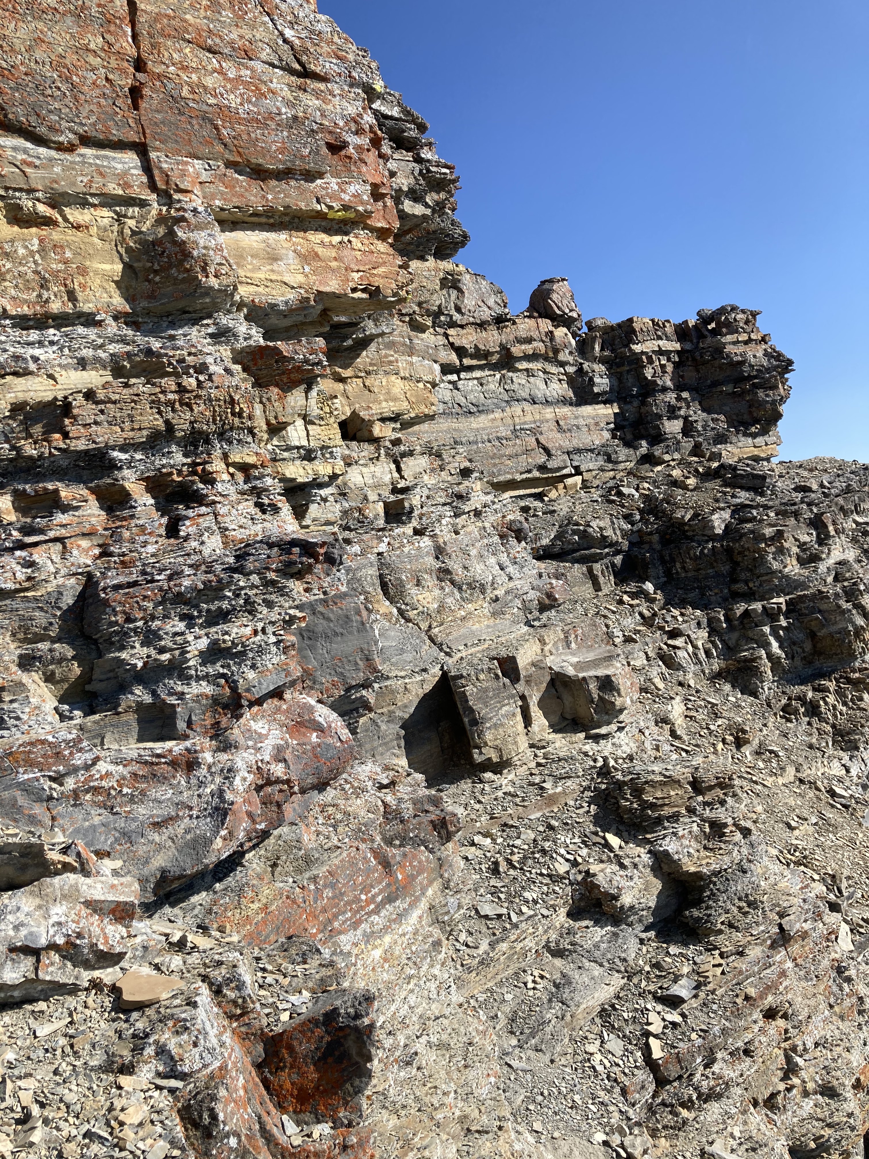
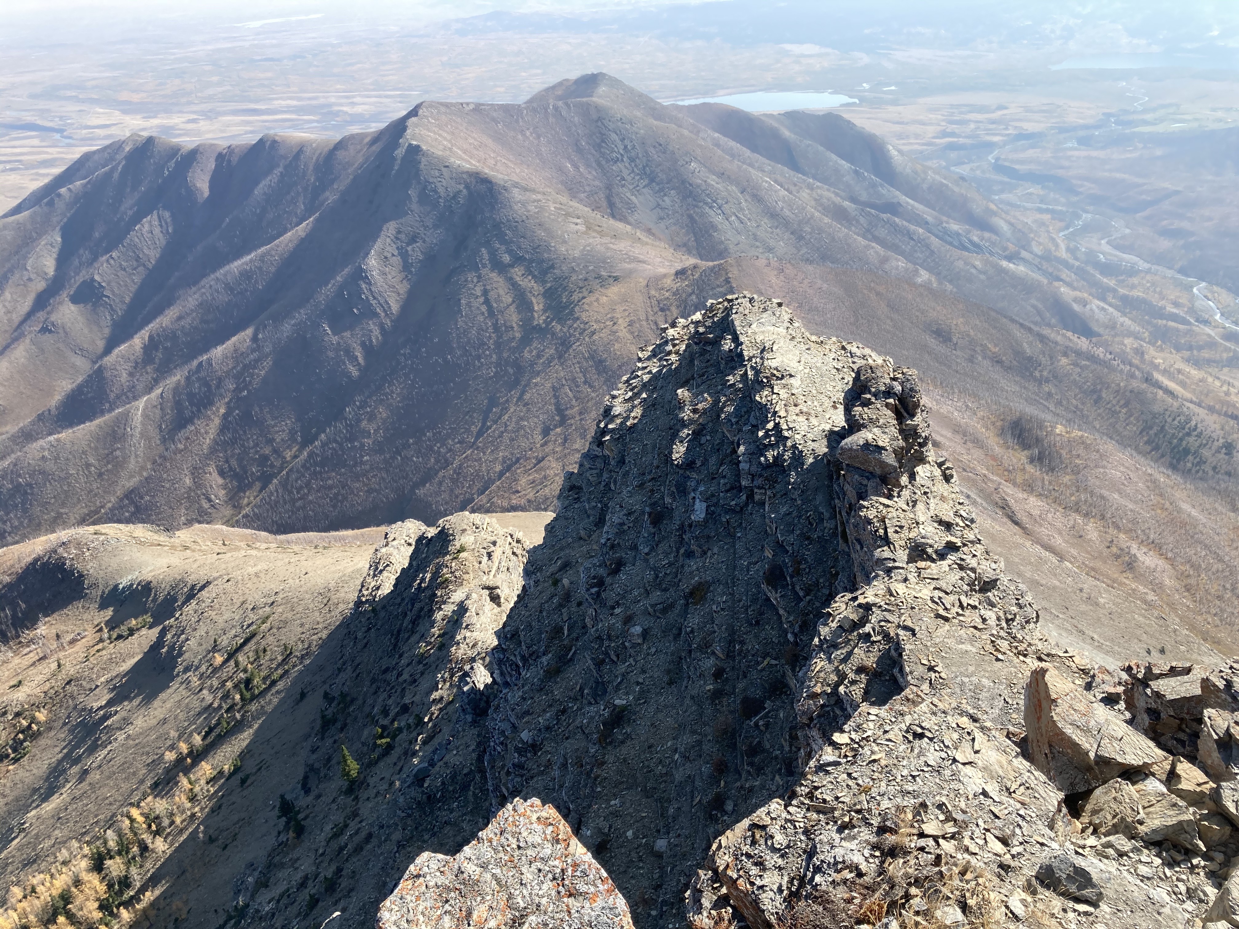
The route then passes over the ridge, and continues along the northern side. I saw cairns here and there marking a route, and I found that there was still something of a visible path in many places. On this side of the ridge, the route continues along the ridge for a short distance, then traverses below steeper rock to a pale rock gully. I ascended here, reached the top, and peered over the edge at the sheer drop to the south. Then I headed left, and was able to pick out the rock “mushroom” described by Kane in the distance. I headed generally in that direction. Eventually I encountered the distinctive black rock of the Purcell sill, and ascended via an obvious weakness. This made for some fun scrambling. There’s 7-8 foot wall to overcome at one point. Since there’s no exposure beneath it, I took the opportunity to attack it more or less head-on just to see if I could. A short distance beyond, I reached the crux.
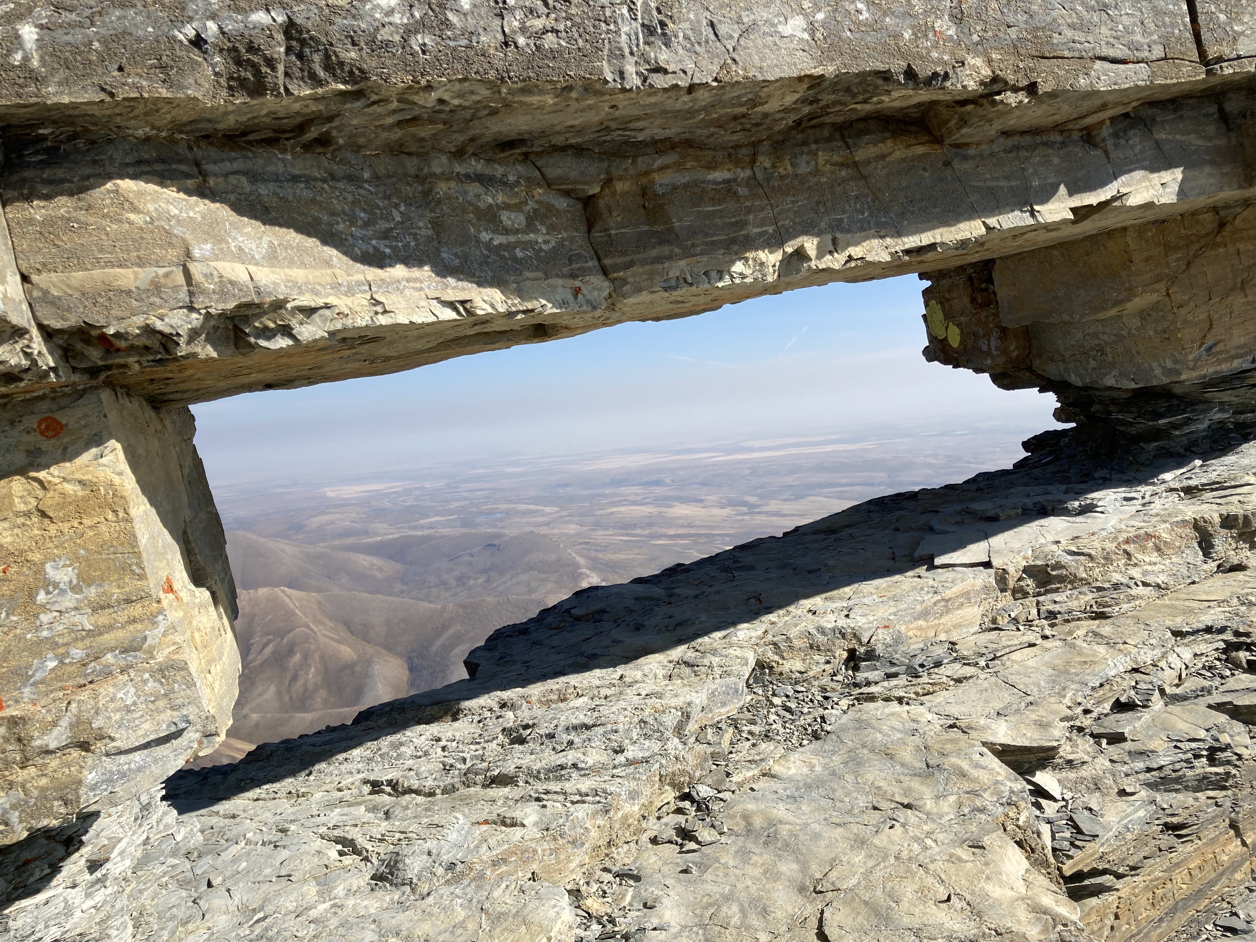
This part of the route has probably turned back a good number of very reasonable people over the years. There’s a broad rock platform, with the summit block above to the north and a rocky pinnacle projecting to the south. Directly climbing up to the summit isn’t practical from this point. To the right, as you look at the summit, there’s a projection of rock with a steep drop below. If you edge south on the rocky platform, you can see that around the bend of the projection there’s a rock window visible. Narrow rocky ledges allow a traverse around that bend. The footing is secure, and with due care and attention it’s possible to make your way around. Once around, there’s a chimney which allows a scramble to the summit.
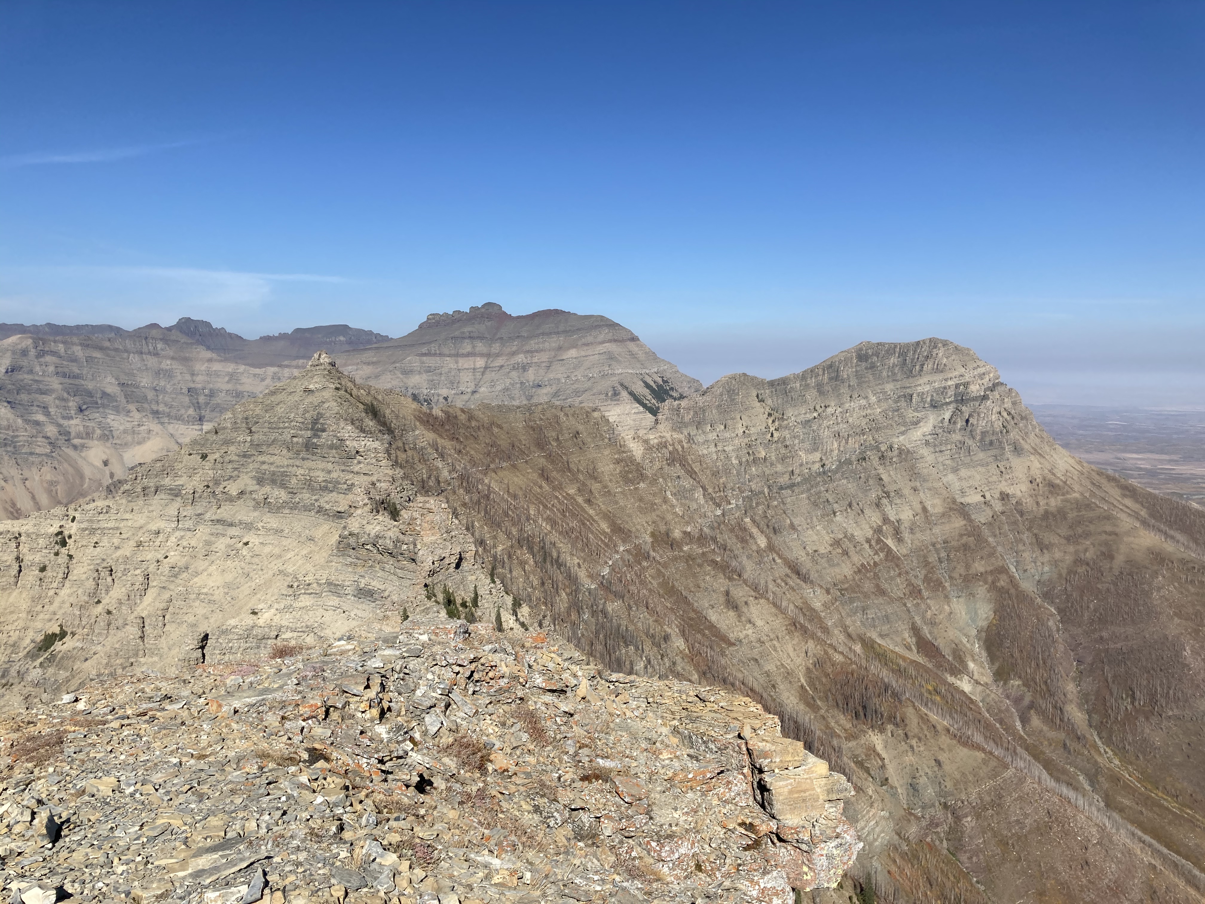
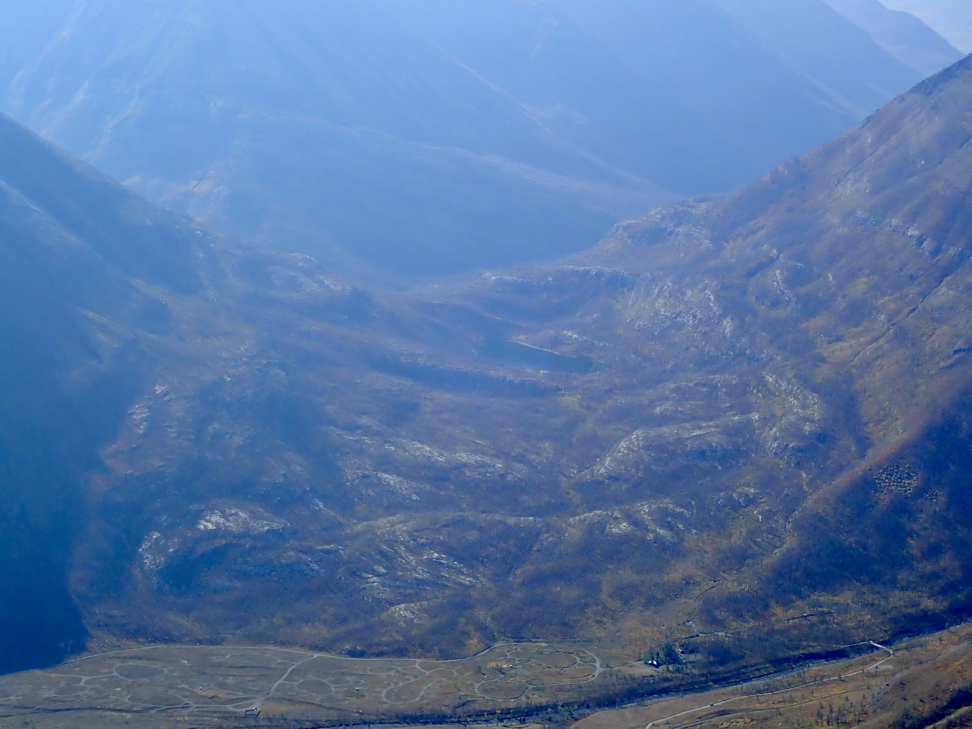
A small cairn greeted me at the summit. I didn’t see a register, though I didn’t dig under the rocks. The day was hazy, subduing the views pretty dramatically. Mount Crandell, Ruby Ridge, Mount Blakiston, and Anderson Peak were visible to the west across the valley, with the peaks beyond silhouetted in the haze. Bellevue Hill is to the south. Galwey’s unofficial north summit, “Rogan Peak”, and Mount Dungarvan are north. East is Lakeview Ridge and the prairies. The evidence of the destruction wrought by the 2017 fires was all around. I peered down across the valley at the Crandell Campground, which is still closed 3 years after the fire. Nearby Crandell Lake would probably have looked quite picturesque, but the haze ruined the view. I enjoyed having the peak to myself for a time, then descended along the same route.
Click on the pictures in the gallery below to access full-sized images.


Great views and very good commentary, Par!!!
LikeLike
I need to come visit this blog more often! Your content is amazing 🙂
LikeLike
Thank you!
LikeLike
Enjoy reading! Thanks! We will visit this mountain soon!
LikeLiked by 1 person
Thanks Par! Great writeup as always.
LikeLiked by 1 person
Thanks for reading and commenting!
LikeLike