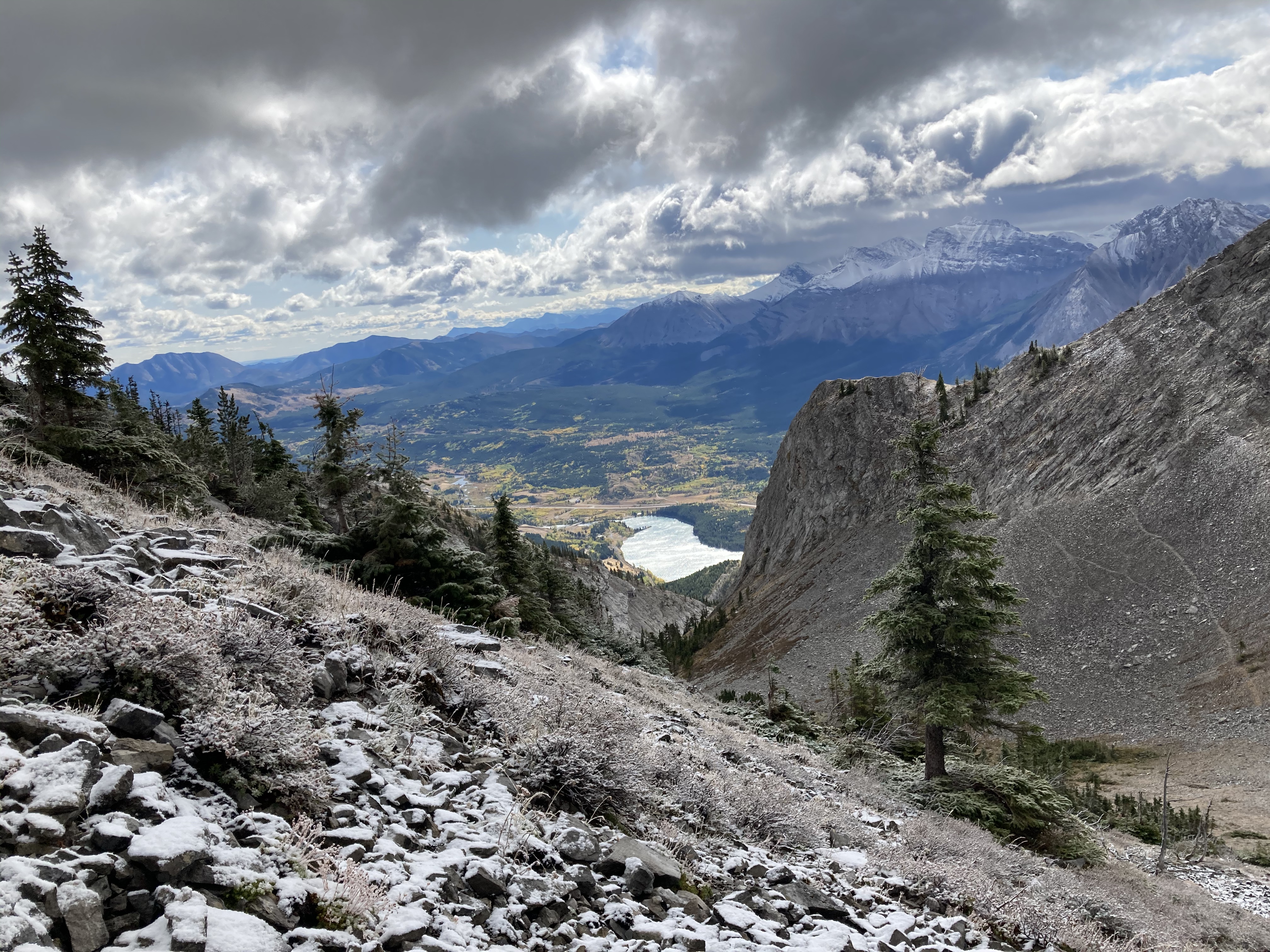
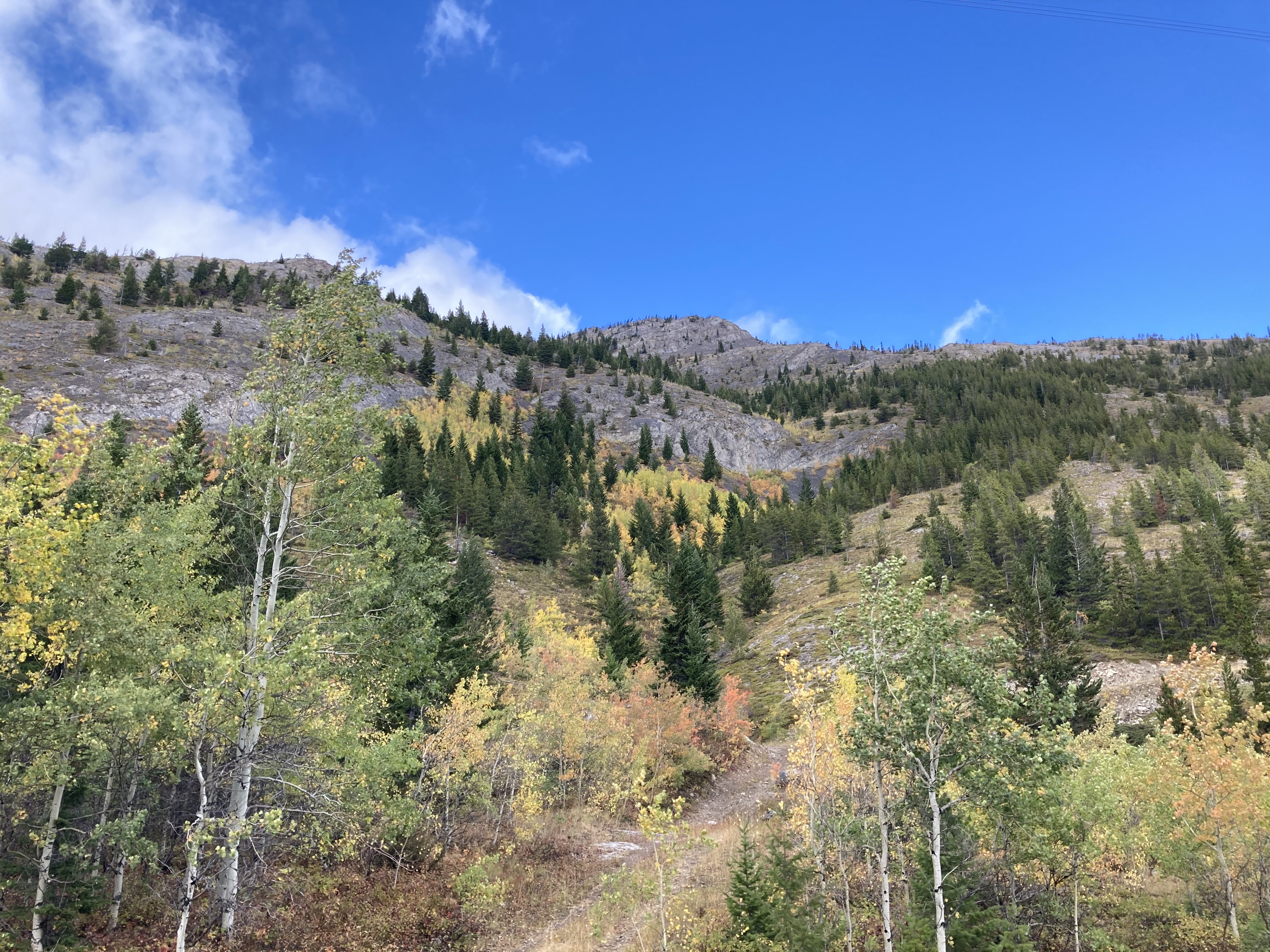
See my prior post for route details. Colleagues from work invited me along for this trip, so my return to the mountain was much sooner than I had anticipated. This time around I knew the correct route to take, but we nevertheless did a bit of exploring off to the climber’s right before heading left and up the scree to the summit ridge. Comparing my tracks between the 2 trips, I could see that this time I progressed further west (left on ascent) before ascending the scree below the ridge. As a result, I spent a fair amount of time ascending in a rocky drainage which had excellent footing and allowed me to avoid much of the tedious treadmill of the scree slope.
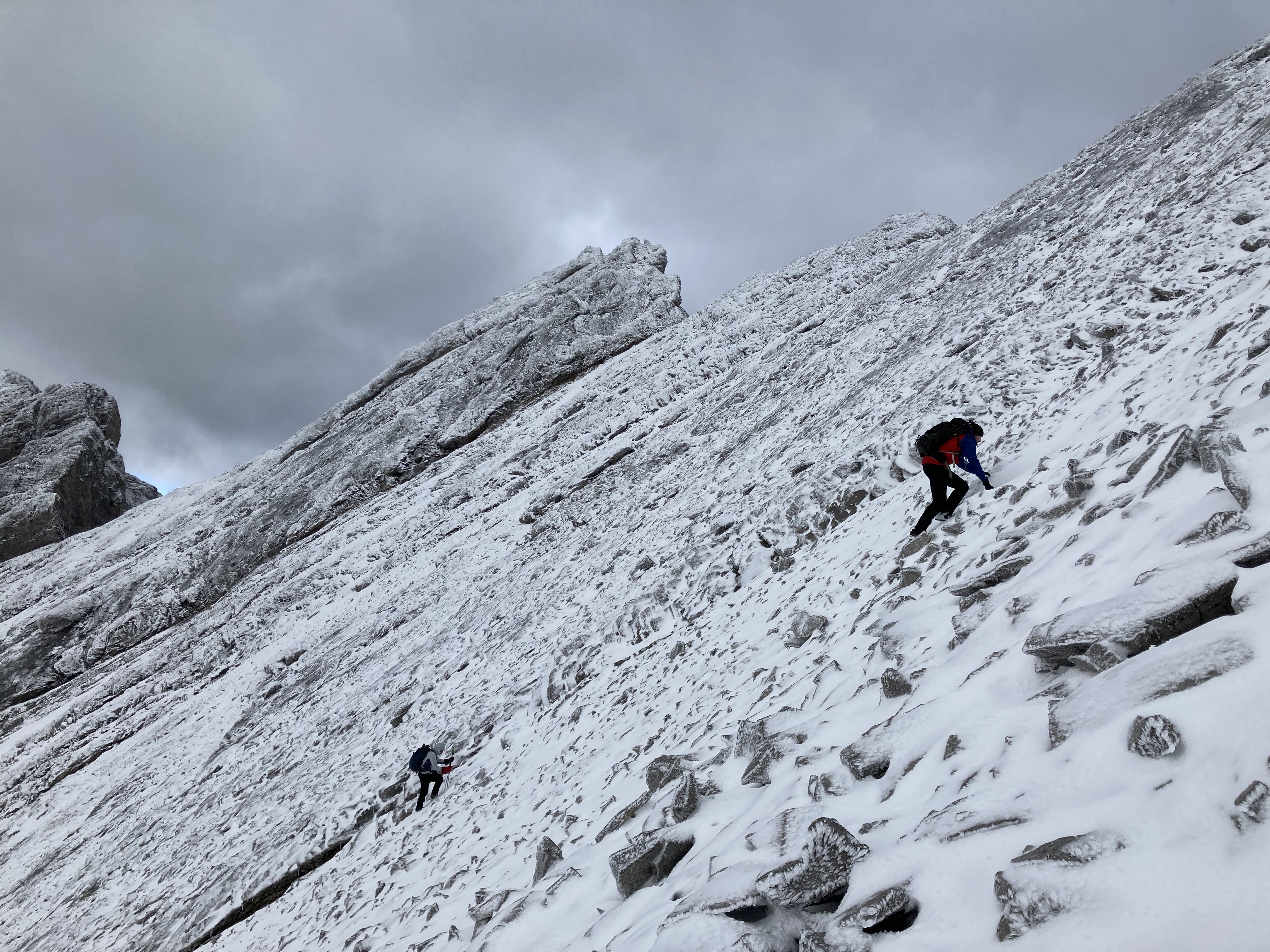
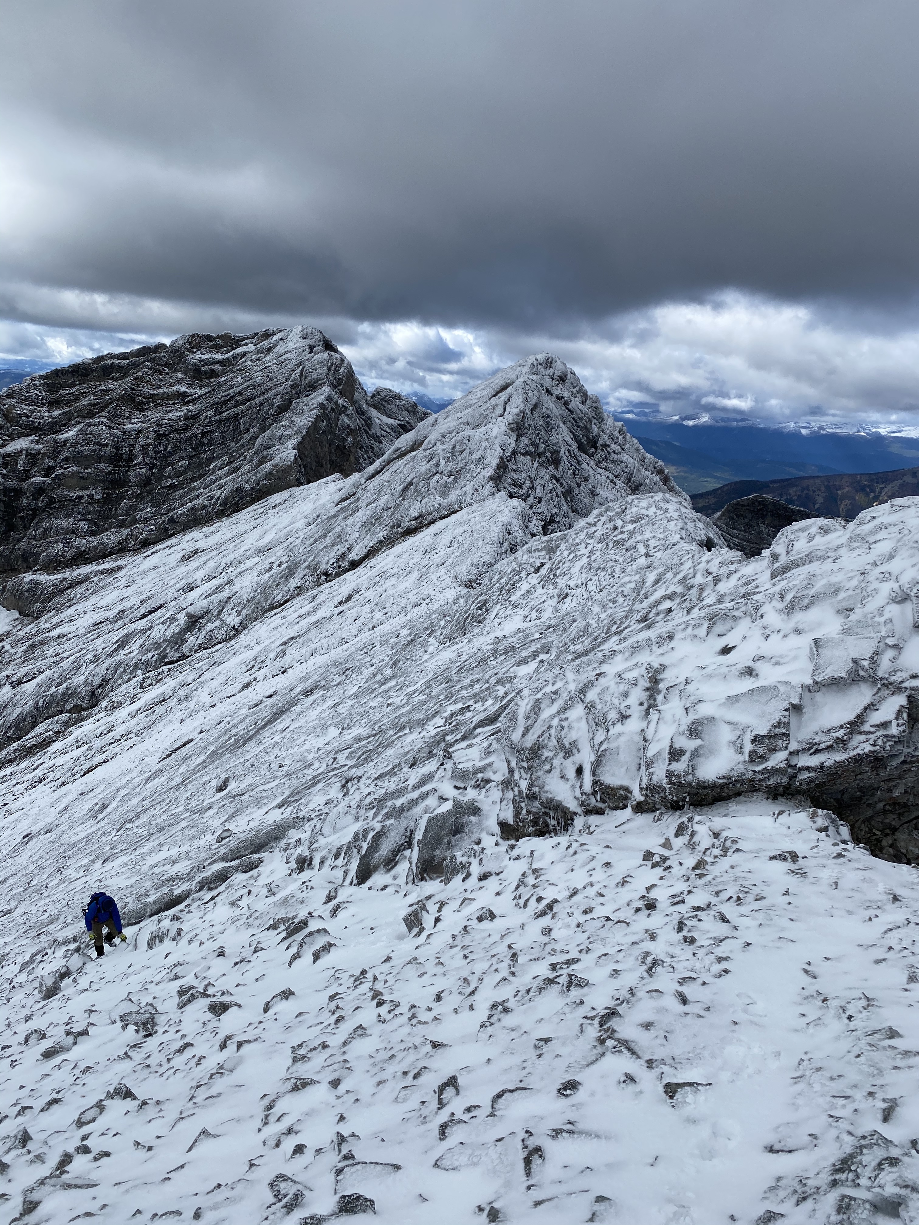
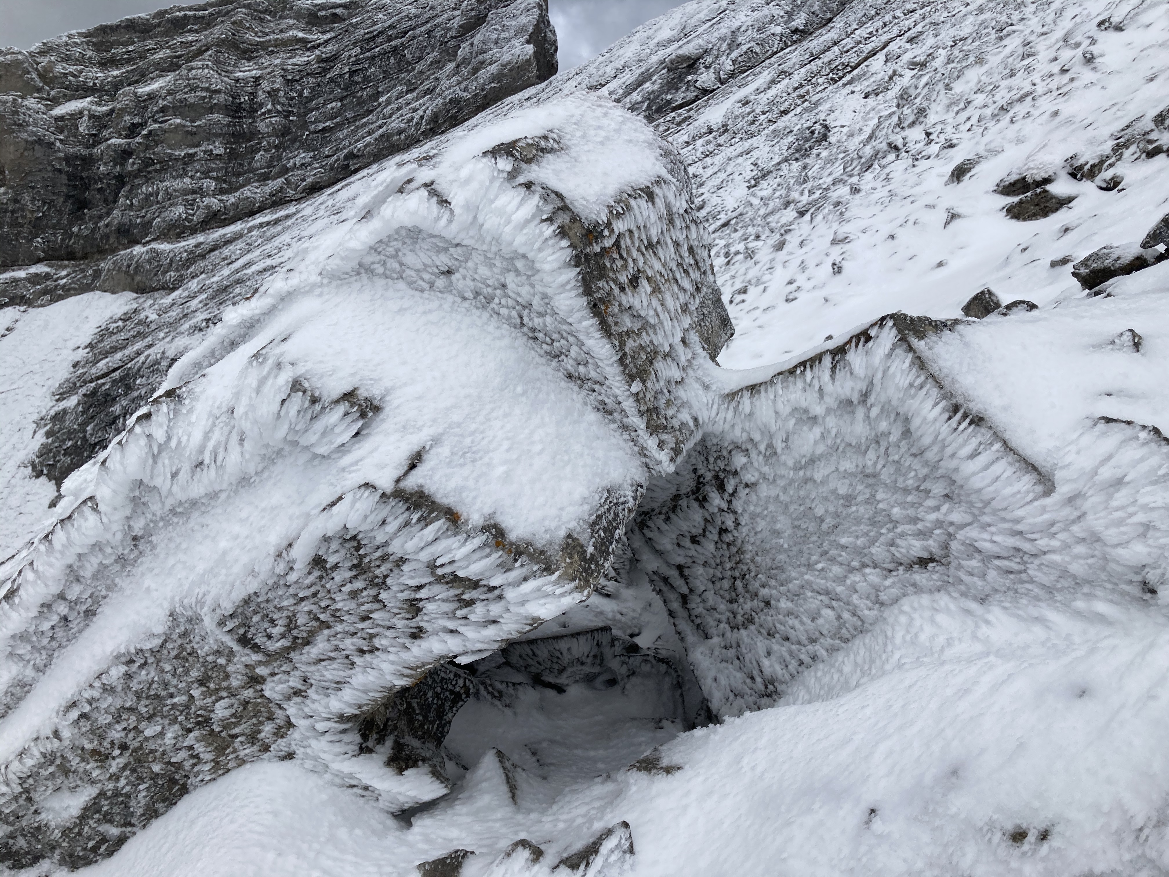
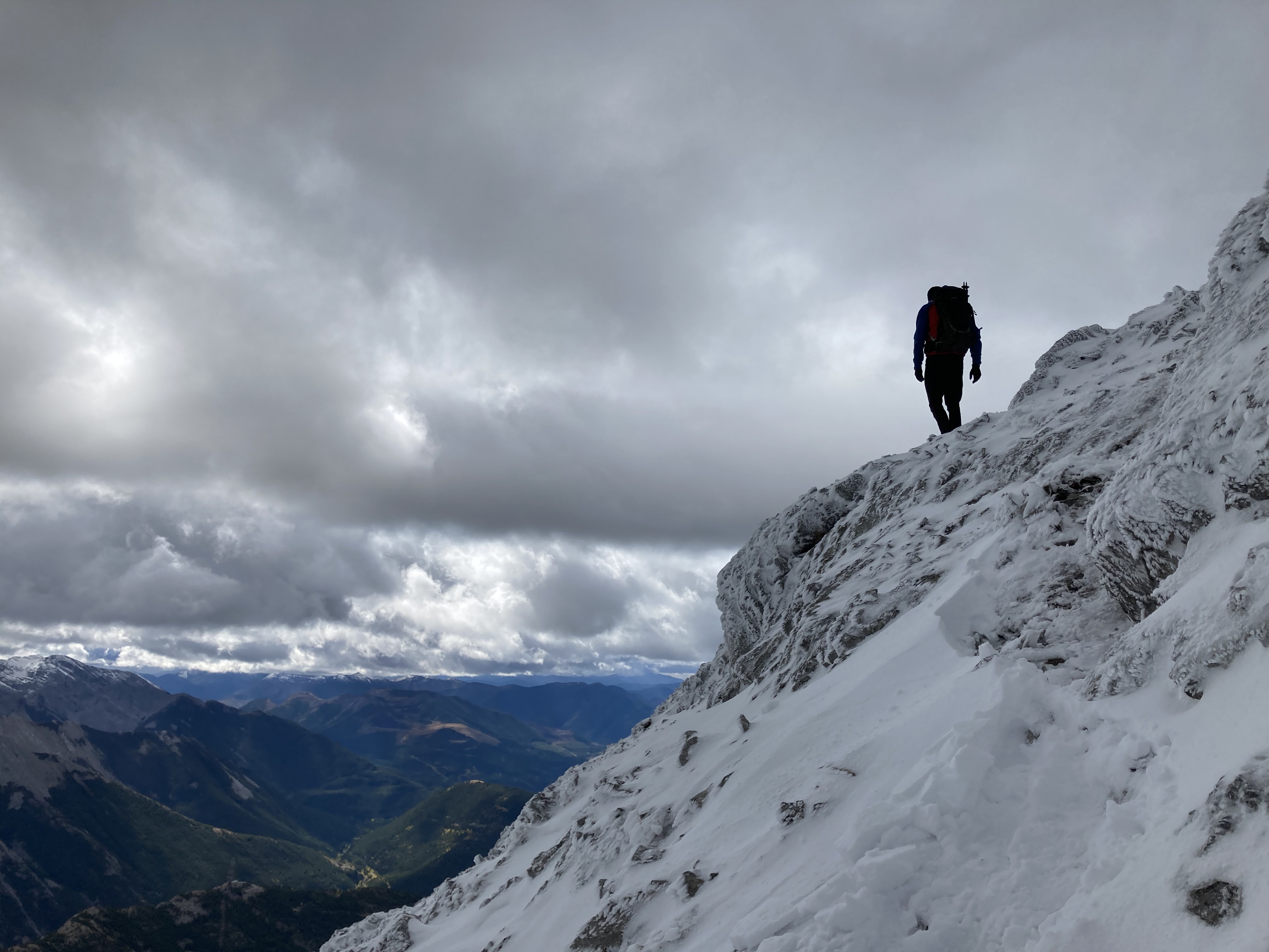
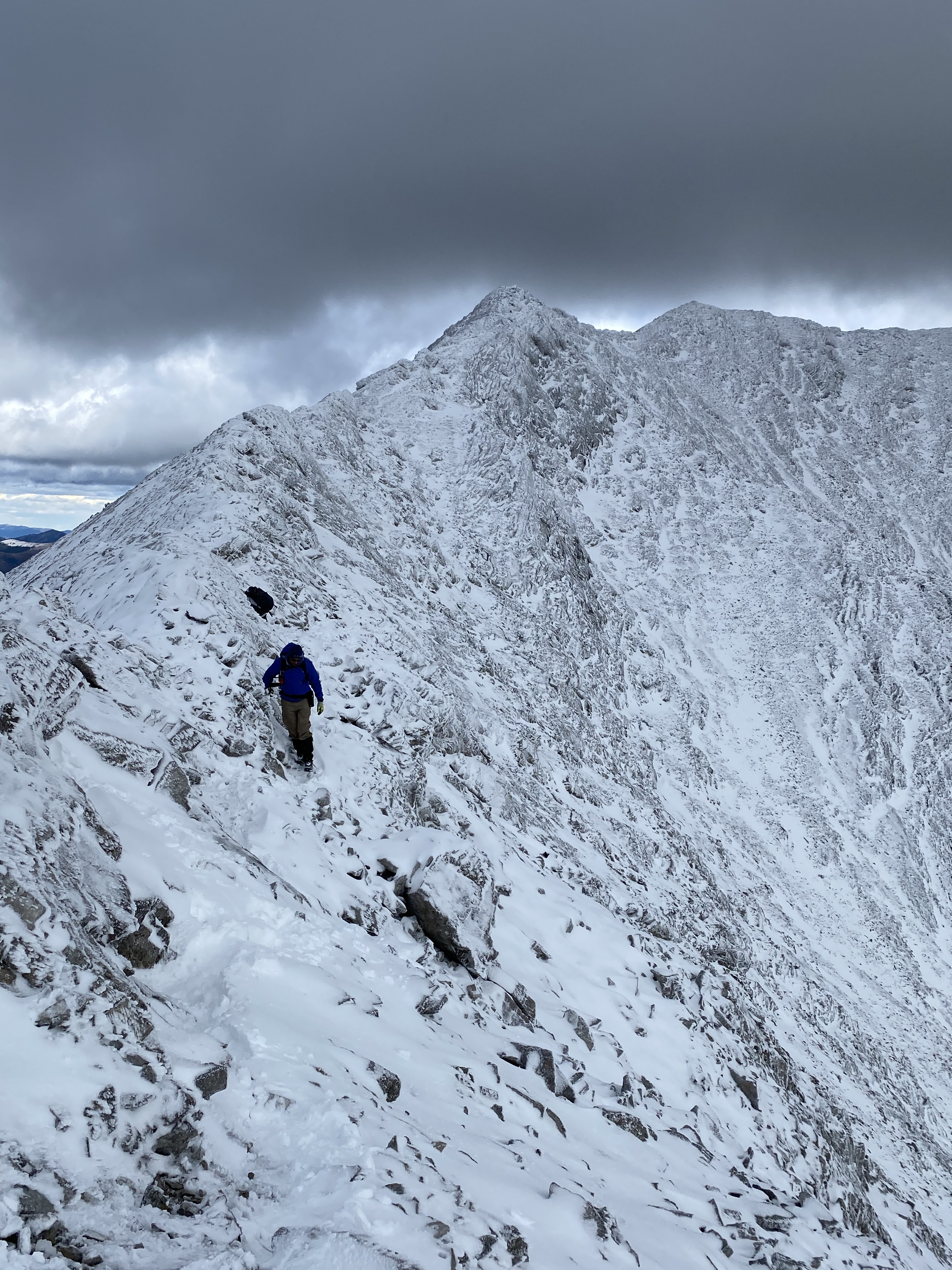
There had been snowfall the night before, which wasn’t very deep. Interestingly, the snow was in the “sweet spot” in terms of depth and stickiness – it joined a lot of the scree and rubble on the slope together and made the footing fairly friendly. The summit ridge was decidedly unfriendly, though – steep rock with an icy glaze and covered by a thin snow layer. We went as far as we deemed safe before turning back.
We descended by a slightly different route – instead of following the creek all the way back down, we veered to the descender’s left (east) at the boulder field to get up on a low rounded ridge which paralleled the descent back to the starting point. As we got there a snow squall blew in, so we left the ridge by dropping into the valley to the descenders’s left (east) and navigated some steep grassy slopes back to the valley bottom. One cliff-band is encountered, but it’s easy to see coming and a soft slope of rubble on the right allows for an easy descent.
Click on the pictures in the gallery below to access full-sized images.
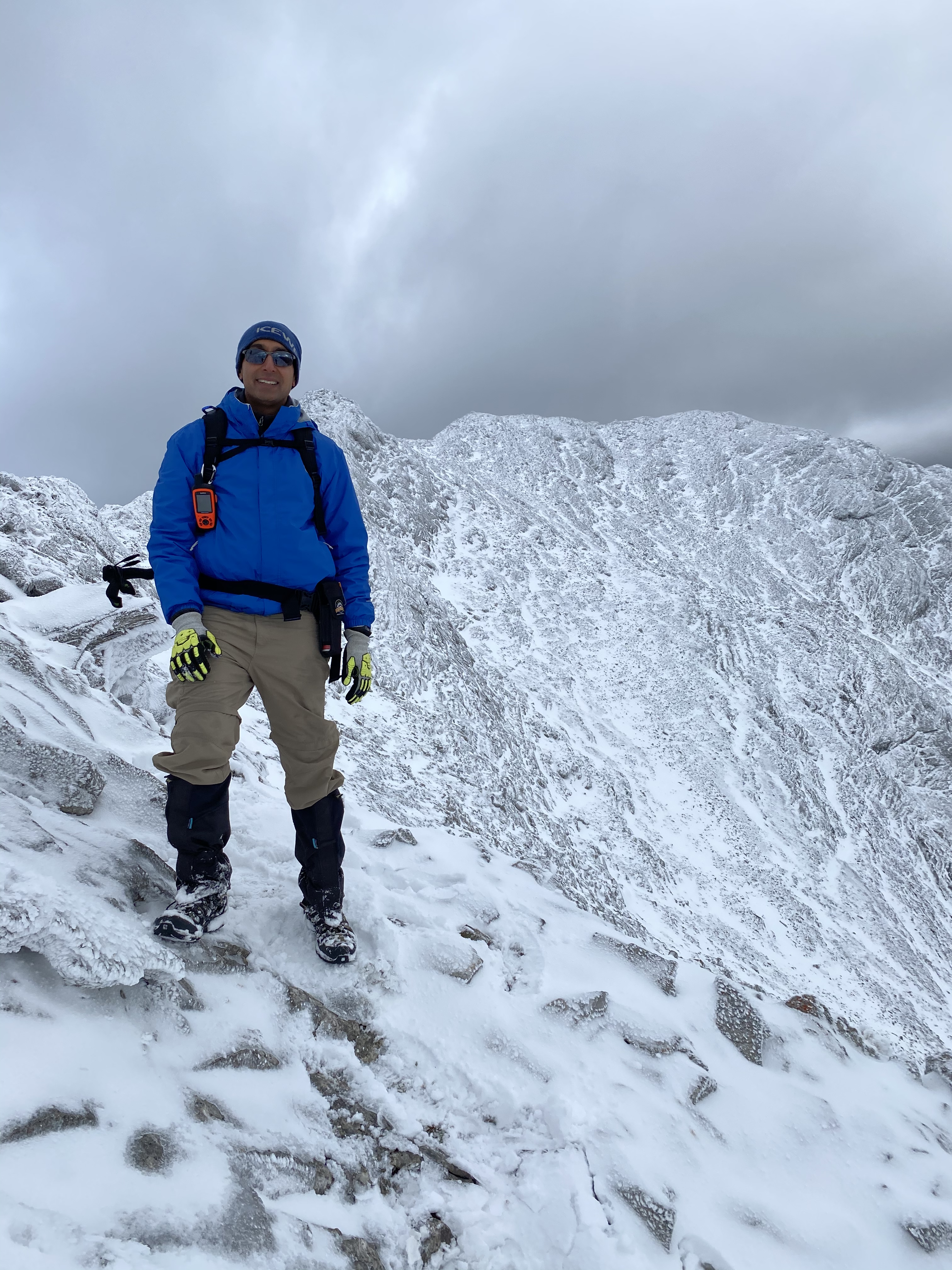
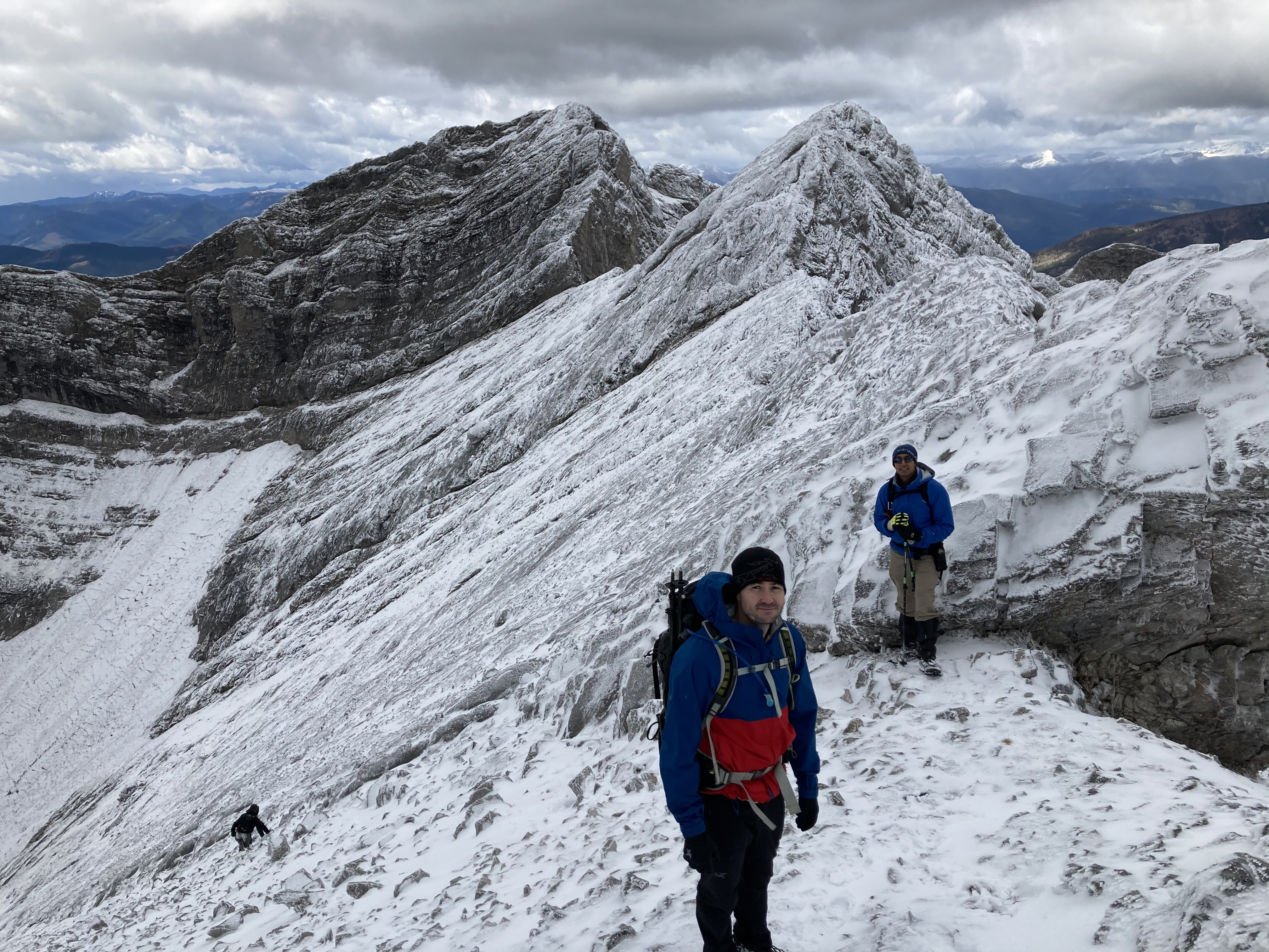
The lower slopes were free of snow, but it was obvious that we’d run into adverse conditions higher up.Matt and Drew moving from the grassy slopes in the meadow towards the snowy scree slopes.Starting up the snow-covered slope. Photo courtesy of Matt Secretan.The day featured some amazing contrasts in scenery. Snowy areas higher up and bare ground in the valleys. Gloomy cloud cover on the mountain tops and sunlit autumn colour below.Matt nearing the ridge. Phillips Peak looming behind.Drew and Matt nearing the ridge top.Me, almost to the ridge. Photo courtesy of Matt Secretan.The wind and snow created some fascinating patterns on the rock.Up on the ridge, looking across at the un-named peak on the other side of the valley.On the ridge. Drew and Matt scout the terrain.Panorama from the ridge. Sentry Mountain is directly across the valley. Sunlight is glittering on the surface of Crowsnest Lake.Here’s where we turned back. More or less as far as I got on my first attempt. It was icy, steep and exposed. Not safe scrambling conditions.A close look – ice on rocks with a snowy covering.Matt leads the way back.Drew and I start the return trip. Photo courtesy of Matt Secretan.I’m so rarely with other people on these trips – so I’ll post this nice pic of me on the ridge. Photo courtesy of Matt Secretan.Drew on the ridge.Matt and I with Phillips Peak behind. One of Matt’s nephews is already descending. Photo courtesy of Drew Sommerfeldt.Back down in Phillips Pass, looking up at the alternate descent route we took. This brought us to the valley bottom a short distance east of our original ascent route – it’s just on the other side of the ridge line on the left of the picture. This proved to be a pretty safe and easy way down. It was a little steep in places, so if there was only thin snow on the grass I can imagine some unintended glissades.


Very nice post Par.
Also, great to see you already have snow there.
LikeLiked by 1 person