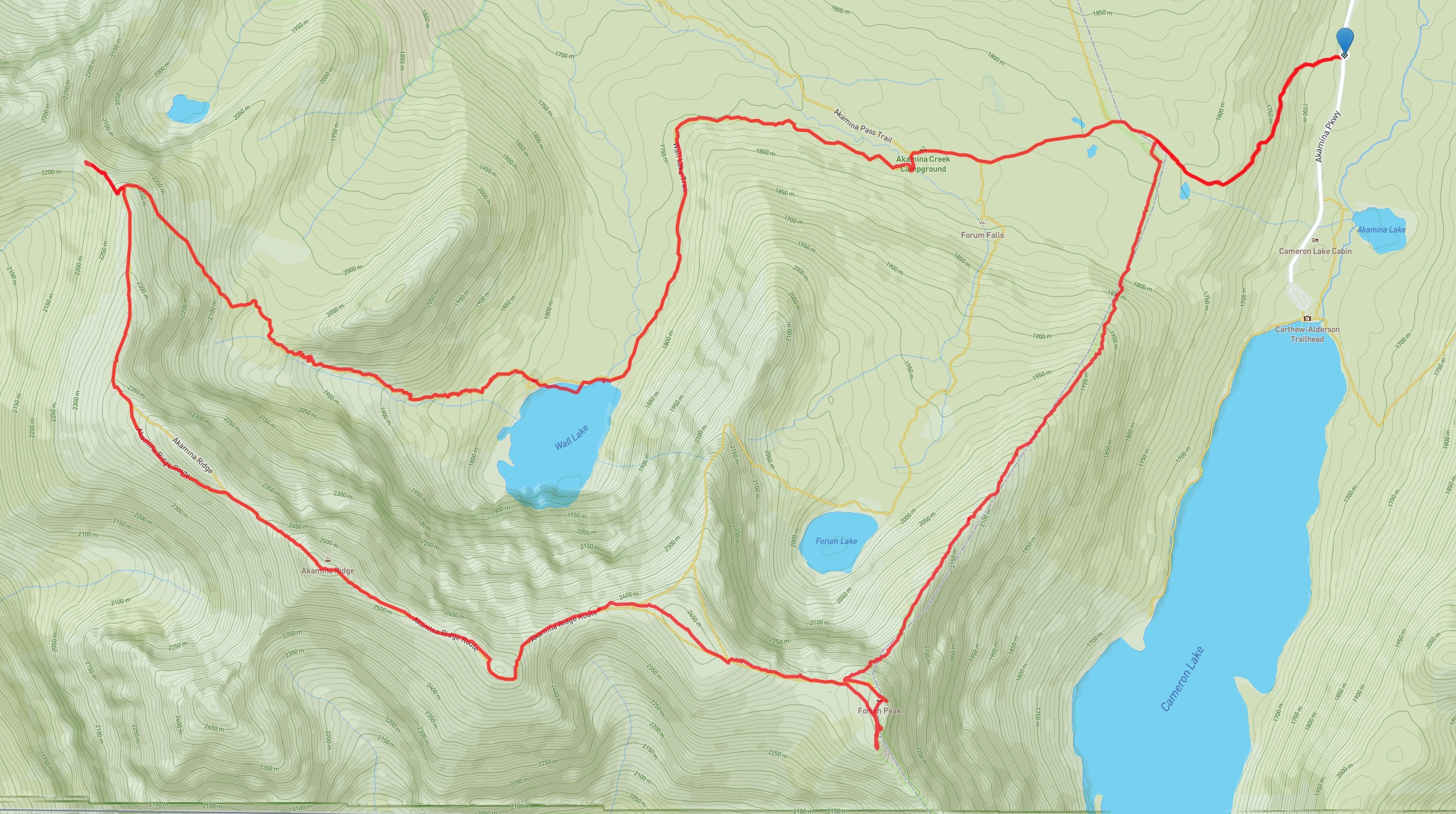
Akamina Ridge is one of the premier hikes the Southern Rockies. The usual route involves following a well-maintained trail starting in Waterton Lakes National Park which passes over Akamina Pass and enters British Columbia’s Akamina-Kinishena Provincial Park. From there, clear signage leads to Forum Lake, then a well-used route is visible ascending from the northwest aspect of the lake towards the ridge. I followed this route last time I visited Akamina Ridge, 6 years ago. I decided to return to the ridge this weekend. I took a different approach this time, first climbing Forum Peak, which connects to Akamina Ridge, then carrying on with the ridge walk. Conditions were as good as they get for an autumn hike and I had a great day in the mountains.
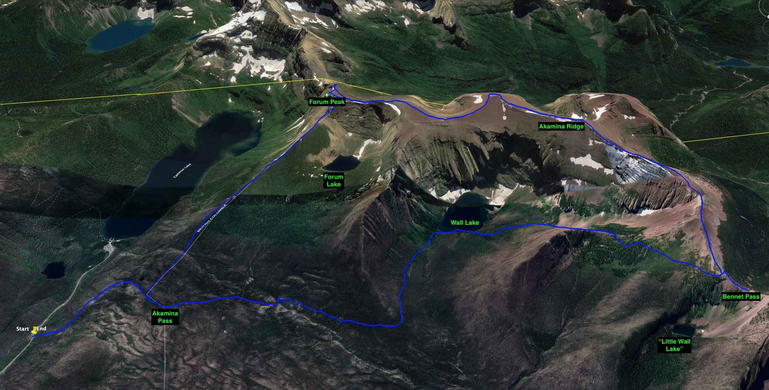
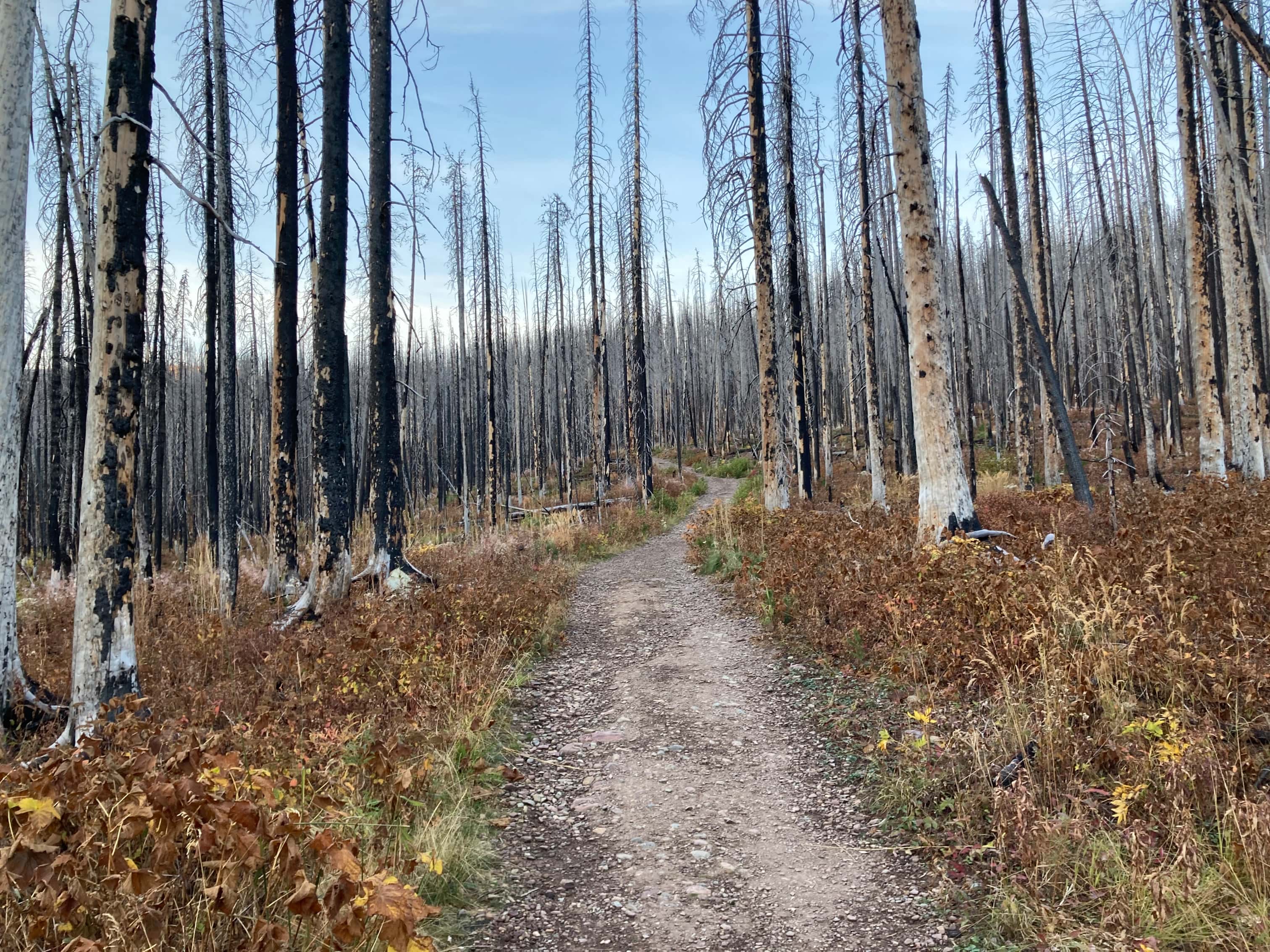
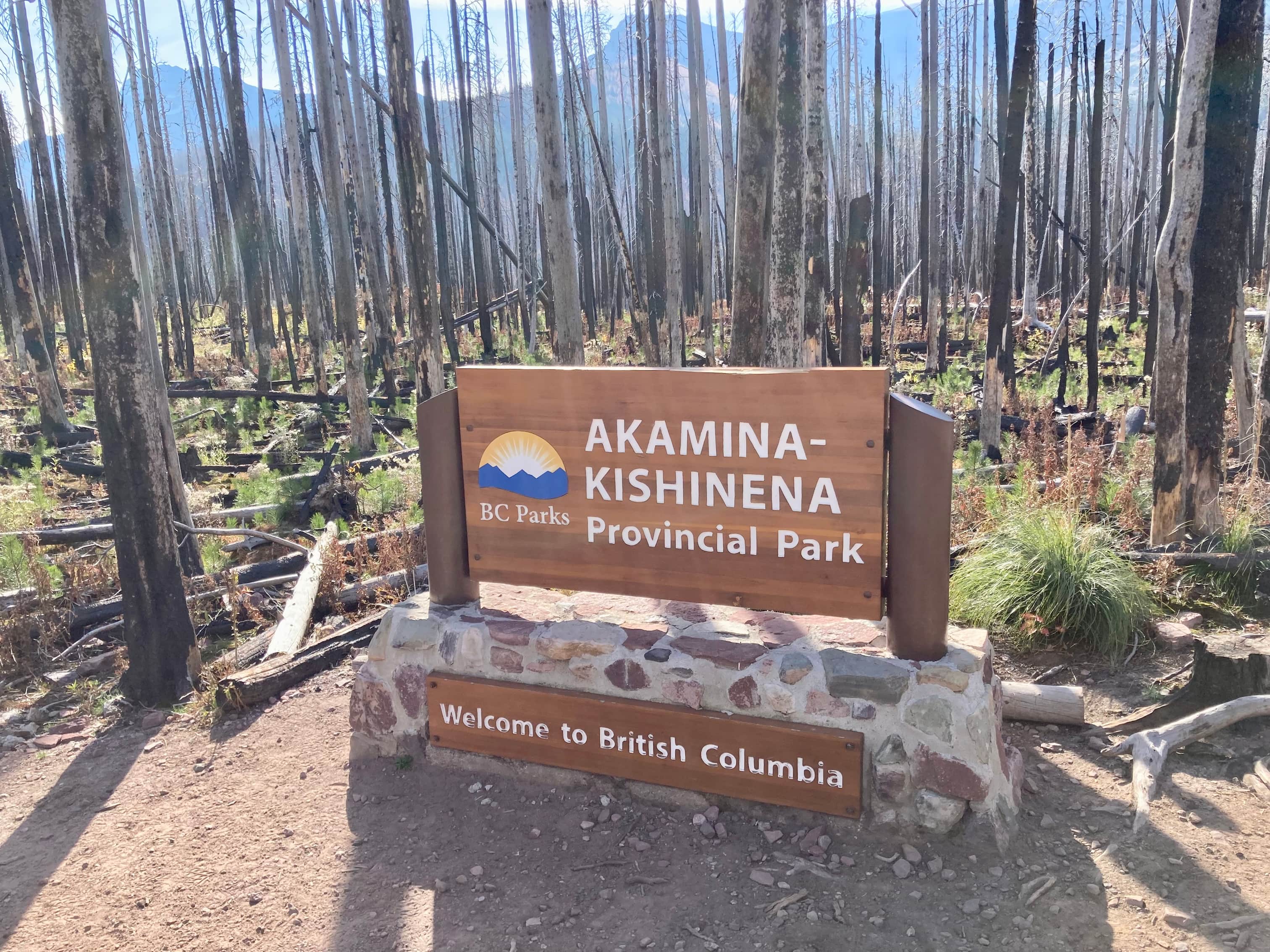
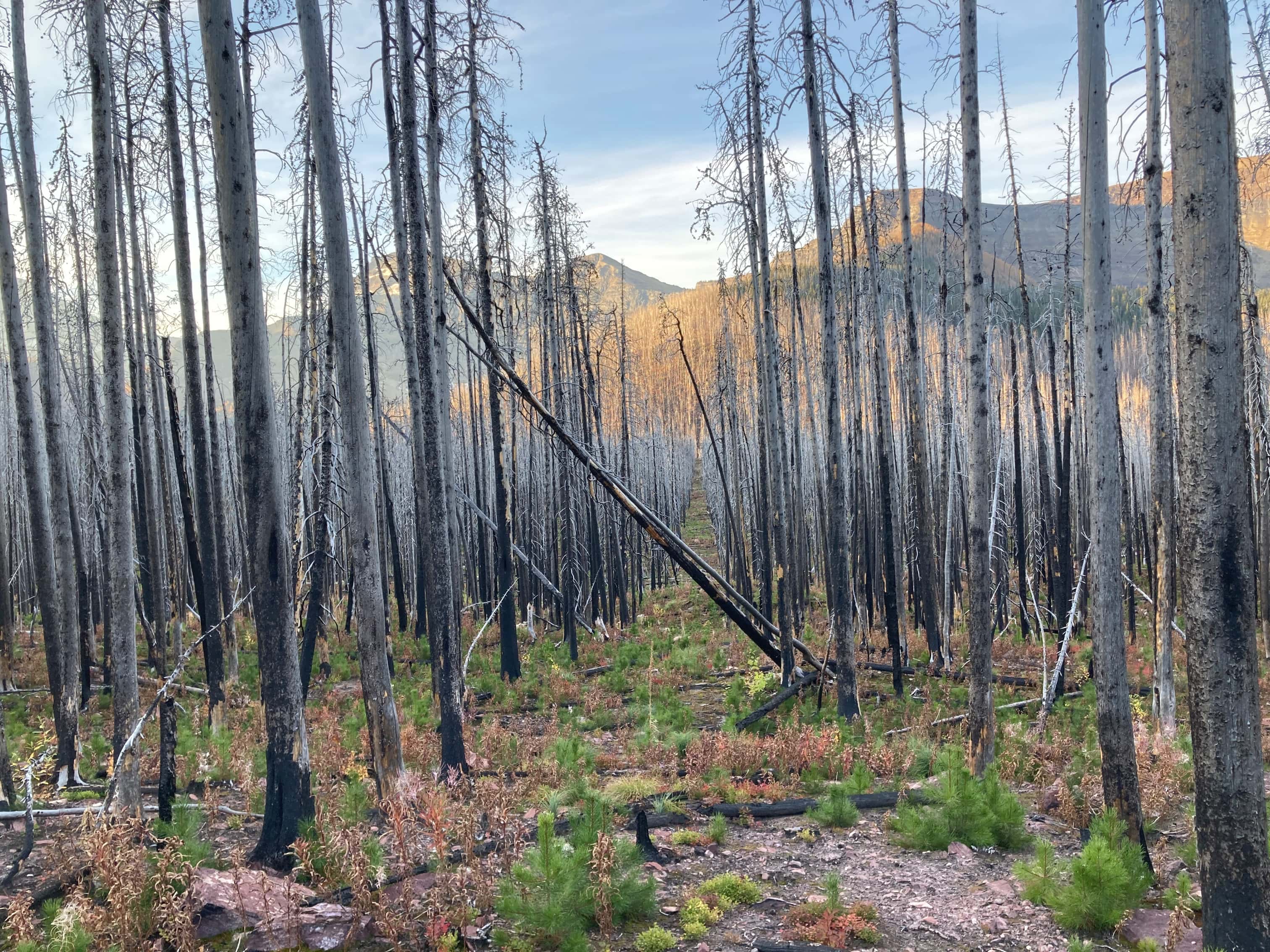
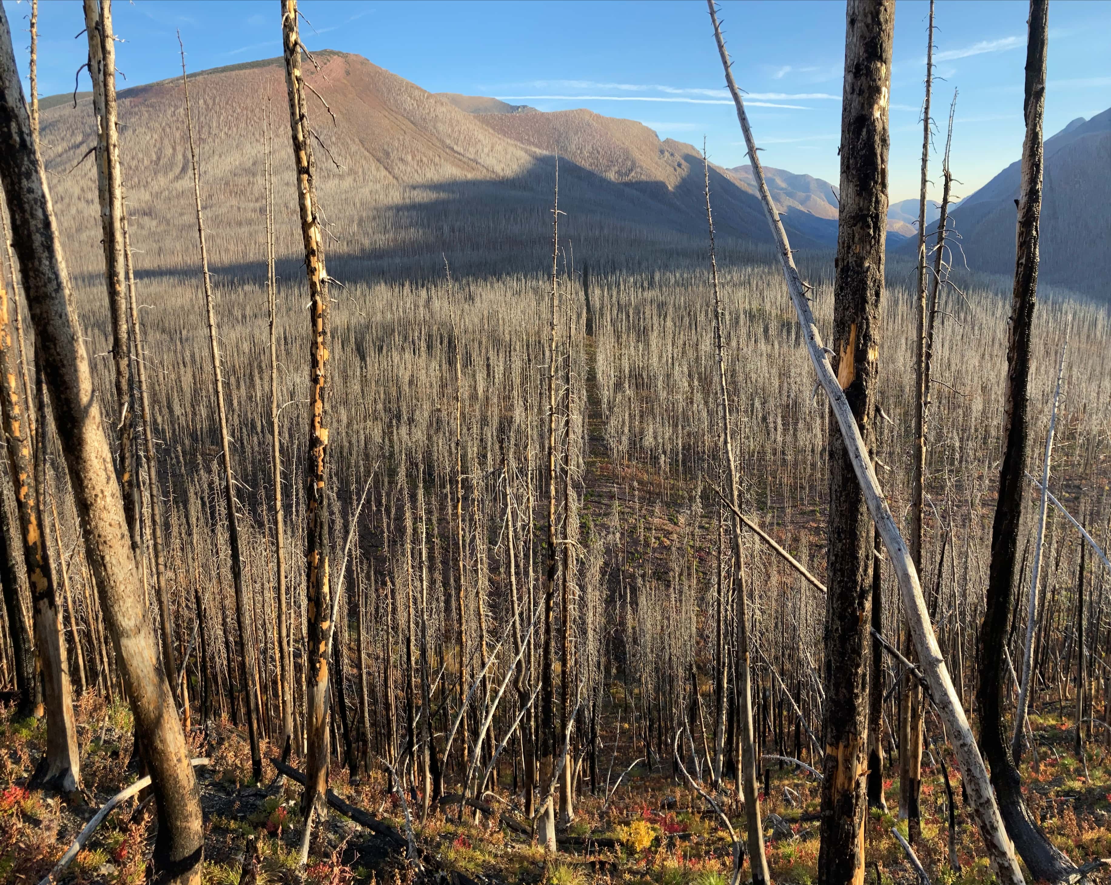
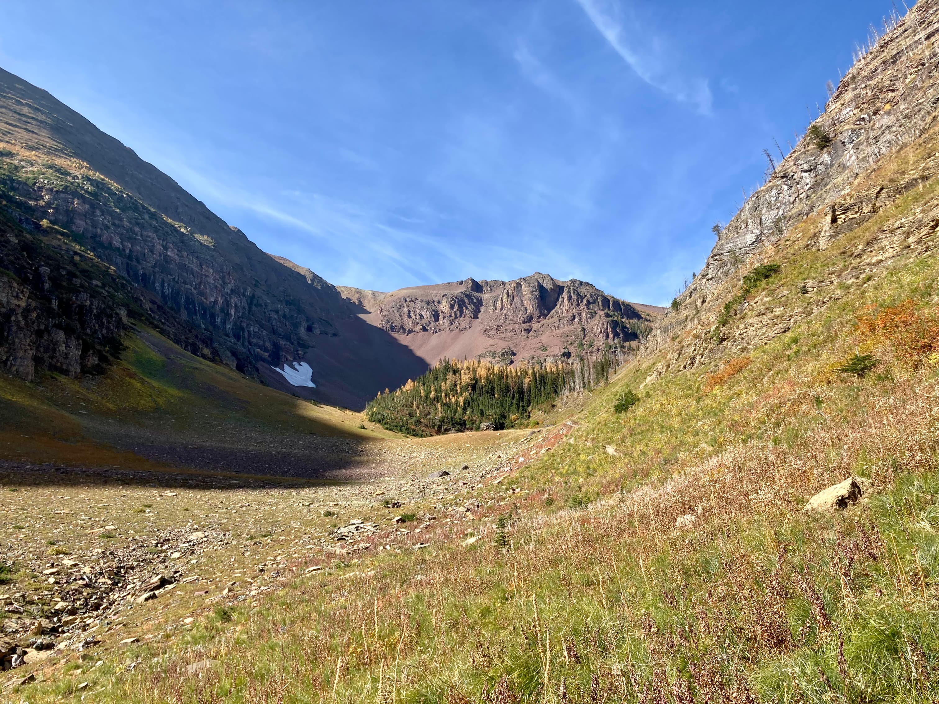
Access is via the Akamina Parkway in Waterton. Just before it reaches the large parking area at Cameron Lake there’s a pull-out and parking area for the Akamina trailhead. This trail leads to Akamina Pass, which marks the provincial boundary. The usual route continues along the trail at this point, but I departed and followed a cutline to the south. I had come this way last winter when I made a snowshoe trip to Forum Ridge. I followed the same route again, ascending the “big hill” then staying on the ridge as the grade eased and I eventually got clear of the trees and could see down to Cameron Lake.
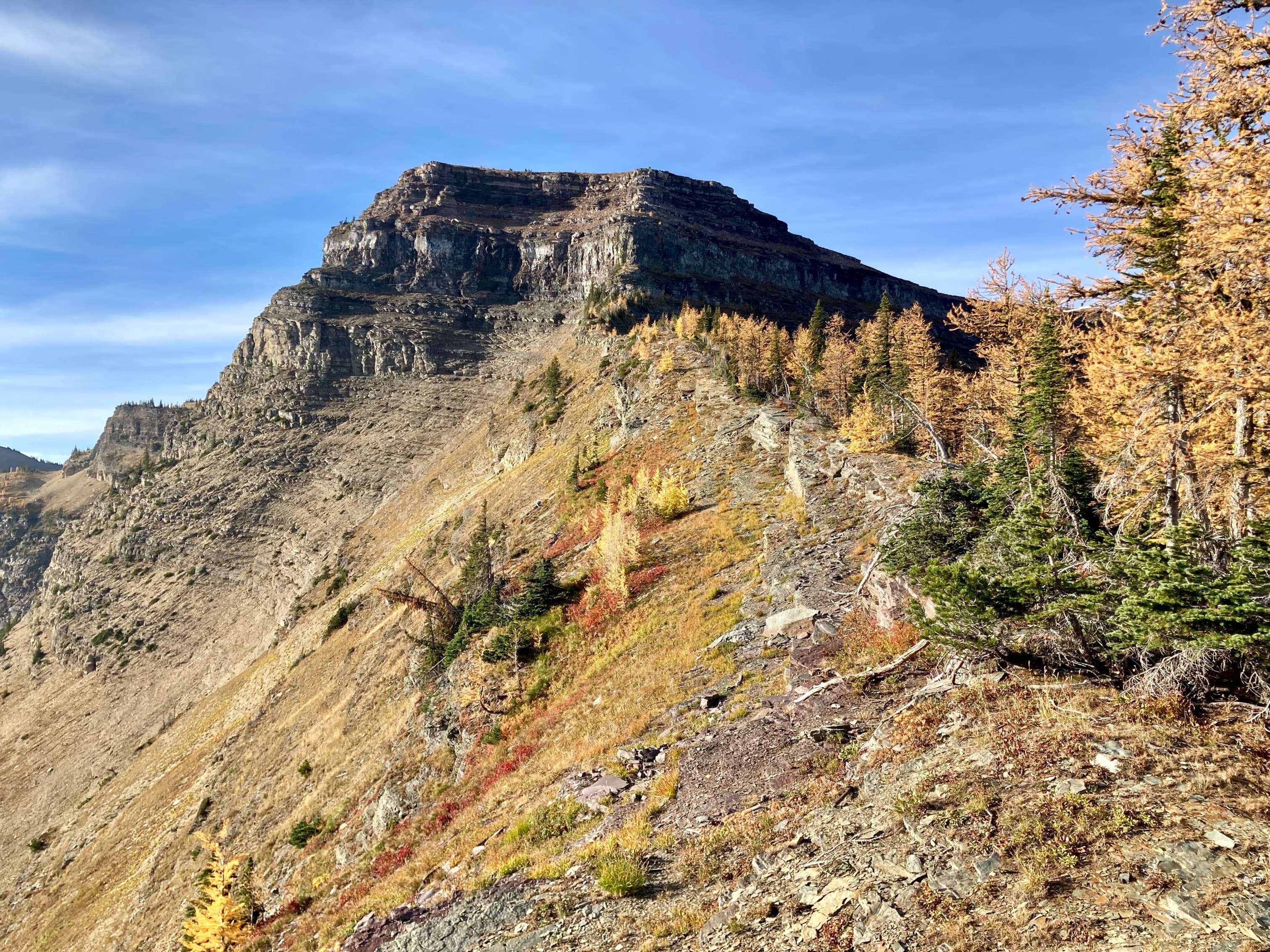
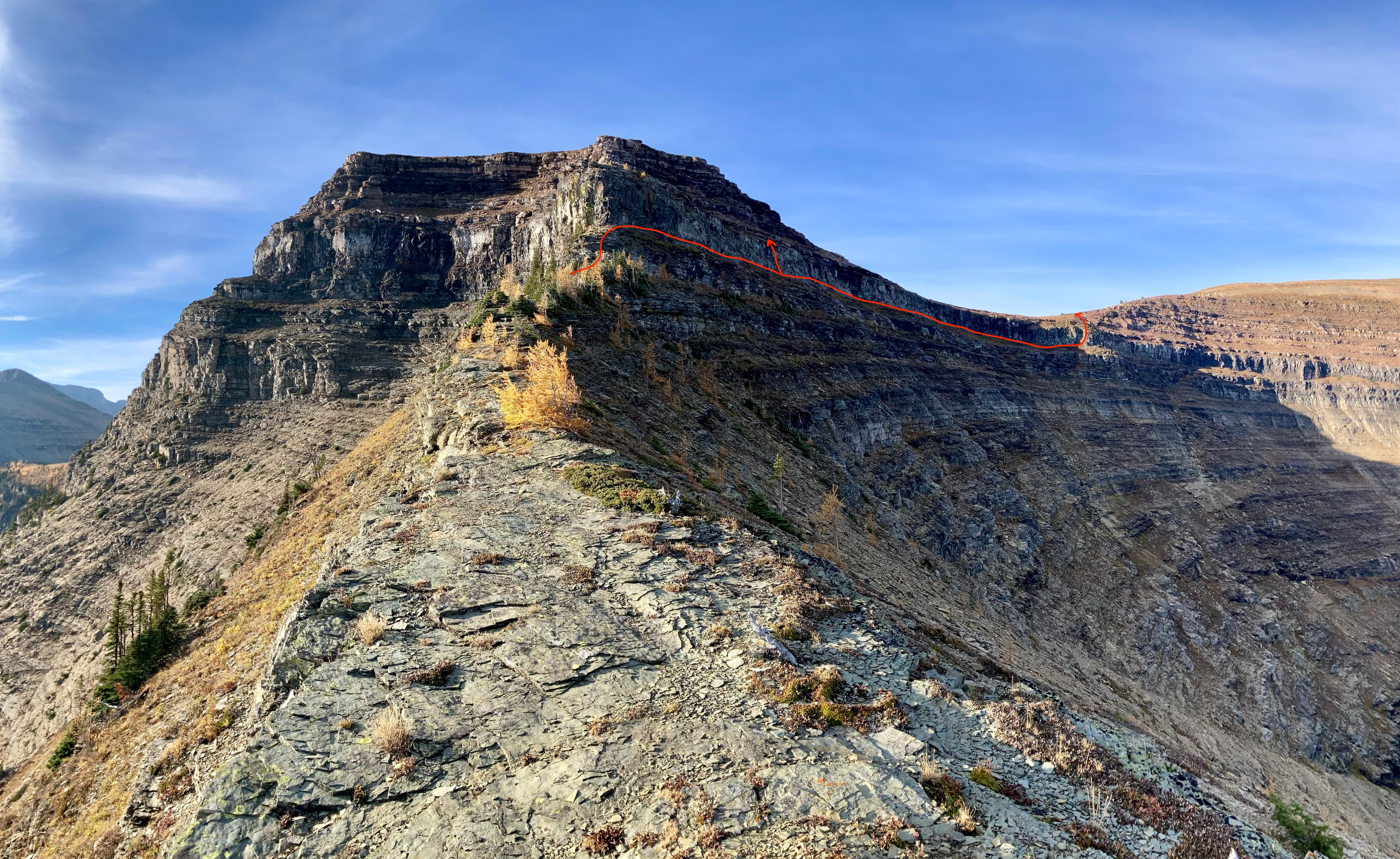
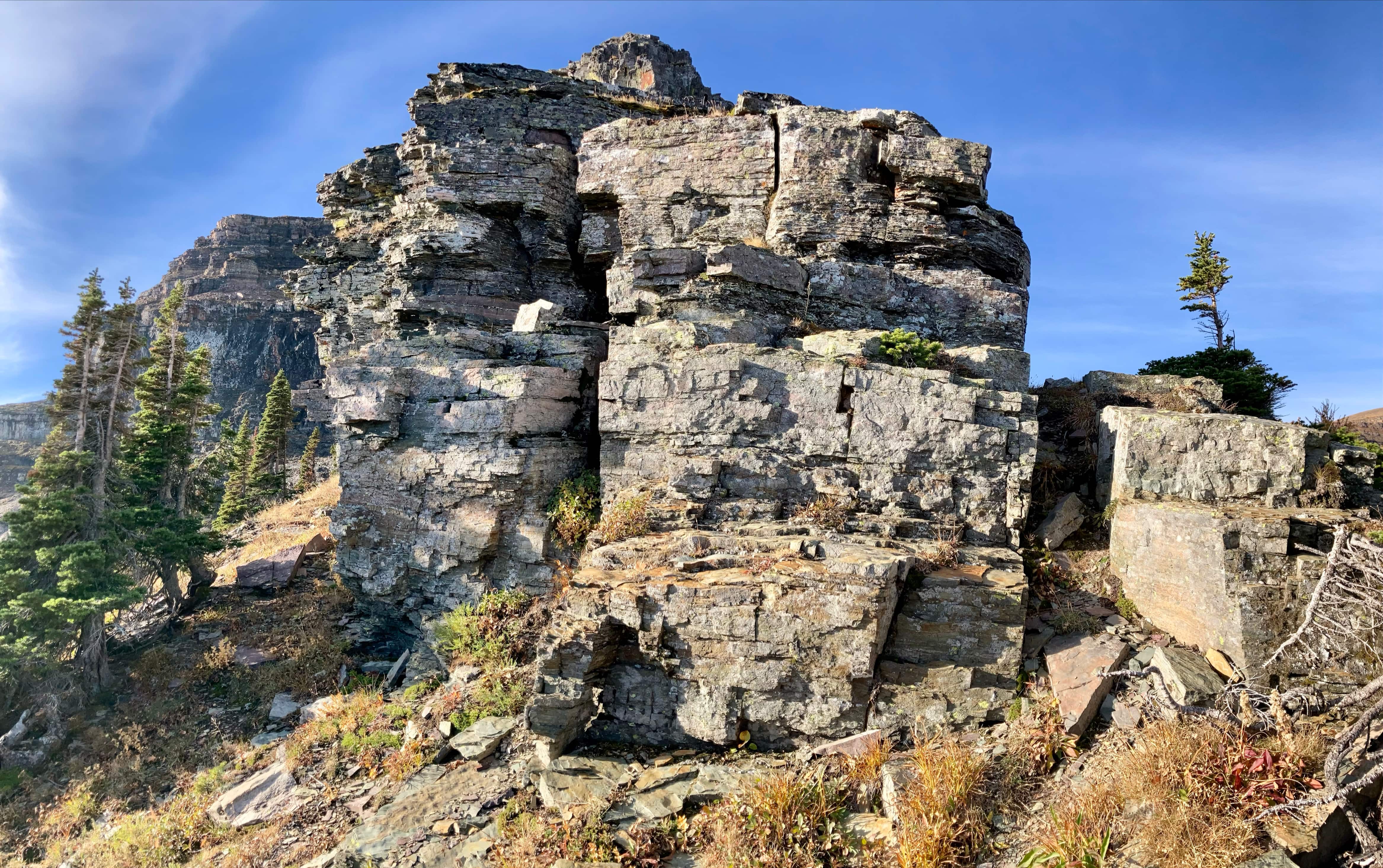
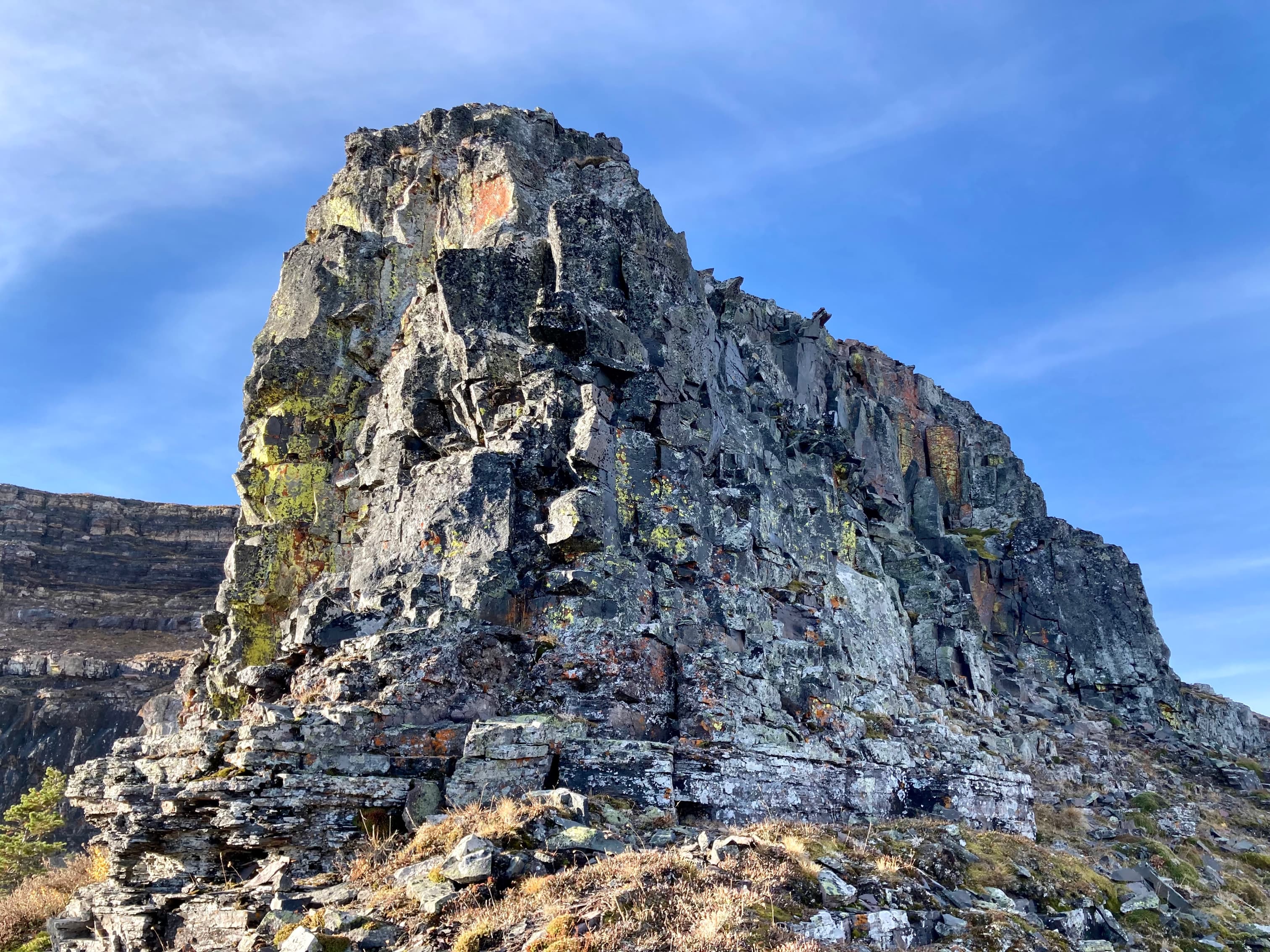
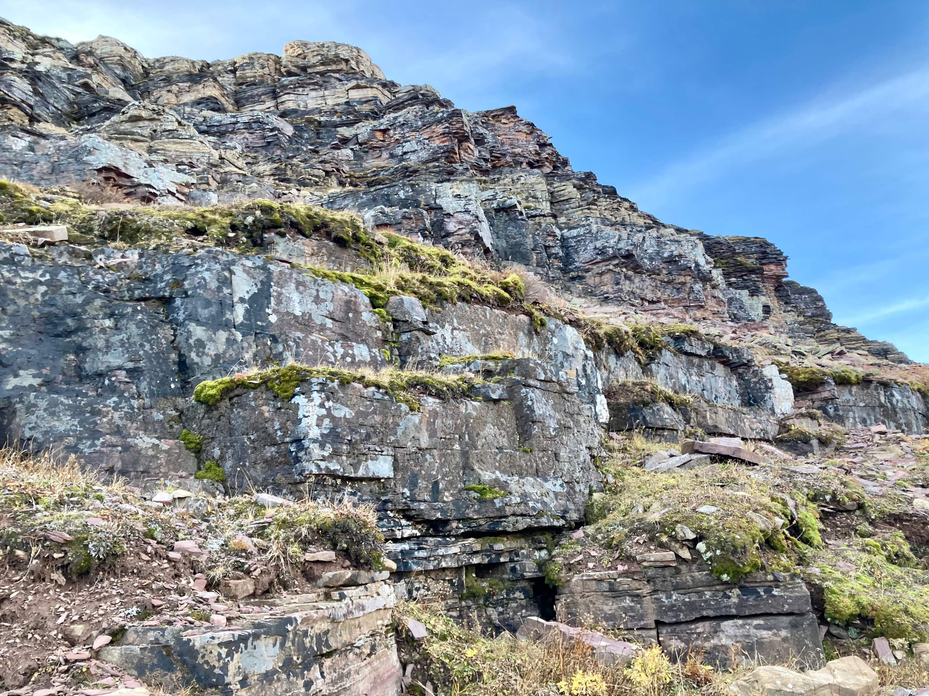
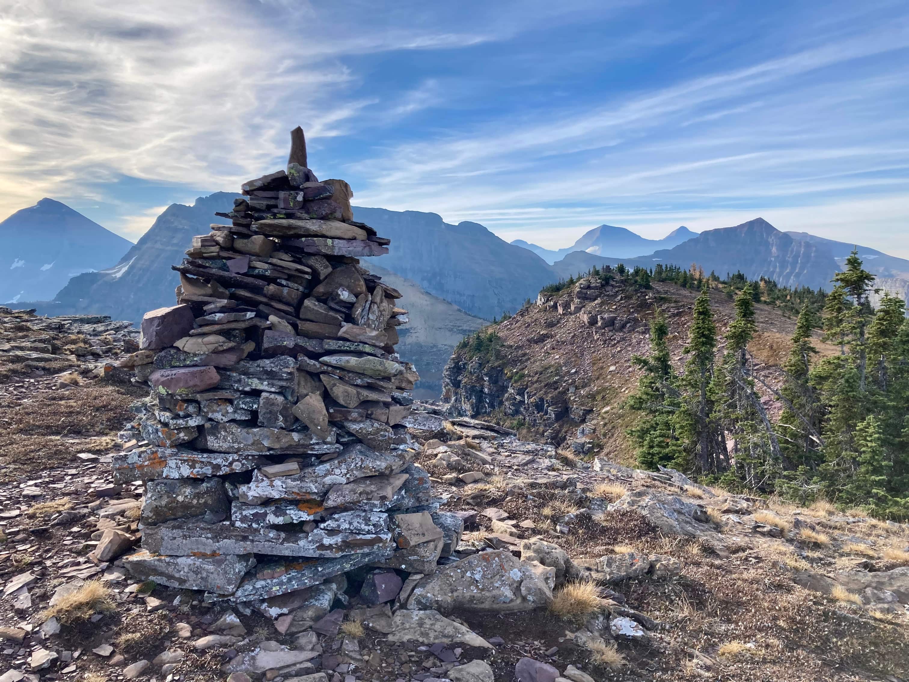
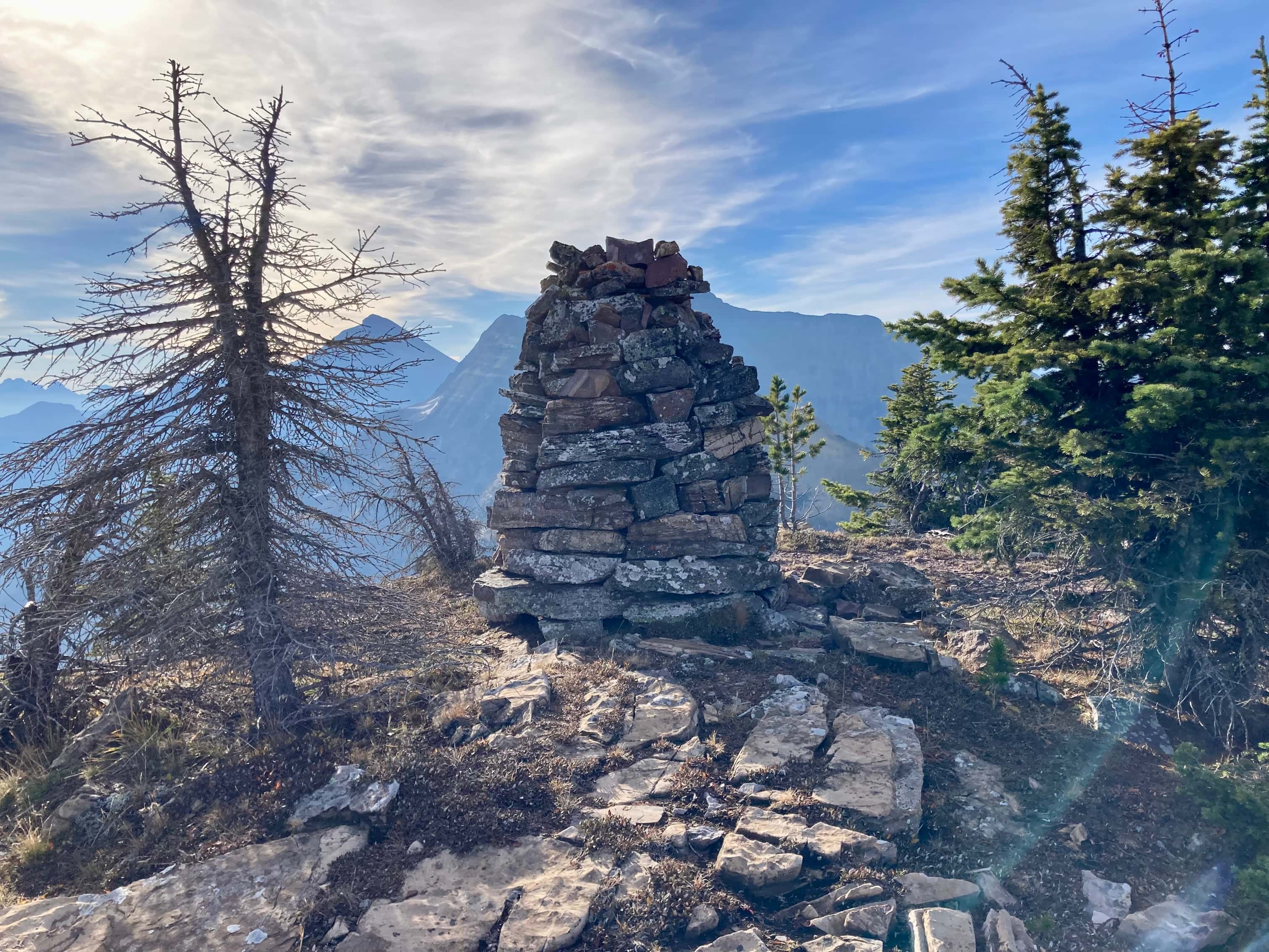
Straight ahead along the ridge I could see Forum Peak’s summit. The direct approach is guarded by some impressive cliffs. Kane describes the best approach to overcoming these in Scrambles in the Canadian Rockies 3rd ed. After climbing over one minor rock step, I followed a ledge along the base of the cliffs around to the right. It felt a little exposed, and I personally wouldn’t try this in anything other than perfectly dry conditions. After a little under 100m I saw what looked like a boot-beaten ascent route up “moderate” terrain. A cairn of exactly 3 very small rocks marked this spot – I wouldn’t count on it being there for very long. Regardless, the spot was fairly obvious. I scrambled up there then carried on picking my upward until I reached the summit ridge. From there I turned left and visited 2 cairns marking Forum Peak’s summit. It took 1 hour 52 minutes to reach the summit.
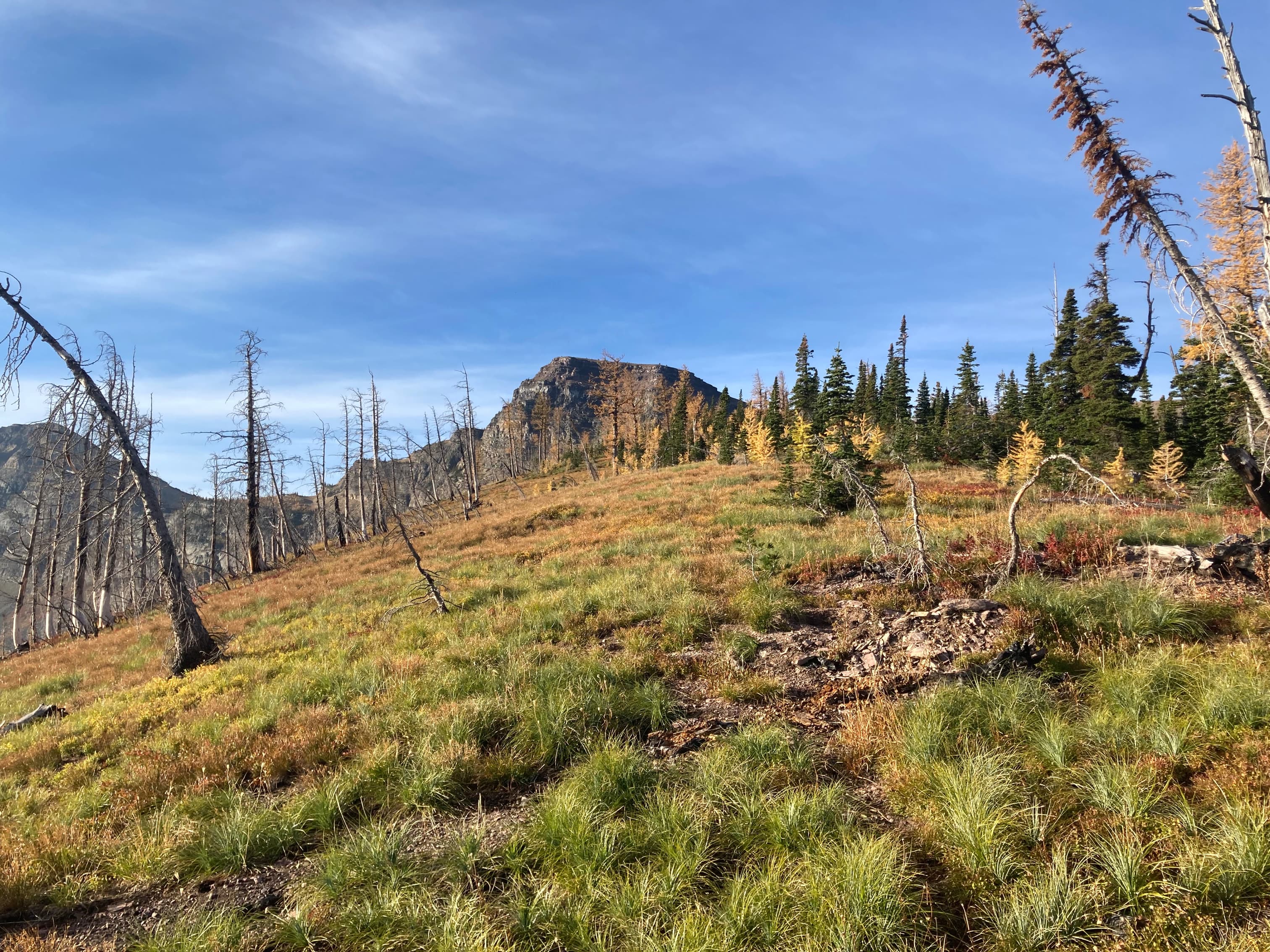
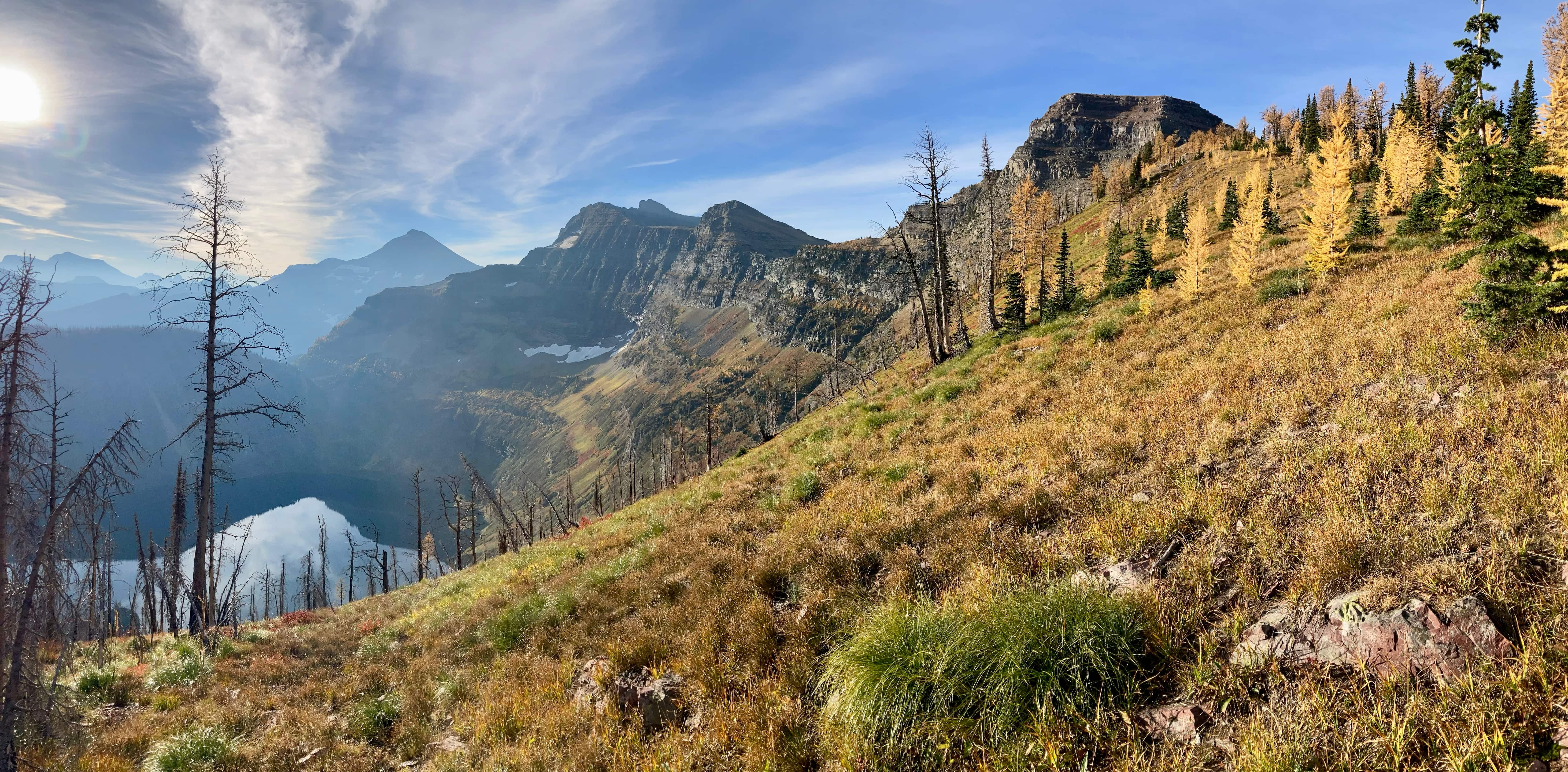
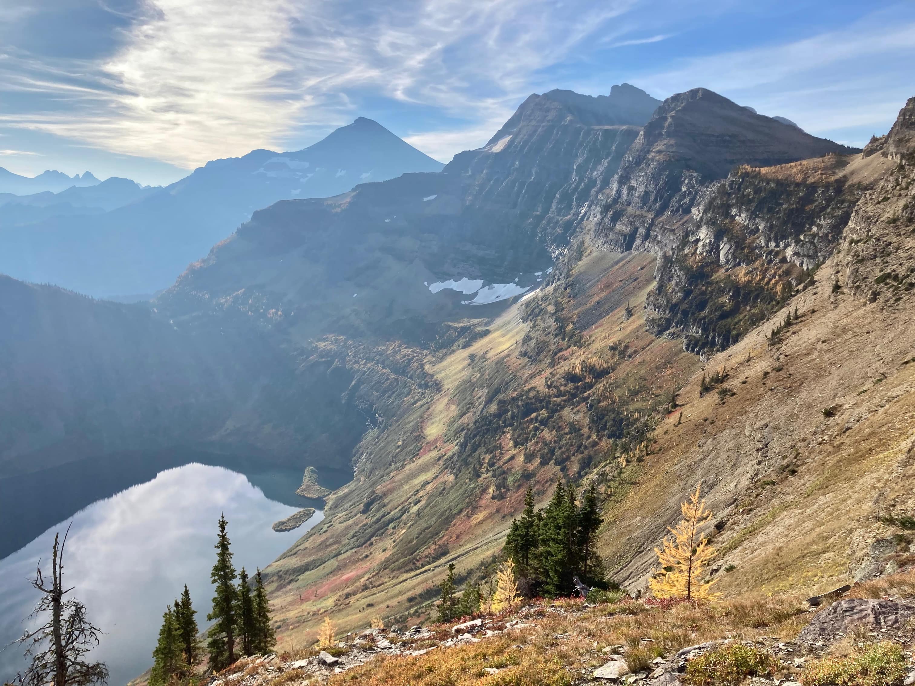
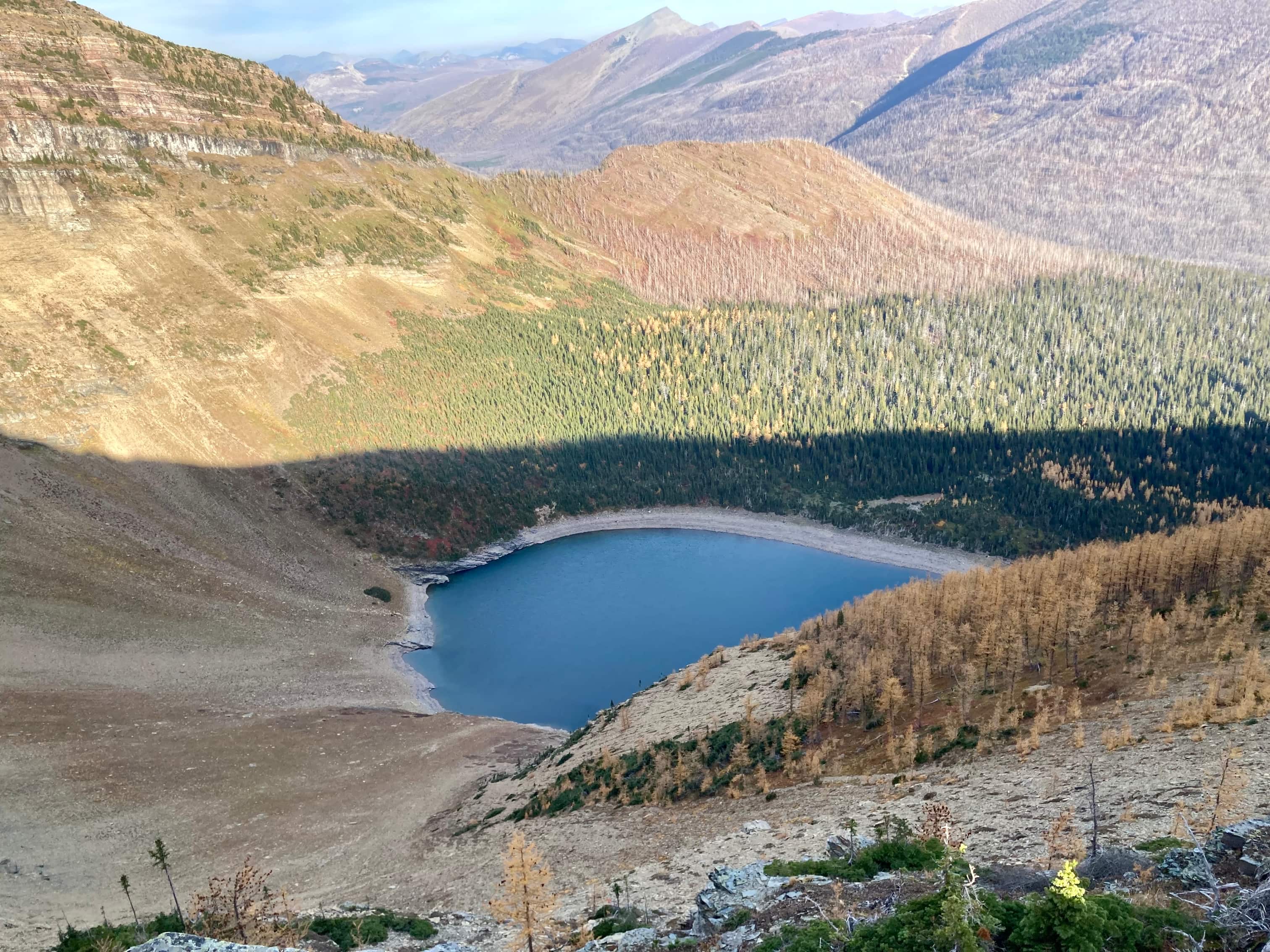
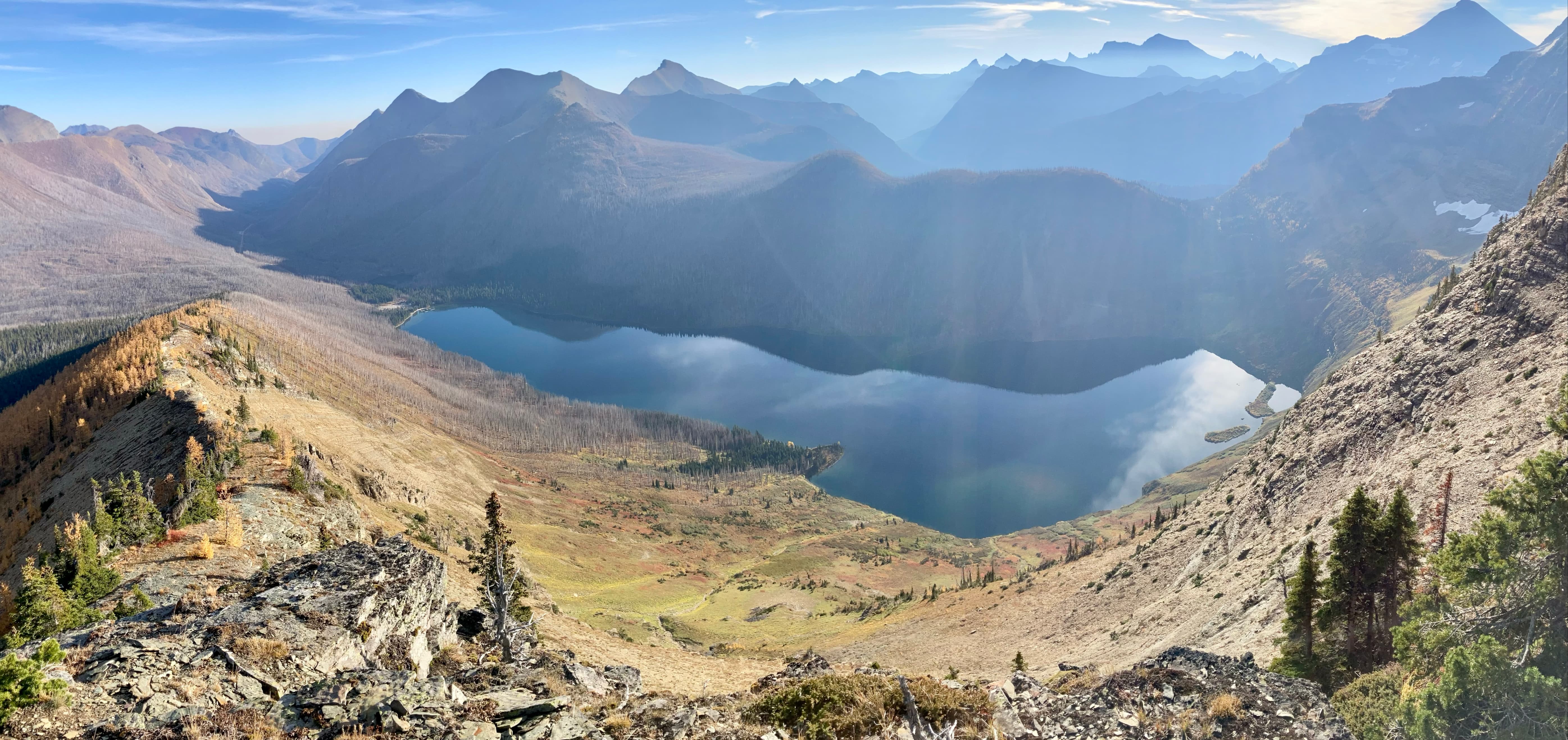
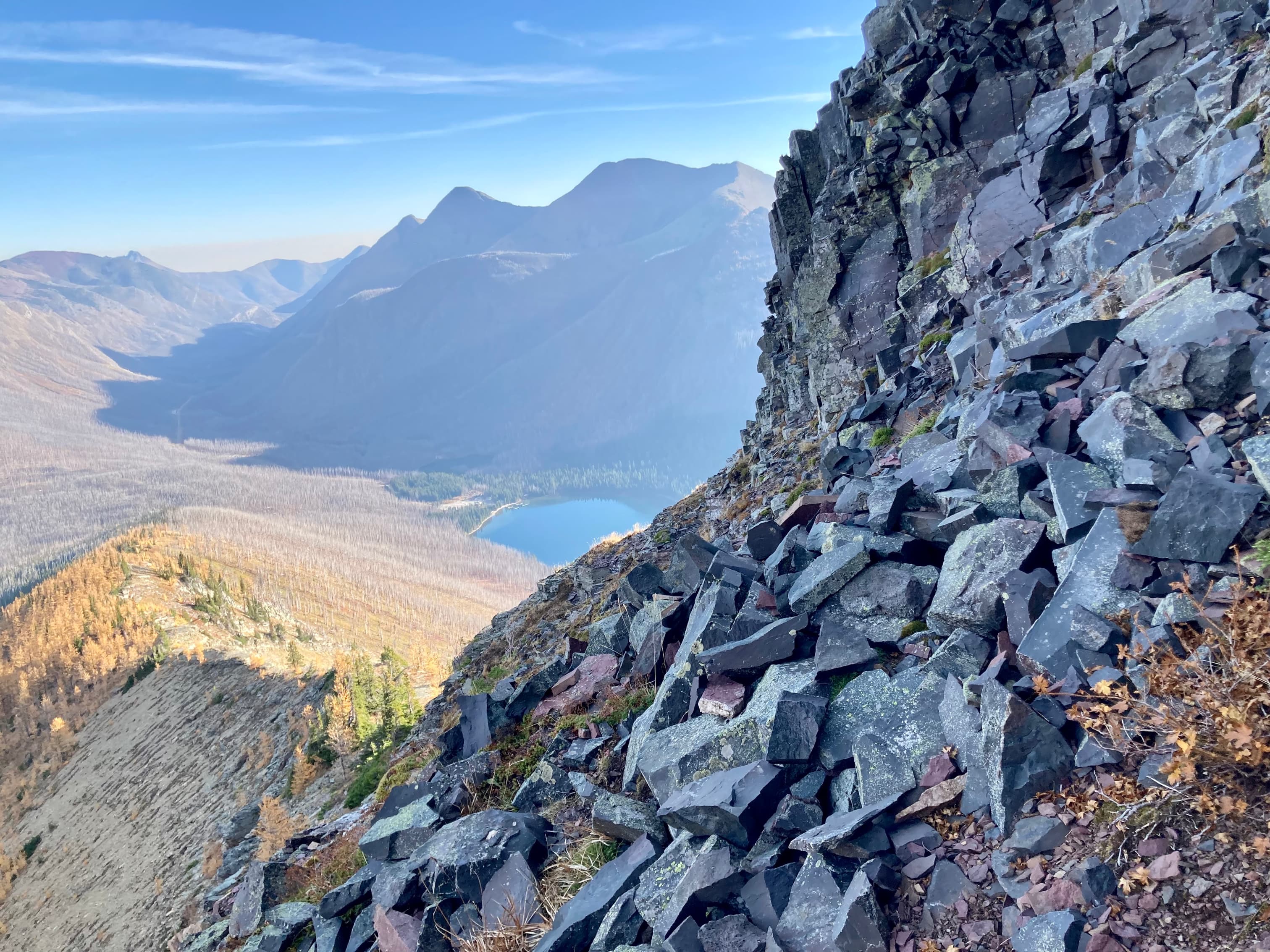
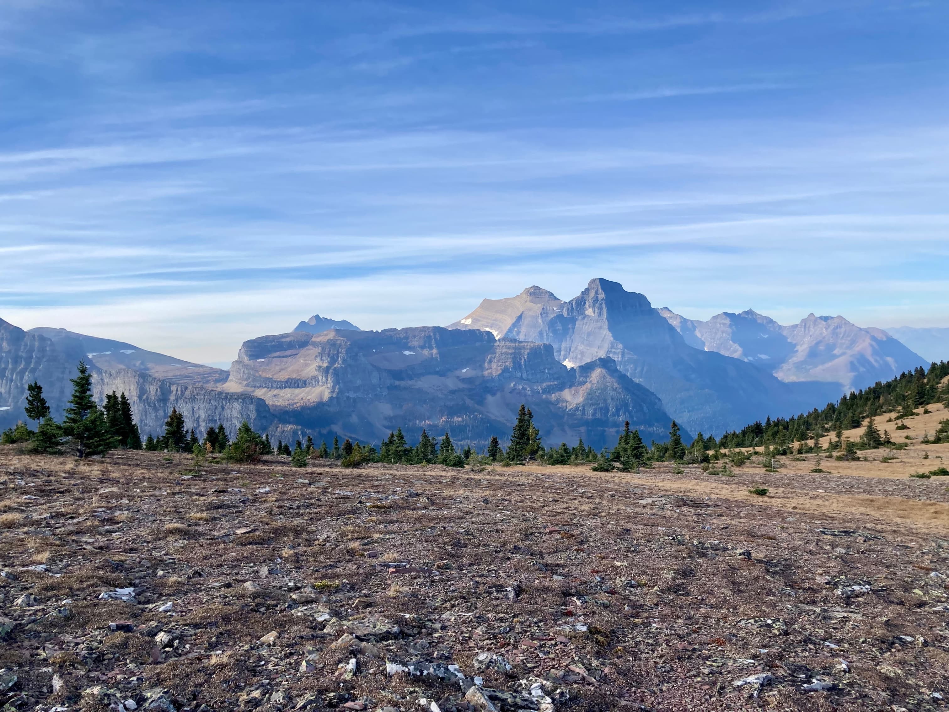
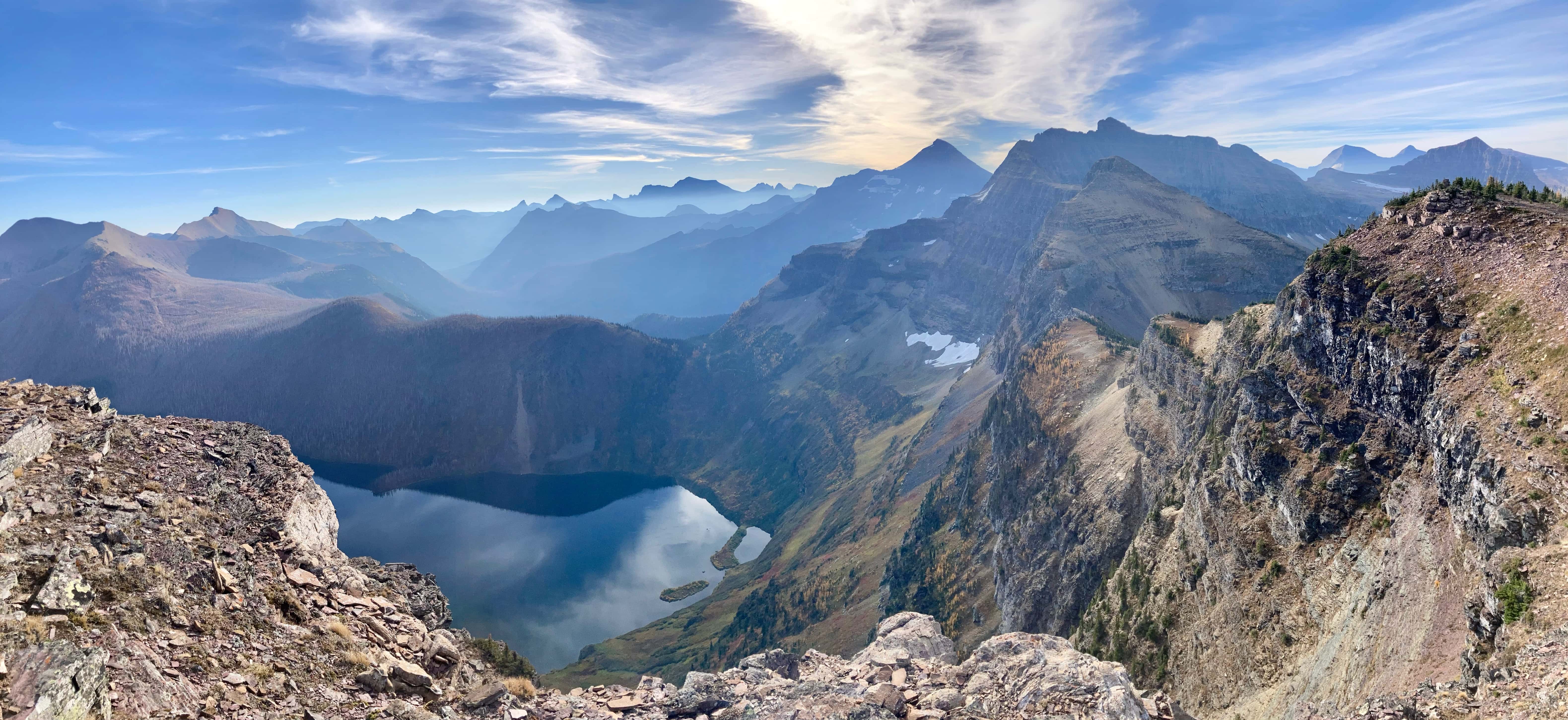
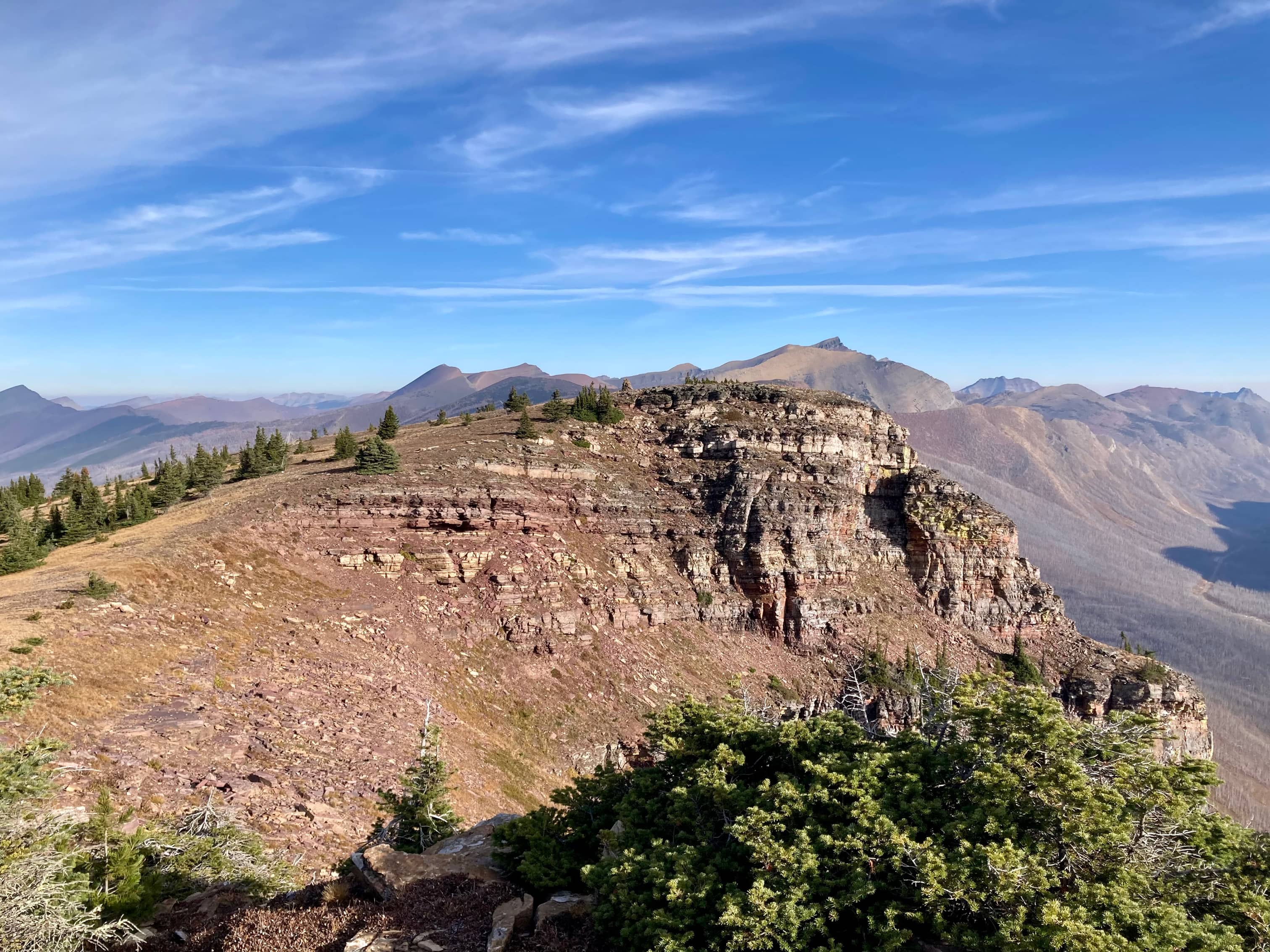
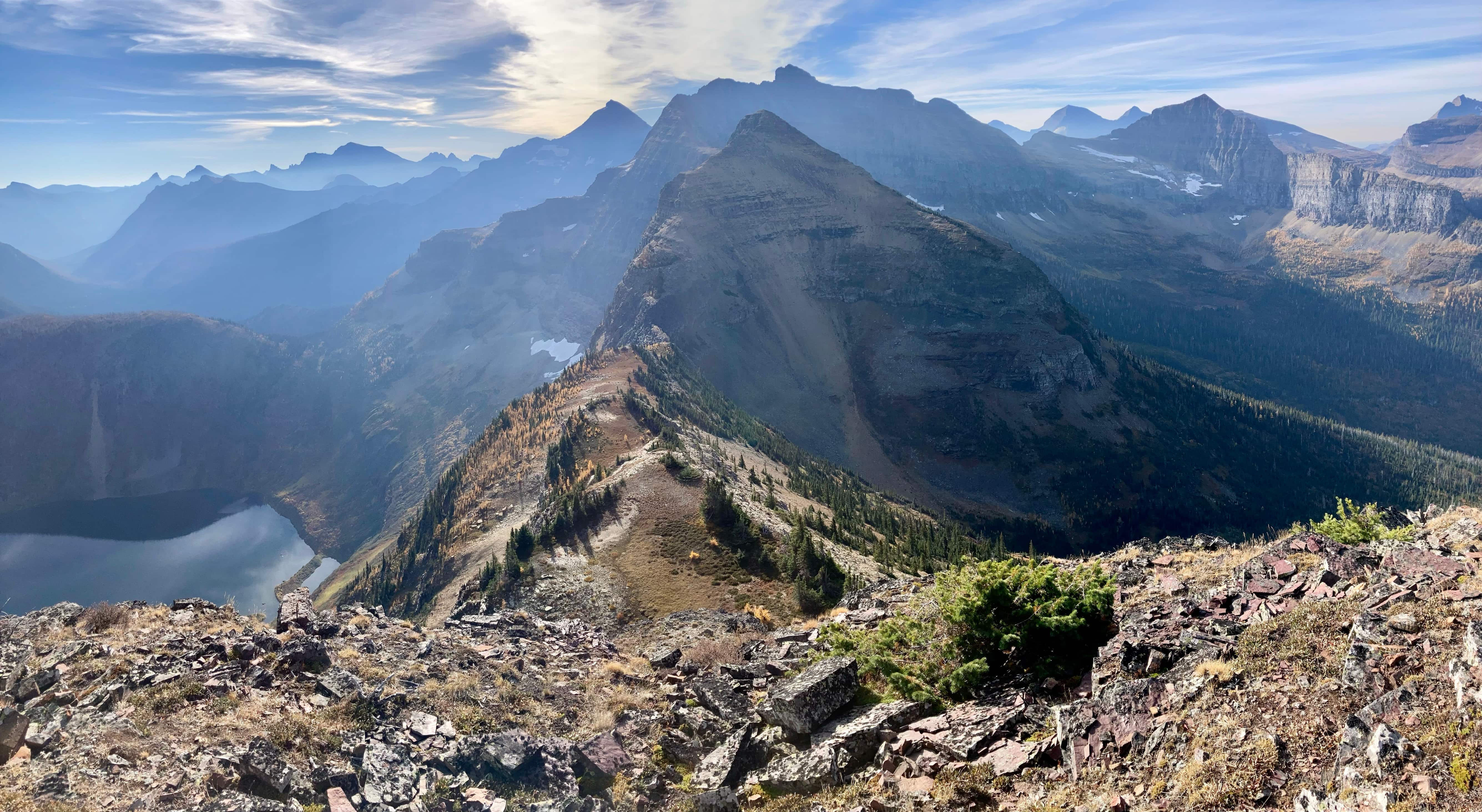
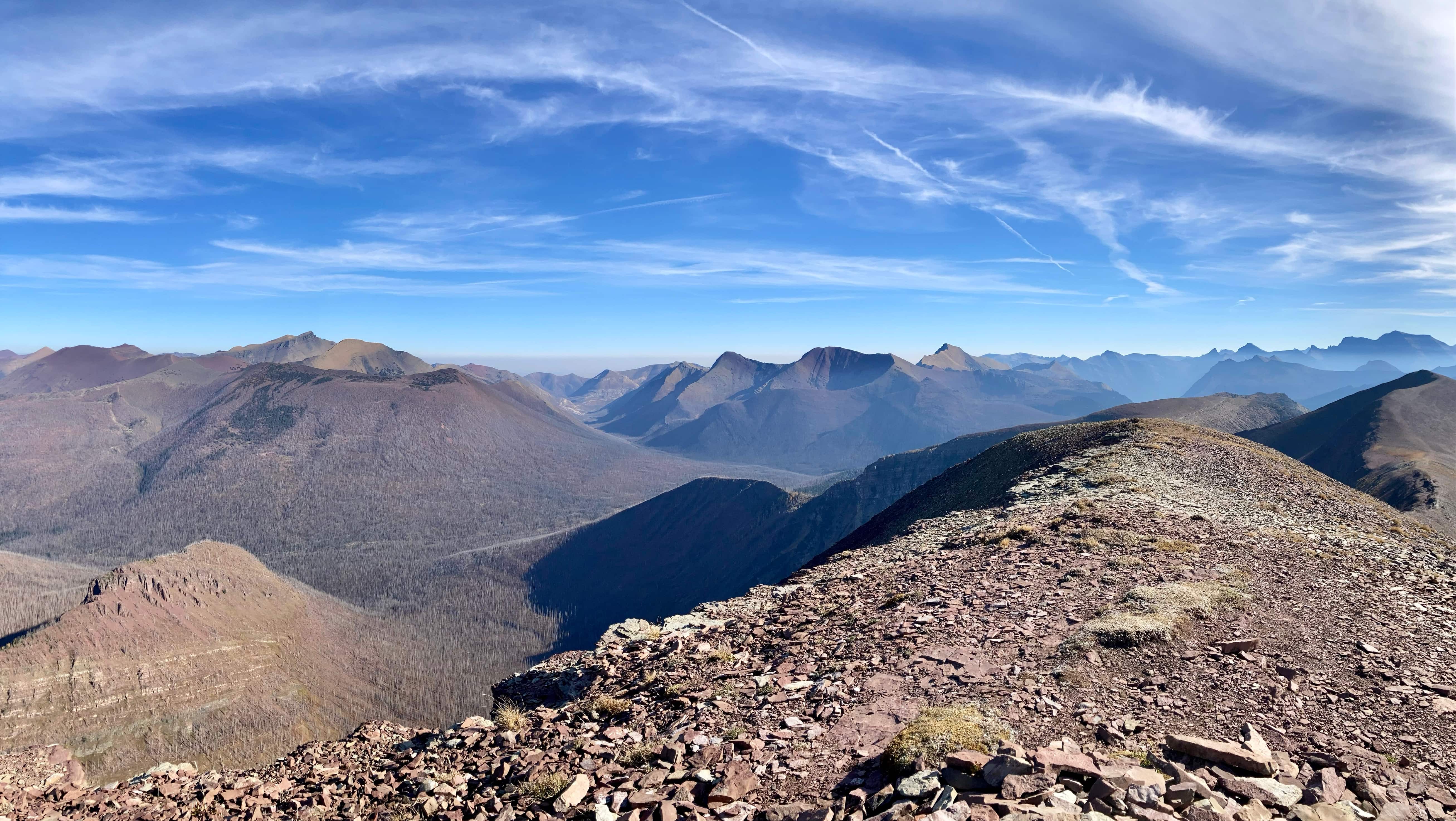
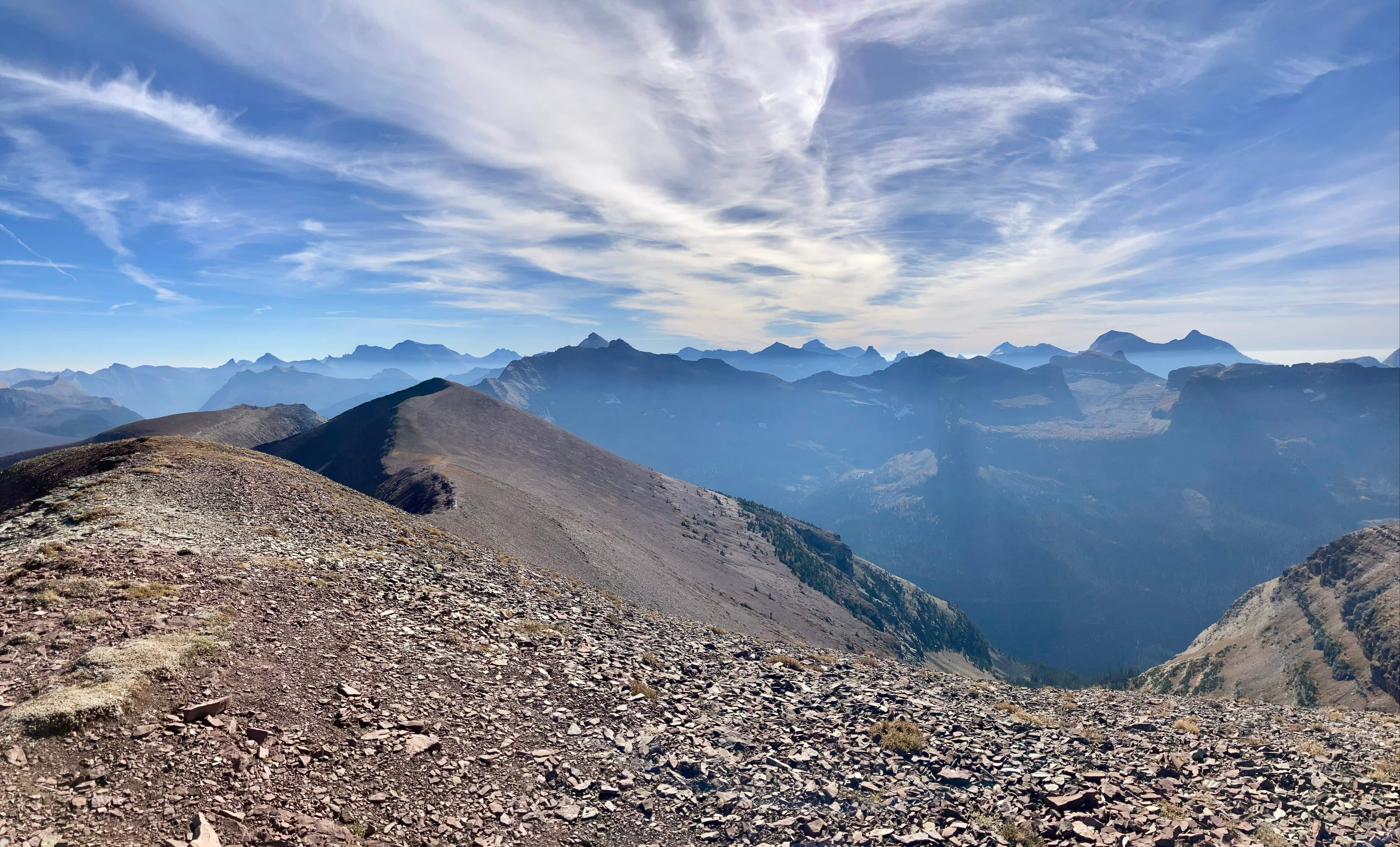
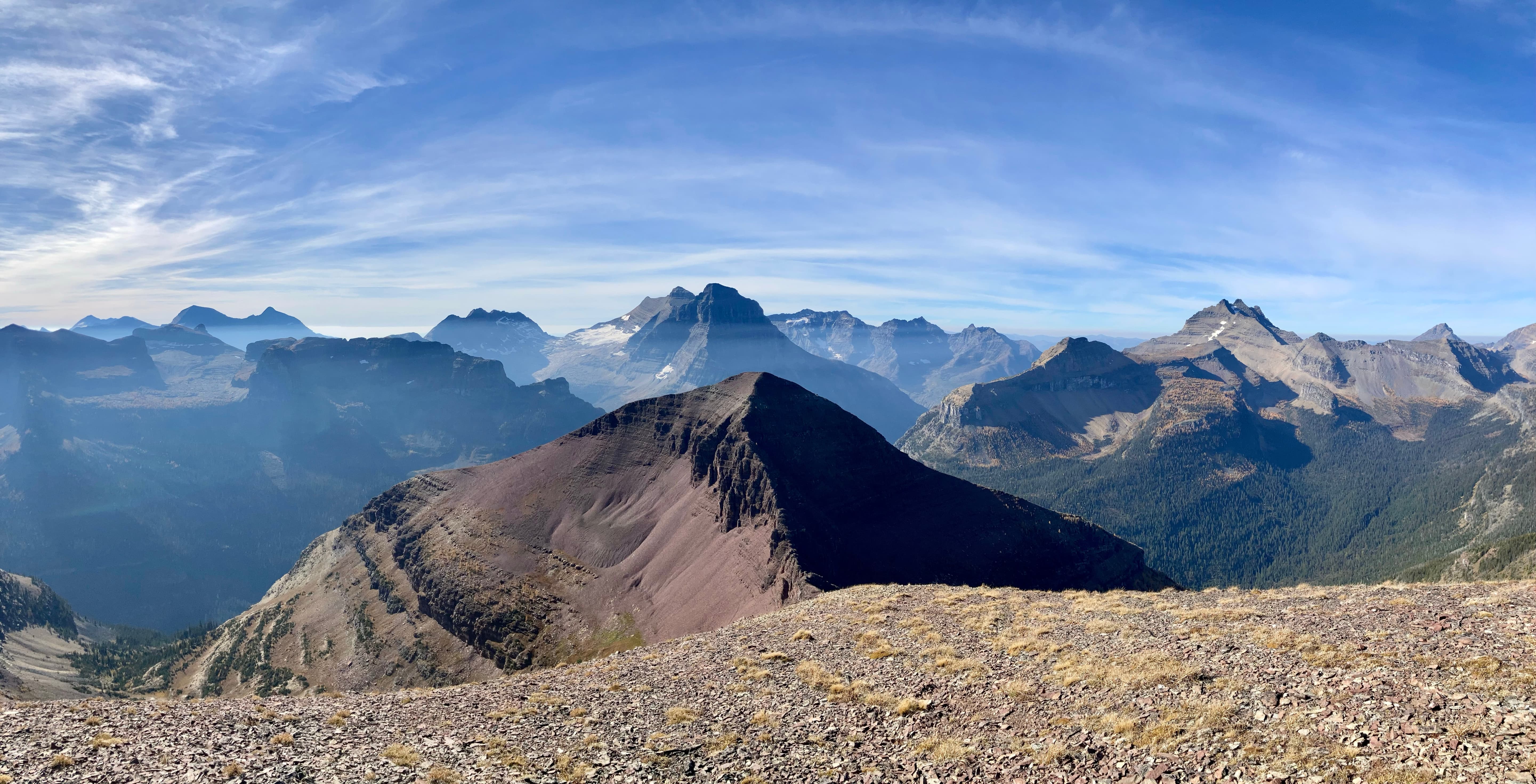
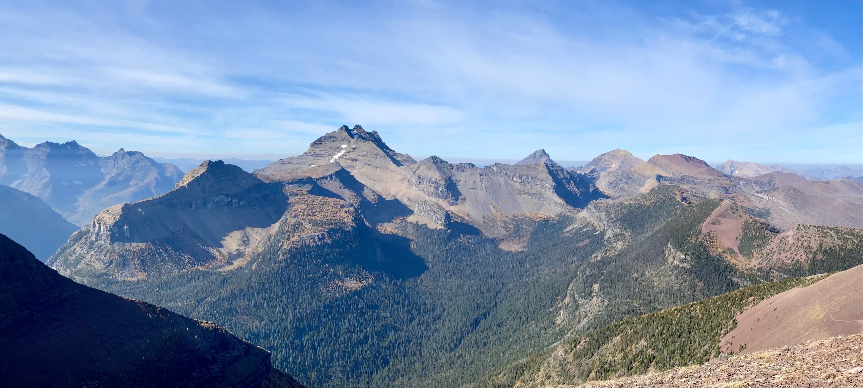
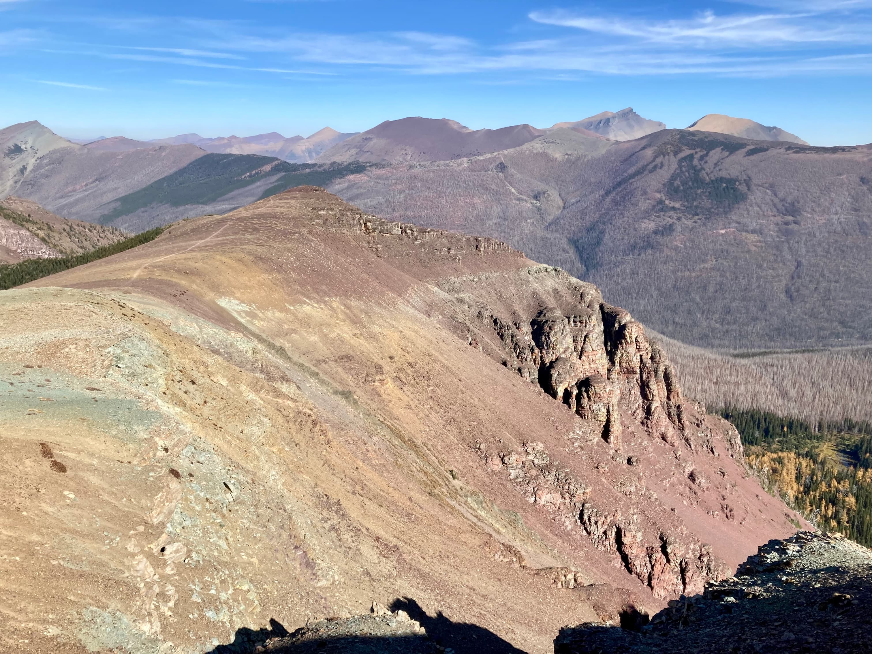
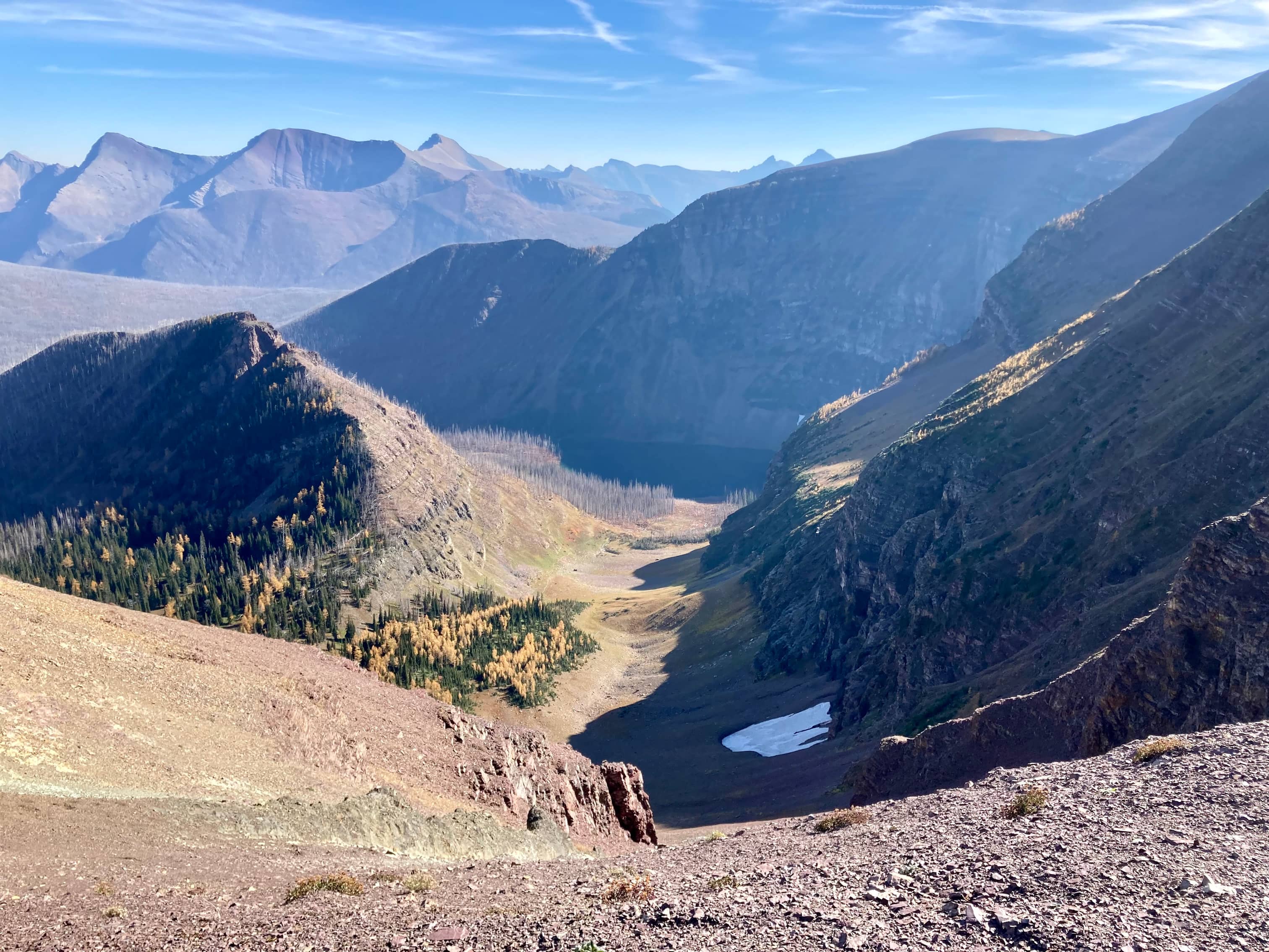
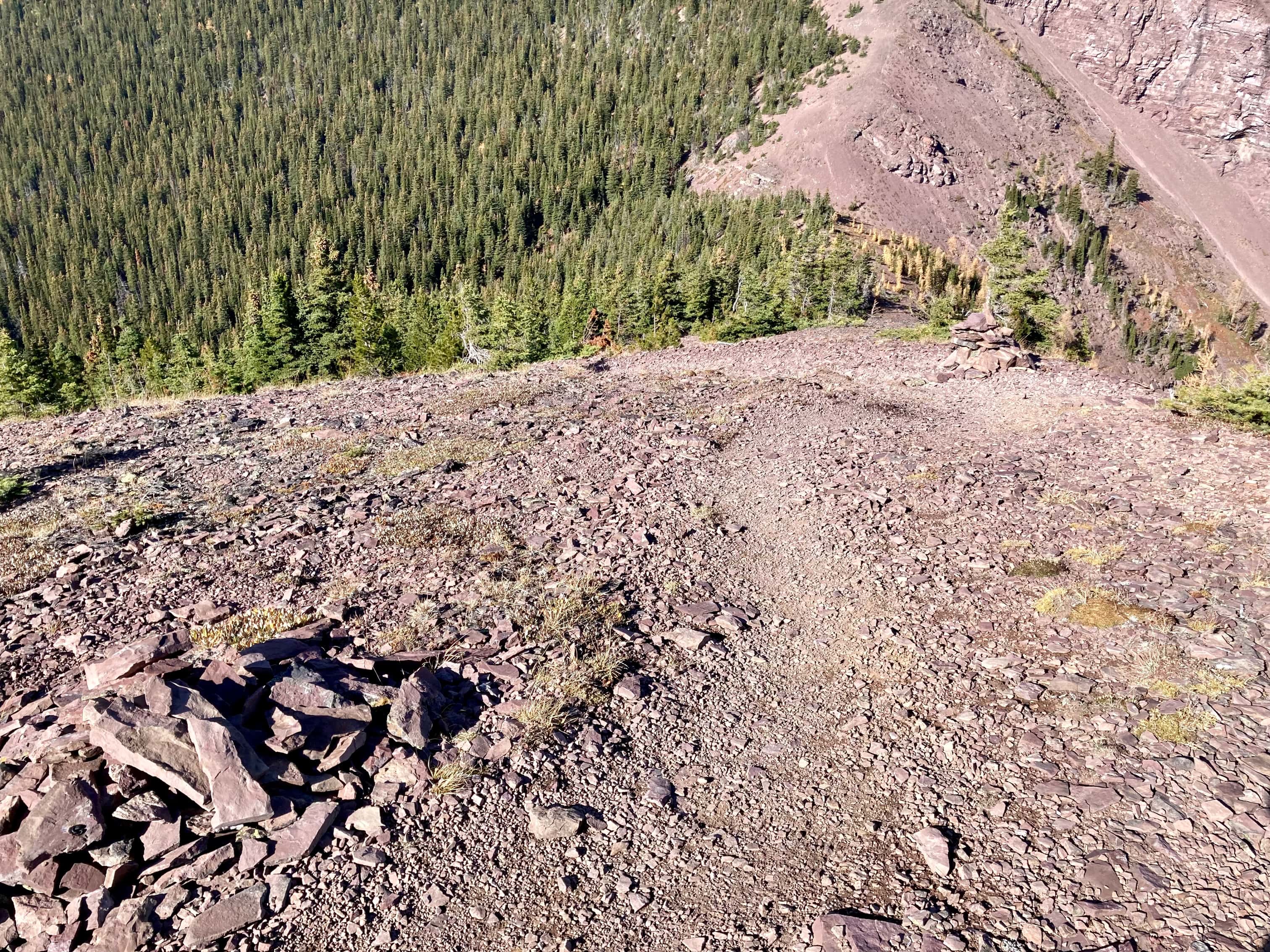
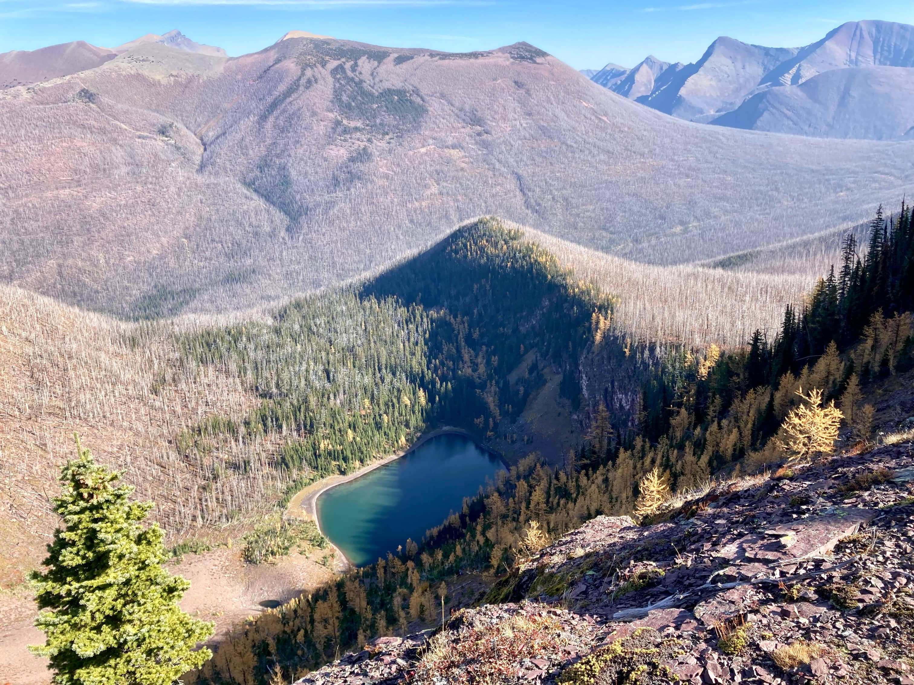
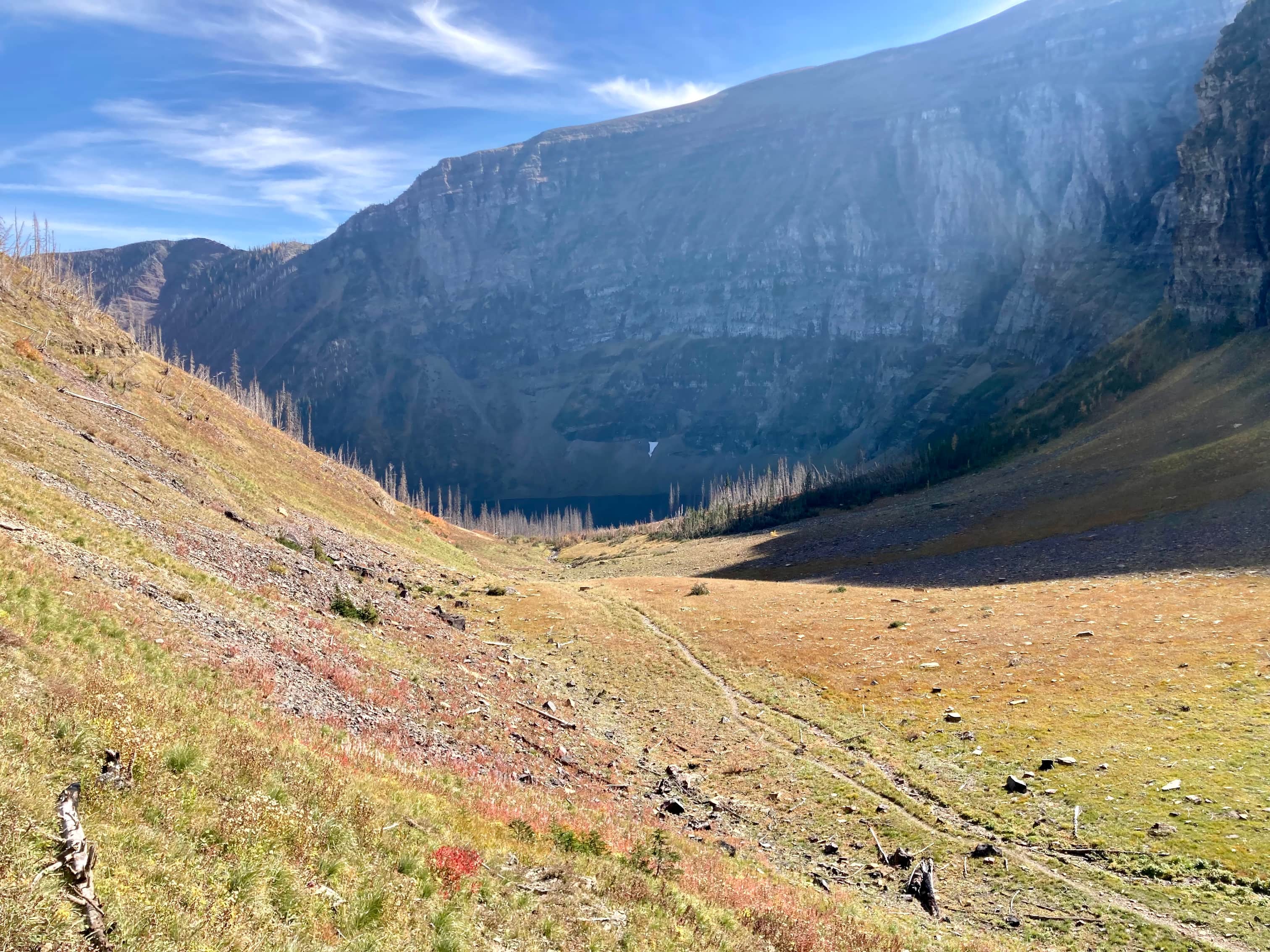
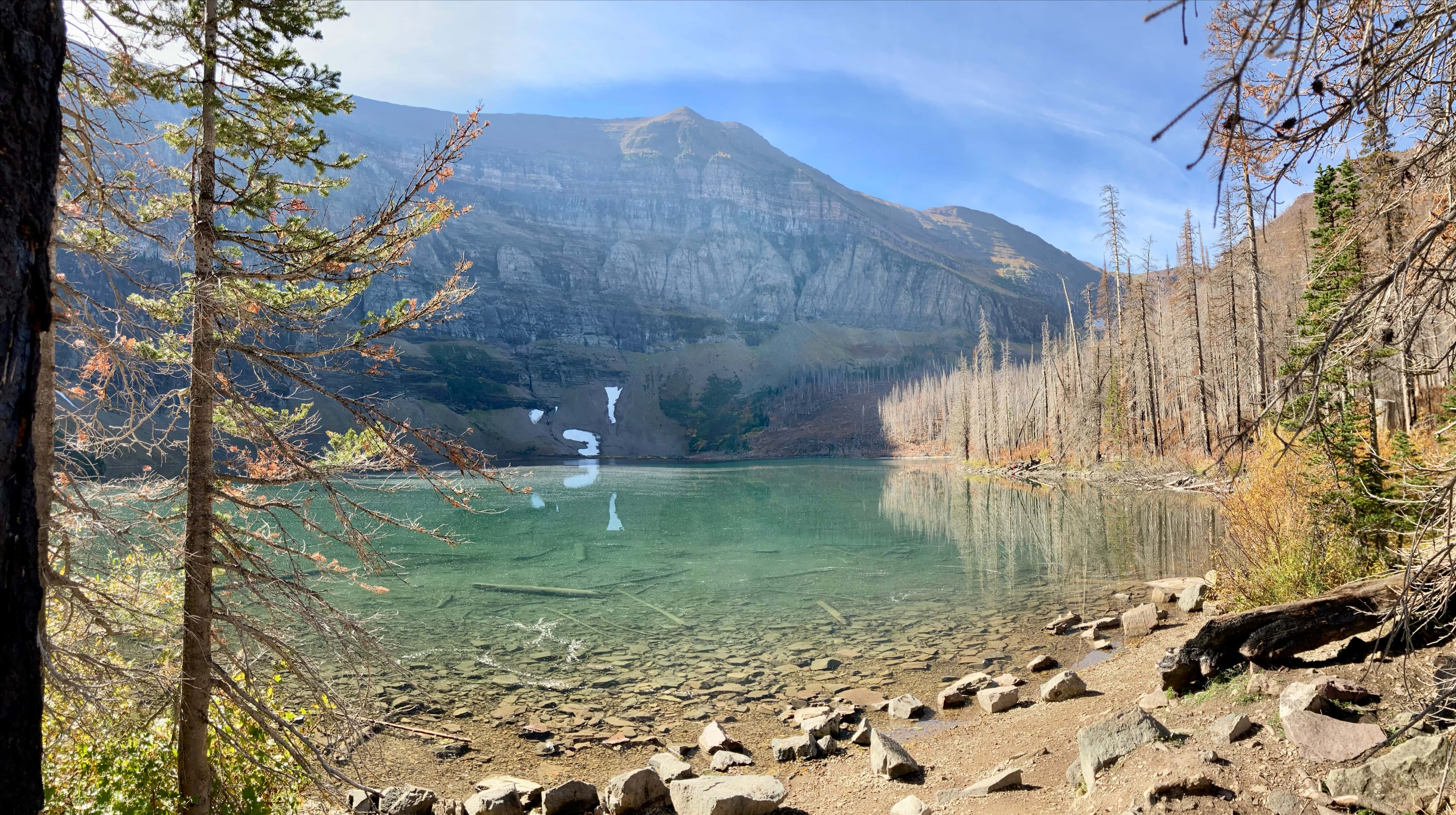
From Forum’s summit, I followed the connecting ridge to the west and soon found the Akamina Ridge trail. No further route-finding was required and I enjoyed the roughly 4 km of sublime ridge walking that makes Akamina Ridge such a popular destination. The weather was almost completely calm and quite warm, so I took a nice long break at Akamina’s summit. In an added bonus, I had the whole area to myself. I didn’t see another person until I was beginning my descent to Wall Lake. The descent route departs from the ridge at a spot marked with a fairly large cairn. The route takes a sharp right turn at the cairn (the trail to the right isn’t immediately obvious, so you need to be looking for it -hence the cairn). I saw there was a trail going left, too, though. I decided to explore that to see if it led to an alternate descent. It didn’t, though – it petered out at a col a short distance to the northwest, which I later learned is Bennett Pass. I small lake was visible in the valley below which my Gem Trek map says is unofficially “Little Wall Lake”. I backtracked from Bennett Pass and ascended along the trail to Wall Lake, then to Akamina Pass, and finally down to the trailhead.
Click on the pictures in the gallery below to access higher-resolution images.
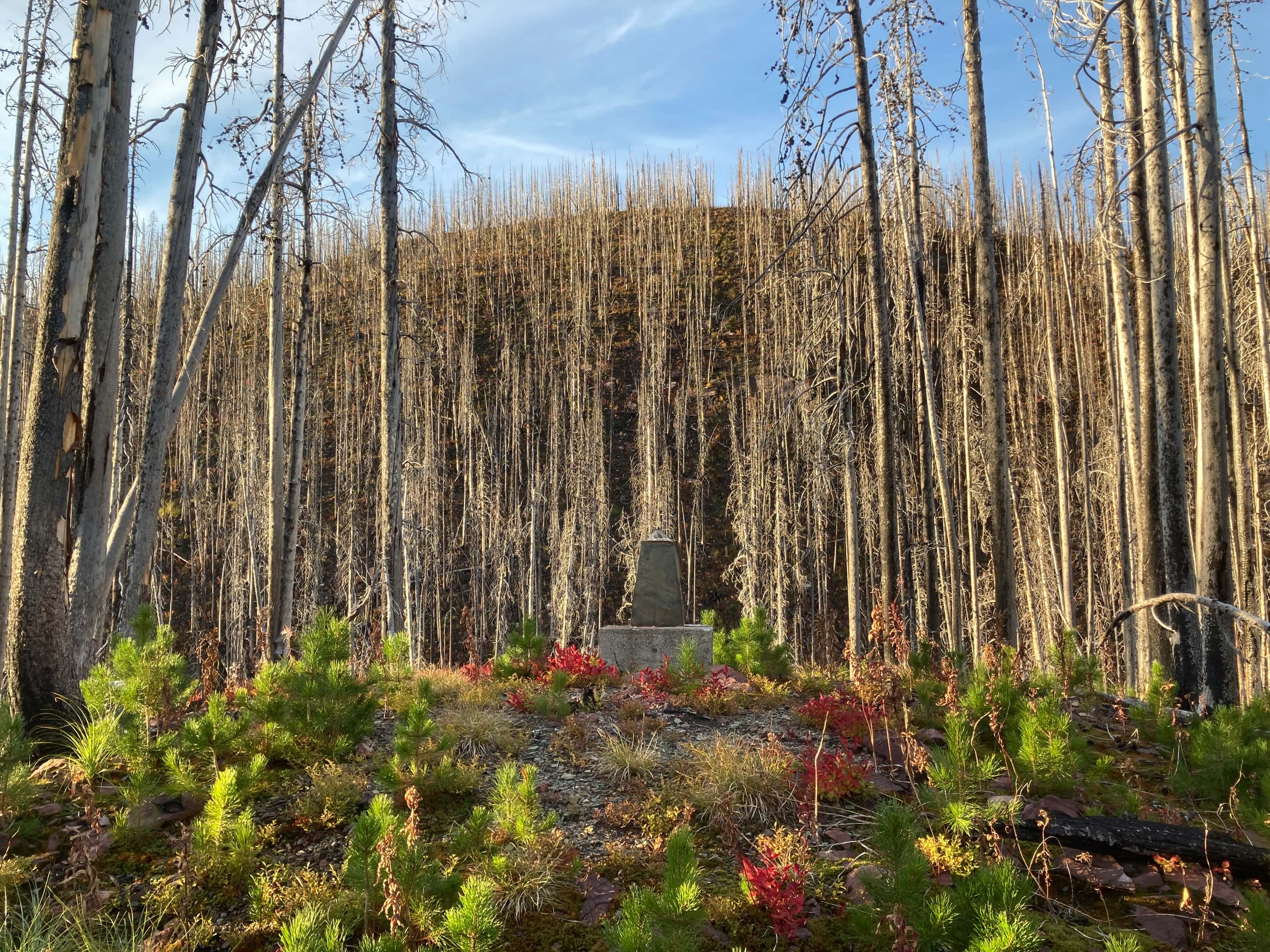
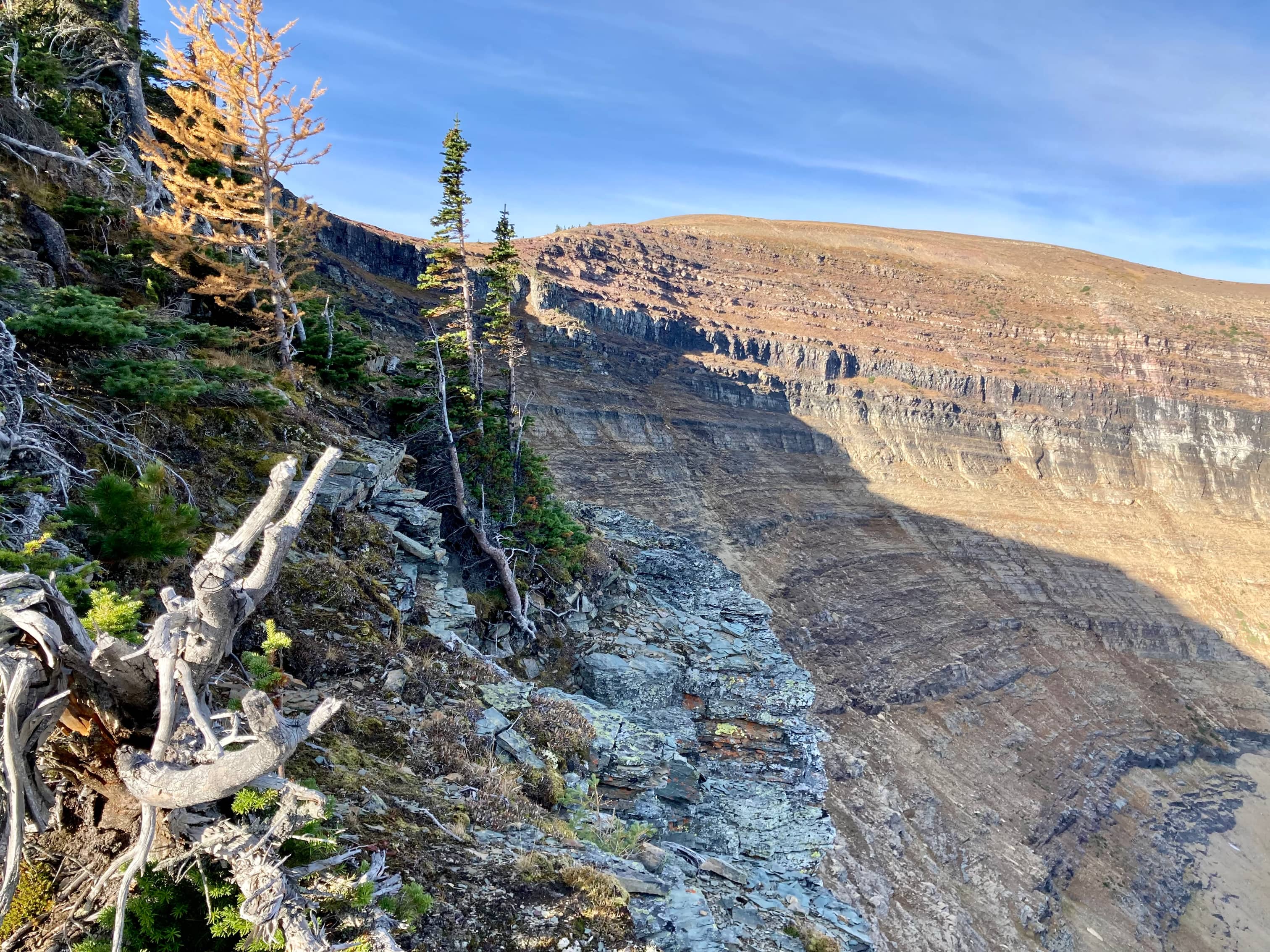
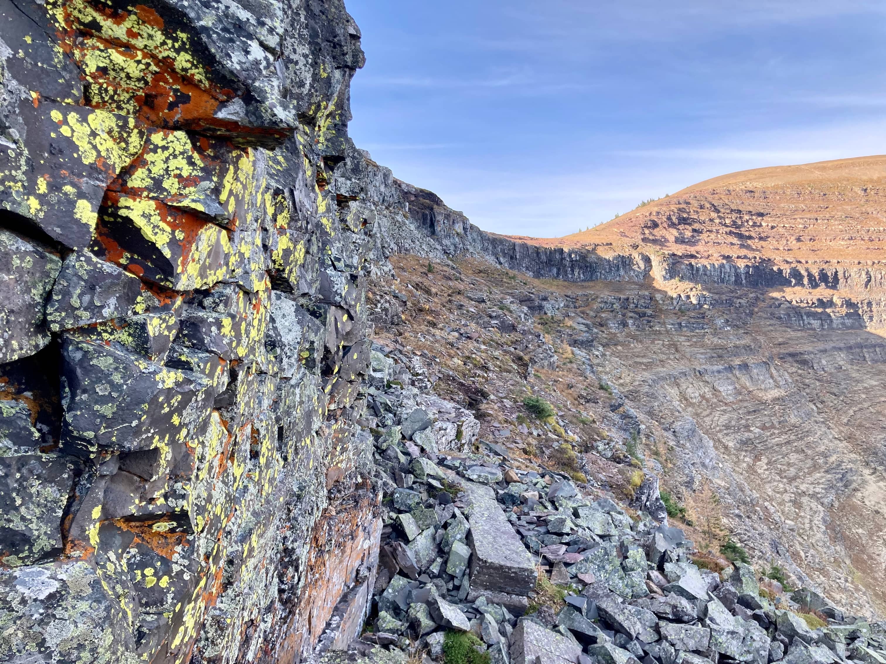
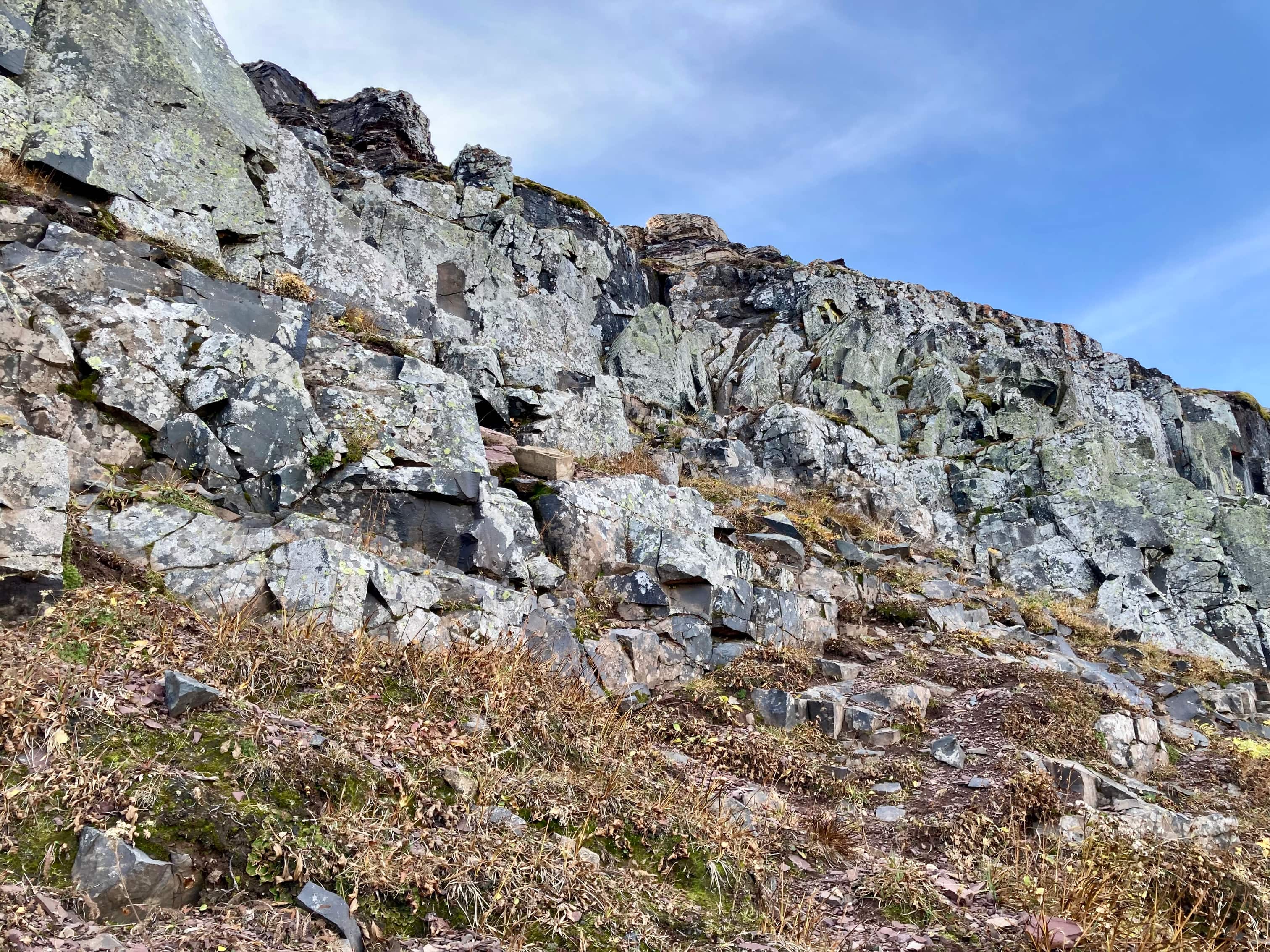
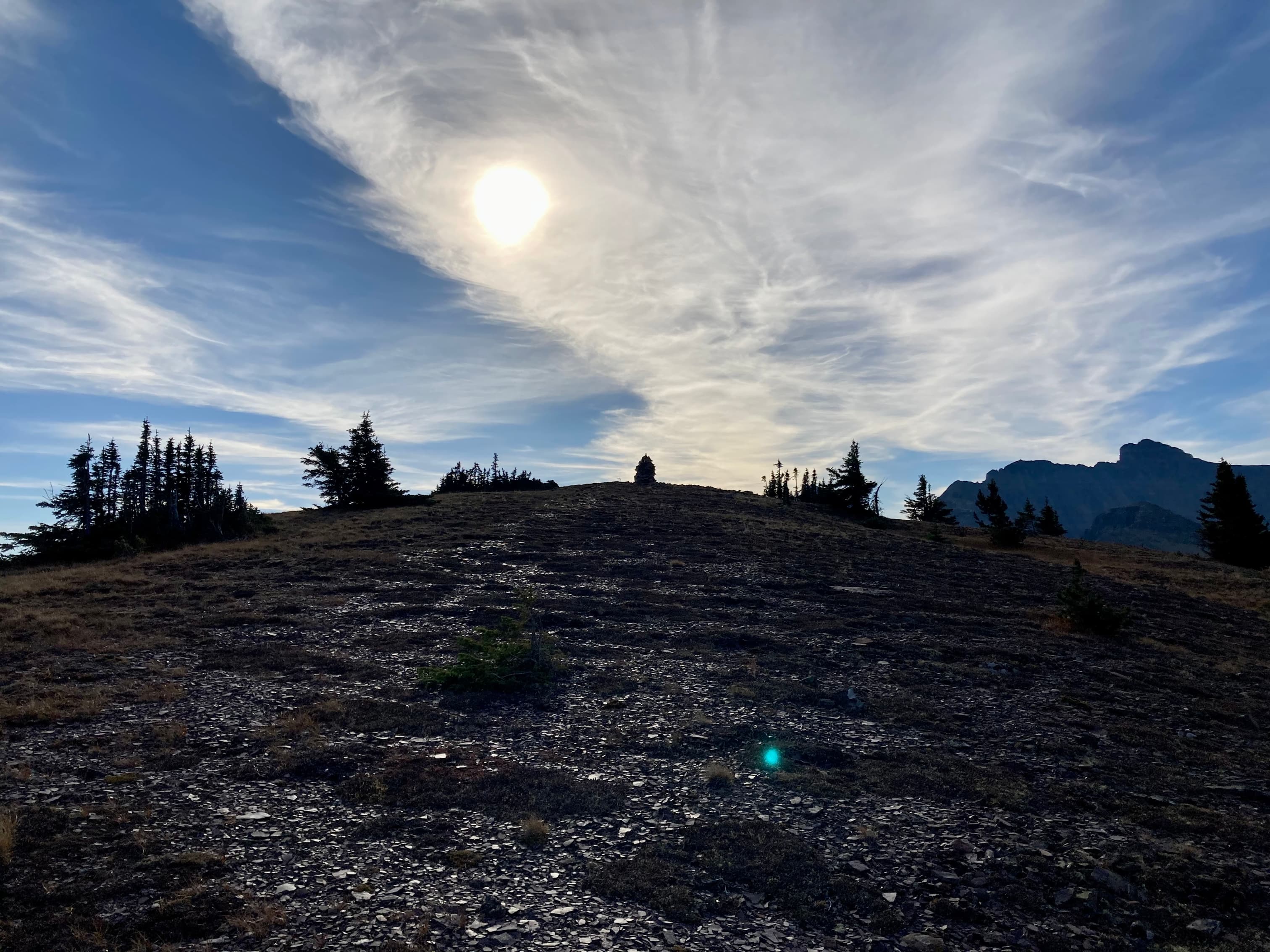
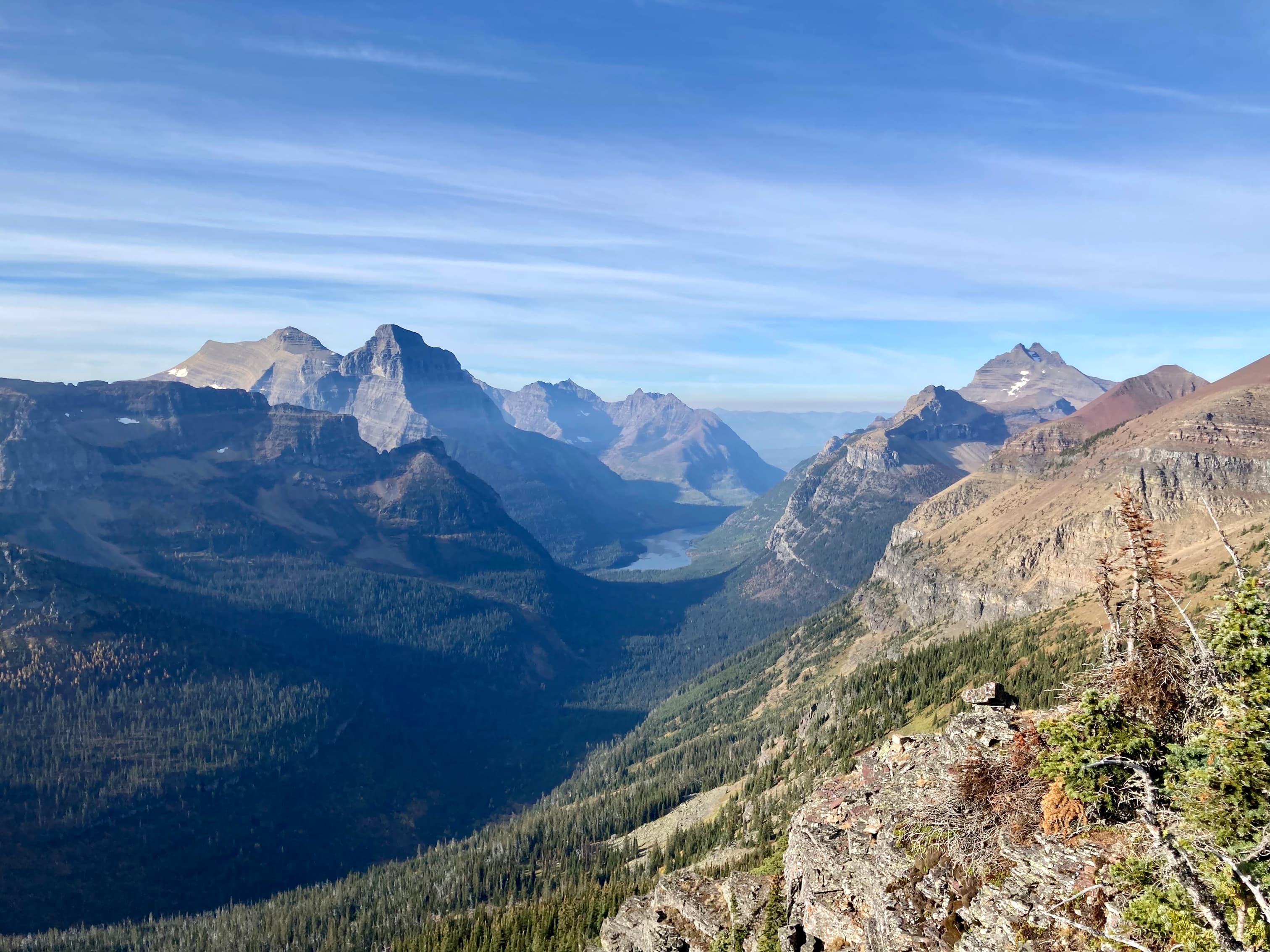
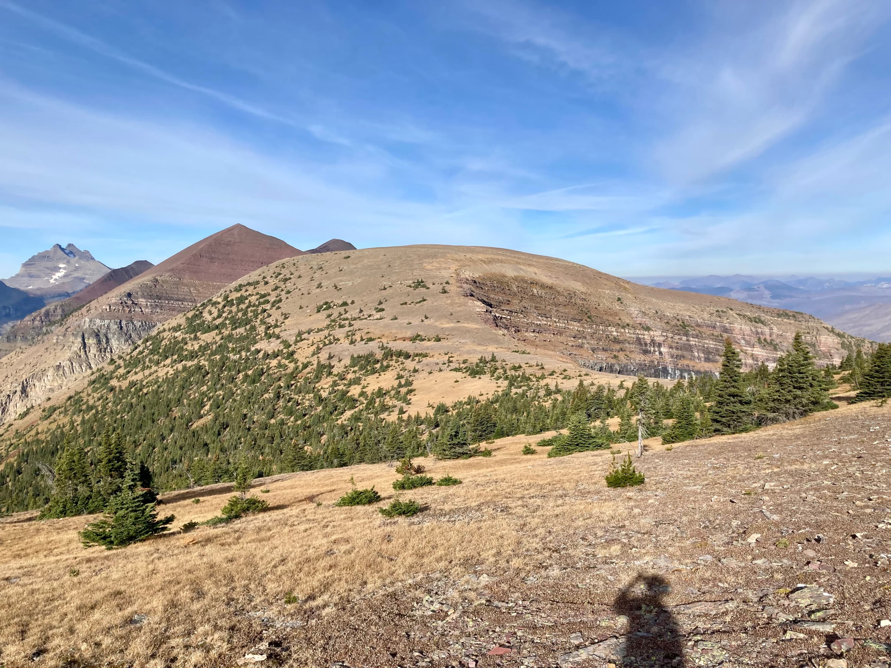
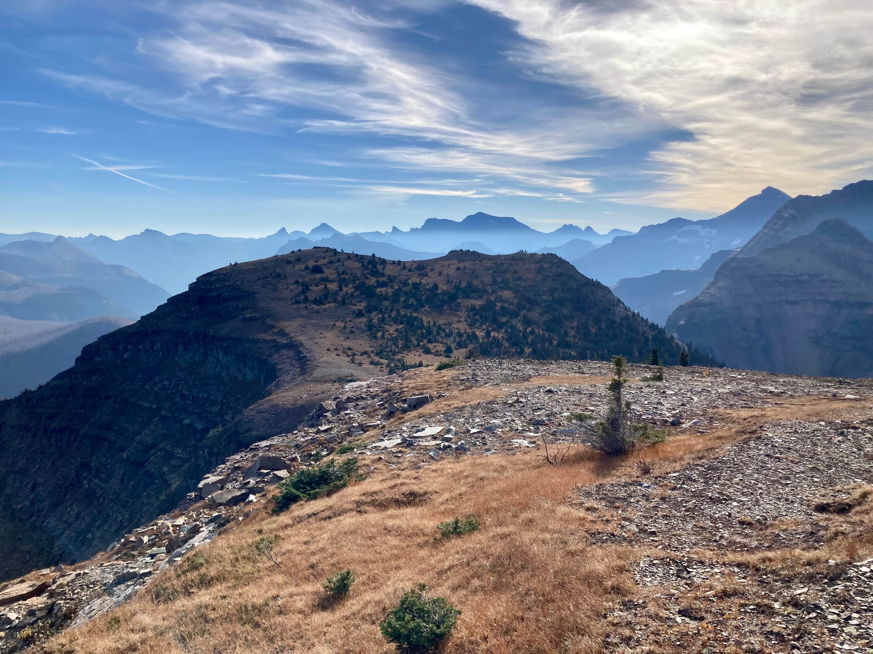
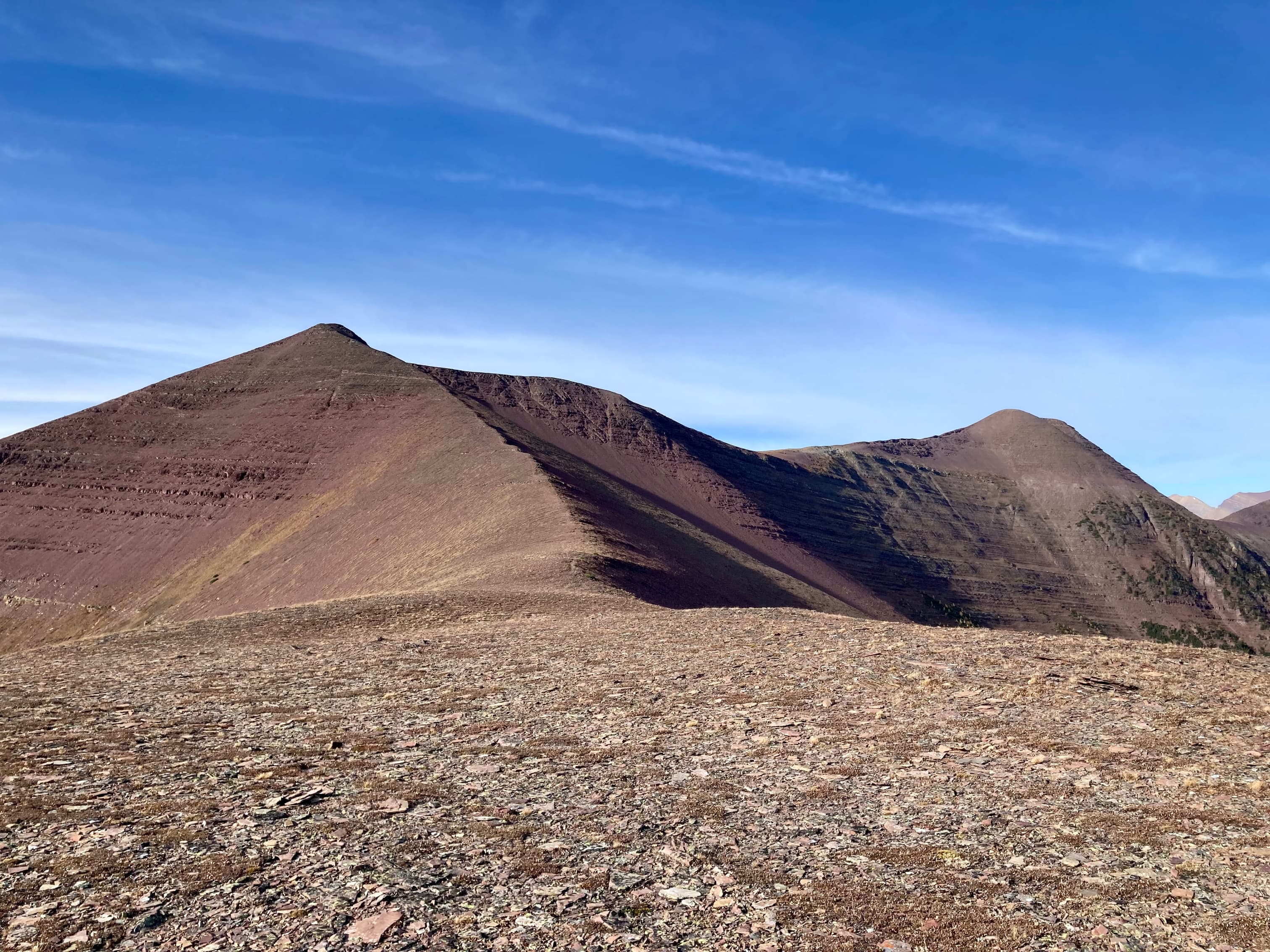
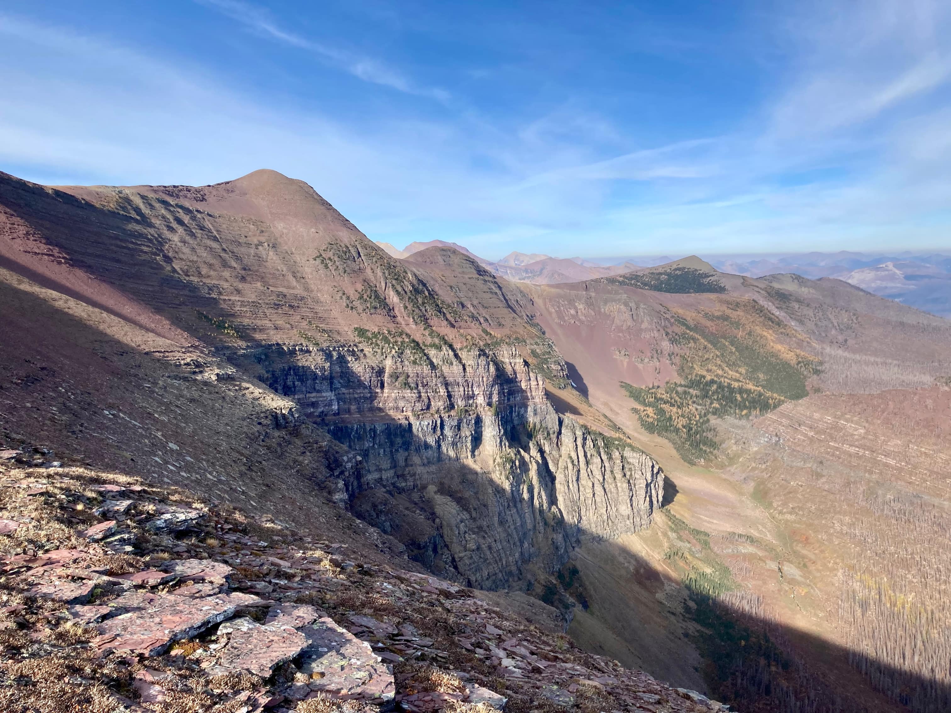
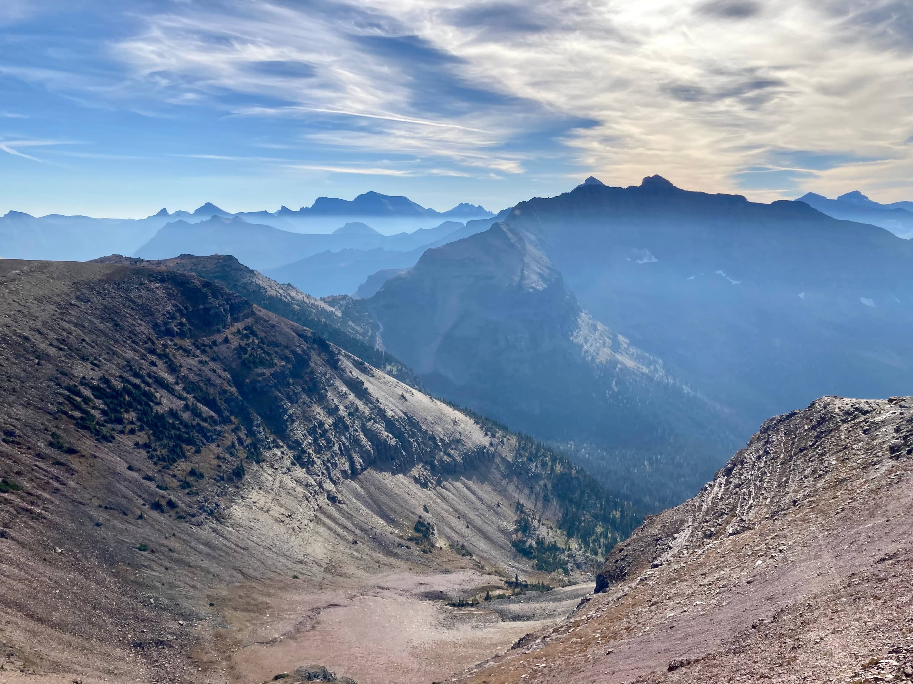
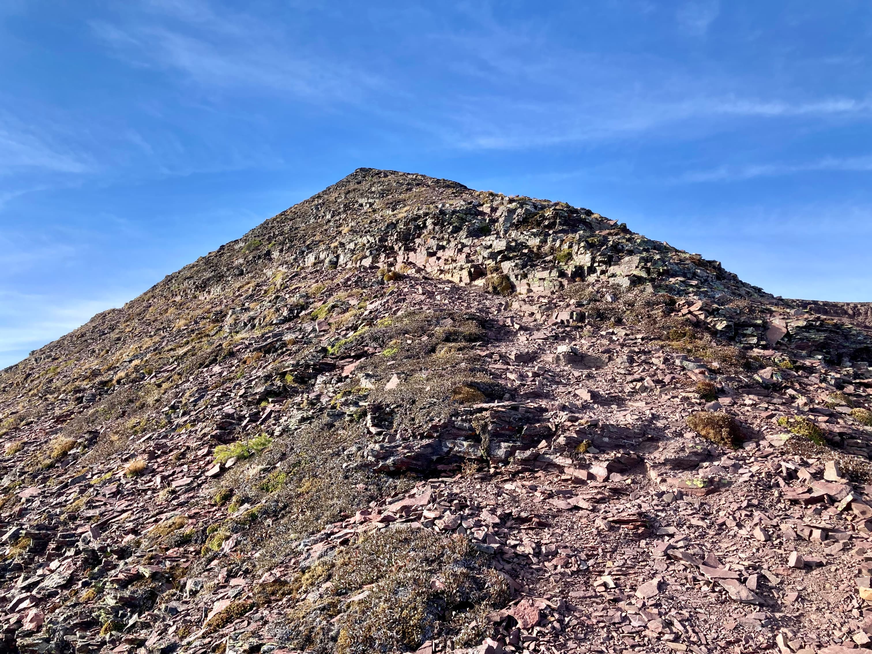
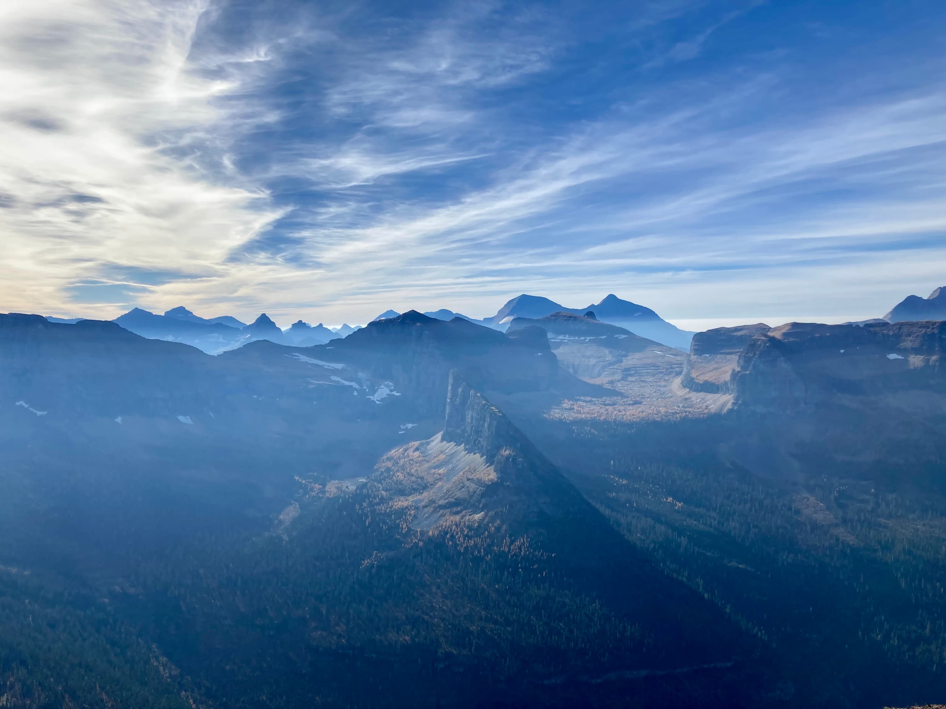
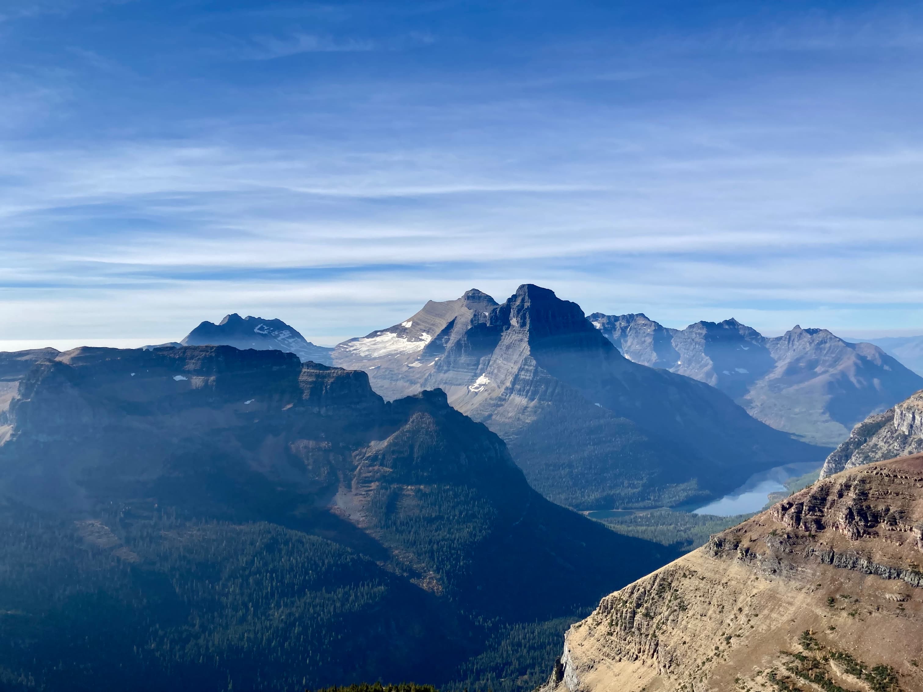
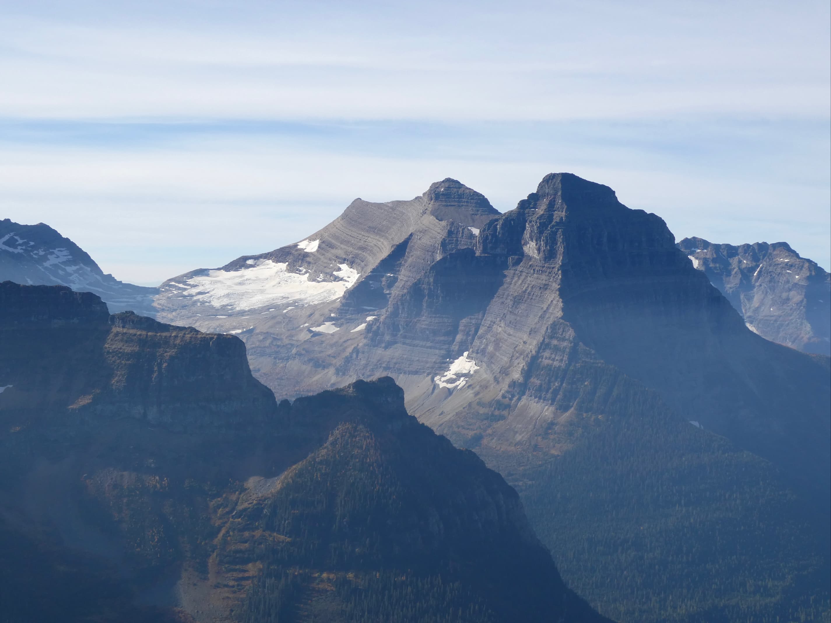
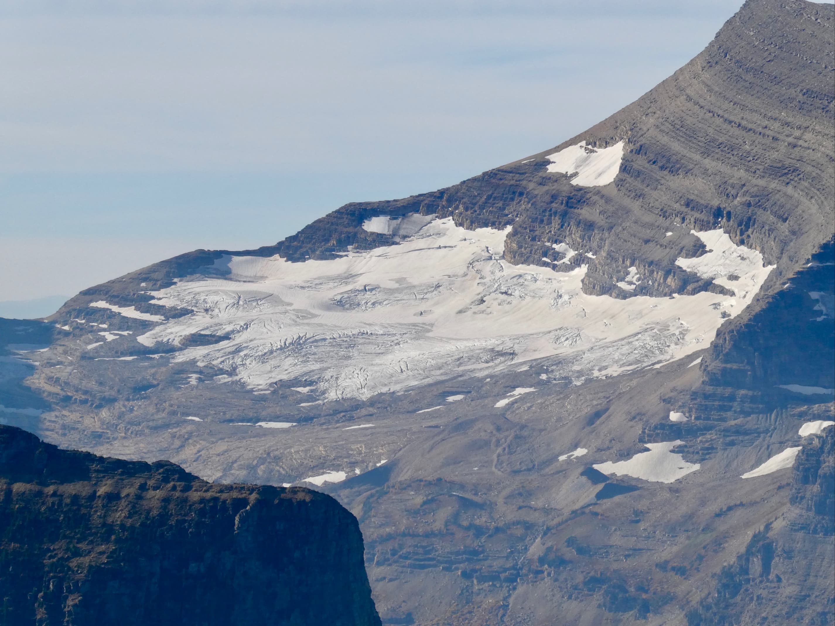
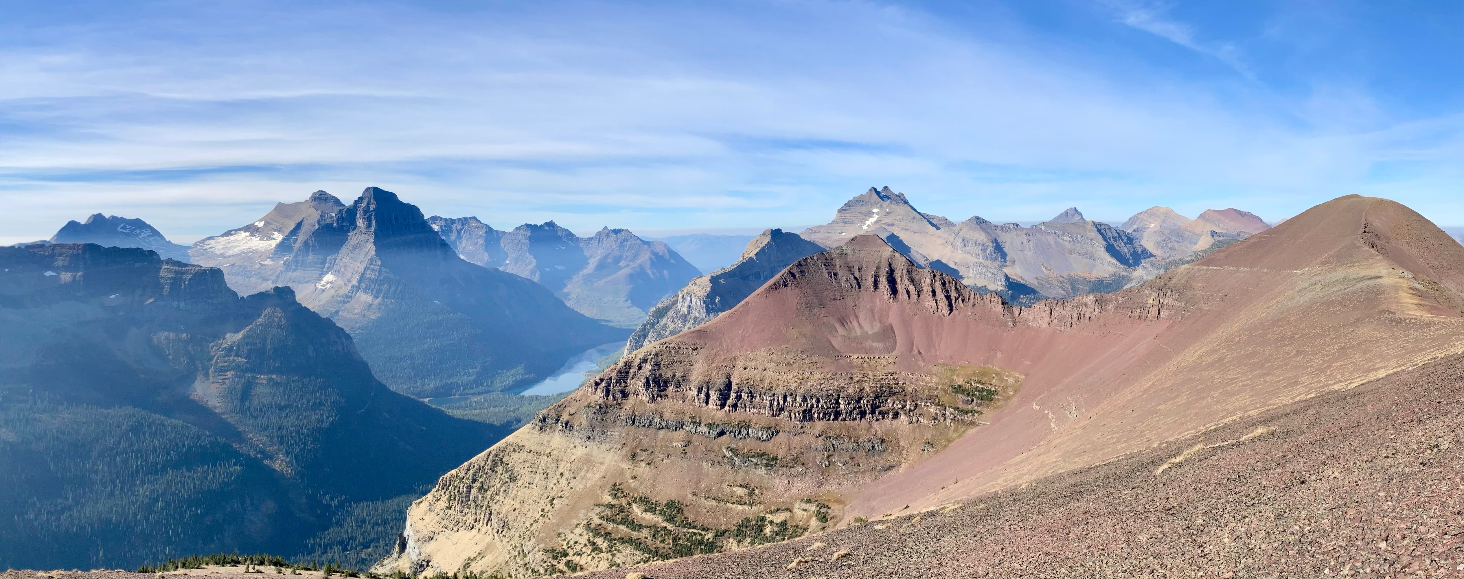
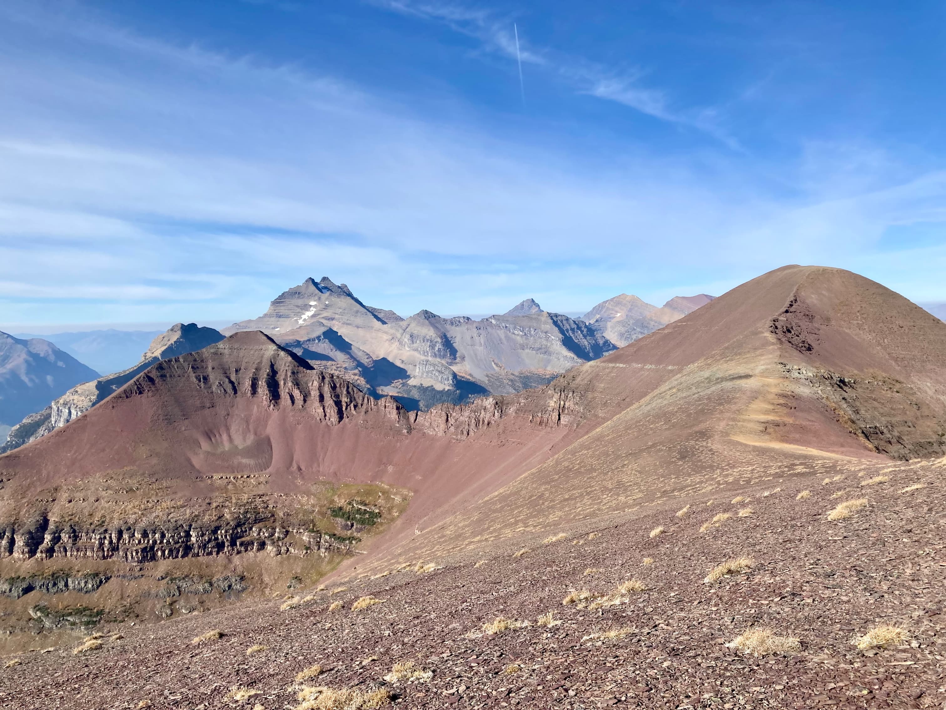
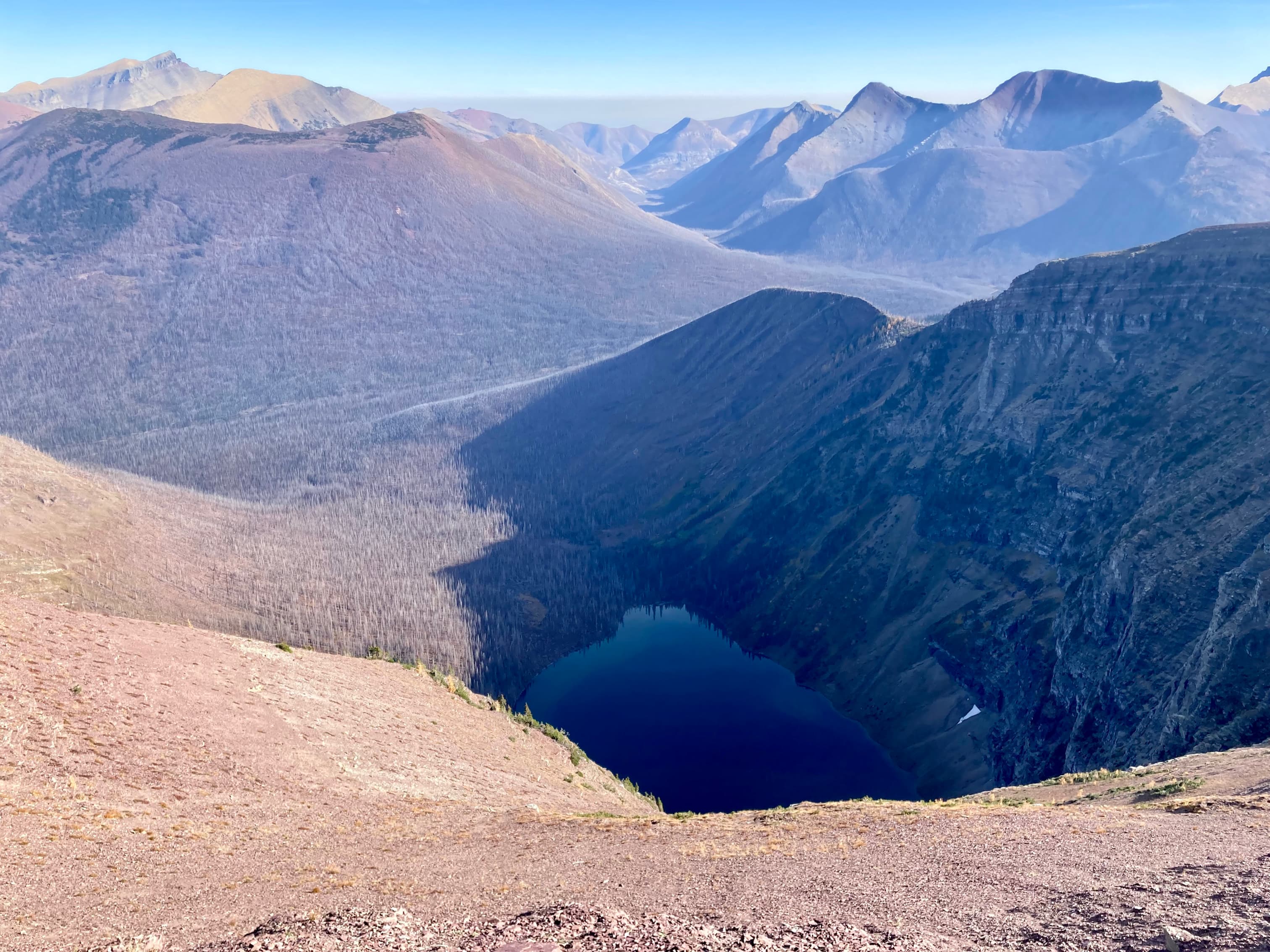
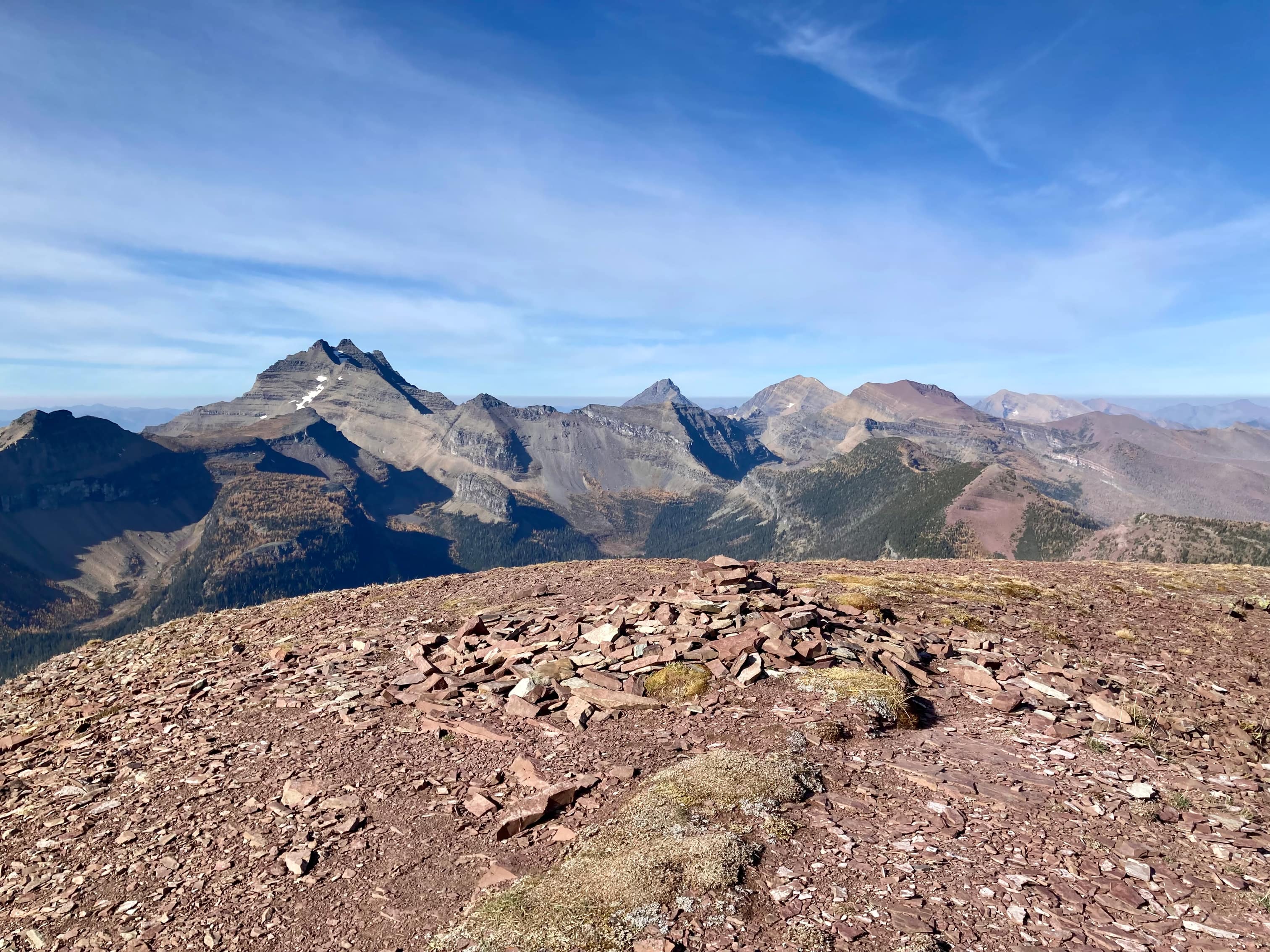
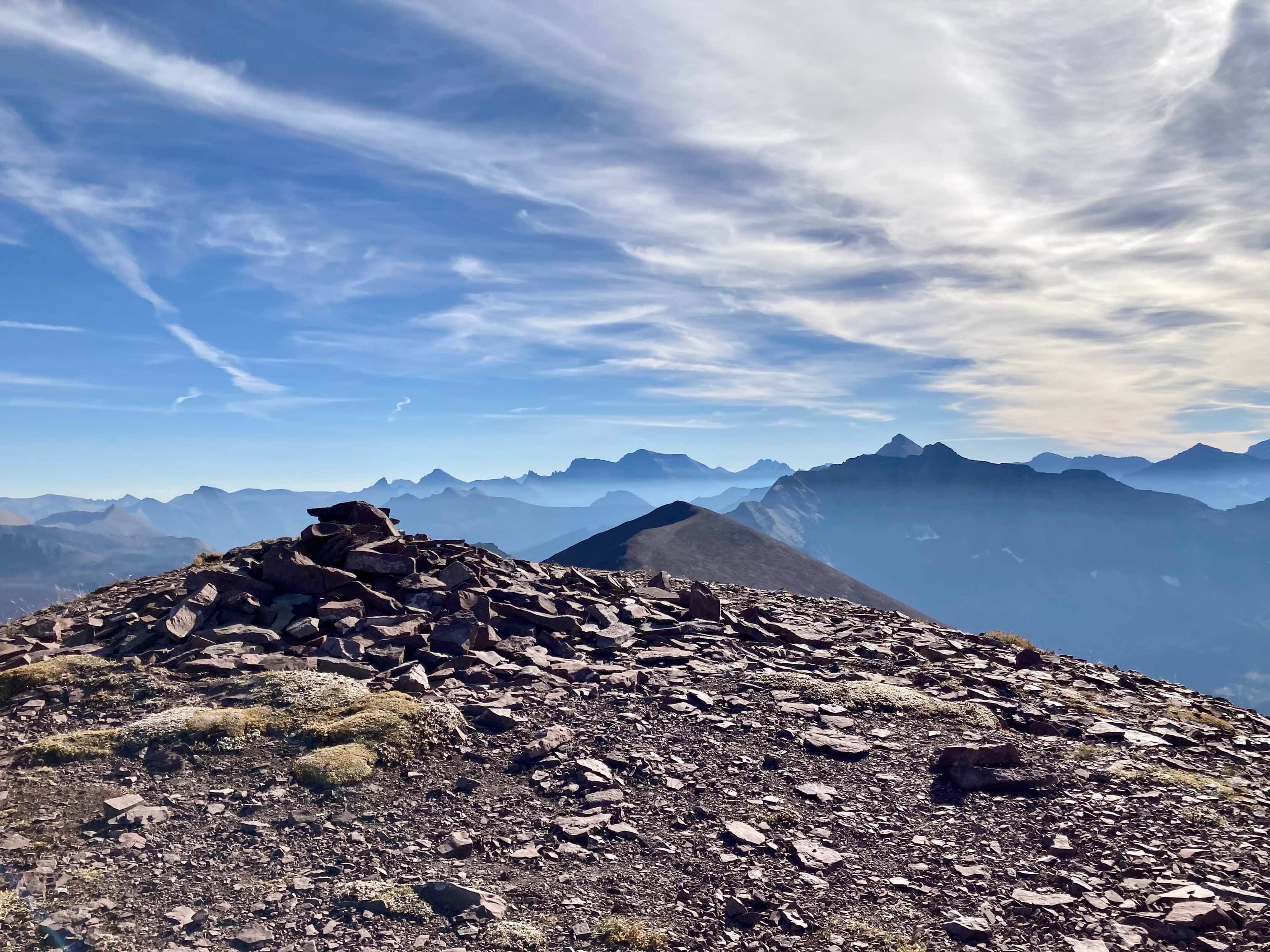
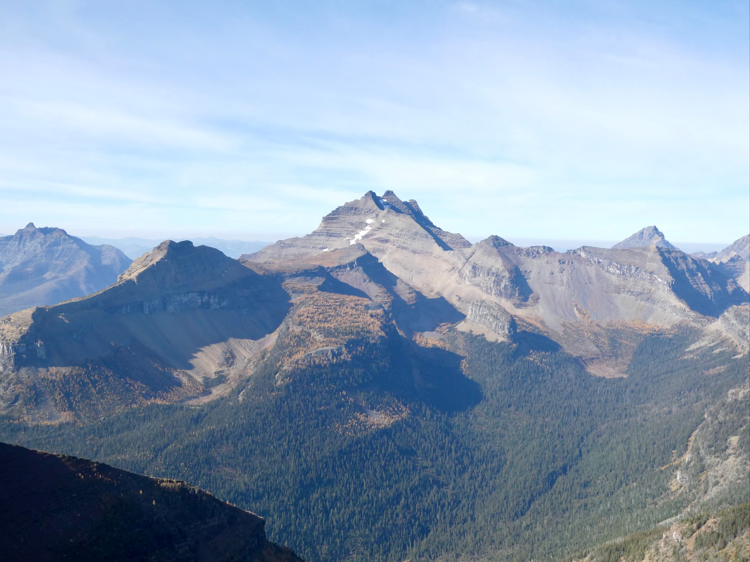
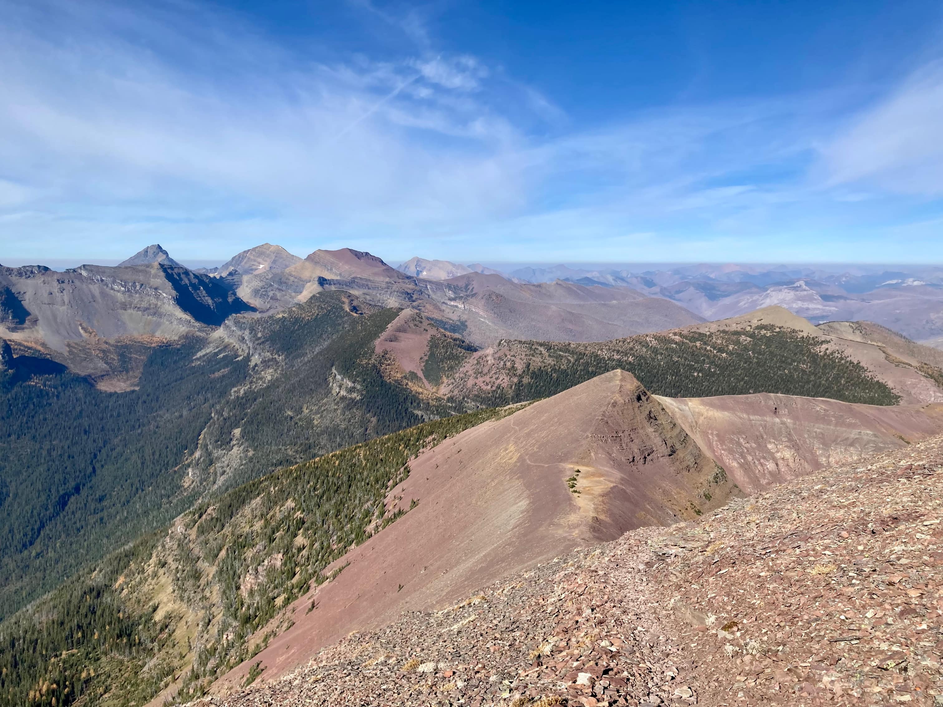
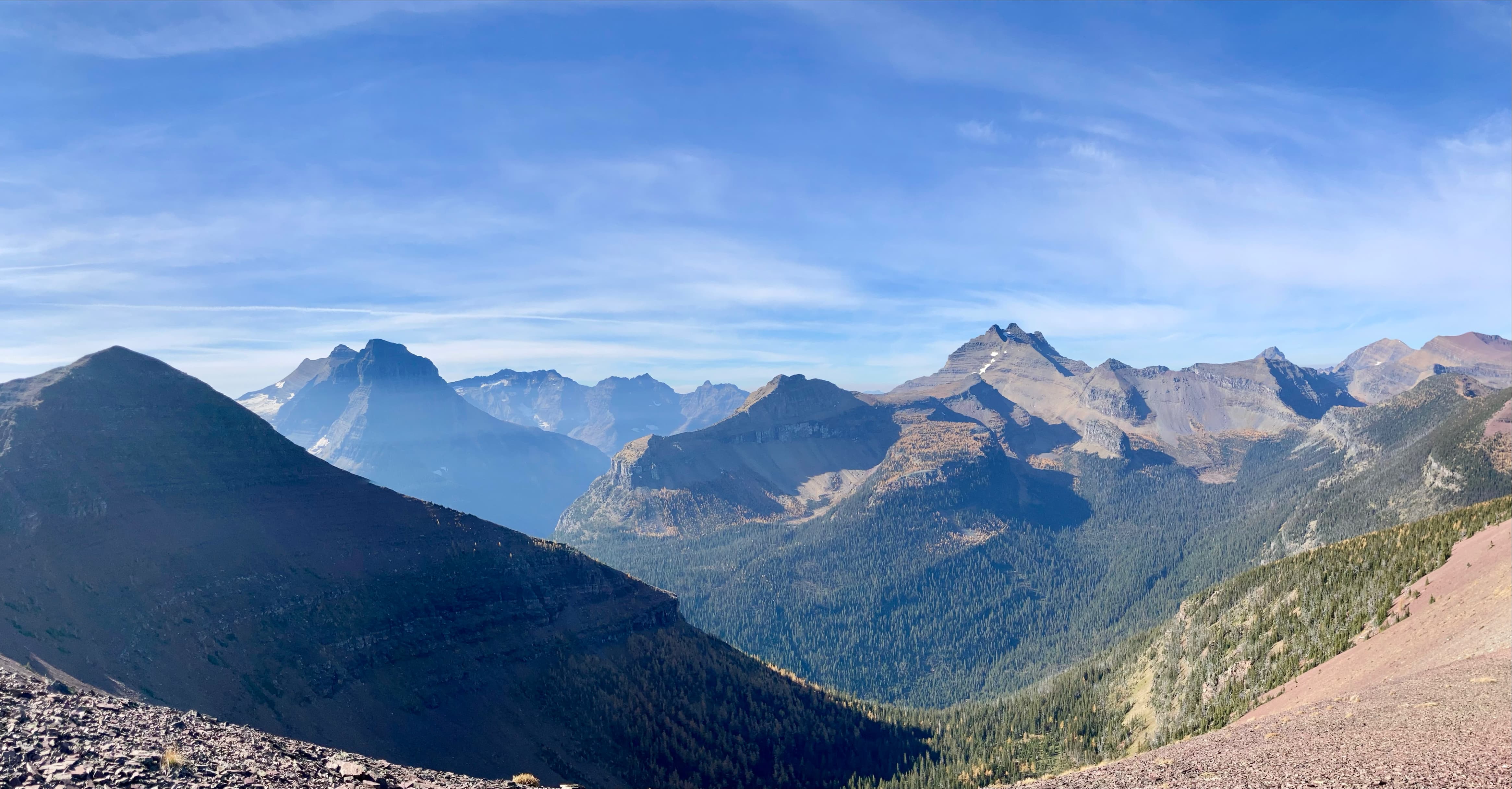
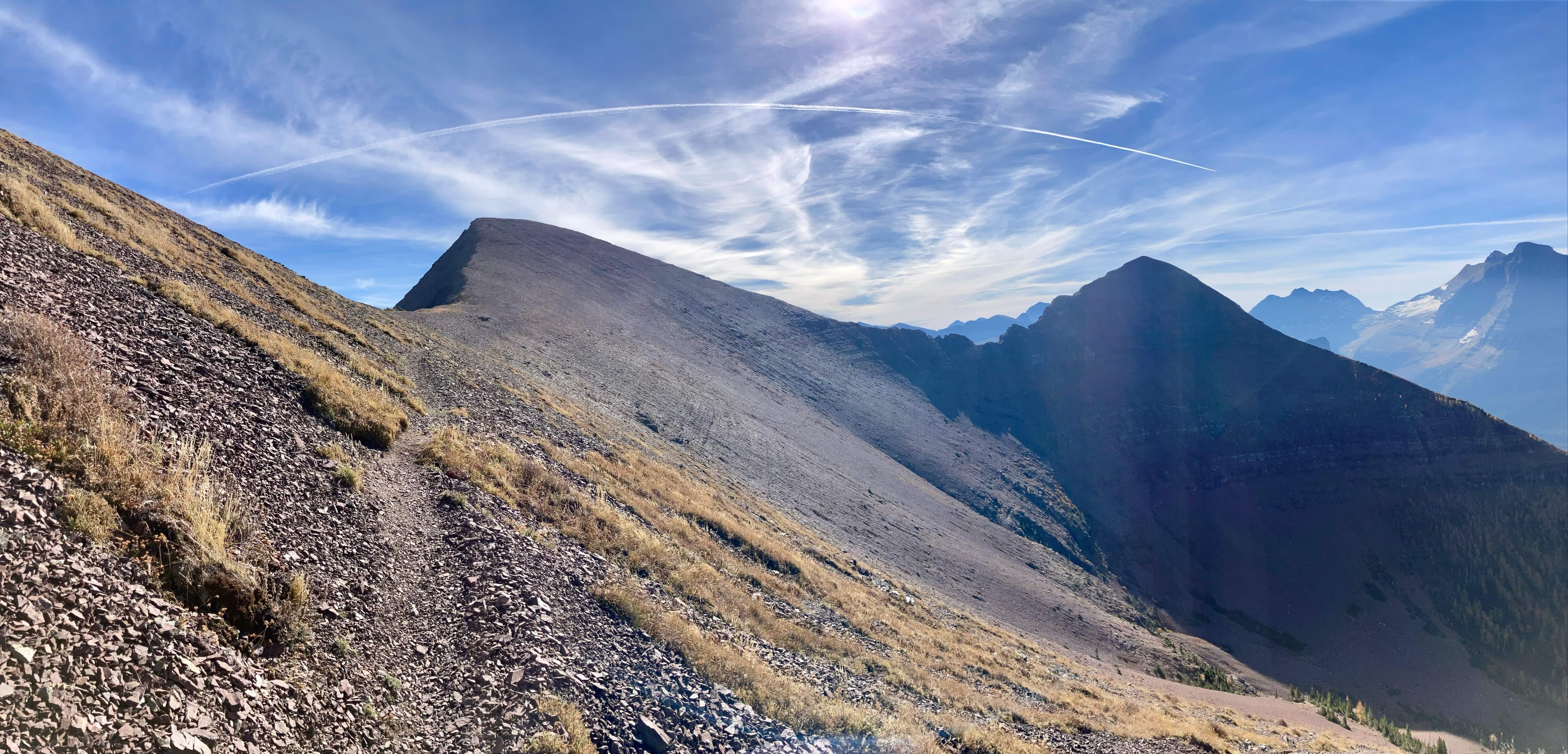
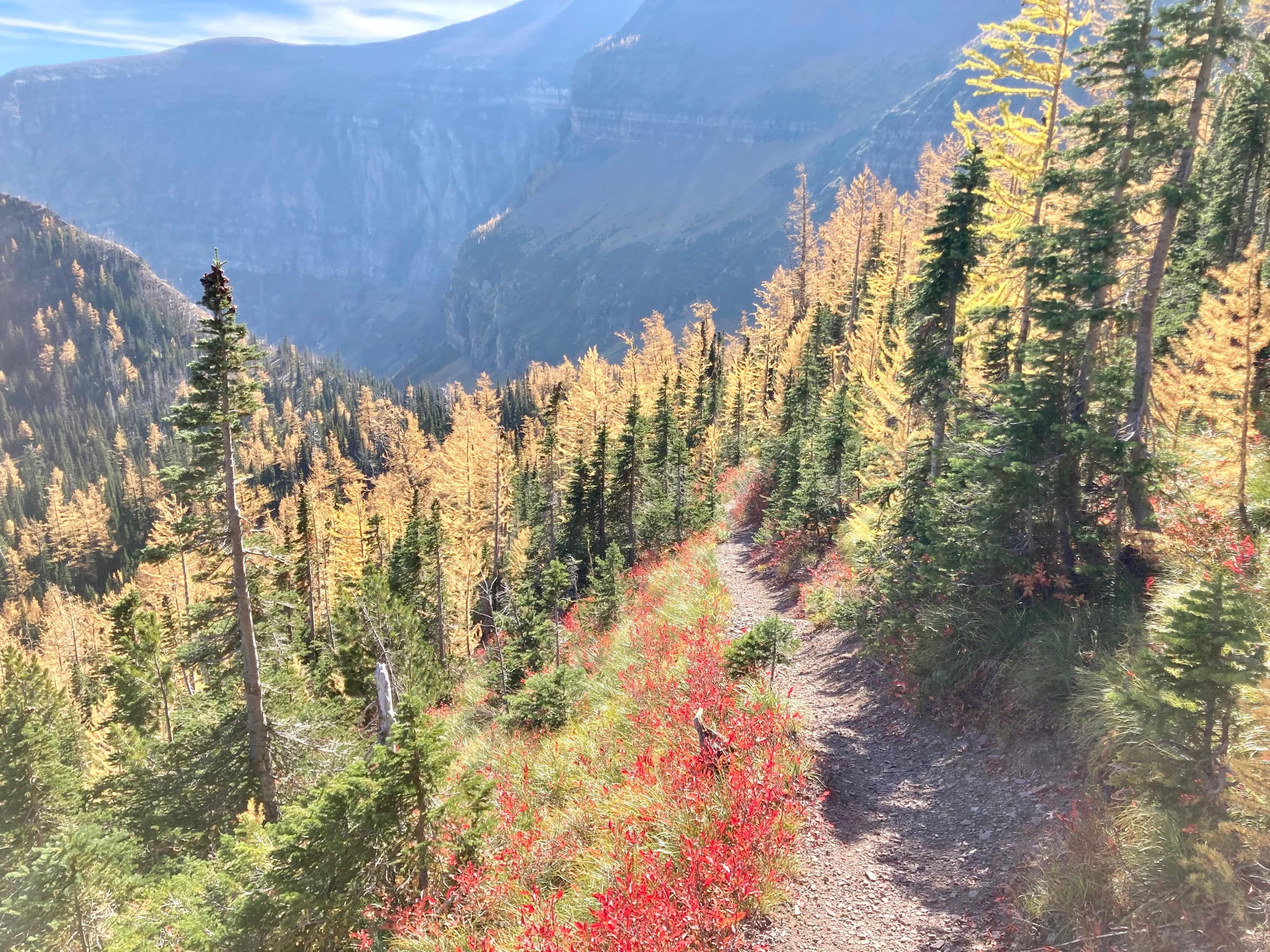
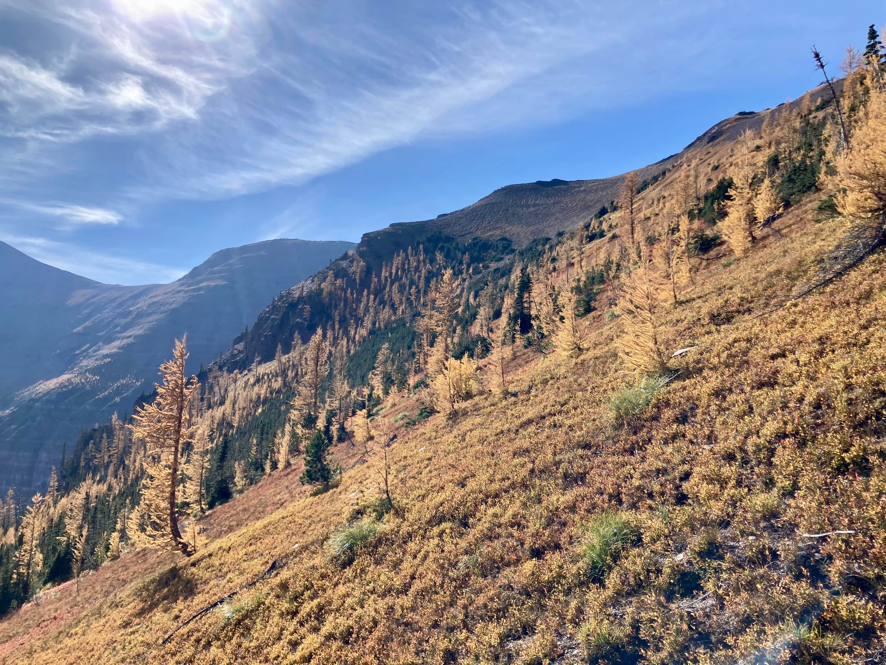
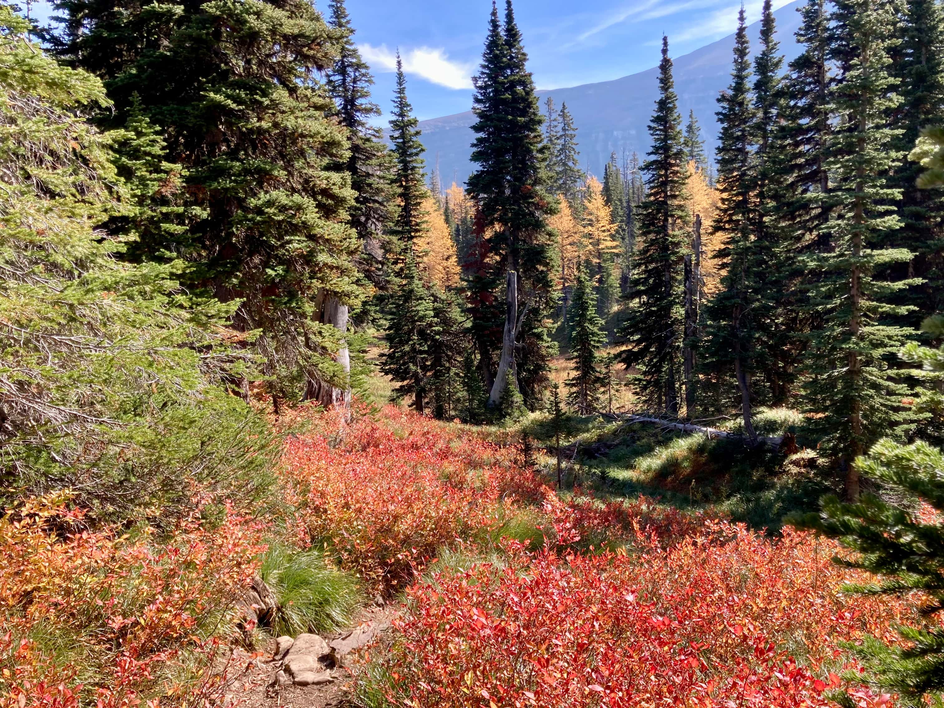
Route overview looking south. I went clockwise.Setting off from the parking area along the Akamina Pass trail.The sign welcoming you to British Columbia and Akamina-Kishinena Provincial Park. Out of frame to the left is the cutline marking the border. It initially goes southeast, paralleling the trail in the direction you came, then turns south. That corner is the easternmost part of B.C.On the cutline heading southwest towards Forum Ridge. Border markers in various states of decay are found along the way. The going’s not too tough as of 2022, but as these burned trees fall it’ll become slow going (unless the powers-that-be maintain the cutline).One of the border markers. The cutline dips down into a gully here then ascends the “Big Hill”. It’s steeper than it looks.Looking back from near the top of the steep ascent. The grade eases off but the ascent continues all the way to Forum Peak’s summit block.Higher up on the ridge the trees thin out. Forum Peak’s summit is straight ahead.Left to right: Chapman Peak, Mount Custer (both in the USA), and Forum Peak (in Canada). Cameron Lake is down in the valley (its southern shore is in the USA).Colourful slopes leading down to Cameron Lake.Getting closer to the summit. Around here I was sizing up the scramble, keeping in mind that I wanted to find a safe traverse to the right.Looking towards the crux. The red line is a sketch of my approximate route (left arrow) and of the easier route (right arrow). You have to scramble above the first rock step to get to the proper ledge below the cliffs. The left arrow is my nearest guess as to where I ascended, but don’t take it as precise guidance.This is the view looking right from below the first rock step. Doesn’t look like a feasible place to start traversing.Looking further right, down to Forum Lake. The “usual” route is faintly visible ascending the slope on the other side of the valley.At the first rock step. I went at it from the right side.Looking back from the top of the first rock step. All of Cameron Lake in view.Looking up at the 2nd rock step. I started traversing right.Looking back after going “around the corner” at the start of the traverse. It felt a little exposed, but really wasn’t too bad. In anything other than dry conditions, though, I’d back off. Very skilled people do this route in the winter, but it’s not scrambling in those conditions.Carrying on, following the ledge below the cliffs. I kept looking up, searching for a feasible route to ascend.I ascended here. There was a hint of a boot-beaten route on the grass heading up to the rock. There was also a mini-cairn consisting of exactly 3 small rocks.Once above the 2nd rock step, this is the terrain. It’s feasible to climb straight up or to traverse a little further right before ascending. The view upon reaching the summit ridge. Kinnerly Peak and Kintla Peak are straight ahead. From here I turned left and walked to the first of two cairns on Forum Peak.The first cairn, silhouetted by the autumn sun.The first cairn. This one is slightly lower than the other one. The other one is on the promontory in the background. This cairn has a pink ammo box tucked into it with a summit register.Checking out the cliffs below Forum Peak’s summit and looking down at Cameron Lake.The 2nd cairn. This one seems very structurally sound.Looking back at the first cairn. Aahkoinimaiisták (Mount Blakiston) is visible to the right of centre.I followed the ridge a short distance south to this drop off. The international border is on the other side of the saddle.Looking west from the 2nd cairn I had this great view of Upper Kintla Lake.From Forum Peak, I went northwest along the ridge top, heading towards the Akamina Ridge trail.Looking back at Forum Peak. There was a haze at lower elevations that gave the day a somewhat ethereal quality.Approaching Akamina Ridge.Looking at the cliffs above Wall Lake. At the right of the frame the descent route from the ridge is visible descending though the forest and into the valley bottom.Looking south from the trail.The trail traverses below the first high-point along Akamina Ridge.Looking due south into Glacier National Park. Between the clouds, the peaks, and the larches this view was sublime.The Agassiz Glacier eventually came into view, sitting between Mount Peabody and Kintla Peak. A closer look at Kintla and Kinnerly Peak.The Agassiz Glacier.Panorama from the same place. Mount Peabody, Kintla Peak, Kinnerly Peak, and Parke Peak are on the far side of the valley. Long Knife Peak, King Edward Peak, and Starvation Peak are on the near side. Akamina Ridge’s summit is at the far right of the frame.Closing in on Akamina Ridge’s summit.Looking down at Wall Lake, roughly 700 meters below.The summit of Akamina Ridge. It was almost completely calm. Unlike a summer ascent, there were no swarming flies. I spent a nice long time up here.Looking southeast (the way I came) from the summit cairn.Looking northeast.Looking southeast.SouthwestNorthwestLong Knife PeakStarting my descent.Yet another panorama taking in Kintla, Kinnerly, Parke, and Long Knife Peak.Looking back towards Akamina Ridge’s summit.Approaching the end of the ridge walk.Looking down towards Wall Lake. The snow patch in the shade looks like it’ll survive the season unmelted.The ridge walk ends here, with two cairns marking the spot to take a hard right and descend. You can see there’s a trail heading left, too. I decided to follow it and see where it went. It turns out that it just goes down to the col then peters out. The col is Bennett Pass.Because I descended down to Bennett Pass I was able to see this lovely little lake that would otherwise be obscured. My Gem Trek map informs me that it’s known as “Little Wall Lake”. It was tempting to descend down to it, but family commitments meant I was on a timeline and had to get back on track ASAP.I climbed back up to the cairns and got on the trail leading down to Wall Lake.Looking back up at Akamina Ridge.Down to the bottom of the valley, approaching Wall Lake.Almost down to Wall Lake.Looking back up the valley.Down on the shore of Wall Lake. From here I followed the trail back to the parking area.