July 29, 2019. A straightforward scramble to an unofficial summit in Waterton Lakes National Park.
- Region: Waterton Lakes National Park. Traditional Territory of the Tsuu T’ina, Ktunaxa, and Blackfoot First Nations
- Distance: 21.1 km round-trip
- Total Ascent: 1200 m
- Elevation of Objective: 2437 m
- Hiking Time: 6h 40m
- Safety and Disclaimer
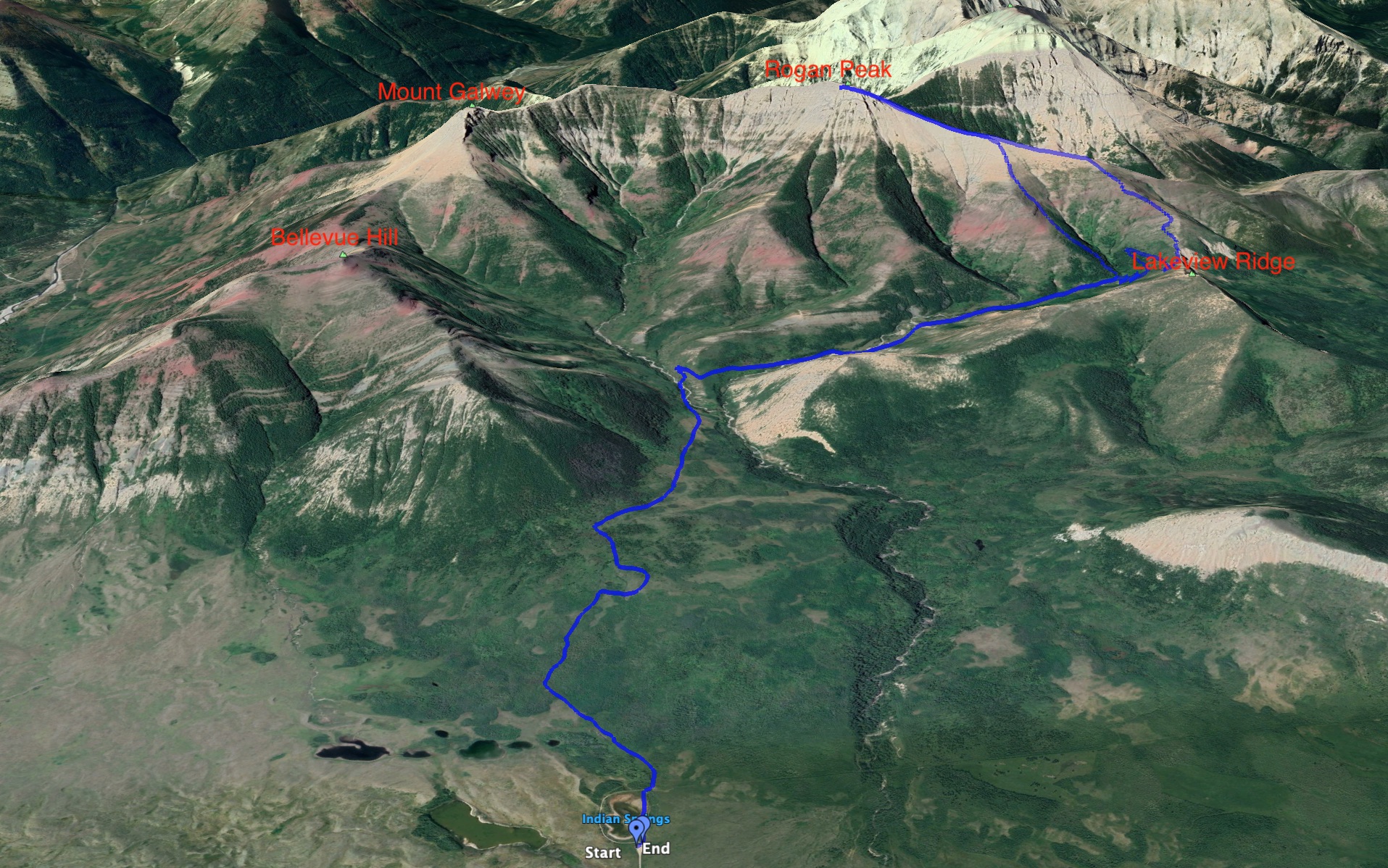
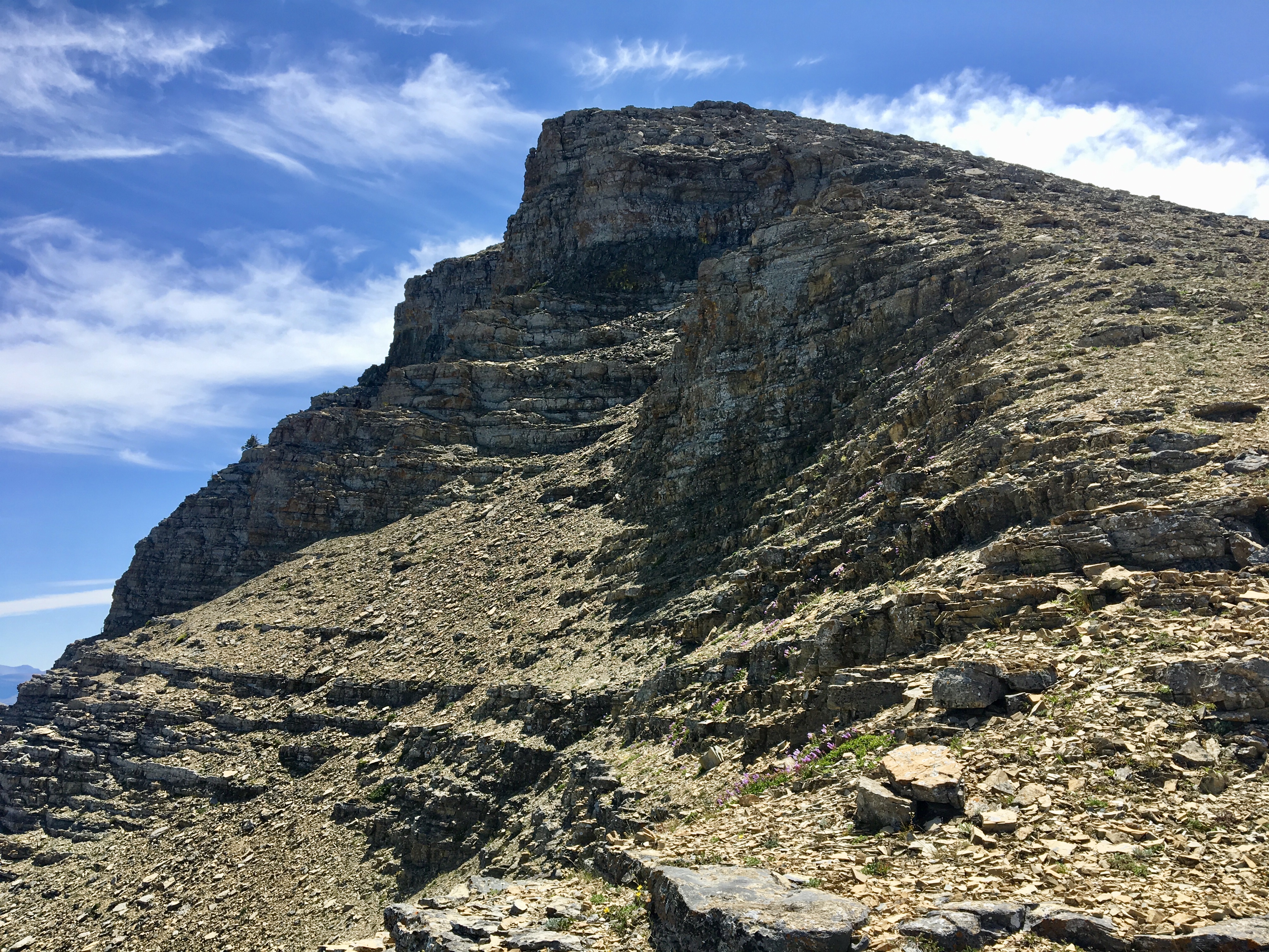
Rogan Peak is a relatively easy scramble described in Andrew Nugara’s More Scrambles in the Canadian Rockies. The name was bestowed by Nugara in honour of his nephew. The official designation is Dungarvan SE2. Ridges connect the peak to Mount Galwey to the south and Mount Dungarvan to the northwest. Along with Mount Galwey and Bellevue Hill, Rogan Peak forms the contour of Horseshoe Basin.
Despite not being an official peak, Rogan stands out and has a higher summit than Mount Galwey. Judging by the summit register, it doesn’t see many visits. Only 2 other 2019 ascents were recorded in the register aside from mine.
Access to the peak is via the Horseshoe Basin trail in Waterton Lakes National Park. Access to the Horseshoe Basin Trail is via a turn-off from Hwy 6, 1 km north of the main park access road for Waterton Lakes National Park. The turn-off leads to a viewpoint loop, with a road continuing from its northern end which abruptly turns west and descends to the area of the bison paddock. Past the paddock, the road ends at a locked gate, where the Horseshoe Basin Trail begins (ask Google Maps to drop a pin here: 49.132256, -113.871124).
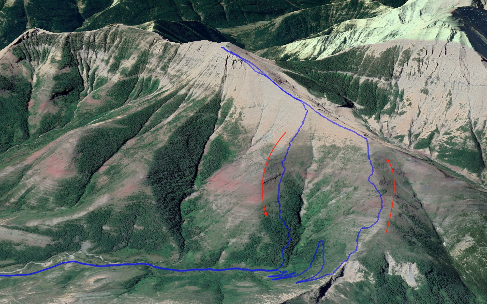
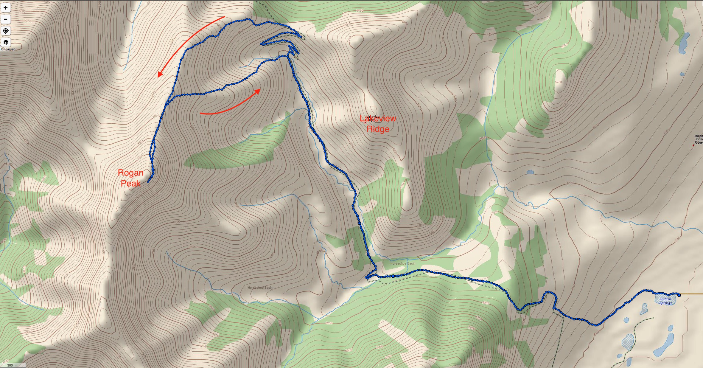
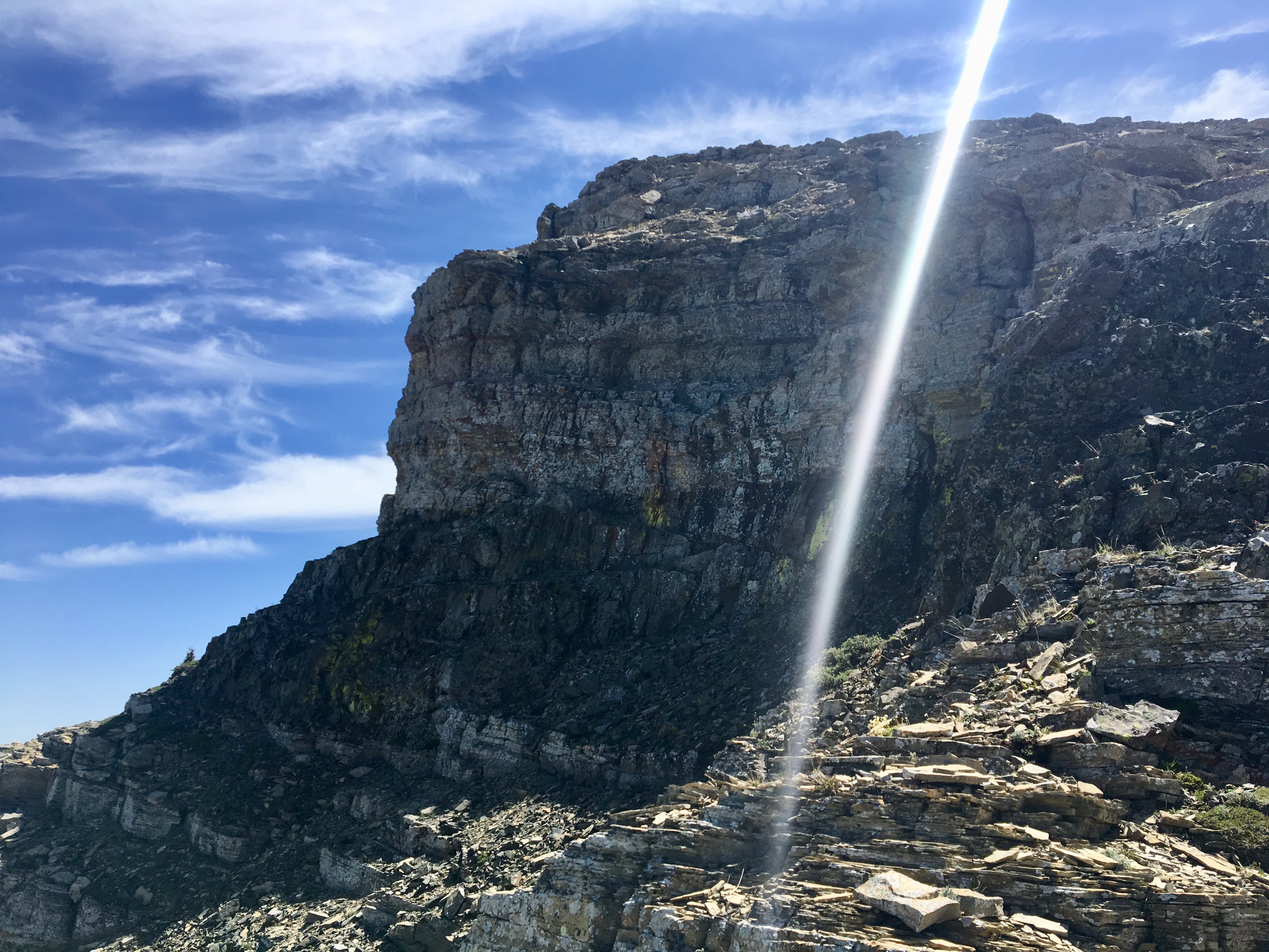
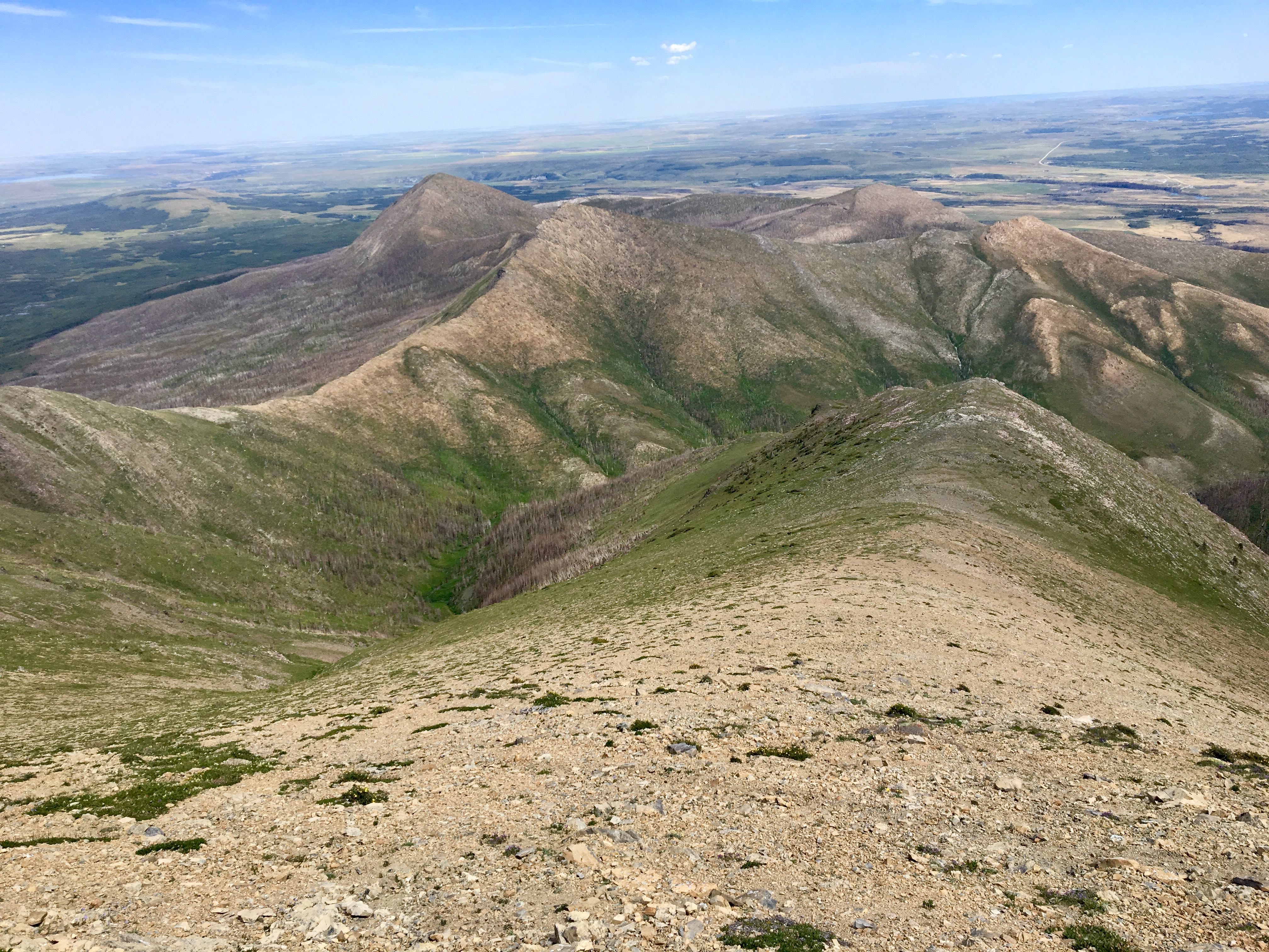
Getting to Rogan Peak involves following the Horseshoe Basin trail clockwise, eventually reaching the switchbacked ascent of the col between Lakeview Ridge and Rogan Peak. This is about 6.5 km of easy hiking with some elevation gain getting up into Horseshoe Basin. From the base of the switchbacks, Nugara points out that there’s a rounded spur that climbs due west and up to the ridge line from that spot. It didn’t look like a good way to ascend, but I kept it in mind for my descent. Instead, I stuck to the switchbacks and climbed to the col. From the top of the col, I turned left and followed the ridge all the way up to the summit. No route-finding was involved. The few rocky bands that are encountered on the ridge can be scrambled over, either head-on or at easier spots that are found after traversing slightly left.
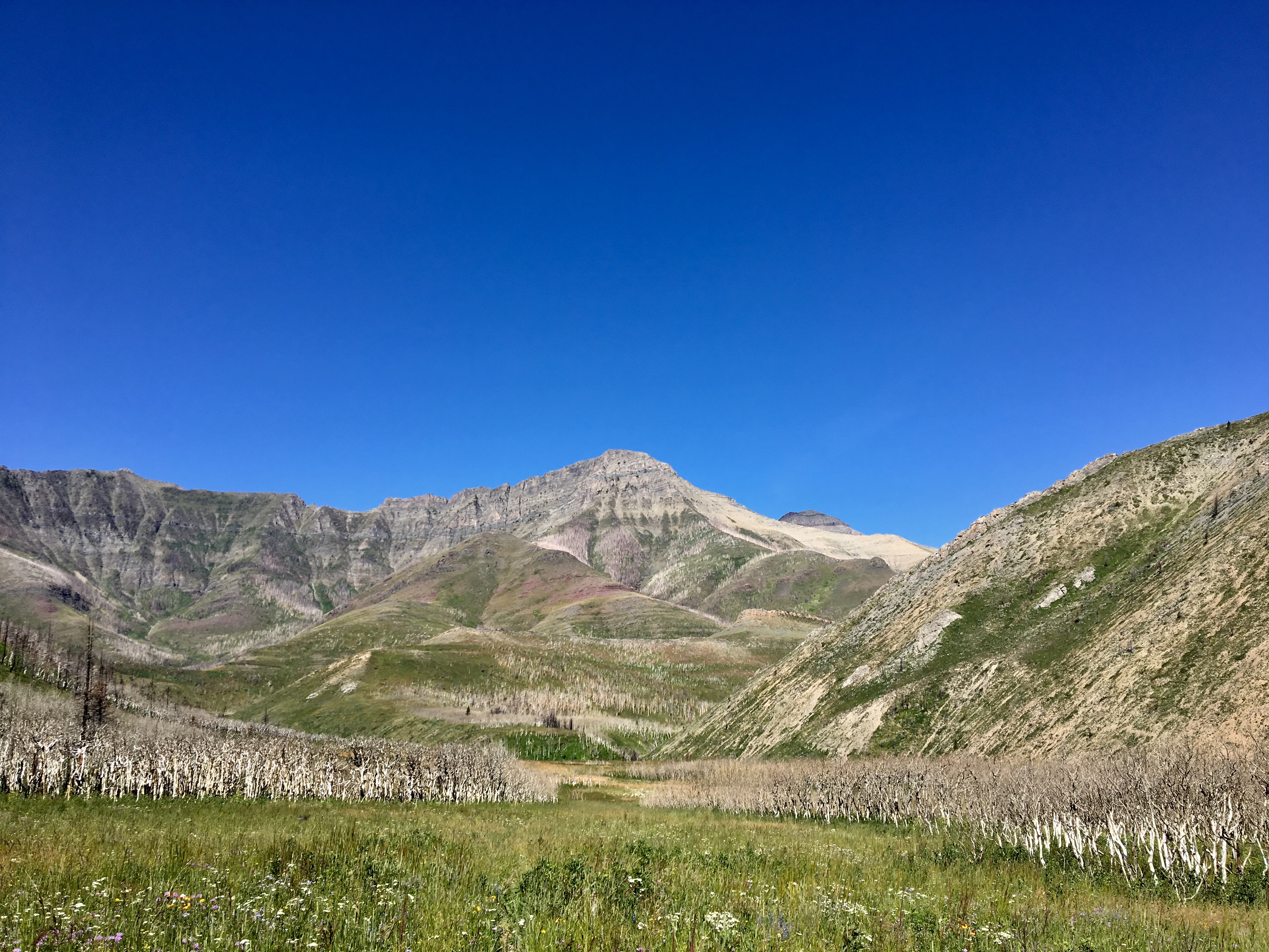
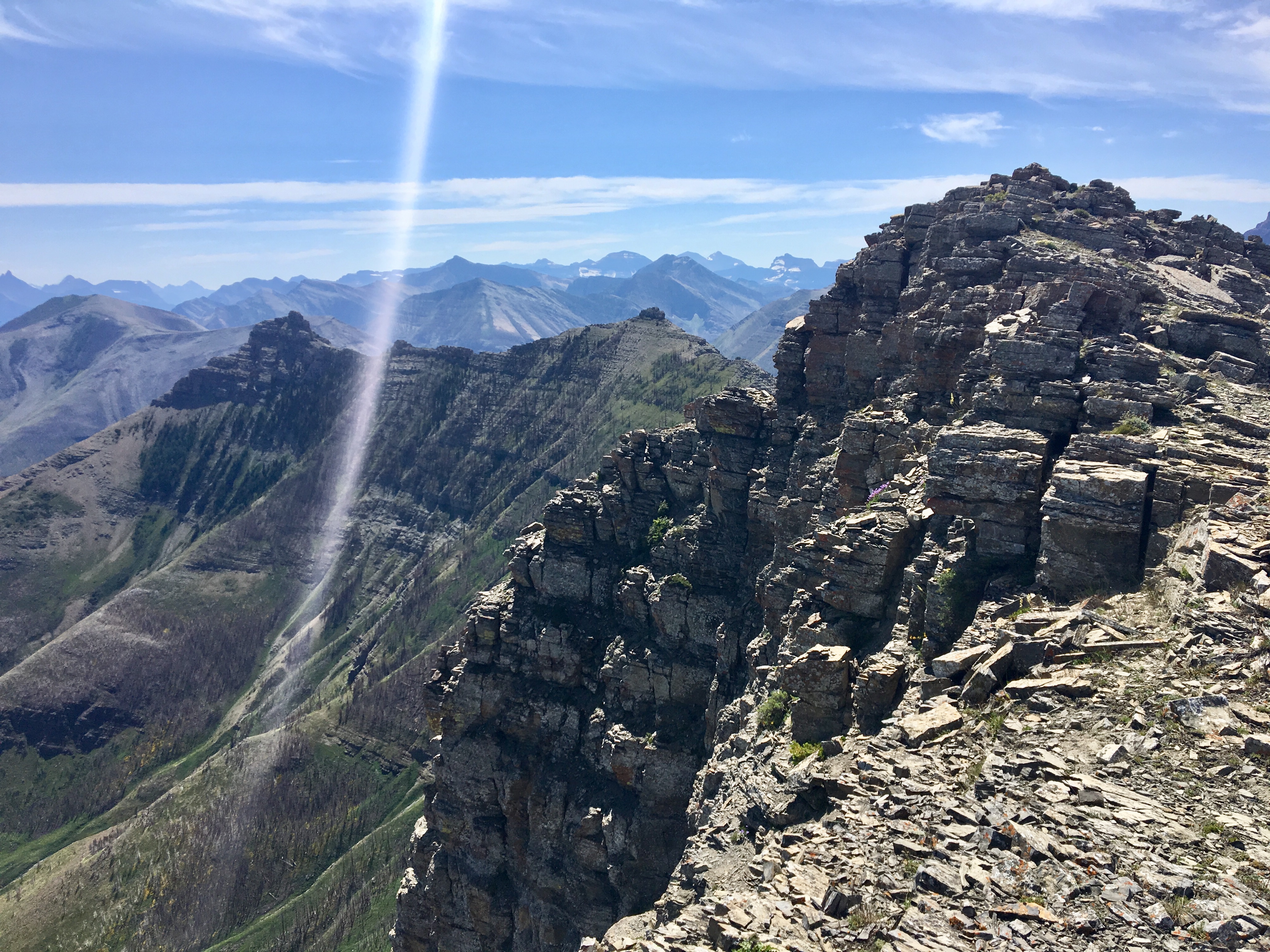
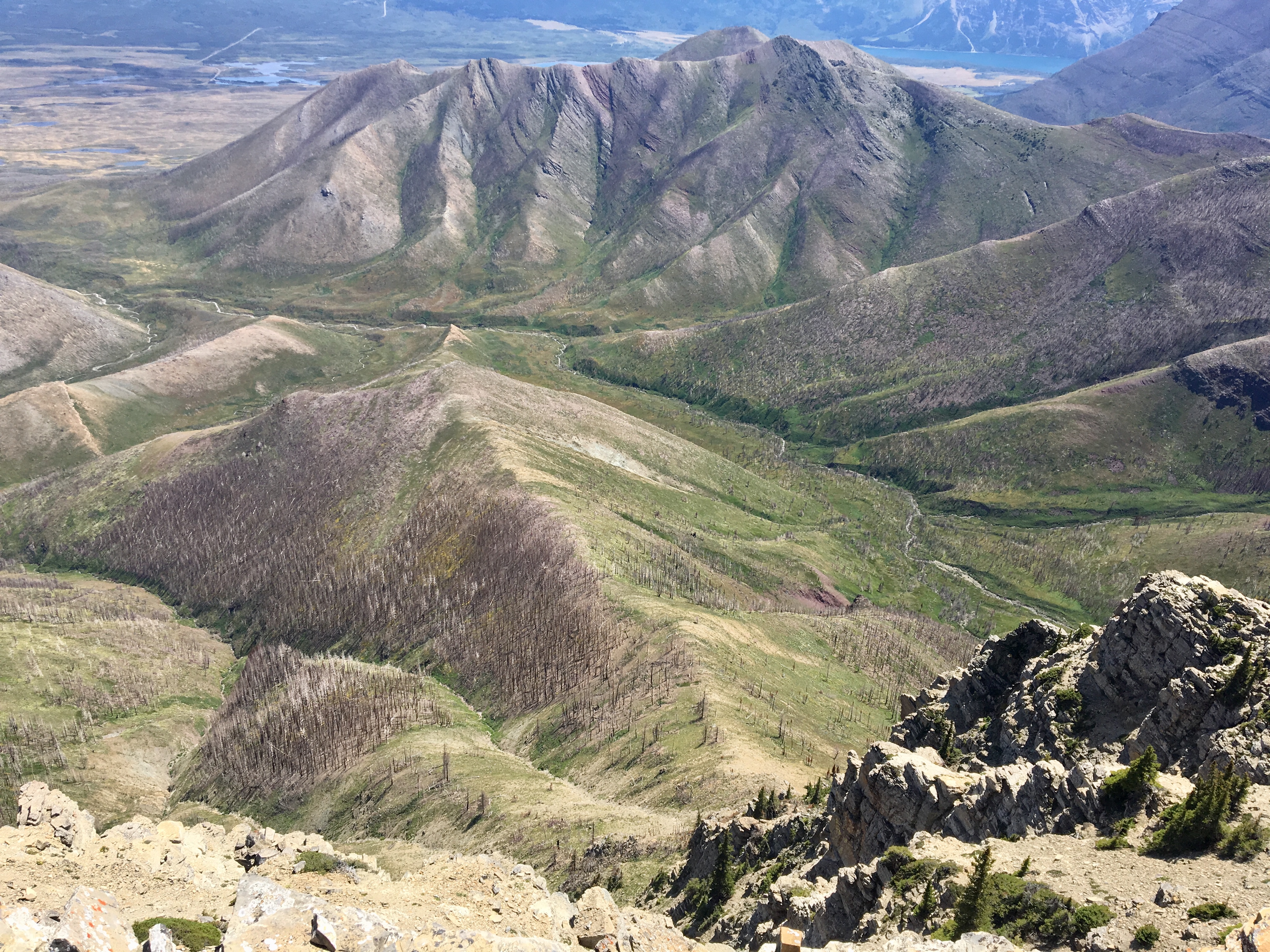
Throughout the ascent there were steadily improving views of Mount Dungarvan’s main peak as well as nice views back down into horseshoe basin. After 3h 35m I was on the summit, enjoying the views that stretched to Glacier National Park in the south, the Castle Wilderness to the north, and the vast prairie to the east. Despite a slight haze in the air the summit views were quite satisfying. At the summit was a cairn and a register in a waterproof container. I added my name to the register and had lunch among the ever-present flies which seem to inhabit every summit in the area.
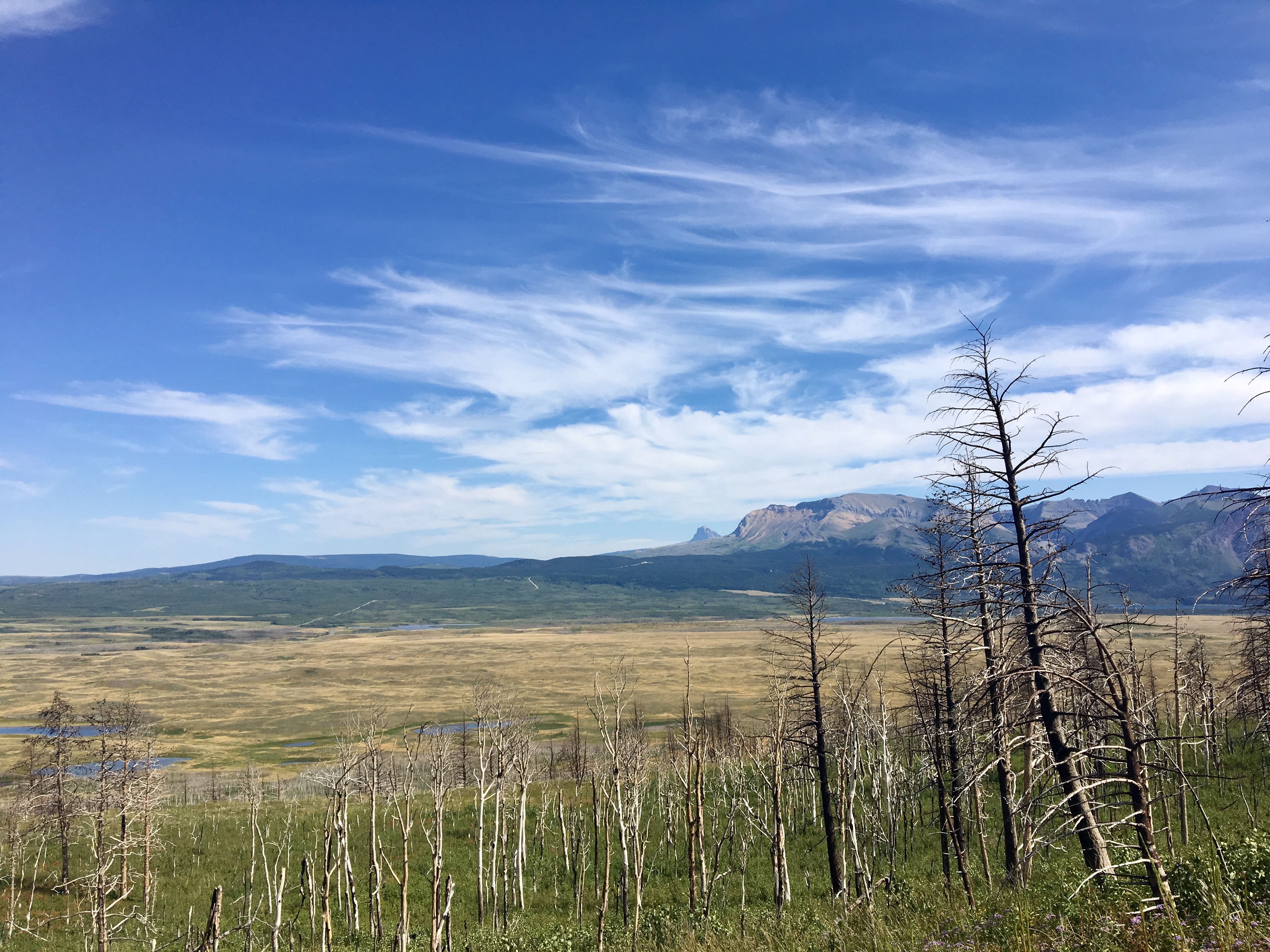
For my descent, I decided to try going straight down the rounded spur which leads directly to the base of the switchbacks. While quite a direct route, I didn’t find that I could move fast. The trees on the slope had been burned by the Kenow Fire in 2017, so there was nothing obstructing my view of the route. However, there was dense ground-cover vegetation growing, and the ground they covered was steep and uneven. This made for slow going. It may have been just as quick to descend the same way I ascended.
Click on the pictures below to access full-sized images.

we were wrong calling SE 2 Mt.Dunvargan , that one is a
separate mountain.
LikeLike