July 22, 2018. An easy scramble to the summit of Lakeview Ridge at the eastern edge of Waterton Lakes National Park.
Although I’ve been visiting Waterton since childhood, I’ve never explored the area around the bison paddock. This section of the park is at the eastern boundary and accessed by a different turn-off than the main park gate. There’s a viewpoint there which is as far as most people explore. However, the road continues beyond the viewpoint to the start of the Horseshoe Basin Trail. My main interest in that trail was as a potential snowshoeing trip in the winter, but I also knew of a couple of scrambles that could be accessed via that trail, including Lakeview Ridge.
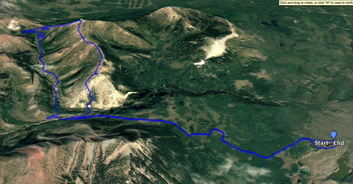
Lakeview Ridge consists of 2 parallel north-south aligned ridge lines connected by a col at the northern end. Both ridge lines are scrambling objectives, but I decided to go to the highest point, which is on the western ridge line. Bob Spirko describes a good route on his blog which uses the Horseshoe Basin Trail for an approach and descent.
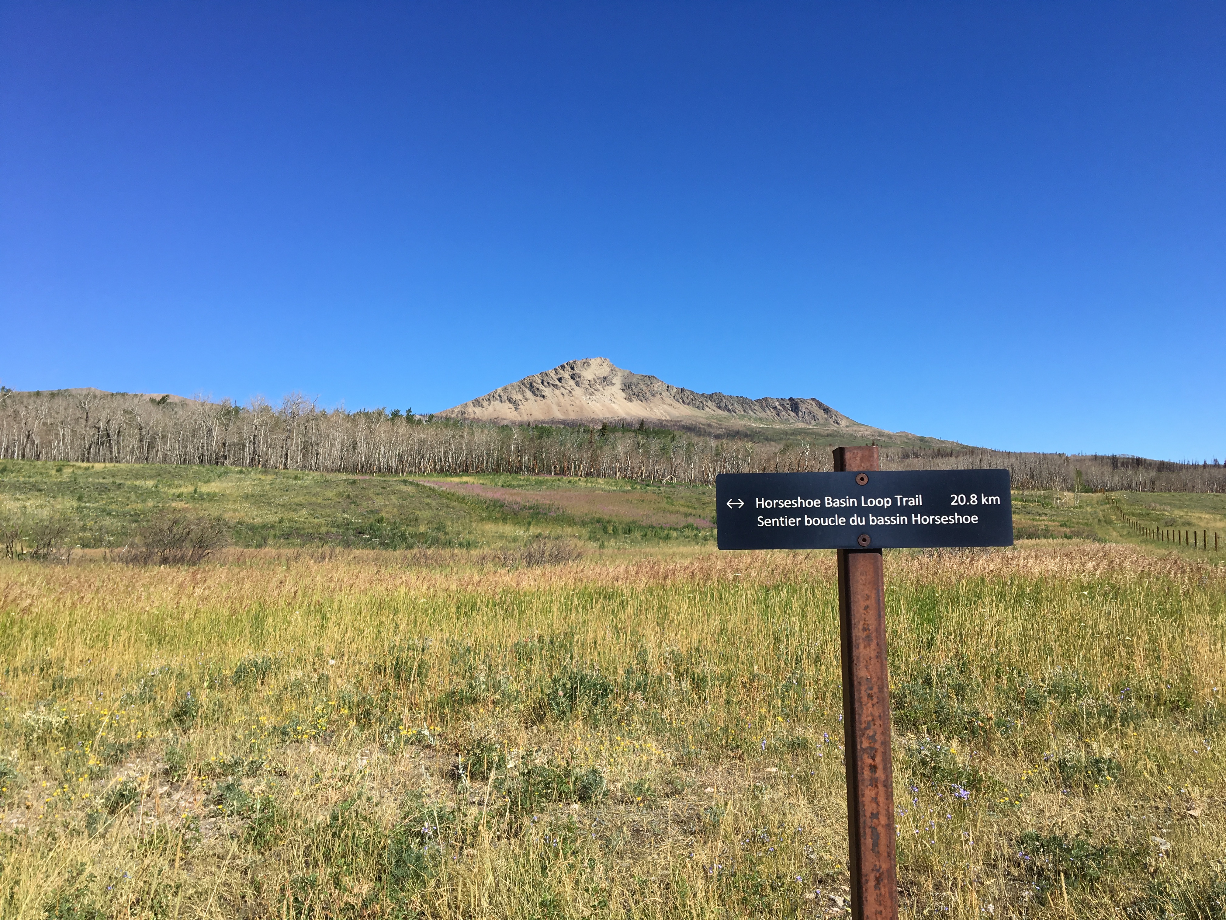
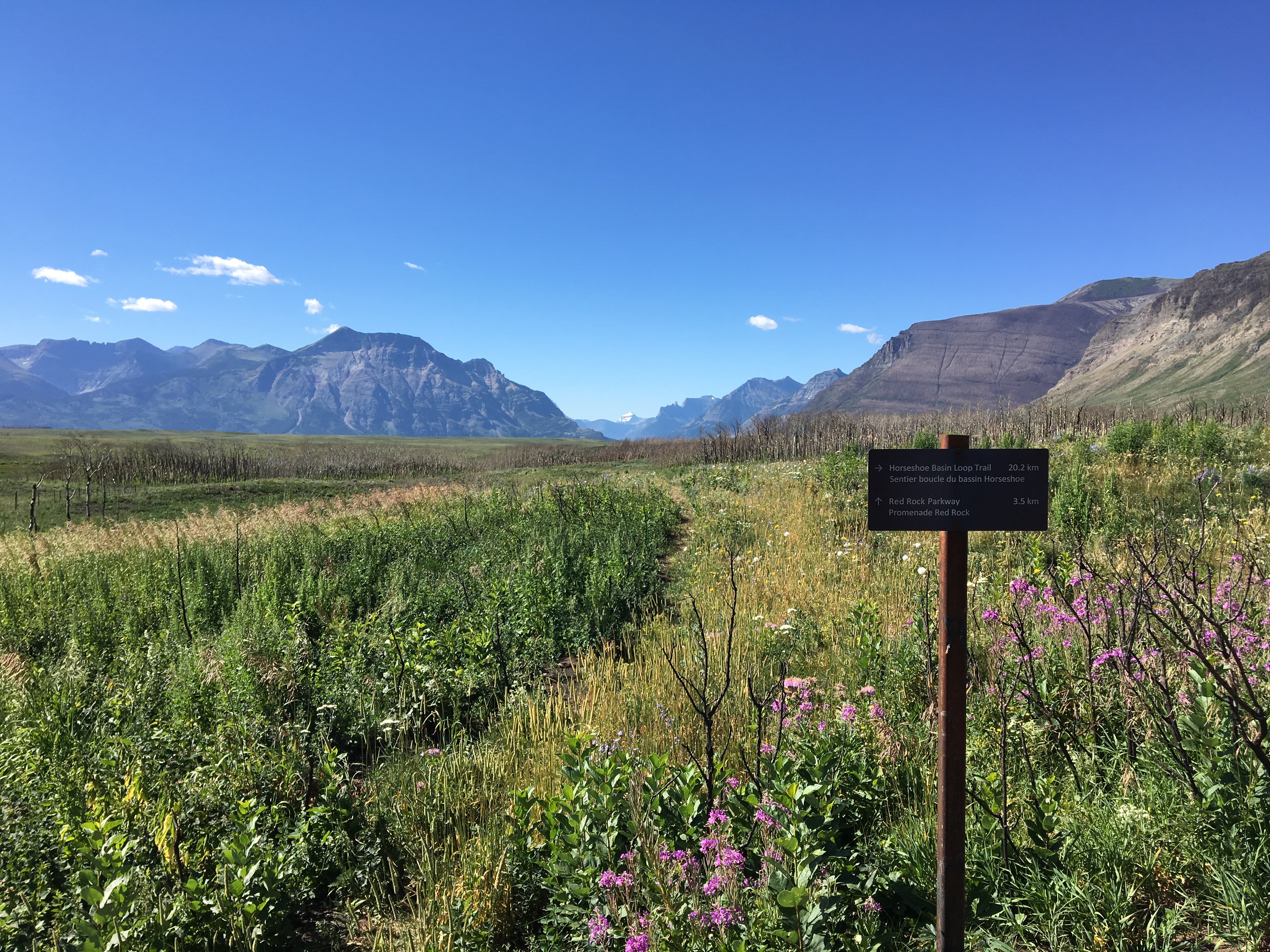
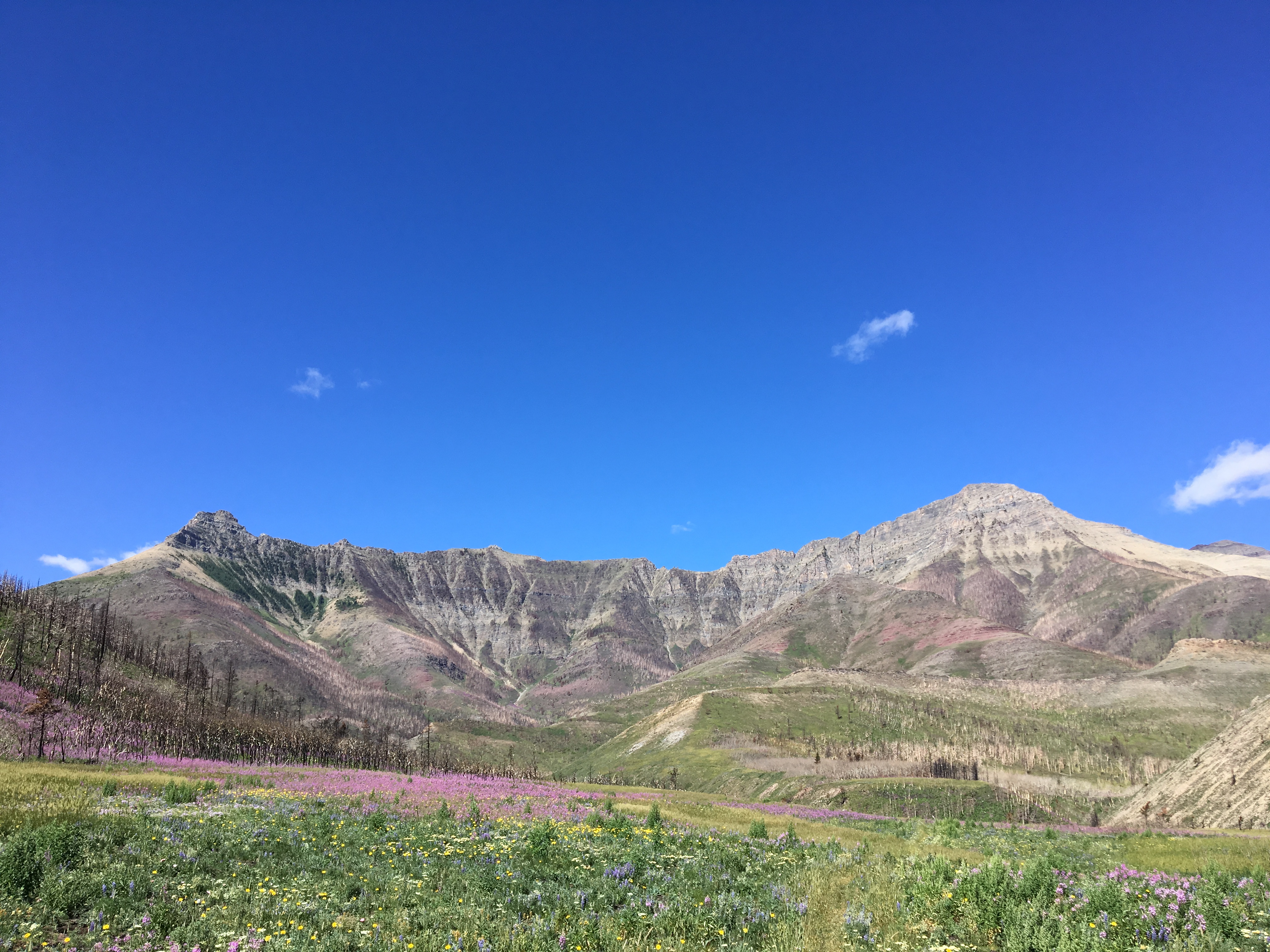
Access to the Horseshoe Basin Trail is via a turn-off from Hwy 6, 1 km north of the main park access road for Waterton Lakes National Park. The turn-off leads to a viewpoint loop, with a road continuing from its northern end which abruptly turns west and descends to the area of the bison paddock. Past the paddock, the road ends at a locked gate, where the Horseshoe Basin Trail begins (ask Google Maps to drop a pin here: 49.132256, -113.871124). The trail goes around a slough and skirts some trees before presenting you with a sign and a fork: Horseshoe Basin Trail forms a 20.8 km loop. I went left (west) and encountered another fork after 600 m, where a trail to the Red Rock Parkway diverges to the left and Horseshoe Basin Trail continues to the right. Heading right, I followed the trail as it ascended towards Horseshoe Basin. Once up at the level of the basin, there were some very nice views of Bellevue Hill, Mount Galwey and the southern outlier of Mount Dungarvan that Andrew Nugara refers to as Mount “Dunwey” or “Rogan Peak”.
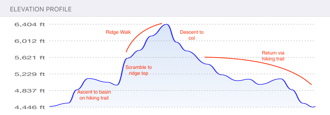
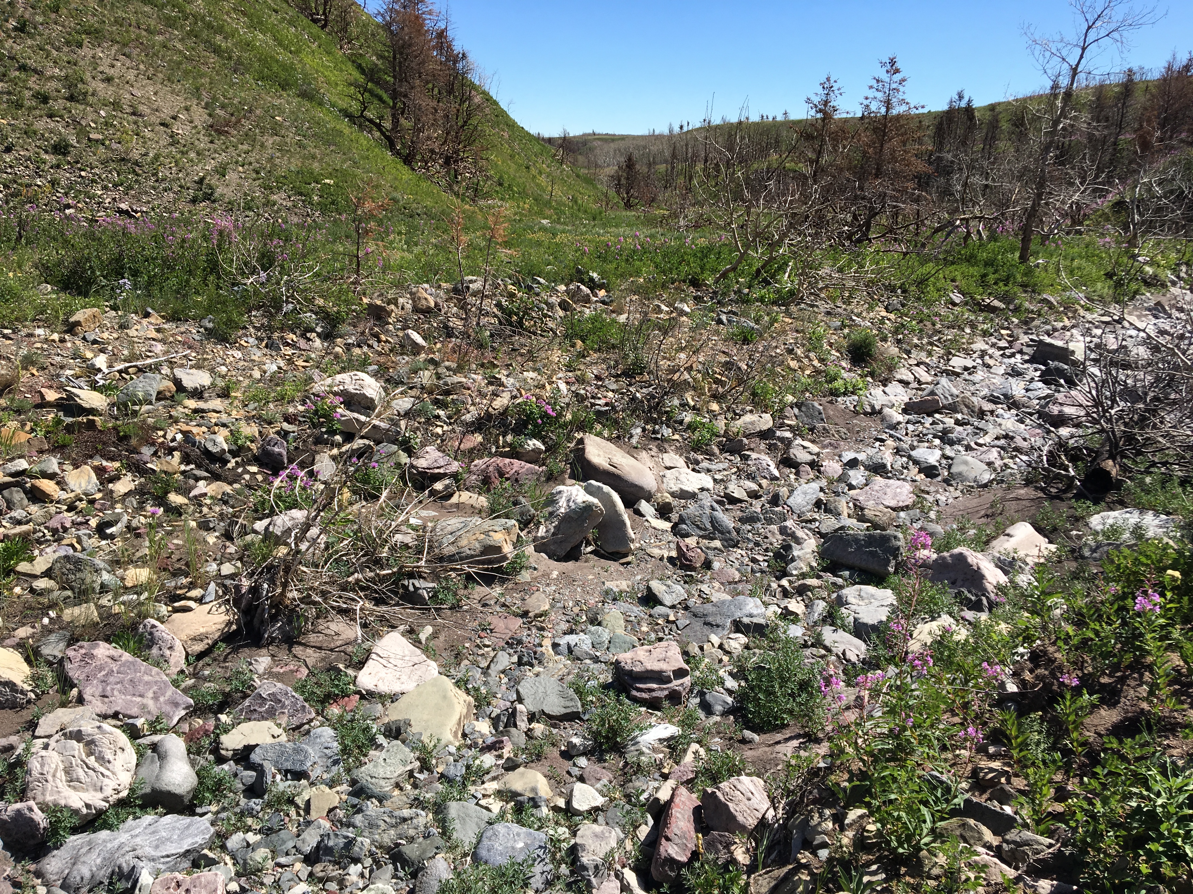
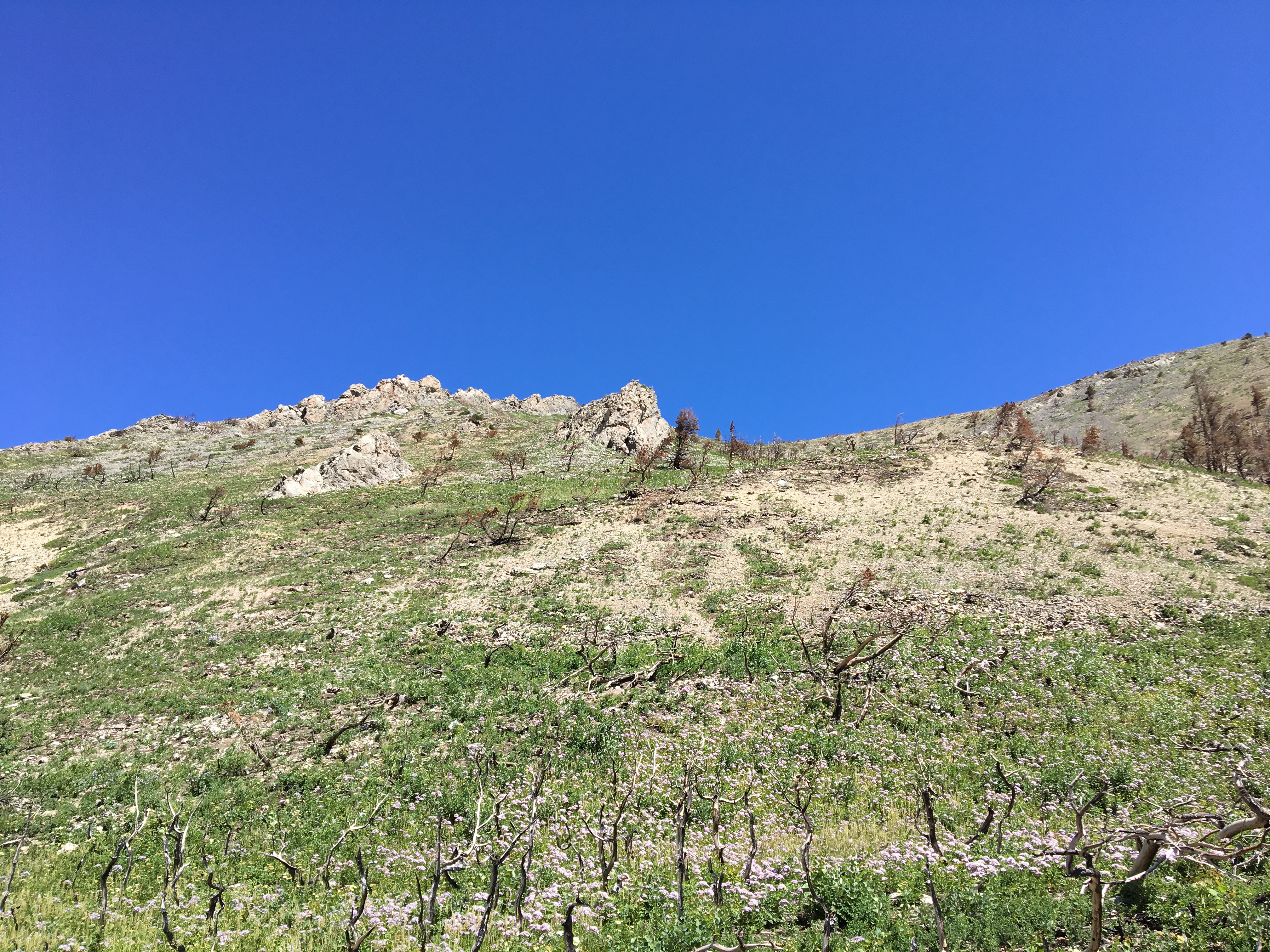
As the trail heads west, it passes between Bellevue Hill on the left and the southern extent of Lakeview Ridge on the right. This southern spur is where I ascended to the ridge-top. A small berm blocks the direct path between the trail and the ridge and is best circumvented rather than climbed. To do so, I followed the trail to where it crossed a creek bed (dry at this time of year). There, I left the trail and followed the path of the creek to the right where it soon hooked around the berm and brought me to the base of the ridge. I scrambled up at this point. There was nothing too challenging, it was just steep hiking. Once on the ridge top I just followed it north to the summit, approximately 2 km away. The summit was marked with a small cairn and a broken survey marker. Distance from my car to the summit was 7.1 km. Summit elevation was measured at 1930m. It took me 2h 26m.
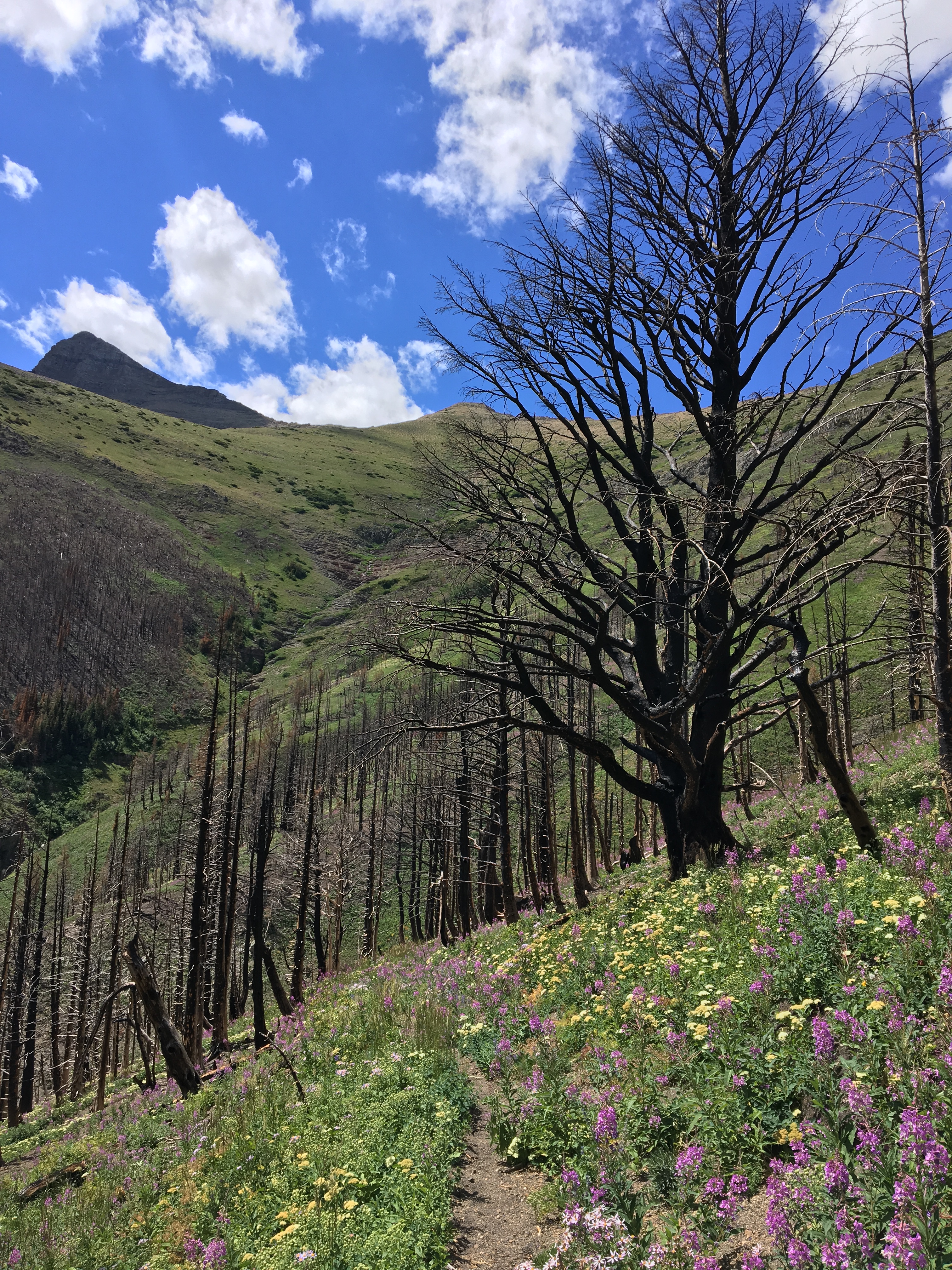
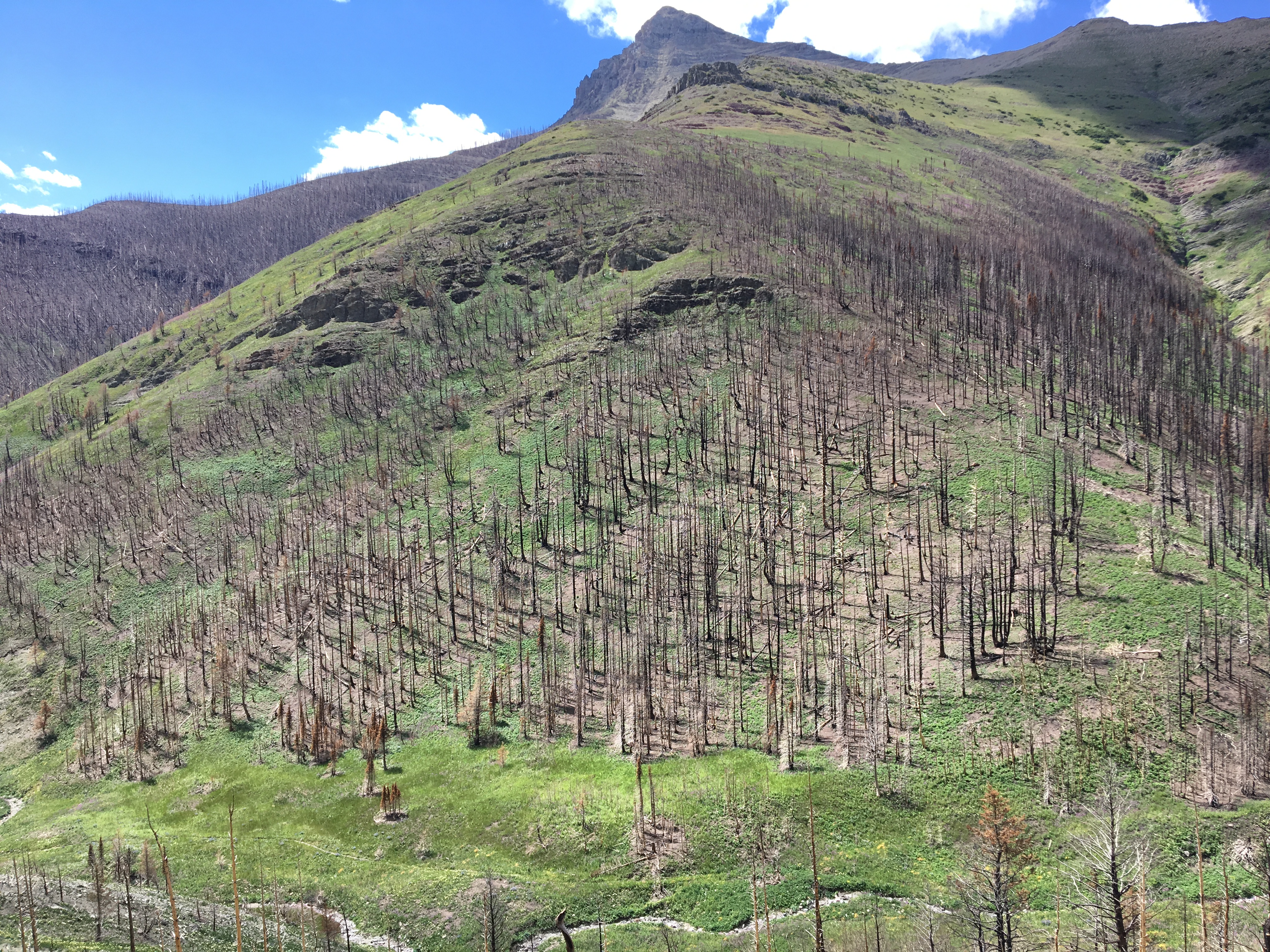
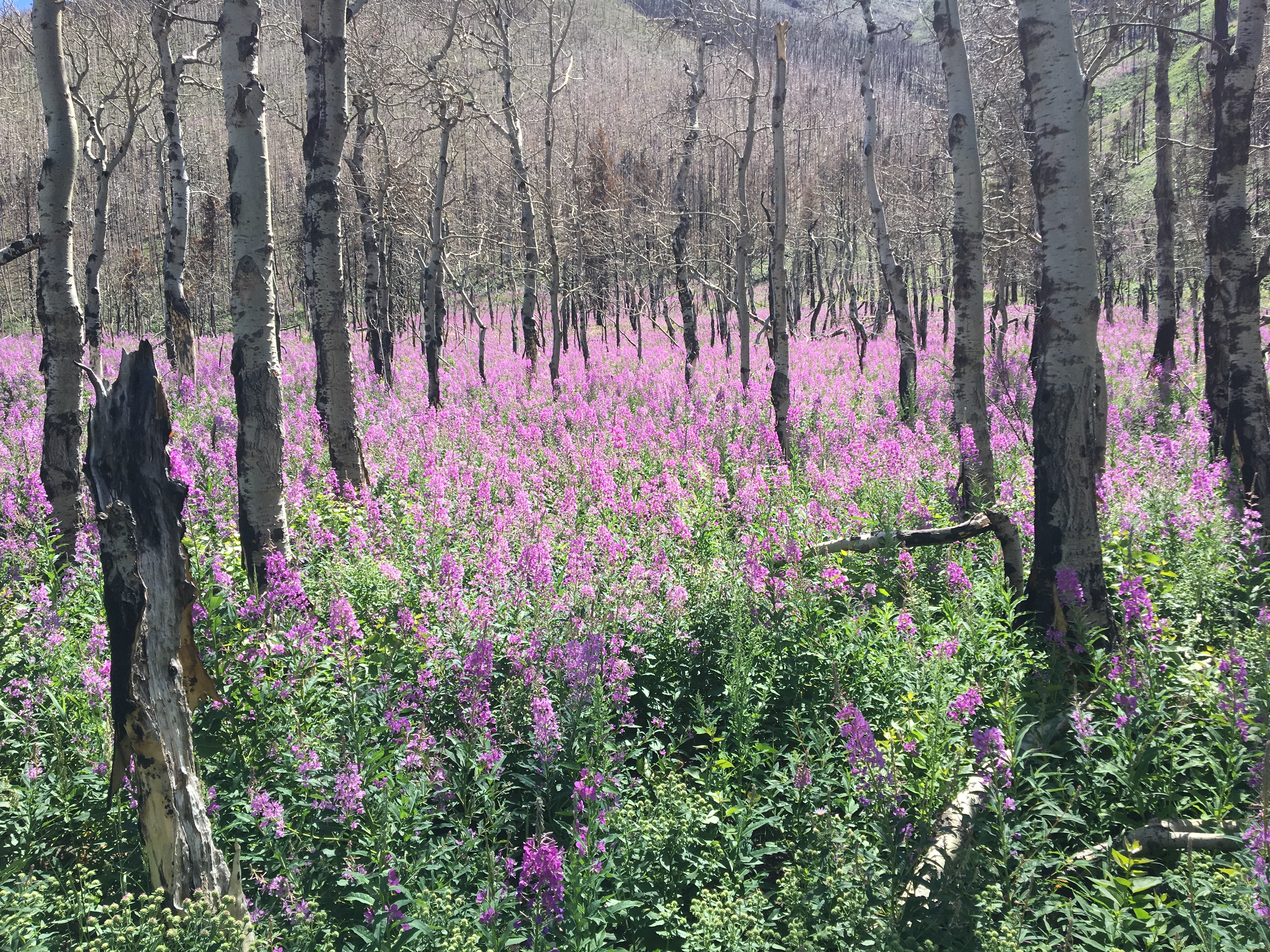
The views from the ridge were very nice, mostly showing off Mount Galwey and Mount Dungarvan as well as the southern ridges and peaks of the Castle Wilderness. Last year’s Kenow fire had made its mark in the area. Purple fireweed was blooming everywhere amongst vast stands of burned trees.
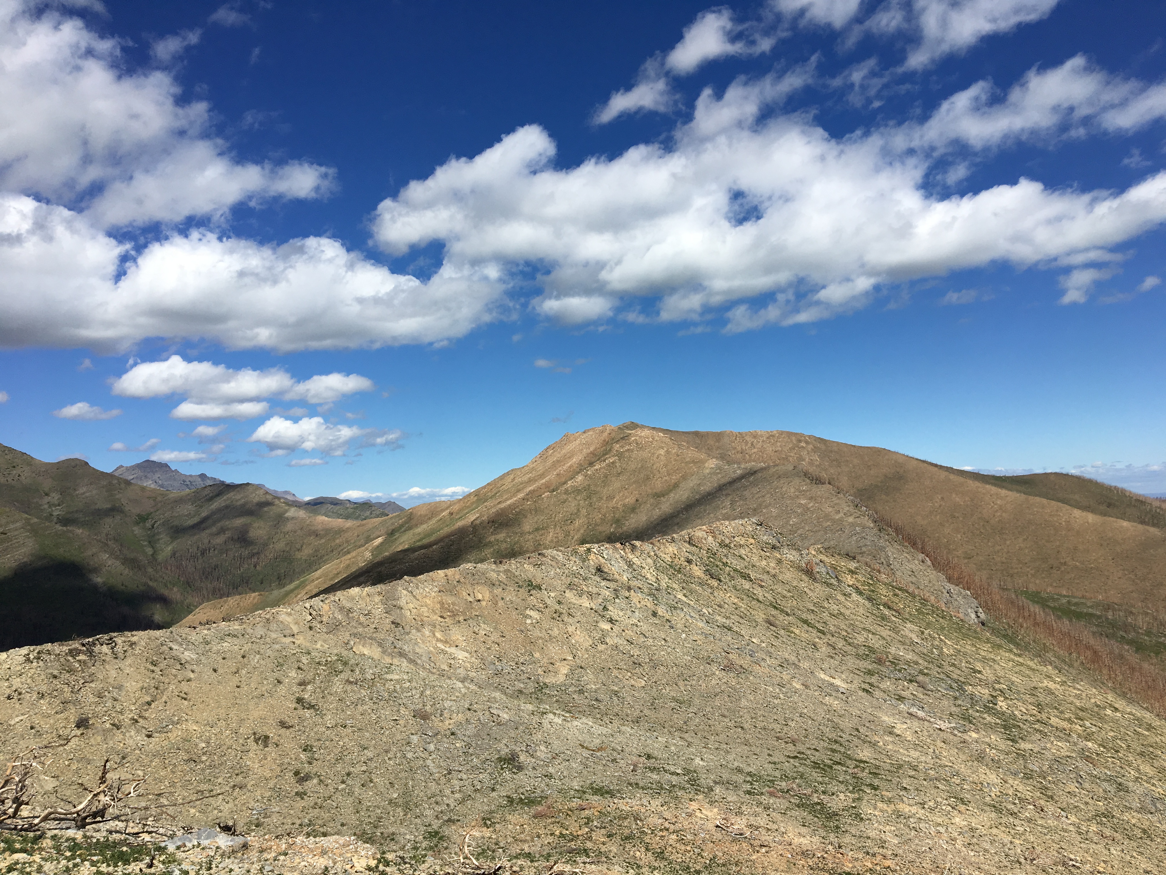
I continued following the ridge to the northwest for my descent. This area was a little steeper than the rest of the ridge but presented no problems. As I descended, I could make out the Horseshoe basin trail zig-zagging its way up to the col between Lakeview Ridge and Dungarvan’s southern outlier. The ridge line met the col and I was back on the trail. I turned left and followed it south back down into Horseshoe Basin, then carried on all the way back to the parking area.
Total distance was 17.5 km. Total ascent was 762 m. Round-trip time was 4h 56m. Click on the pictures below for full-sized images.
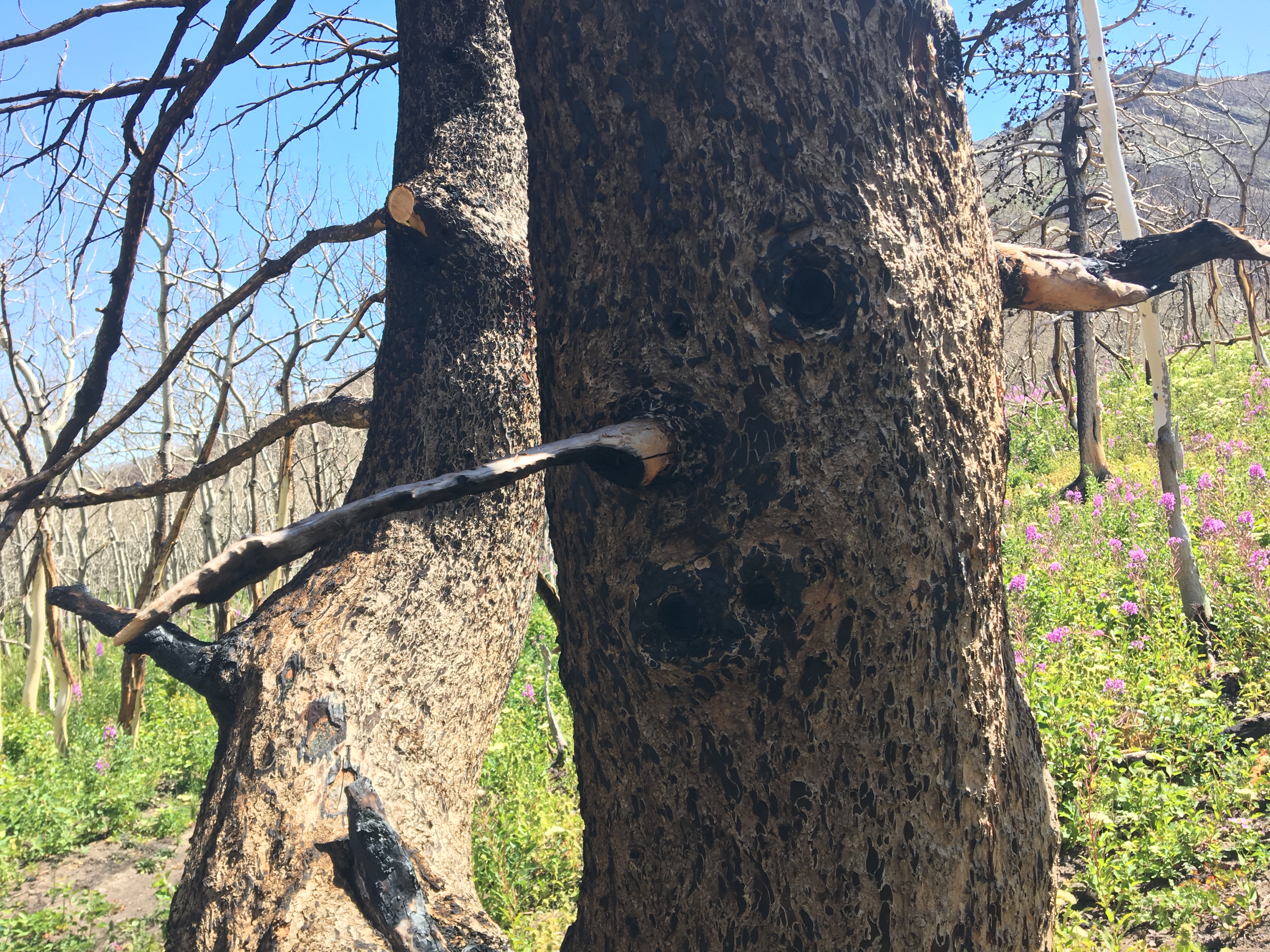
Overview of the full route. The loop on the ridge was done counter-clockwise.Close-up of the ridge. The asterisk marks the berm that is circumvented by leaving the trail and following the creek bed. Leaving the trail earlier and heading directly to the bottom of the ridge would result in unnecessary bushwhacking.Elevation profile of the full route.From the parking area the eastern part of Lakeview Ridge is the most obvious feature (right of picture). The summit of the western part of the ridge is the subtle peak in the distance to the left of centre.Right away after passing the slough you’ll find this trail sign. The eastern part of Lakeview Ridge remains the most obvious visual feature. Head left here.Not far beyond, there’s another fork in the trail. Go right. Vimy Peak is to the left of centre. I was standing on top of it a few days before.The trail begins to climb towards the basin. Burned trees were everywhere. Purple flowers covered the slope and there was fine ash piled on the dirt of the trail. It would have looked very different before the fire.After a short climb, Horseshoe Basin comes into view. The trail goes between Bellevue Hill on the left and the southern extent of Lakeview Ridge on the right.Horseshoe Basin. The summit of Mount Galwey is on the left, “Rogan Peak” is on the right.The trail descends to the level of a creek running down from the basin. Leave the trail at that point and go right, following the creek bed (a rocky area that’s not well seen in this shot) and around the end of the berm to circle behind it (dashed arrow) and up to the base of the ridge.The creek bed. Earlier in the year depending on the water flow this may be a tougher area to navigate.The base of the ridge. You could take any of a number of routes up, but it’s better to trend left once beyond the rocky outcrops in the foreground to go towards the left-sided rocky outcrops in the distance.Up on the ridge, looking back at the basin towards Mount Galwey and “Rogan Peak”.Looking north along the ridge towards the summit.The Kenow fire went up and over the ridge. It’s staggering to think of the scale of the inferno. Sofa Mountain and Chief Mountain are visible in the distance.This survey marker is embedded next to a high point well away from the summit. Not sure why that would be.At the high point about 1 km short of the summit.At the true summit, looking towards Mount Dungarven. There was a small cairn that I built up a bit, as well as a broken survey marker.Summit portrait. It was a perfect day to be in the mountains.Summit panorama looking north.Summit panorama looking east, towards the lower eastern summit.Summit panorama looking south. Mount Cleveland is towering in the distance.Summit panorama looking west. From left to right: Mt. Galwey, Dungarvan’s un-named outlier (Nugara’s “Rogan Peak”), Mt. Dungarvan and Mt. Glendowan. It’s Waterton’s little Ireland.Looking down into the basin. A patch of purple fireweed stands out among the burned trees.Descending towards the col to rejoin the hiking trail, which can be seen zig-zagging up the slope.A peek through a rocky cleft looking north, down in to Oil Basin. The rock on this part of the ridge would make for more interesting scrambling on the ascent if the route were to be done clockwise. The downside of that would be that the good views would be behind you once you were on the summit and walking south along the ridge.Almost back on the trail. You can see that “Rogan Peak” could be scrambled by continuing to follow the ridge beyond the col.Back on the trail and ready for the return journey in the valley. The magnificent devastation of the Kenow fire is evident.A face in the bark of a burned tree. Reminiscent of Iceland’s rocky trolls.Another face. Maybe these are ents? Dryads?Destruction and renewal.Tree trunks and shadows. The elimination of the foliage has left some interesting underlying rocky terrain visible.The sun shines down on Waterton Lakes and Vimy Peak.


2 thoughts on “Lakeview Ridge West”