July 18, 2018. A challenging bike-and-hike to the summit of Waterton’s iconic peak.
Many (possibly most) promotional pictures featuring Waterton Lakes National Park will show the amazing views the park offers – of mountains not actually in Waterton. A common photograph is of the picturesque Prince of Wales Hotel looking south across Upper Waterton Lake towards the towering Mount Cleveland, which is in Montana’s Glacier National Park. Waterton’s Cameron Lake is also particularly photogenic – thanks to Glacier’s Mount Custer looming to the south. However, when you’re in the Waterton townsite, or perched above it on Bear’s Hump, it is Waterton’s own Vimy Peak that dominates the view and features prominently in keepsake photographs. When I set up this blog, an impressive winter photograph of Vimy was the obvious choice to use as the header.
There is a steep, well-established trail that goes to the summit, but access is a challenge. Vimy sits on the opposite side of the Waterton lakes from the townsite, with no easy drivable access. Of course, neither does the hugely popular Crypt Lake trail but Crypt has a twice-daily ferry service going to the trailhead in the summer. Vimy has no such convenience available. Access requires a 7 km journey along the Wishbone trail. Not only does this add 14 km to a day’s outing, but it also takes one through some of Waterton’s more bear-populated terrain. As a result, it seems many hikers give Vimy a pass. That’s unfortunate, given the amazing views from the top.
I was lucky enough to be invited along on a group excursion to Vimy Peak. The plan was to bike the approach trail and travel as a large group to minimize the chance of bear encounters. Biking turned out to be an excellent idea – although I crashed spectacularly at one point. There was one bear encounter on the Wishbone trail, but it ran off in response to shouting.
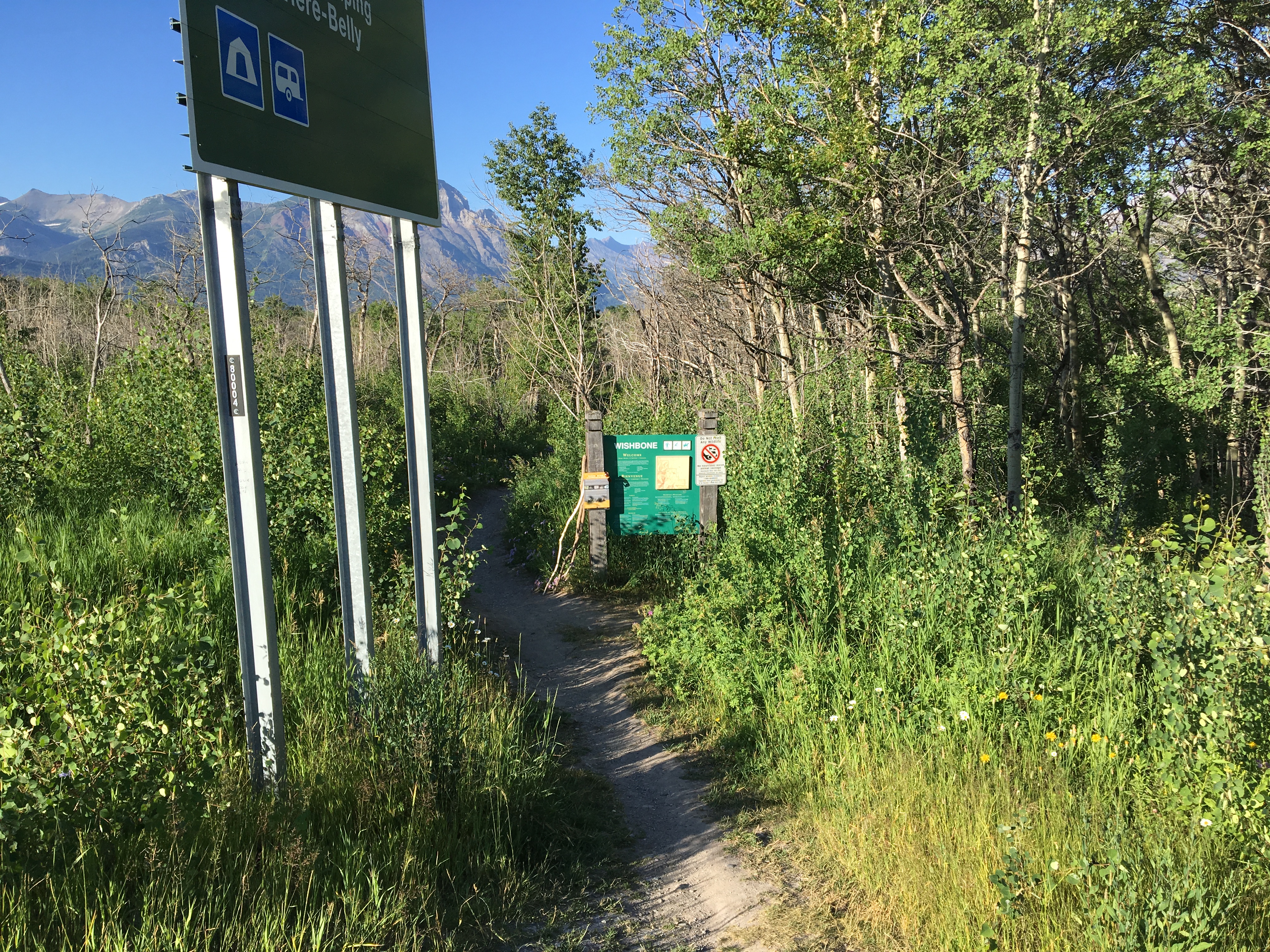
The Wishbone trail, which allows access to the Vimy Peak trail (then continues on to Crypt Landing) is accessed via a pull-off from Hwy 6. If approaching Waterton on Hwy 5 from Cardston, turn left onto Hwy 6 towards the Chief Mountain Border Crossing shortly before crossing the bridge over the Waterton River. The parking area is at 49.108915, -113.826465. The Wishbone is a fairly flat trail that is sometimes level but usually rutted. Bicycles are allowed as far as the Vimy Peak trailhead at 7km. The trail crosses Sofa creek after 5.5 km. There’s no bridge, but the water wasn’t deep and fording was easy. On the other hand, I found that riding a bike in a narrow rut is actually pretty hard! Given my total lack of on-trail mountain biking experience, I got going too fast during the return-trip. The front tire climbed its way out of the rut, the rear tire turned perpendicular, and I went flying. It was an avoidable crash, and I really should have been more cautious.
The bear encounter happened in the morning as our group was biking in. The lead cyclist entered a treed area, just before the Vimy Peak trailhead. He encountered a big brown bear. He couldn’t provide any more identifying features. It was on the trail, walking in the same direction we were all riding. He gave a shout, and the bear ran off.
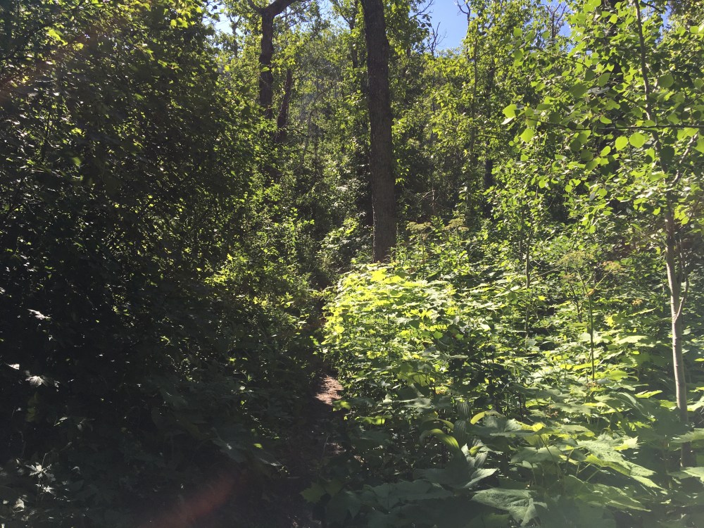
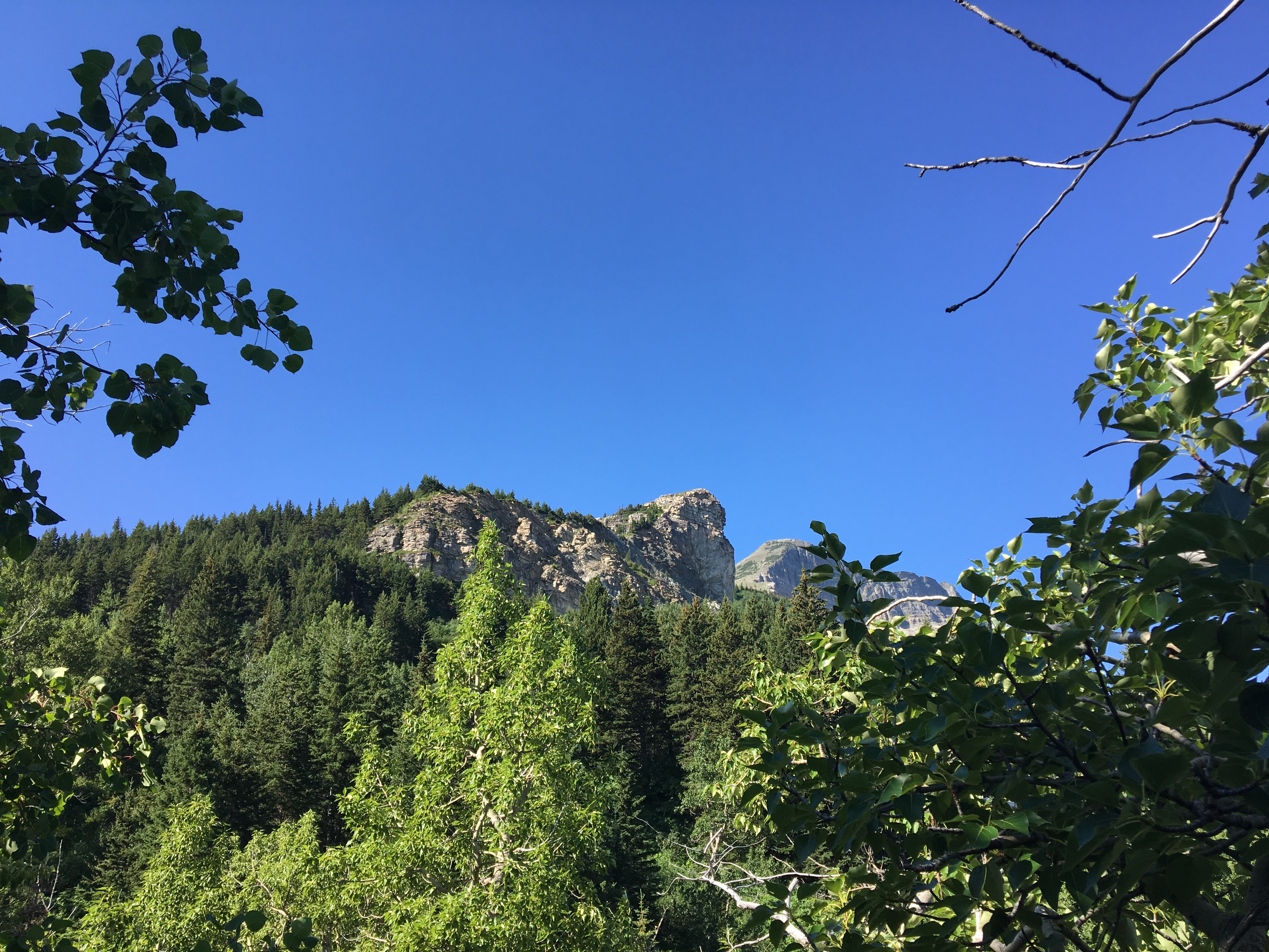
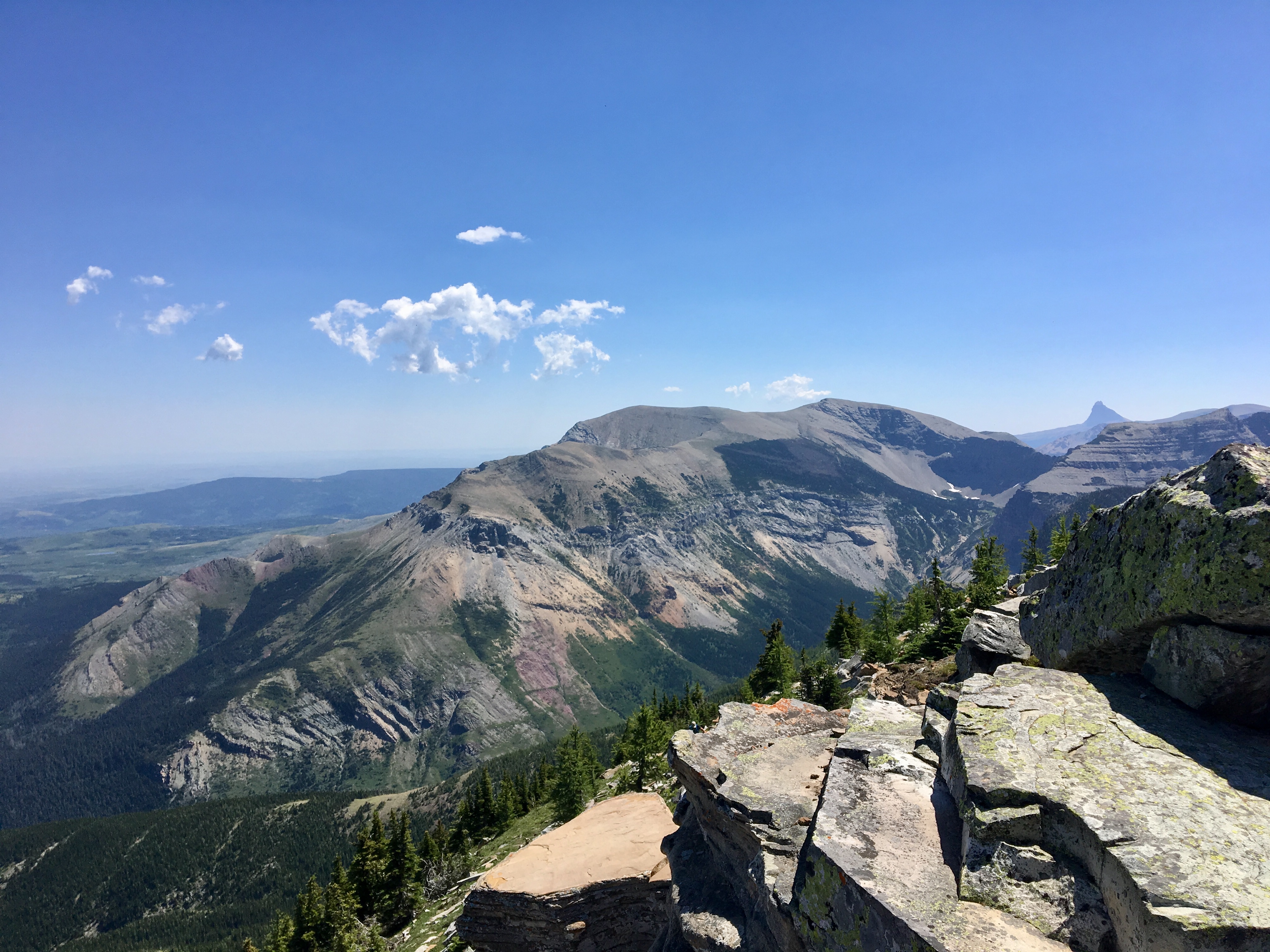
At the start of the Vimy Peak trail itself we all stashed our bikes in the bushes. It was a particularly hot day, so some of the party also stashed extra water to pick up on the return journey. We set off up the trail. There wasn’t much to see at first, with the trail passing through trees and thick underbrush. Here and there we found clearings which provided a view down towards the Waterton lakes and townsite. A distinctive rocky outcropping, called the Lion’s Head, was intermittently visible above and to the right of the trail. The trail would eventually loop around behind that outcropping and head up a drainage, paralleling a brook. The hiking in the drainage was less claustrophobic and the cool water of the brook was very refreshing to splash onto our skin. The trail crossed a waterfall, and a short distance above that the brook disappeared. It seems that the brook is fed by melt-water from Vimy Basin. The Basin contains no lake, just some snow piles. The melt-water doesn’t accumulate as a lake, but percolates through the rocks and eventually appears down in the drainage.
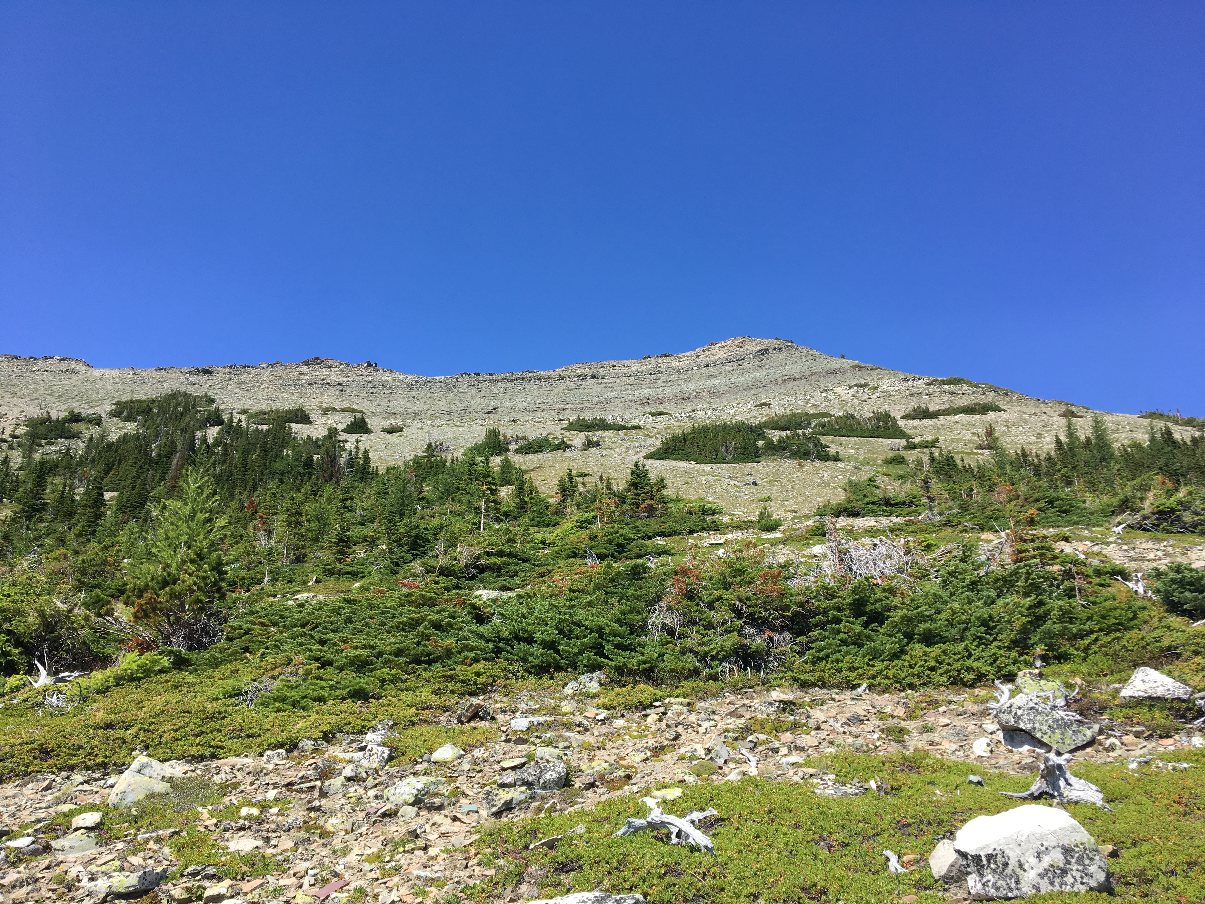
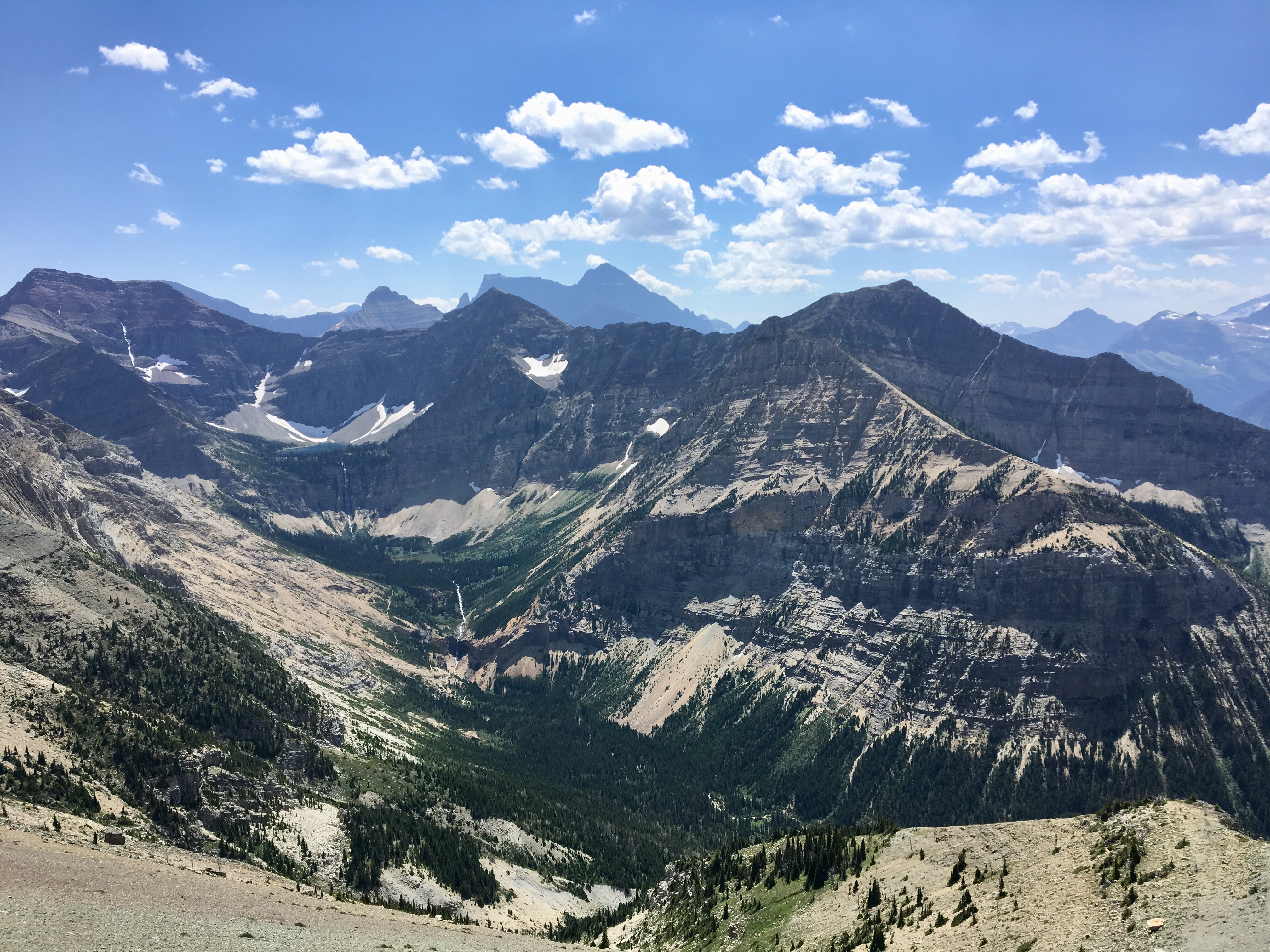
After about 4.8 km on foot, we reached the area of Vimy Basin. Here the views finally started to open up, with the summit coming into view along with a section of Vimy Ridge extending southwards. Sofa Mountain was visible the east. Above Vimy Basin the trail became less distinct, but still fairly easy to follow as it ascended the bare southeast face, then went up and over the eastern ridge and made its final ascent. Slowly, views over Vimy Ridge opened up and Crypt Lake was visible sitting in its hanging valley. When the route reached the eastern ridge, it was possible to cautiously peek over the edge down the precipitous northern face. After 4h 12m of biking and hiking, we reached the summit (2,379m).
The summit views were excellent. It was a sunny day with minimal haze. There was a walled cairn awaiting us with a summit register sheltered inside. There was ample room up there for everyone to sit, eat and enjoy the views. The most striking for me was looking down onto Crypt Lake, Crypt Falls and Burnt Rock Falls.
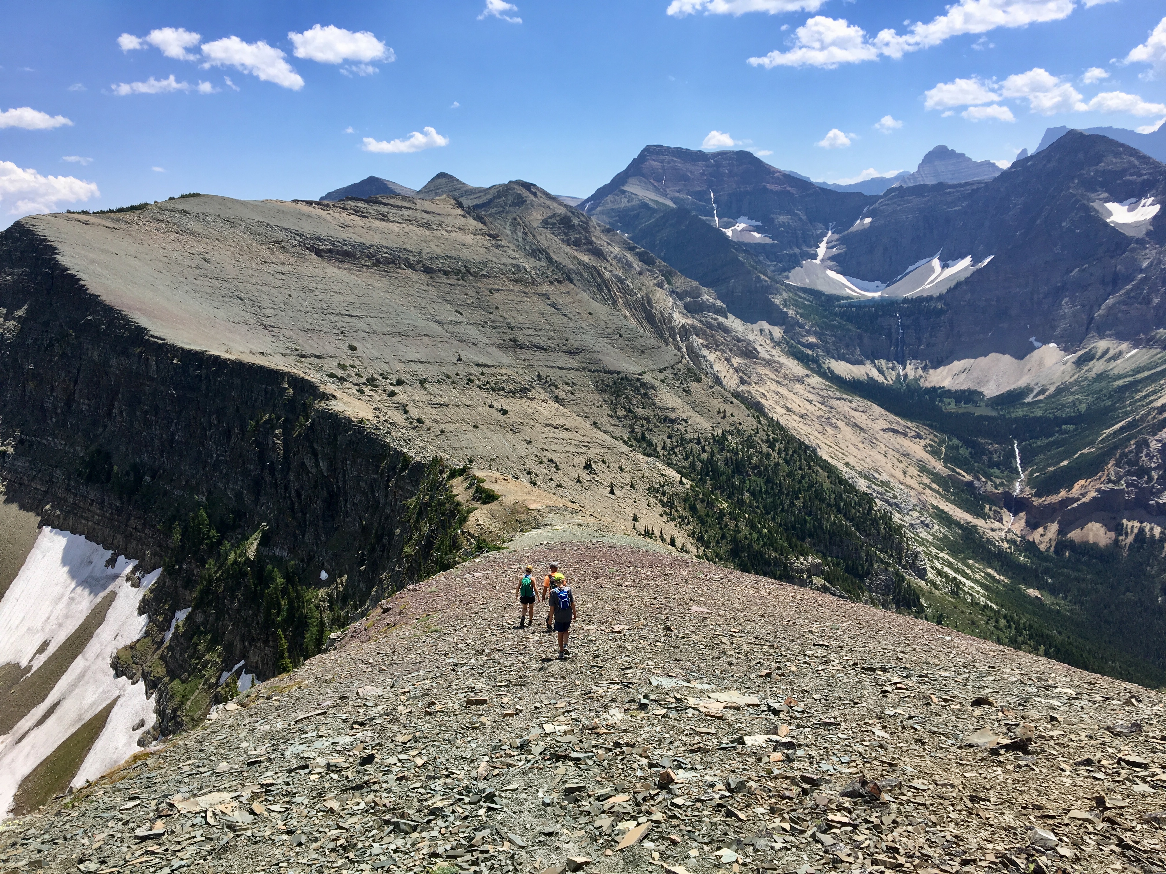
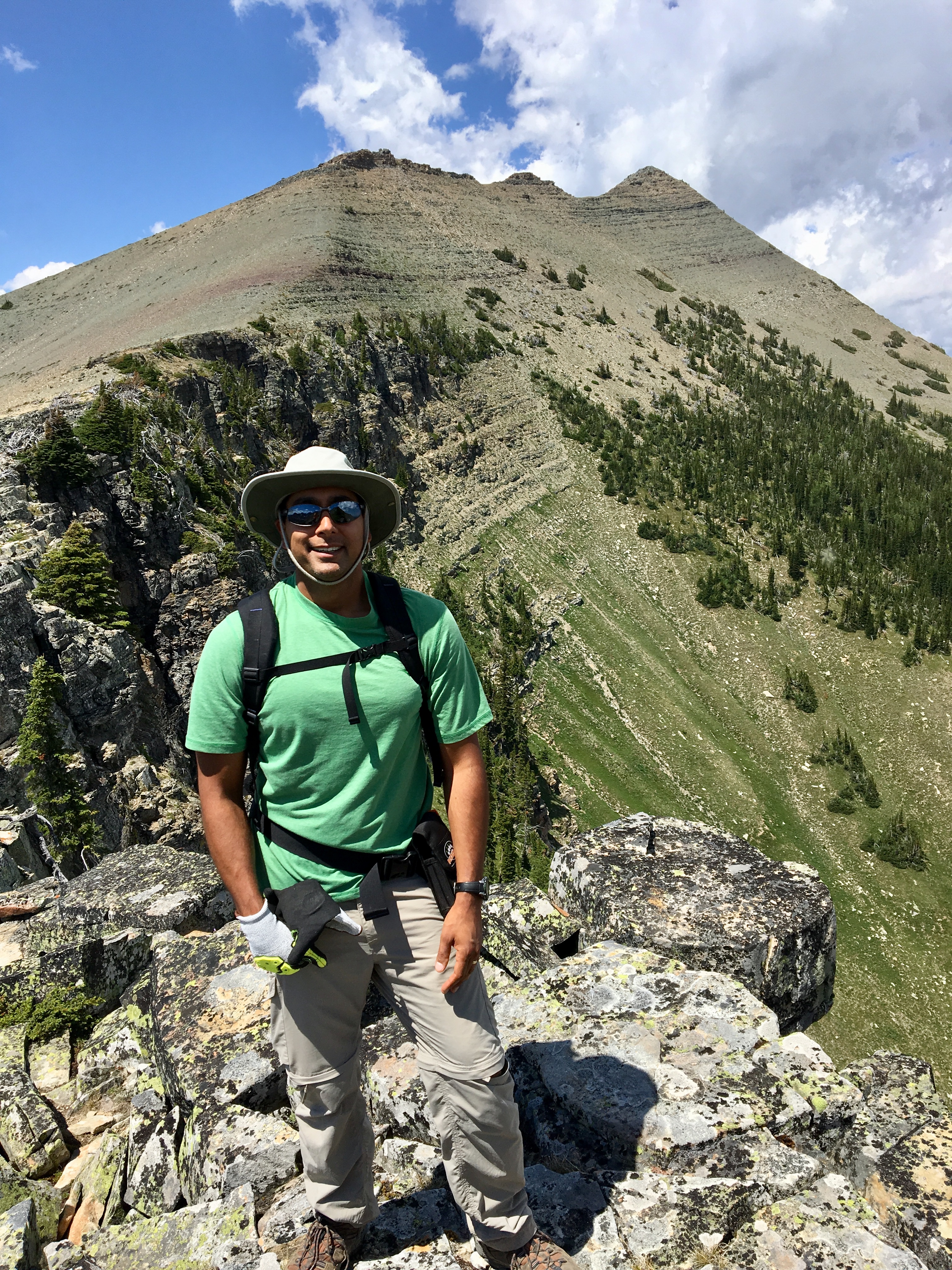
We spent an hour on the summit. On the way up, we saw a definite switchbacked trail descending into Vimy Basin from the ridge opposite our ascent route. Referring to our maps we could see that this was an alternate descent route which could be reached if we traversed Vimy Ridge, passing above Vimy Basin. This was more of an off-trail hike/scramble and would entail roughly 1.5 km extra hiking, along with a short descent followed by additional elevation gain. As a result, not everyone in the group was keen on it. A group of 4 of us were eager to try it out, and I’m very glad I did. For one thing, it involved a ridge walk in an area of astounding scenery. For another, although we’d cover more horizontal distance and lose then gain some elevation, the overall descent would be more gentle compared to return straight back down the way we came.
We agreed to meet at the waterfall below the basin, and the group of 4 set out along the ridge. Most of the route was straightforward hiking with easy scrambling moves. One point, however, involved some major exposure. Navigating it was non-technical, just a little hair-raising. It was no problem on that fairly calm day, but that may not be the case on a typical windy Waterton day. Once we finished our ridge traverse, we found the switchbacking trail descending to the basin. Directly across the valley we could see the other party slowly descending. I shouted a greeting and we experienced the most amazing echo. Our descent route also gave us a good look at Vimy Basin. It was intriguing that there was such a large depression with no standing water in it. Once the party re-grouped at the waterfall we carried on down to the bikes and returned to the parking area.
The total time for the trip was 8h 55m. This was with fairly regular stops and an hour on the summit. Total distance with the descent route I took was 27.6 km (14 km on the bikes). Total ascent was 1,369 m.
Click on the pictures below for full-sized images.


Very nice description of yout trail experience and beautiful pictures.
Great.
LikeLike
Rats. The switchbacks were a gentler descent?
Those views were beautiful. Definitely worth the hike.
LikeLike
They were definitely gentler! I’d firmly recommend that descent for anyone that feels they could manage the ridge. Much easier on the knees and ankles.
LikeLike
How treacherous do you think it would be to tackle this during the winter??
LikeLike
Potentially very dangerous depending on conditions. People with the requisite gear and training climb it in the winter, but it’s not something I’ve tried. Once you get to the foot of the mountain you’re on Class 2/Challenging avalanche terrain. If the trail is snow covered then route finding may be an issue. In winter conditions the upper reaches would be more like mountaineering than hiking/scrambling.
LikeLike