April 4, 2021. Waterton’s best short hike.
- Region: Waterton Lakes National Park. Traditional Territory of the Blackfoot, Tsuu T’ina, and Ktunaxa First Nations
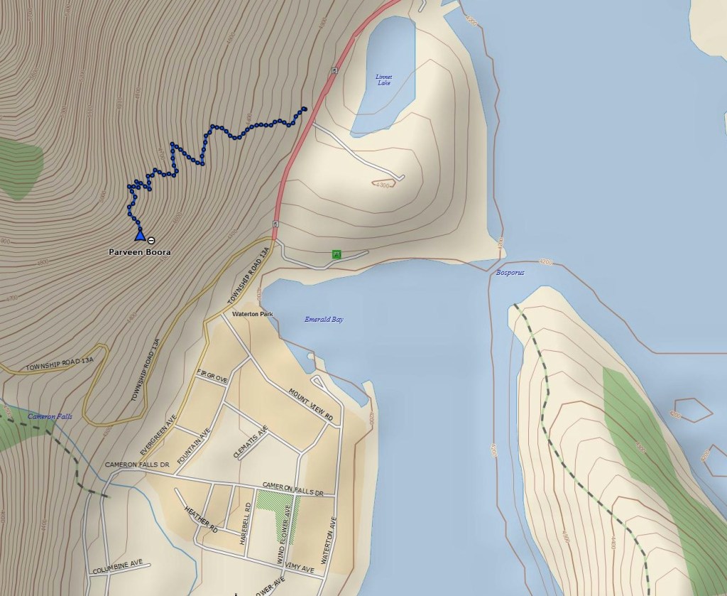
- Distance: 1.4 km one-way
- Total Ascent: 230 m
- Elevation of Objective: 1540 m
- Time: 30-45 minute ascent (depending on how much boulder climbing you/your kids stop to do)
- Safety and Disclaimer
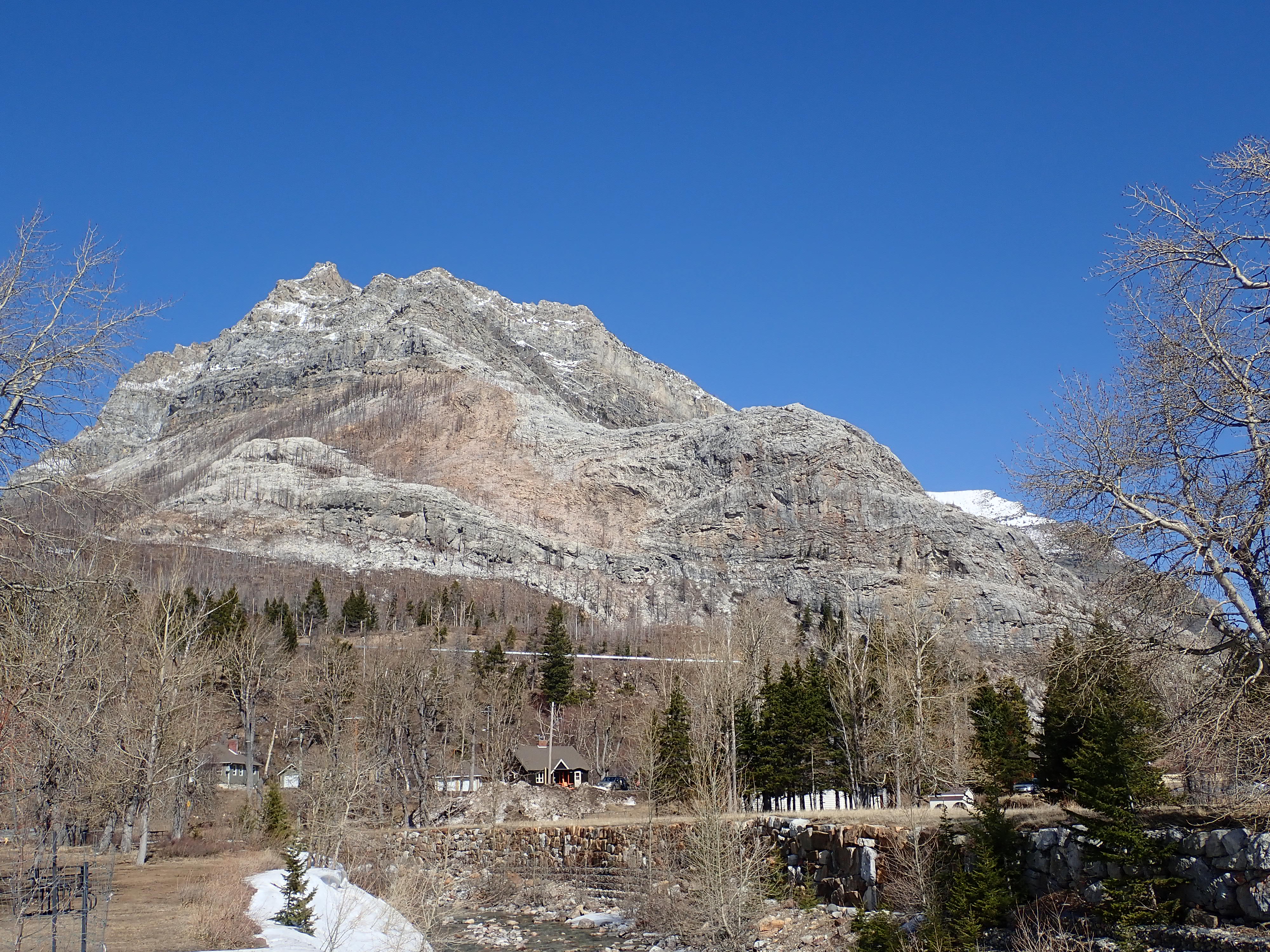
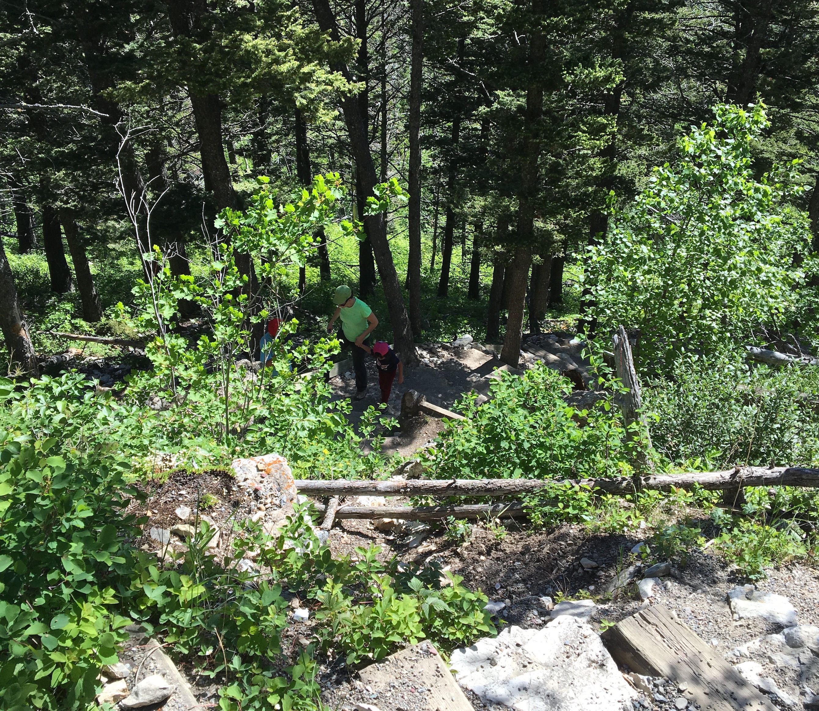
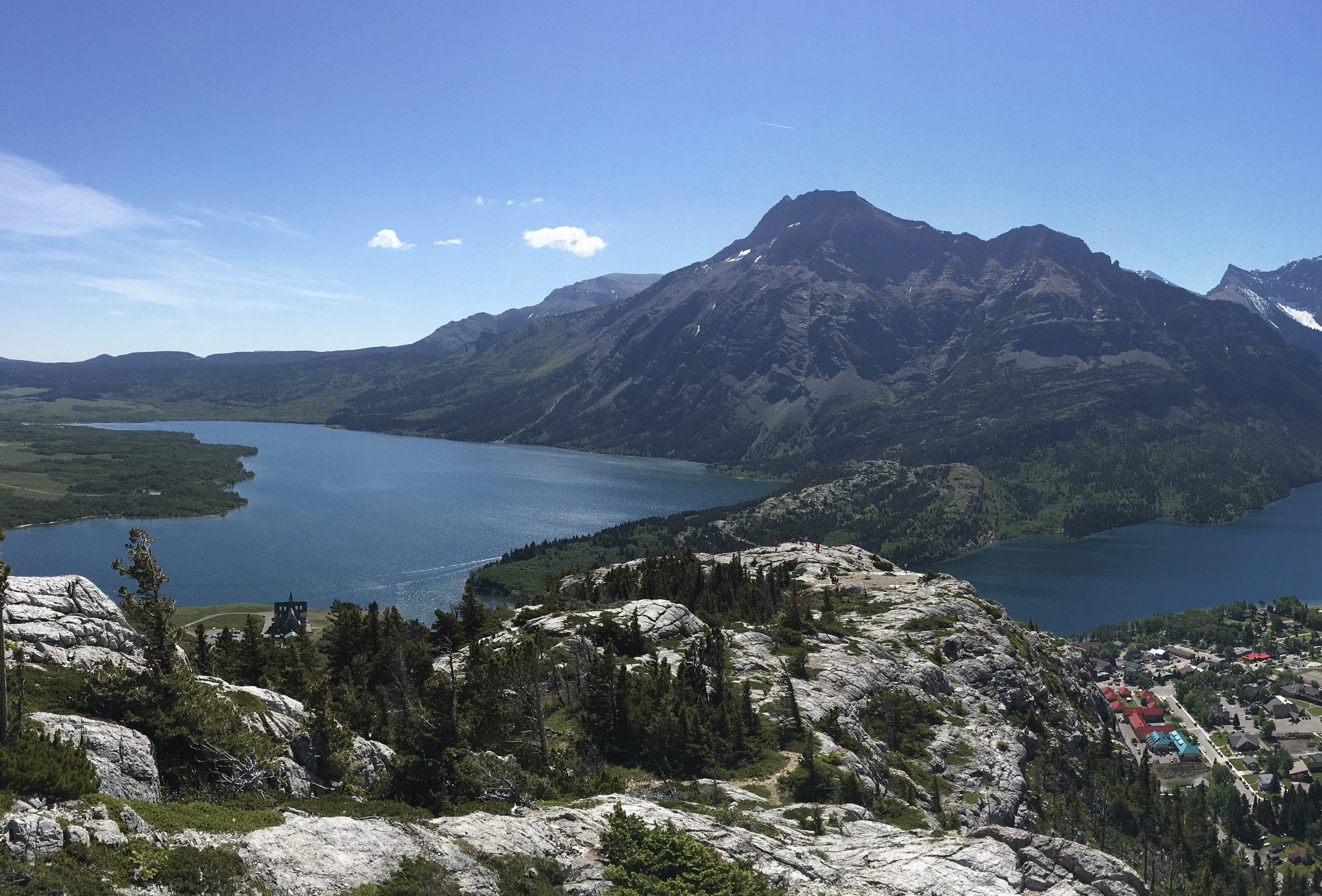
Bear’s Hump is unquestionably one of the best short hikes in the Canadian Rockies. The trailhead is accessible from Waterton’s main access road, it does not take long to climb, and the view from the top is iconic. The “featured image” for this post shows off the view on an idilic summer day in 2016, before the fires of 2017 burned the forest away.
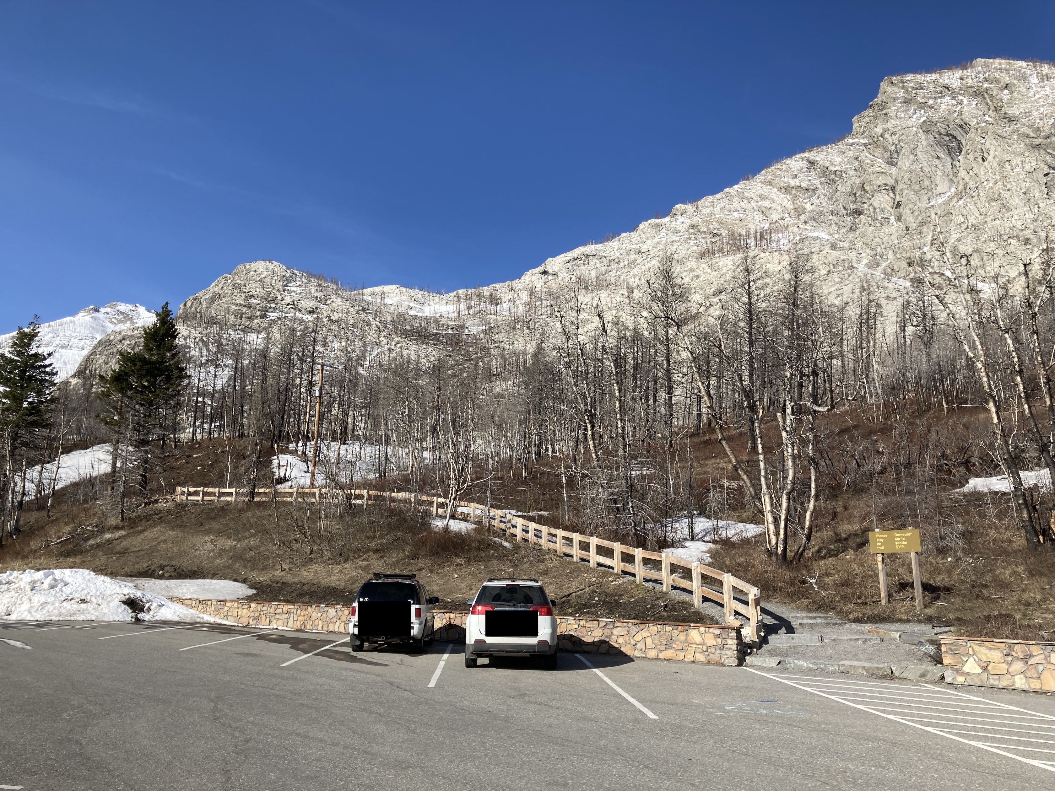
Before the fire, the Parks Canada information building used to sit adjacent to the trailhead. That building burned down and was not rebuilt since there were already plans in place to relocate information services to another site. Luckily, the large parking area was retained and improved. The trail has been cleared and reinforced and numerous benches have been placed along the switchbacks. Bear’s Hump is once again open for business.
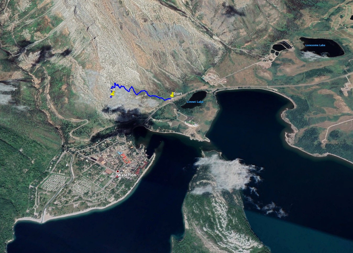
The trailhead is easy to find. The parking area is right on the park access road, about 7.5 km from the gate. Click here to see the Google Map. Toilet facilities are no longer available on site, so if someone needs to use the facilities before hiking, it’s a good idea to carry on to Cameron Falls where there are well-maintained flush toilet facilities. Note that as of this writing it’s been a long time since Google updated Street View in the area. Rest assured there is a big obvious washroom facility across the street from the falls.
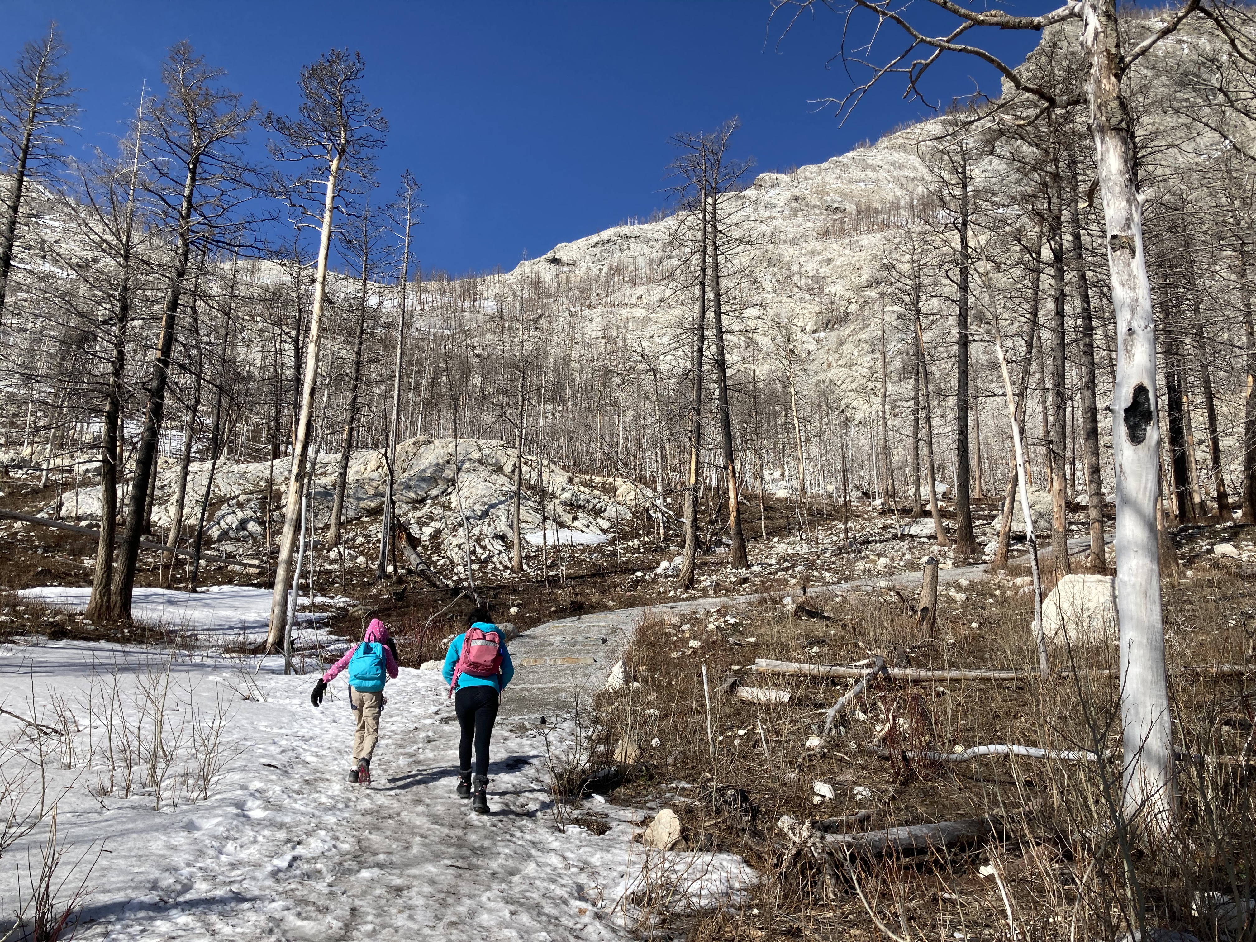
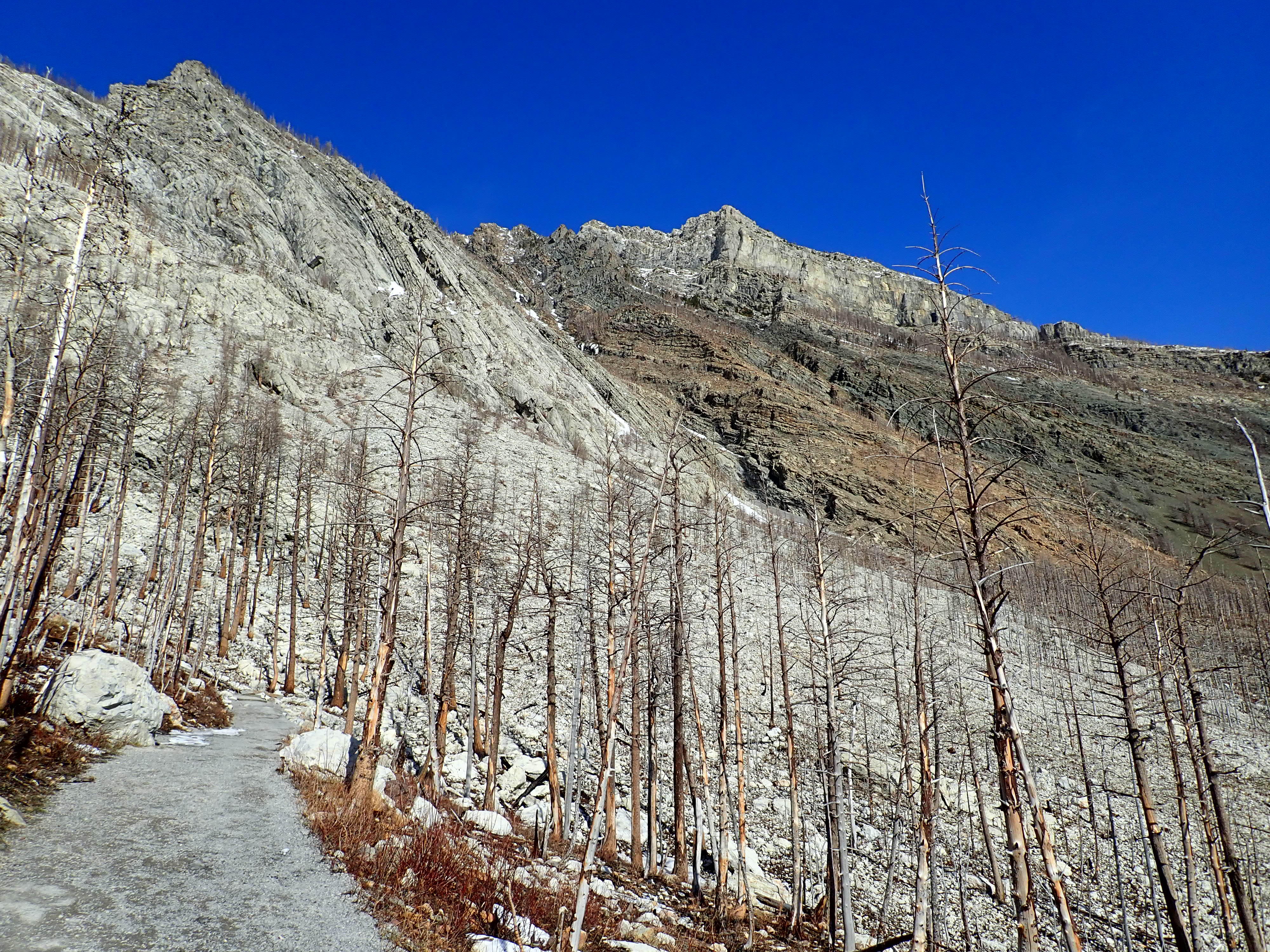
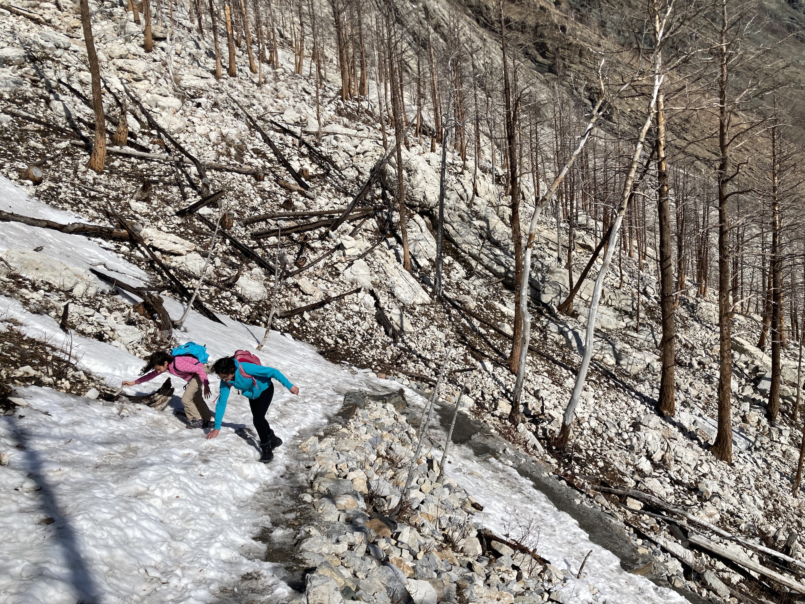
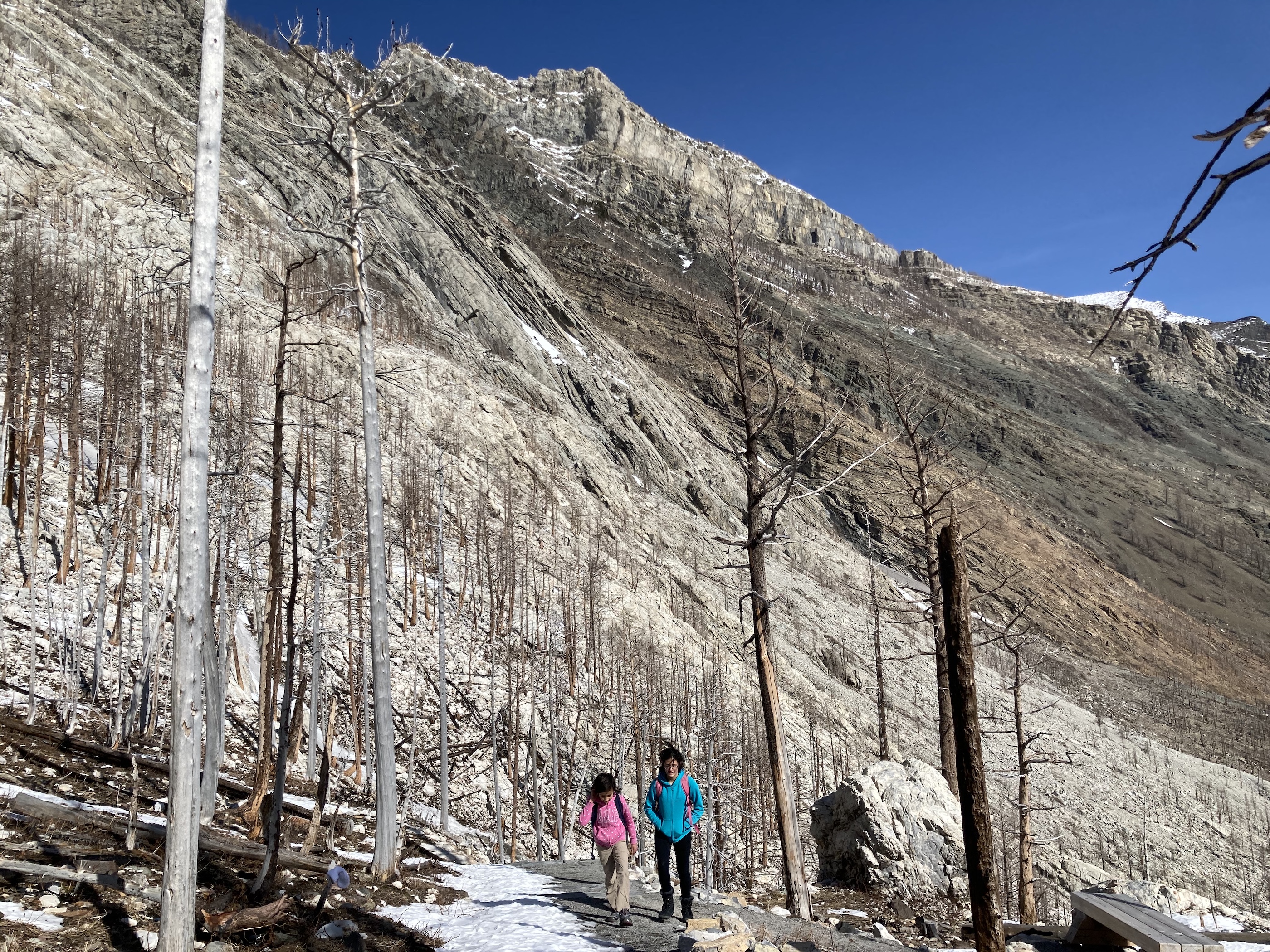
There’s not too much to say about the trail – it’s a series of reasonably steep switchbacks. There are lots of places to rest if needed, and now that the trees have burned away there are actually decent views all the way along. There are also some boulders and rocky outcrops right along the trail which now lie exposed and act like a magnet for little climbers.
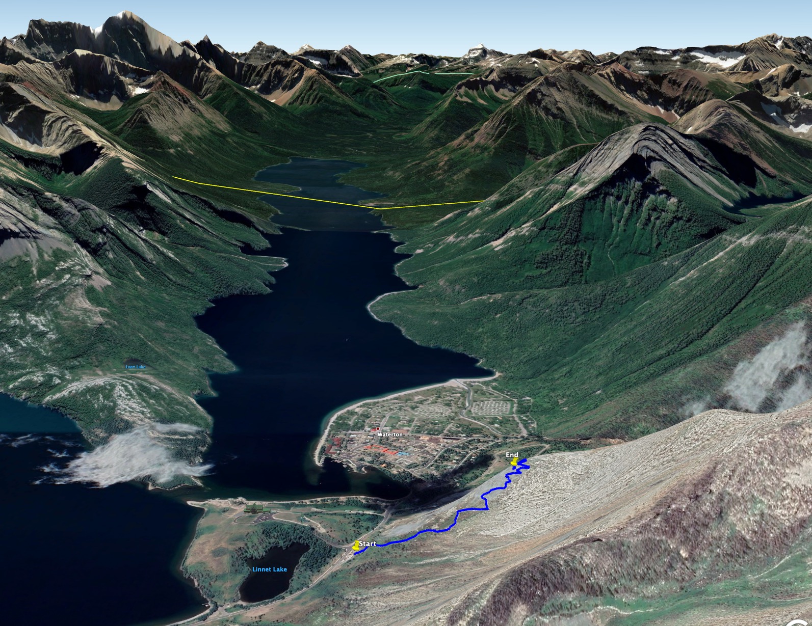
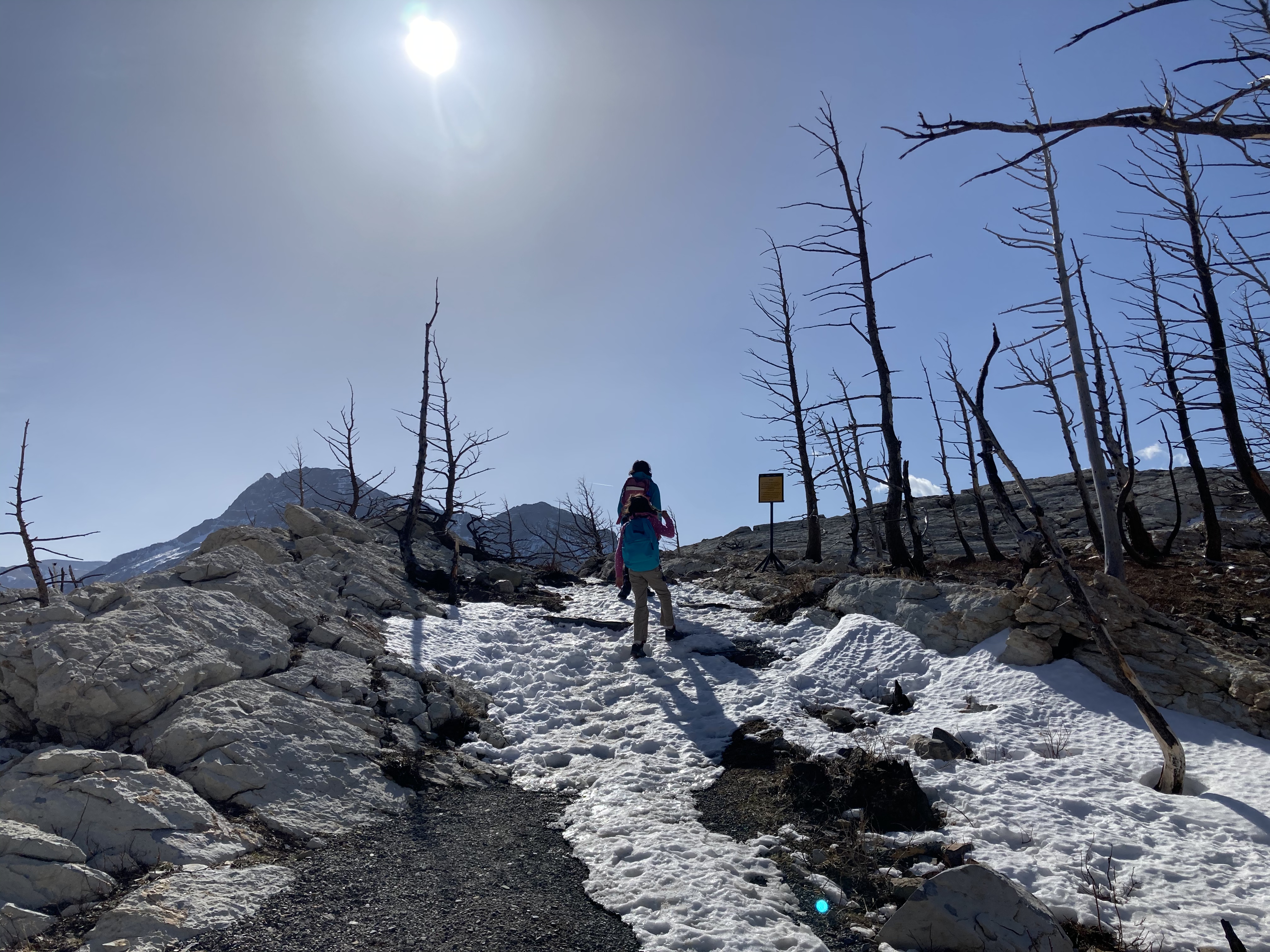
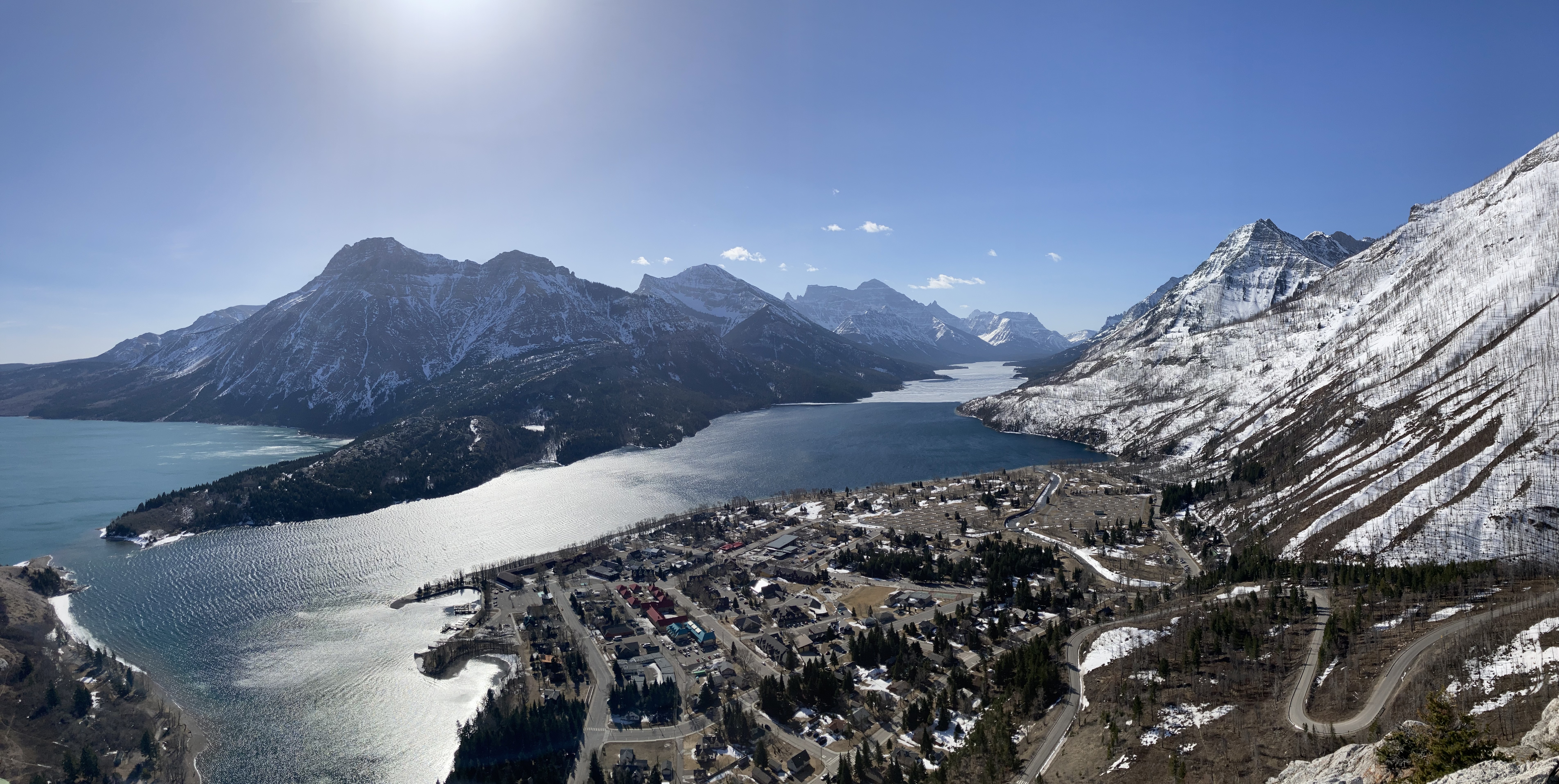
The trail is largely sheltered from Waterton’s famous winds. As soon as you reach the end of the trail you will be fully exposed, though. The view from the top is excellent, giving an unobstructed look south across Upper Waterton Lake toward Mount Cleveland in Glacier National Park. Vimy Peak and Mount Boswell are across the lake to the east. Closer by, on the west side of the lake, are Bertha Peak and Mount Richards. Down an adjacent valley Mount Alderson is visible to the southwest. The Prince of Wales hotel, the townsite, and the marina are nearby. On a summer day you get a bird’s eye view of a busy world far below.
The top of the trail is the starting point for the difficult scrambling route up Mount Crandell. I’ve never tried ascending that, but I have climbed a short distance beyond the end of the trail on what is a safe and fun area of rock.
This trail can be climbed any time of the year, but depending on the conditions snowshoes or microspikes may be needed.
Click on the pictures in the gallery below to access full-sized images.

Excellent post and what a lovely view looking down at the Prince of Wales hotel! Really stunning!
LikeLiked by 1 person
On a fine summer day it’s as beautiful a place as any in the Canadian Rockies.
LikeLike