March 13, 2021. A snowshoe trip to the top of a low ridge on the Continental Divide.
- Region: Crowsnest Pass. Traditional Territory of the Ktunaxa and Blackfoot First Nations
- Distance: 9.9 km round-trip to both the main and secondary summit
- Total Ascent: 594 m
- Elevation of Objective: 1893 m
- Total Time: 3h 46m (includes a fairly long stay on the summit)
- Safety and Disclaimer
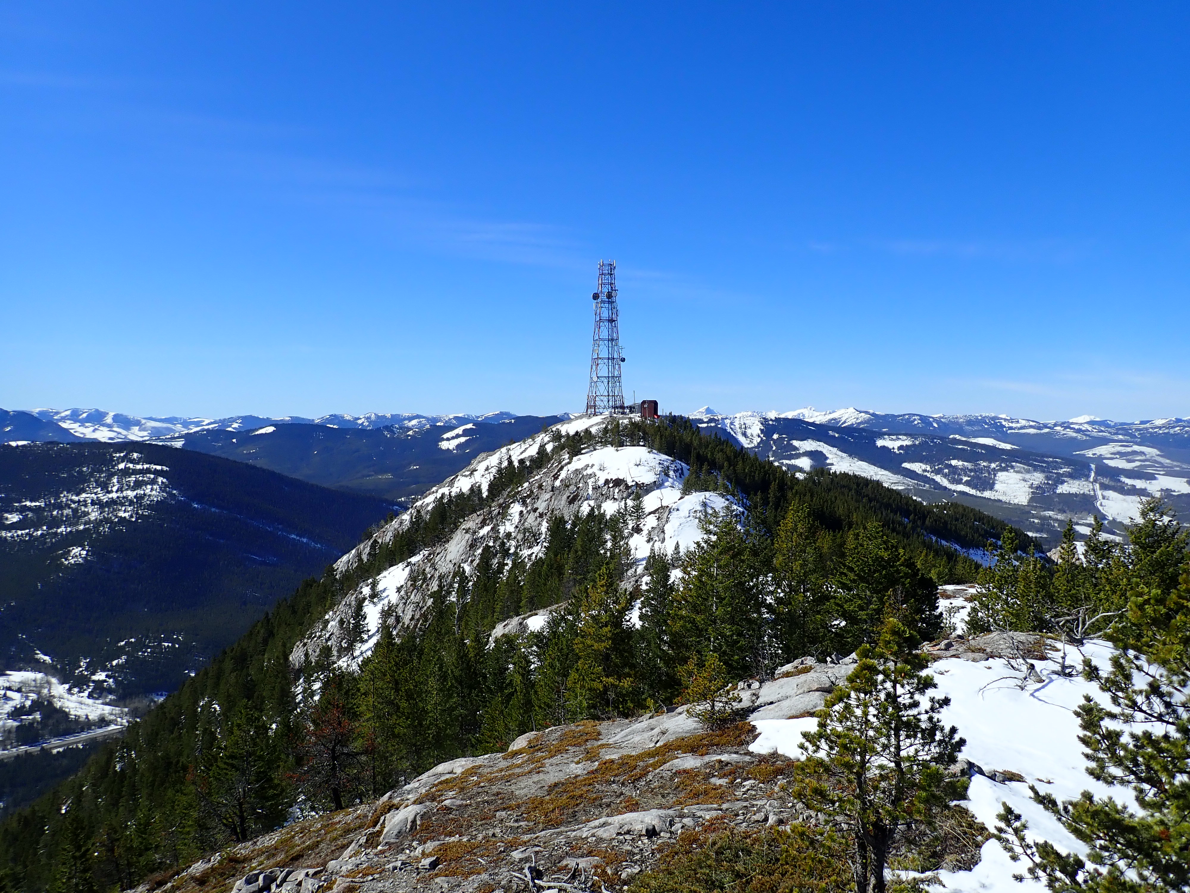
Almost exactly 3 years before this trip I snowshoed to the summit of Island Ridge on a warm and sunny day. I had taken note at that time of Crowsnest Ridge, directly across the valley. A telecom tower sat on top, which made the ridge itself less than picturesque. However, I figured the views would be pretty good, making it a good objective for a future outing. I reviewed Bob Spirko’s trip report, describing a route that began along the same road I used to approach Mount Tecumseh, but deviating to climb directly up a cutline ascending the northwestern toe of Crowsnest Ridge. From there Spirko followed the ridge until it intersected an access road that switchbacked from Phillips Pass up the steep north face of the ridge. Then he followed the road to the summit. This struck me as a more interesting route to take rather than climbing up the access road the whole way, and it would keep me out of avalanche terrain, which I thought the lower reaches of the switchback road were definitely in.
On the day of this trip, I was treated to weather almost exactly the same as 3 years ago. The sky was clear, the wind was never more than a light breeze, and the air was warm.
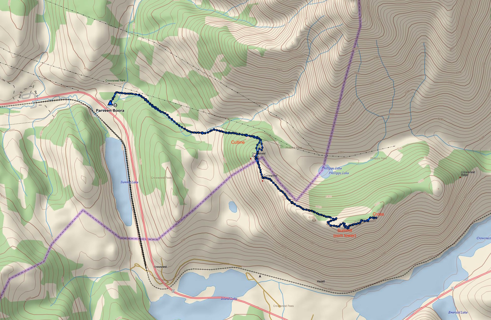
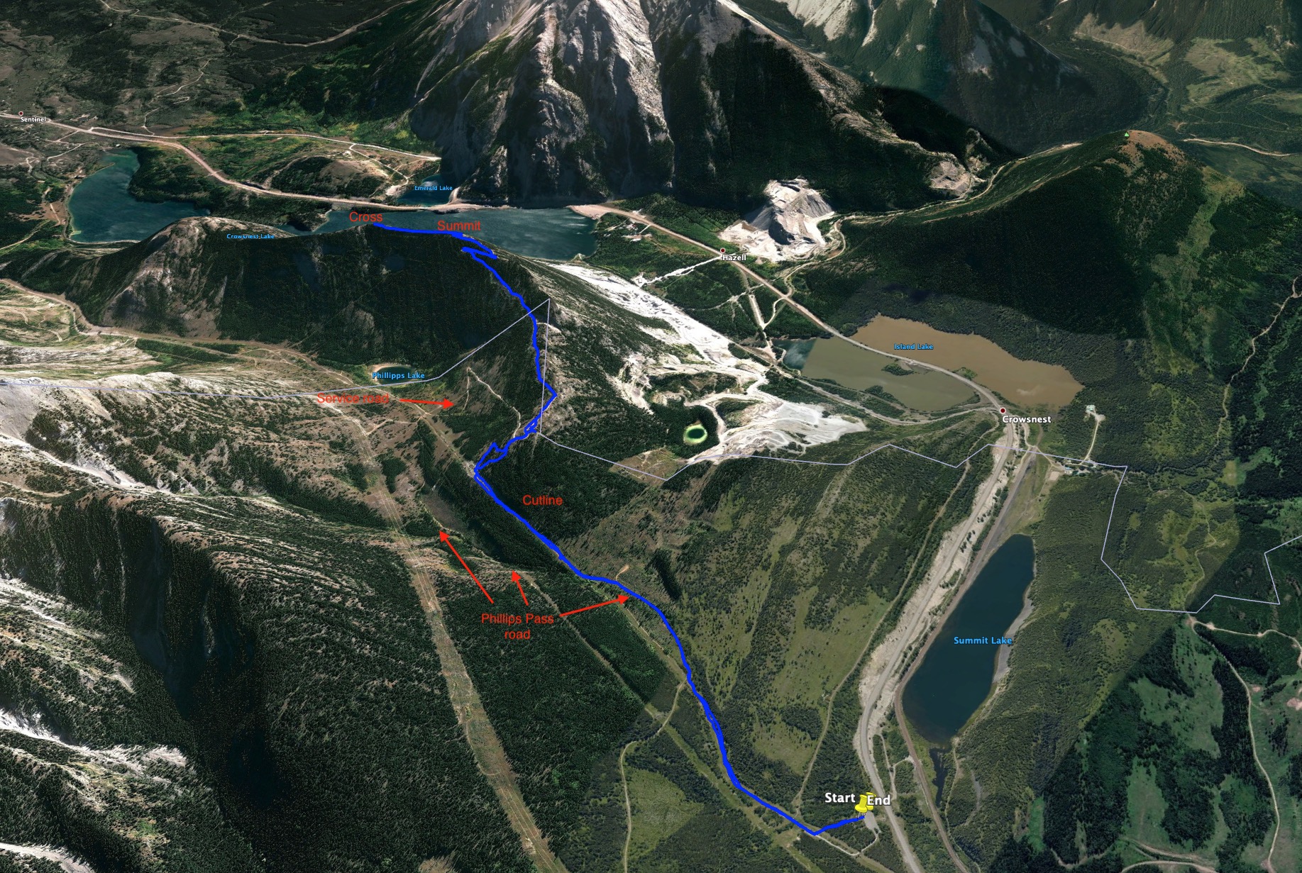
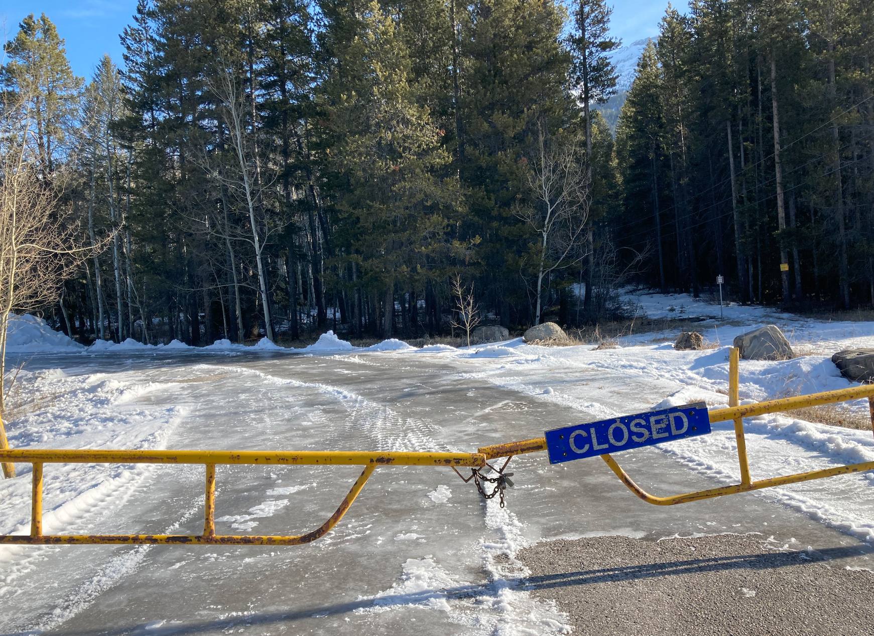
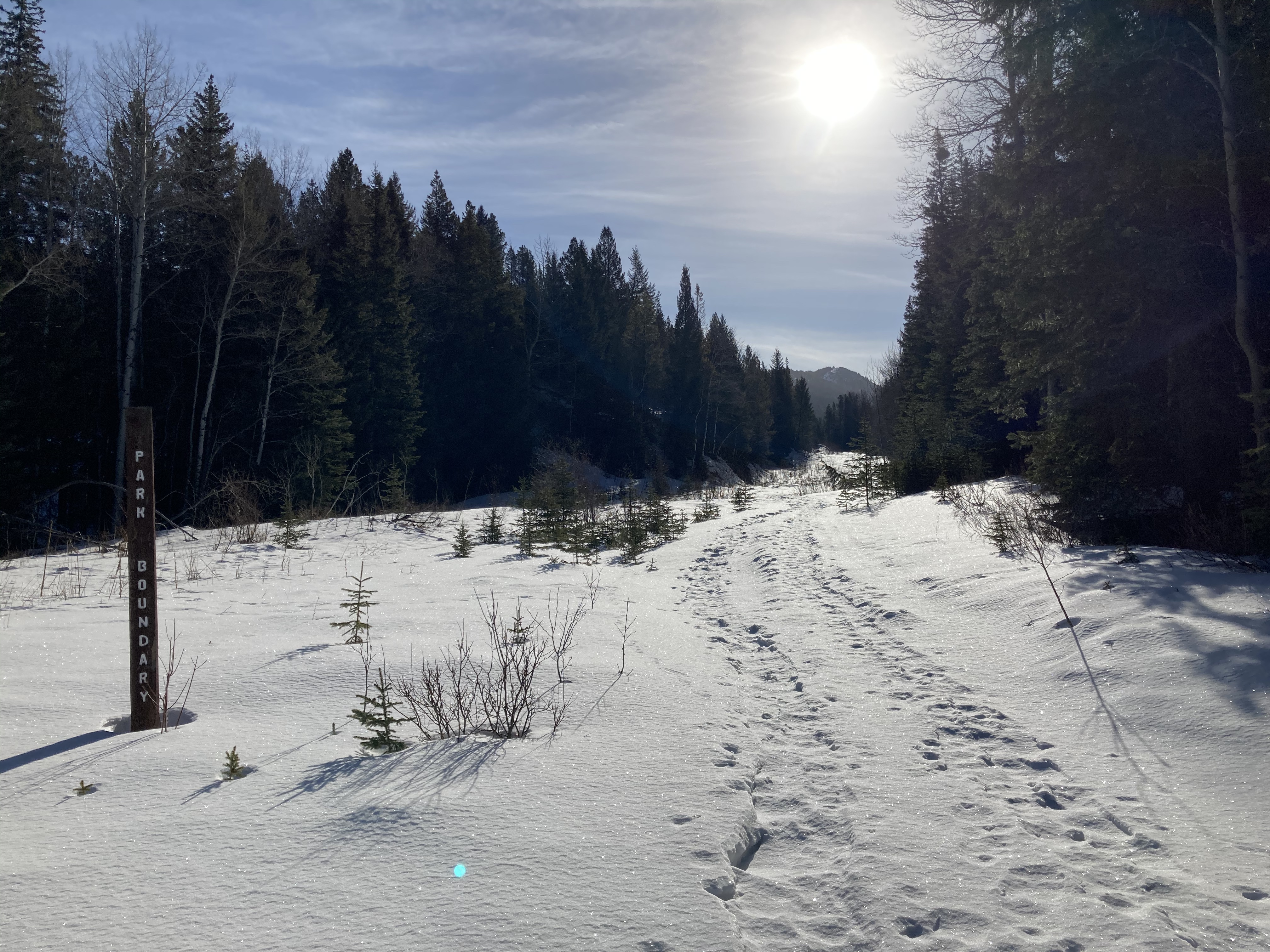
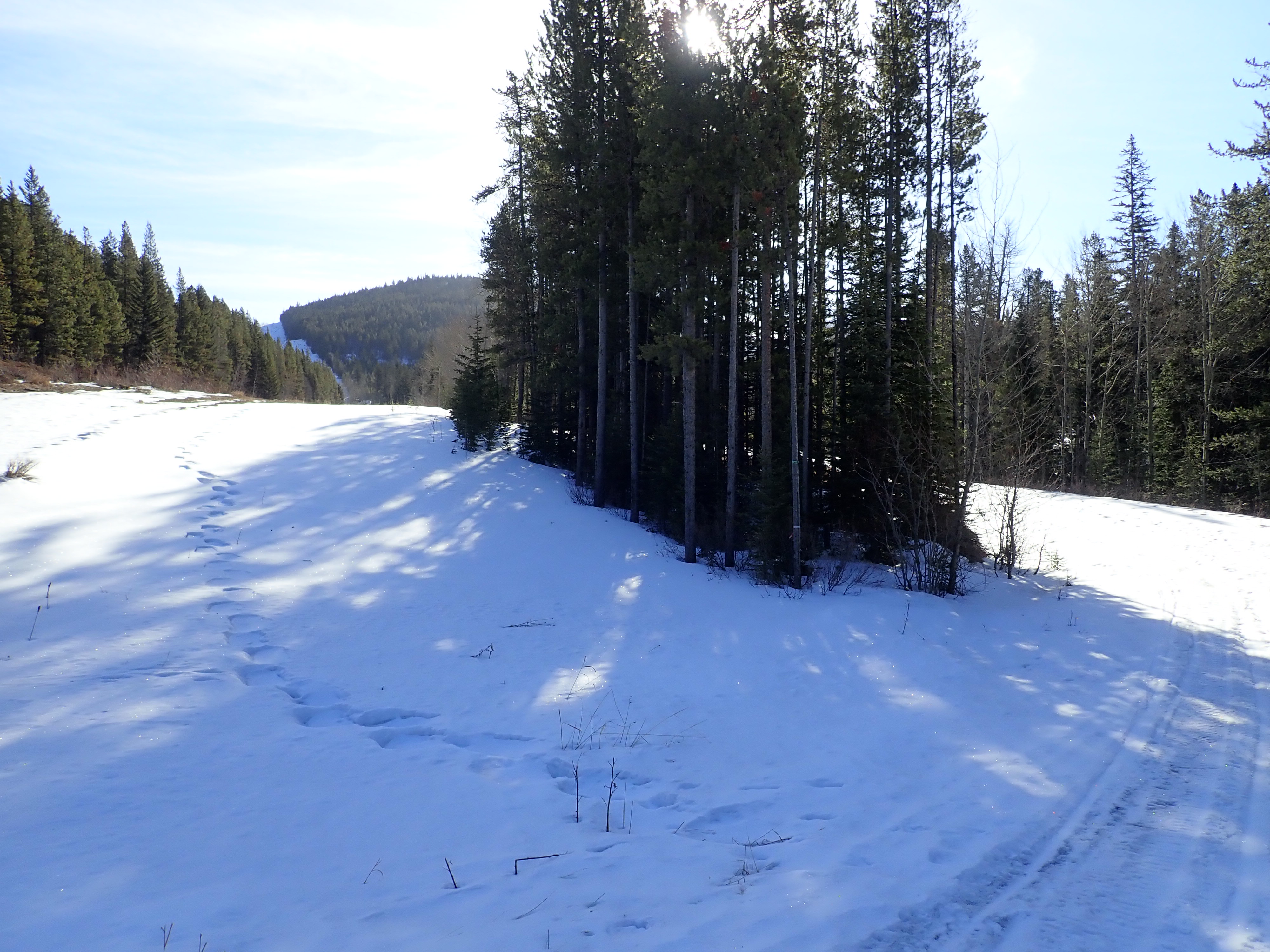
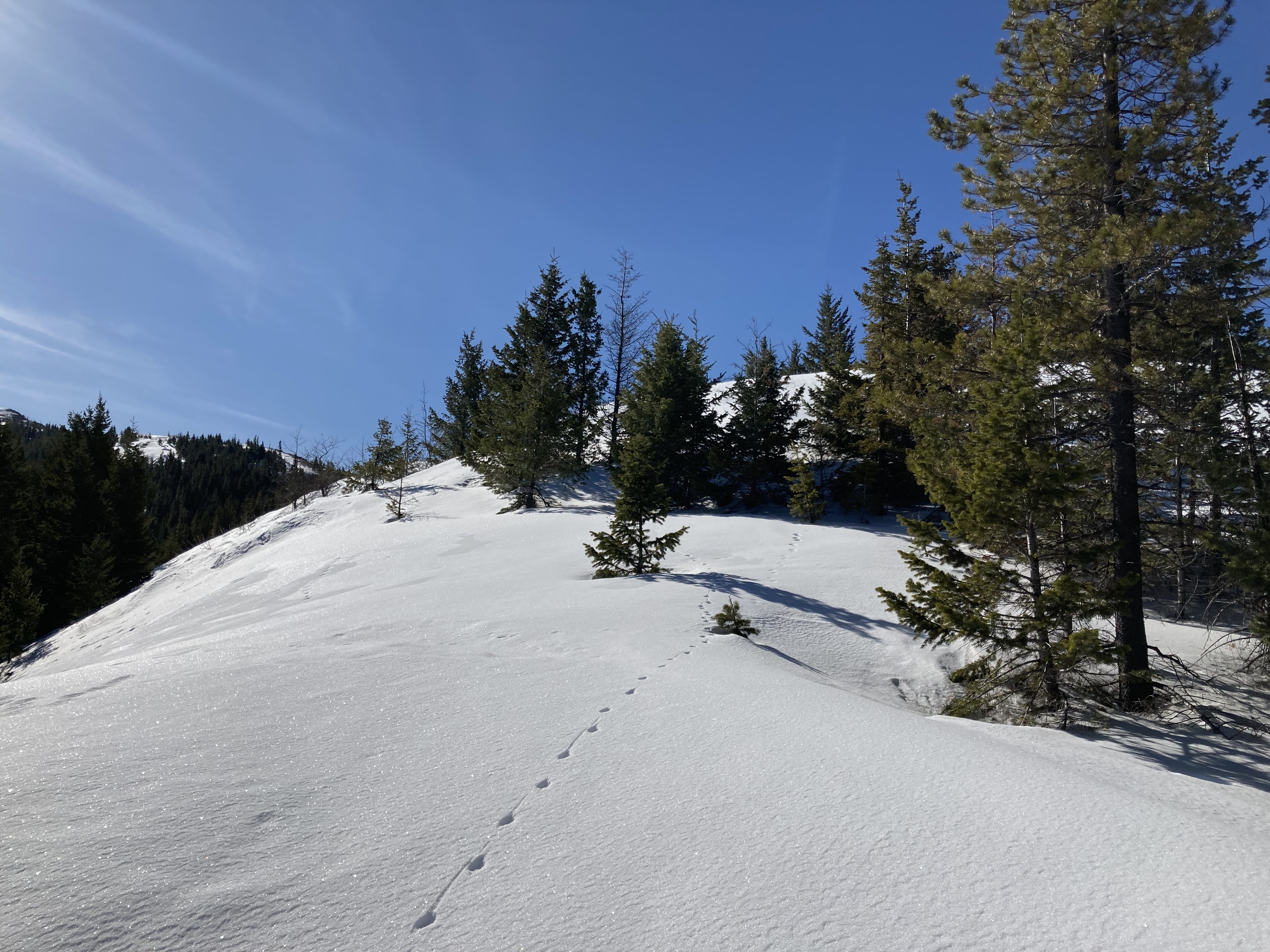
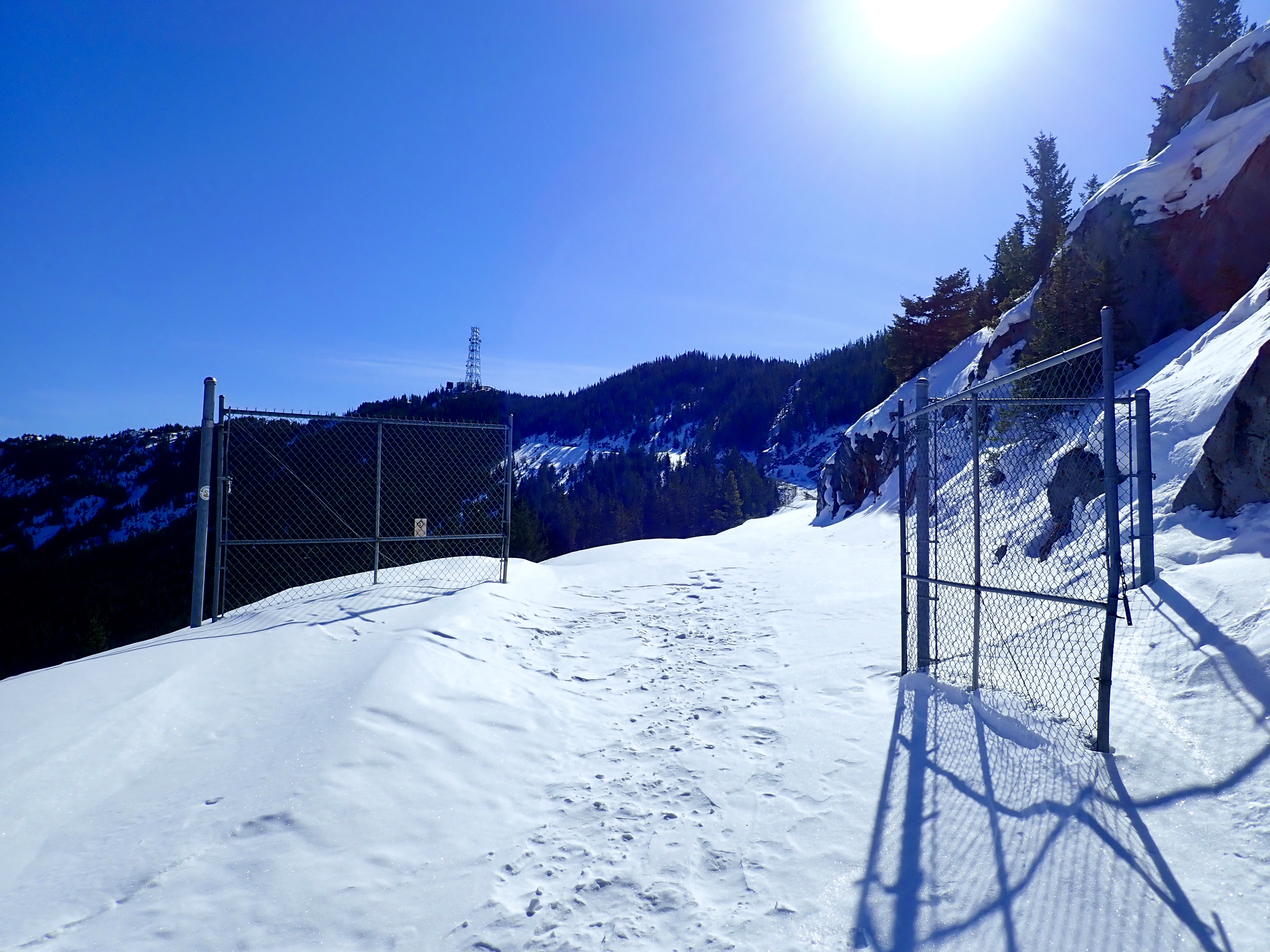
The route starts from the Crowsnest Provincial Park parking area off Hwy 3, just to the west of the Alberta/BC border. There’s a big parking area with some toilet facilities and picnic tables, but it’s closed in the winter. I pulled off the road and parked in the pull-out area outside the locked gate. Click here and Google Maps will drop a pin on the spot. When I was heading to Mount Tecumseh I had my bike with me, so I got onto the old Phillips Pass road where it departed from the western end of the parking lot. Since I was on foot this time, I just followed a path north through the trees from the parking area and got myself onto the road. I followed it eastward until it reached the base of the northwestern toe of Crowsnest Ridge. A very clear and wide cutline proceeded straight up the slope at that point, while the road deviated north to hook around the ridge and stay in the valley.
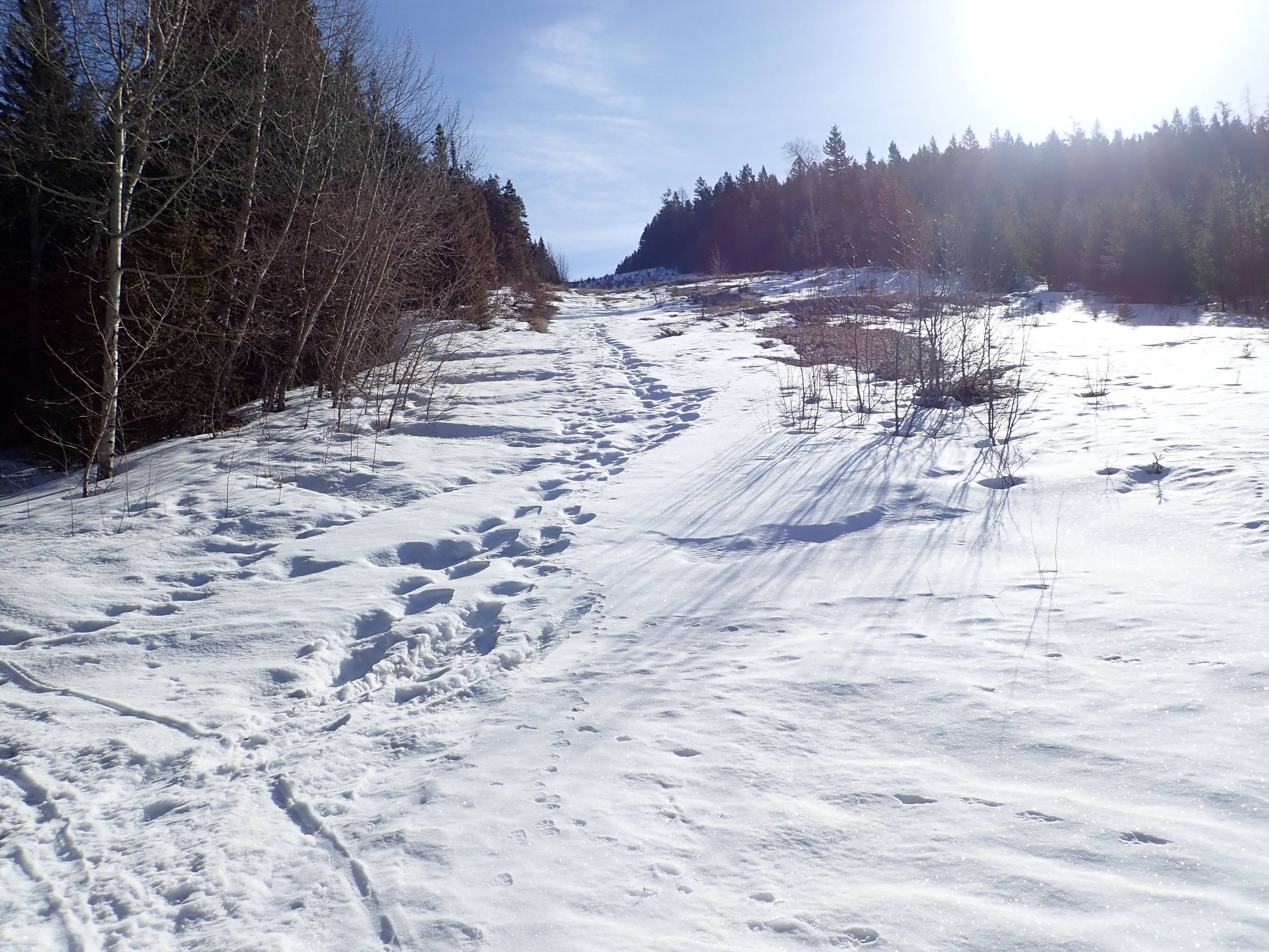
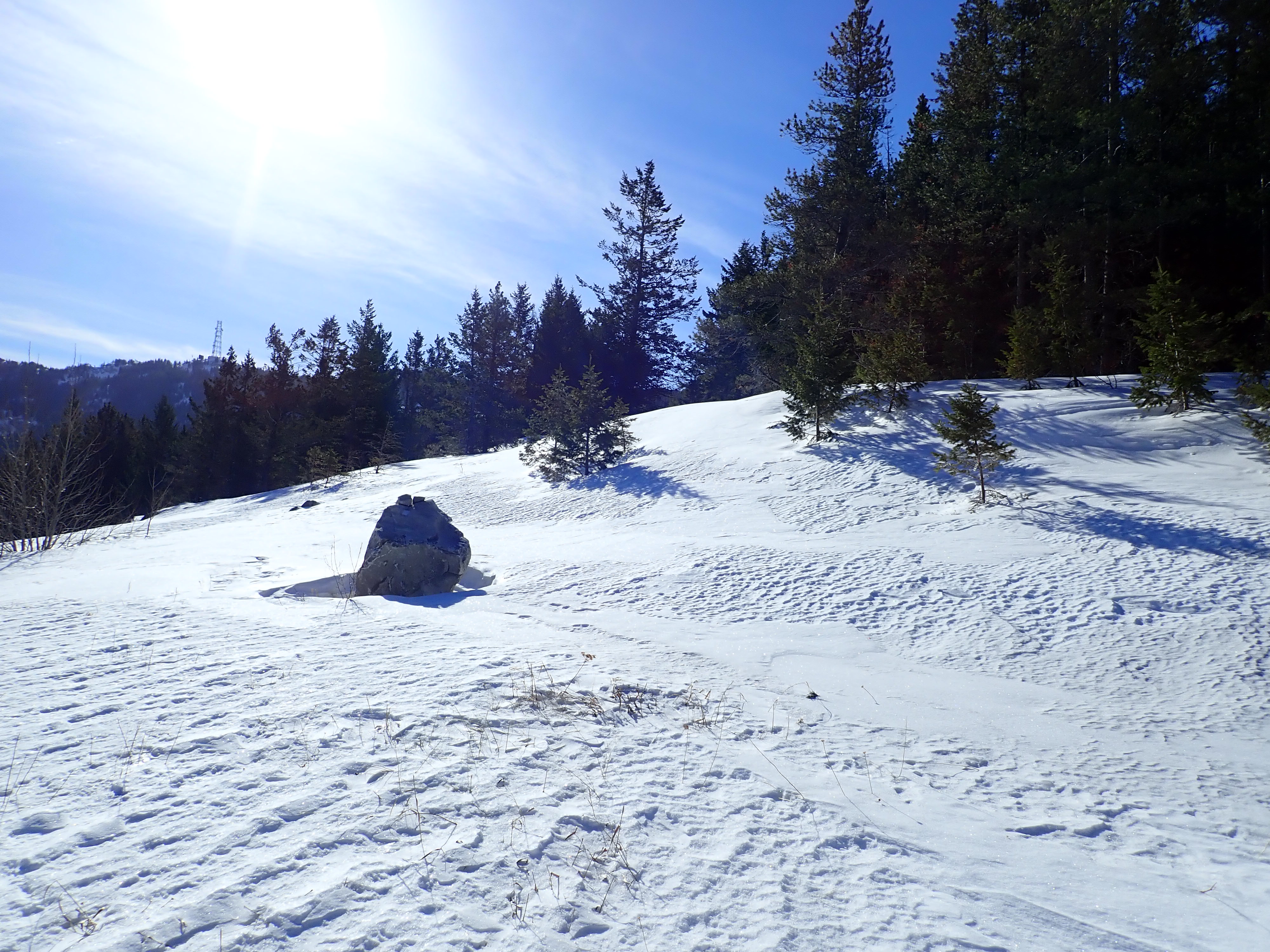
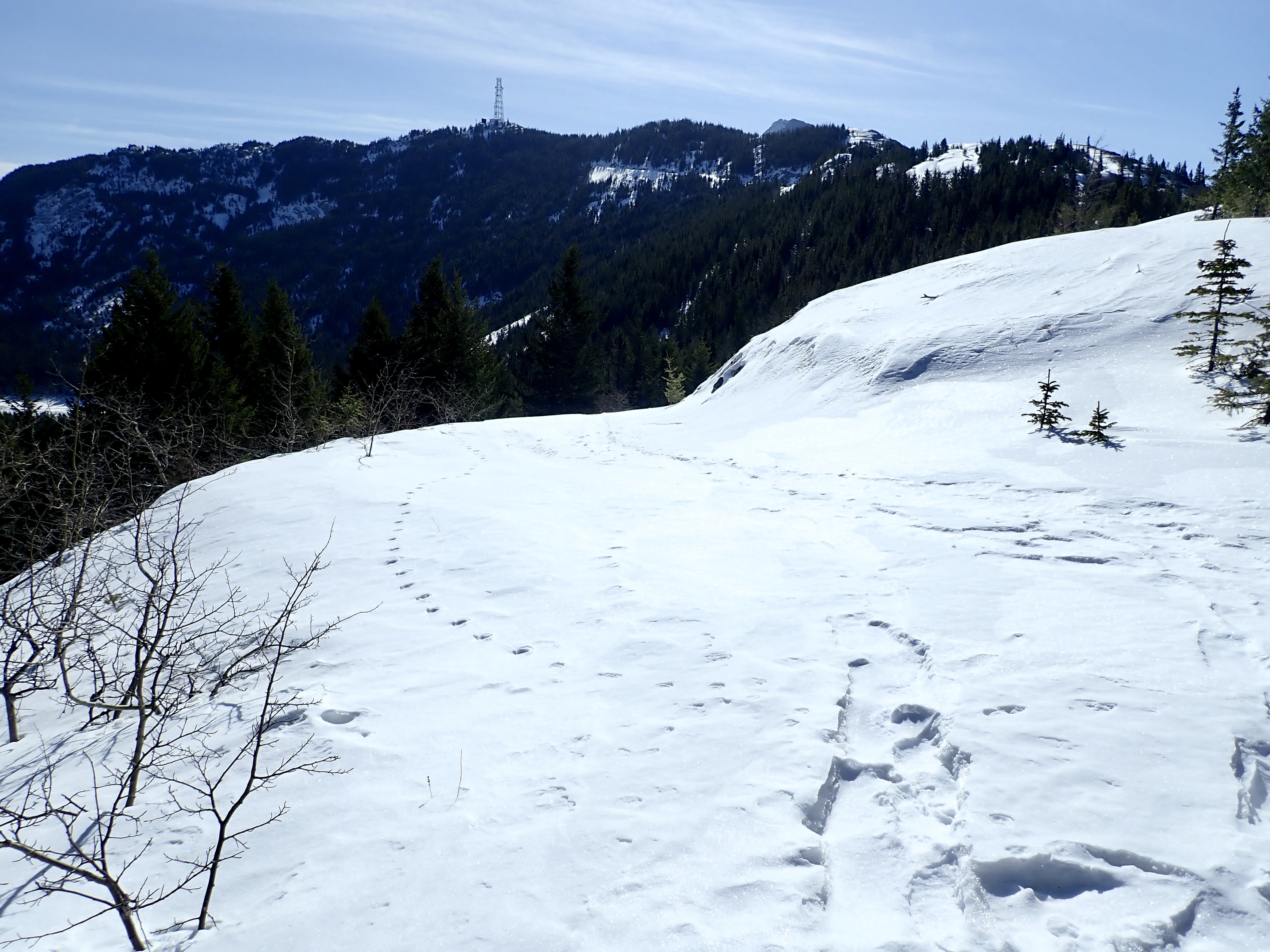
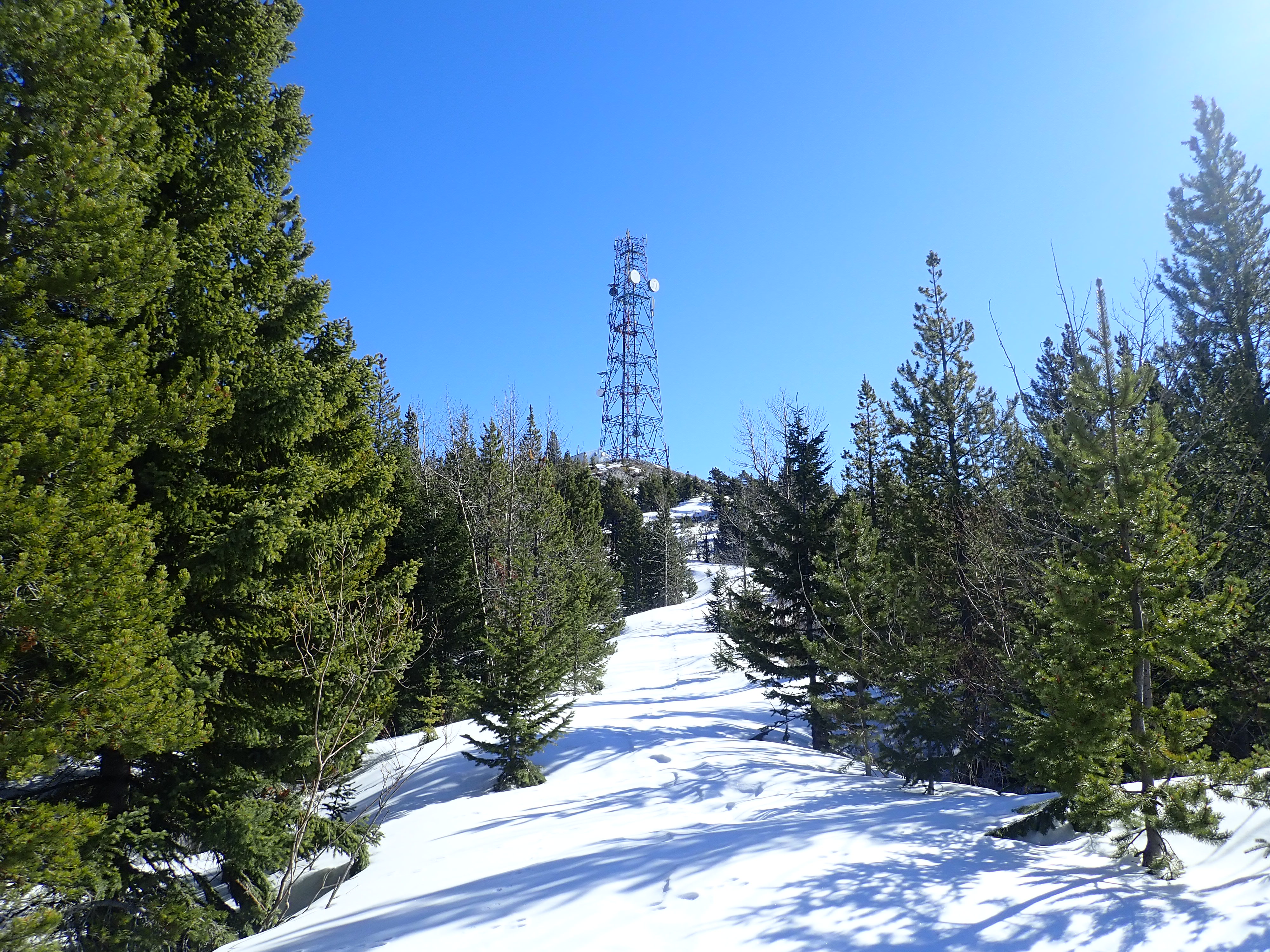
Ascending the cutline made for fairly steep climbing, but it was short lived. The cutline’s apex, where it intersected the wide ridge-top, was marked by a distinctive boulder. Up to this point I hadn’t needed snowshoes, since the wind and warmth had scoured much of the snow from the west-facing slopes. On the ridge and on the leeward side there was still lots of deep snow remaining, so I put my snowshoes on then departed the cutline, heading south and ascending the ridge. Eventually I intersected the snow-buried road as it reached the ridge, and then I followed it to the summit. Spirko had mentioned that staying high on the ridge crest just above the road that wasn’t a good idea since a deep notch part of the way to the summit would require you to down-climb. I can confirm that’s good advice.
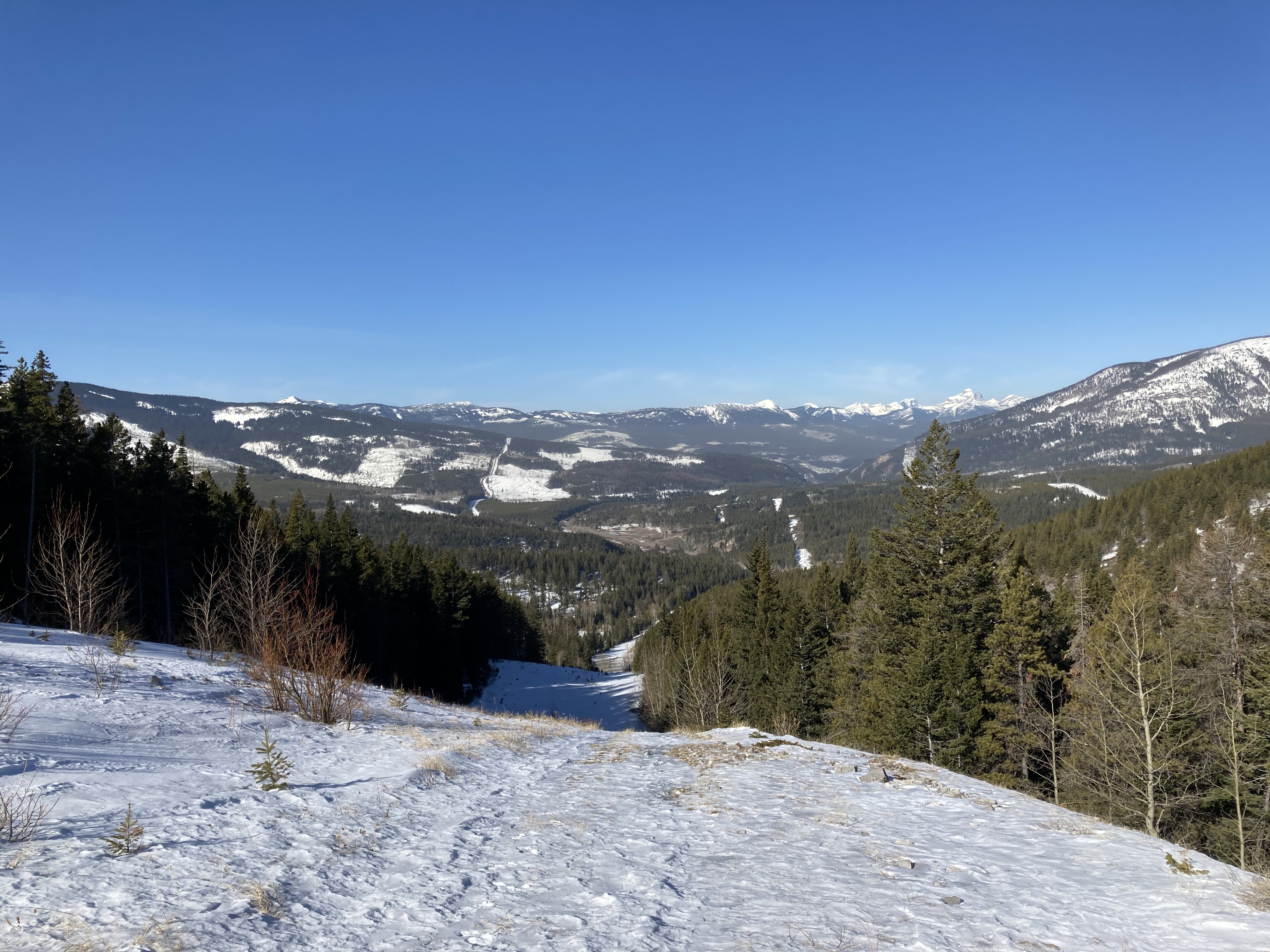
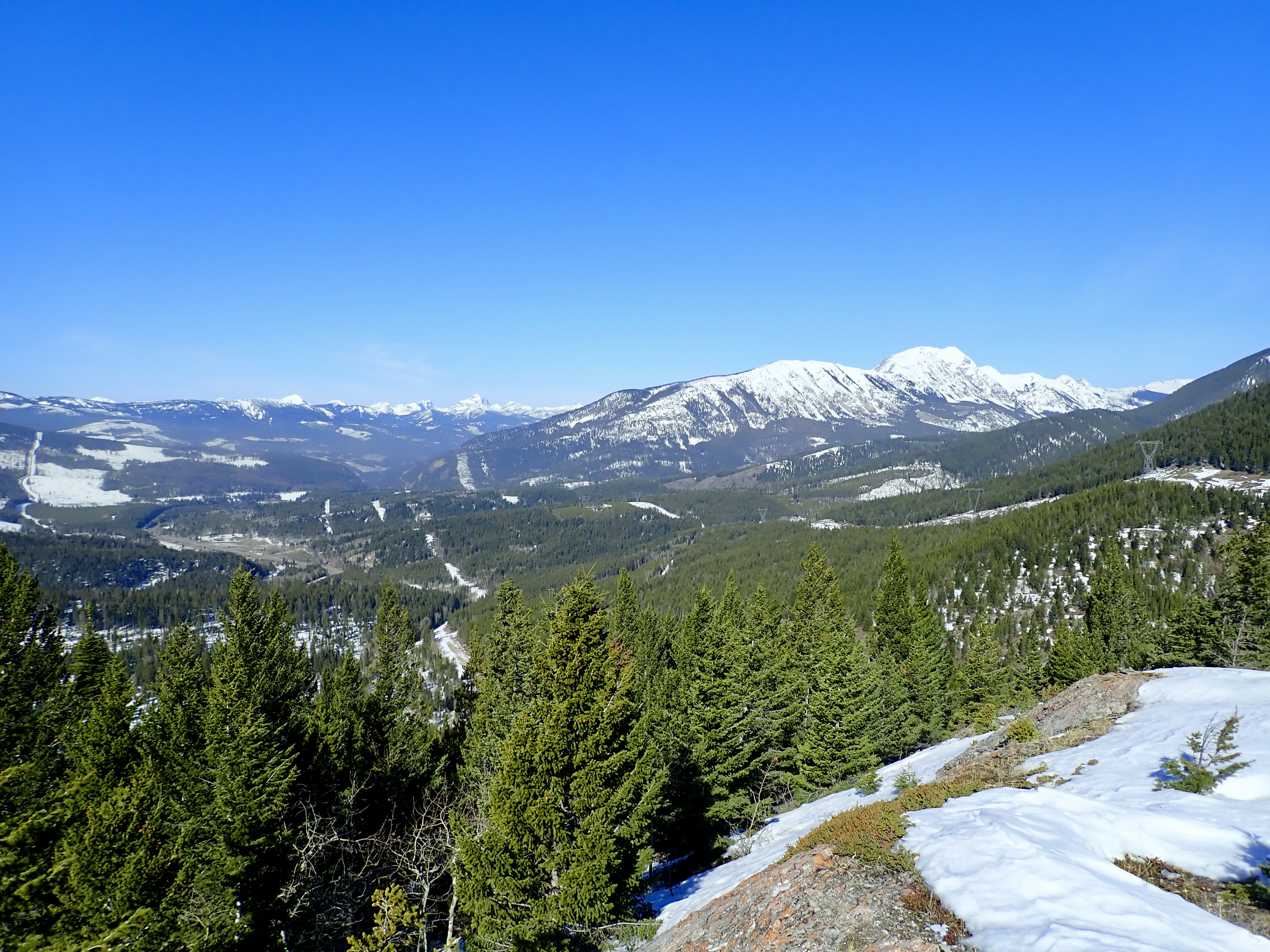
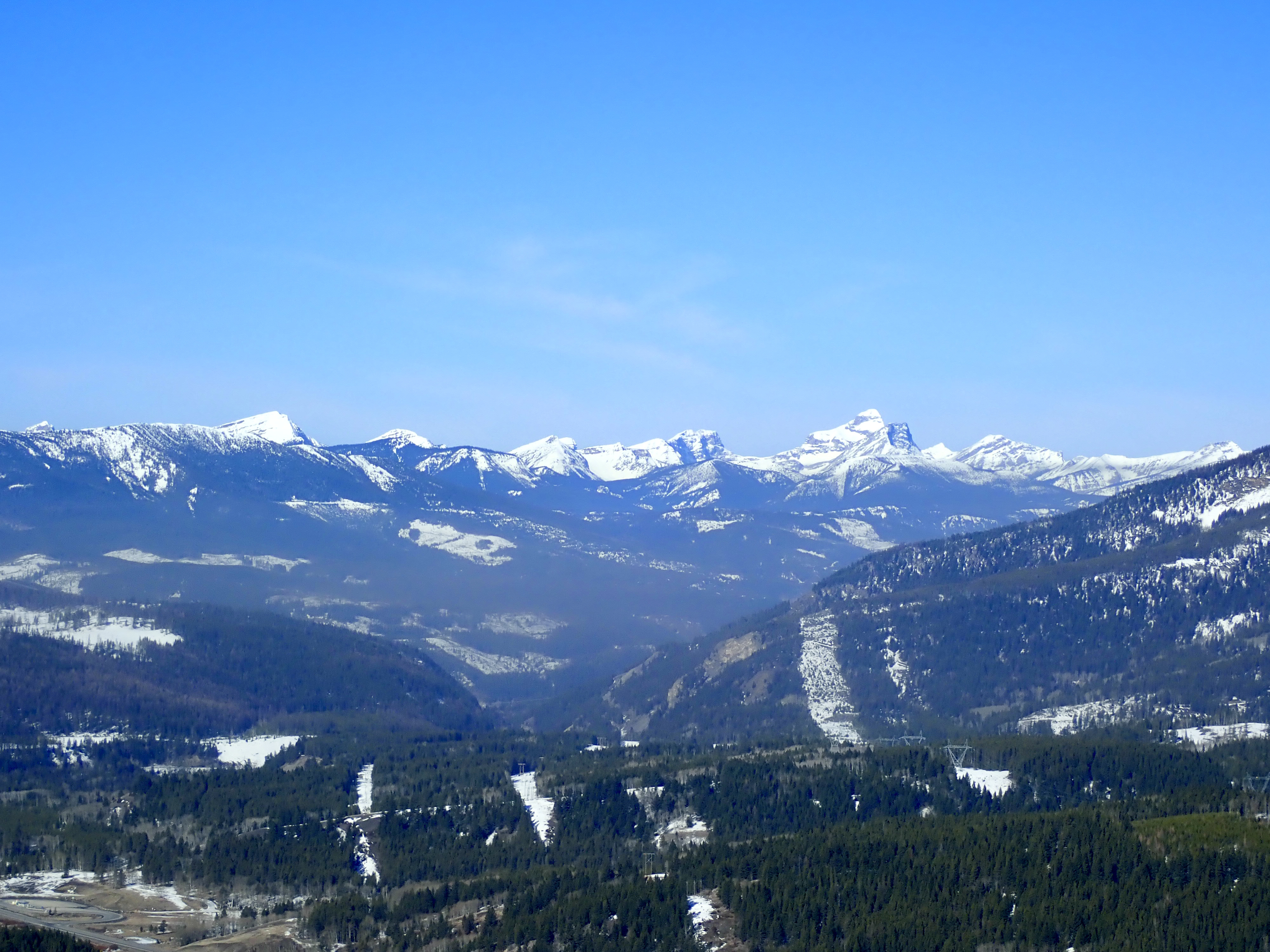
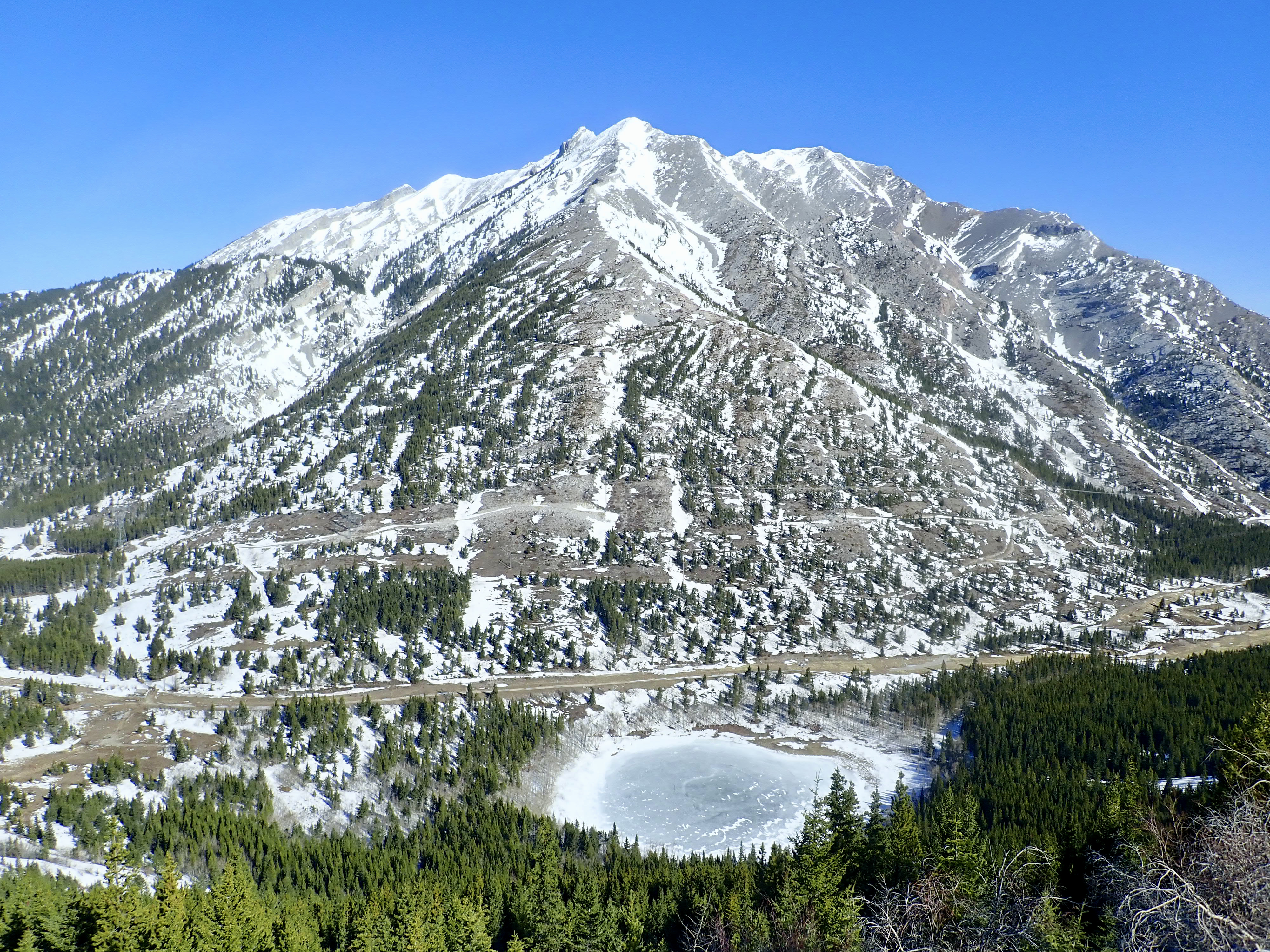
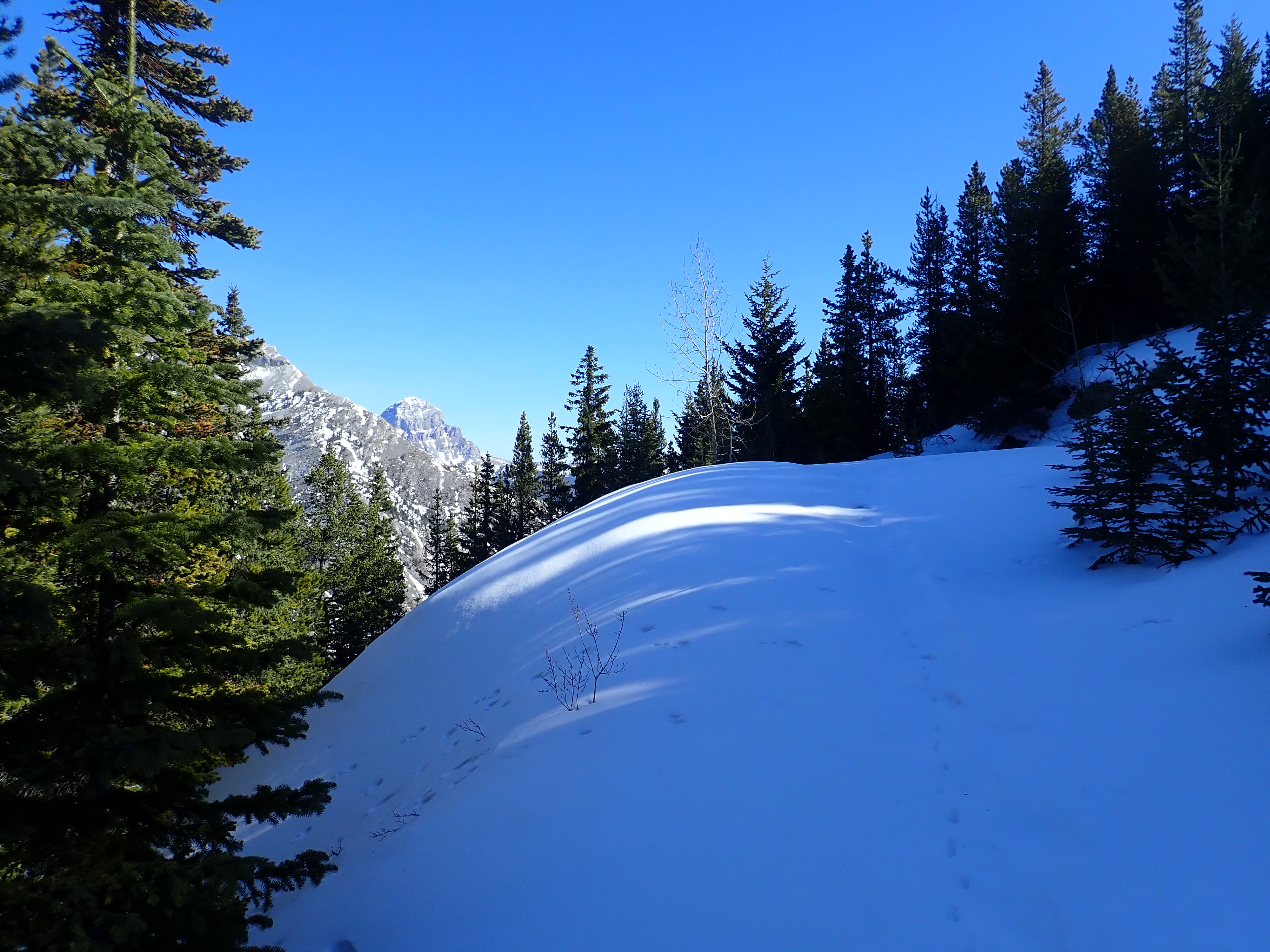
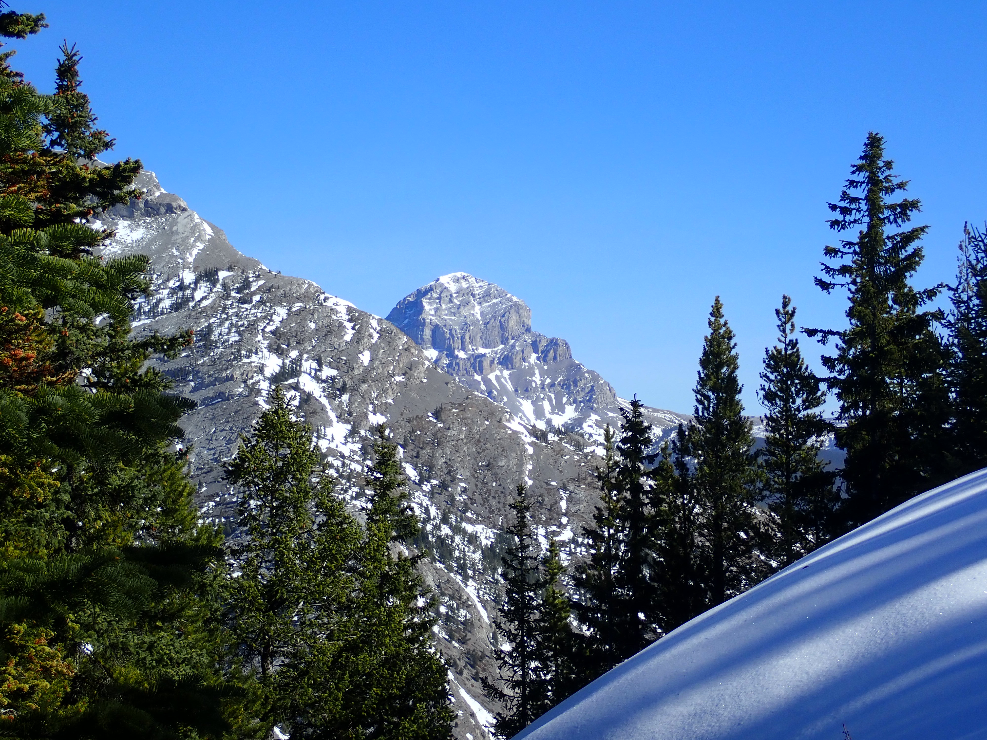
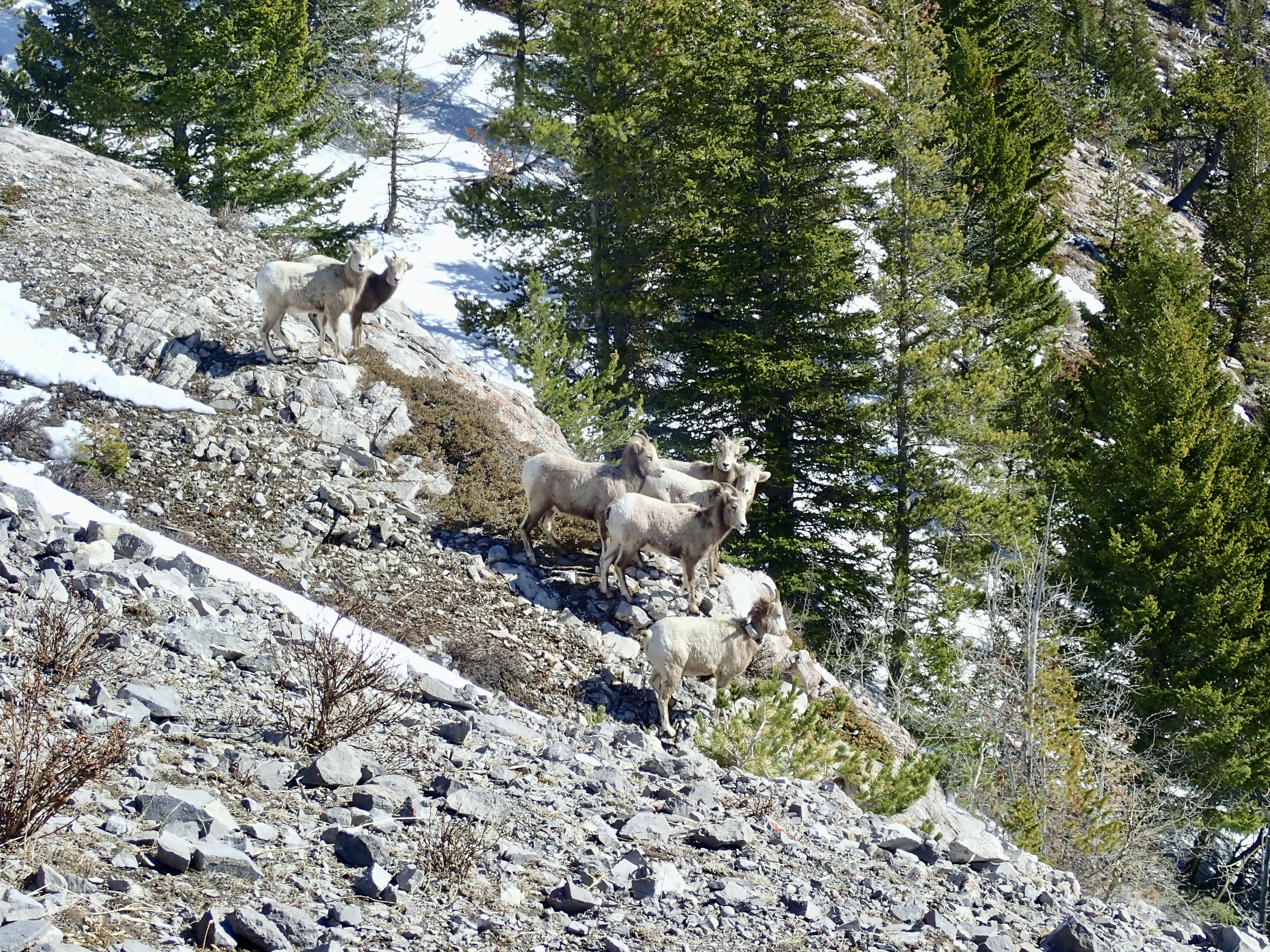
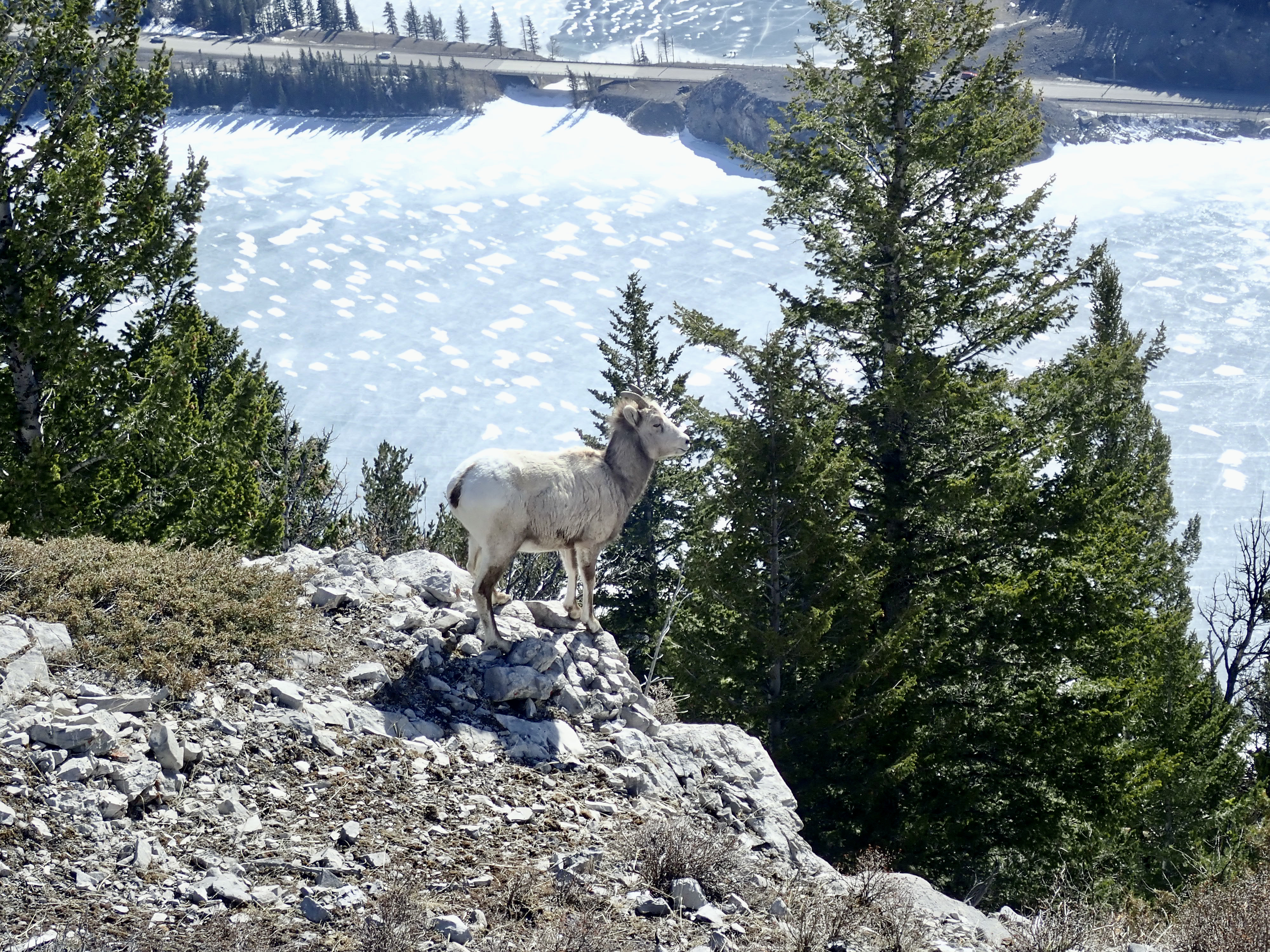
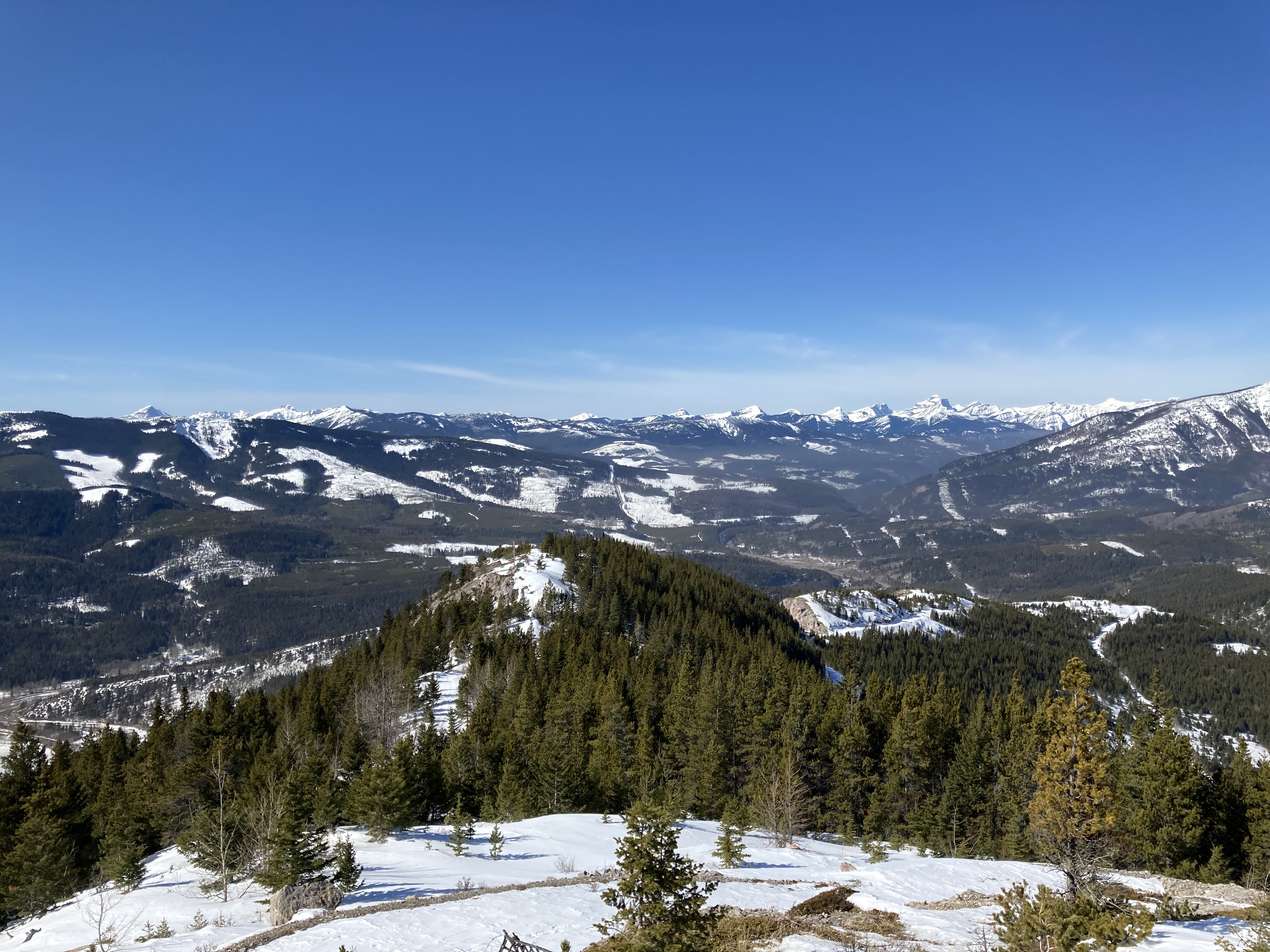
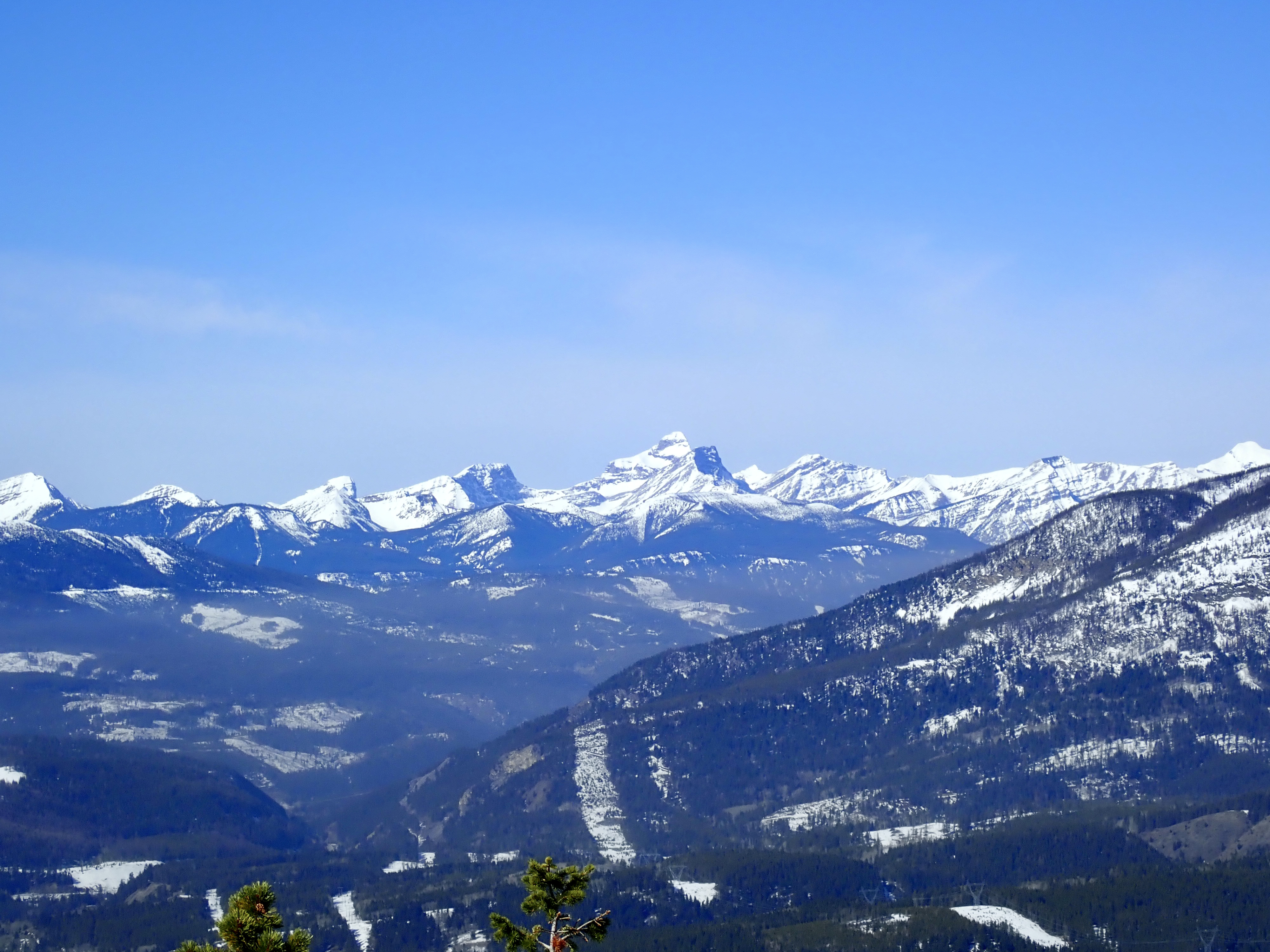
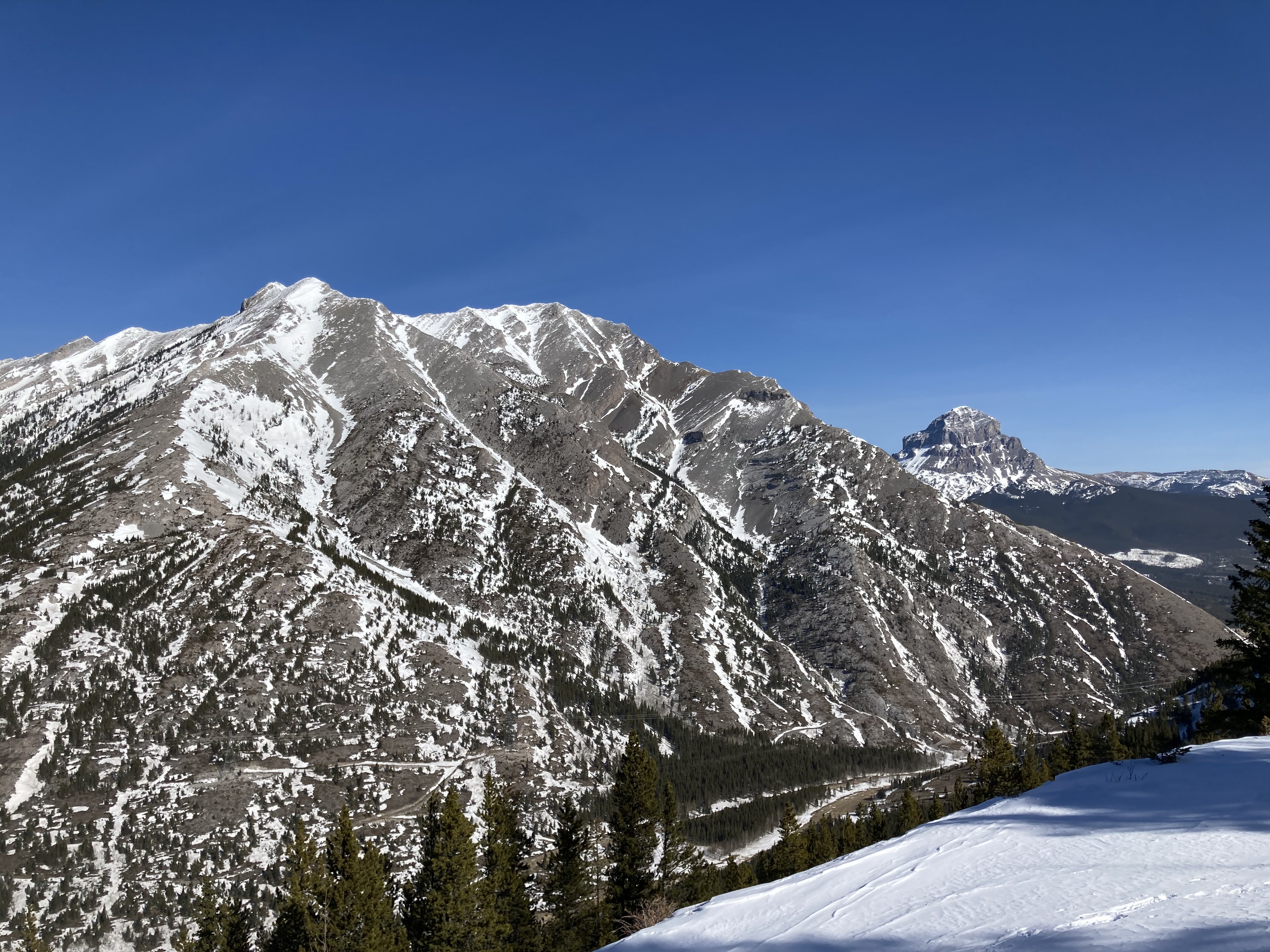
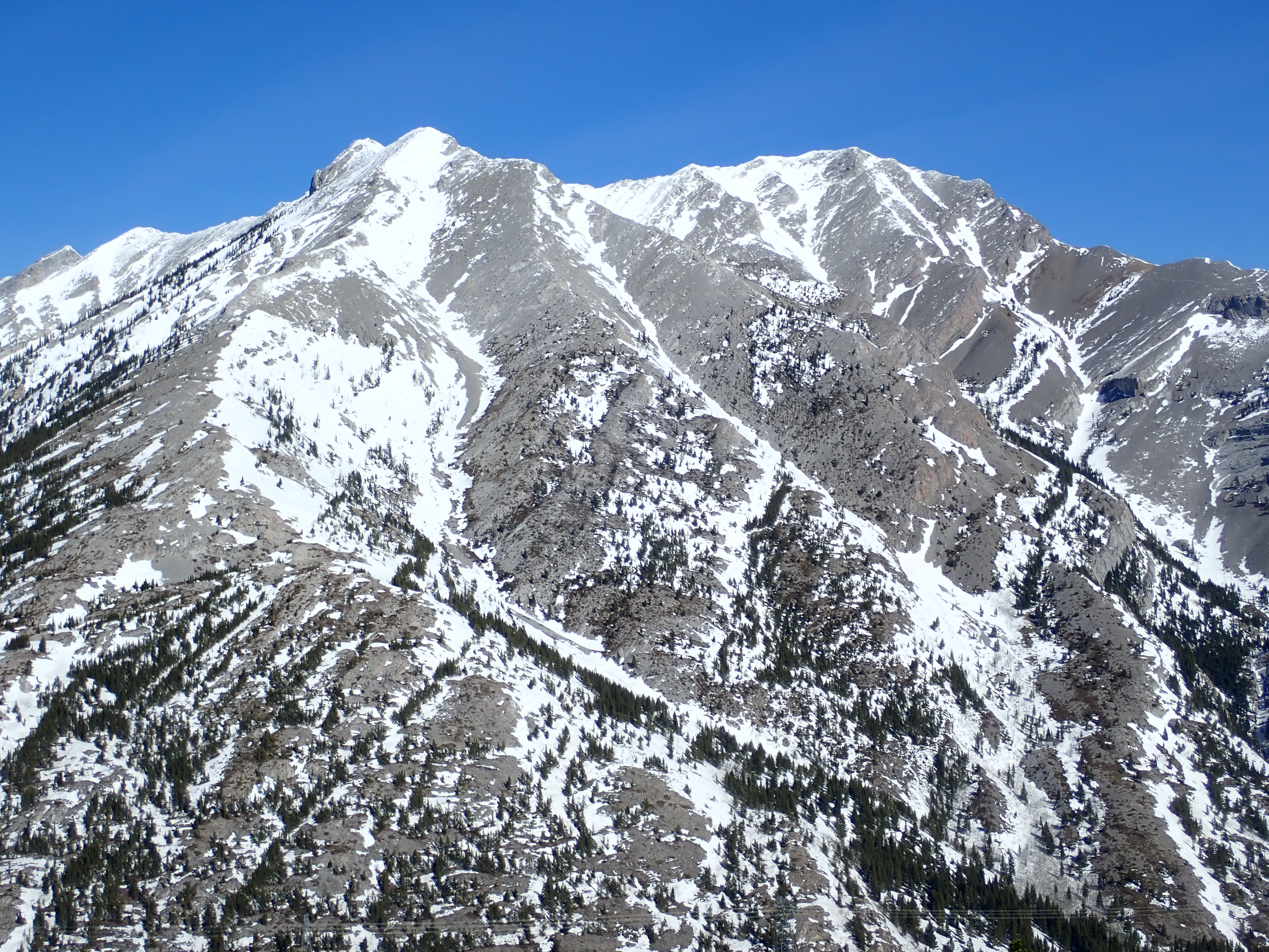
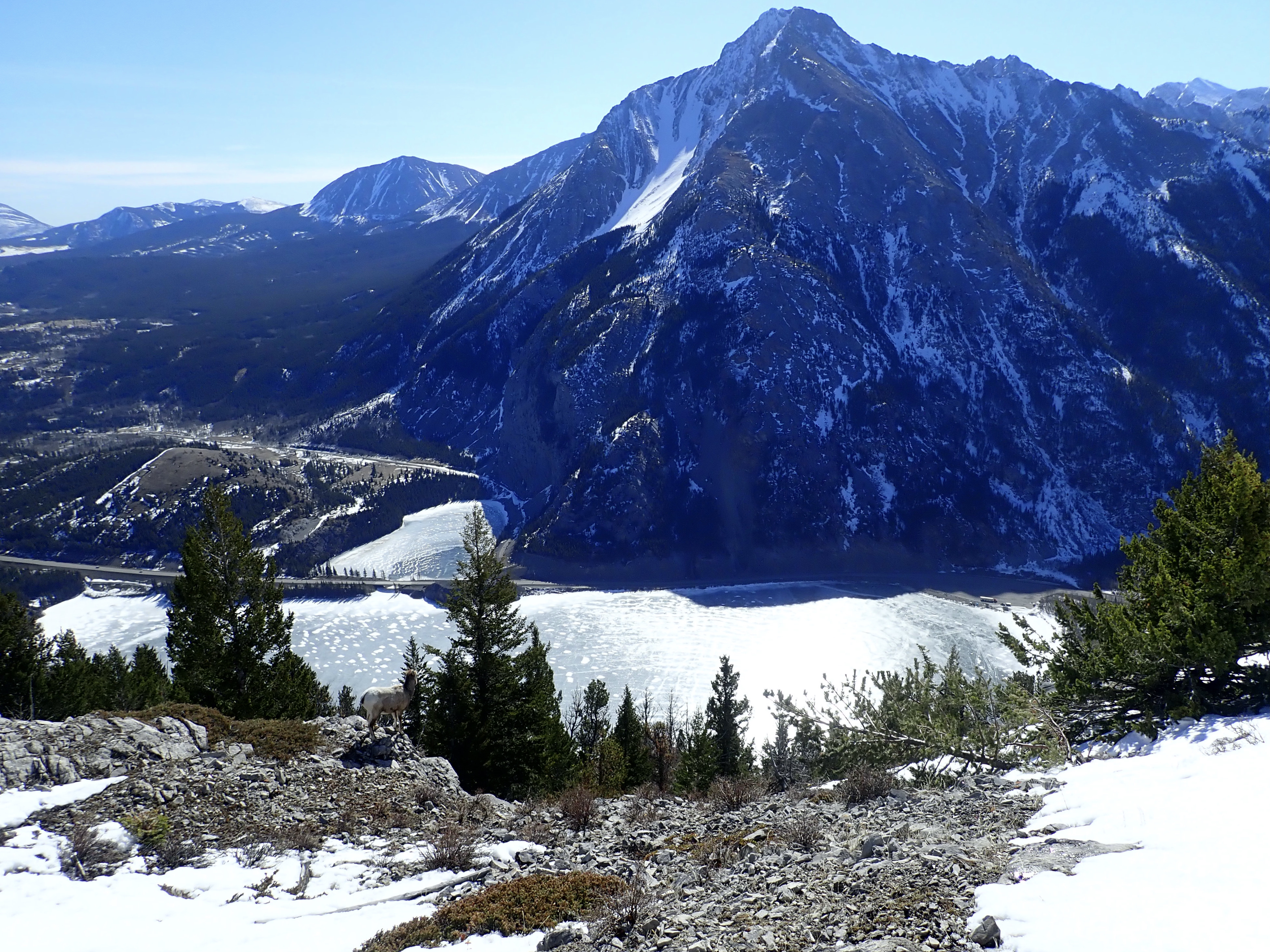
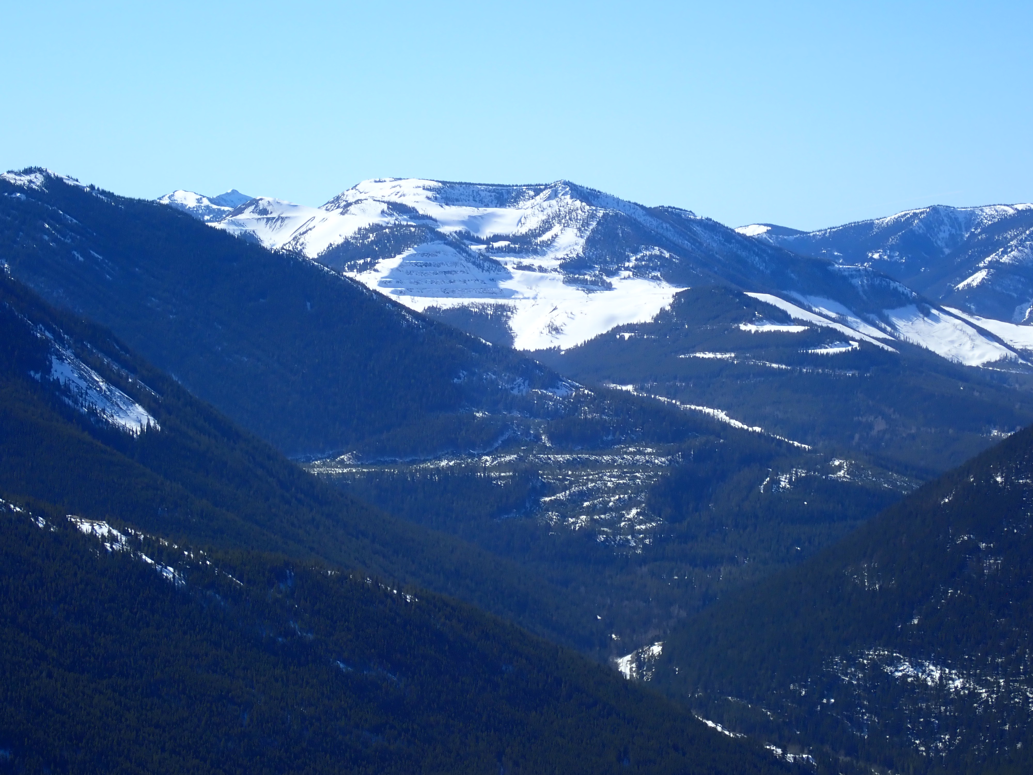
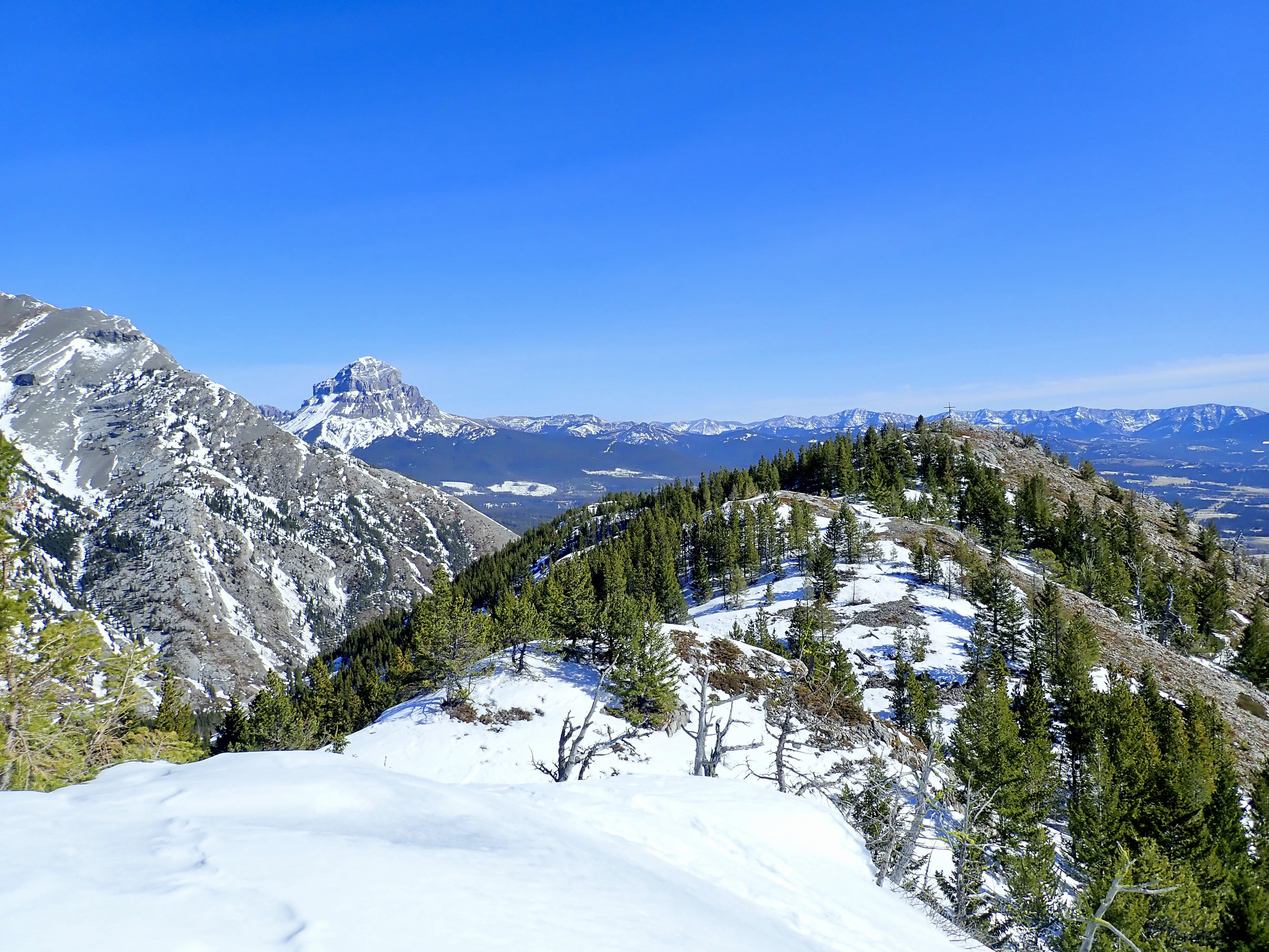
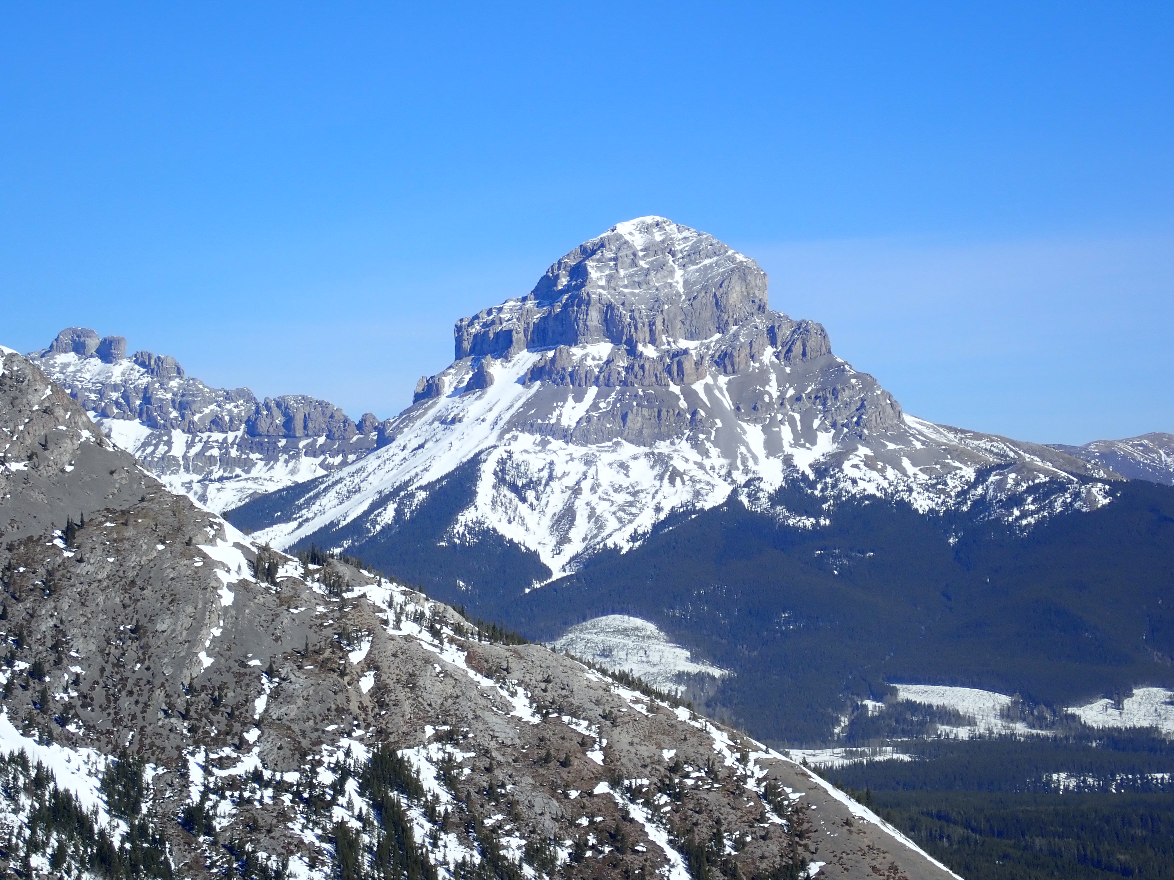
The summit is the site of a giant telecom tower and some service buildings. There’s even a pit toilet up there. The views from the summit were excellent. Mount Phillips and Tecumseh are nearby to the north, Crowsnest Mountain peeks around Tecumseh’s shoulder to the northeast. Sentry Mountain dominates the view across the valley to the south. Directly below the ridge to the south are Crowsnest, Island and Emerald Lakes. Far to the west is the distinctive shape of Mount Washburn.
I was surprised to notice that the lower eastern summit was marked by a very large cross. I’d seen a similar cross at the top of Wedge Mountain, so I imagine it’s the work of some local enthusiasts. I made my way over to the cross just to prolong my stay on the top of the ridge. The view was more-or-less the same, aside from affording a bit of a better angle to see Crowsnest Mountain.
After a nice long stay on top I returned by the same route. Comparing this trip to Island Ridge, I think this ascent was more interesting to do. The views are very similar, but I’ll give the edge to Island Ridge, since its location also provides views of Mount Ptolemy and Andy Good Peak.
Click on the pictures in the gallery below to access full-sized images.

Beautiful pictures of the gorgeous scenery.
LikeLiked by 2 people
Wow, what a stunning landscape!
Crowsnest Mountain looks very interesting! Do you know if there are any established climbing routes to the top?
LikeLiked by 1 person
There’s a well-travelled scrambling route to the summit. I climbed it so long ago that we were carrying a film camera! I’m planning on a return trip soon.
LikeLiked by 1 person
I thought so!
In case you will go back on Crowsnest Mountain and you decide to blog about it, I would love to read through and look at the photos!
Thanks for the reply.
LikeLiked by 2 people
Drive by this little beauty many times over the years and have photos from the turn of the Century Boundary Commission standing where the radio tower is now!
Hope to actually stop and make the climb some day this summer.
LikeLiked by 2 people