February 10 & 11, 2018. Two easy snowshoe trips to the tops of a pair of low mountains in Banff.
I had a conference in Banff over the past weekend, so part of my preparation was making some plans to snowshoe. There was a winter storm which rolled through the province just before the start of the conference, resulting in extreme avalanche hazards throughout the region, even below tree line. This was fine, since I only had 2-3 hours free each day. Long treks into the backcountry wouldn’t be feasible. Luckily, Banff features 2 low mountains which are easily accessible, free of avalanche terrain, and with well-defined trails all the way to the top: Tunnel Mountain and Stoney Squaw Mountain.
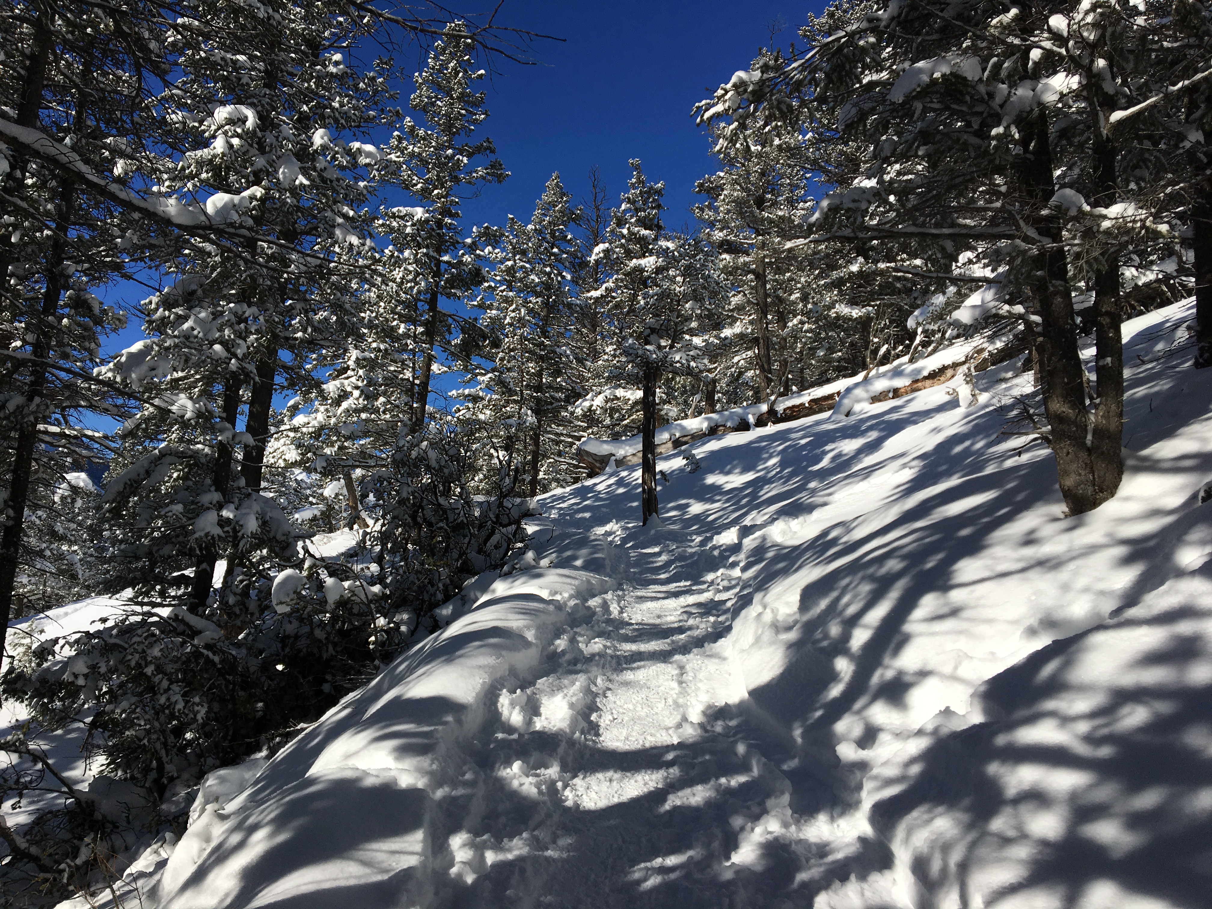
Tunnel Mountain trail is possibly one of the most heavily travelled trails in Banff. In the winter the trail can be icy, so ice spikes or snowshoes are recommended, though I met a few people without either. The route starts at the intersection of Tunnel Mountain Drive and St. Julien Road (ask Google Maps to drop a pin here: 51.172817, -115.558177). Tunnel Mountain Drive is closed in the winter beyond the intersection. When you get there you can park nearby the gate and then set off on the snow-covered road beyond. Very soon, the marked and signed trail head for the Tunnel Mountain trail is reached.
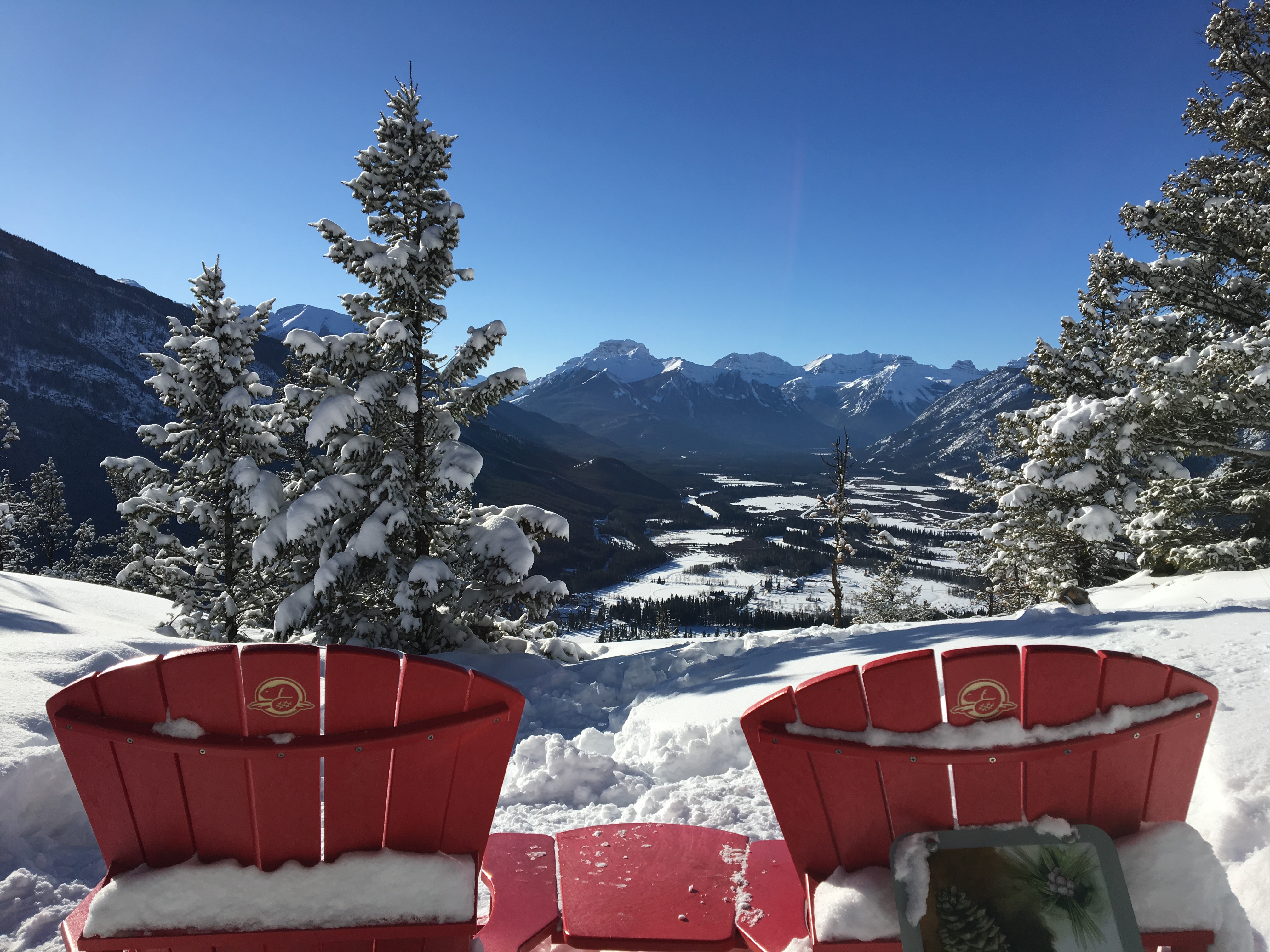
The trail is very clear, rising in a series of switchbacks through the trees, trending generally southeast, then turning to the north above the steep eastern face to reach the summit. Along the way, you first get views directly west down the Bow Valley towards Mount Bourgeon, Massive Mountain, Pilot Mountain and Mount Brett. Nearby, just across the river, you can look down on the Fairmont Banff Springs. Once the eastern face is reached and the trail turns north there are excellent views of Mount Rundle and the peaks of the Fairholme Range across the Bow Valley to the east. The summit is treed, and there’s a nearby sign notifying you that you’ve reached your goal. Enjoy the views for a time, find the red Adirondack chairs, then return the way you came.
Total distance for Tunnel Mountain was 4.5 km with 250 m elevation gain. The round-trip took me 1h 12m. I was moving a little briskly just so I could get some exercise. I encountered no difficulties.
Stoney Squaw Mountain is a very similar trip. The views are not as good as those from Tunnel Mountain due to heavy tree cover. On the other hand, Stoney Squaw Mountain features a loop route so you don’t have to retrace your steps. The trailhead is at the southeast end of the Mount Norquay ski area parking lot. Access is easy from Highway 1, just follow the signs to the Norquay ski area. The road goes up a series of switchbacks and brings you to the parking area. Look for the roofed kiosk at the southeast corner of the lot. There will be an obvious trail with a sign. Incidentally, Google Maps erroneously marks the peak as Snow Peak. I’m not sure how this came to be the case. Snow Peak is located in Kananaskis Country in the Burstall Pass area.
The trail is very easy to follow. There are one or two slightly steep areas on the way up, but nothing sustained. As the trail tops out, there are some decent, but tree-obstructed views of Cascade Mountain and some views across the valley to the Fairholme Range in the distance. As the trail begins to descend there are again some slightly steep areas. Eventually the trail intersects with a broad cut line and turns left, then right into a big clearing looking directly onto the ski slopes of Mount Norquay. Thereafter the trail descends back to the parking area.
Total distance for Stoney Squaw Mountain was 4.6 km with 260 m elevation gain. The full loop took me 1h 37m at a steady pace with a break at the top to take in the views.
Click on any of the pictures in the gallery below to open full-sized images in a separate tab.


One thought on “Tunnel Mountain and Stoney Squaw Mountain”