March 11, 2018. A snowshoe trip up a low mountain in the Crowsnest Pass with moderate elevation gain, in challenging snow conditions.
This is a trip I’ve been sizing up since the beginning of the winter. It’s described by Dave McMurray on his amazing Peaks and Streams blog, which drew the attention of Andrew Nugara, who included it in A Beginner’s Guide to Snowshoeing in the Canadian Rockies 2nd ed. The weather forecast was for a warm, sunny day. Most miraculously, there was minimal wind forecast. I seized the opportunity and hit the road.
Island Ridge sits adjacent to Highway 3, just before it crosses into B.C. Ask Google Maps to drop a pin here: 49.626550, -114.671854. Turn south at that intersection. There’s a mining/logging road there that heads south down the valley. The highway skims past the north end of Island Ridge, but the start of the climb is at the south end. Most of the horizontal distance of this route, therefore, involves walking around to the south side of the ridge so you can begin to climb up. People with a lot of confidence that their vehicle won’t get stuck in the snow can drive a lot of that distance on the road, but I had no such confidence in my Mazda 6 so I parked just inside the turn-off.
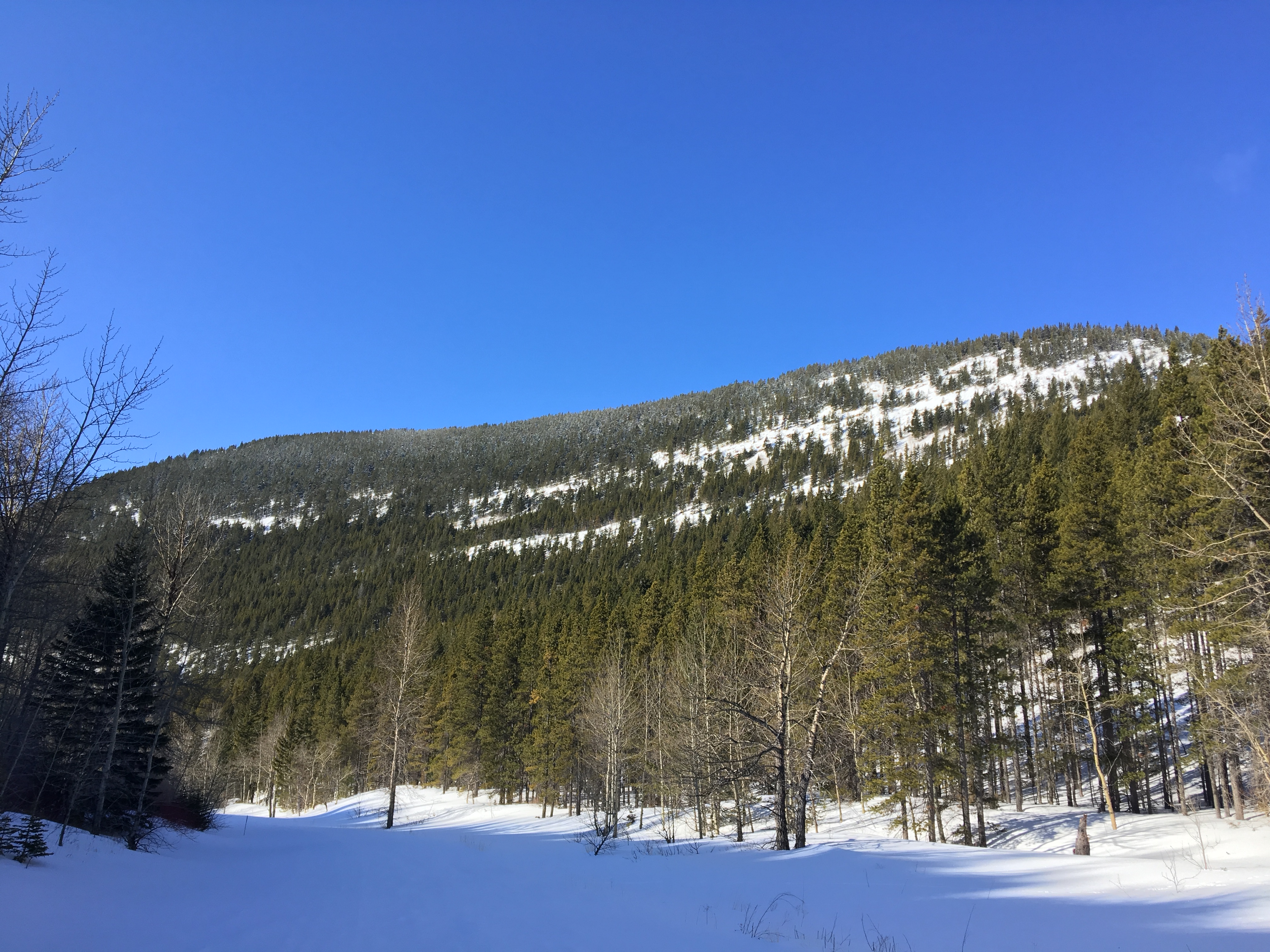
I had the trail to myself the whole day. One set of human foot prints went a short distance up the road then turned back. The rest of the way I only saw animal tracks in otherwise untouched snow. I followed the road as it went south, with Island Ridge to the right, then followed the curve around the south side of the ridge. There’s a clearing there which marks the point to leave the trail and begin climbing. McMurray says he began his ascent at a point roughly opposite the unsigned Ptolemy trailhead. I passed by a trailhead, which was unsigned, and which corresponded to a trail on my TopoMaps app. It turns out this wasn’t the trail McMurray meant, and I think this resulted in my having to deal with steeper slopes than I otherwise might have. I should have continued a short distance more along the main road until I encountered another unmarked trailhead. This would have gotten me closer to the toe of the ridge and possibly saved me a bit of struggle.
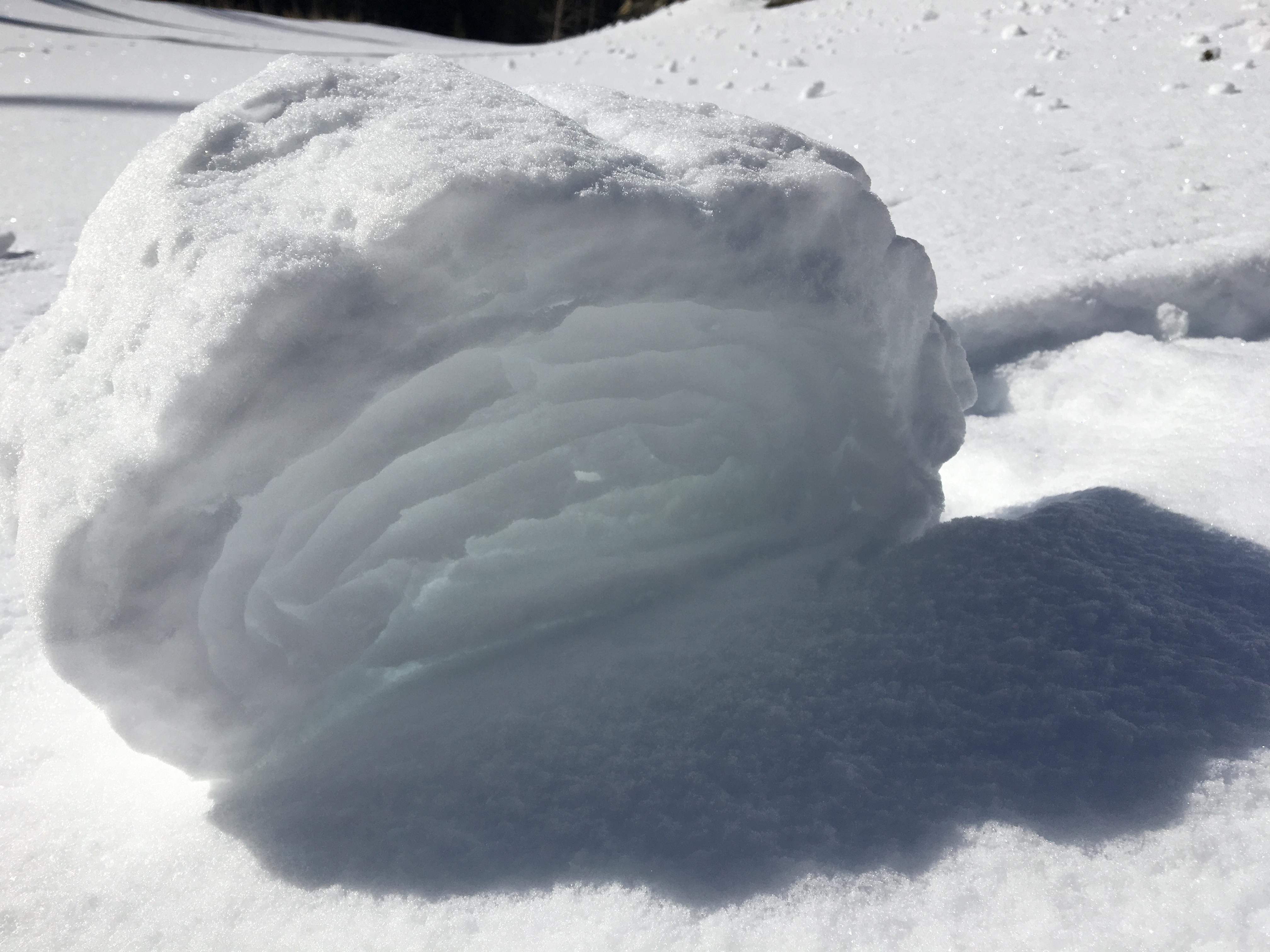
Interestingly, though, there was flagging marking a tree where I started up the slopes, and from time-to-time I would encounter more flagging. I have no idea if this means I was following a trail because the snow was deep. It was very deep, in fact, and soft and wet. Even with snowshoes I’d often sink thigh-deep. My poles would punch through even further. Hauling my feet out of the post-holes sometimes took tremendous effort, so my progress slowed to an absolute crawl until I finally go up on to the ridge.
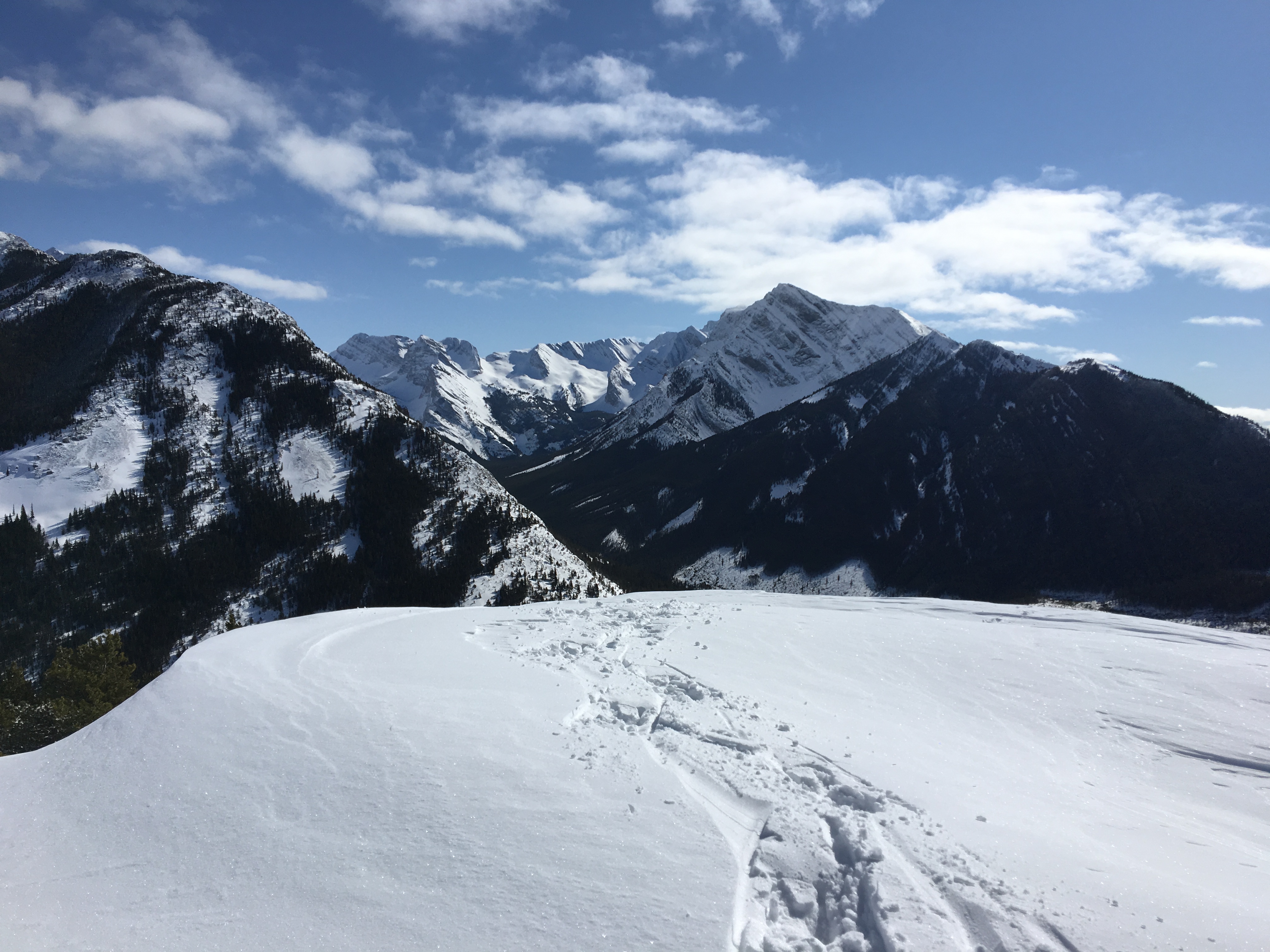
Once on the ridge the snow was still deep all the way to the summit, with the exception being a small zone that had been cleared by the wind. The going was easier, though, as the snow was somewhat more supportive. The views began to open up immediately once I gained the ridge. I reached the summit at 1813m and took in the amazing view looking east through the Crowsnest Pass, with Crowsnest Mountain and Mount Tecumseh to the left and Sentry Mountain to the right. To the southeast were views of snow-covered Chinook Peak, Andy Good Peak and Mount Ptolemy and its outliers.
I followed my own footsteps back down to road. The descent proved to be challenging, too. Most of my steps plunged me deep into the snow, and then my foot would slide downward some distance under the snow – despite the crampons on the snowshoe. Meanwhile my other foot would be firmly lodged down the deep hole created by my last step. The end result was some crazy mountain gymnastics as I attempted to keep all of my limbs moving down the mountain at the same rate. My poles were not helpful in this struggle since they’d plunge even deeper than my snowshoes. I was very pleased to reach the bottom of the ridge.
There was a wide discrepancy between my 2 tracking apps as to exactly how long this route was. MotionXGPS said it was 8.3 km with 526 m elevation gain. TopoMaps said I walked 10.5 km with 442 m elevation gain. Nugara describes the route as 8.4 km with a 440 m elevation gain. It took me 4h 20m to go up and back. Different snow conditions would easily shave an hour off that time.
Click on the pictures in the gallery below to open full-sized images in a separate tab (particularly recommended for the panoramas).


It looks like you had a really nice day in a beautiful landscape and some stunning photos!
Well done
LikeLike
Thanks, Olympus 🙂
LikeLike