March 17, 2018. A rewarding snowshoe trip up to a fire lookout in the Castle Wilderness. (see November 2019 update below for a shoulder-season report, and the May 2020 update for a summer hike with kids report)
- Distance: 9 km round-trip (winter distance due to road closure)
- Total Ascent: 496 m
- Elevation of Objective: 1798 m
- Total time: 3h 6m (snowshoeing)
- Safety and Disclaimer
Carbondale Hill is the site of a fire lookout and is featured as a hiking or snowshoeing trip on a number of blogs, as well as Nugara’s snowshoeing book. I had an unscheduled day and the weather was friendly: calm winds and warm, but cloudy. I figured it was a good day to head up onto this famously wind-blown peak.
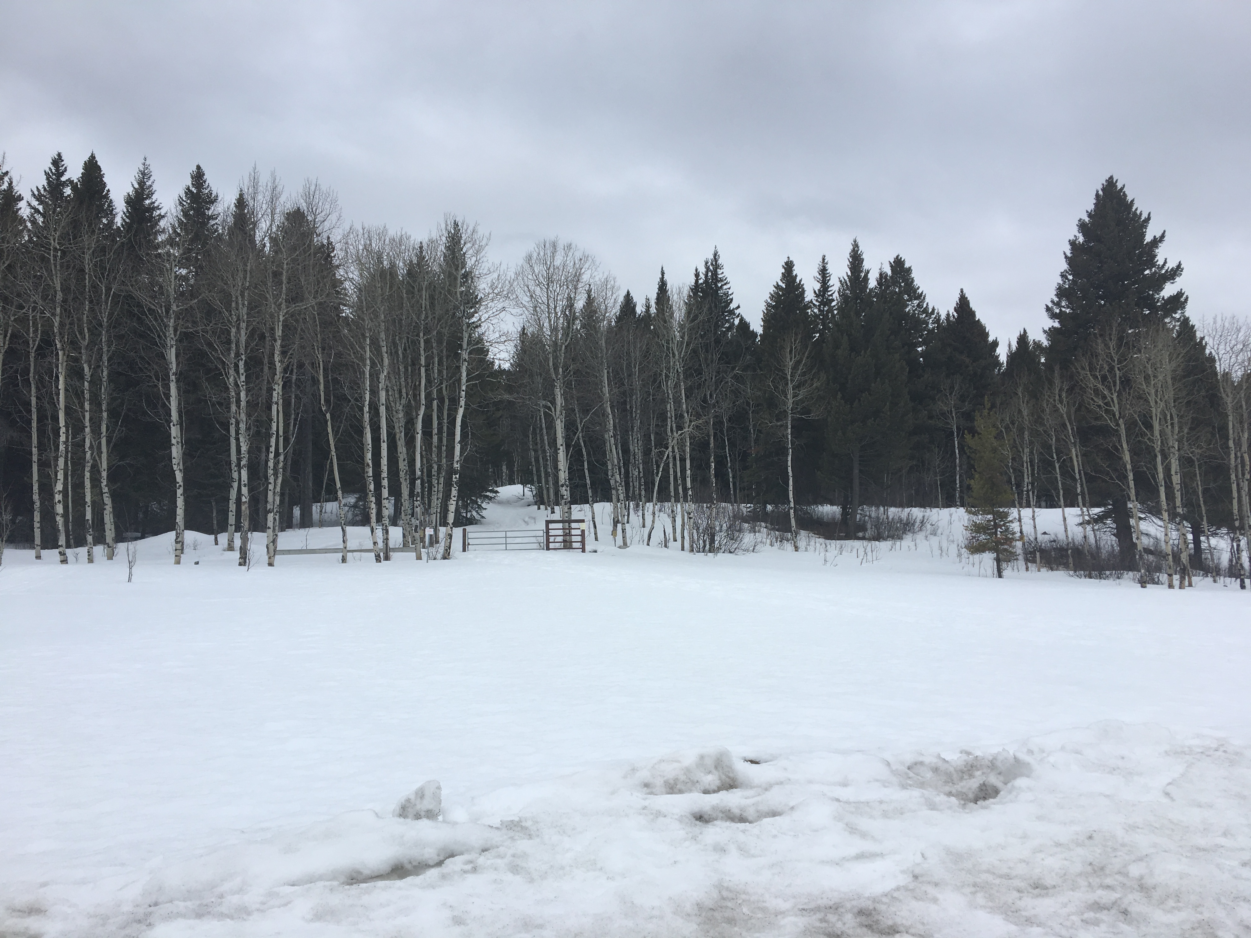
To access, head west on Hwy 507 from Pincher Creek and turn south onto Hwy 774 to enter the hamlet of Beaver Mines. A little over 14 km past the sign telling you you’re leaving Beaver Mines, there’s a right turn towards a trio of campgrounds: Lynx Creek, Castle River Bridge and Castle Falls. Follow this road a short distance to the closed gate and park. Google Maps can guide you there if you drop a pin here: 49.408248, -114.341286
I jumped over the gate and followed the road northeast for about 1.1 km. The road was clear of snow so I stowed my snowshoes on my pack off the start. It was important to bring them, though, because there was very deep snow everywhere but on the road. At 1.1 km a trail came into view, heading into the trees off to the left. It was blocked by another closed gate. This is a rough road, which actually leads all the way to the summit. The alternate route, which I took, was to follow the road for a time then head directly up the ridge.
The snow on this road was roughly 3 feet deep (based on the plunging footprints of many deer), but there was a decent upper crust and the lack of direct sunshine meant that the snow wasn’t soft when I was hiking up. My snowshoes kept me on the surface of the snow with no problems. The road starts out heading roughly north, then turns slightly northeast and finally swings around to the west as the route becomes a little steeper. At roughly 3 km there is an obvious break in the trees to the left (south). This leads to viewpoint which looks south across the valley.
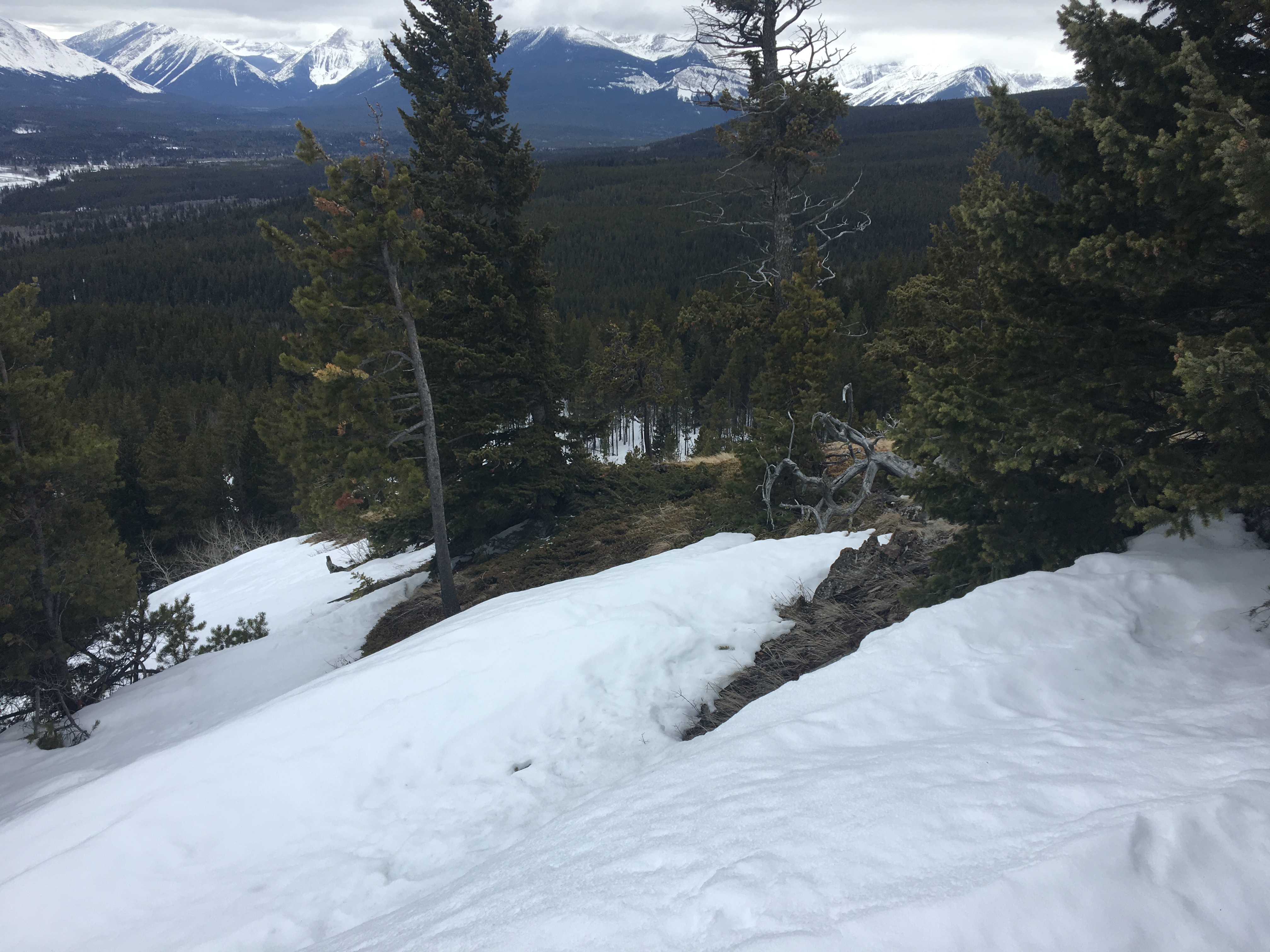
Not far beyond this spot on the main road, the trees to the right (uphill) thin, and the route up the ridge becomes obvious. I turned right and started climbing. I found that there was good, very supportive snow over most of this route provided I stayed toward the eastern side of the ridge. The snow as completely gone just a few meters west, on the wind-ward side of the ridge. It was preferable to stay on the snow. It was smooth and supportive, resulting in easier travel than on the uneven, brushy and rocky ground.
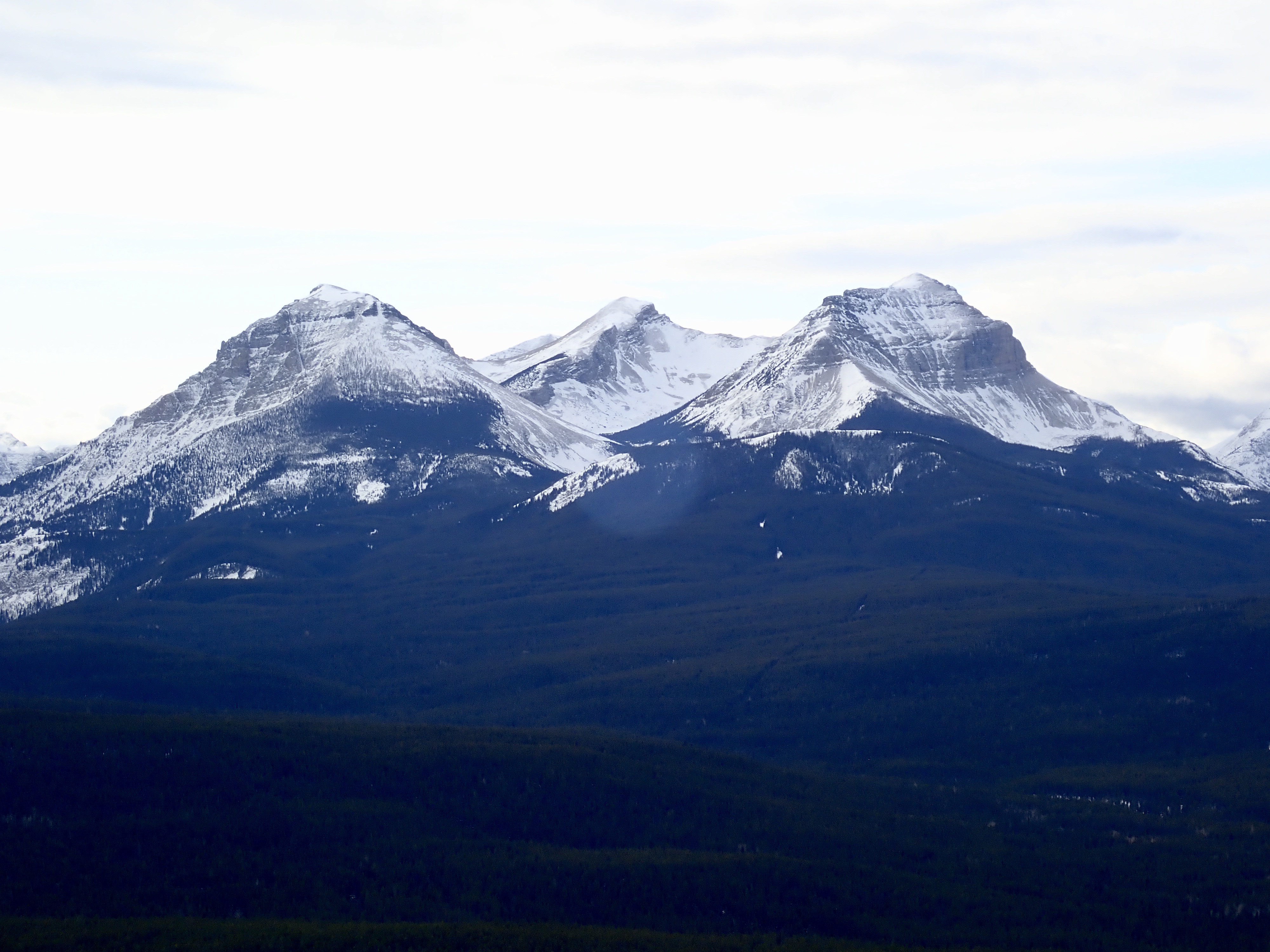
As I neared the summit, I saw the famous cornices of Carbondale Hill. They were an impressive sight, and I had to remind myself to be careful not to stray out onto one in an attempt to get a good view of another one further up the hill.
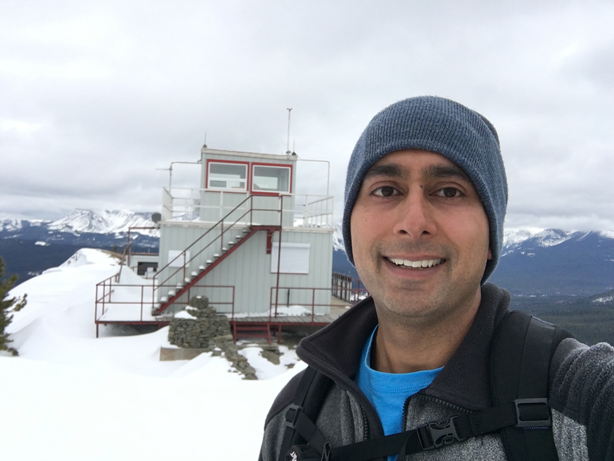
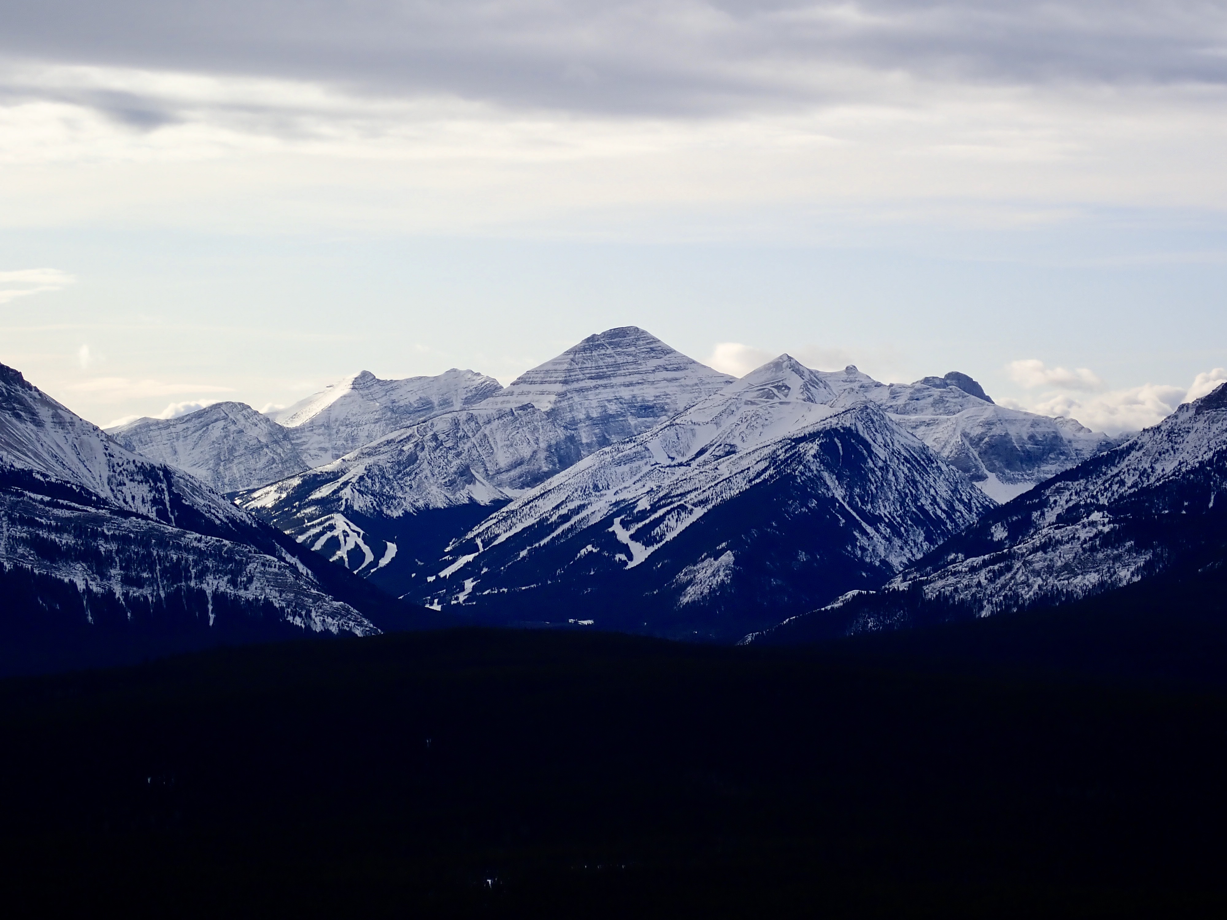
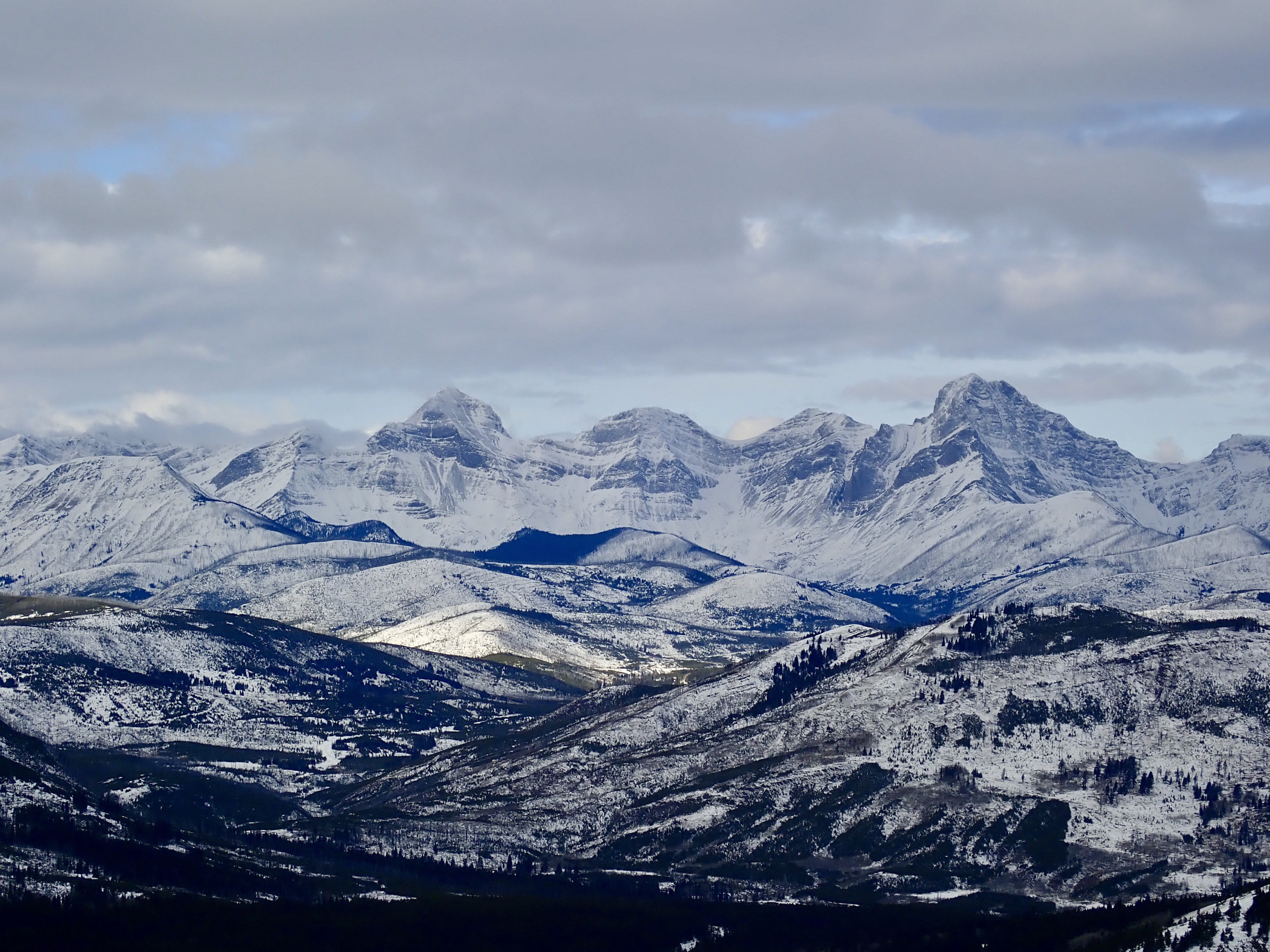
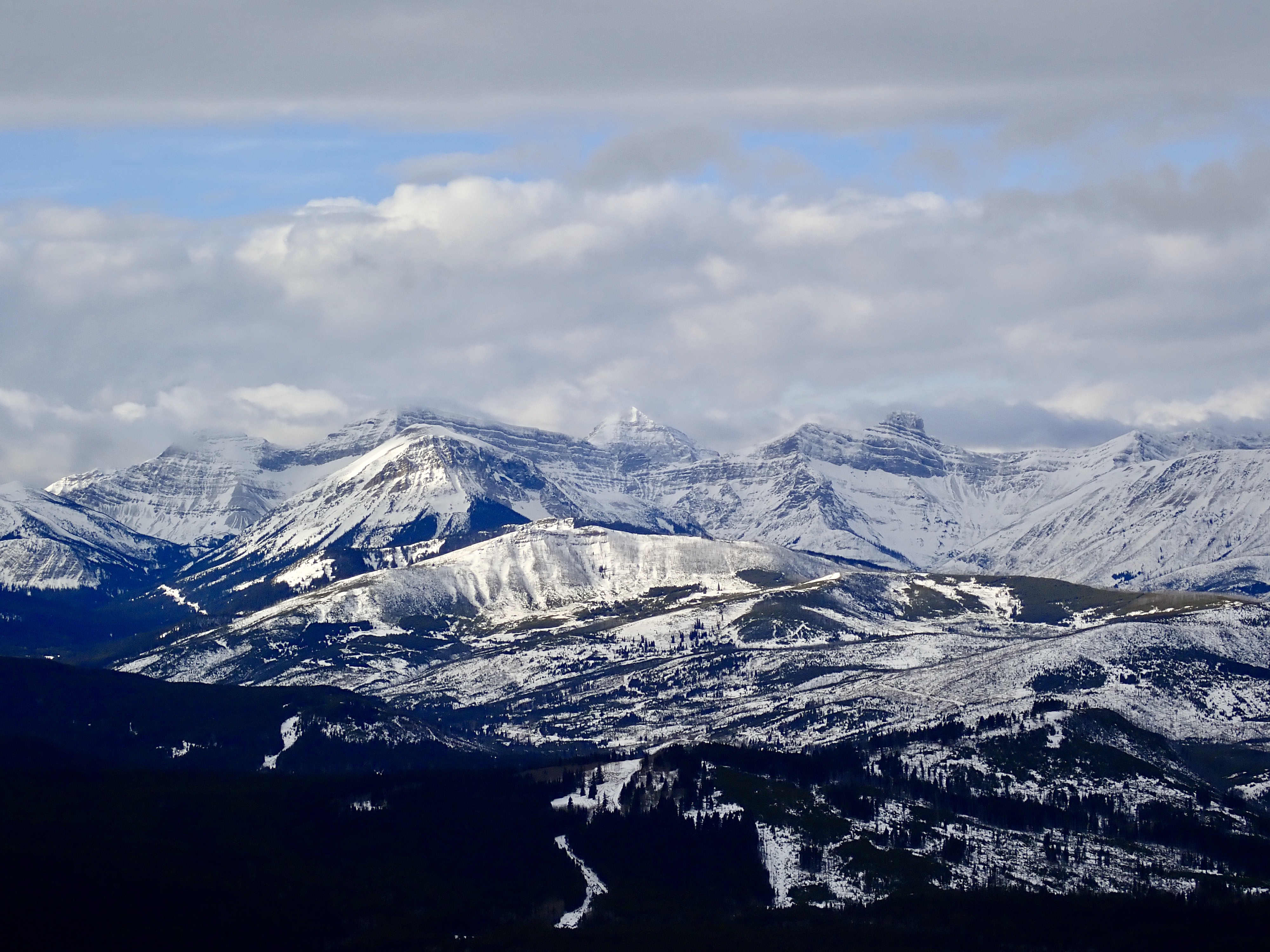
I reached the lookout at the top with no difficulties. It wasn’t manned, but I stayed off the deck. I sat out on the wooden helicopter pad to eat my lunch. I could view in to the far distance in all directions, but because of low clouds I had limited views of the rocky tops of the mountains. I imagine the view would be pretty great on a clear day. This must be a popular place for summer hikes. After lunch, I took the same route back down.
November 2019 update: I climbed this as a shoulder-season excursion on November 25, 2019. There was snow along the route, but not deep enough to warrant snowshoes. I was interested to see that the closed gate mentioned in my description above was open. The closure happens on December 1, I guess. There was still a sign forbidding “unauthorized” travel, though. I didn’t know what to make of that so I just parked near the gate. There’s no other notable update regarding access. One new thing I did encounter, though, was that someone has put up a bunch of flagging near the top of the ridge where the cornices develop. Perhaps this is with the intention of keeping people on solid ground and off the cornice snow, which is definitely a good thing. Just keep in mind that flagging comes and goes for a variety of reasons, so don’t rely on it. I managed to get some better pictures on this outing as compared to my first thanks to my new TG-5 hiking camera.
May 2020 update: I did this trip along with my daughter and a couple of other families on May 30, 2020. The winter gate was open, so we could drive to the start of the trail which I describe above. This knocks about 1.1 km off the beginning and end of the trip. However, we followed the road all the way up instead of deviating onto the ridge as I’d done before. This meant the total distance still ended up being 8.8 km. The start of the trail is presently marked with a little kiosk, though there was nothing posted on it. Following the switch-backed road route, this >400m ascent was well within the abilities of motivated 8-12 year-olds. The round-trip time including lunch at the summit was 3 hours.
June 2022 update: There is now a roomy gravel parking area at the summer trailhead, which is very nice. On the downside, it seems you can no longer closely approach the lookout or helicopter pad.
Click on the pictures in the gallery below for full-sized images.


I am always grateful for your trip descriptions. You’ve supported me and friends many times. Thank you!!
LikeLike
Thank you, Gloria. I’m glad the blog has been useful for you!
LikeLike