January 13, 2019. A tedious climb to a low summit in the Castle Wilderness.
Distance: 6.25 km round-trip
Total ascent: 478 m
Elevation of objective: 1800 m
Hiking time: 3h 13m
Steep, uphill bushwhacking. Barbed wire. Copious deadfall. Traveling through trees. Bare ground alternating with thigh-deep snow. These are the features that await on Mount Backus.
Mount Backus isn’t a particularly interesting peak. I’m not sure why it, of all the low peaks along Highway 774, attracts hikers. Perhaps the other low peaks don’t have treeless summits. The summit view from Backus is amazing, but it’s the same summit view you’ll get at the top of Carbondale Hill. But whereas Carbondale Hill made for a pleasant climbing experience, Mount Backus was anything but.
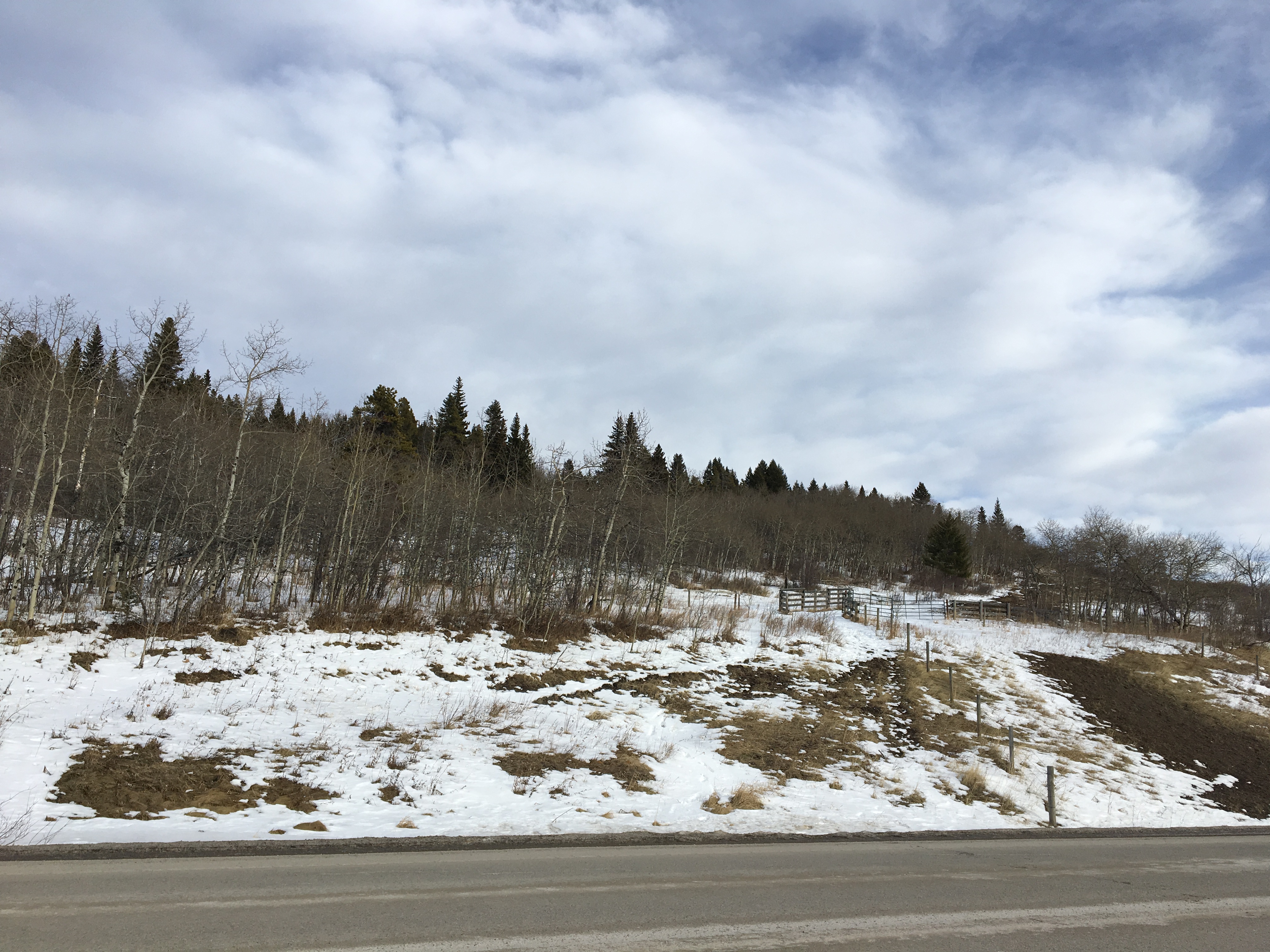
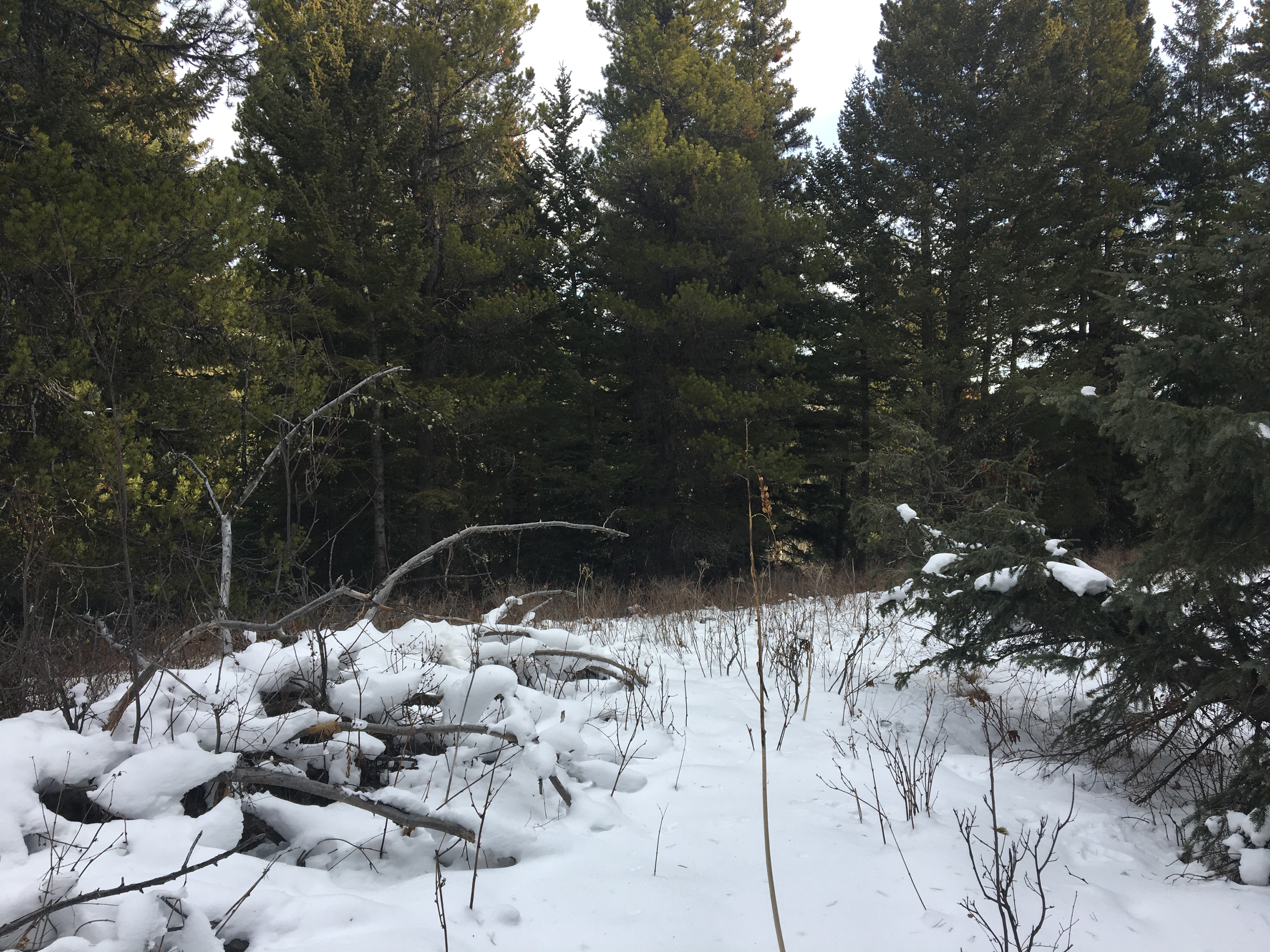
I followed the directions in Nugara’s Beginner’s Guide to Snowshoeing in the Canadian Rockies and Bob Spirko’s route description. The trail begins 10.1 km from the intersection of Hwy 507 and 774, heading towards the Castle Mountain ski resort. A pull-out on the south side of the highway adjacent to some cattle fencing is the place to park. The route starts on the opposite side of the highway. Between the highway and the climb to the summit is a low outlier that needs to be climbed up and over. Apparently other routes can be attempted that don’t involve this gain and loss of elevation but they aren’t so great. Once on the opposite side of the outlier, a direct uphill climb awaits to the summit. There is no trail, and any route will do. I tried to follow Spirko’s advice and angle towards the small treeless clearings. Nevertheless, I spent a lot of time huffing and puffing through the trees and over copious deadfall.
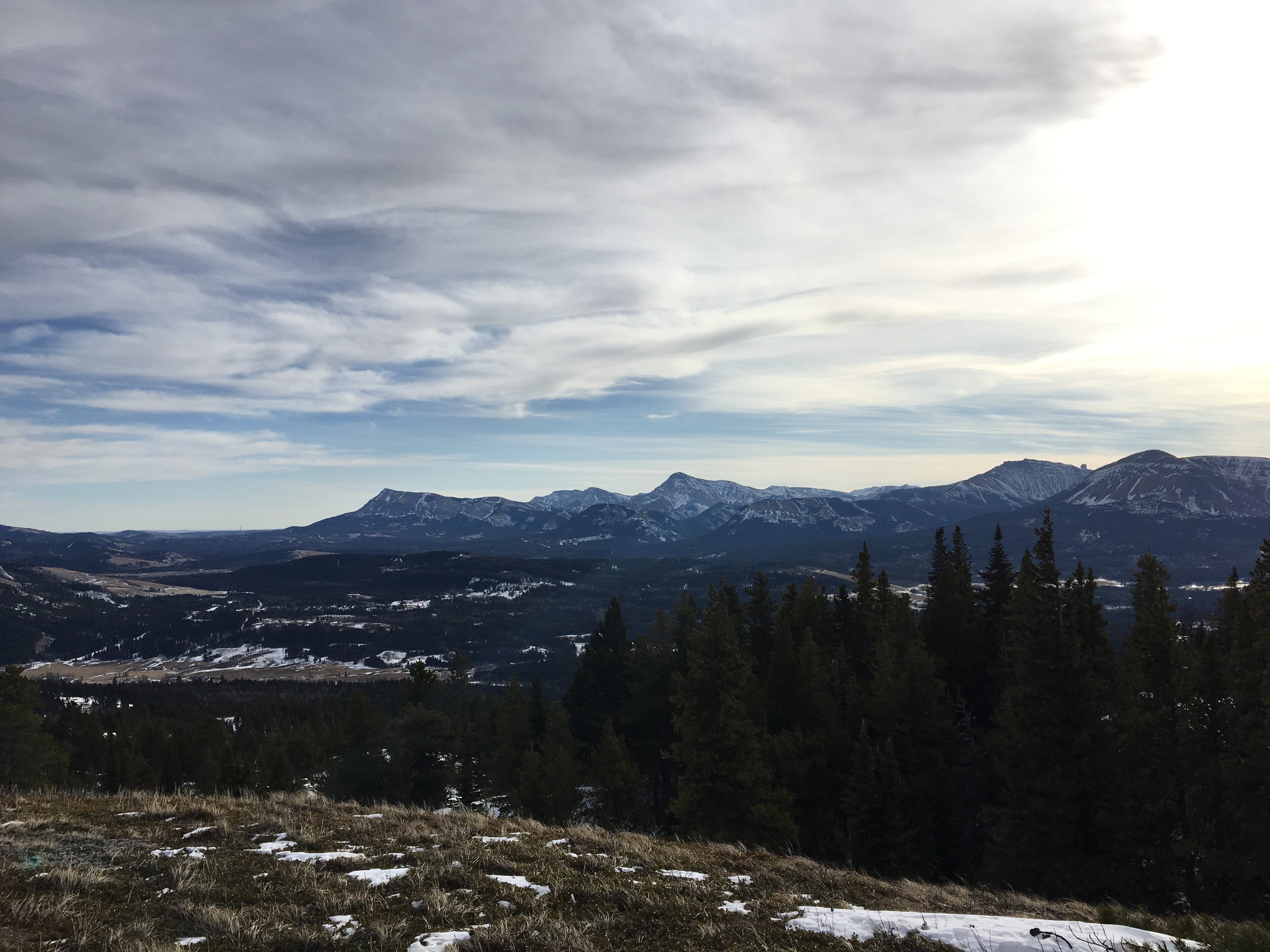
So, it wasn’t an enjoyable climb. There are no views until you’re close to the summit, so there isn’t much to break the monotony of the climb. Maybe if there was consistently deep and more supportive snow it would have been more fun. Once high up on the slopes some views opened up, and they were spectacular.
I reached the summit in 1h 46m of steady climbing. The weather was fair, but the wind was picking up by the time I got there. A cairn marks the main summit, and a 2nd cairn marks a slightly lower summit a short distance west. I hung out for a while then followed my footsteps back down to my car.
I don’t know if I’d do this trip again, even in better snow conditions. Carbondale Hill is right next door and a much better winter outing.
Click on the pictures below for full-sized images.
Route overview.Topo map of my route.Elevation profile.Looking across the highway from the parking area. This is where you start. The bare patches are deceptive – the snow was deep.Up at the cattle gate, the barbed-wire fence has been pulled down to its left. That’s the way to go. Beyond that, you need to bear right for a short while, paralleling the fence until it gets to those trees. Then you go left until the trees thin, turn back to the right and you’ll encounter the fence again as it curves left.Once I encountered the fence again, I followed along to the left until it ran by open slopes. I hopped over at that point and climbed uphill.The open slopes mentioned above. From here I climbed up to the line of trees and entered the forest. The high point of the outlier is up there.The high point of the outlier. Inspiring, right? At this point a compass bearing or GPS is really handy to make sure you’re walking in the direction of Backus’ summit as you descend through the trees.As I mentioned, there’s no trail. I saw this lonely bit of flagging. I’m not sure what it was supposed to be marking.Down in the valley between the outlier and the main part of Mount Backus. The summit is in the background, in the middle of the picture.Down in the valley looking northwest at a heavily wooded ridge – I suppose you could climb up to that and follow it to the summit, but it would probably be less fun that the more direct route through the trees on the right and straight up the slope. There’s another barbed-wire fence up there to hop over.I kept making my way in the direction of the summit and tried to pass through clearings like this one as much as possible. Again, the snow is deeper than it looks. I wish it had been way deeper and more supportive. Walking through all these thickets wasn’t fun.Finally, the first views appear. Looking over my shoulder I was treated to this view of the snowy slopes of Mount Syncline.My route eventually connected with the heavily treed ridge. These two boulders are the only things I could characterize as natural landmarks for the whole trip.More nice views over my shoulder. Mount Darrah, Mount Pengelly, Mount McGladrey.Things got slightly rockier. At this junction it’s best to stick to the higher ground on the left.Eventually views opened up to the south – Prairie Bluff, Mount Victoria, Victoria Ridge, and the distinctive square top of Castle Peak just popping above the intervening ridge line at the right of the picture.The summit comes into view. I continued along the ridge to the left. There wasn’t any particularly tricky terrain. The snow was deep in between the trees here.The summit cairn. Crowsnest Mountain’s distinctive peak is the distance, just right of center.The 2nd cairn. Again, Crowsnest Mountain is distinct in the background.Me on the summit.Panorama looking northwest from the 2nd cairn. Intriguing mixture of terrain and colour.Panorama looking from west to northwest from the 1st cairn. Distinctive Mount Darrah is almost dead-centre.One more shot of Mount Darrah and her sister peaks.Following my tracks back down. I guess it wasn’t so bad a day…