January 5, 2019 / January 8, 2022. A straightforward winter hike to a low summit in the Crowsnest Pass.
- Region: Crowsnest Pass. Traditional Territory of the Ktunaxa, Blackfoot, and Tsuu T’ina First Nations
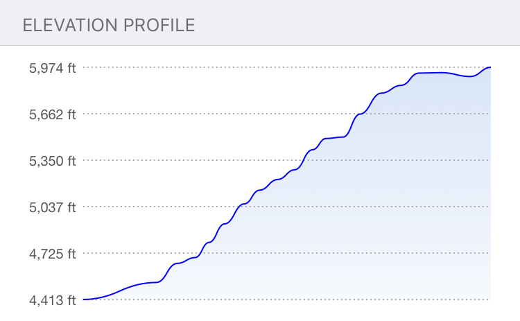
- Distance: 8.29 km round-trip
- Total Ascent: 495 m
- Elevation of objective: 1820 m
- Round-trip time: 3h 17m (2019, minimal snow), 3h 40m (2022, deep snow)
As is typical at the start of the winter season, it’s been a long time since I’ve had a chance to get out to the mountains. There are the usual reasons involving work and family life, compounded by severe wind warnings through the 2018/19 Christmas season. I’d actually given up on hiking or snowshoeing during the holiday season. But this morning I awoke and noticed no wind was blowing. I checked the forecasts in Waterton, Pincher Creek and the Crowsnest Pass – no wind throughout the day. Temperatures were warm and no precipitation was forecast. I leaped out of bed and assembled my gear. My objective today would be Saskatoon Mountain.
Given that Saskatoon Mountain is, literally, in Coleman, AB’s back yard, there are a number of trails beaten by the locals up to the summit. I followed the route described in Nugara’s Beginner’s Guide to Snowshoeing in the Canadian Rockies. It’s the same route Dave McMurray and Bob Spirko describe on their blogs. It has the advantage of starting from a well-trafficked trail with easy access and ample parking.
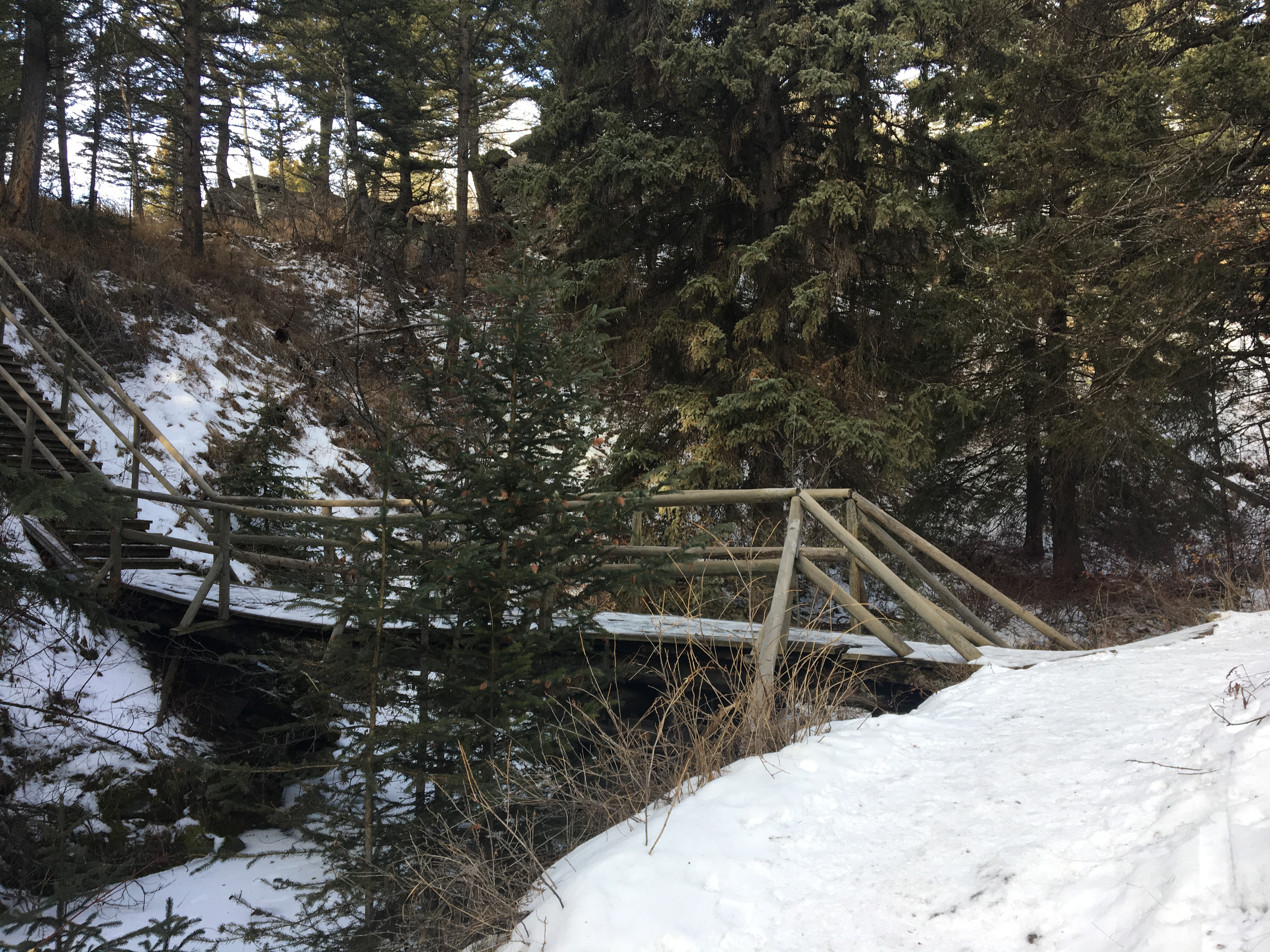
The trail starts at the Miner’s Path in Coleman. There’s a signed turn-off from Highway 3 as you pass through Coleman, AB. Park at the trailhead and check out the interpretive sign before setting out. This trail follows Nez Perce Creek. Cross over one bridge. At the second bridge, continue straight forward instead of crossing, following the right-hand bank of the creek. There’s a fence with a gate to go through, then you eventually encounter a nice little waterfall and a staircase ascending to the right. I don’t know if the waterfall has a name, but the walk to that point was straightforward and pleasant and the waterfall would make a great destination for anyone with little hikers that want to get outdoors in the winter. The hiking starts at the top of the staircase.
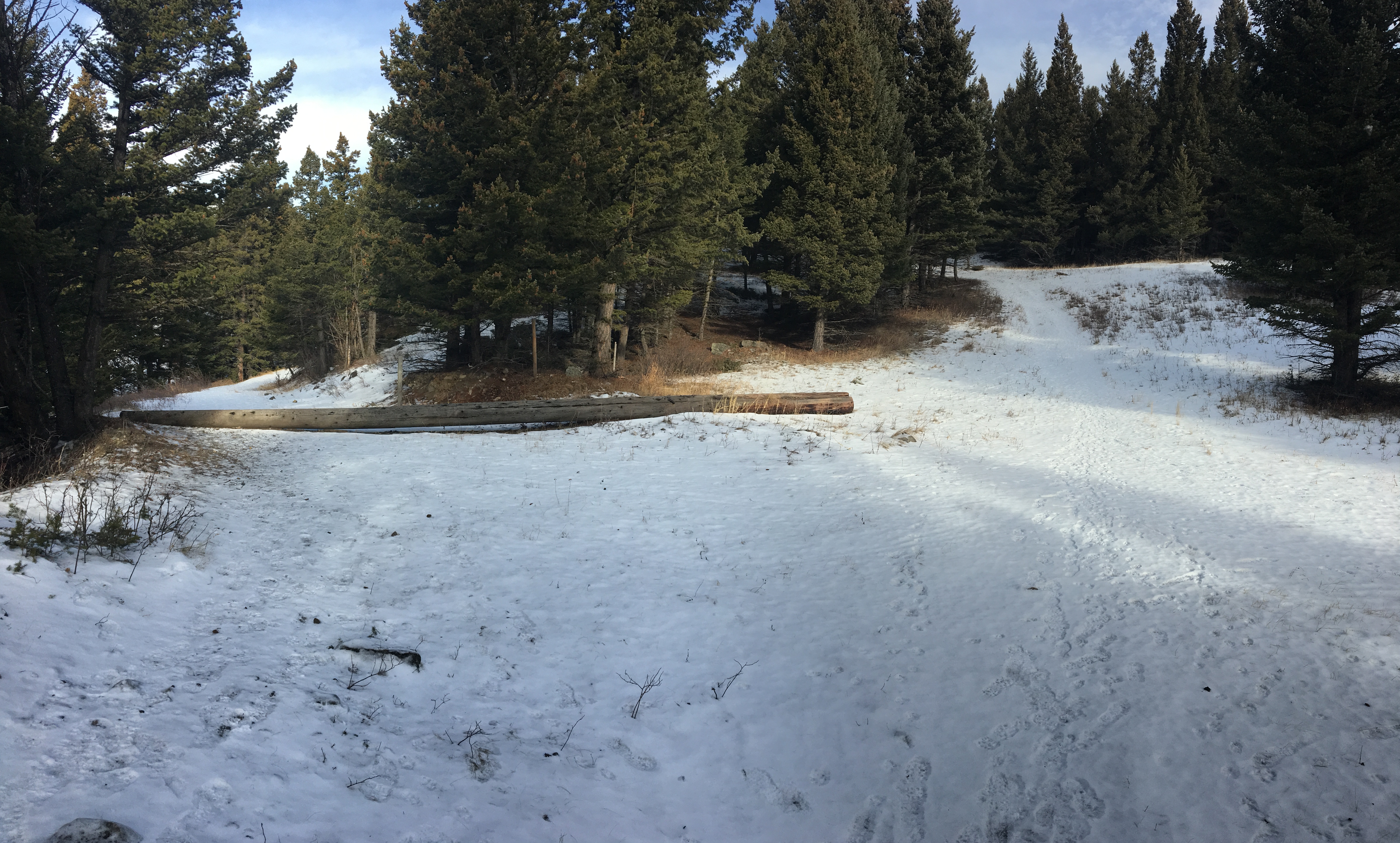
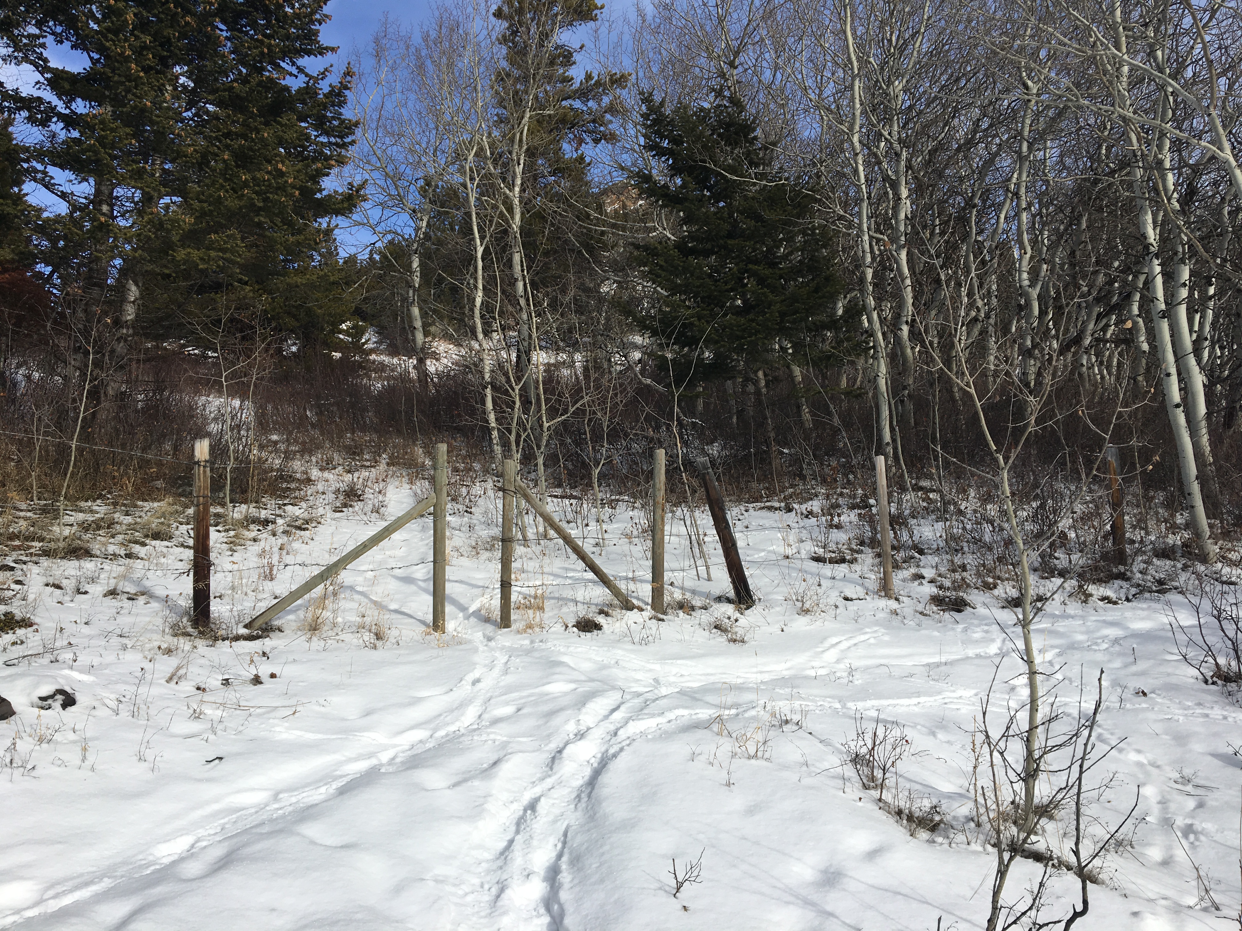
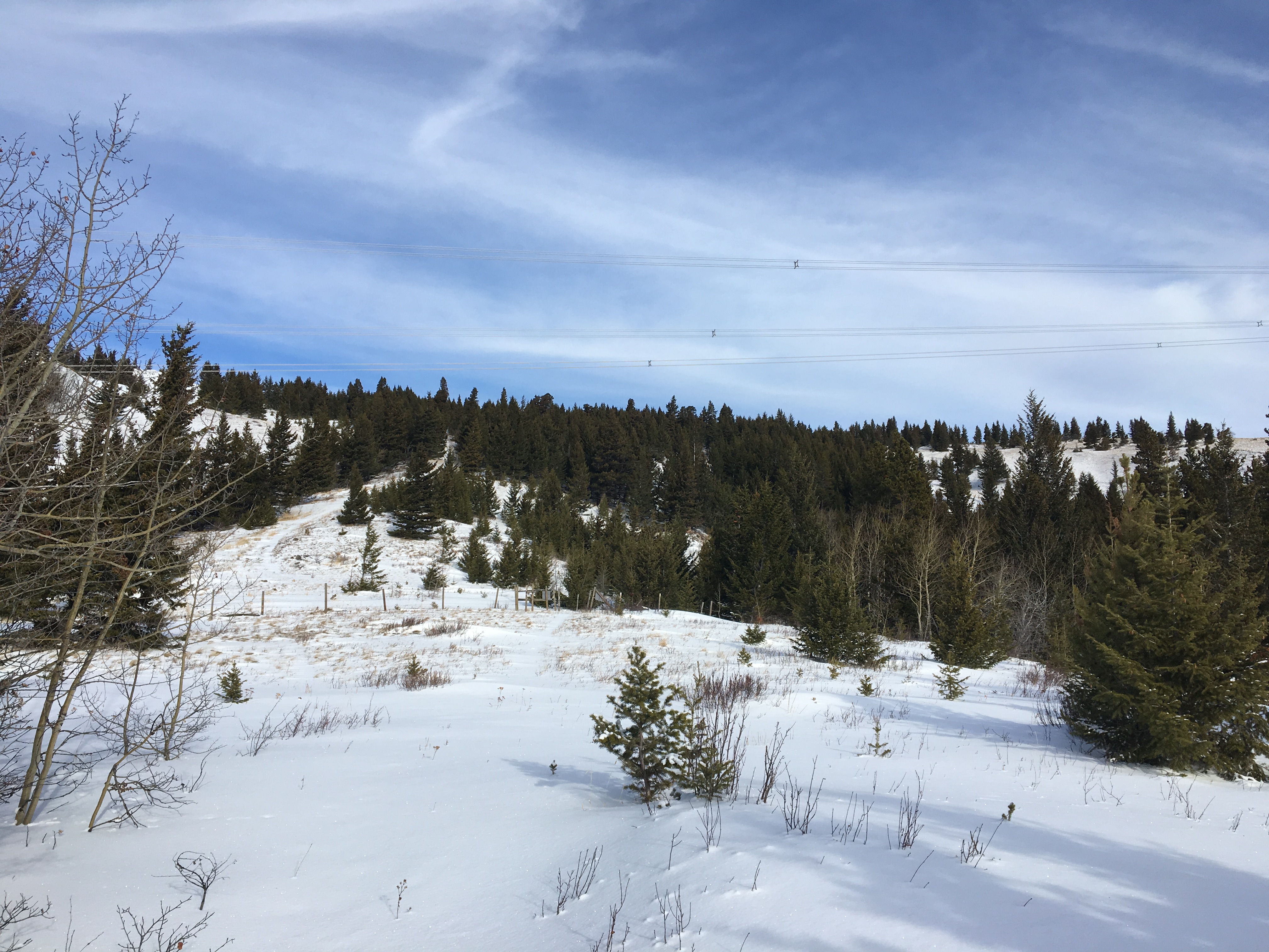
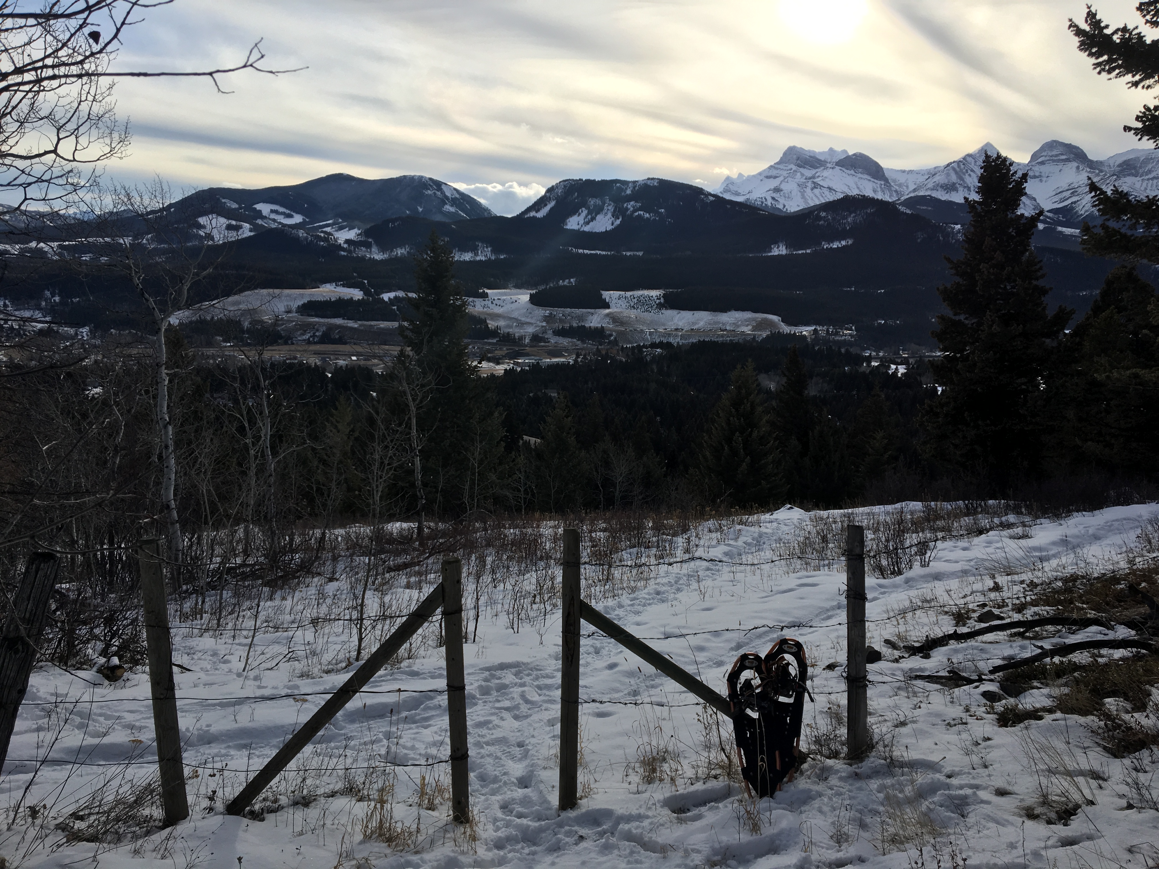
There wasn’t a lot of snow, but what snow there was had been heavily trafficked. I followed the footprints heading off to the right, entering some wide trails between trees and eventually entering a clearing which allowed a view up the slopes. The summit isn’t visible from this point (in fact, it isn’t visible until you’re almost on it). The first high point visible is a rocky outcrop at the top of fairly steep grassy slopes. The first of 2 barbed wire fences is encountered around here. It’s easy to pass though – there’s a gap in the fence for hikers. Continuing upwards, from there I passed through the second barbed wire fence. Again, there was a gap for hikers. I left my snowshoes here since it was clear I wouldn’t need them.
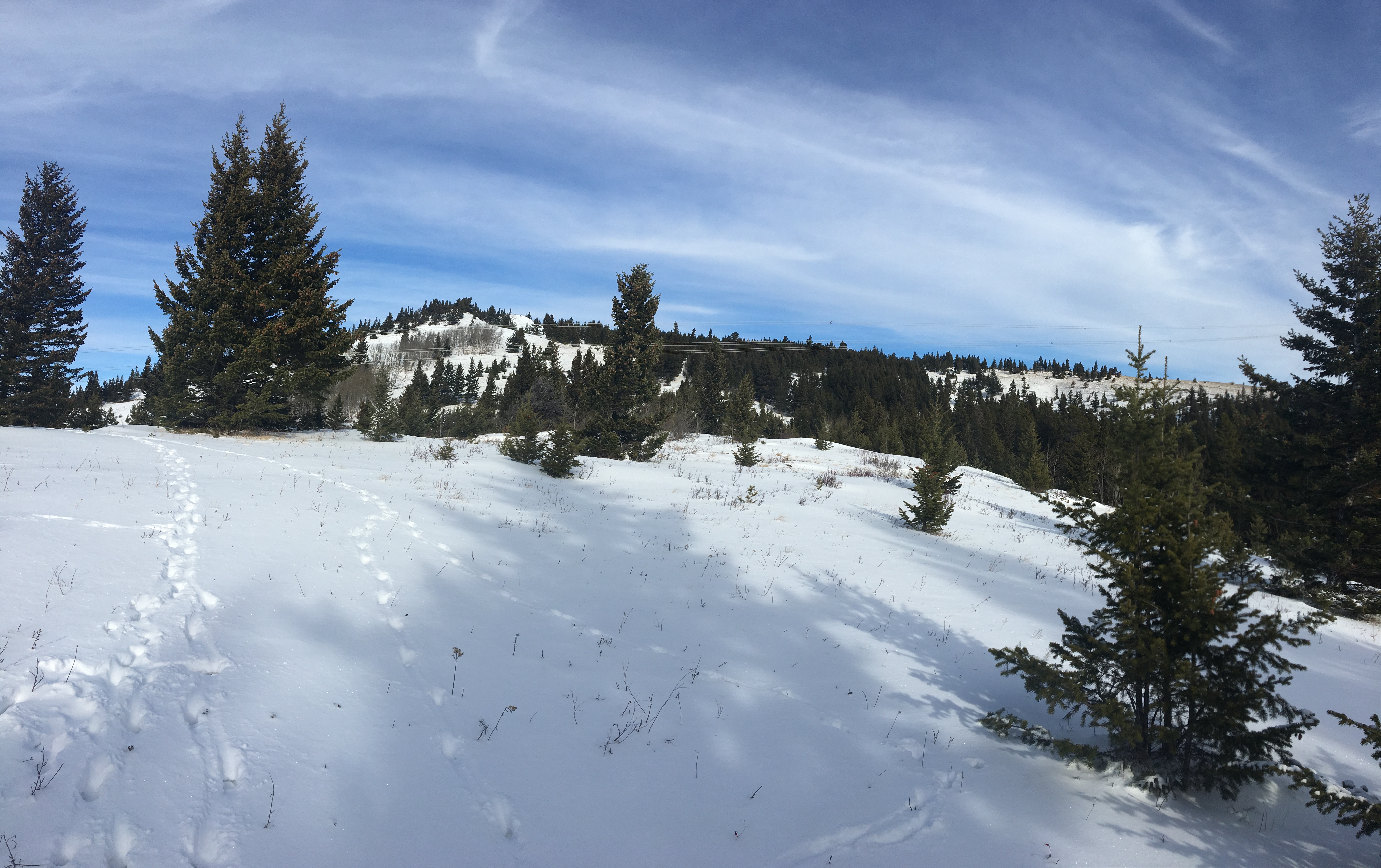
Beyond the 2nd fence I entered another clearing, once again giving a view of the rocky outcrop. Climbing directly up and over would involve a steep ascent, only to lose altitude right away in order to continue to the ascent ridge. I therefore skirted around to the right and started a gentle ascent and traverse east of the rocky outcrop. Any route would do here, but I happened across some flagging on the trees here that led me along a very favourable route. I’d eventually gain the broad ridge without difficulty.
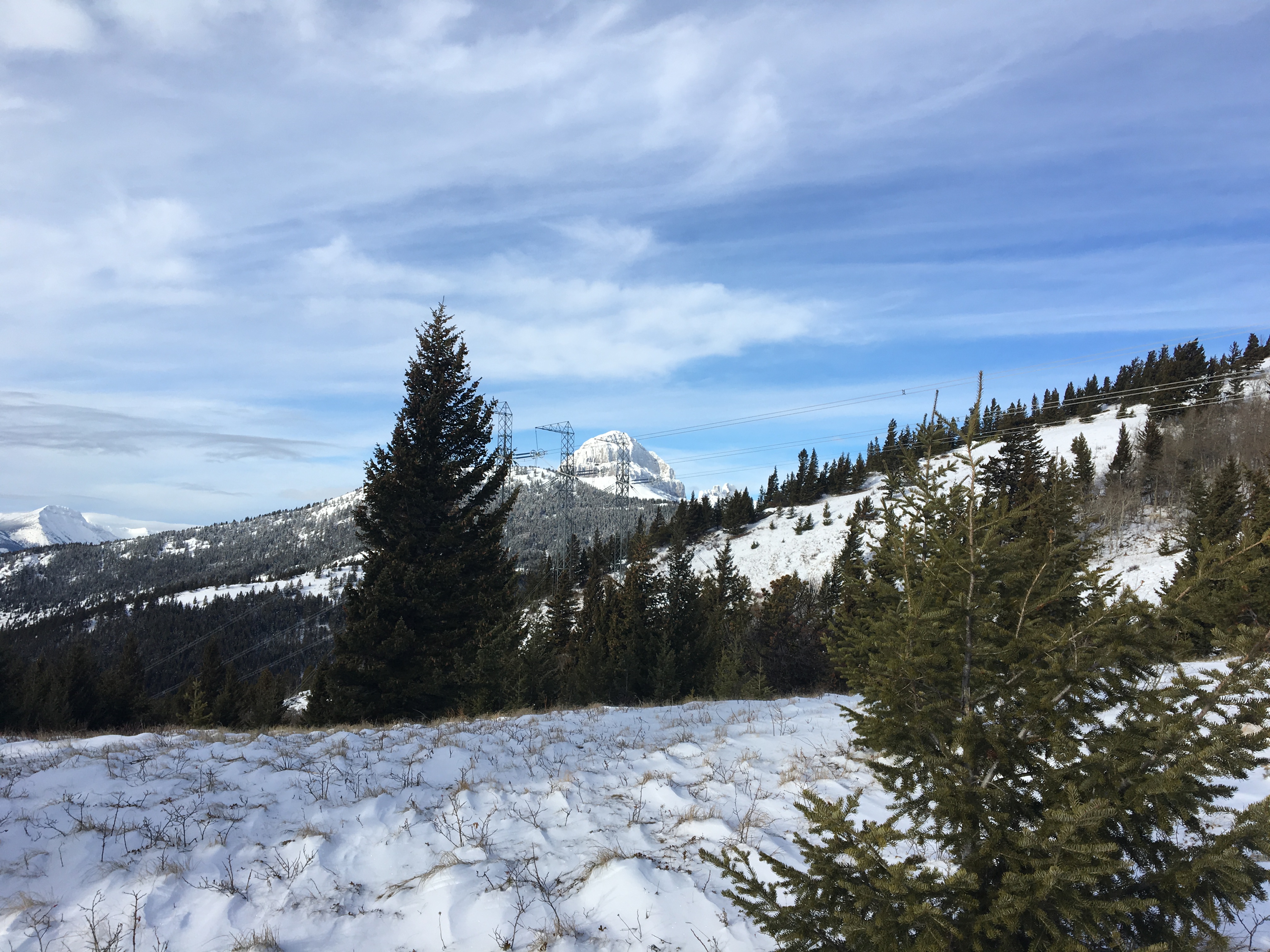
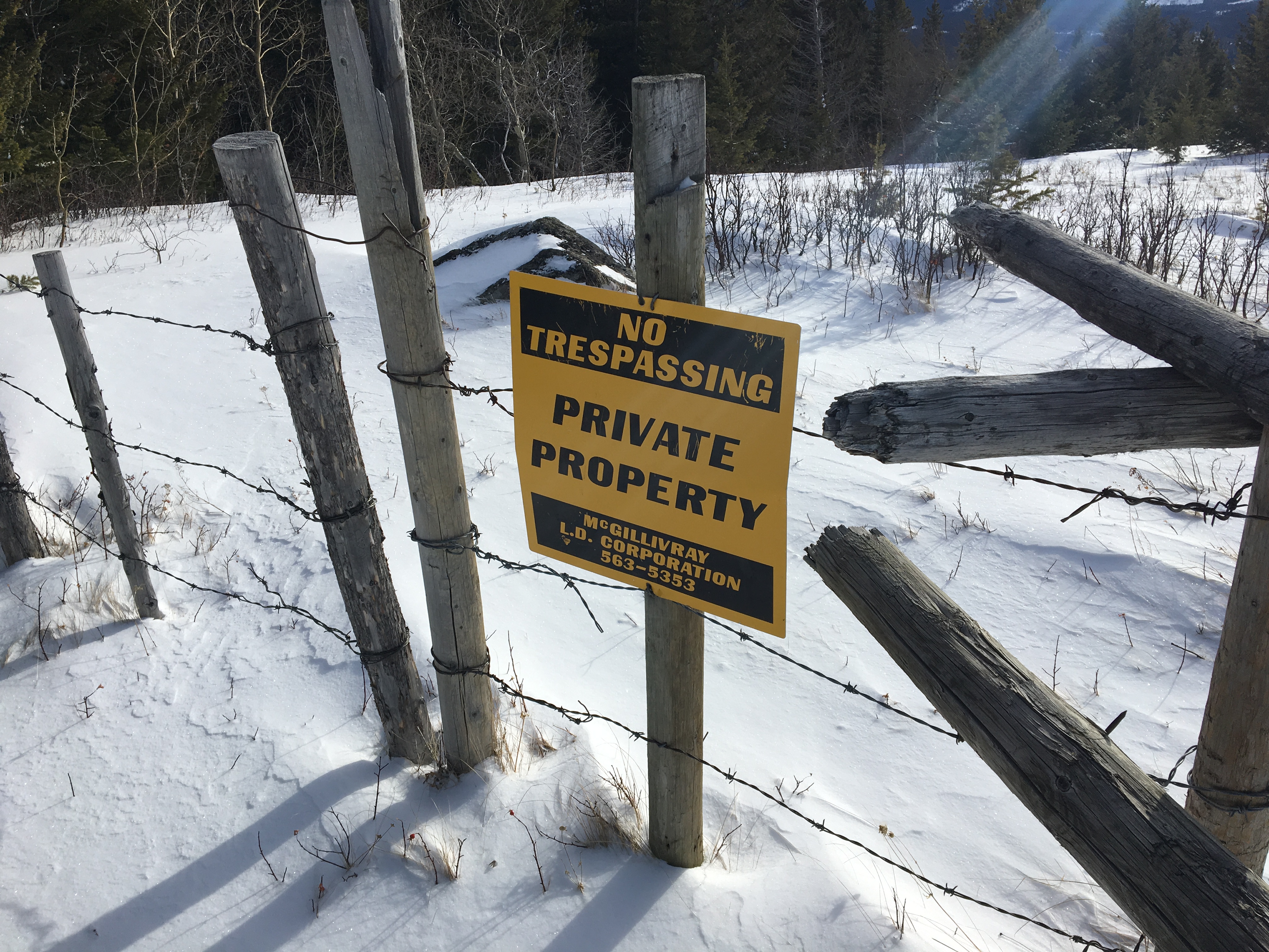
Once on the ridge, I continued north towards and underneath some power lines. There was another fence here, again with a gap in it for hikers. There was a mysterious No Trespassing sign on this fence – facing uphill. Dave McMurray comments on this in his blog post. Like him, I found no other signs anywhere along the route suggesting that I’d entered/exited private property anywhere else. According to his blog, he inquired with locals, who told him that this was the route most people took up the mountain.
There’s a little cairn marking a wide trail beyond the fence. I continued up this way. Off to the left the lower summit of the mountain was obvious. Apparently, many people make this their destination rather than the true summit as the views are almost identical to those at the true summit. It’s marked by an big stone cairn. Since I had plenty of time and energy I decided to continue on to the true summit and tagged the lower summit on my way down.
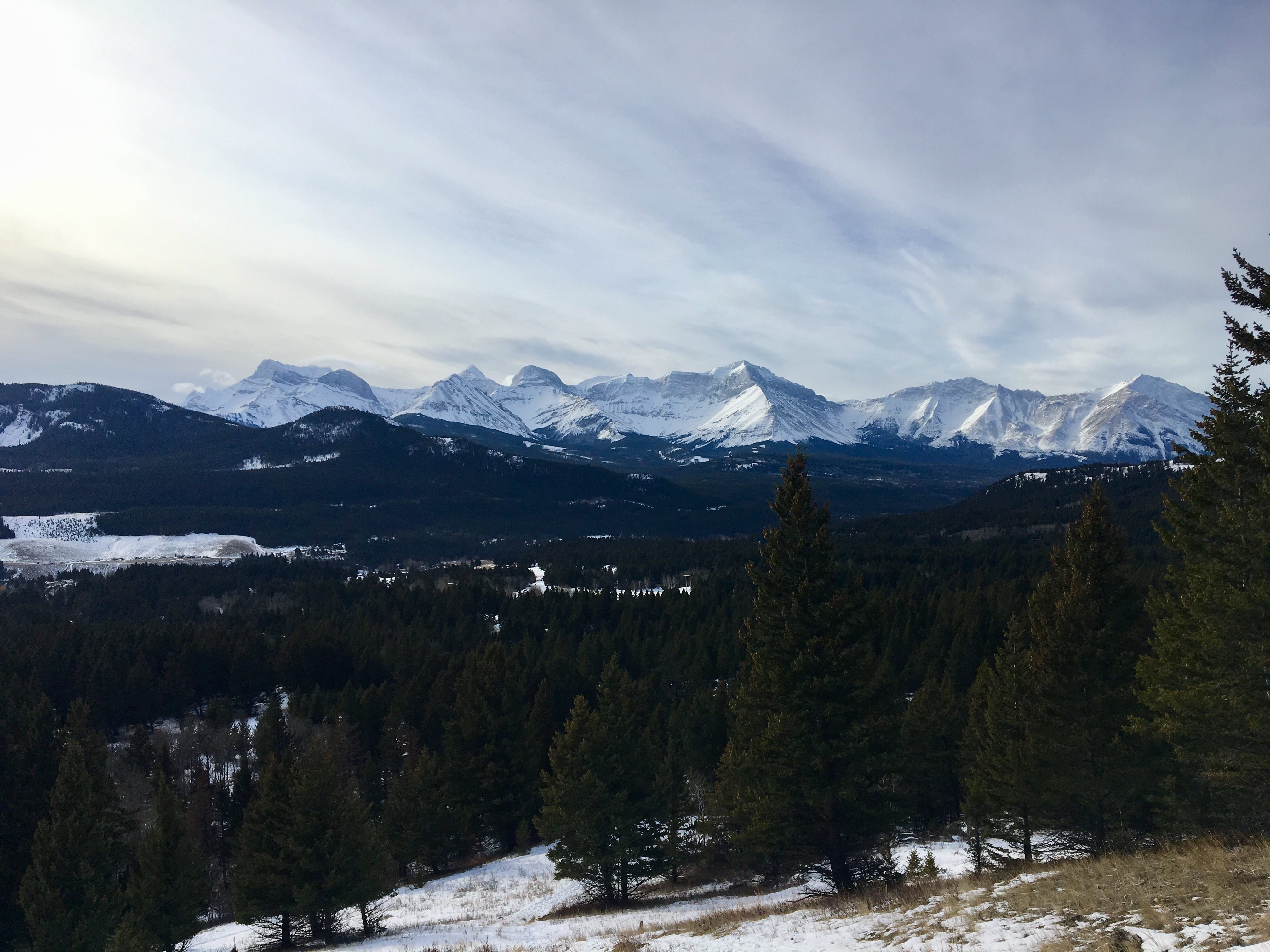
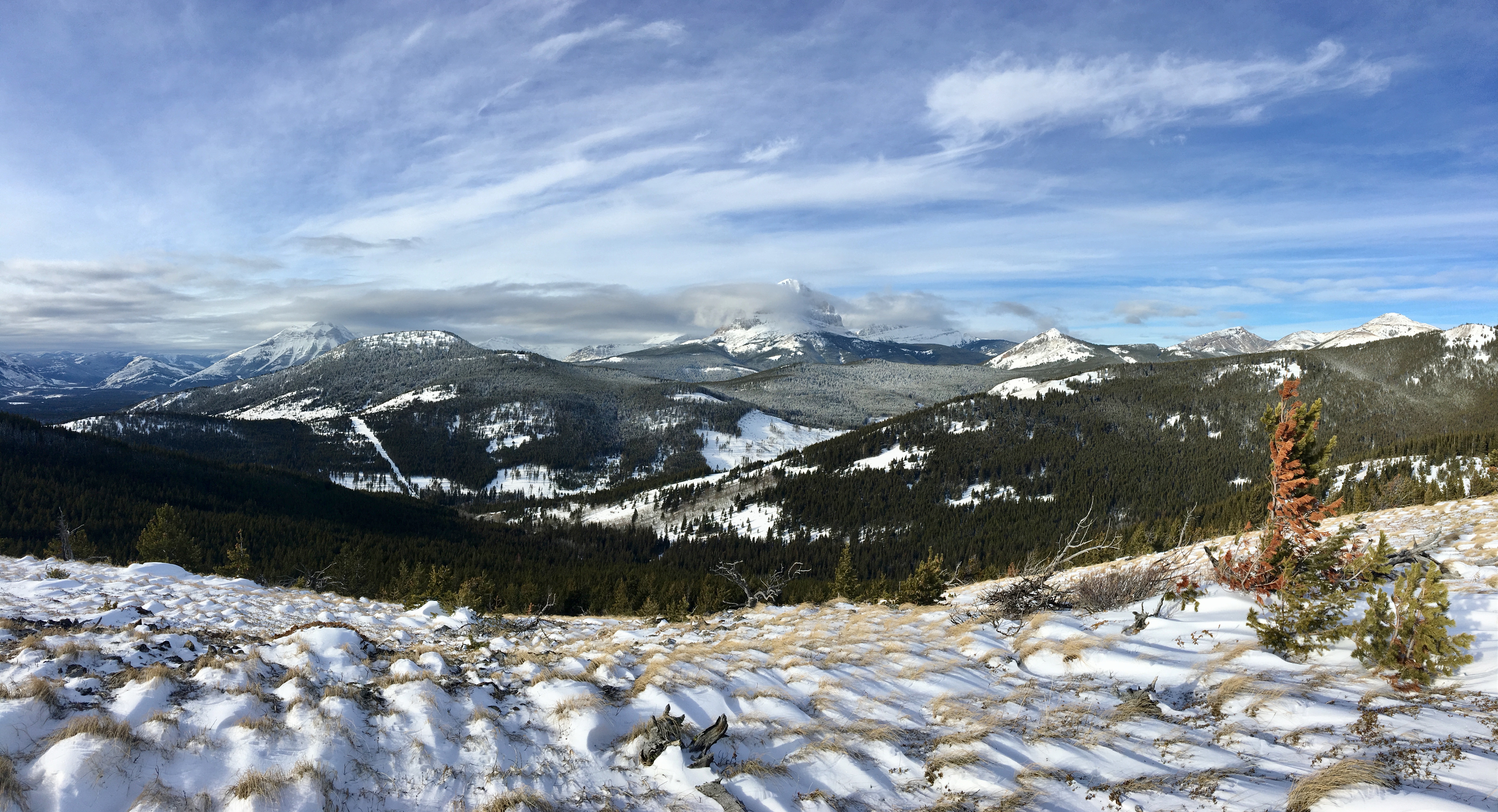
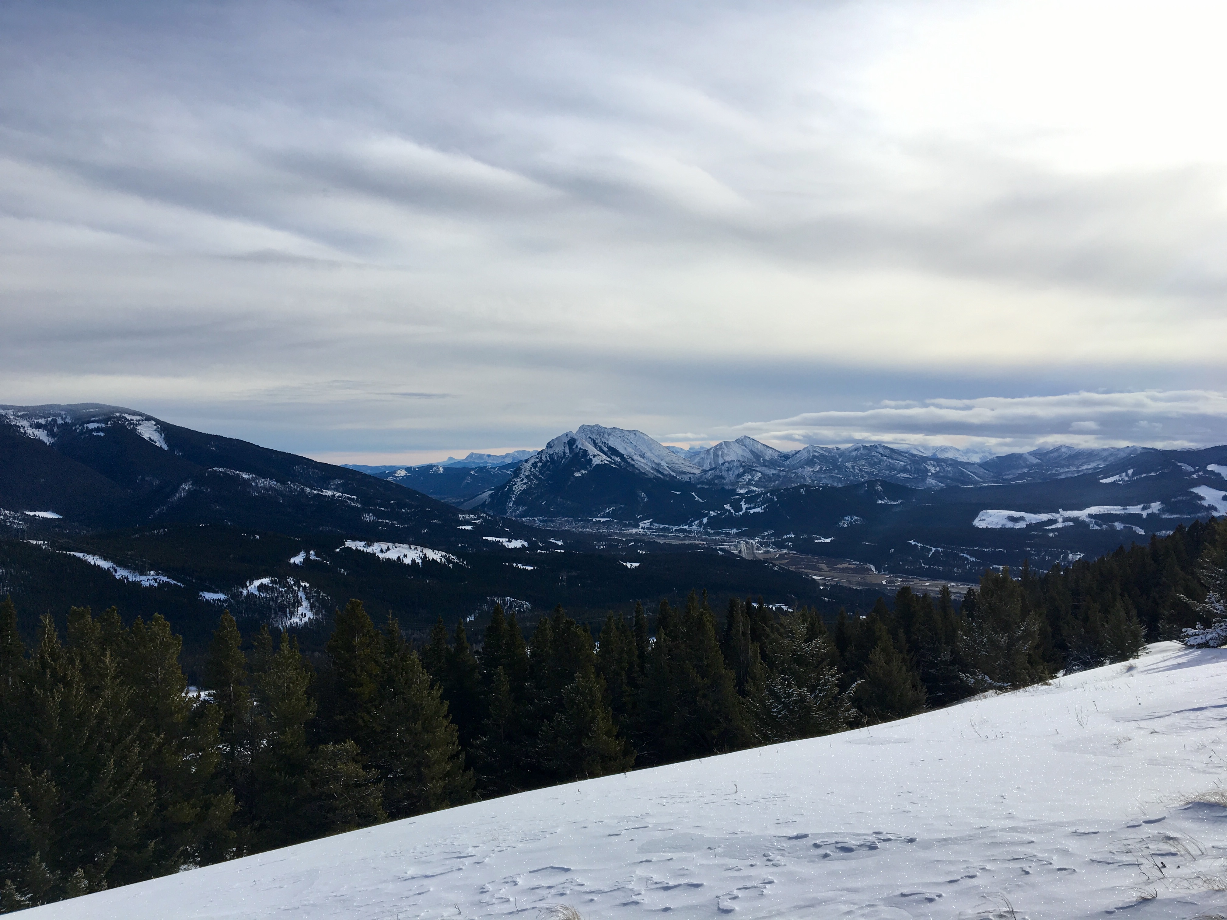
I continued north, passing through some trees, to a clearing, and through more trees. Finally, the summit came into view. In short order I was on top. It took 1h 34m from my car to this point. The summit is almost devoid of trees, aside from a pair of stunted conifers. The views were excellent in all directions. Crowsnest Mountain and Seven Sisters are the highlights, off to the east. During my ascent I’d glimpsed some excellent views of those peaks. Unfortunately, some low clouds had rolled in by the time I reached the summit. I spent about 20 minutes there, enjoying the views (and hoping the clouds would move off – they didn’t).
I returned following the same route, but took a detour to the lower summit. The weather was ideal (aside from a bit of cloud). The wind was almost non-existent on the summit. Overall, this was a rewarding outing. Route-finding wasn’t hard, though I imagine it may be more of a challenge with deep snow on the ground. As it was, there was just enough snow to accentuate the subtle depressions of the trail in many places. On a couple of the slopes the snow was problematic because it wasn’t deep enough to afford any grip – just deep enough the make descent slippery. However, the terrain was safe everywhere I went. A slip wouldn’t be disastrous.
January 8, 2022 Update: I returned 3 years after my first visit and found no changes to report regarding the route. The weather was much different than during my 2019 visit, though. It was cold and there was deep snow all the way along. Snowshoes were indispensable. I once again visited the true summit before tagging the lower summit. I don’t think I’ll bother with the true summit next time I’m up there. Unless you’re peak-bagging, you’ll have just as satisfying a day on the mountain only visiting the lower summit with the cairn.
Click on the images in the gallery below to access full-sized pictures.


“Of course, once I was back in my car and driving away I could see the clouds had moved off. Oh well.” Good to know we’re not the only ones this happens to! 😉
LikeLiked by 1 person
amazing!!!
LikeLiked by 1 person
Very nice one. Beautiful photos too
LikeLike