June 10, 2022. A short scramble to great views of the Spray Lakes area.
- Region: Kananaskis Country. Traditional territory of the Stoney, Tsuu T’ina, and Blackfoot First Nations
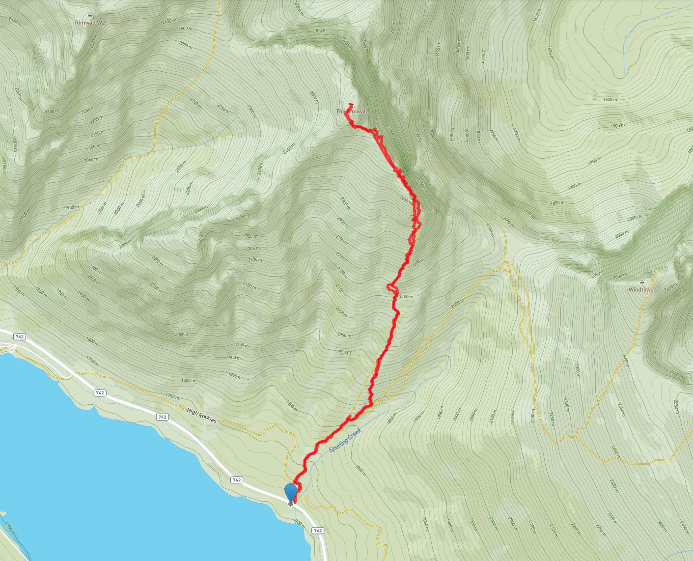
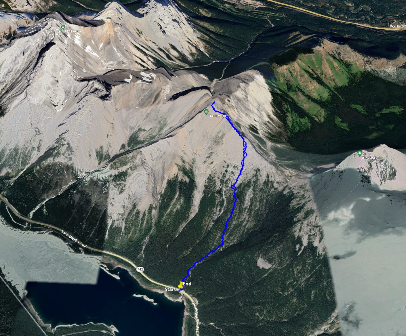
- Distance: 7.7 km round-trip
- Elevation Gain: 1000 m
- Elevation of Objective: 2657 m (Kane’s guidebook puts it at 2680 m)
- Total Time: 5h 14m
- Safety and Disclaimer
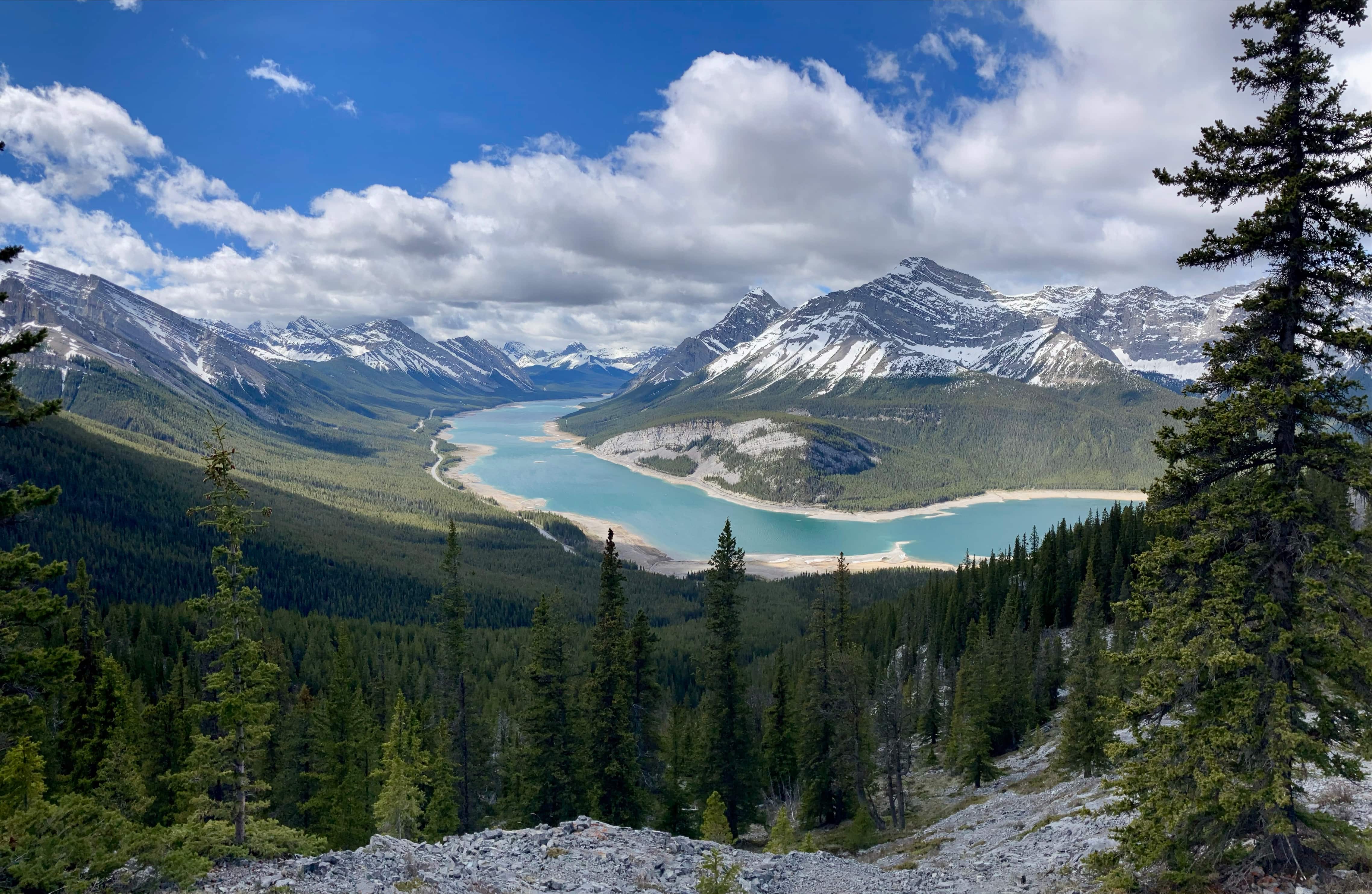
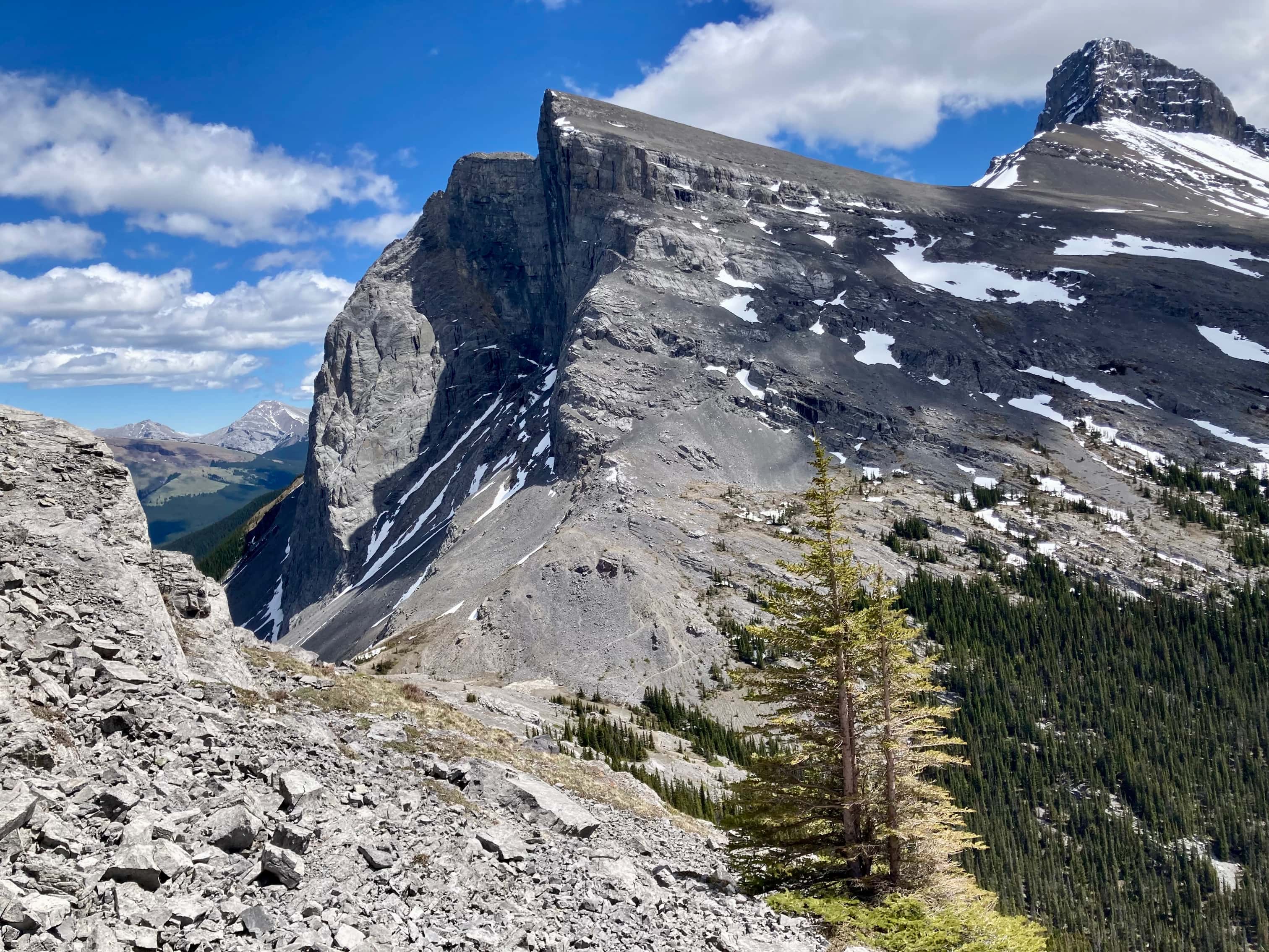
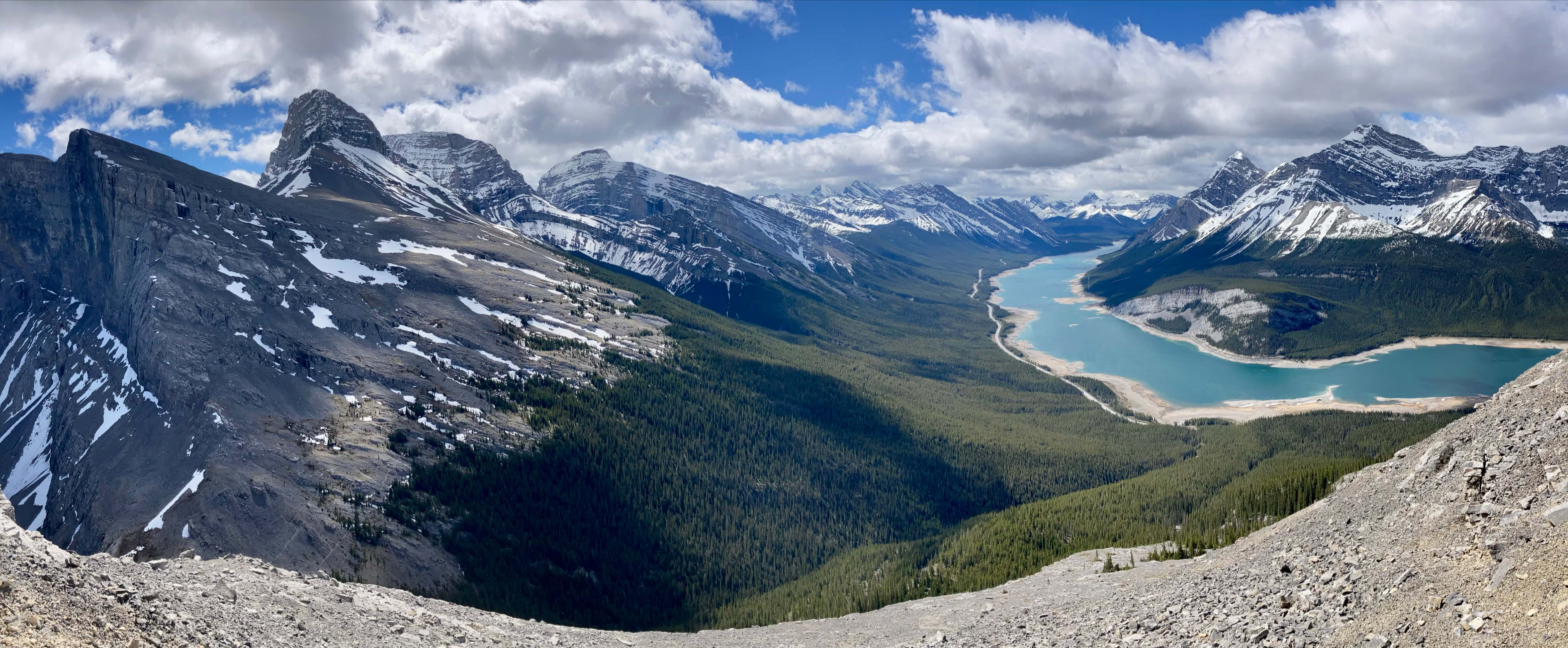
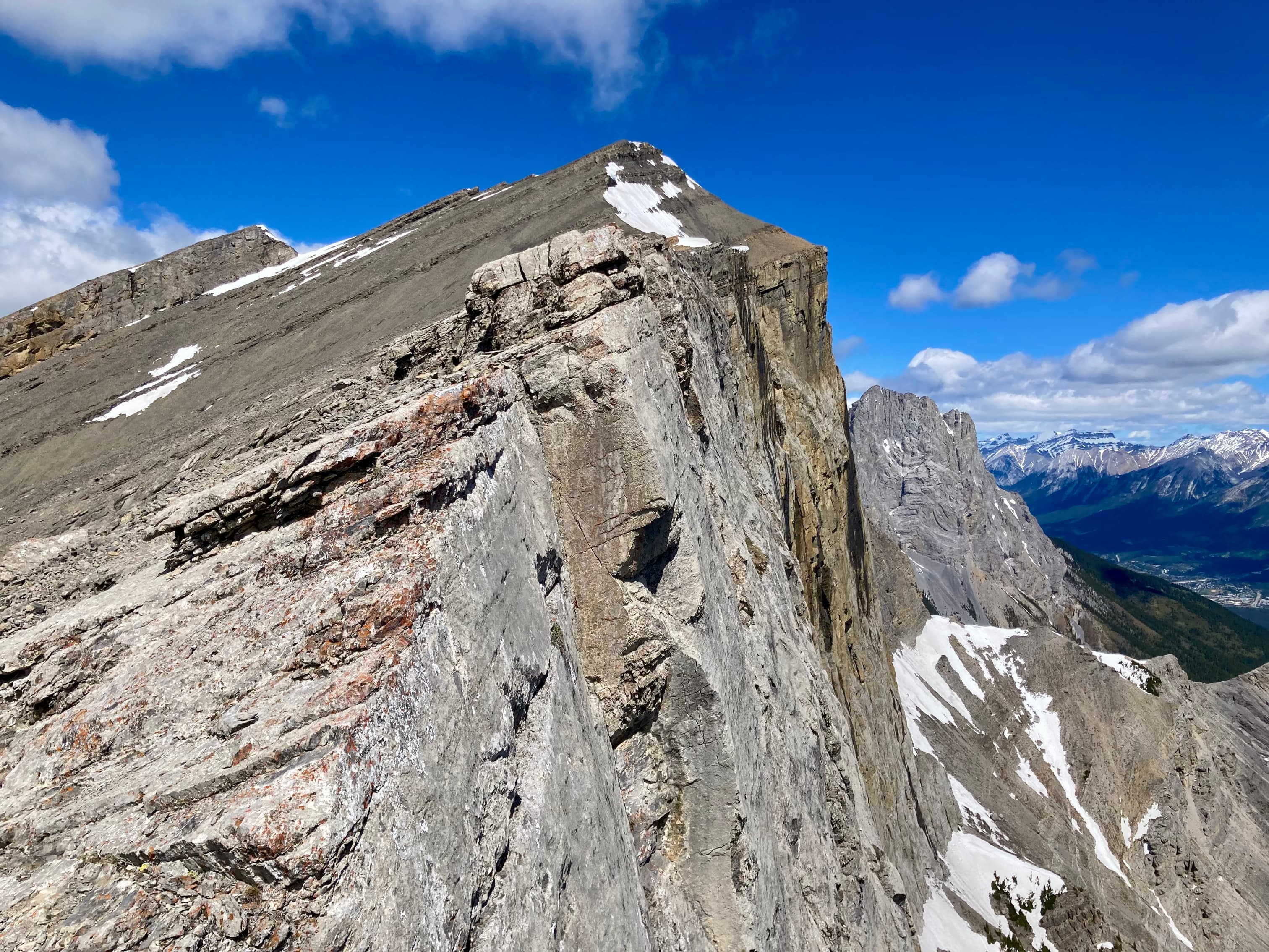
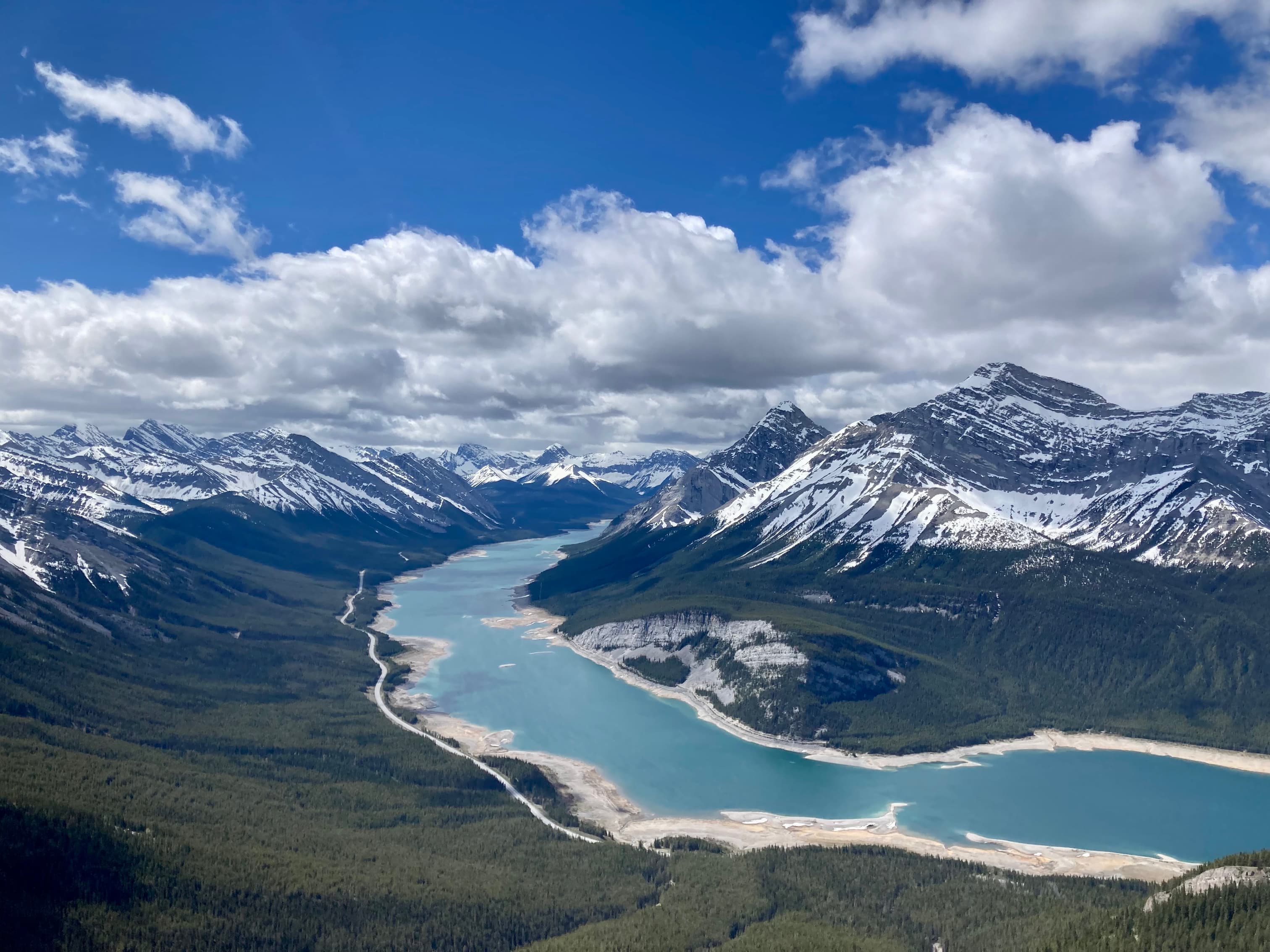
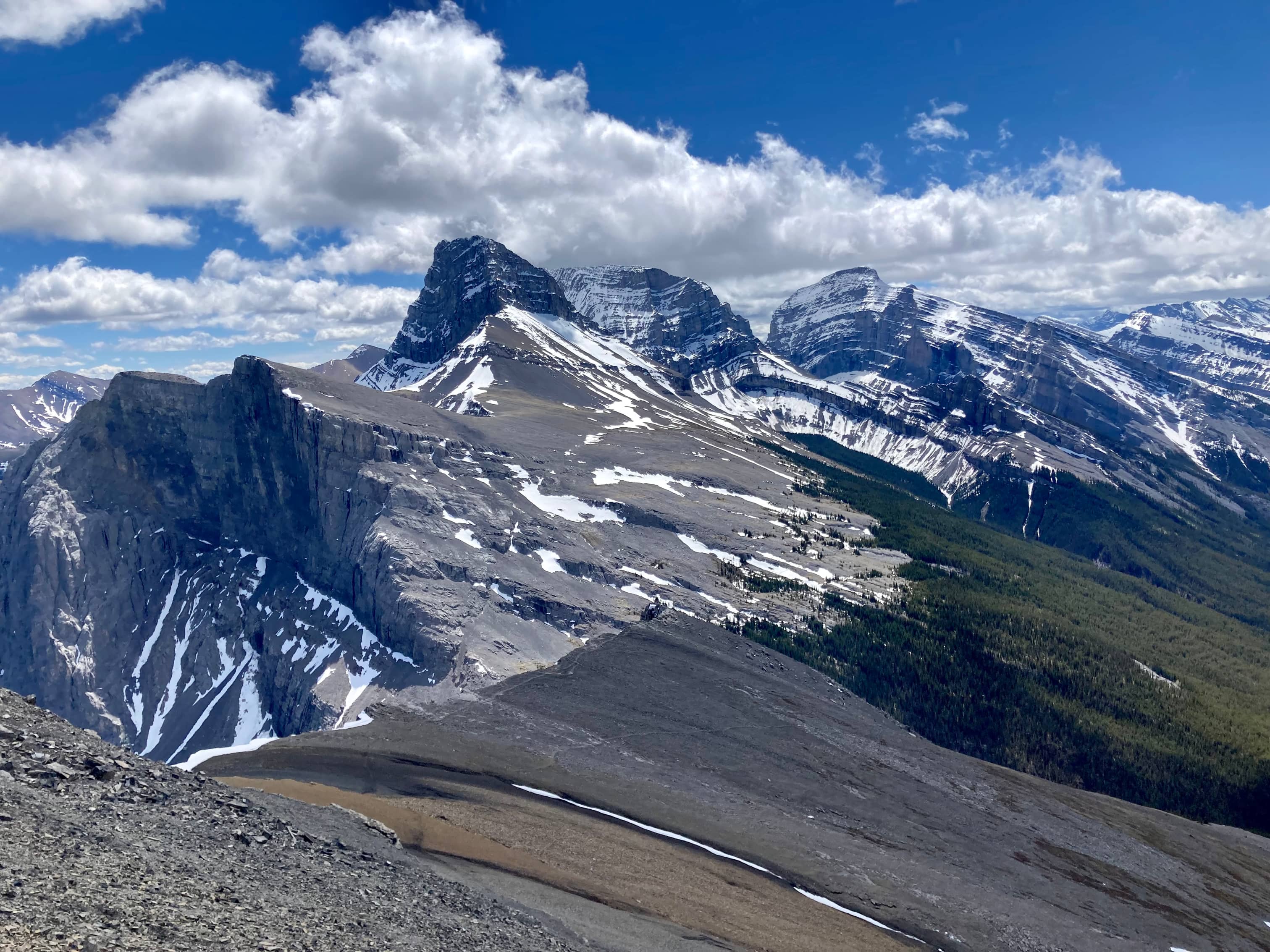
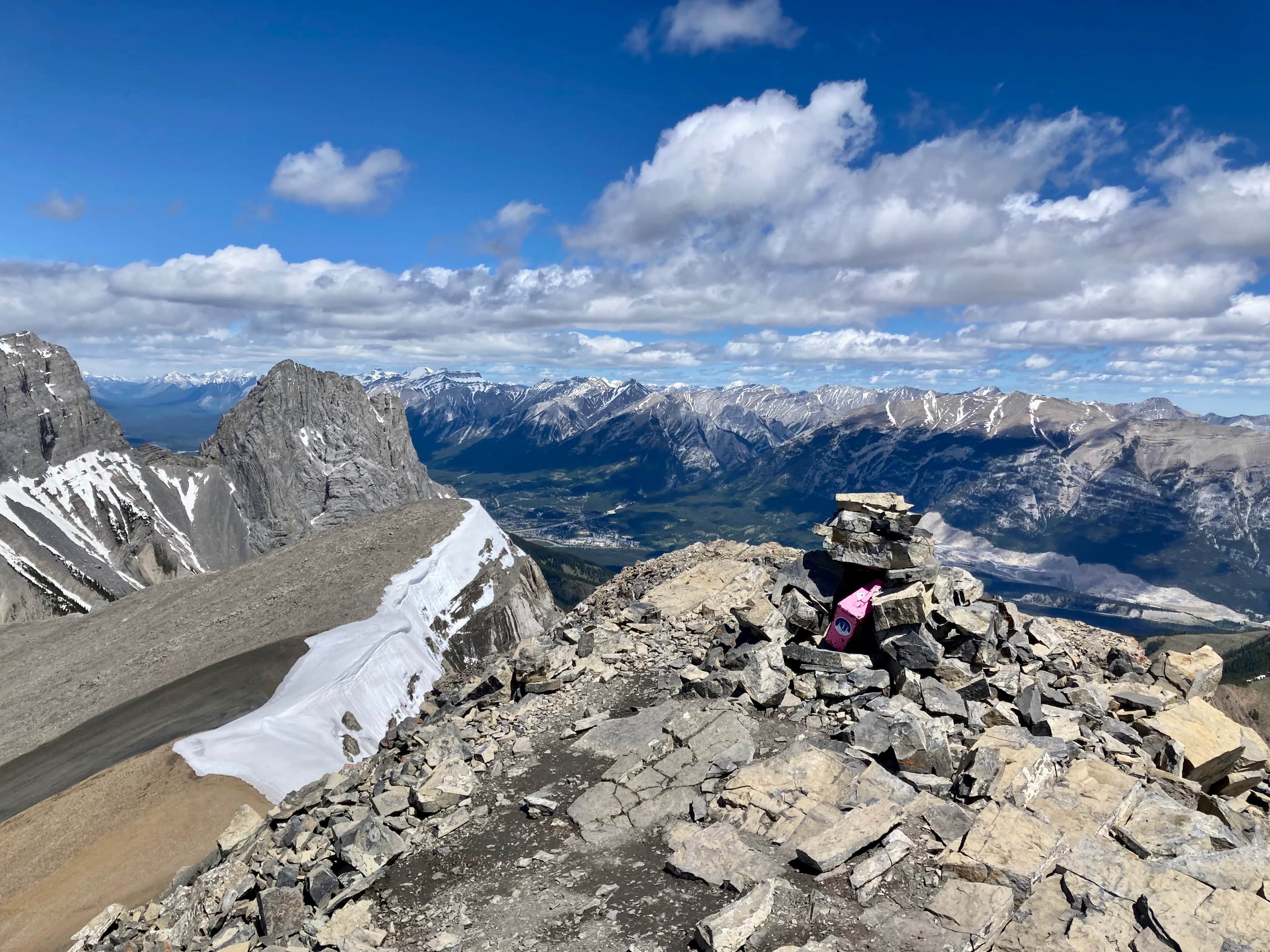
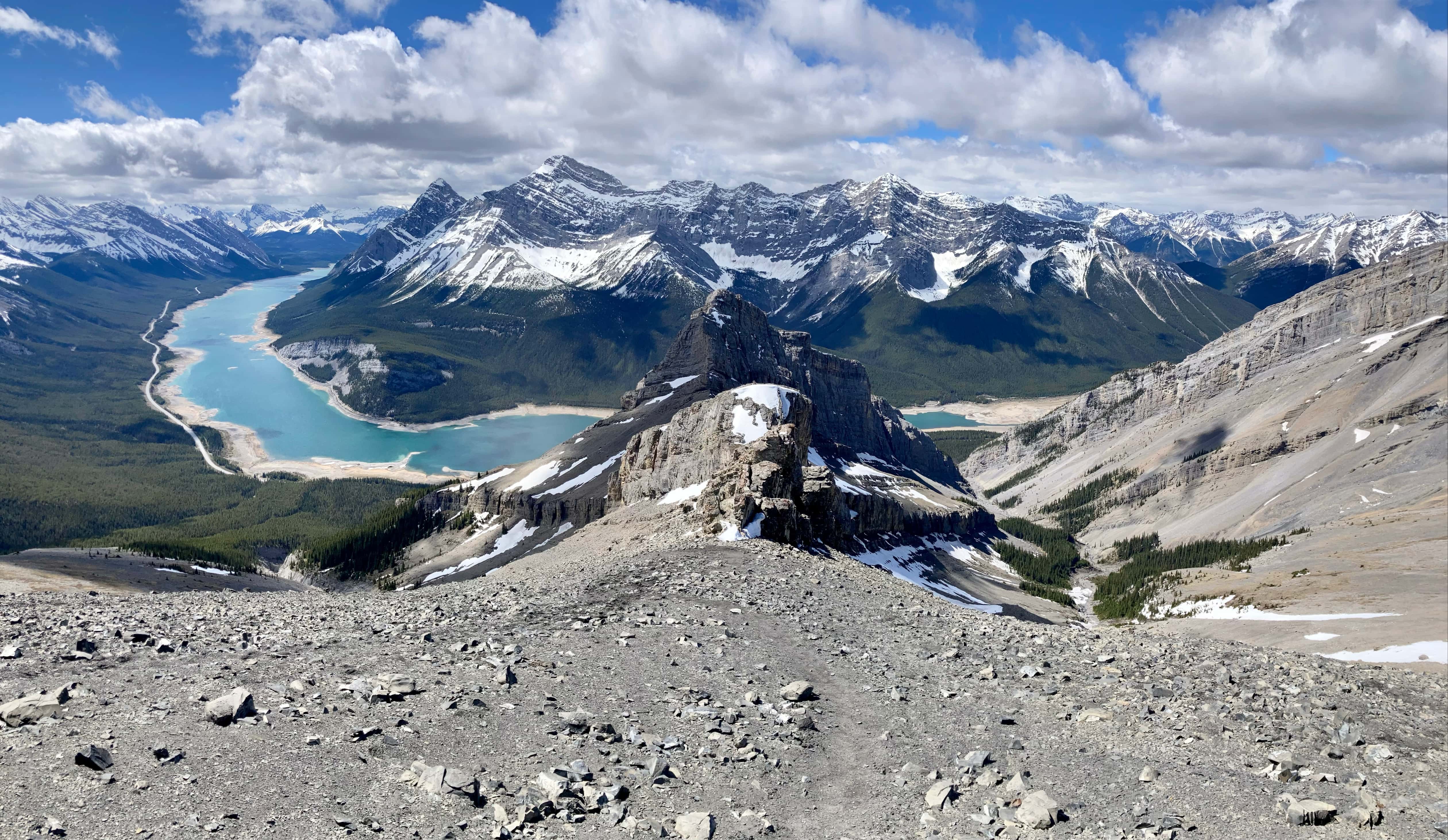
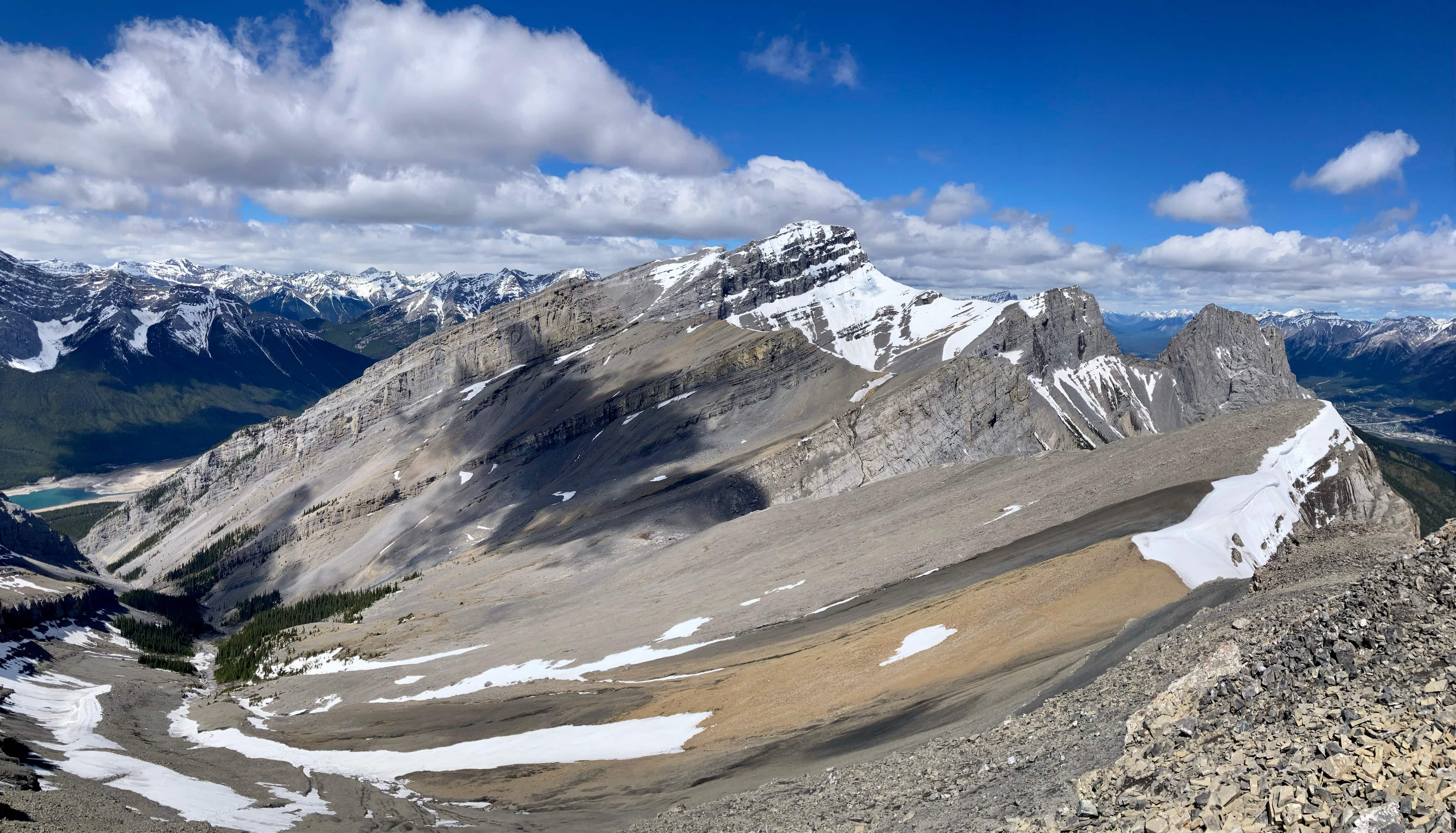
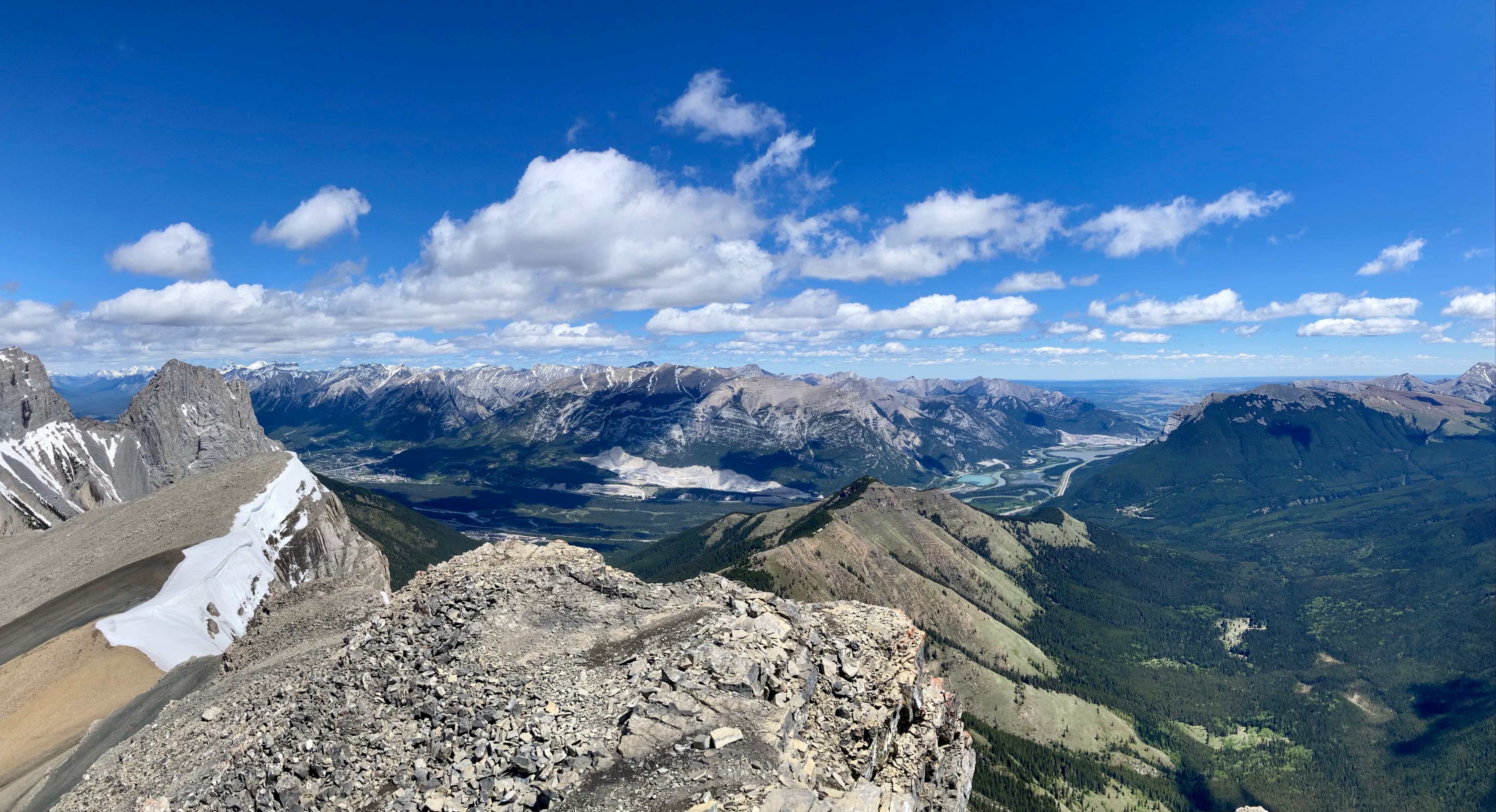
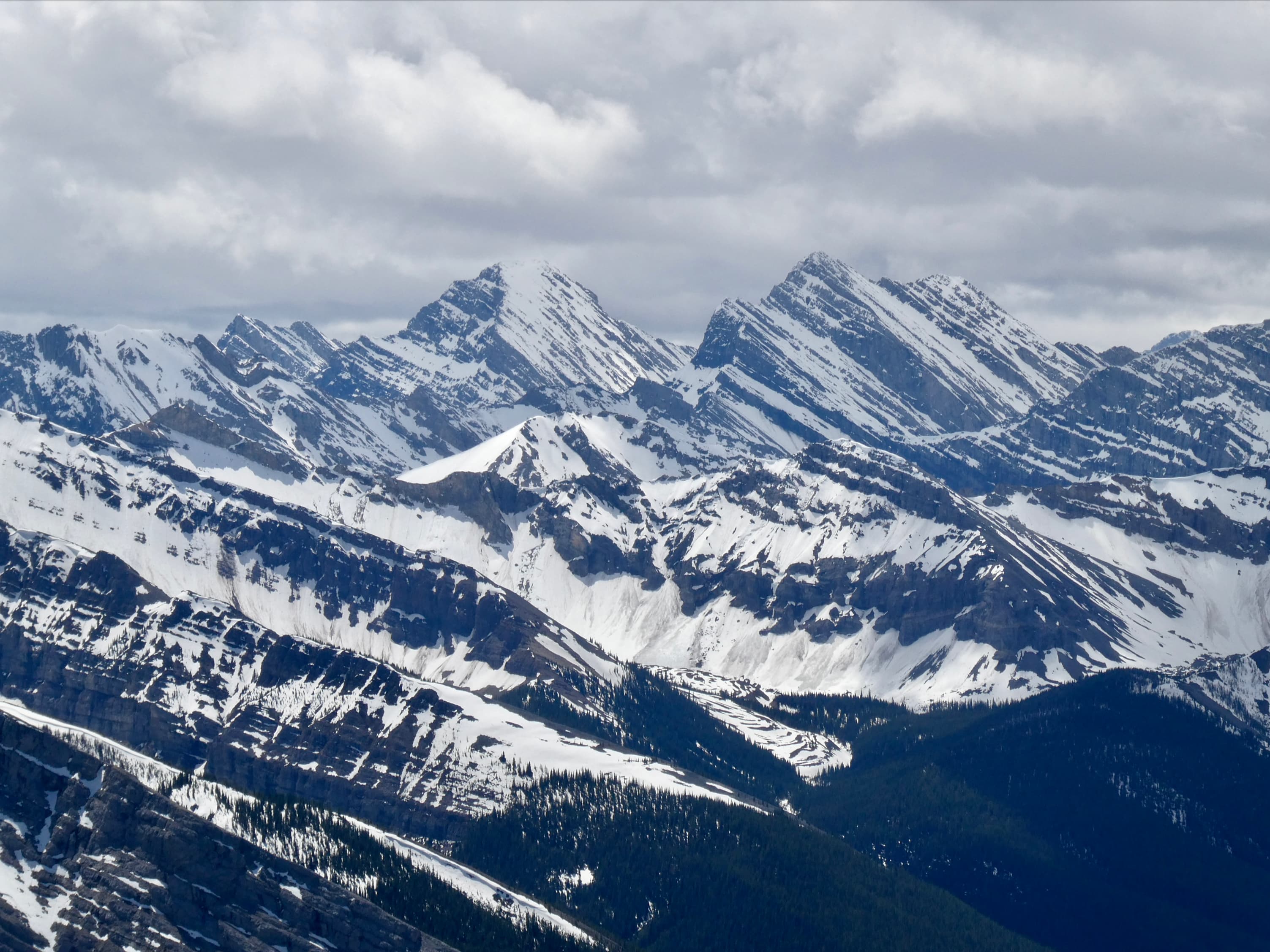
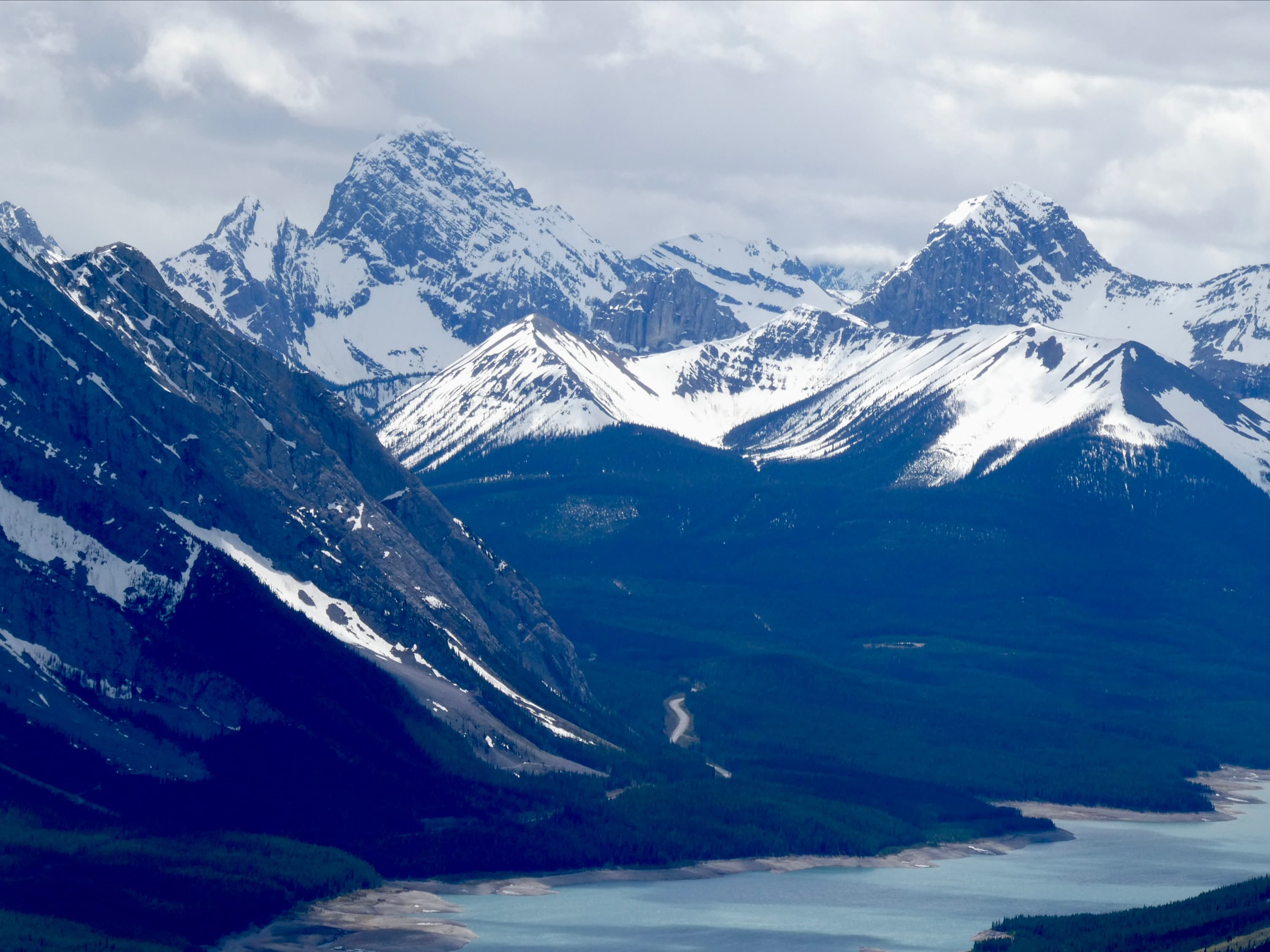
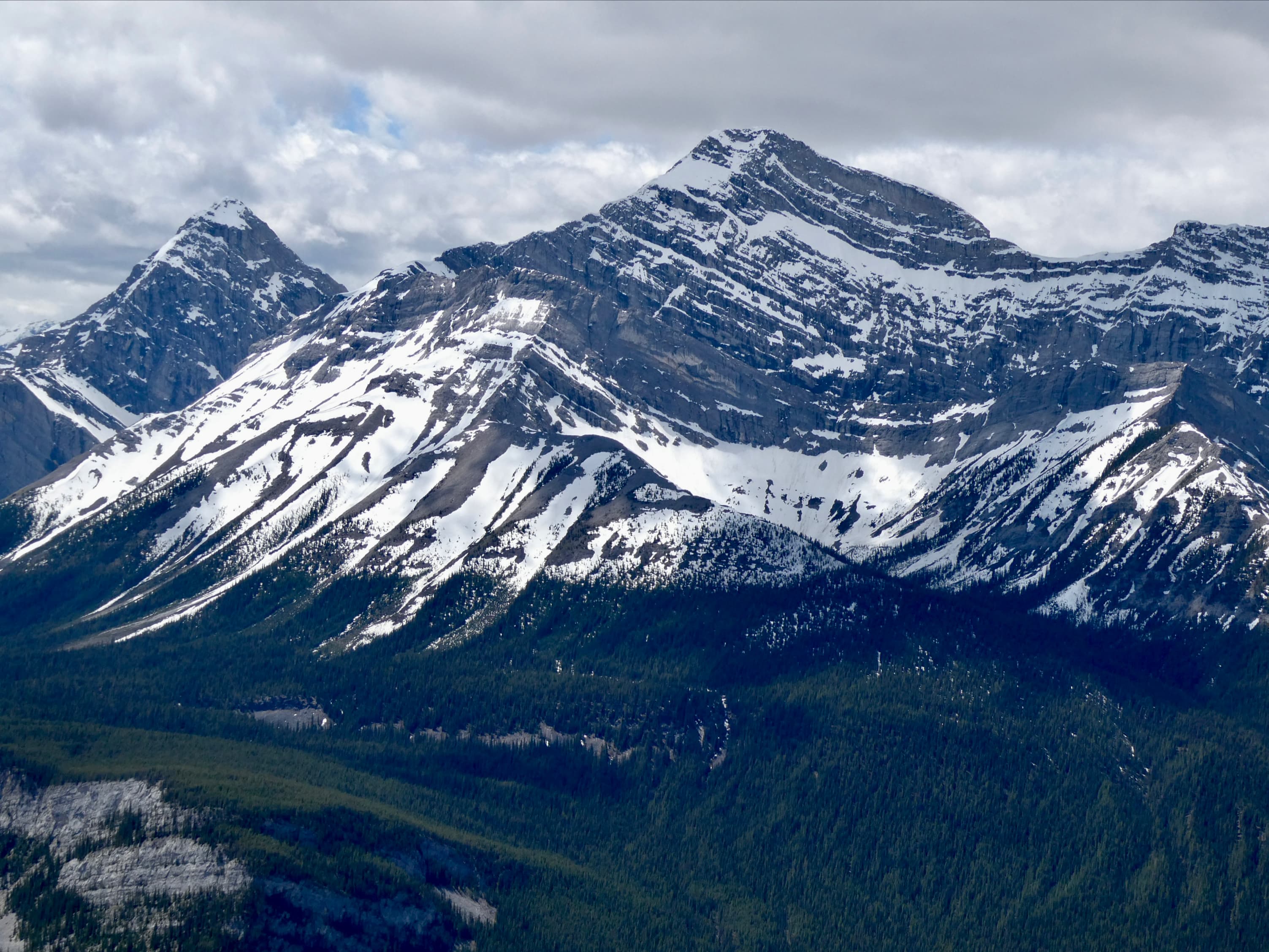
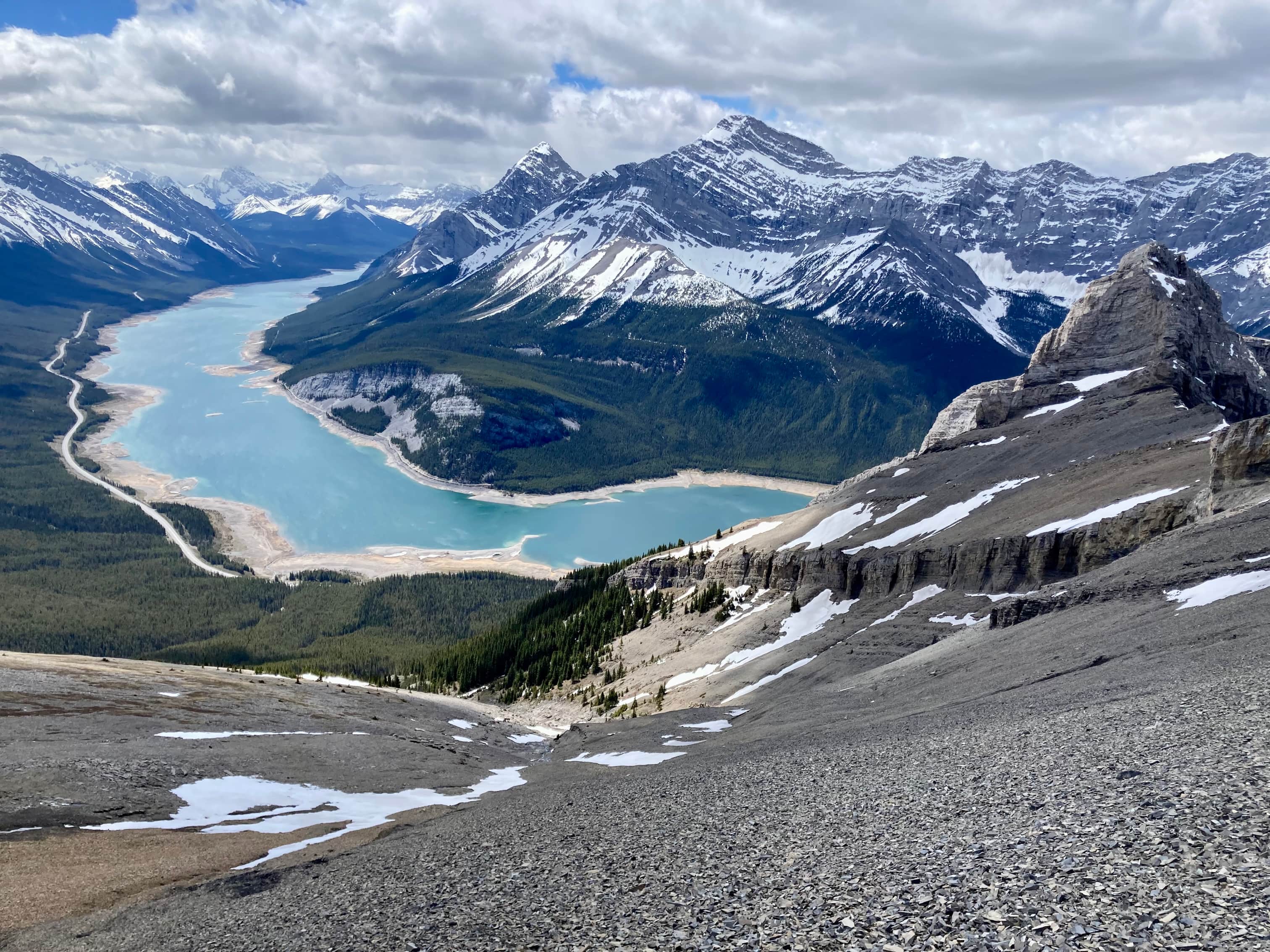
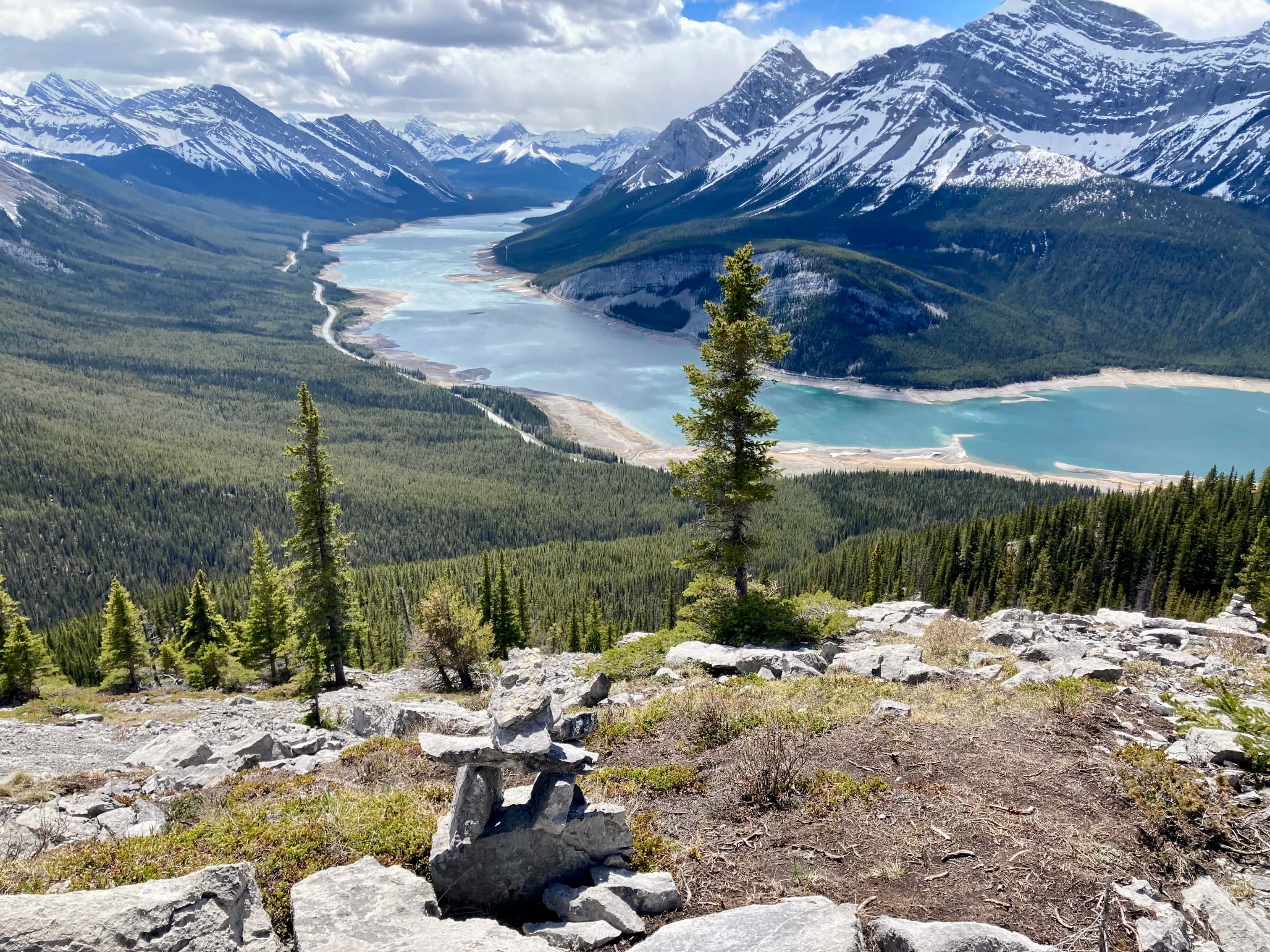
Rimwall Summit is a ”moderate” scramble featured in Kane’s Scrambles in the Canadian Rockies. Kane undersells it a bit, I think, writing that it’s worth doing ”If you’ve done the local favourites”. Having done the trip, I’m a little surprised it isn’t one of the local favourites. It’s easy to access, being nearby Canmore, and the route begins at a clearly marked trailhead. By halfway up the climb expansive views of the Spray Lakes Reservoir open up. From the summit you are surrounded by great views. Three Sisters is to the north, Mount Lougheed to the south, Spray Lakes Reservoir and surrounding peaks to the west, and the Bow Valley to the east.
The route starts at the West Wind Pass Trailhead. Google maps will lead you right to it. The access road, (Smith Dorien Trail/Hwy 742) is unpaved but fairly well maintained. A high clearance vehicle isn’t needed. There are broad gravel shoulders to park on at the trailhead. There’s also a sign notifying of seasonal closure of the valley to the east of the pass, which is relevant if you’re planning to follow the trail up and over the pass but it doesn’t impact this route.
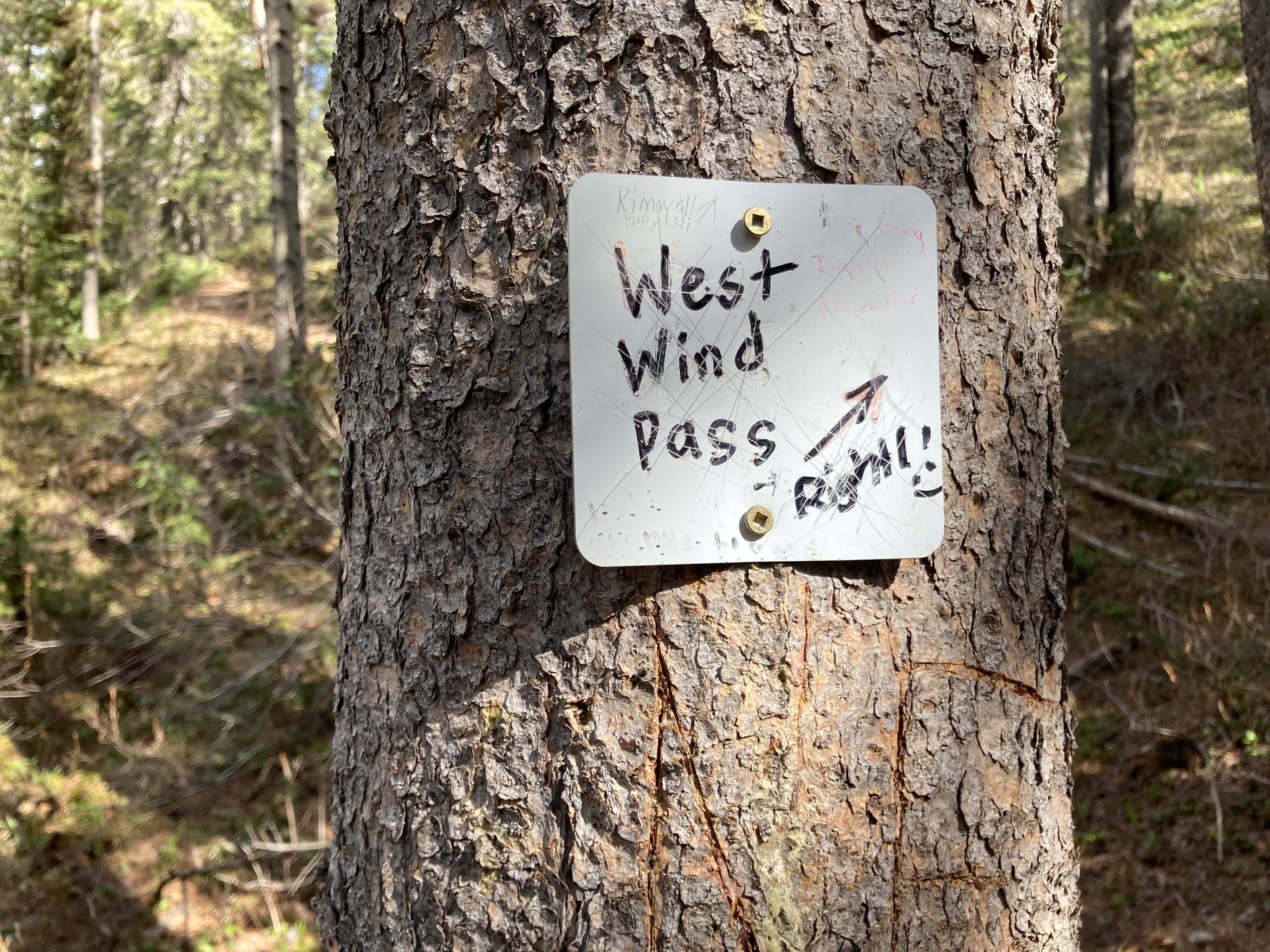
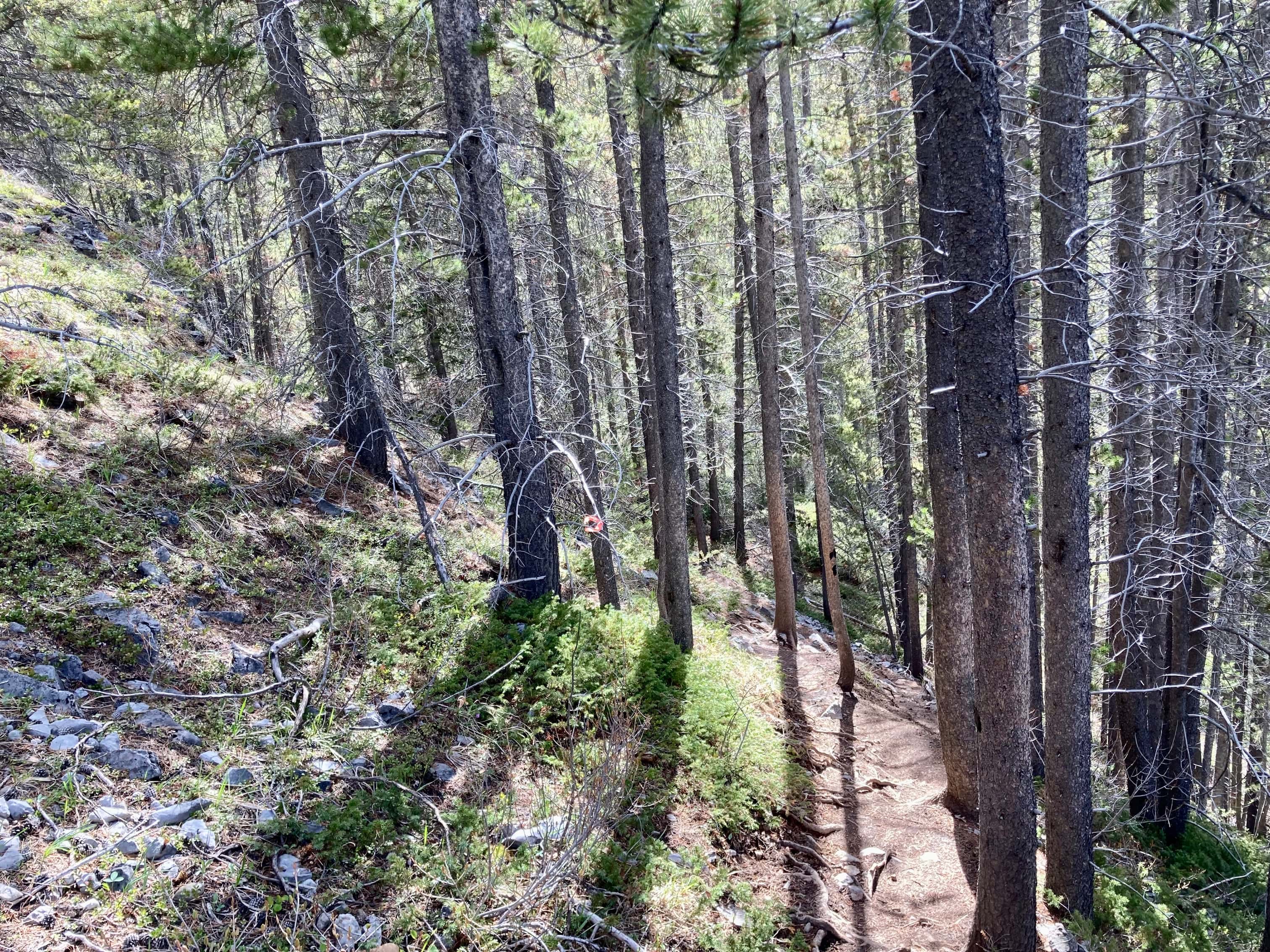
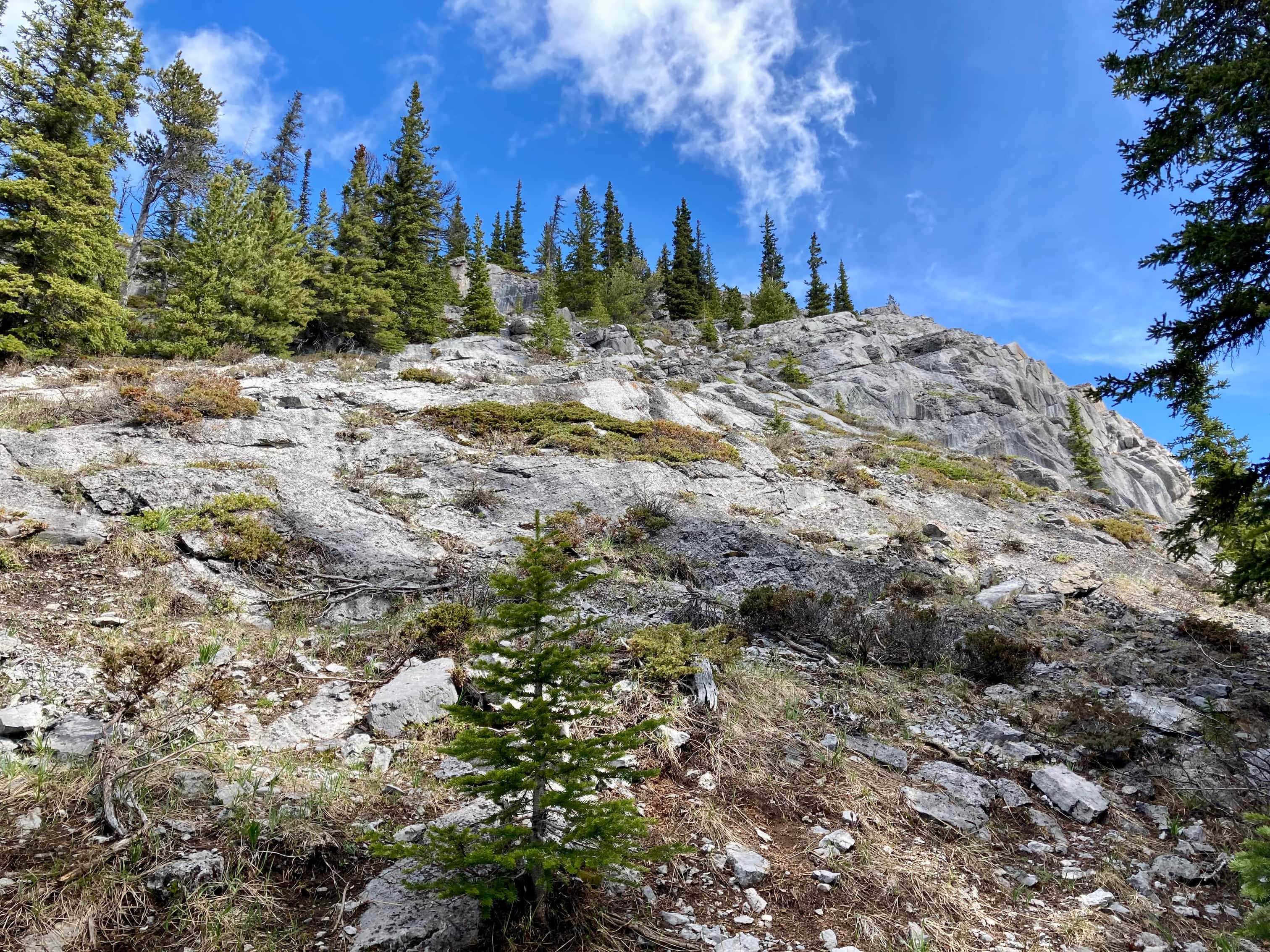
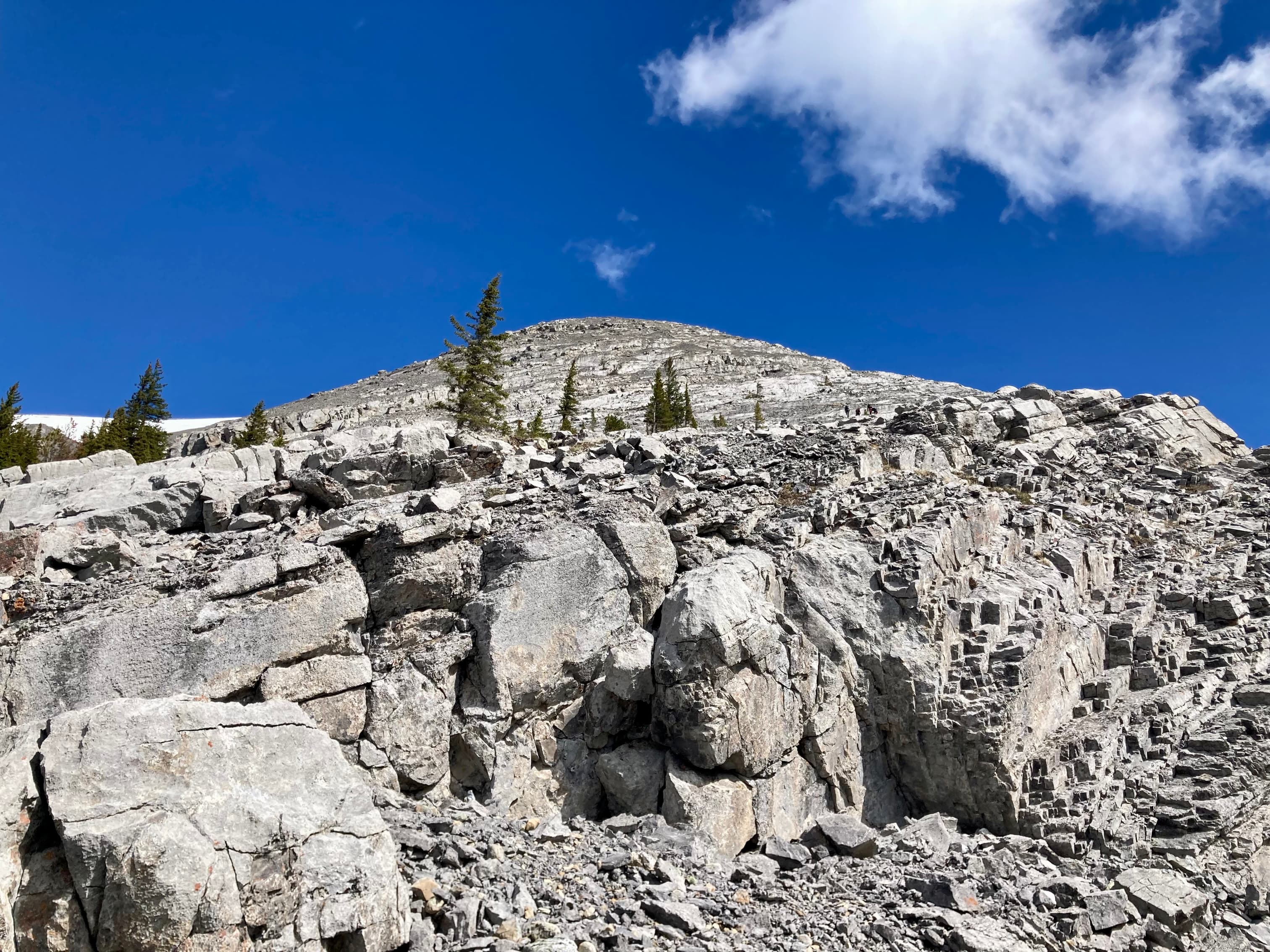
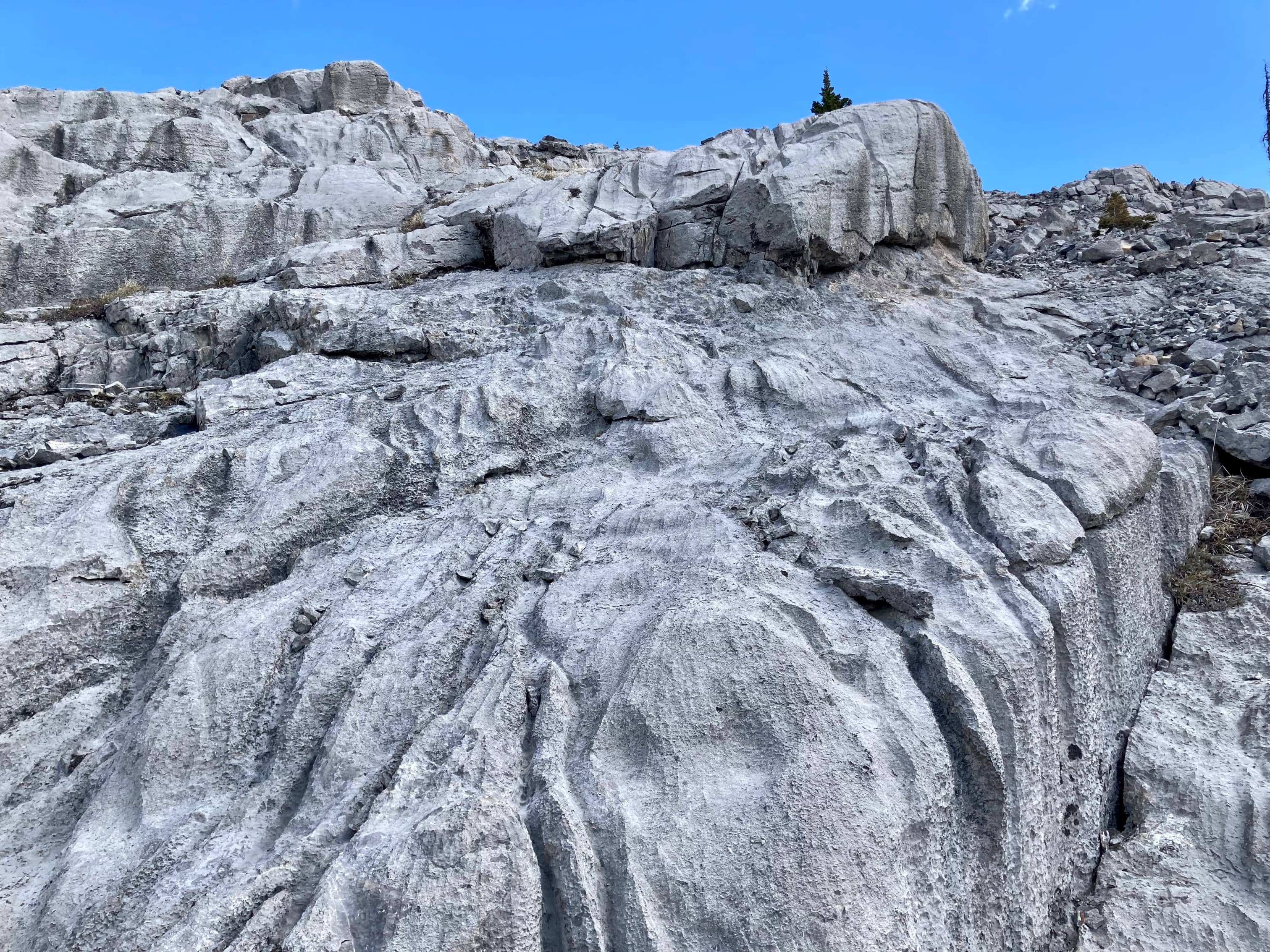
From the trailhead, we followed the official trail towards West Wind Pass. There was a fork about 250 meters along which was marked with a small white sign posted on a tree. A message written in Sharpie told us ”West Wind Pass —-> Right !!”. We obeyed the sign. During my internet research before this trip I had read about a cairn marking a left turn about 1 km from the trailhead. We found it and departed the main trail and started to ascend steeply. Despite being off the main trail, it wasn’t hard to see where to go – the route is popular enough that the way is pretty clear. Between the boot-beaten path and many, many cairns there wasn’t too much route finding to do. Once out of the trees there were some low rock bands to climb up (no major scrambling) and we were on the ridge.
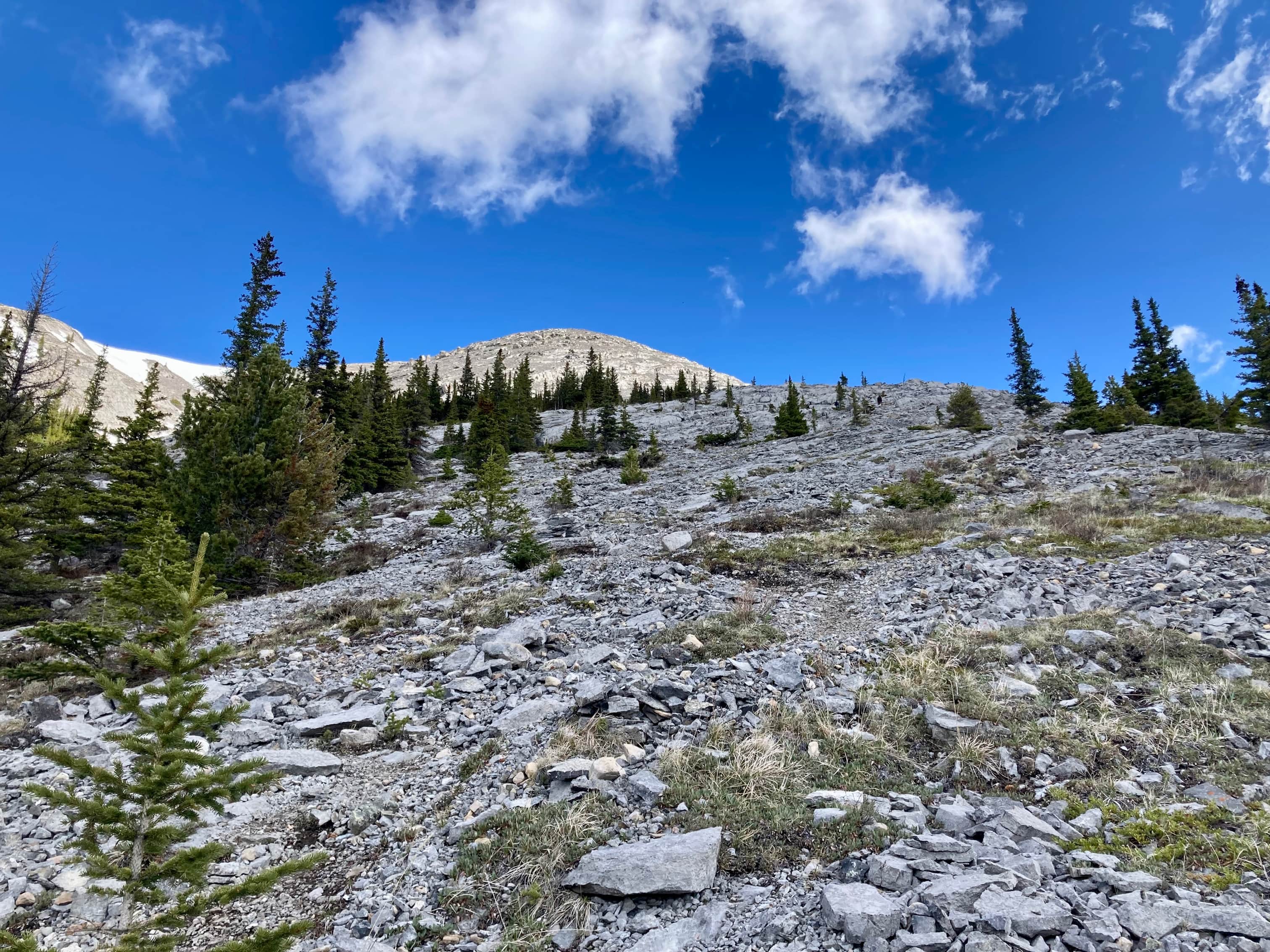
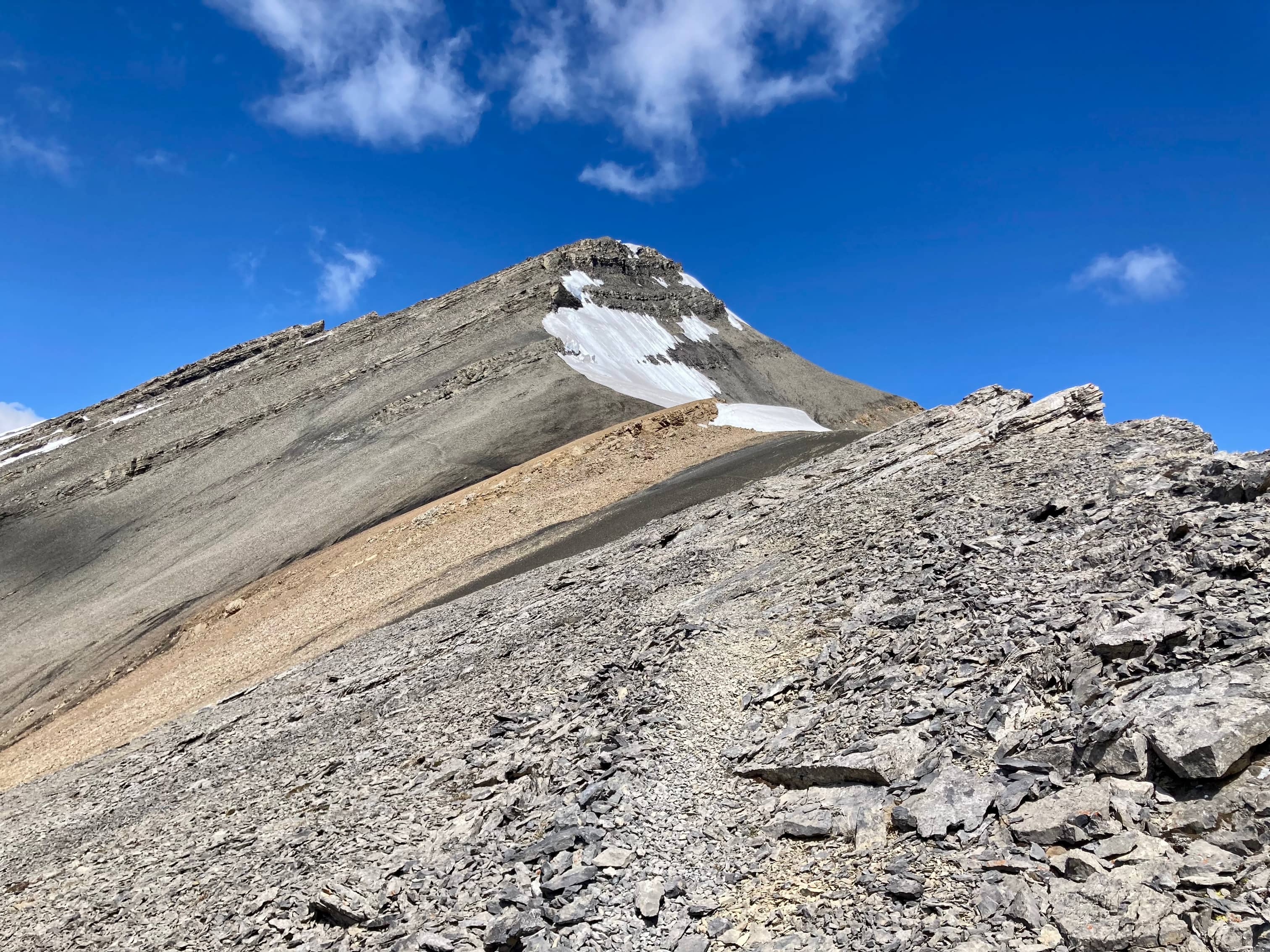
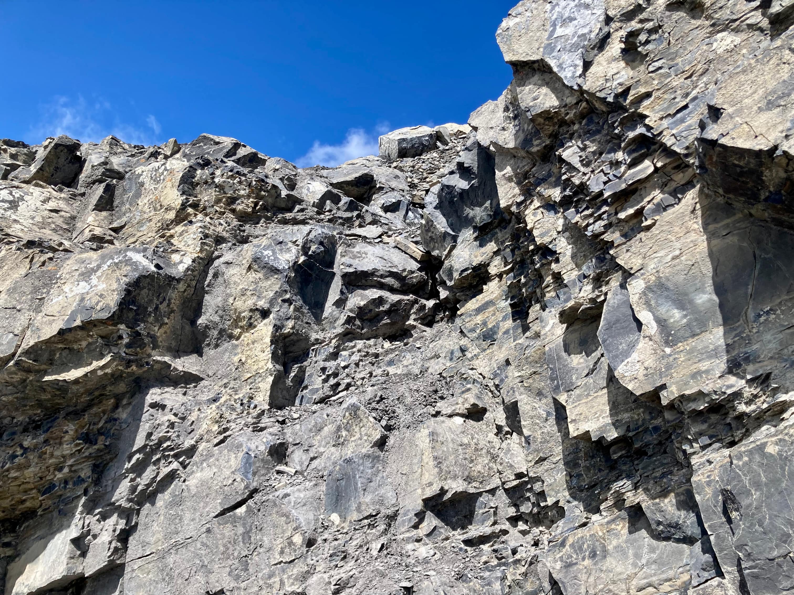
From there the route ascends to the false summit and continues along the ridge to the summit. As far as I can tell, the only unavoidable scrambling comes in the form of two low rock bands just below the summit. Hands-on scrambling is required, but there’s no exposure. It should be noted that along the route below here there are a few opportunities to scramble if you feel the urge but they can be avoided. Moving at a pretty easy pace we reached the summit after about 3 hours. The wind was howling and very cold but we still stayed for a while to take in the great view. We returned by the same route.
Click on the pictures in the gallery below to access higher resolution images.


Incredible scenery and photos!
LikeLiked by 1 person
Thank you 🙂
LikeLiked by 1 person