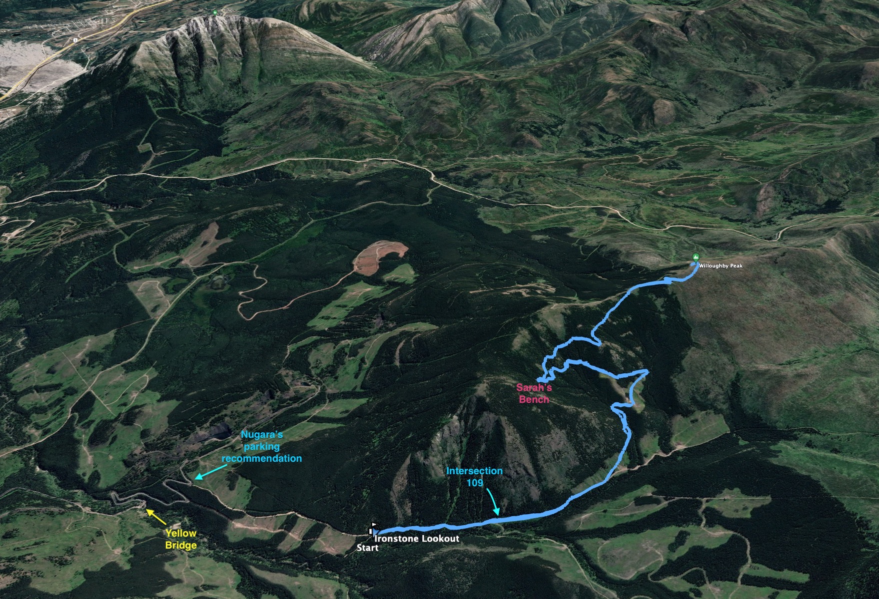
Topo map of the route. Don’t be fooled by the yellow lines implying a trail from the northern summit to the apex of the big switchback. There isn’t one (See Bob Spirko’s report).
The snow melt is a month or more behind schedule as the true hiking season kicks off in 2022. Most of the more interesting hiking trails and peaks remain snow bound, so I decided to do a relatively quick and easy trip to Ironstone Lookout in the Crowsnest Pass. This trip is included in Andrew Nugara’s Popular Day Hikes: The Castle and Crowsnest. Bob Spirko also reported on his ascent back in 2015 (he also climbed it on June 6, as it turns out). Spirko was up-front about the journey itself being a little lack-lustre, but he views from the top looked great, so I decided to give it a shot. His ascent was on a day with better weather than mine, so definitely check out his post to see the potential rewards of climbing to this lookout on a clear day.
Access is via the York Creek Staging area south of Coleman. I outlined how to get there in my Mount Coulthard post so you can reference that for directions. Instead of parking before the yellow bridge, this time I kept driving to a point about 600 meters short of intersection 109. By that point the road was getting too rough for my tastes so I parked at a clearing and set off walking along the ATV path. At intersection 109 I took the left fork, then took the left fork again at the next intersection 800 meters later. From that point there was no further navigation required and I followed the trail all the way to the lookout. The ascent only took about 1h 40m.
The trail itself was not particularly exciting, but it wasn’t too long before views to the west opened up and there were expansive views towards Mount Coulthard and other peaks in the Flathead Range. The weather wasn’t great, with lots of low cloud, but that added a charm of its own to the views. Part of the way up I encountered “Sarah’s Bench”. Spirko got some information about this from a local man – Sarah Thompson was a former fire lookout and the bench is named for her. The bench sits in a serene little clearing beside the trail.
Aside from some gates, there really isn’t much else aside from Sarah’s Bench to look out for on the route. There’s the option to follow the ridge north from the summit to a lower northern summit but I opted not to, given that the views wouldn’t be much better from there.
Click on the pictures in the gallery below to access higher resolution images.
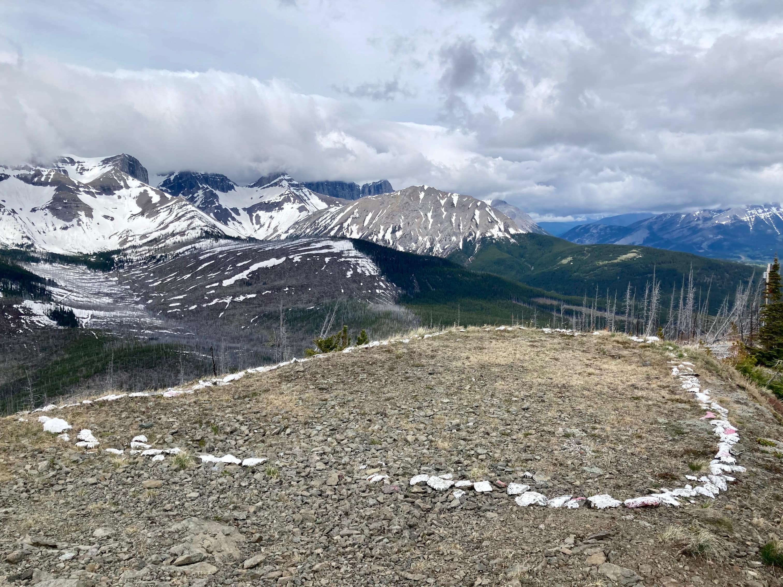
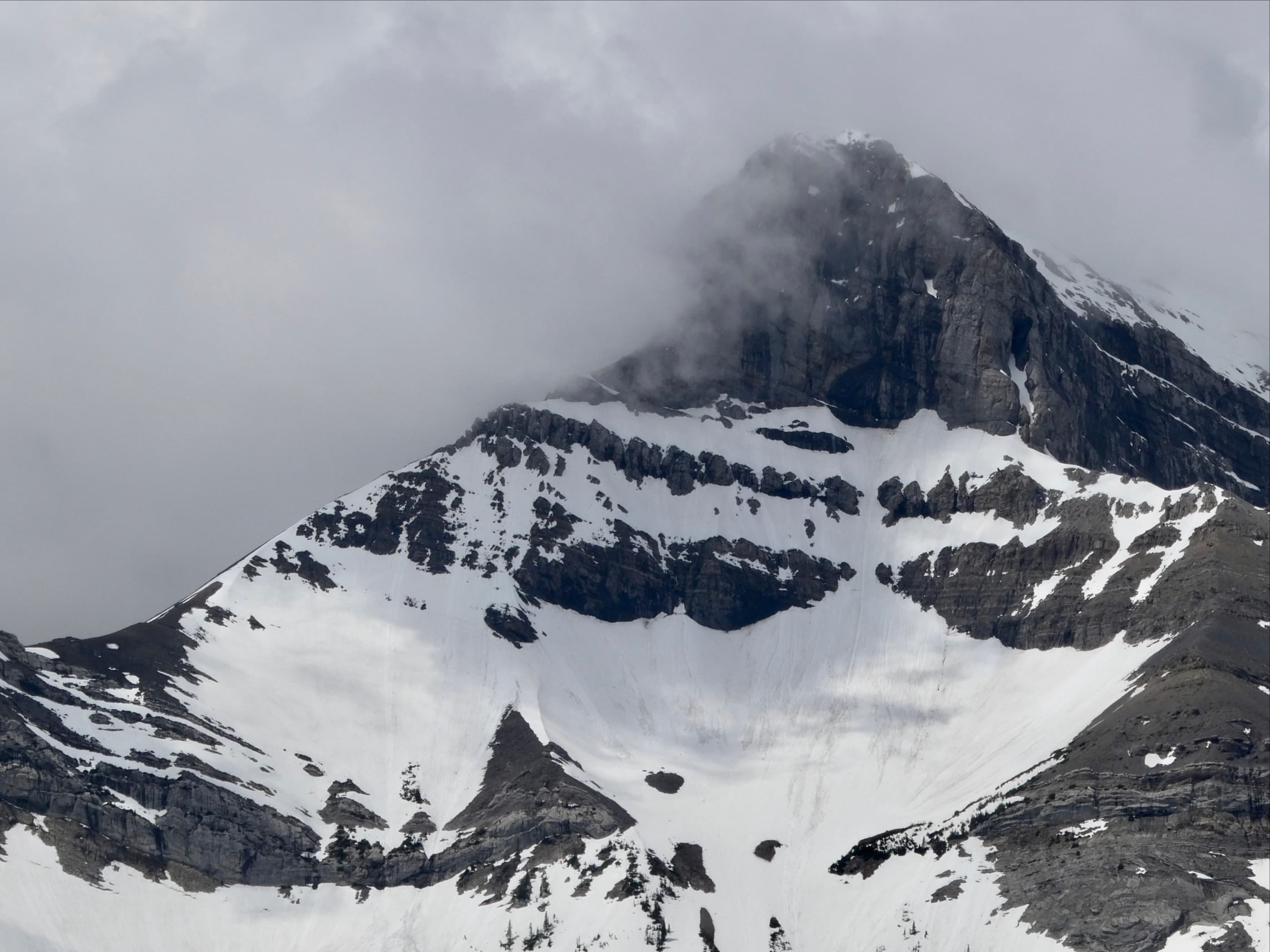
Route overview looking east. The Yellow Bridge is the one I referenced in my Mount Coulthard post. Nugara suggest parking a short distance beyond, but my Outback was able to handle another kilometre or so.My parking spot, roughly 600 meters short of intersection 109.At intersection 109 I went left. To the right, trails carry on towards the Plan Crash site and the base of Mount Coulthard and Mount McLaren.At the next fork, I once again went left. There was an open black gate shortly after the fork, then this closed yellow gate and some logs across the road beyond, presumably to prevent ATV traffic. It’s easy to pass around on the right.Eventually the trail comes out to this avalanche pathway and the views to the west open up. Mount Coulthard is on the left and Mount McLaren on the right. Andy Good Peak and Mount Parish have their heads in the clouds in between.Sarah’s Bench. It’s in a little clearing next to a switchback. The mossy ground gives it a different ambiance than other places along the trail.The bench is a little worse for wear. Large parts of the inscription have flaked away with the paint.Almost to the ridge. The antenna on the top of the watch tower is visible. There was plenty of snow on the trail between the trees.The lookout. It didn’t seem to be manned today. I stayed away from the buildings.Ironstone Lookout on the summit of Willoughby Peak.A large ring of white rocks next to the station. Mount McLaren is in the background.Summit panorama looking west. Only Mount McLaren (on the right) is fully visible. On a clear day Mount Coulthard, Andy Good Peak, Mount Parish, Chinook Peak and some big outliers would be visible.The much more mellow summit panorama looking east. Bluff Mountain, Turtle Mountain, and Hillcrest Mountain are across the valley.Looking toward the lower northern summit. I didn’t visit there, but it would be easy enough to follow the ridge.Looking south from the summit. Prairie Bluff, Pincher Ridge, and Victoria Peak are visible. A closer look at the summit of Mount Parrish when the clouds moved off a bit.A closer look at Mount Coulthard’s summit.As I began to descend the clouds broke up more and the light improved. As I got lower the situation with the clouds continued to evolve.The best view I got all day of Mount Coulthard came just as I was about to descend back to the valley bottom.Almost back down to the access road. The clouds continued to break up. I guess I mis-timed this outing slightly, since the afternoon looked like it would be sunny but it was still worthwhile.