August 29, 2021. A scramble in the Crowsnest Pass featuring 3 summits, an outlier, and the debris from a plane crash.
- Region: Crowsnest Pass. Traditional territory of the Tsuu T’ina, Ktunaxa, and Blackfoot First Nations
- Distance: 22.9 km round-trip
- Total Ascent: 1493 m
- Elevation of Objective: 2640 m
- Total Time: 6h 50m
- Safety and Disclaimer
Note: The Total Ascent was measured somewhat differently by different apps (as much as 1770m in one), so I went with a moderate measurement. There are ups and downs moving between the summits as well as on the ATV trails to and from the mountain.


Summer 2021 is nearing its end, along with the two hottest, smokiest months I can recall. The past week has seen a little bit of autumn crispness enter the air and the smoke has finally cleared. I took the opportunity to climb Mount Coulthard, an objective I had been putting off until a clear day came along. The mountain has four cairns arrayed across three summits and one nearby outlier. Each spot has slightly different views of the surrounding landscape and I found that it was definitely worth tagging all four.
Access to this peak is a little convoluted, involving going through Coleman to a fairly rough access road leading to an area primarily used by ATVs. Ask Google to guide you here – the pin is dropped near a pull-out to the left of the road as you drive in. This is a good place to park – the route properly starts a short distance down the road, where it descends to North York Creek, but there are No Parking signs there . Some older resources may have different advice. I went with Nugara’s suggestions from Popular Day Hikes: The Castle and Crowsnest since it’s the most recent publication in my collection dealing with that area. Vern Dewitt over at Explor8ion parked in a slightly different area and had no problems. His trip report detailing his adventures in cycling this approach is here.
From the parking area I followed the road down to the creek. Here the road splits with the left branch going over a yellow bridge, and the right becoming an ATV trail marked 111. Either direction will lead eventually lead to a confluence of the two routes at another bridge about 4 km west. I read a variety of opinions about which way was best to go, but I settled on following 111 on the way in. I found it so miserable and muddy that I decided to check out the other route on the way back. That way was also muddy and miserable, but only for about half its length. Describing these routes is a little tough without a map so:

This is a part of the official Livingstone PLUZ Motorized Summer 2021 map. The website to find up-to-date maps of the area is here. These are presumably updated yearly. I added a pointer to where the yellow bridge is. On my way in I followed 111-110-108. On my way out I followed 108-109-111. It’s only after the fact that I found this map and realized that I could have driven my car (it has good ground clearance) all the way to 109. I brought a bike since Nugara mentions that it can speed up the approach, but 111-110-108 was basically impossible to ride except for a short distance at the beginning. Any place that wasn’t a series of big mud puddles was too rocky to ride over. On my return I found that 108-109 was the same way and it was going somewhat steeply uphill. 109-111 was ridable, though. In the end I’m not sure I saved any time with my bike, but carrying the thing up and down the trail made for some decent exercise. ATVs and dirt bikes were zipping back and forth as I made my way along the trails so I had to move off into the bushes from time-to-time.
From 108 there are signs pointing the way to “Plane Crash”. I didn’t bother bringing my bike beyond this point and hiked along the steadily climbing trail without difficulty. The wreckage of an RCAF DC-3 sits at the base of Mount Coulthard. It crashed in bad weather in 1946 resulting in the deaths of all 7 airmen on board. Their bodies were recovered, so the site is not a final resting place. However, the wreckage has become something of a memorial, with an information sign and 7 crosses present. Unfortunately, the memorial has had to suffer the indignity of years of graffiti. There are even several bullet holes.
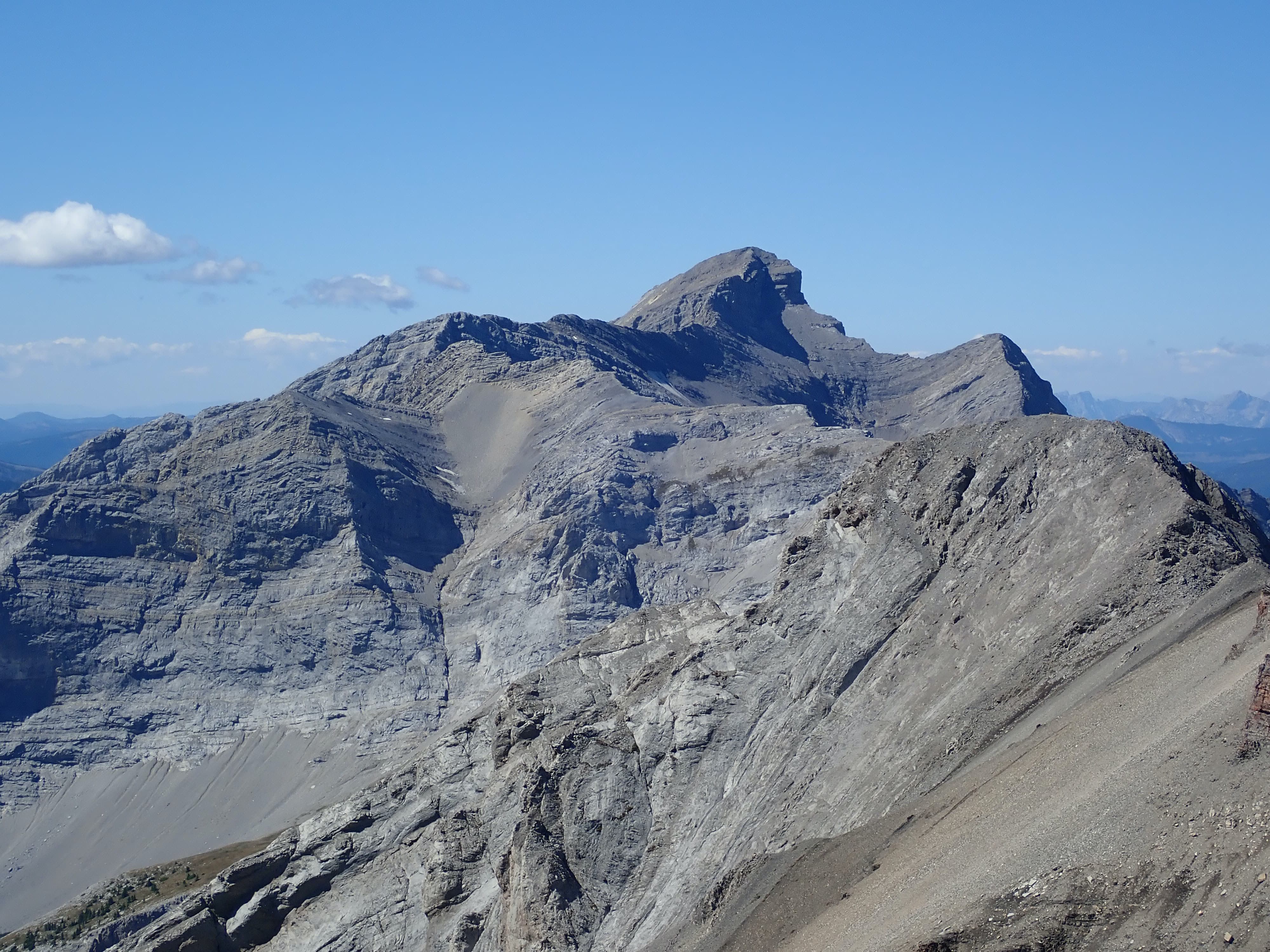
The ascent to the top of Mount Coulthard starts immediately beyond the crash site. Where the ATV trail ends there are obvious dirt trails ascending a steep slope. These ascend to the right of a waterfall and eventually enter a broad cirque under Mount Coulthard, Andy Good Peak, and the connecting ridge in between. The northern outlier of Mount Coulthard towers to the left as you enter the cirque and the idea is to ascend the steep grassy slopes leading to the col between this outlier and the centre summit of Mount Coulthard. Aside from having the sun in my eyes i didn’t have any problems with this ascent. I kept to the grassy areas of the slope as much as possible so I didn’t have to treadmill in any scree.
From the col I began my clockwise circuit of the four cairns, first heading left (north) to the outlier. Then I went south and east on a faint trail passing under the rocky face of the central summit, heading towards the east (true) summit. From there I went west, toward the central summit. Seen from the east it looks daunting, but there was an easy way up. I traversed to the right, under the rock face, then hooked around onto scree slopes which allowed reasonably easy access to the top. From there I descended to the west and followed the ridge to the final cairn on the western summit. This last ascent had some brief exposure to the left. The footing was secure, but a slip and slide could be disastrous. From there I returned to the col between the west and central summits and rode the scree back down into the cirque.
It was great to have clear skies. There was only the slightest bit of haze, except to the south where a little bit of smoke still lingered in the sky. I stopped at each cairn for a time to take lots of pictures and enjoy the views. There was some gain and loss of elevation involved in doing the circuit but it didn’t feel too onerous, and the views from each cairn are different enough to make it worthwhile to visit each one. Descending out of the cirque I returned to the ATV trails and made my way back to my car.
Click on the images below to access higher resolution images.


Great photos! It was good you waited for the smoke to clear. 🙂
LikeLiked by 1 person
It’s been so nice to have clear air again!
LikeLike