Autumn of 2021 has arrived, and the smoke has finally cleared from the air over southern Alberta. The forecast was for warming weather and relatively calm winds, so I decided conditions were right for a long ridge walk to check out the larches turning golden in the Castle. Barnaby Ridge felt like the best objective.
Barnaby Ridge is the long ridge directly across the valley from the Castle Mountain Ski Resort. Seen from the resort it is quite imposing but the topography looks fairly mellow. Viewed from the east, like from Whistler Mountain, it has a very stark and rocky character. I’m aware of at least 2 routes to the summit, but the one via Southfork Lakes and Southfork Mountain allows for a 2-summit day and a nice, long ridge walk.
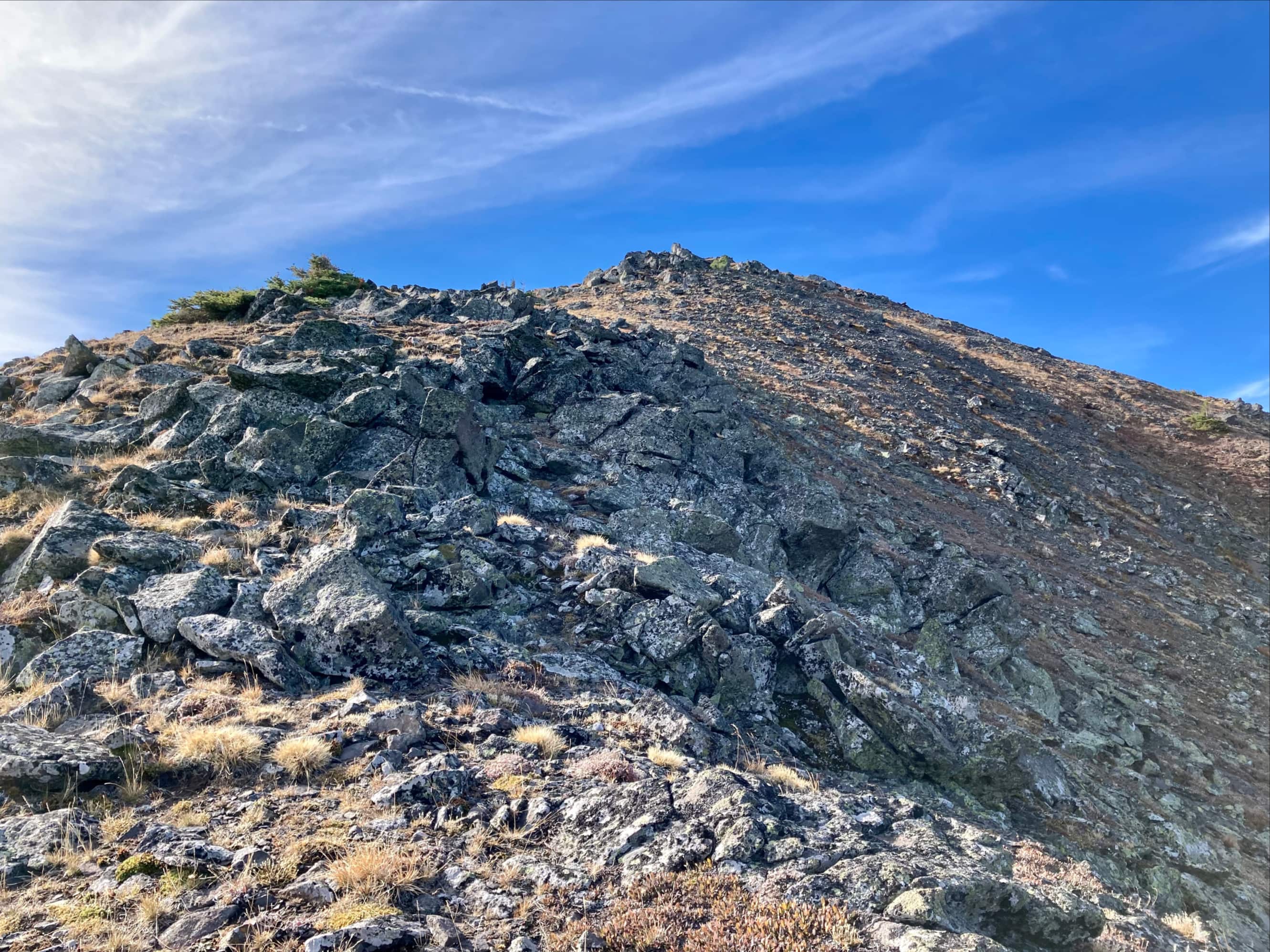
Access is the same as for Southfork Lakes. Check out that post for access details and a description of the ascent to Barnaby Lake and Southfork Lakes. From the lakes, the first objective is the summit of Southfork Mountain. This is attained by following the ridge line ascending west then southwest above Southfork Lakes. As I climbed, I found a discernible trail. It passed into the trees along the ridge and arrived in a picturesque clearing almost completely surrounded by larches. From there, I ascended some rubble-strewn slopes to the summit. There was no tricky scrambling, just steep climbing. It’s a good idea to have a clear idea in your head of the direction you ascended from, though. On your descent you can end up at the top of some steep gullies if you veer too far right.
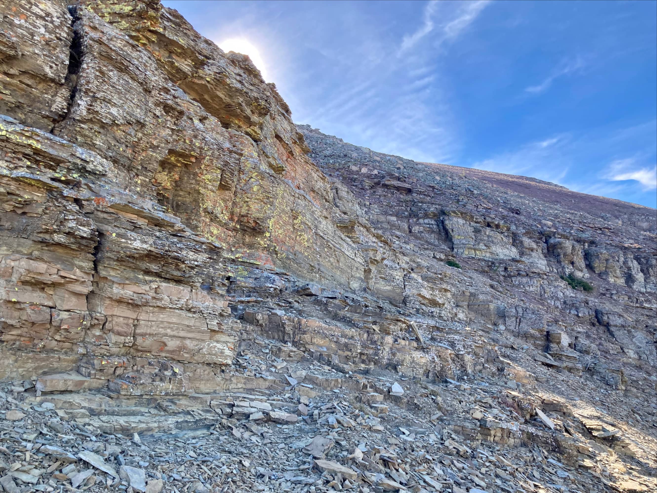
The summit of Southfork Mountain is a good objective in and of itself if you’re looking for a quick and easy scramble with excellent scenery. It took me 2h 20m to get to this point. Once you’re up there, though, your attention will immediately be drawn south along the broad ridge towards a rounded high-point referred to as “The Amoeba”. From a distance, the lower part of the ascent to this high-point looks like it could involve some tricky scrambling up a rock face, but it turned out to be fairly straightforward. I had to use hand holds in a couple of places, but it didn’t feel very exposed and route finding wasn’t difficult. I would say that it’s a good idea not to veer left as you climb, as that could take you to some very exposed terrain. Rock fall would also be a concern here if you’re in a group.
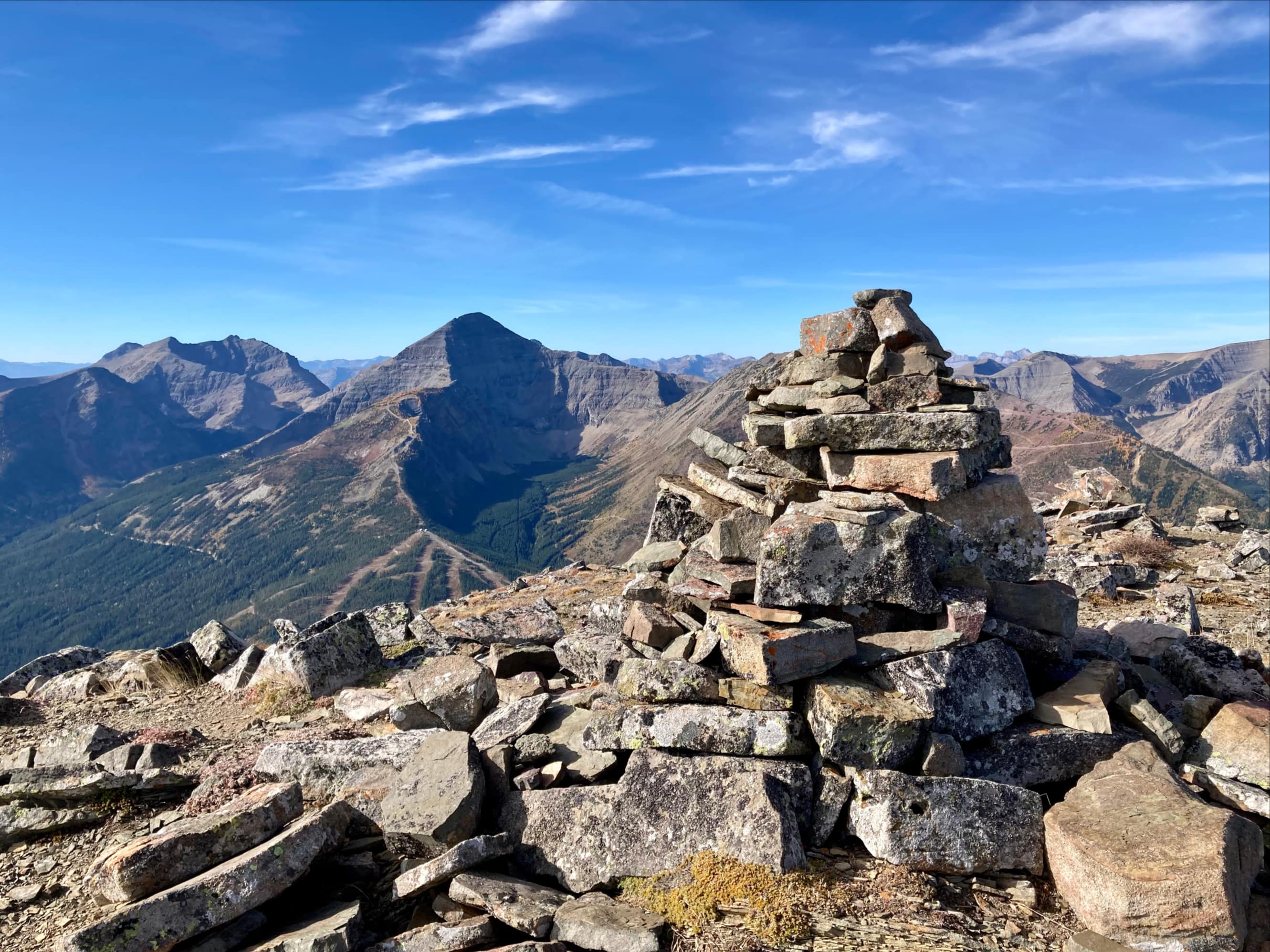
The top of “The Amoeba” resembles a gentle grassy hill. It’s notably higher than the summit of Southfork Mountain so the views are a little better. At the east end of the mound there’s a small cairn at a prime view-point looking east towards Beaver Mines Lake and the front ranges of the Castle. From here the summit of Barnaby Ridge is in full view to the south. The route is obvious, but involves the loss and re-gain of a little under 200m of elevation. On approach to the summit I could discern 3 high points. The central one is the true summit and you can slog directly up to it or zig-zag as you see fit. I arrived at the summit cairn at 3h 54m. A beat-up register is in a plastic container up there. I decided not to pull it out.
Barnaby Ridge’s location allows for great views in all directions. I didn’t go to the western high point – and in retrospect I don’t know why. It’s only a few minutes walk from the summit and would have allowed for some unobstructed views towards Middle Kootenay Pass. I ended up spending a long lunch break sitting at the eastern-most of the three high points and admiring the view towards Beaver Mines Lake, Table Mountain, Whistler Mountain, Mount Gladstone, Castle Peak, and Windsor Ridge. Gusty winds from earlier in the day had calmed somewhat and it was nice not being chased off a summit by high winds or swarming insects. Golden larches stood out amongst the greenery on the slopes and valleys all around. It was quite the idylic autumn day.
On my return I bypassed the summit of “The Amoeba” on a faint trail to the left (west). This didn’t bypass the scrambling area, but the down-climb wasn’t hard. Between “The Amoeba” and Southfork Mountain’s summit I wandered a little further right (east) so I could have a better view down into the valley holding Southfork Lakes. At the end of the day, the water of the cold West Castle River felt great on my tired feet.
Click on the pictures in the gallery below to access full-resolution images.
Route overview looking north.Barnaby Ridge’s mellow west face as seen from Middle Kootenay Pass. The summit and “The Amoeba” to its left are easy to make out.Barnaby Ridge’s dramatic eastern face as seen from the slopes of Whistler Mountain.On the way up to Southfork Lakes. Morning sun lights up the eastern slopes and ski runs of Gravenstafel Ridge. Barnaby Ridge casts its shadow along the bottom of the picture.The setting moon over Mount Syncline. Southfork Mountain, the first summit of the day.Larches almost glowing beyond the little outlet stream below Barnaby Lake.Golden light reflecting off Barnaby Lake made for an interesting blue/yellow contrast in the water.On arrival at the first Southfork Lake, the route to the summit is visible to the west. Once on the rightward ascent in this picture there’s a faint trail to follow which enters the trees. Note the steep gullies below the summit. Keep these in mind on your descent.Approaching the larches below the summit.The trail I was following passed through the tree line into this clearing.The rubble-strewn slopes below the summit. You could climb straight up, but I went to check out the rocks on the left.Almost to the summit, looking down at Southfork Lakes.Green lichen and black rocks, so the summit must be close.The summit of Southfork Mountain.Mount Syncline across the valley to the northwest. Distinctive Mount Darrah is in the distance.The angle and quality of the light made for some moody colours and shadows.Panorama to the west taking in all of the Castle Mountain Ski Resort (Mount Haig and Gravenstafel Ridge), as well as Mount St. Elois and Syncline Mountain.Looking south from Southfork Mountain’s summit toward the rounded form of “The Amoeba”.Approaching the rock bands. A bit of scrambling terrain. No tricky route finding involved. Provided you don’t start drifting left as you ascend you won’t be dealing with any significant exposure.Looking back from above the rock bands.Looking east from the red argillite summit of “The Amoeba”. Beaver Mines Lake is to the left. Table Mountain, Whistler Mountain, North Castle, Mount Gladstone, Castle Peak, and Windsor Mountain are on the other side of the valley. Victoria Peak is visible further in the background to the right of centre. A panorama looking west from that same point showing just how flat the summit of “The Amoeba” is.From “The Amoeba” the summit of Barnaby ridge is in full view. All three high points can be seen along the skyline of the ridge from here. The central one is the highest and is the true summit.Some of the terrain along the way to the minor high point between “The Amoeba” and the summit.Looking southwest towards Middle Kootenay Pass.Looking southeast, larches look like they’re spilling off the shoulder of Barnaby Ridge.The very steep eastern face of “The Amoeba”.Approaching the final climb to Barnaby Ridge’s summit.The summit cairn on Barnaby Ridge. Cairns are also on the slightly lower peaks to the northeast and southwest (in the background of this picture). I found a beat up register in the cairn but didn’t try to unfurl the wad of paper within.Panorama looking east. The northeast cairn is on the high point nearby. Beaver Mines Lake, Table Mountain and Whislter Mountain are near centre. Mount Gladstone, Victoria Peak, Castle Peak, and Windsor Mountain are in the distance to the right.Panorama looking southeast. The little tarn in the hanging valley below has no name that I’m aware of. Peaks in the distant background include Mount Blakiston in Waterton and several peaks in Glacier National Park. To the right are Rainy Ridge, Three Lakes Ridge, and Jake Smith Peak.Looking a little closer at the tarn in its little hanging valley.An even closer look at the little tarn and its larch forest.Looking southwest at the slightly lower adjacent peak and cairn. Rainy Ridge and its neighbours are to the left, Mount Haig and its neighbours are to the right. A closer look at Rainy Ridge, Jake Smith Peak, and Three Lakes Ridge.Mount Blakiston at centre, Mount Cleveland further in the distance to the right.Kinnerly Peak is the triangular mountain at the centre. On the left Vulture Peak, Mount Carter, and Rainbow Peak. To the right are Kintla Peak, Long Knife Peak, Starvation Peak, and King Edward Peak.Castle Peak and Windsor Mountain.Looking west at Mount Haig and Gravenstafel Ridge.Panorama to the north. The red argillite summit of “The Amoeba” obstructs the view back to Southfork Mountain. Gravenstafel Ridge, Mount St. Eloi, and Mount Syncline are on the left. Beaver Mines Lake is on the right. Mount Darah and outliers are in the far background near centre.From the northeast cairn I had this nice view of Lys Ridge interposing itself between Barnaby Ridge and the mountains beyond.Heading back.Stopping to admire some rocky scenery along the way.Looking east from the low point between Barnaby Ridge’s summit and “The Amoeba”.Lots of contrast in these rock layers.To save a bit of wear on my knees I followed a faint trail in the scree to the left of the amoeba. It was steeply side-sloping in places, but didn’t present any major hazard. It doesn’t bypass the rock bands but down-climbing wasn’t hard.The light at the end of the day was more favourable to get a good picture of the scrambling section of the route.I deviated a little bit east from the direct route I used on my ascent so I could have a look down at both Southfork Lakes and Barnaby Lake.A slightly closer view. The colour of the lakes from this angle was amazing.After descending from Southfork Mountain (bearing left on descent to avoid the gullies) I got back to the clearing in the larches and had this nice view down to Barnaby Lake.Southfork Lakes.The afternoon light was much more conducive to good pictures down by Southfork Lakes.Back down to Barnaby Lake.One last picture before heading down.


Beauty photos!
Was just up there a few weeks ago, colours were just starting.
Sent from my iPhone
LikeLiked by 1 person