*The net elevation change is only 880m, but the ridge walk (and then the return ridge walk) add to the total ascent for the day. Alternate descent routes could knock about 150m off the total
Now that we’re firmly in shoulder season I figured it was a good time to visit Ruby Ridge. It is one of Nugara’s peaks in More Scrambles in the Canadian Rockies 3rd ed. Based on Nugara’s description and Bob Spirko’s trip report I figured I’d be on relatively safe terrain in the event conditions were unfriendly. The mountain itself is not tall, and the terrain via the usual route isn’t too inspiring. What Ruby Ridge has going for it is location: it sits next to Waterton’s two tallest mountains and offers views south towards Cameron Lake and the peaks of Glacier National Park beyond.
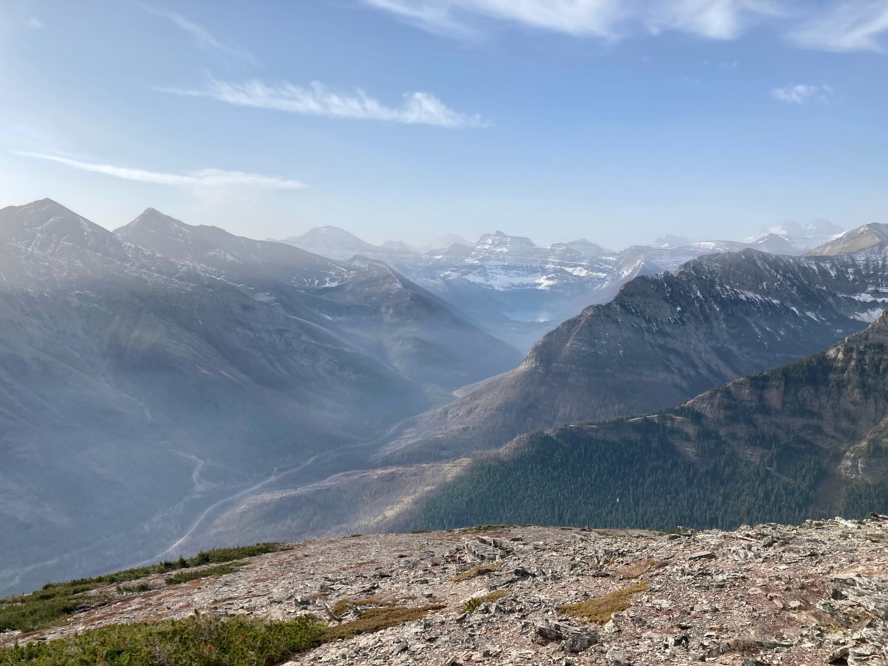
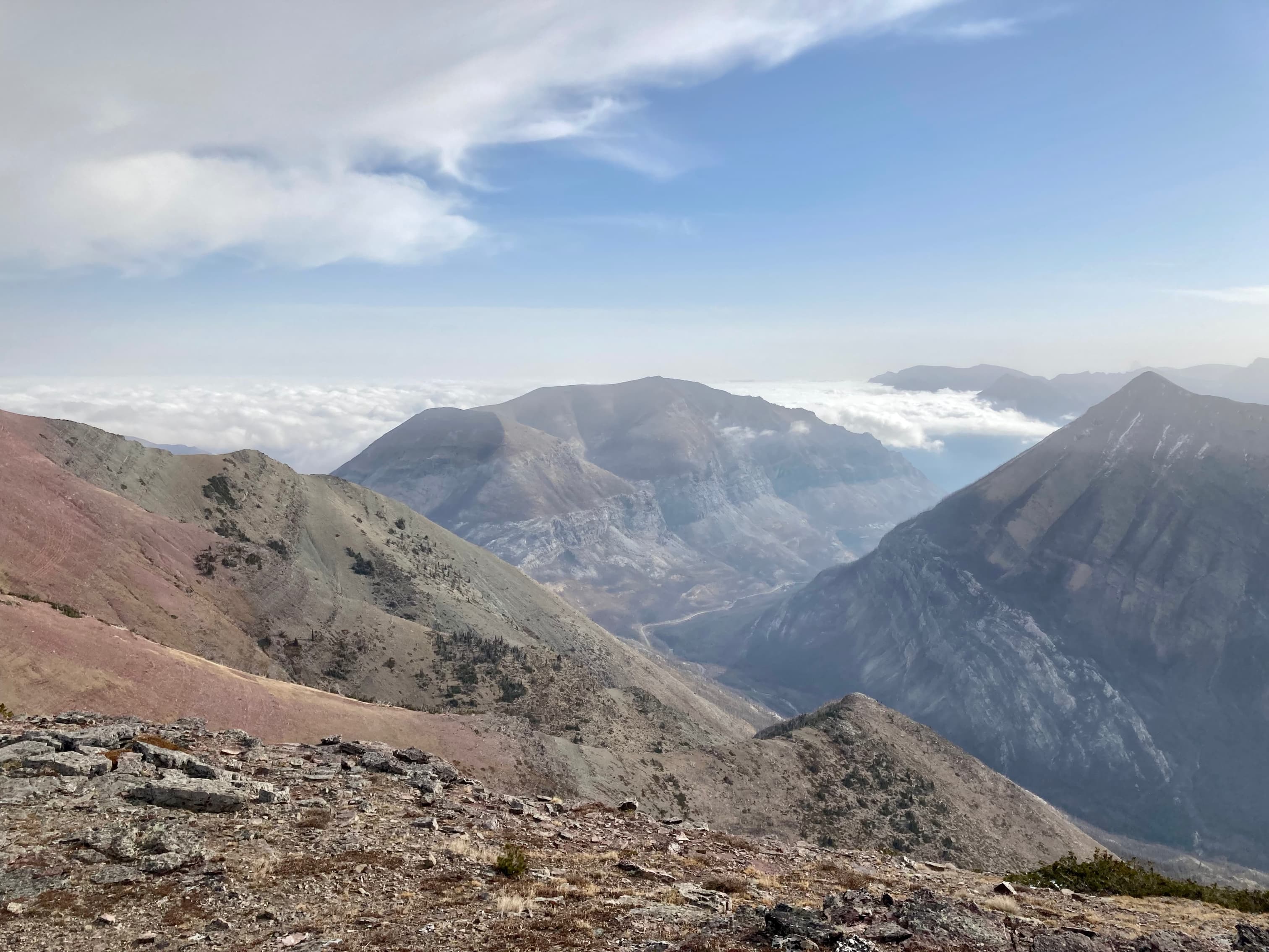
I was lucky enough to experience a temperature inversion on the day of my climb. An inversion is a phenomenon wherein the usual temperature gradient is inverted: instead of the air getting colder as you ascend, it gets warmer. The cold air is stuck down low and clouds form at lower altitudes near the interface between the hot and cold air. If you’re up on a mountain you’re treated to warm temperatures and striking views of the tops of clouds. The inversion made for a memorable day on Ruby Ridge.
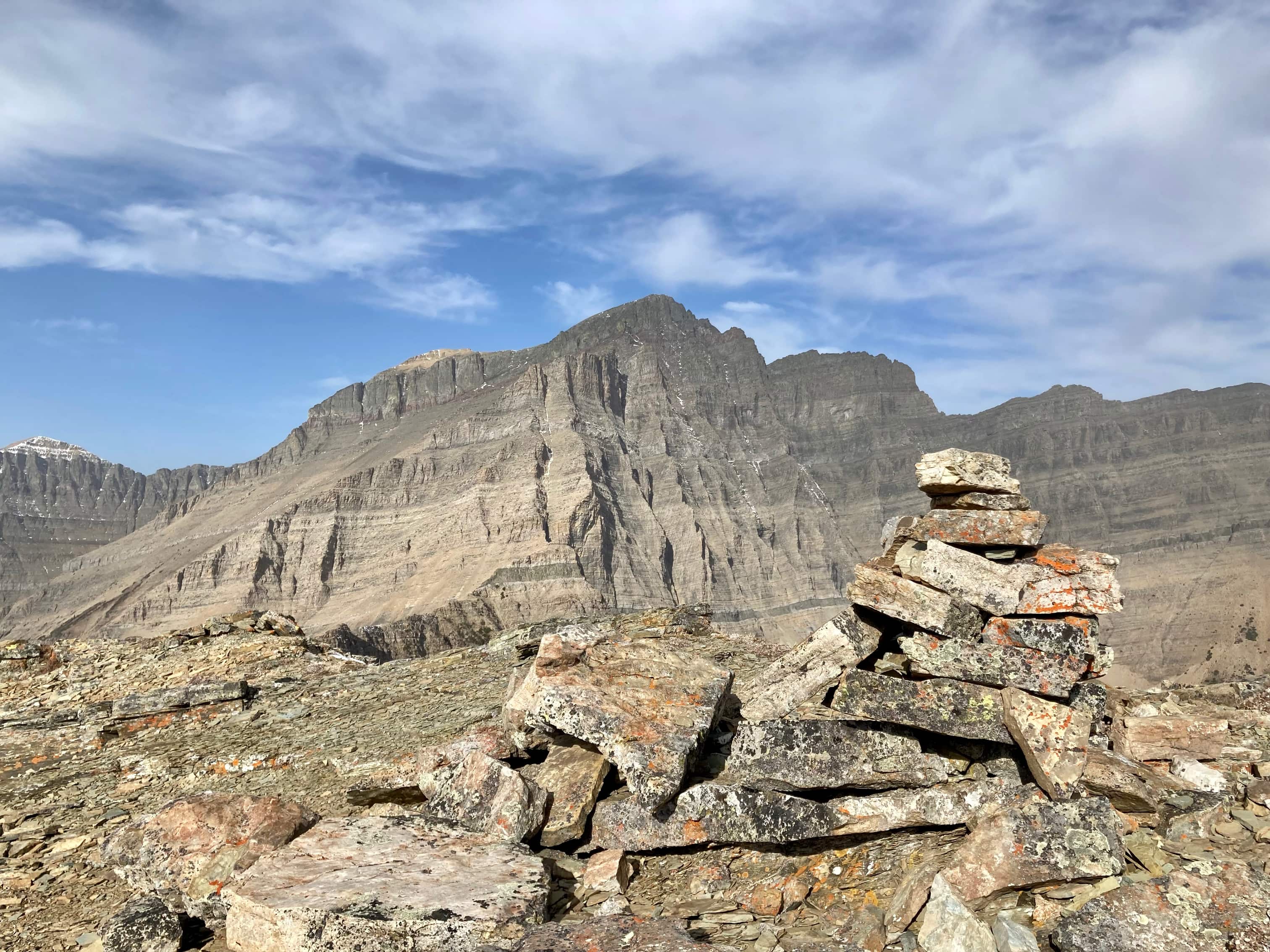
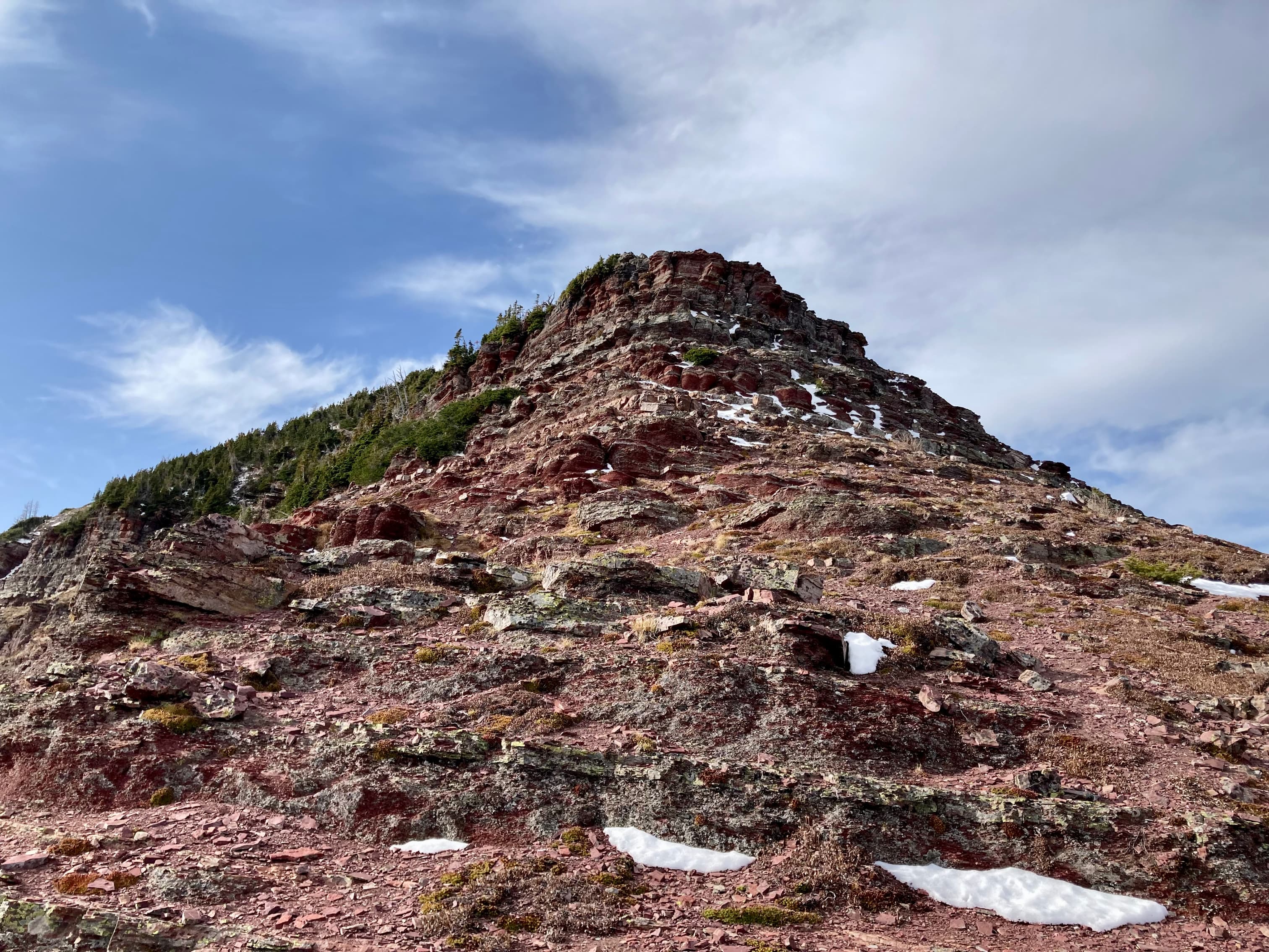
Access is via the Lineham trailhead along the Akamina Parkway in Waterton. The large, clearly signed parking area is 9 km up the Parkway from the Waterton townsite. I followed the Lineham Falls trail for about 1.8 km to where the trail intersected the broad, open ridge line coming down from the right. The initial ascent was a slog on open grassy slopes which eventually changed to scree. Rocky outcrops eventually came into view and I headed towards those so I could have more supportive footing. After an initial very steep ascent the grade levelled off a bit. There was no route-finding involved. I just continued climbing until I saw a couple of high-points of yellow rock to the left and a line of grey rock bands to the right. The summit is more to the right at this point, so I headed for the grey rock and was soon at the summit. It took about 1h 55m to this point.
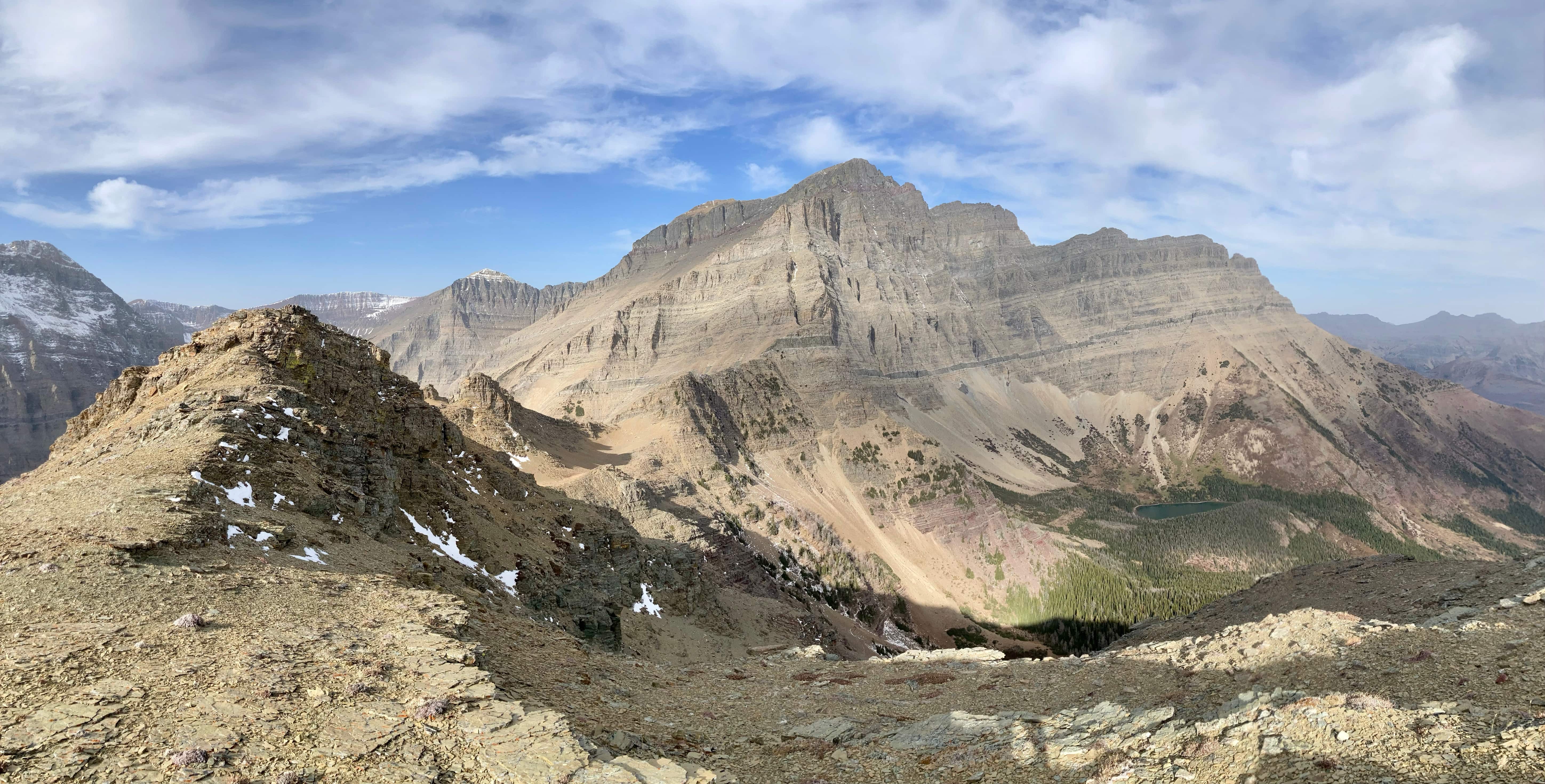
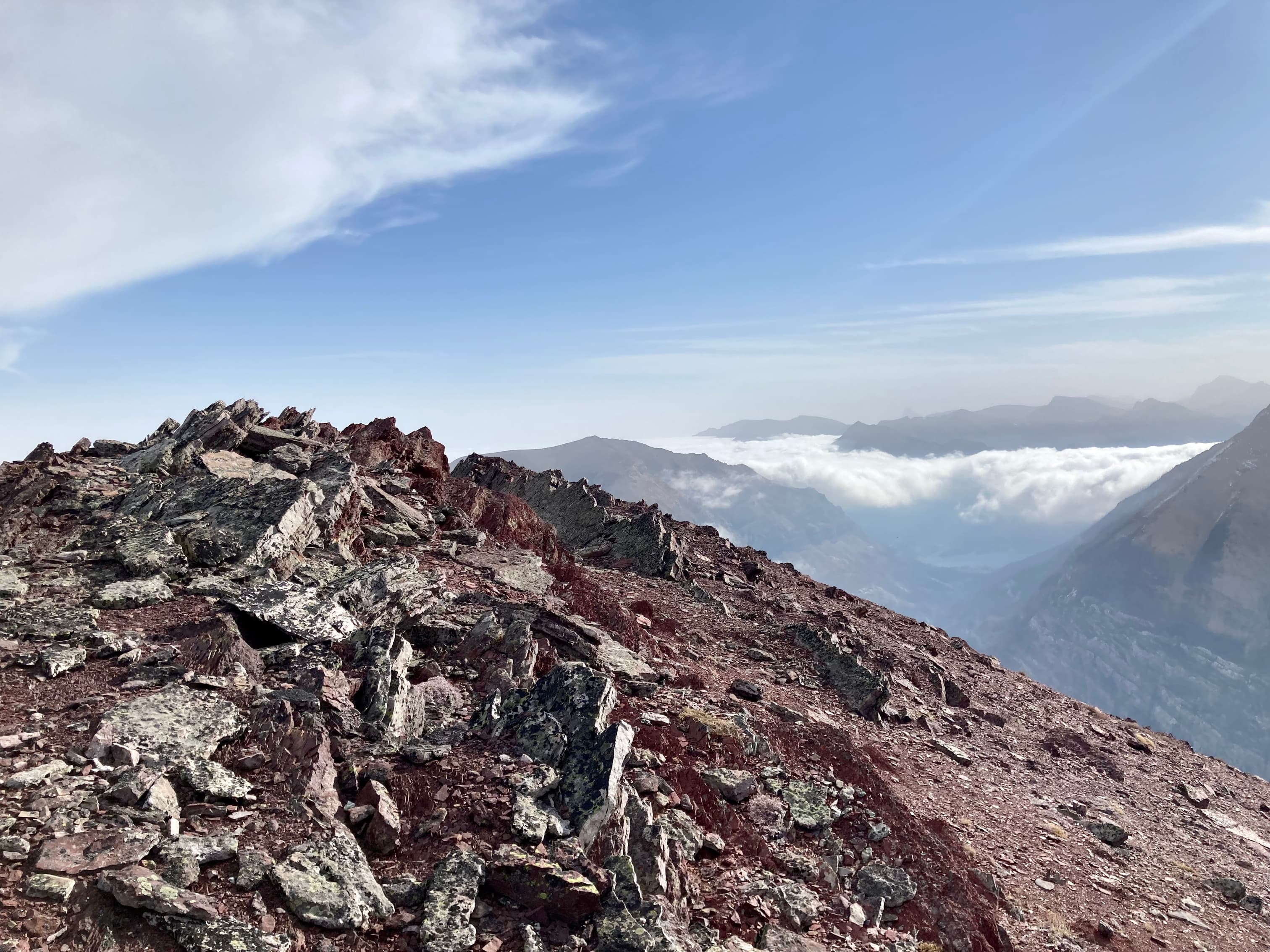
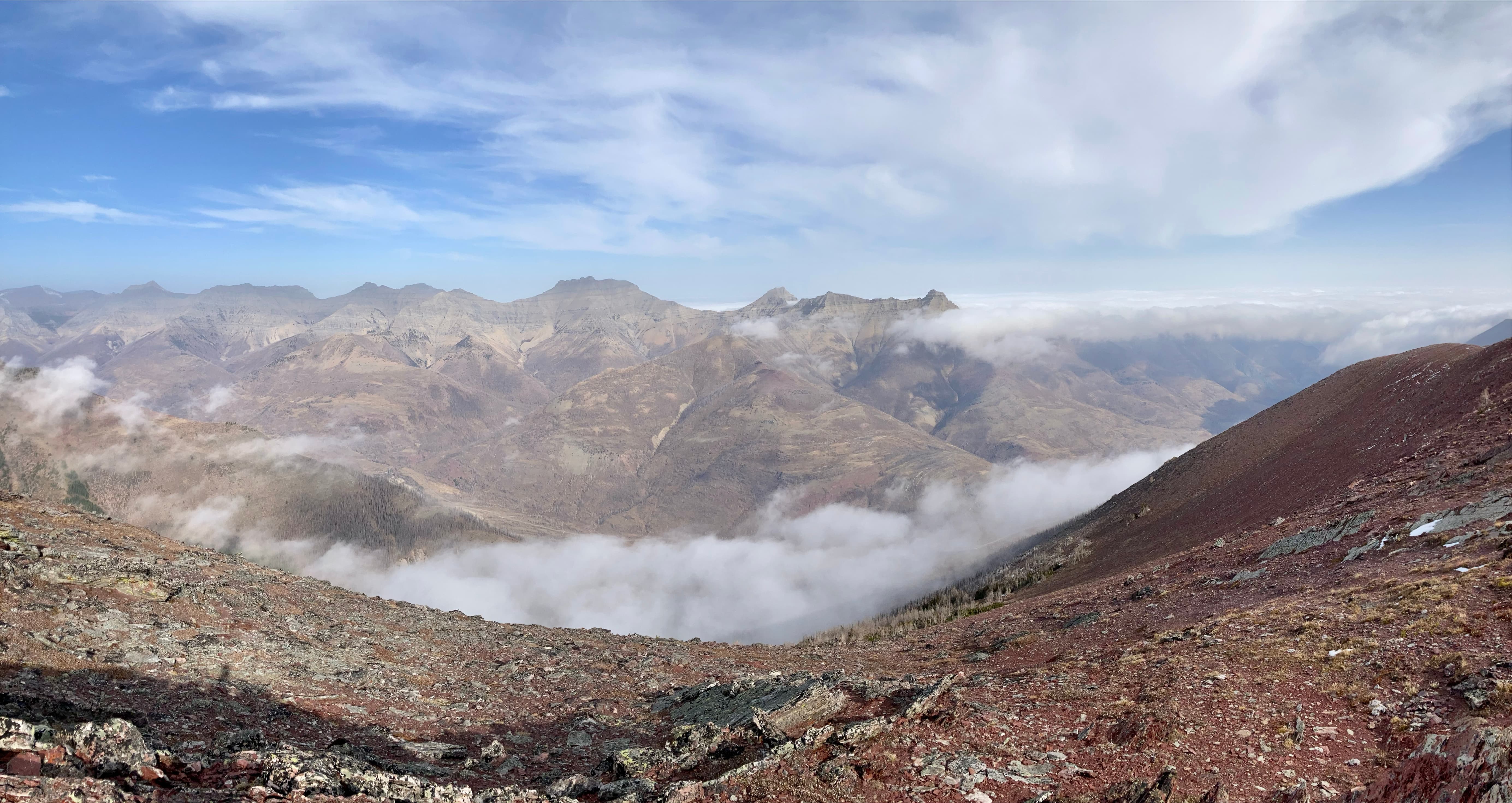
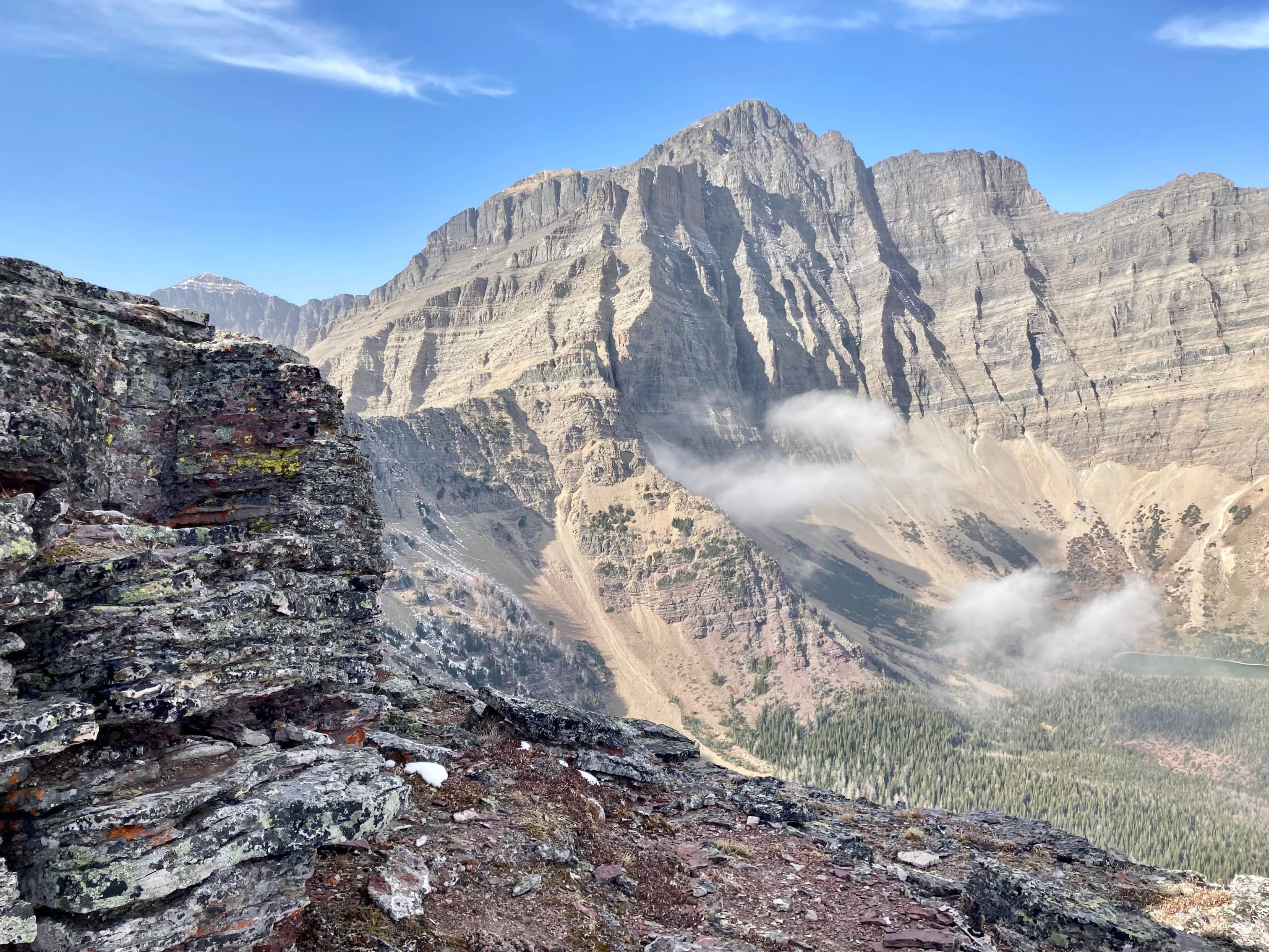
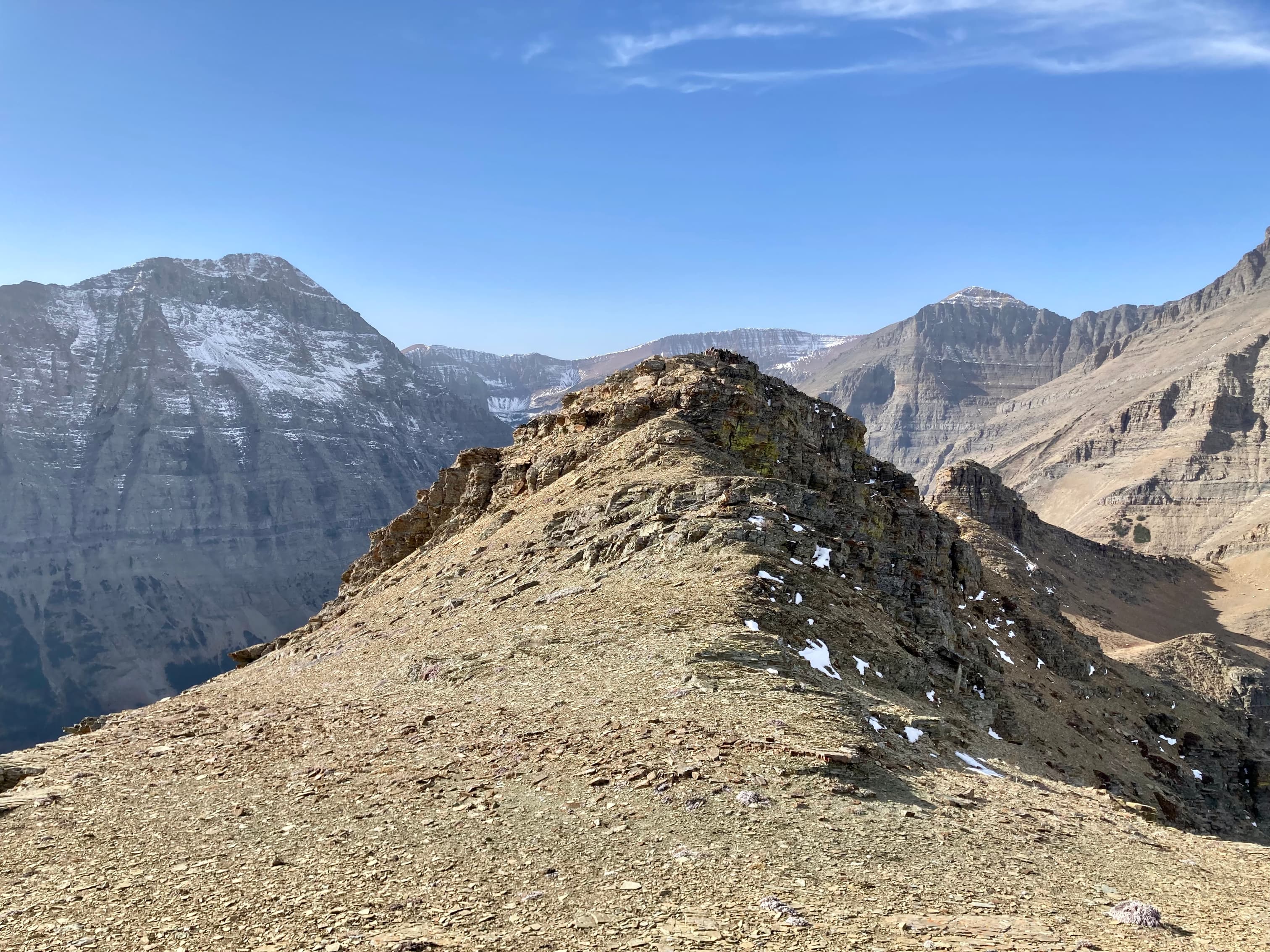
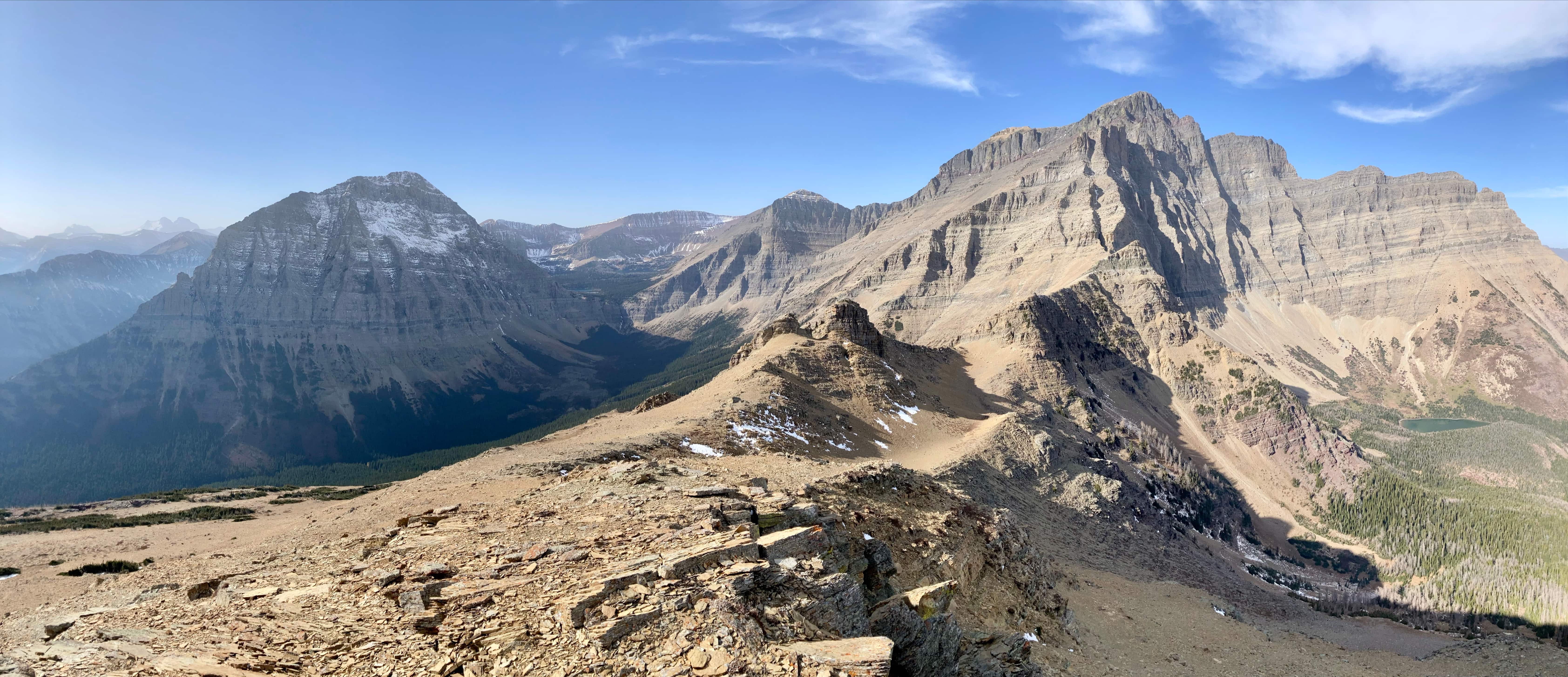
The star attraction of this scramble is Ruby Ridge’s neighbour – Aahkoinimaiisták (Mount Blakiston). The mountain’s stark southeast aspect is in full view with diminutive Ruby Lake sitting in the valley below. To the west, Mount Lineham’s east face looks very impressive, and it is possible to look into the hidden valley of the three Lineham Lakes sitting above the headwall of Lineham Falls. Cameron Lake is visible down the valley to the south.
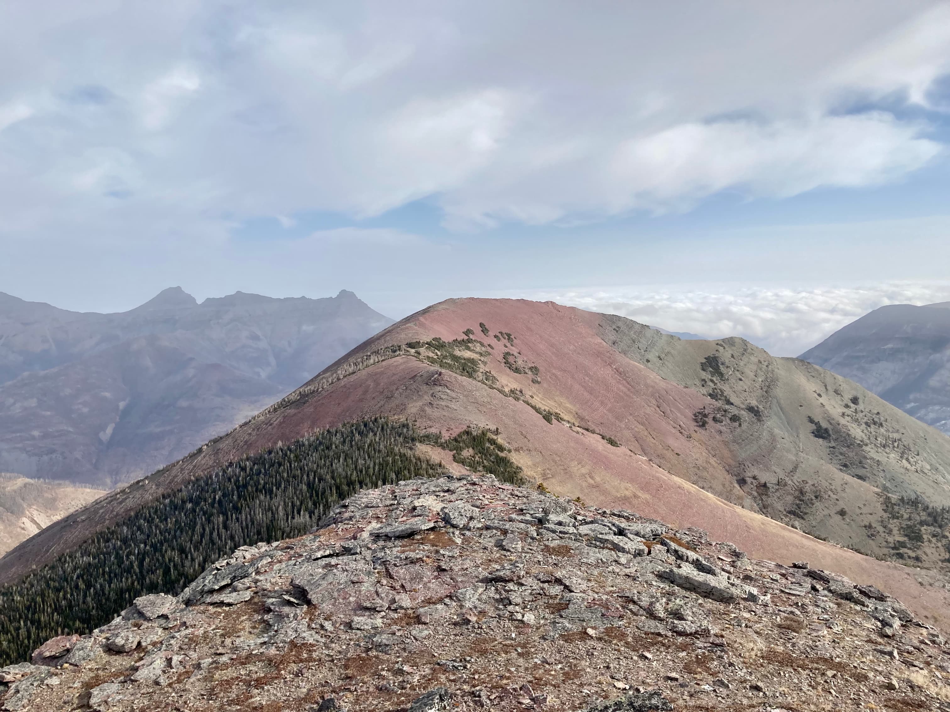
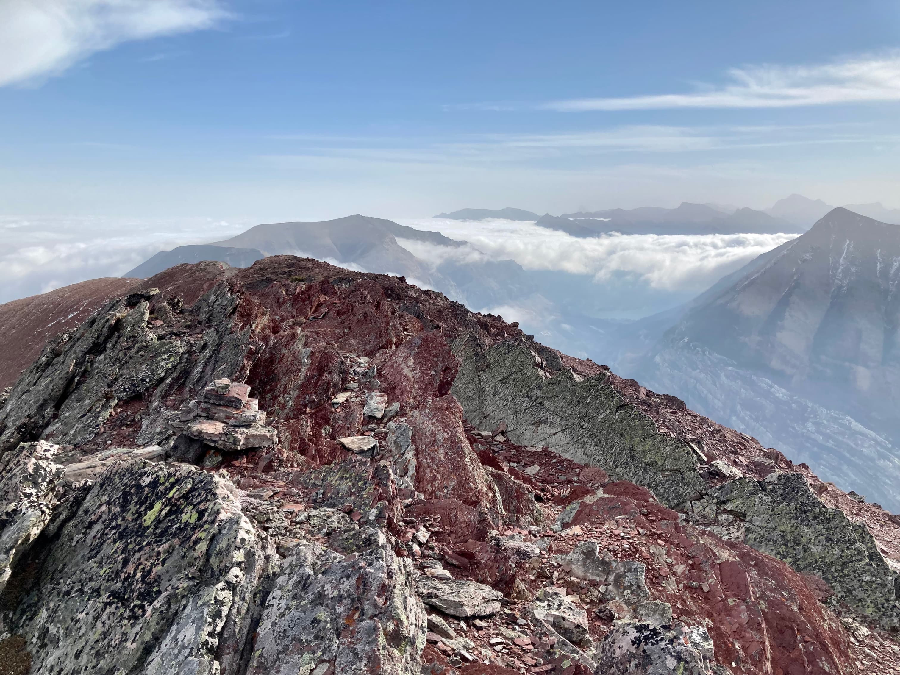
This point is the true summit of Ruby Ridge, but the slightly lower summit to the east is only about 1.5 km away and the trip makes for a fun ridge walk. Up to this point there is no real scrambling along the route, but the trip to the east summit involves down-climbing three rock bands to a col. The rock bands do not represent a major hazard provided you can pick out a good route to down-climb. I ended up doing a little bit of hands-on scrambling on my descent. In general trending left on the descent made for easier terrain. The third rock band was the trickiest. There’s nothing particularly exposed, luckily. From the col I ascended the easy slopes back up a little over 100 m to the eastern summit. It took less than an hour from the western summit. The views aren’t dramatically different from there but it’s a worthwhile ridge walk. On the day of my trip I had a better view of the low clouds caused by the inversion from the east summit.
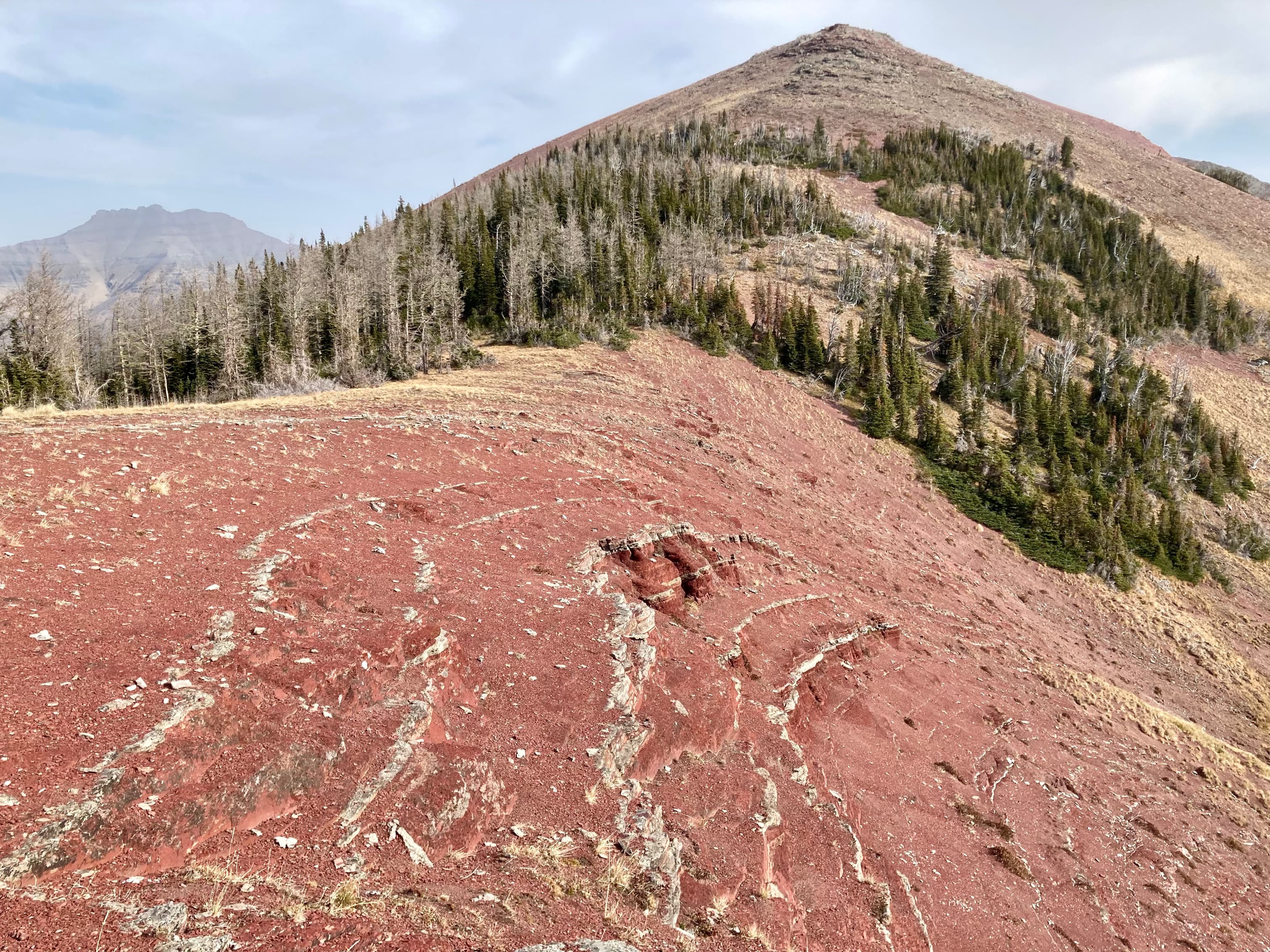
For the return trip, some people descend south from the col and find their way by various routes down to the road or the trailhead. I just retraced my steps – I felt like doing a little scrambling and the climb back up the rock bands to the true summit was enjoyable. I also wanted to spend more time admiring Lineham and Blakiston rather than putting them to my back by descending southeast from the col. After getting back to the western summit I visited two rocky high points a short way to the west before descending back to the Lineham Falls trail.
Click on the pictures in the gallery below to access full-resolution images.
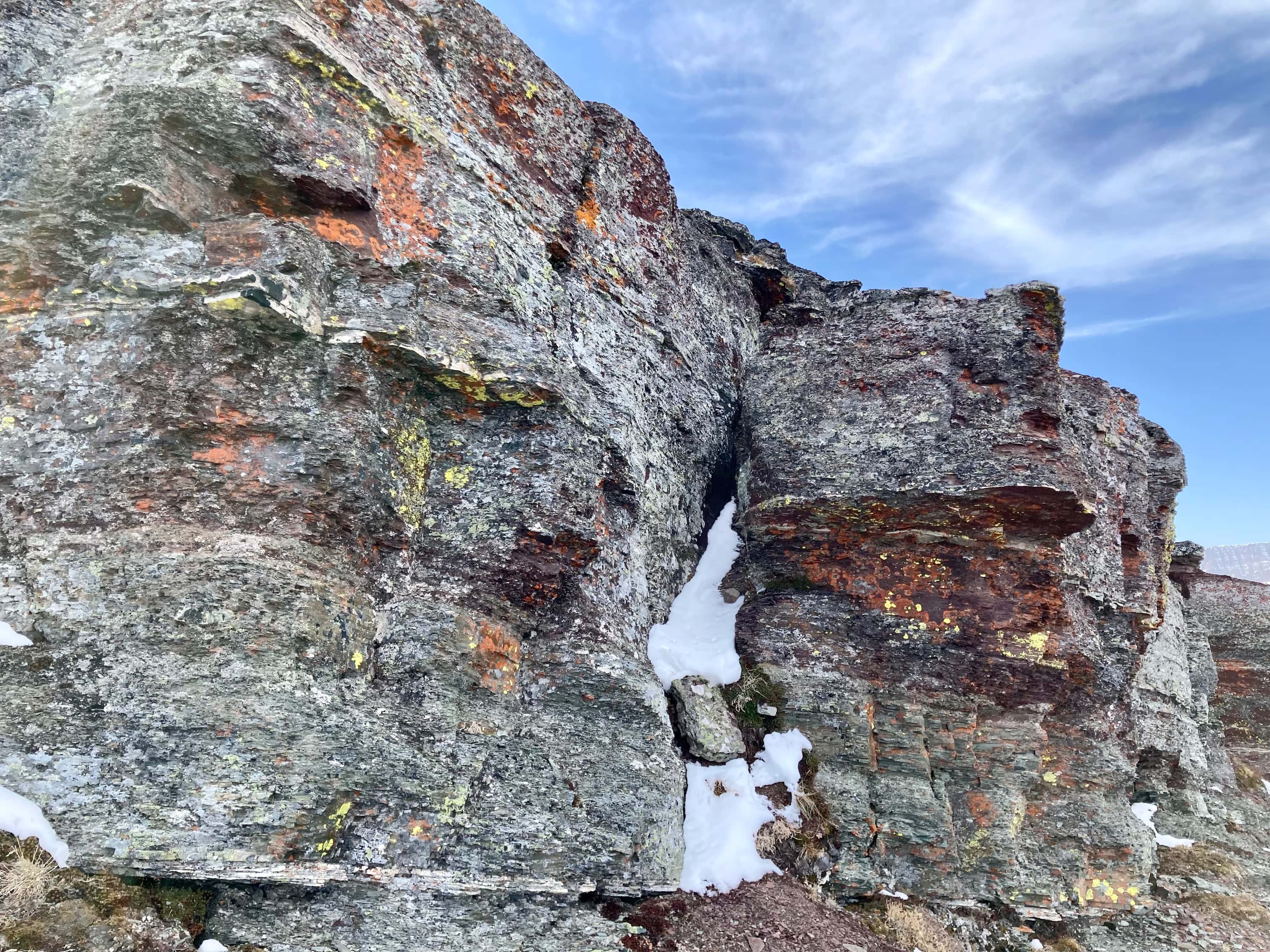
Route overviewRuby Ridge as seen from the Lineham trailhead.Following the Lineham Falls trail. Once the slopes to the right open up you could ascend pretty much anywhere. I continued until the trail reached a point where it intersected the descending ridge line up ahead.Not the most inspiring terrain to be climbing, and it was quite steep.In short order I could glance over my shoulder and enjoy views to the south. Mount Custer is in the distance. One golden larch stands out on the lower slopes of Mount Lineham.The terrain eventually became more interesting and rocky.Looking down the valley to the northwest. Mount Lineham is on the left and the headwall over which Lineham Falls tumbles is in full view.Some more interesting rock.Panorama from southwest to northwest from part way up the slope. Around here it was evident I was climbing up into warmer air. The sun felt hot and there was no wind. The valley to the left heads to Cameron Lake. It filled in with sparse cloud and fog through the day.The steepness of the ascent finally eased a bit and Mount Blakiston came into view off to the left.The character of the rocks changed again, and there were more bushes as I neared the final part of the ascent.Cameron Lake eventually came fully into view in the distance behind me. It remained shrouded in fog through the day.Looking east towards Mount Crandell I could see that I was already above cloud level and there was definitely an inversion.Southern panorama from below the summit.Buchanan Ridge is directly across the valley. Coming to the last bit of the ascent. The two high points of yellowish rock to the left are not the way to the summit. The summit is beyond the grey rocks to the right.The first full view of Aahkoinimaiisták (Mount Blakiston) upon reaching the ridge top.Walking the last few meters to the summit cairn of Ruby Ridge.The cairn with Aahkoinimaiisták in the background.Aahkoinimaiisták / Mount Blakiston and Ruby Lake. The black band with white stripes above and below it is the Purcell Sill – an intrusion of magma between layers of sedimentary rock. Once you see it and know to look for it you’ll pick it out in the strata of several mountains in the region (scroll back up and you’ll see it on Mount Lineham).Cameron Lake, a little better seen but still indistinct because of the fog and cloud. On a clear summer day the view in this direction must be spectacular.Another shot of Aahkoinimaiisták. The name means Pipe Stone Mountain. The black stone was used for making ceremonial pipes.Looking west towards Mount Lineham and Mount Hawkins. Several rocky high points are present along the ridge connecting to Mount Blakiston.Proceeding east along the ridge towards the second summit. The terrain dips steeply up ahead at the first of 3 rock bands. In the distance to the right would usually be views of open prairie, but there were cloud tops as far as the eye could see.Mount Crandell. Ruby Ridge is about 60 m taller than it. A look back up from the bottom of one of the rock bands.Down on the col between the two summits. This was the only place I found bear scat of varying ages. I wonder if there’s a bear that uses this col to pass between the two valleys on either side.Looking south, down the drainage descending from the col. A few mountain sheep were wandering the grass.A closer look at some of the sheep.Ascending from the col towards the east summit.Looking back to the west at the true summit.The eastern summit has a very different character than the west. There’s lots of jagged angled rock.The cairn on the eastern summit. Mount Galwey’s summit is poking through the clouds in the background.Panorama from the southwest to northwest from the east summit.Looking southeast towards Mount Crandell.Panorama to the east. Newman Peak, Mount Glendowan, Cloudy Ridge, Mount Dungarvan, “Rogan Peak”, and Mount Galwey are visible.Looking south. A bit of Upper Waterton Lake is visible under clouds towards the left of the frame. Buchanan Ridge is across the valley. Mount Alderson is beyond that, and Mount Cleveland is in the distant background.An example of the interesting topography of the eastern summit. It looked like you could walk through this corridor and onto the cloud tops.Glancing right while heading back to the col. Clouds had started entering the valley above Ruby Lake.Instead of starting an alternate descent route from the col, I decided to go back the same way I came. I wanted to spend some more time taking in the views of both Mount Lineham and Blakiston, and I also felt like scrambling back up the rock bands.A bit of a chimney to scramble up.In general, traversing right allowed for easier terrain when navigating the rock bands.Before descending back to the Lineham Falls trail I decided to check out these two rocky high points.Looking towards the headwall over which Lineham Falls tumbles. Lineham Lakes are visible in the hanging valley.A look at the ridge connecting Ruby Ridge to Mount Blakiston. I think that the rocky high point with the black band just below its peak is what Andrew Nugara and Dave McMurray call “Igneous Peak”. If you’re looking for further adventures along that ridge line, check out McMurray’s trip report.A last look at one of the most striking vistas in Waterton. Mount Lineham, Mount Hawkins, and Mount Blakiston. The Lineham Lakes are visible in their hanging valley to the left of centre, and Ruby Lake is at the right.