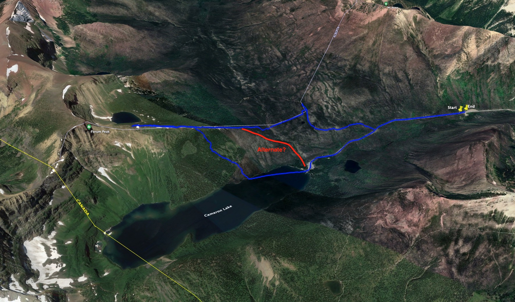
For the last day of winter 2022 I decided to climb Forum Ridge in Waterton. The trip is detailed in Nugara’s Snowshoeing in the Canadian Rockies 2nd ed and the route he describes ascends terrain that is low avalanche risk. The trip culminates up on a ridge overlooking Cameron Lake. Once past the tree line on the ridge you are in a land of cornices at the top of major avalanche pathways, so I didn’t stray beyond the trees. Nevertheless, the broad treed ridge ascends quite high up and I was treated to some excellent views.
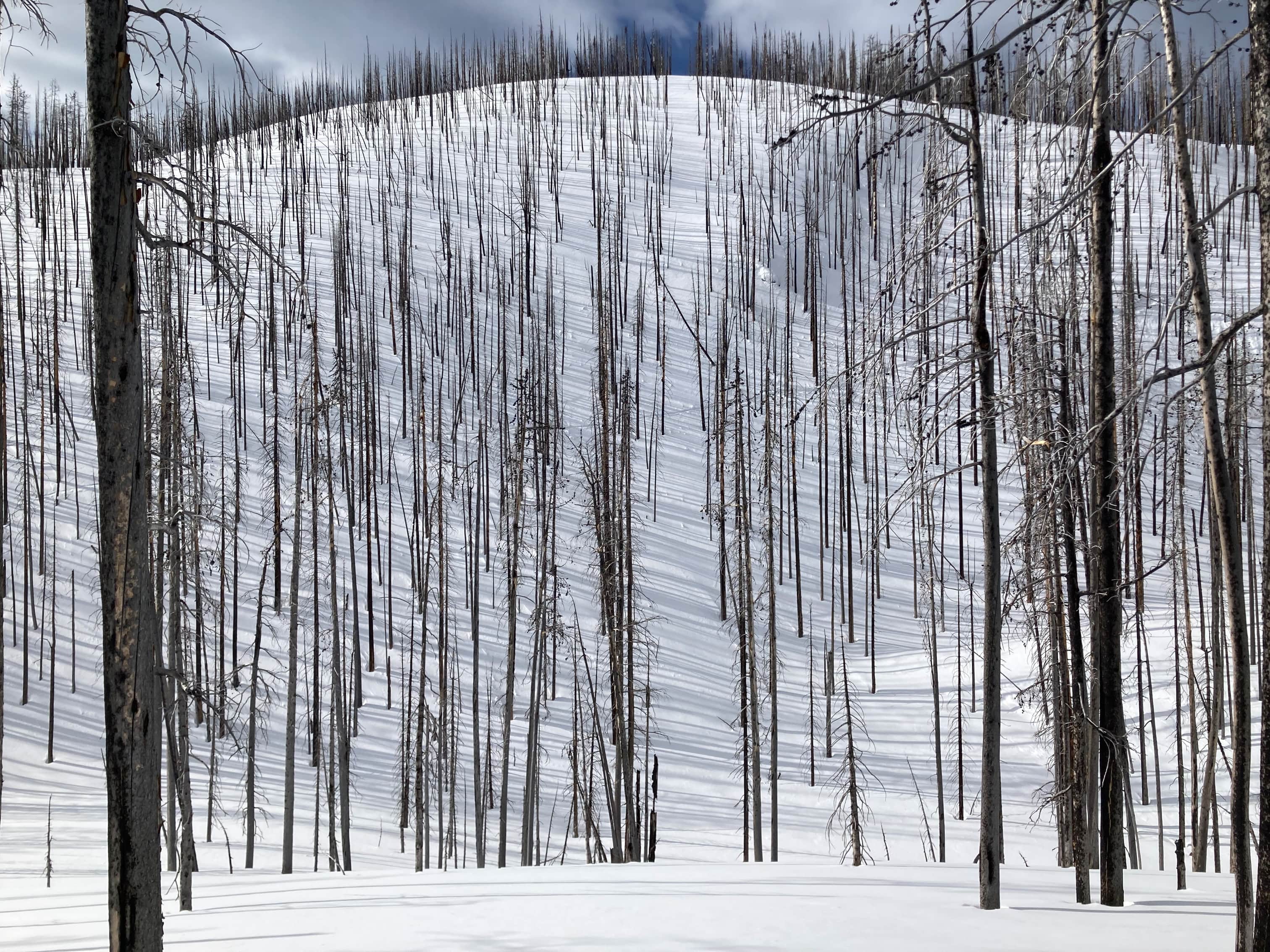
Access is via the Akamina Parkway. I parked at the winter closure site and walked up the road to the Akamina Pass trail. I followed the trail looking for the cutline marking the provincial boundary. The forest had been burned by recent fires so it was actually a little tricky to see the cutline at first. When I reached a kiosk near the top of the pass I ascended up a hill to my left (south) then backtracked until suddenly the cutline came into view. I followed this southwest until it descended to the base of what Nugara calls “the big hill”. The cutline goes straight up the hill, but I zigzagged a bit then diverted diagonally to my left (east) to get to some more gentle slopes. This ascent was a slog. There was lots of snow on the hill. Plenty of burned trees were still standing and acting as anchors but as time goes on and the trees fall I get the feeling it will be quite unsafe to charge directly up the path of that cutline.
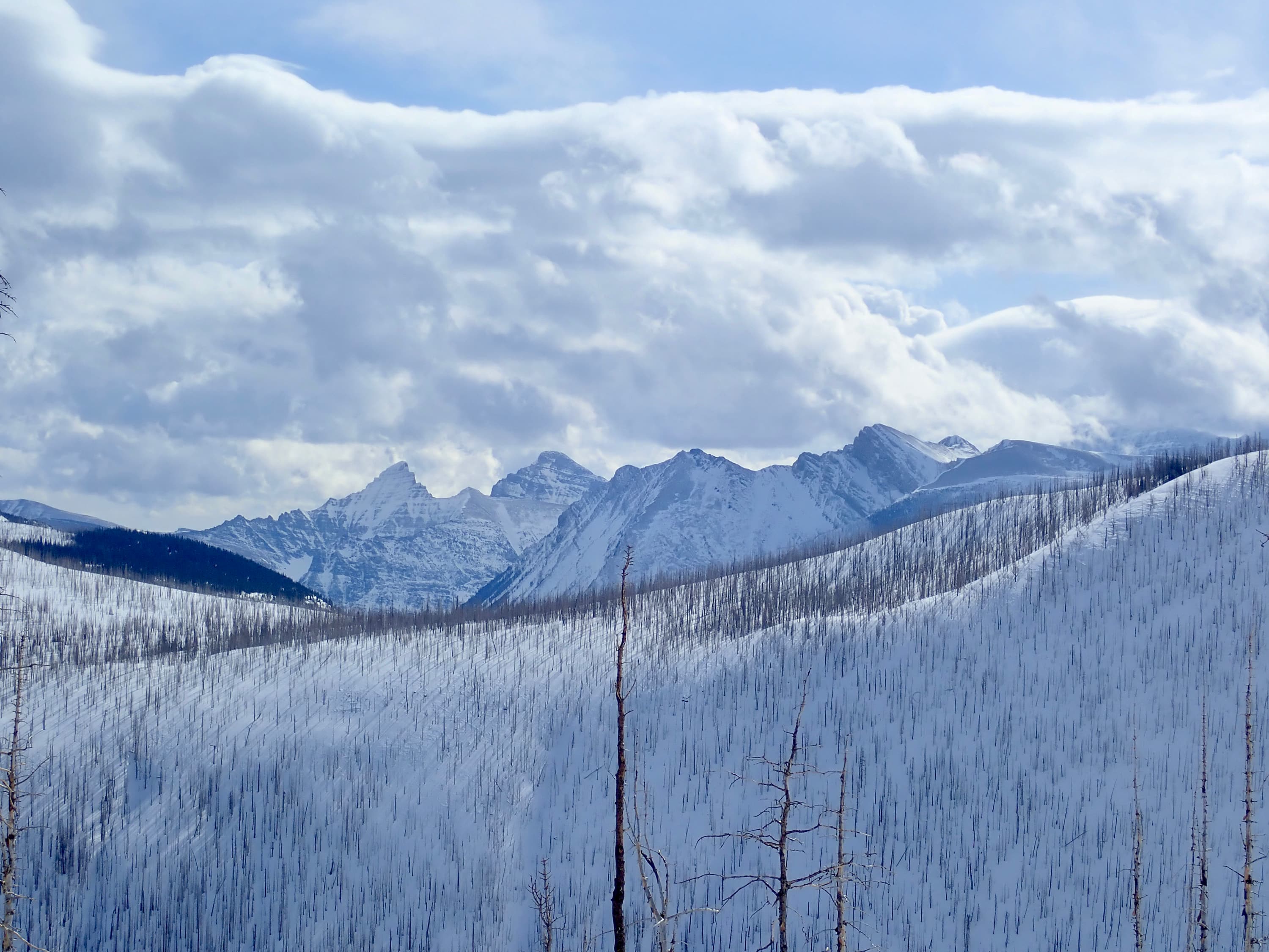
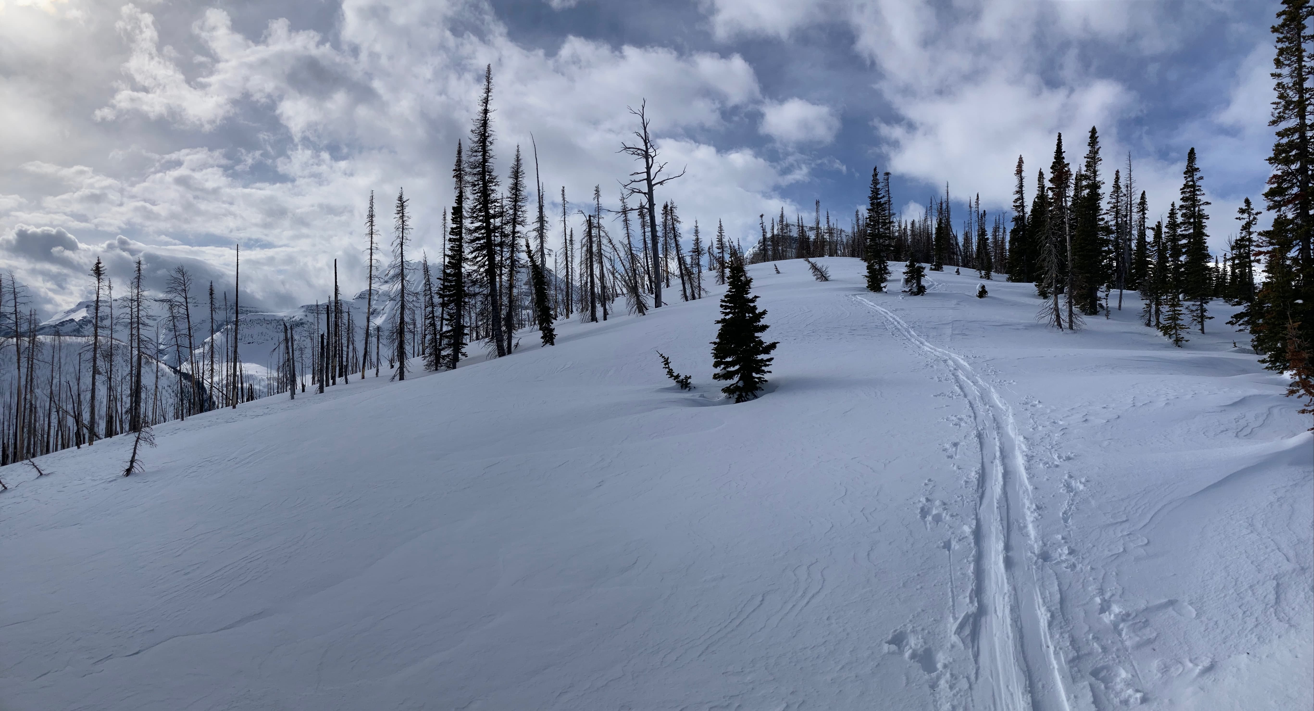
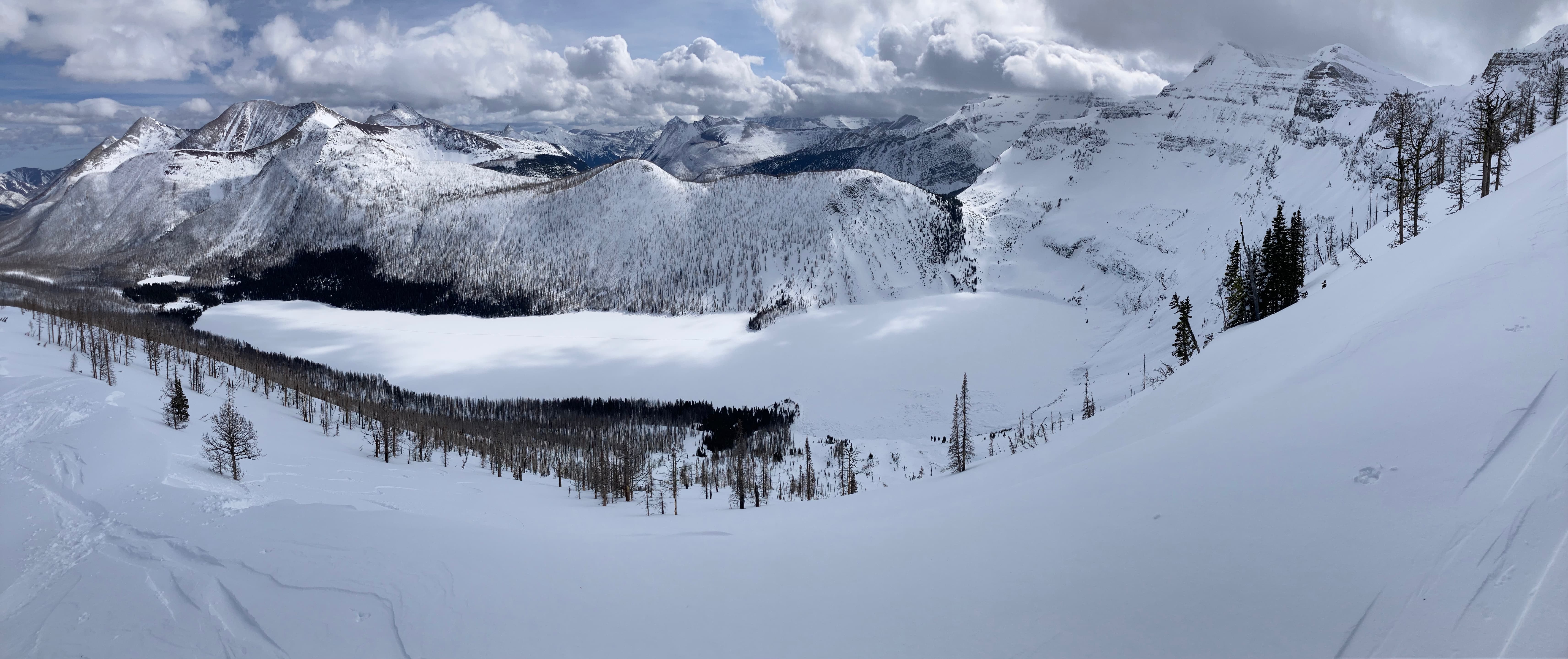
From the top of that ascent I rejoined the cutline and carried on through a couple patches of un-burned forest. I was now up on the broad northeast portion of Forum Ridge. Views began to open up in all directions and I carried on until I could see the end of the trees. The major avalanche pathways down to Cameron Lake begin around there and I could see plenty of cornices overhanging towards the lake. Some backcountry skiers were up there cutting a test block before descending beneath the cornices. We exchanged greetings and they expressed the standard sentiment I encounter from skiers (along the lines of “why would you climb something you’re not going to ski down?”). I found a place to sit on a big drift beside the trees and enjoyed the views.
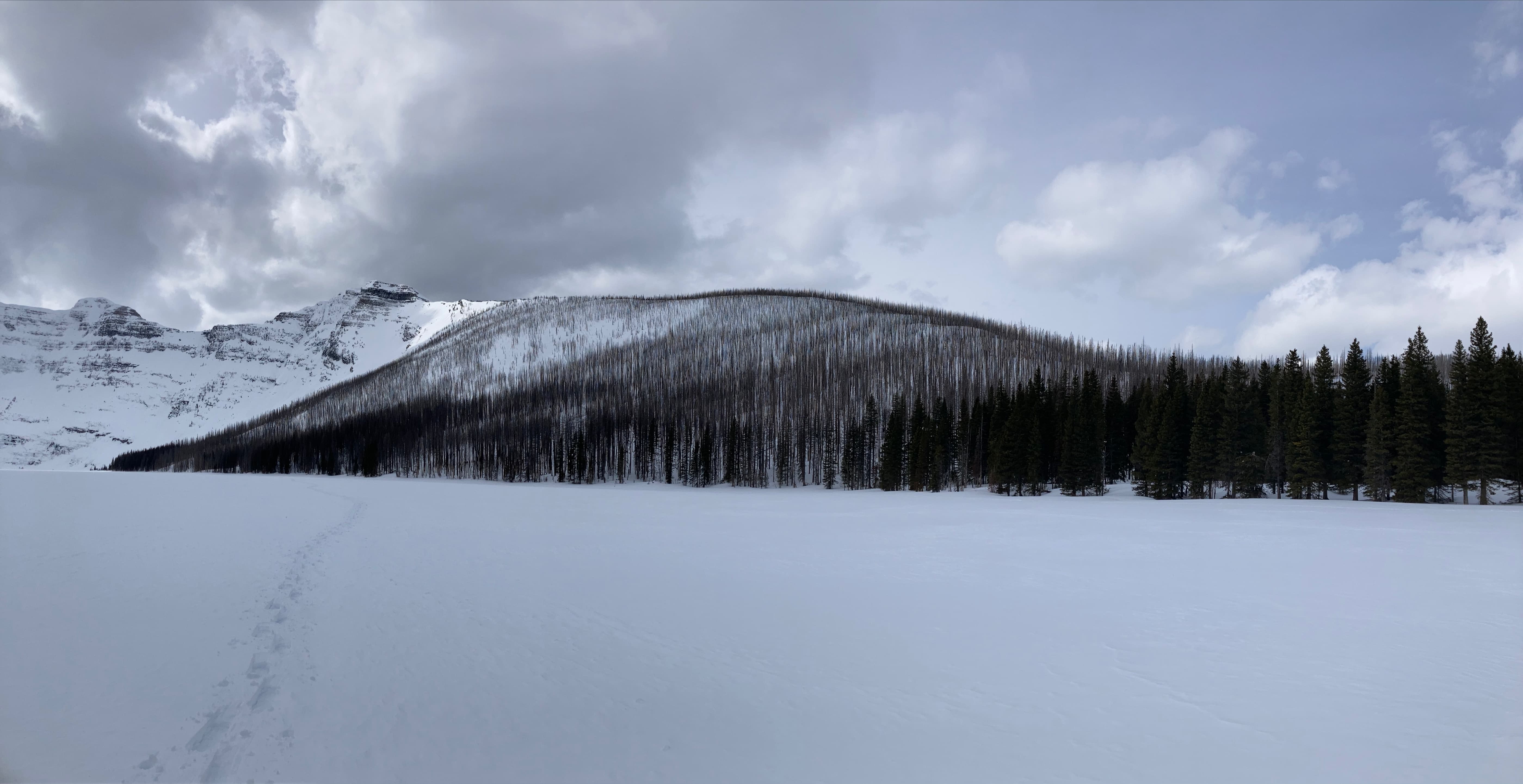
For the descent I decided to follow Nugara’s advice and go down to the lake. Parks Canada’s website had some advice regarding assessing the safety of burned forested slopes. It was basically “if the standing standing tree trunks are sparse enough to ski between then consider it an open slope”. I backtracked to where the angle of the slopes became more shallow and the trees were still thick and made my way down.
This route will likely become more hazardous in the coming years as the natural anchors on these slopes fall away (that’s just an opinion, I’m not an expert). It may be safest to ascend and descend on the broad, shallow-angled toe of Forum Ridge that starts near the north end of Cameron Lake (which I think was the route taken by the skiers I met).
Click on the pictures below to access full-resolution images.
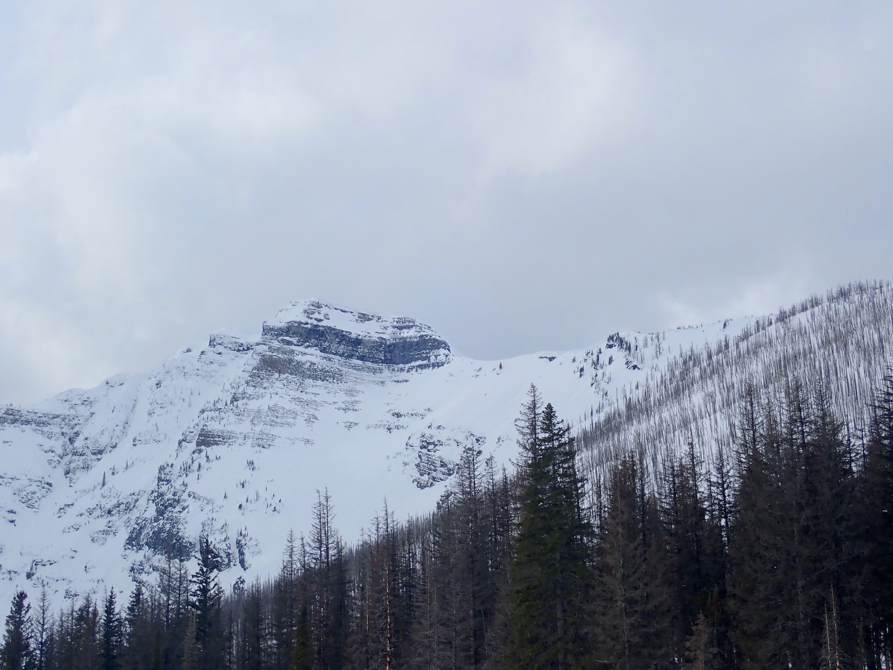
Route overview looking northwest. The red line follows the fairly gentle contour of Forum Ridge as it descends to the north end of the lake.Looking at the objective from Akamina Pass. Part of the cutline and the broad shape of the ridge is apparent from this angle. I would end up following the ridge to where the trees thin out, just before it becomes substantially narrower.Coming up on the start of the Akamina Pass trail. Mount Custer in the background.On the Akamina trail. As I got closer to the provincial border I kept a lookout to my left for the cutline.On the cutline. It was actually hard to make this out from the trail. I got to a point where I figured I’d gone past it so I left the trail and ascended a slope to the left (south) and backtracked until my point-of-view lined up with the axis of the cutline and it sprang into view.“The big hill”. This picture doesn’t do justice to the steepness of the lower reaches of this hill. I descended to the base then stayed in the woods to the left, angling for the gentler angled slopes. It looks like some skiers traversed this hill near the middle.Looking back down from the top of the steep portion of the hill.Up on the broad ridge top, looking southwest at some distant peaks in Glacier National Park.Telephoto view of those same peaks. A little more climbing and more peaks come into view. The clouds began to roll in as well.Ascending along the broad, friendly ridge top. I encountered the ascent route of some skiers.Mount Custer came into better view once I was on the ridge. To its left the top of Chapman Peak was covered in cloud.Telephoto view of Mount Custer’s summit, which isn’t visible until you’ve climbed well above the valley bottom.Carrying on along the ridge. Forum Peak’s summit comes into view.Looking north, back the way I came. The cutline is visible in the trees below. You can see where my route and the skiers’ ascent converged. Diminutive Akamina Lake is to the right with the northern edge of Cameron Lake behind the trees further right.Looking northwest. I think that’s Festubert Mountain.Looking northeast at Buchanan Ridge.Some trees continue to enhance the view, even when they’re dead.The top of the ridge finally came into view.Lots of broken clouds rolling over the peaks. The skiers are visible in the distance. I went a short distance beyond them and stopped.The summit of Forum Peak. Apparently, competent mountaineers with the right gear can gain the summit from this direction. I was content to enjoy the view from here.Mount Custer. Chapman Peak’s summit was still stubbornly in the clouds.Telephoto view of the upper reaches of Mount Custer. A full view of snow-covered Cameron Lake and the north face of Mount Custer.A slightly different view.The north end of Cameron Lake. The Carthew-Alderson trail ascends the slopes on the other side of Cameron Lake heading towards Summit Lake.Telephoto view across the lake towards Mount Alderson. The Carthew-Alderson trail is visible zig-zagging towards the ridge.Looking southeast into Glacier National Park.The south end of Cameron Lake. The international border cuts across the lake roughly where broad stripe of trees is, just to the right of centre.Looking back the way I came. Mount Rowe is on the left with Mount Lineham peeking up from behind it. Buchanan Ridge and Mount Alderson are on the right.More Mount Custer.One more full panorama of Cameron Lake.Starting my descent.A final look at Mount Custer from the ridge.Down on Cameron Lake looking back up at where I was.A look at the broad, gentle lower part of Forum Ridge as it comes to the level of Cameron Lake. Given the changes brought about by the fires, I think in the future I’ll just ascend and descend along that ridge. It avoids “the big hill” and stays in simple terrain.


One thought on “Forum Ridge”