June 23, 2019. An enjoyable rainy day hike to a picturesque lake.
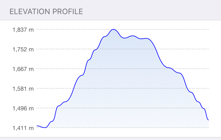
- Distance: 8.3 km loop*
- Total Ascent: 460 m*
- Elevation of Objective: 1800 m
- Total Time: 2h 25m
*Due to the fact that I wandered around en route, these figures may vary from the most direct route.
Castle Mountain Ski Resort is the closest downhill ski area to Lethbridge. When I was a kid it was called Westcastle Ski Resort, and we’d have the occasional school ski trip there. I haven’t gone there too much lately. Although I like mountains and I like winter, I don’t like crowds, so downhill skiing never became a major interest. I have learned, though, that there are decent hiking objectives in the area. Joey Ambrosi describes some in his Southern Rockies Trail Guide, and Andrew Nugara’s More Scrambles in the Canadian Rockies 3rd ed. includes several good scrambling objectives.
My original intent had been to ascend Mount Haig, then return via a loop route that tagged Gravenstaffel Peak. These are the two mountains that host the ski resort. Unfortunately, the forecast called for rain and possible thundershowers. I therefore decided to go for an objective at a lower elevation, and settled on Haig Lake.
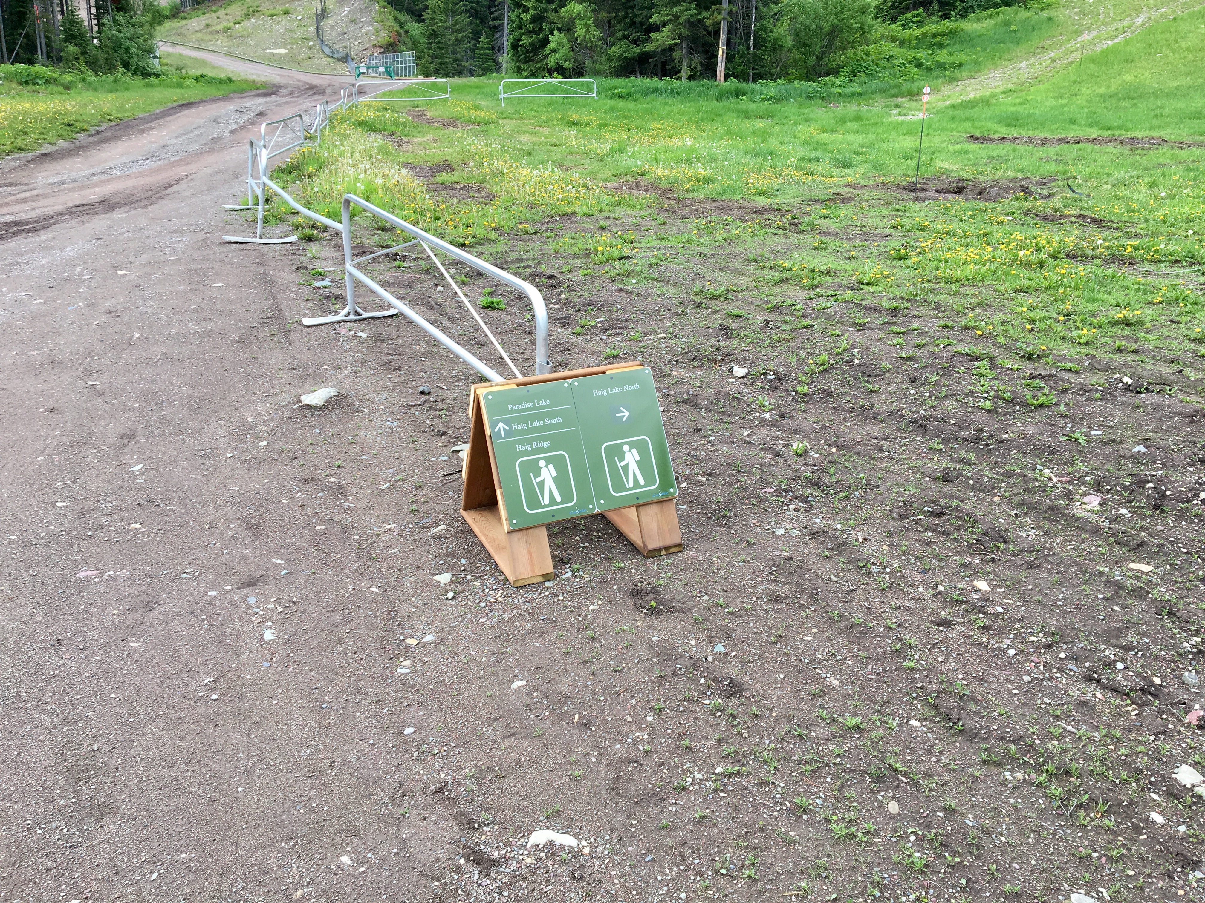
I was pleased to see that the resort website has started promoting hiking on their premises as a summer activity. Two trails to Haig Lake are featured on their map. Between that map and the maps in my guidebooks I had a pretty good idea of where to go. I learned that some effort had been put into signage and trail-markers, too. The only complicating feature during my trip was some construction that caused me a little confusion during my return trip.
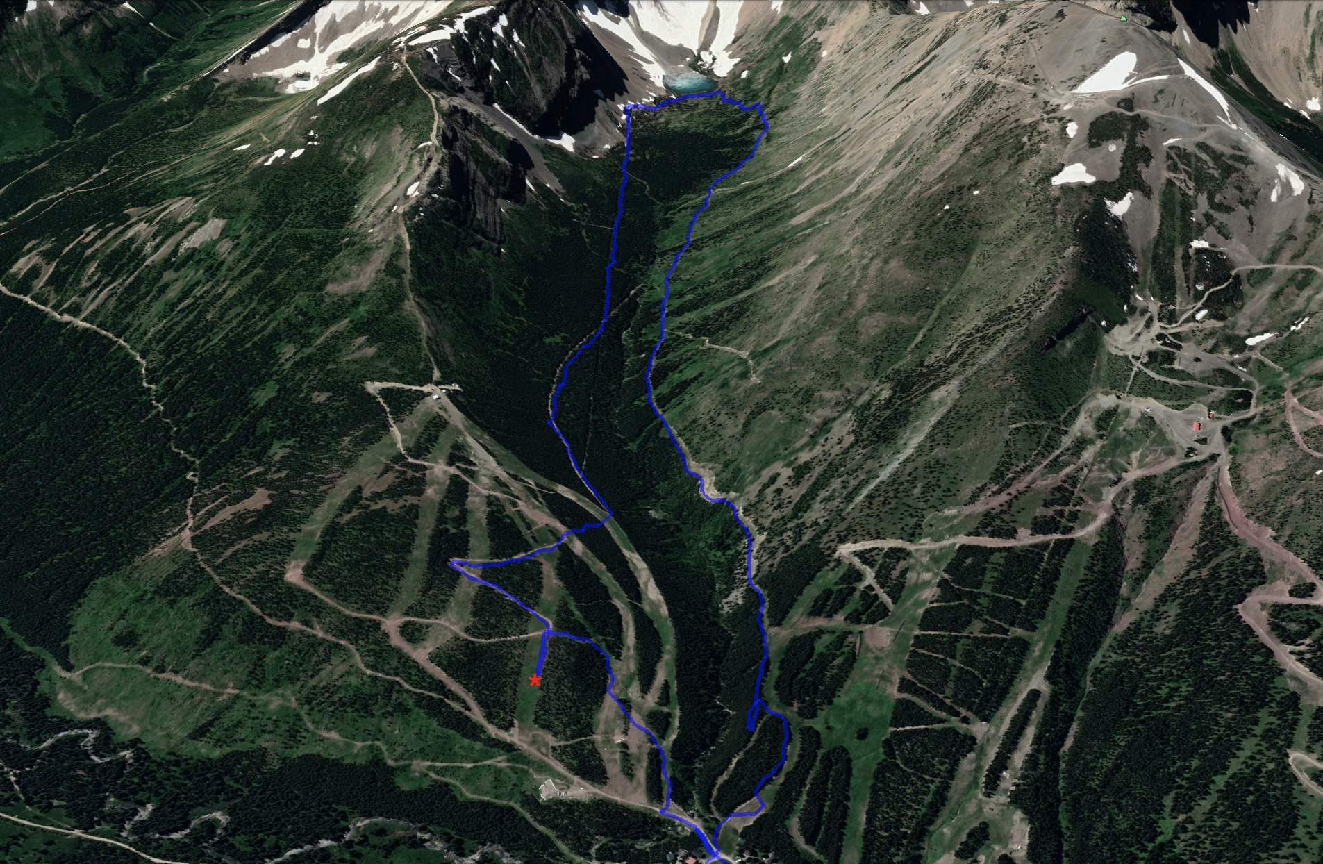
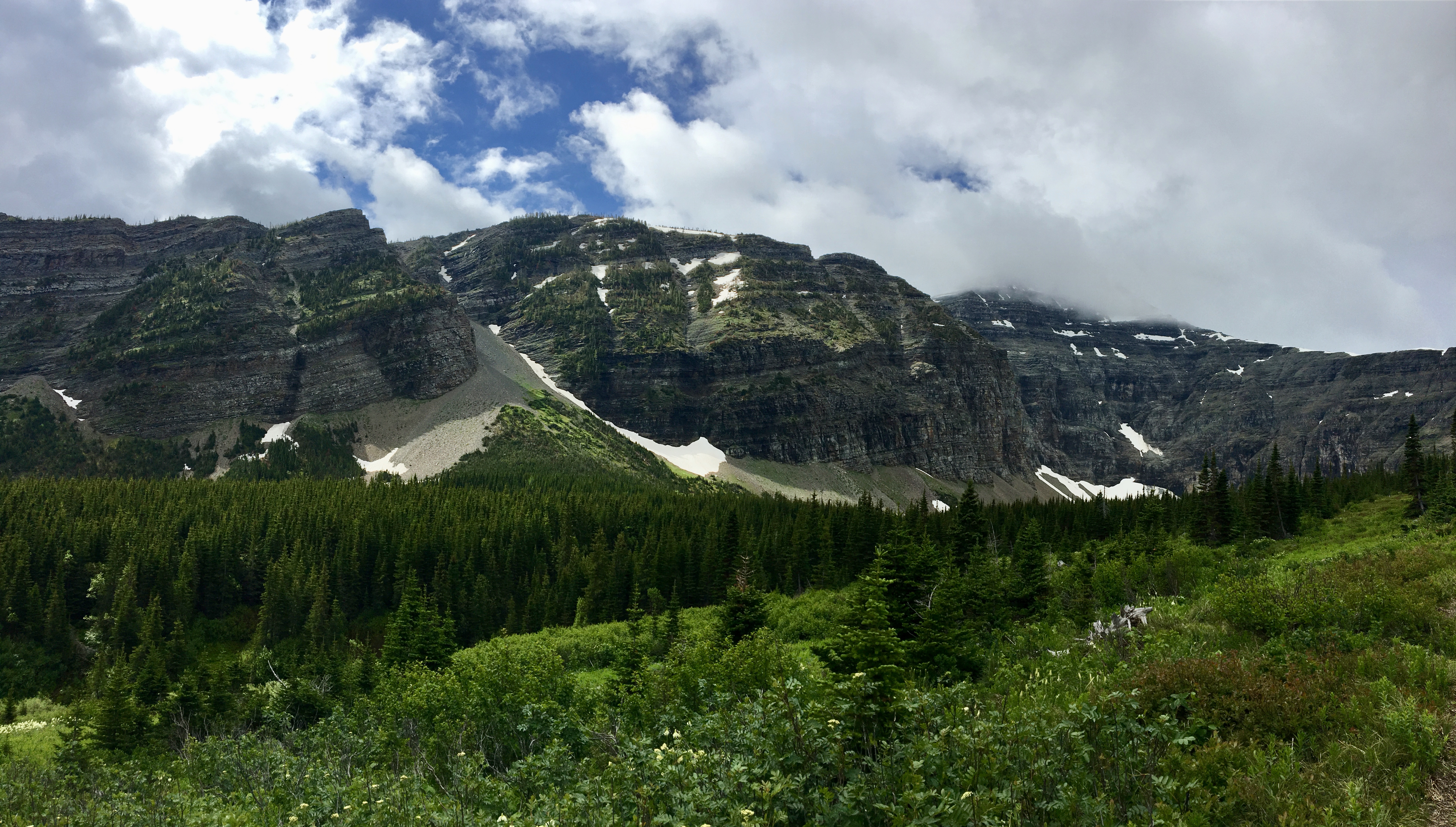
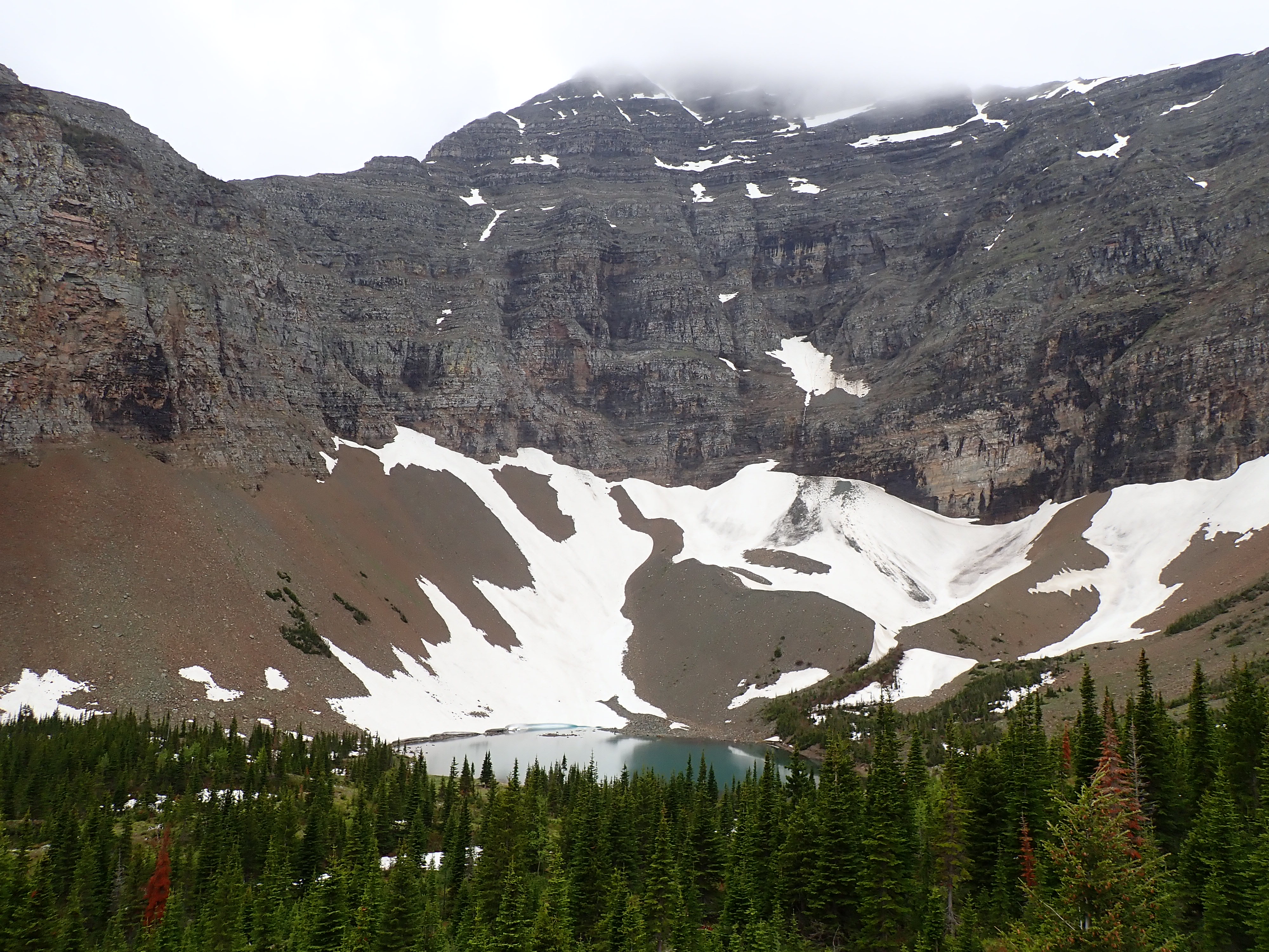
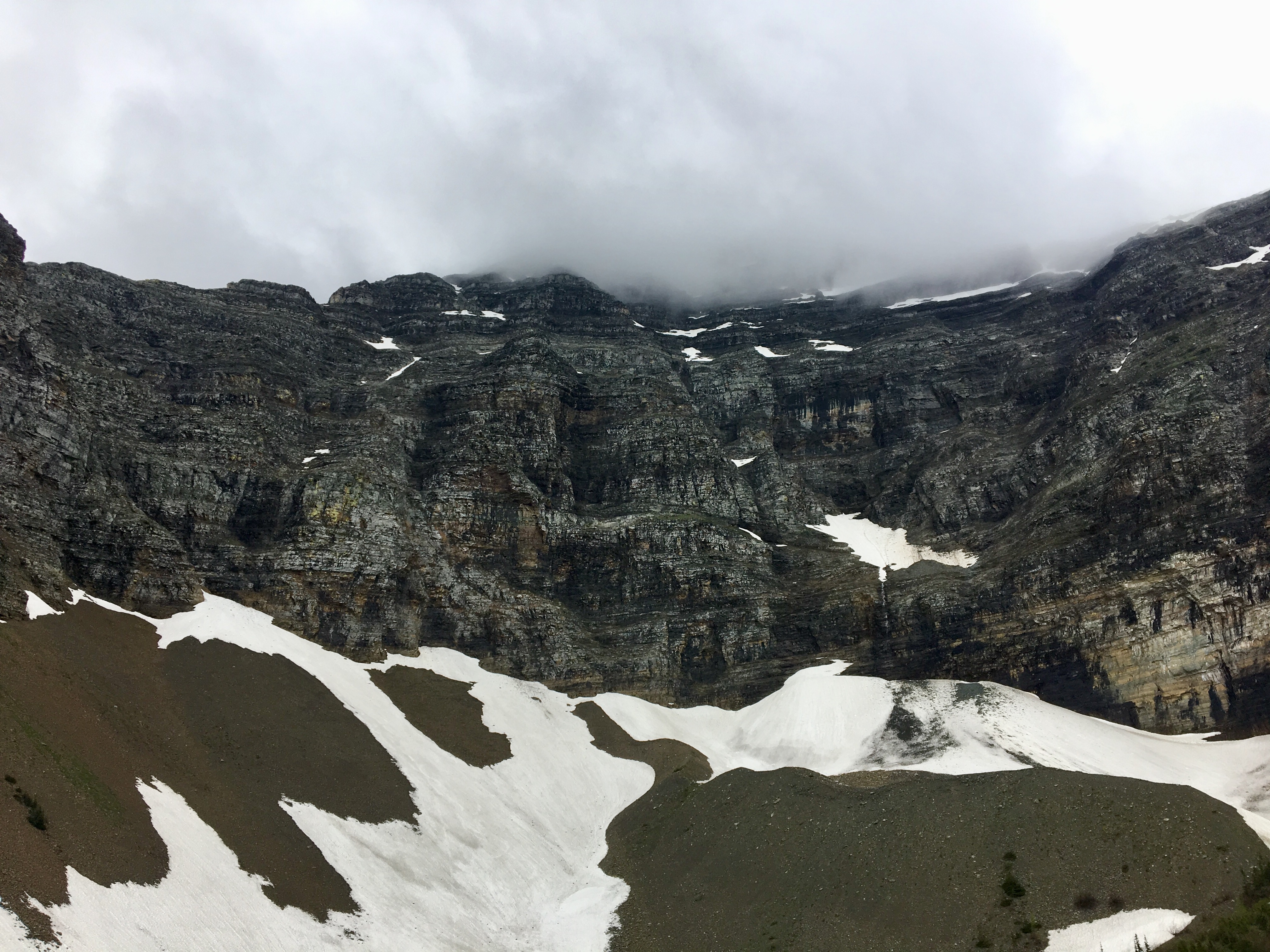
Haig Lake sits under the sheer northeast face of Mount Haig, in the deepest part of the valley separating that peak from Gravenstaffel Peak. Access to the trail is reasonably straightforward. I drove to Castle Mountain Ski Resort and parked in the main lot. I meandered around until I found the start of the trail, but on my return I discovered that the easiest thing to do would have been to walk right into the main area of the resort (between the ski lodge and the rental shack). Right there I would have seen very clear signs directing me to the various available trails.
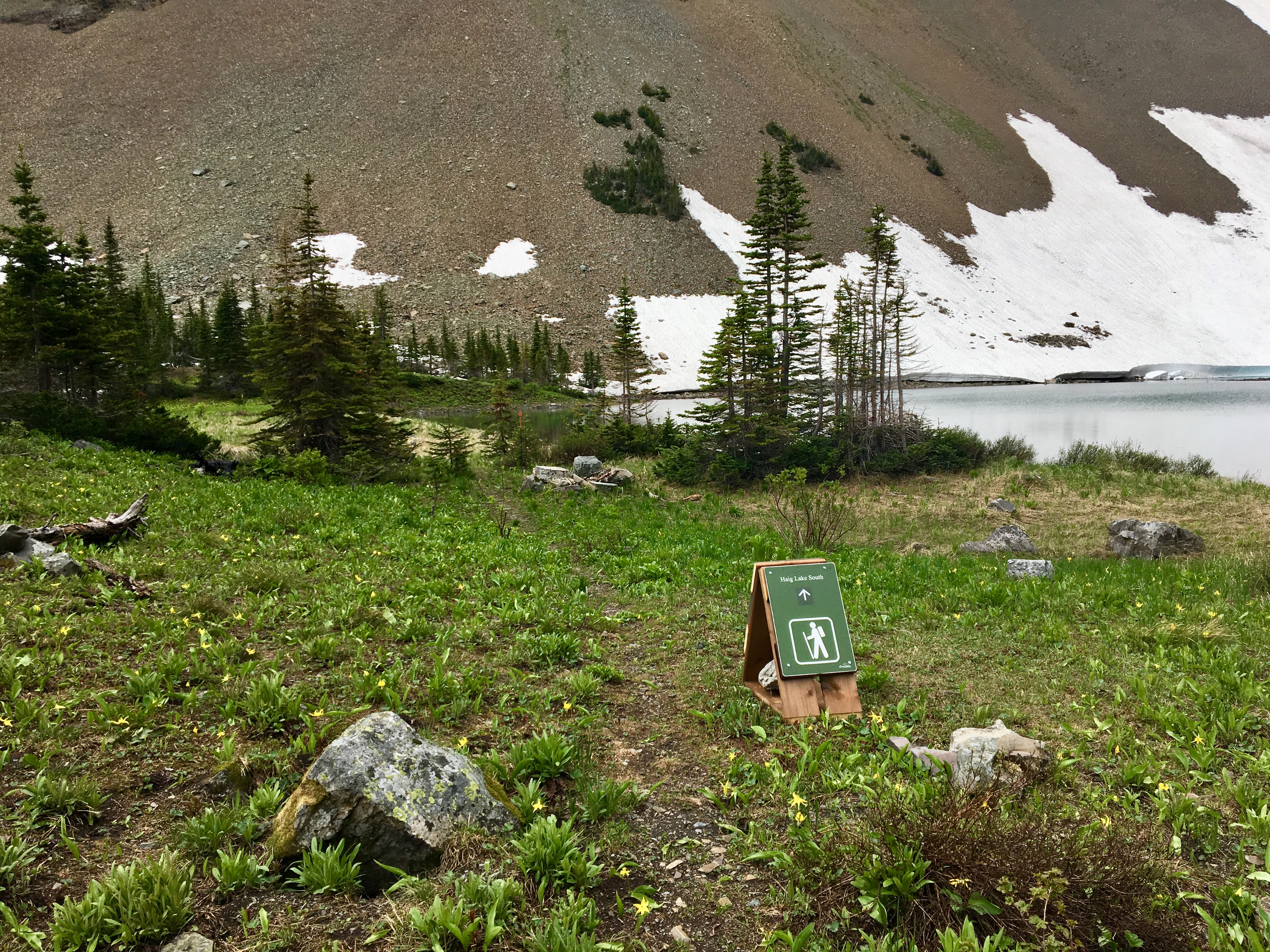
The signage for Haig Lake directs you down Haig Way, a street which eventually takes a sharp bend and turns into Huckleberry Lane. At the bend, there’s additional hiking trail signage. There are 2 trails heading to Haig Lake, one designated North and the other South. They meet up directly with each other on the lake shore, so this allows for a loop route. I ascended via the North trail and descended via the South. I’d recommend doing it this way because the North trail is a little rougher (better for ascent than descent), and because before it arrives at the lake it brings you to a high-point which looks down into the cirque holding Haig Lake. It’s a great view which you don’t get on the South trail. The South trail is wide, smooth and straight – perfect for descent.
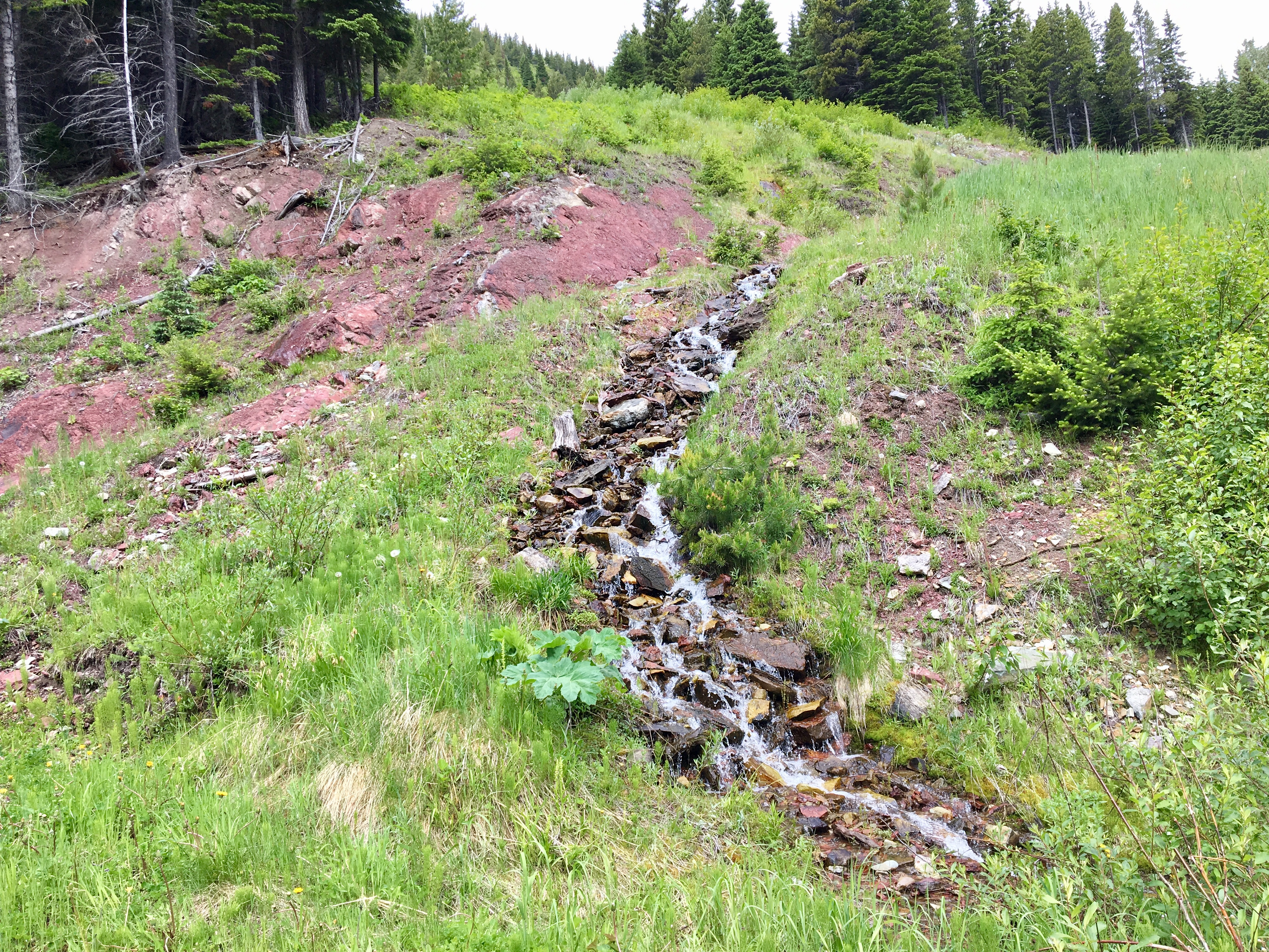
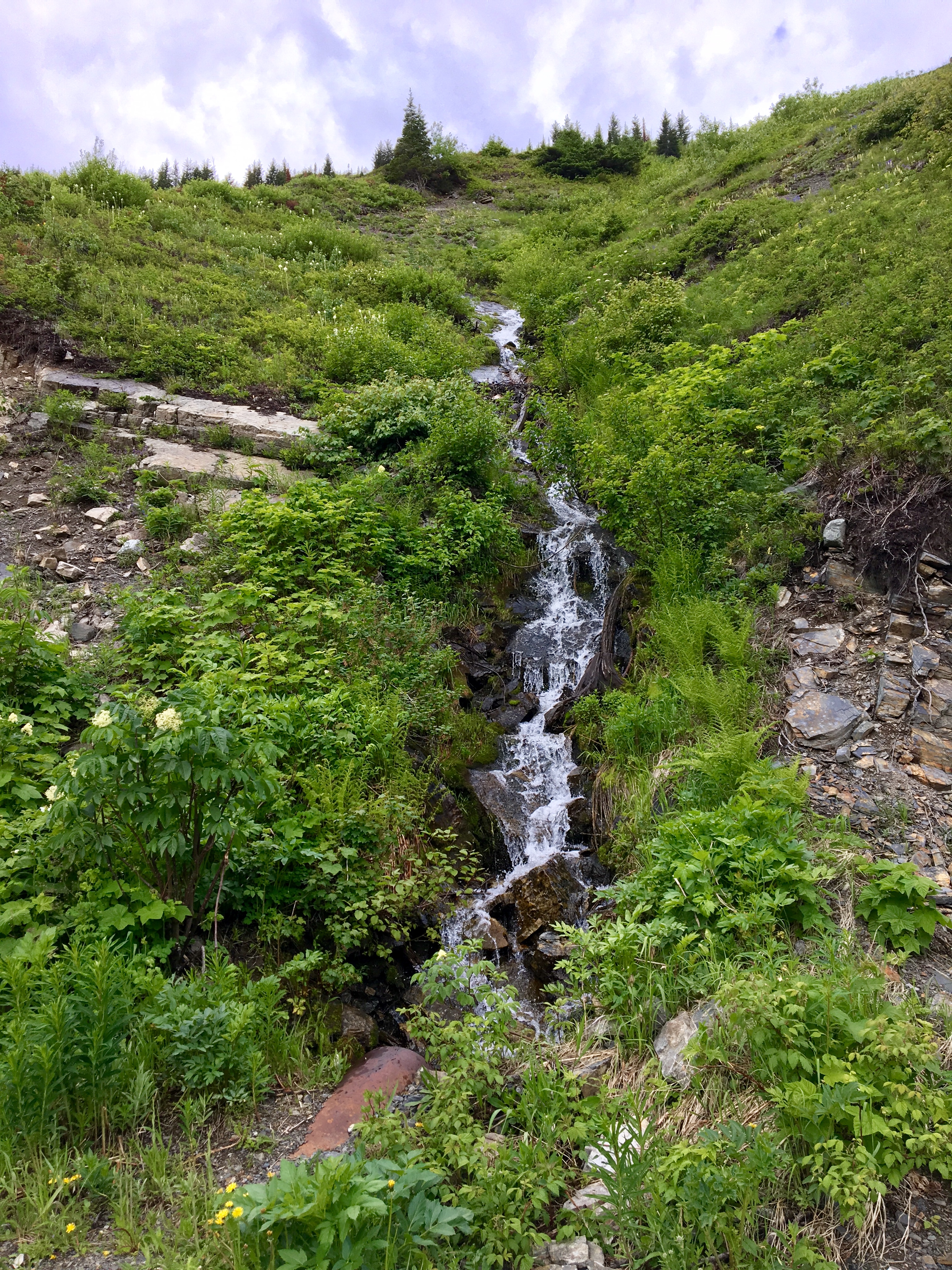
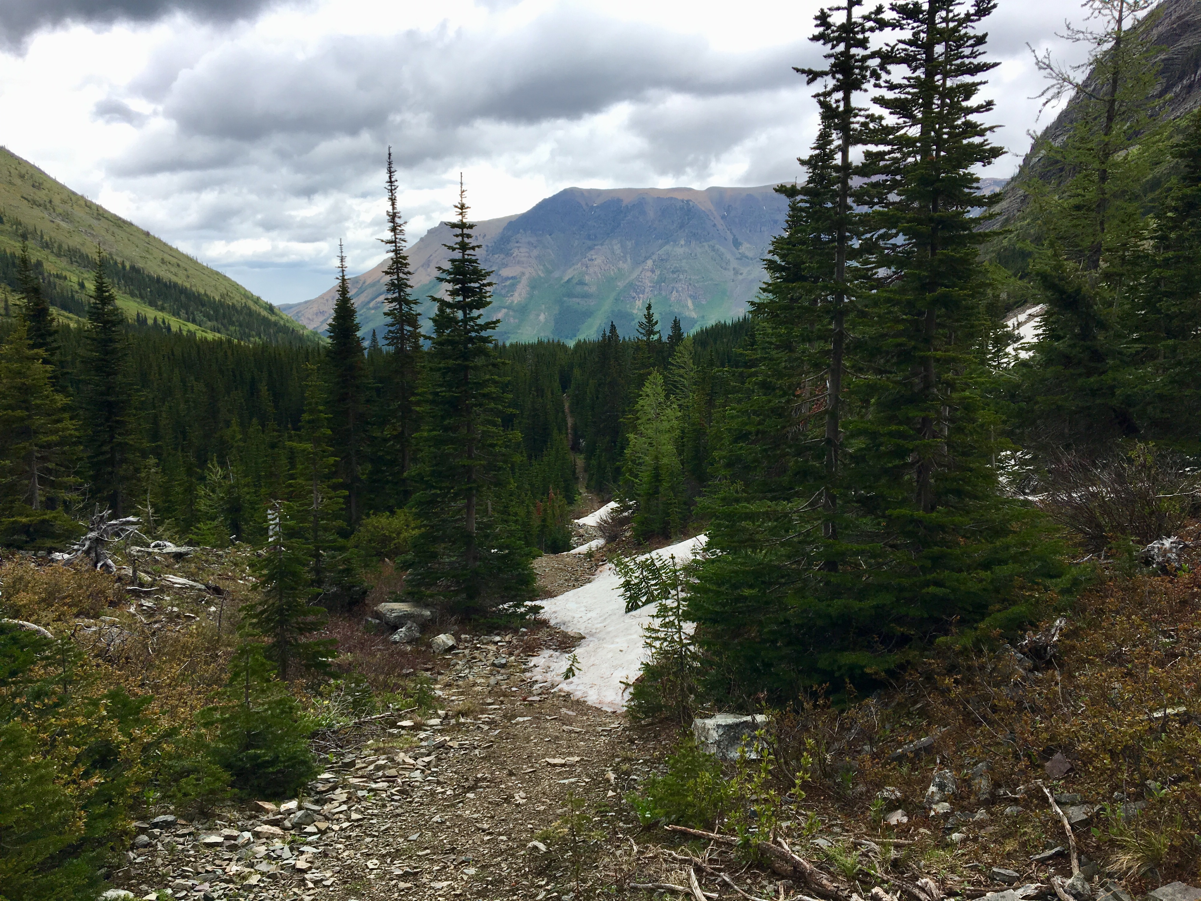
The North trail sets off up a ski run, so the climbing is a little steep at first, Signs and trail markers direct you slightly left, eventually crossing another run. Further climbing and westward traversing lead to a wide path with a hiking trail sign perched high above it on a tree. This is the Clinch Traverse ski run and it’s the path followed by the Haig Lake North trail. I found the hiking to be fairly pleasant. Here and there I stopped to check out streams or interesting rocks, and the views of Mount Haig’s northeast face slowly improved. There were dense, heavy clouds rolling in and bringing rain, so the top of the mountain was obscured. After about 1h 10m of hiking I reached the lake.
Rain started to fall as I arrived, but it wasn’t heavy. I had a chance to sit for a time and have a sandwich. Nobody else was up there and it was very tranquil. Ongoing snow melt on Mount Haig fed a couple of waterfalls. Every now and then I could hear rocks crashing down the cliff face as erosion continued its work.
I returned via the South trail, which directly joins the North. This trail looks like it follows a cutline – it’s perfectly straight for most of its course. Once I was back to the ski runs, I followed the signage heading down but ended up deviating before the bottom because of some construction. It seemed to me that the route was leading me directly towards a totally fenced off area. I therefore crossed over to the area beneath the Huckleberry chairlift and followed it down. I may have been wrong about this part of the trail being inaccessible, but I didn’t want to go all the way down and have to climb back up. Some of the terrain below the chairlift was actually kind of tricky, but that added some interest to the trip.
Click on the pictures below to access full-sized images.


If you like winter fun but not crowds, I suggest Castle’s snowshoe & dinner date nights. Small groups and fun descent followed by a tasty meal.
LikeLiked by 1 person
We just did this loop with the boys and
some friends while camping at Castle River Bridge. I wish I’d seen your post first with the suggestion to start with the North trail. But yes, we did look back to enjoy the stunning view. 😁
LikeLiked by 1 person