August 3, 2019 with August 2023 update. A straightforward scramble up a peak on the continental divide.
- Region: Castle Mountain Resort. Traditional territory of the Tsuu T’ina, Ktunaxa, and Blackfoot First Nations
- Distance: 12.7 km round-trip
- Total Ascent: 1200 m
- Elevation of Objective: 2611 m
- Total time: 5h 47m
- Safety and Disclaimer
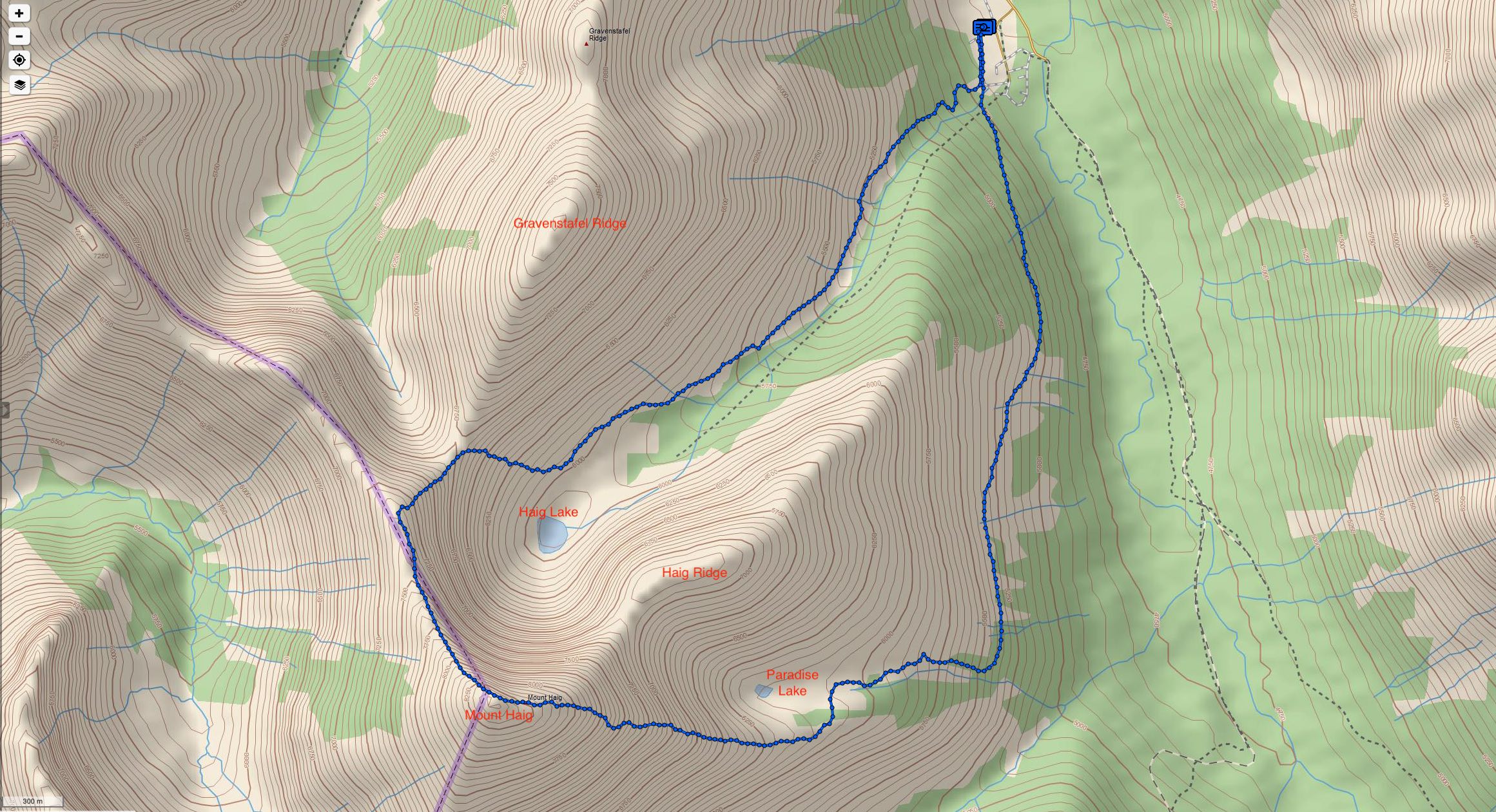
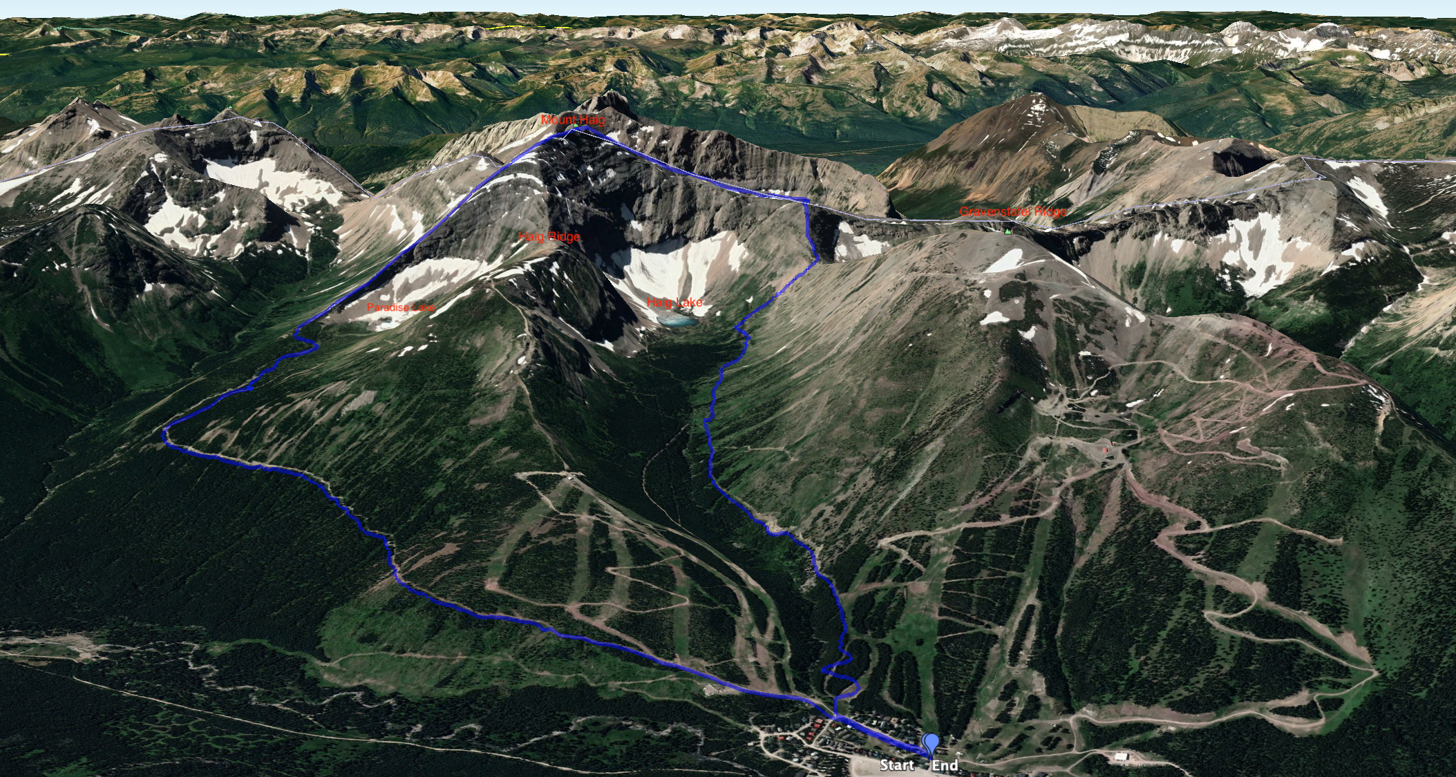
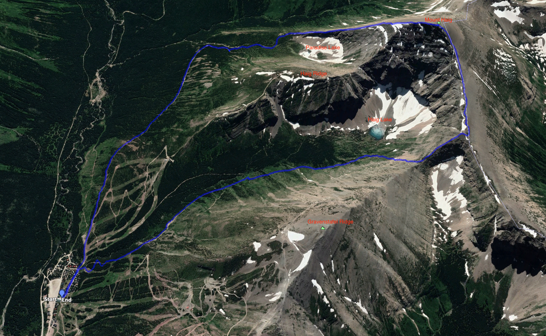
Earlier in the summer I had set out to climb this peak, but the weather didn’t cooperate. I salvaged my days by exploring the trails to Haig Lake and Paradise Lake, both of which are now being marked and maintained by the Castle Ski Resort. This was fortuitous, as it turned out, because it allowed me to see that there was a better way to approach the ascent ridge of Mount Haig than what’s described in Nugara’s More Scrambles in the Canadian Rockies 3rd ed. Nugara describes ascending Haig Ridge, under the ski lifts, then descending south into Paradise Lake’s valley before once again regaining altitude on the ascent ridge. Now, however, the Paradise Lake trail allows access to the ascent ridge without any un-needed gain and loss of altitude.
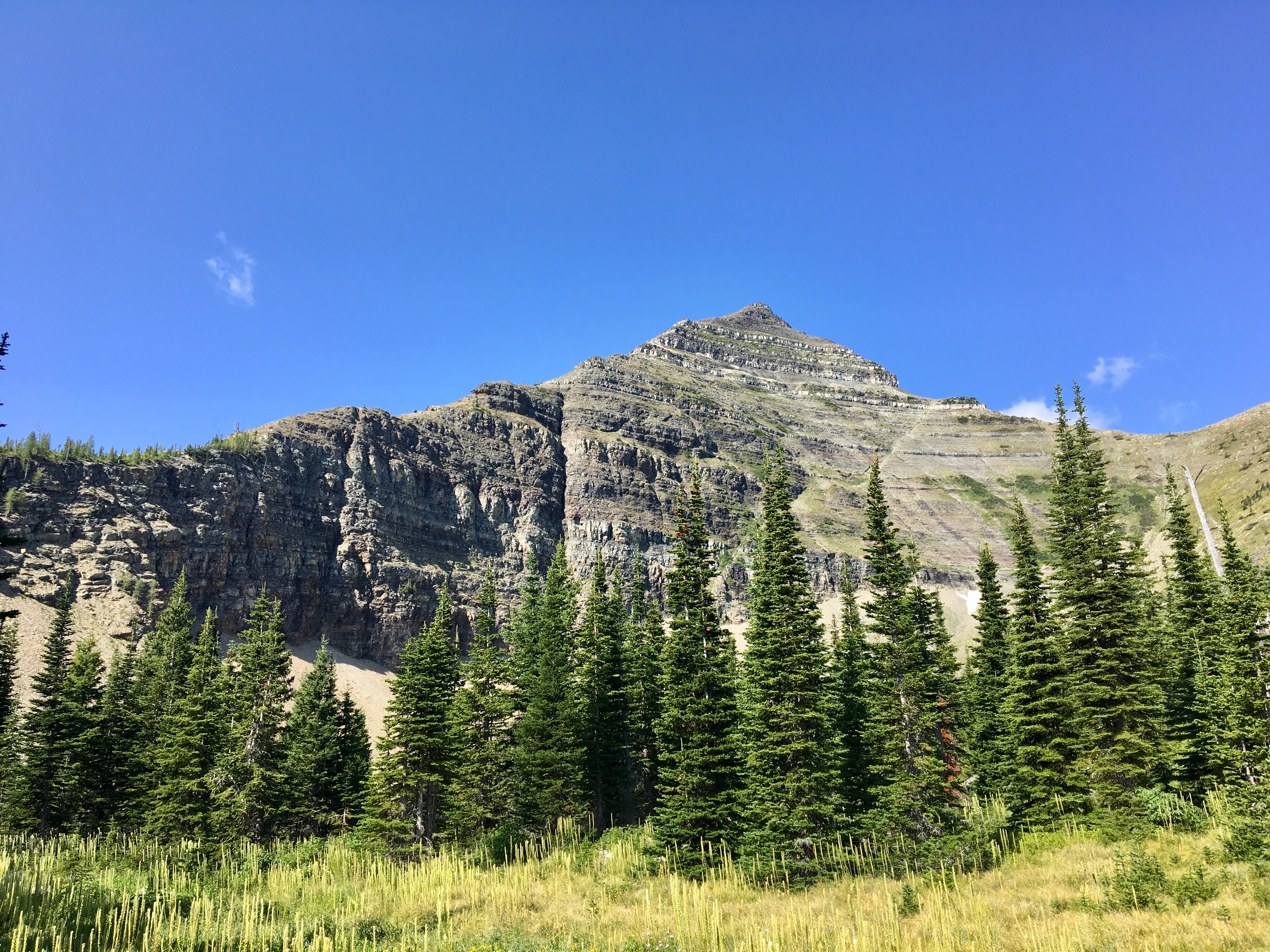
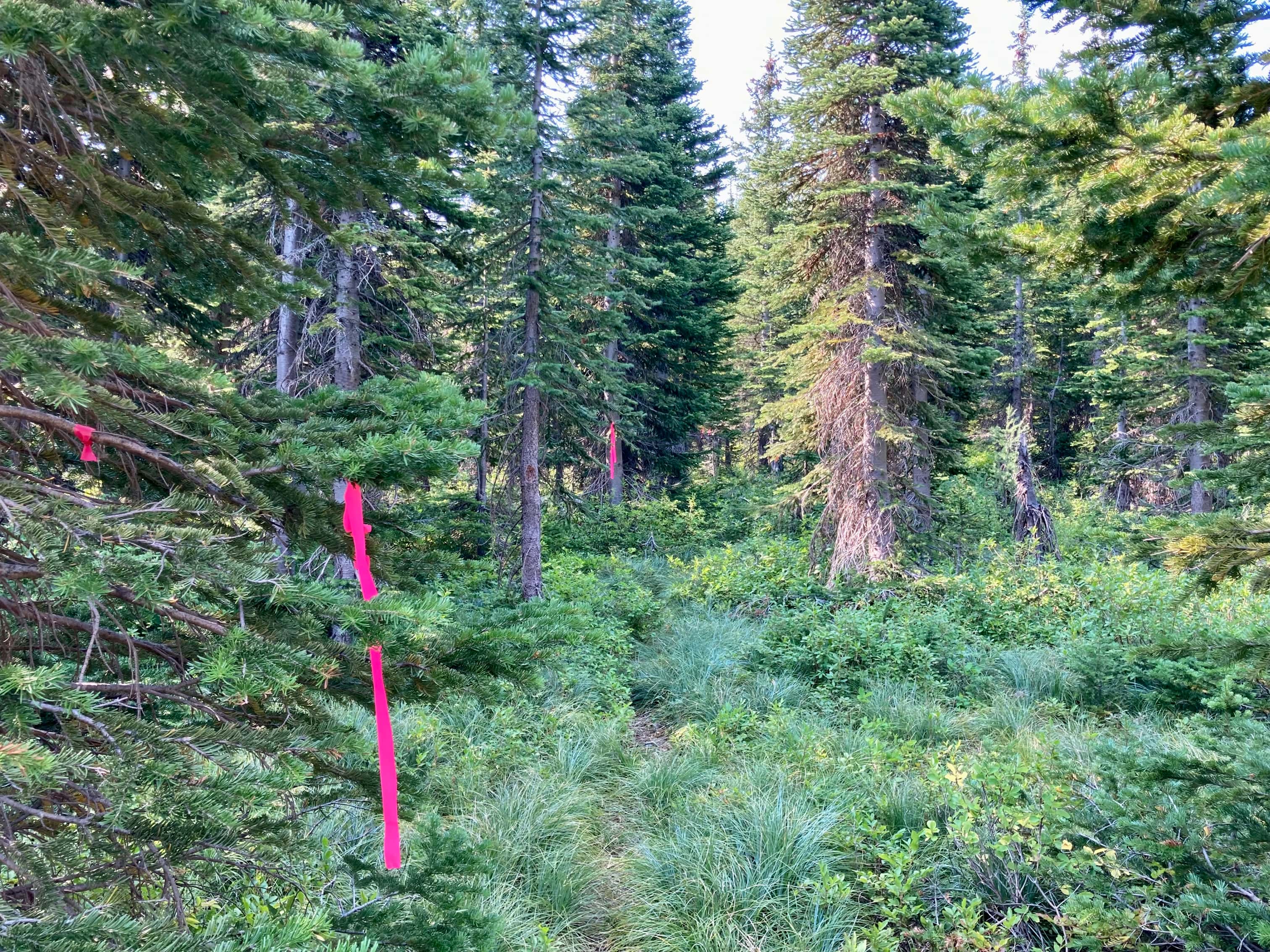
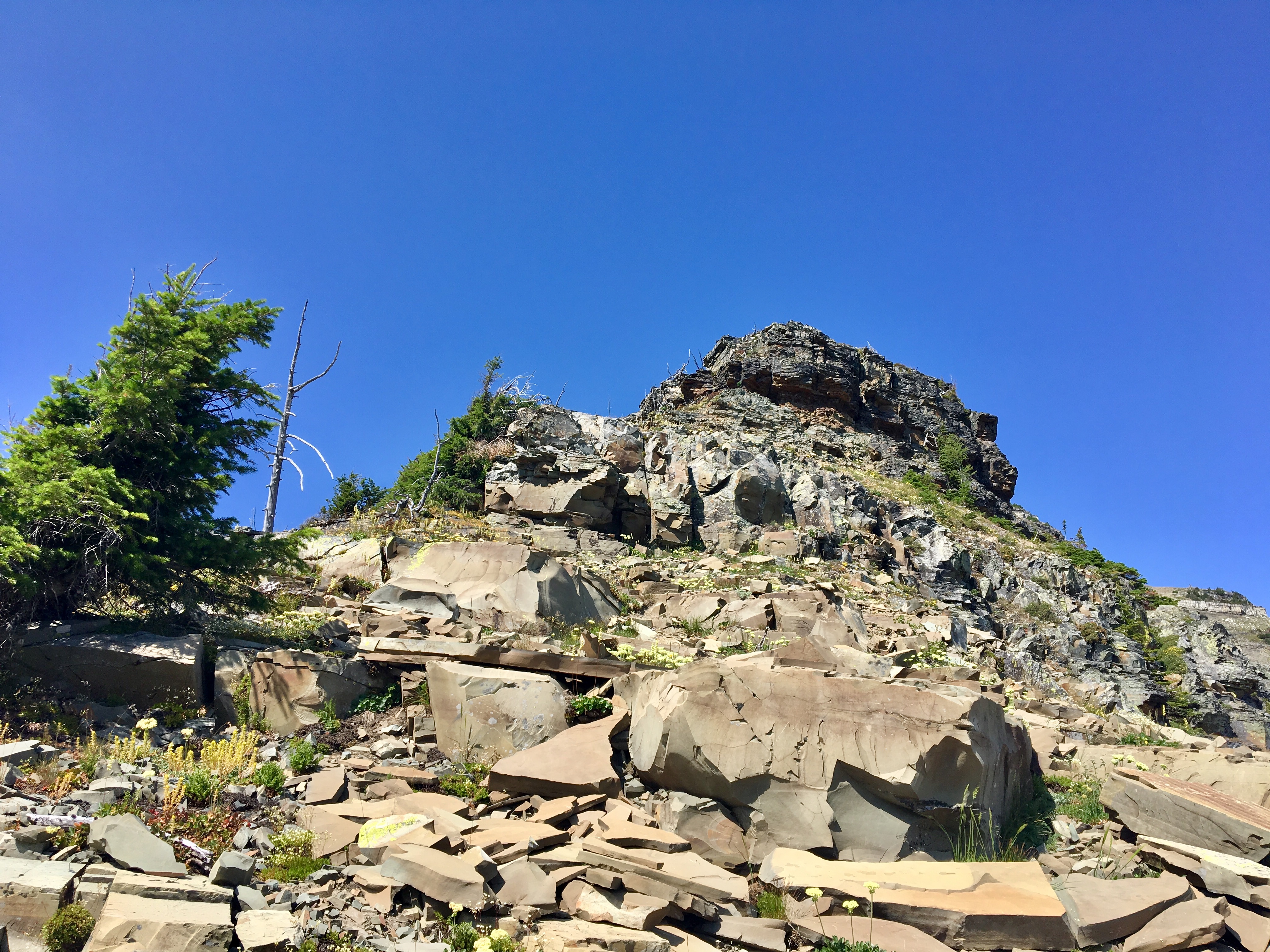
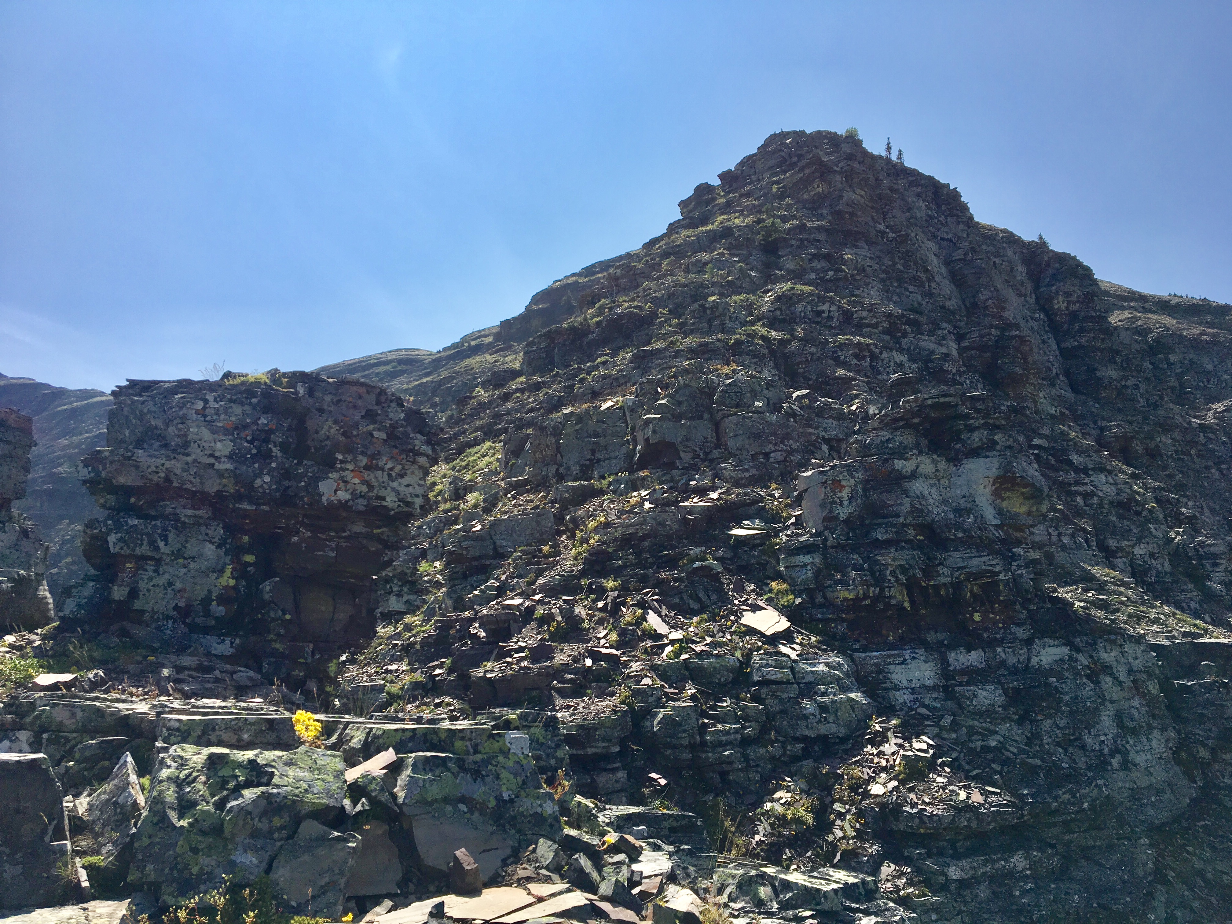
I followed the Paradise Lake trail as previously described for a little over 4 km. At this point, after the trail has steeply ascended, crossed the woods and entered the grassy valley, there’s a distinctive white boulder adjacent to the trail. The trail carries on to the right towards the lake, but I broke off to the left and headed for the eastern ridge of Mount Haig. There were a couple of faint trails that seemed to be heading the right way, and I followed one which seemed to be the most direct one. At this level the ridge is fairly rounded, but it has treeless patches that make it easy to know once you’ve gotten on top. Once on the ridge, I turned right and began to ascend. Route-finding wasn’t an issue here. A few rock bands along the way give a chance for hands-on scrambling. They can be taken head-on for a challenge or you can traverse left to find an easier spot.
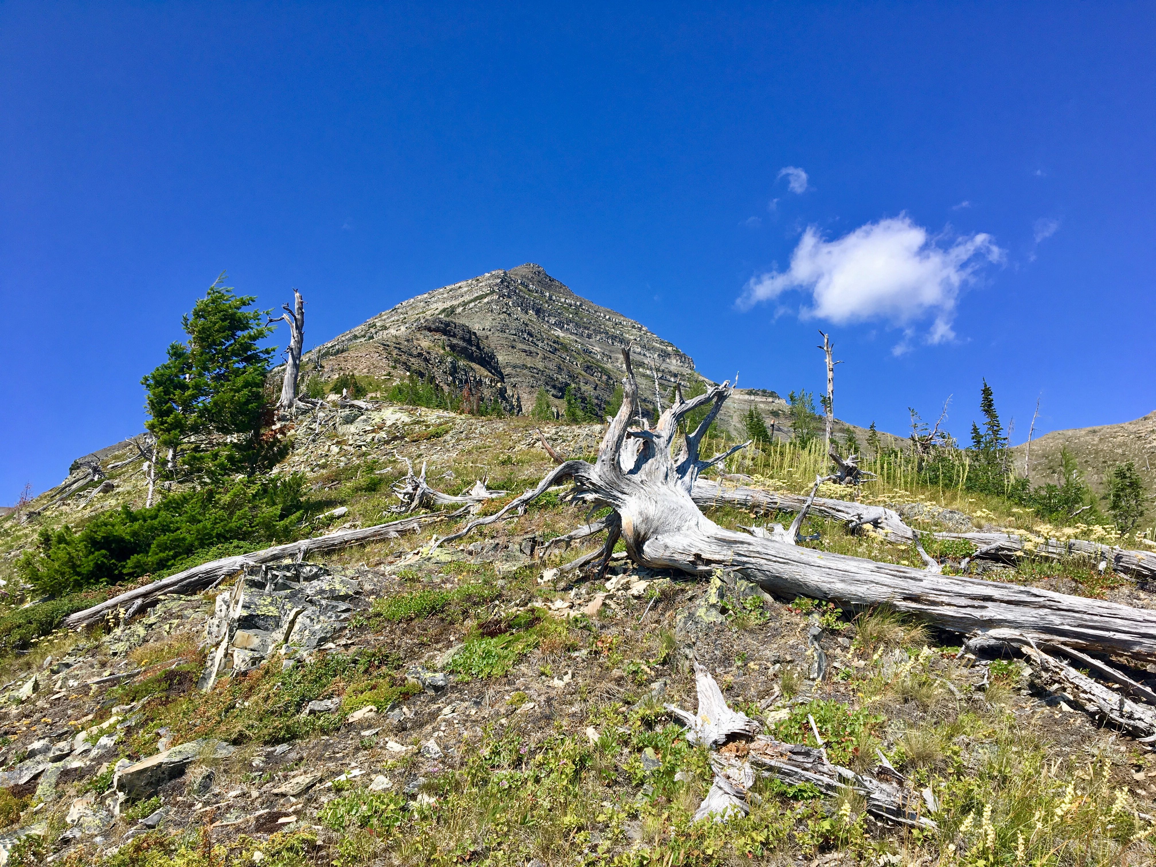
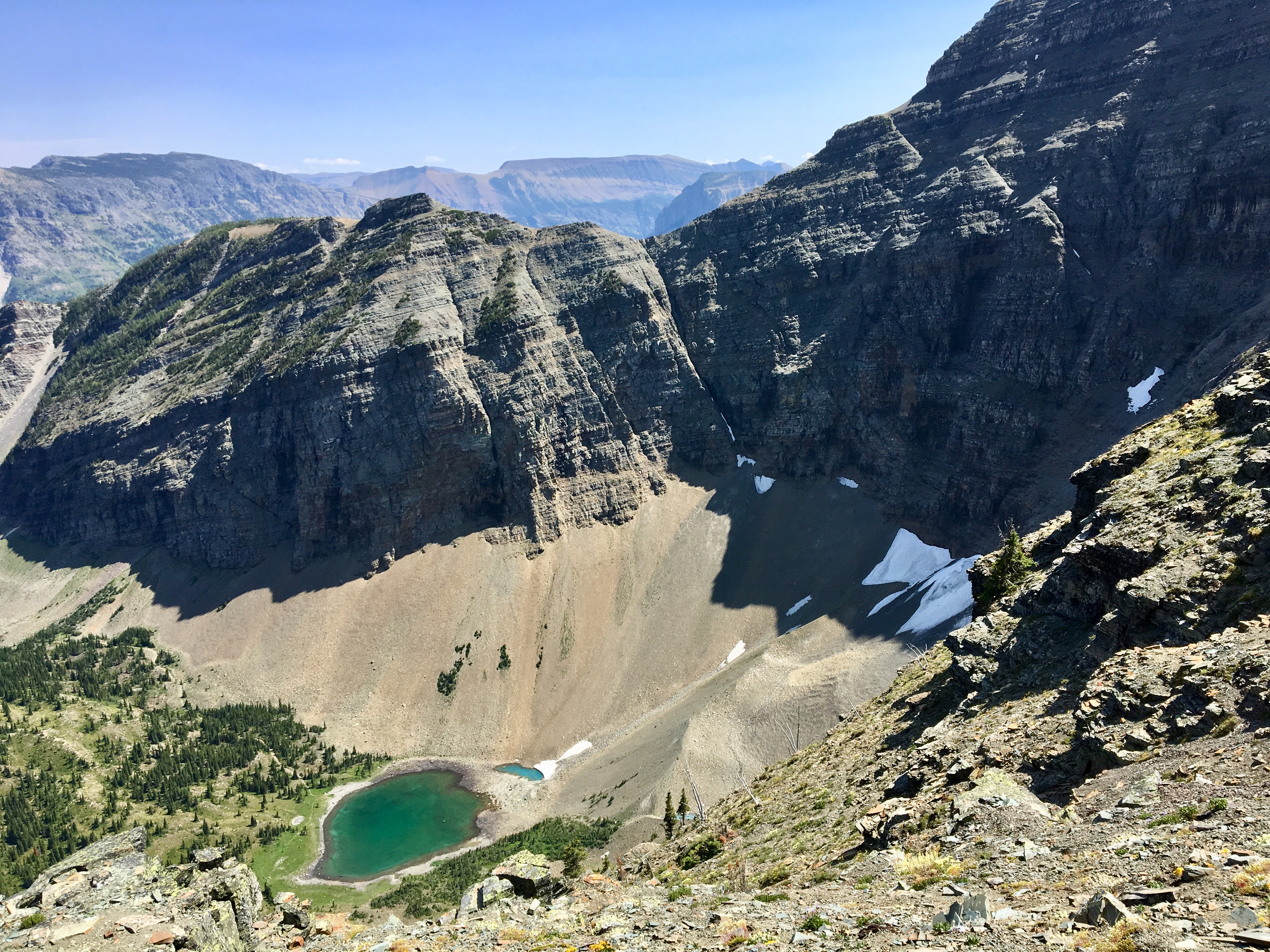
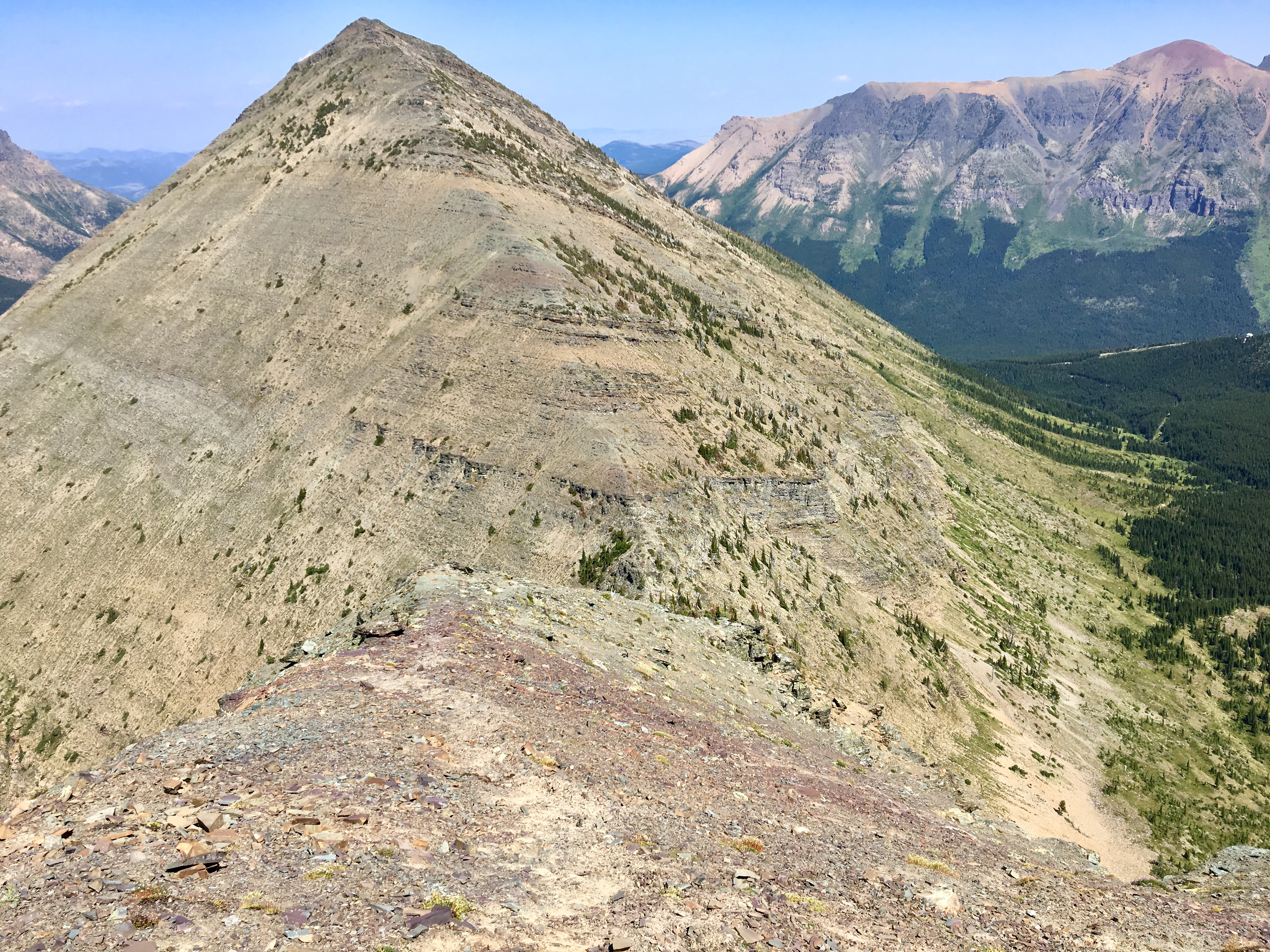
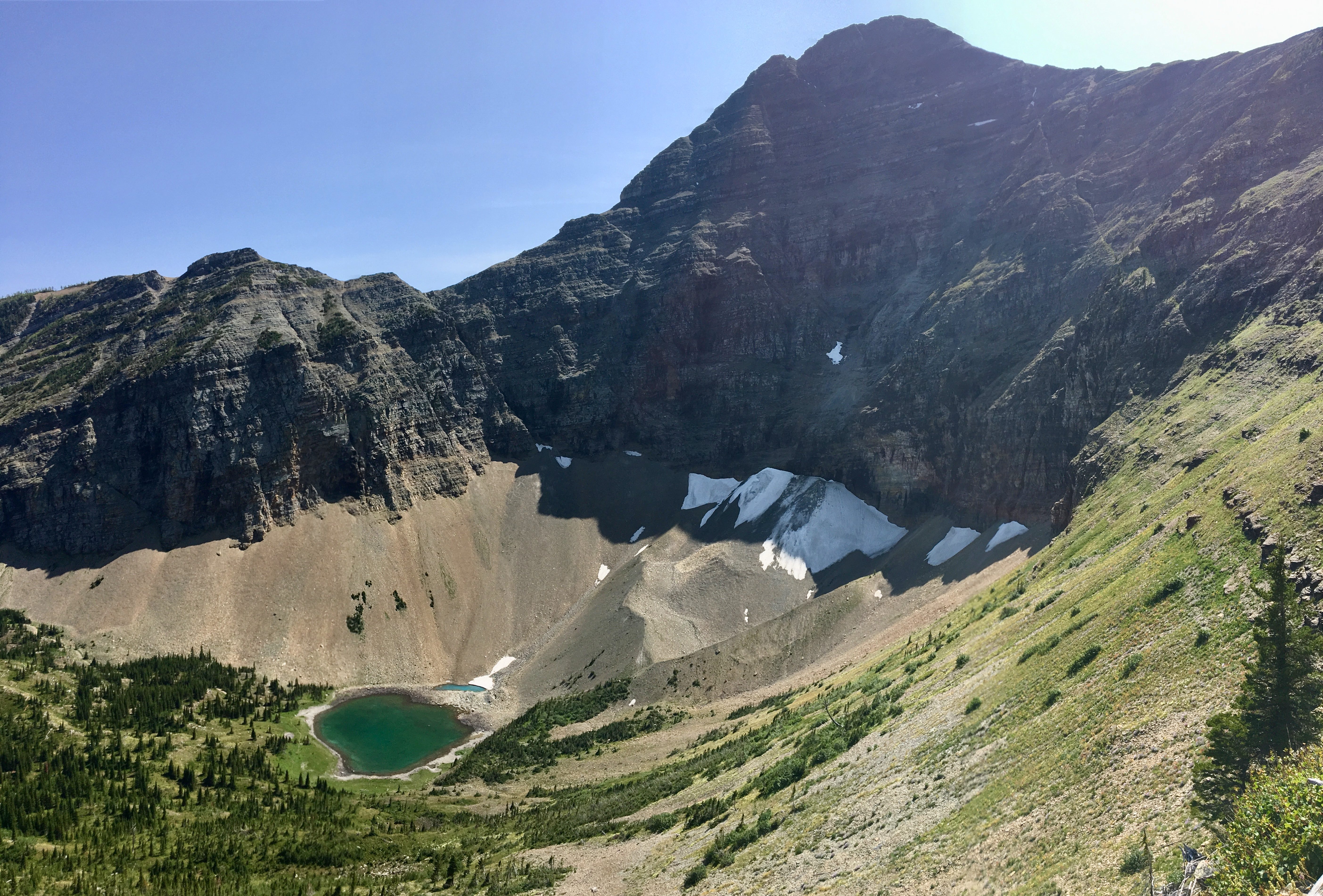
To the north, over the edge of the ridge, there are initially views down into Paradise Lake’s valley. Later, the main ascent ridge crosses the axis of Haig Ridge and there are views down into Haig Lake’s valley. To the south, there are nice views to the adjacent un-named outliers of Mount Haig.
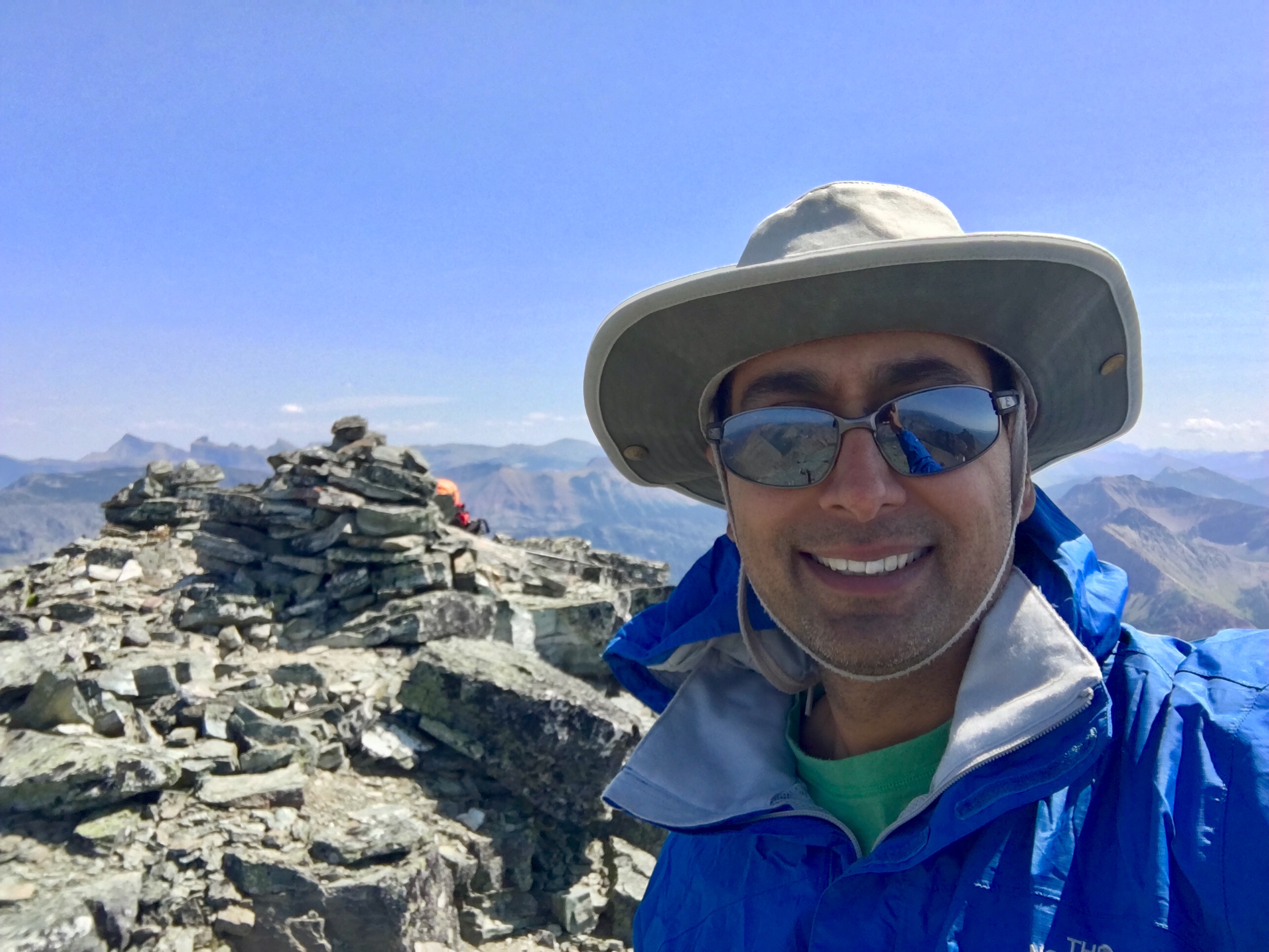
I reached the summit 3h 15m from the trailhead. There’s a cairn with a register, and excellent views in all directions – Haig is one of the tallest peaks in the area. To the east Victoria Peak, Mount Gladstone and Castle Peak are visible beyond Barnaby Ridge. To the west, the peak of Tombstone Mountain is visible, most of the mountain being obscured by intervening ridges. To the north, Gravenstafel Ridge is immediately adjacent, with Mount St. Elois and Mount Syncline a short distance beyond. Farther north are the peaks of the Crowsnest Pass. To the distant southeast I could even make out peaks in Waterton and Glacier National Parks.
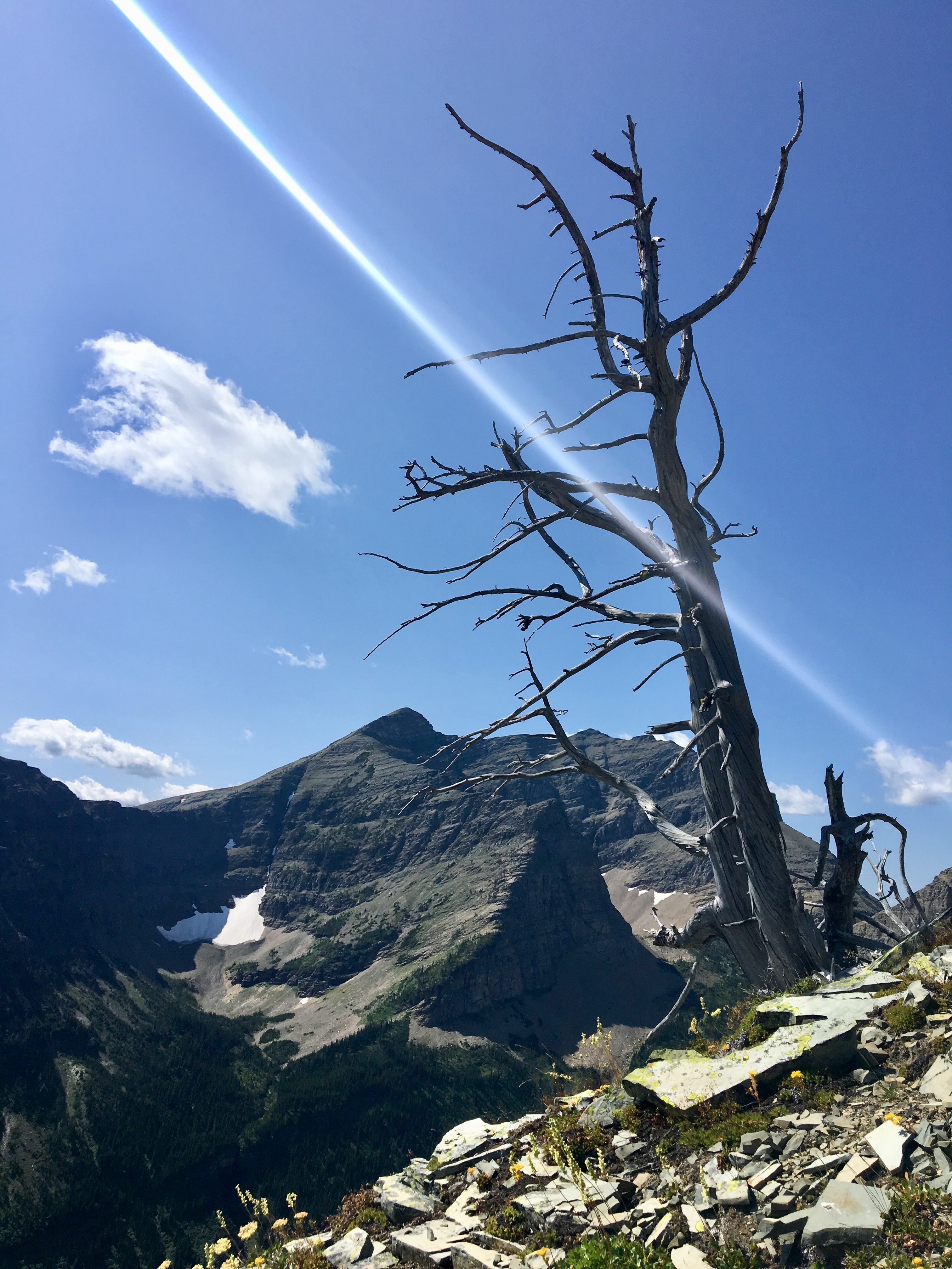
Rather than descending by the same route, I decided to do a loop as suggested by Nugara. This involves following Haig’s northwest ridge to where a subsidiary splits off to form a col with Gravenstafel Ridge, then descending from the low-point on the col into the valley with Haig Lake. From there, the Haig Lake trail can be followed back to the parking area. The main challenge is the descent to the col, which involves down-climbing with some brief exposure on debris-strewn rock. Looking down at the col from the summit, I also made note of some cliff bands to avoid on the descent from the col that wouldn’t be visible from above.
Click on the pictures in the gallery below to access full-sized images.


Really nice post and the Haig Lake and the summit photo look stunning!
Well done, and thanks for sharing
LikeLiked by 1 person
Realy great descripion and pics amazing to.Thanx for publishg .
LikeLike
Thank you for reading!
LikeLike
Great pictures and route. Thanks for the post.
LikeLiked by 1 person
Thanks for reading, Dave!
LikeLike