August 9, 2019. A guided hike to a viewpoint above the Mendenhall Glacier near Juneau, Alaska.
- Region: Tongass National Forest, USA. Traditional territory of the Tlingit people
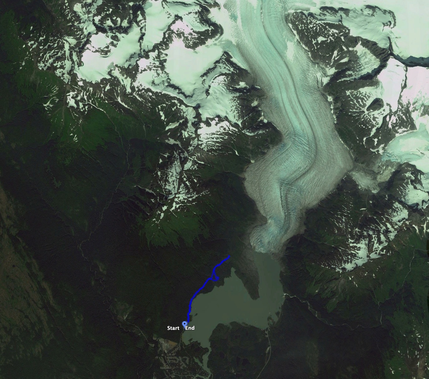
- Distance: 6.4 km round-trip
- Total Ascent: 214 m
- Elevation of objective: 221 m
- Total time: 2h 57m (as part of a diverse guided hiking group)
- Safety and Disclaimer
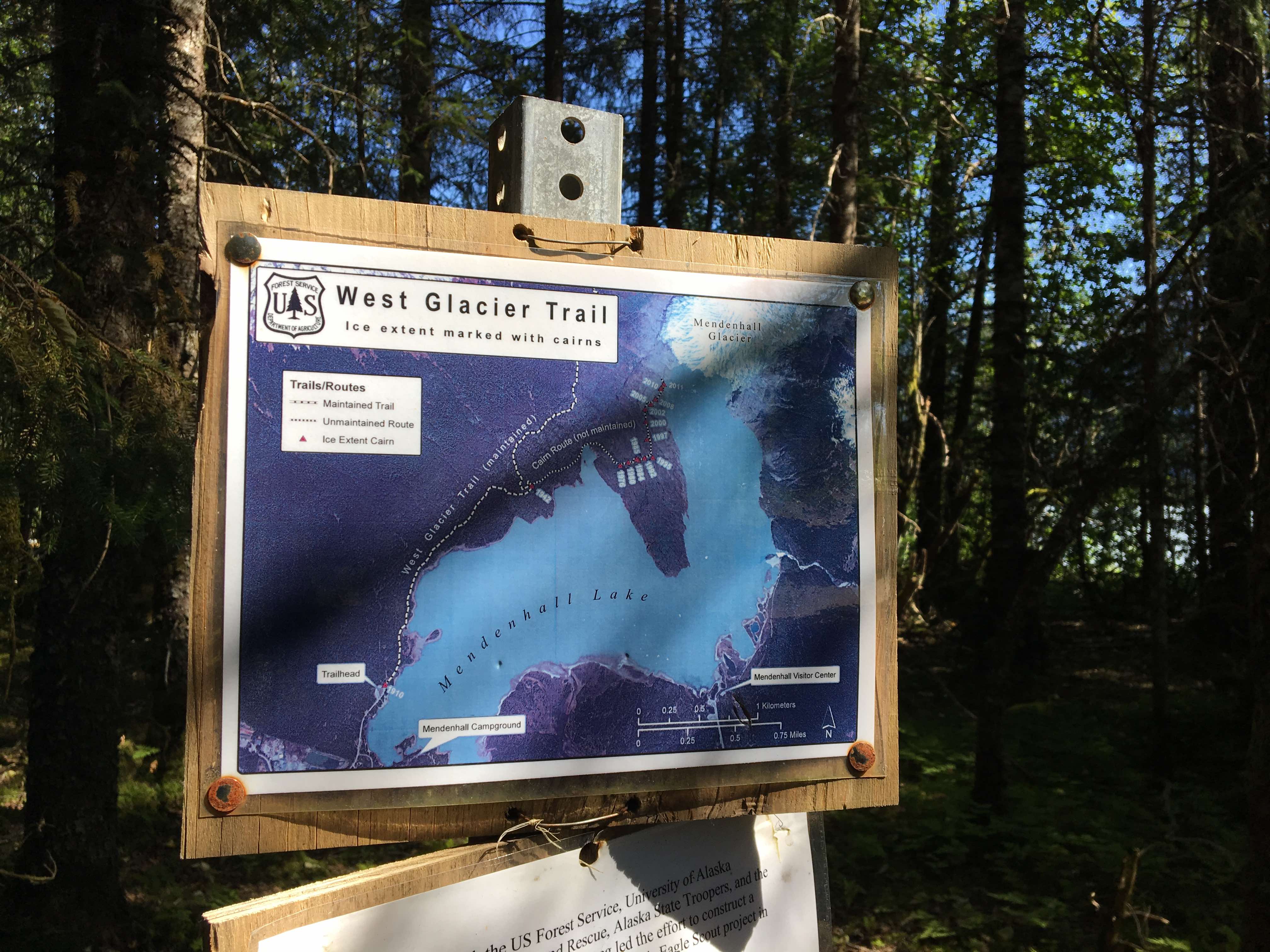
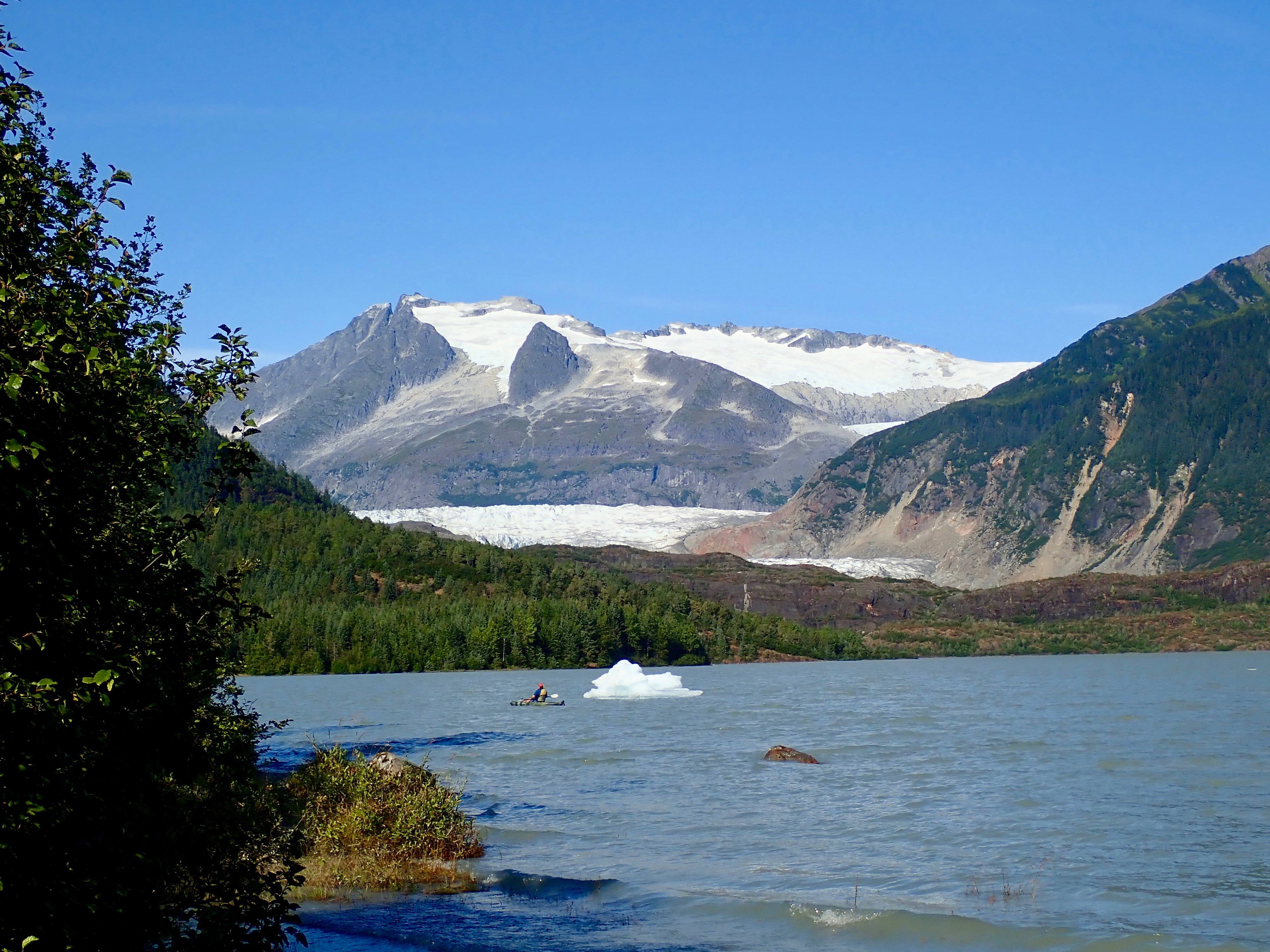
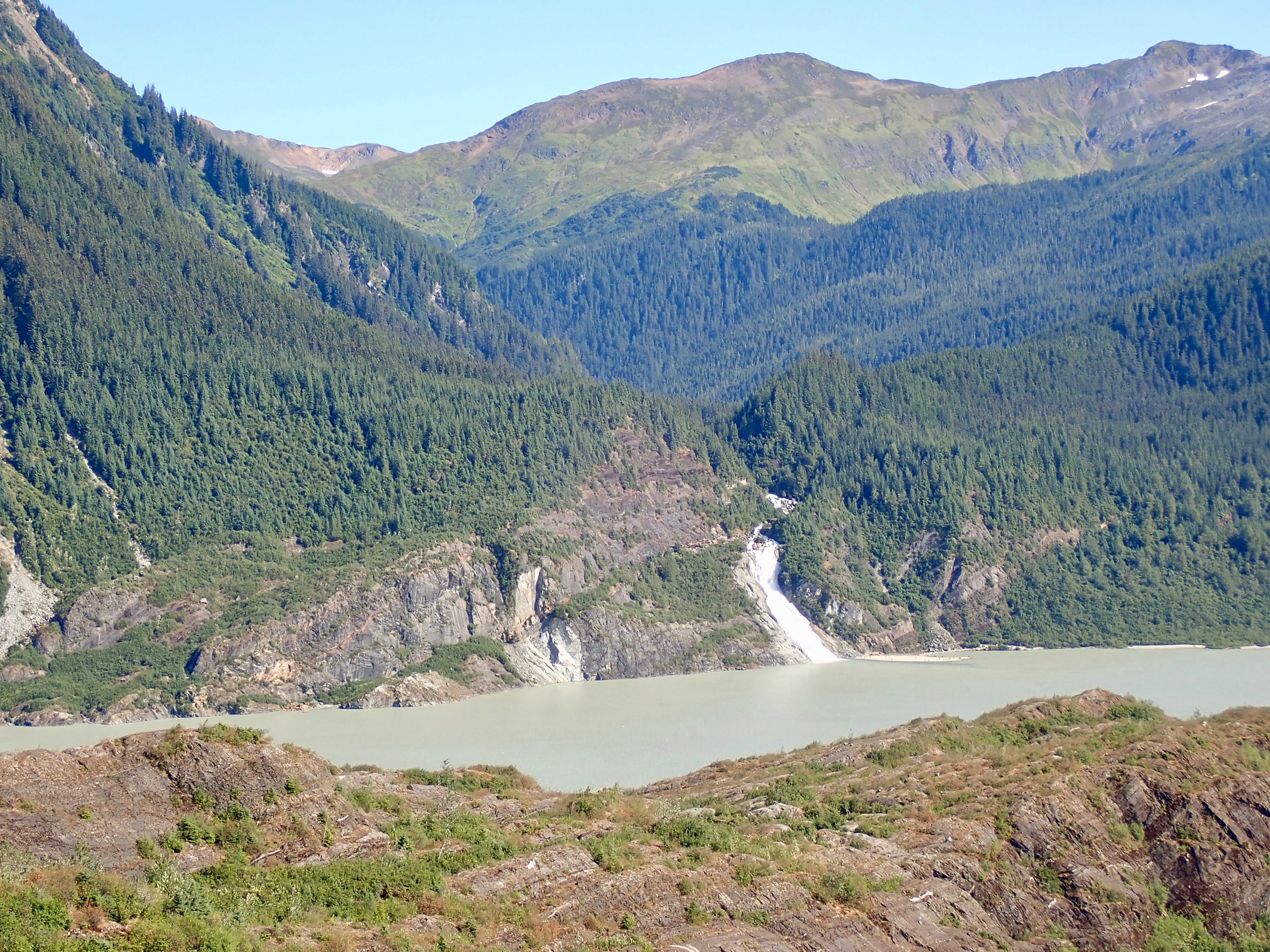
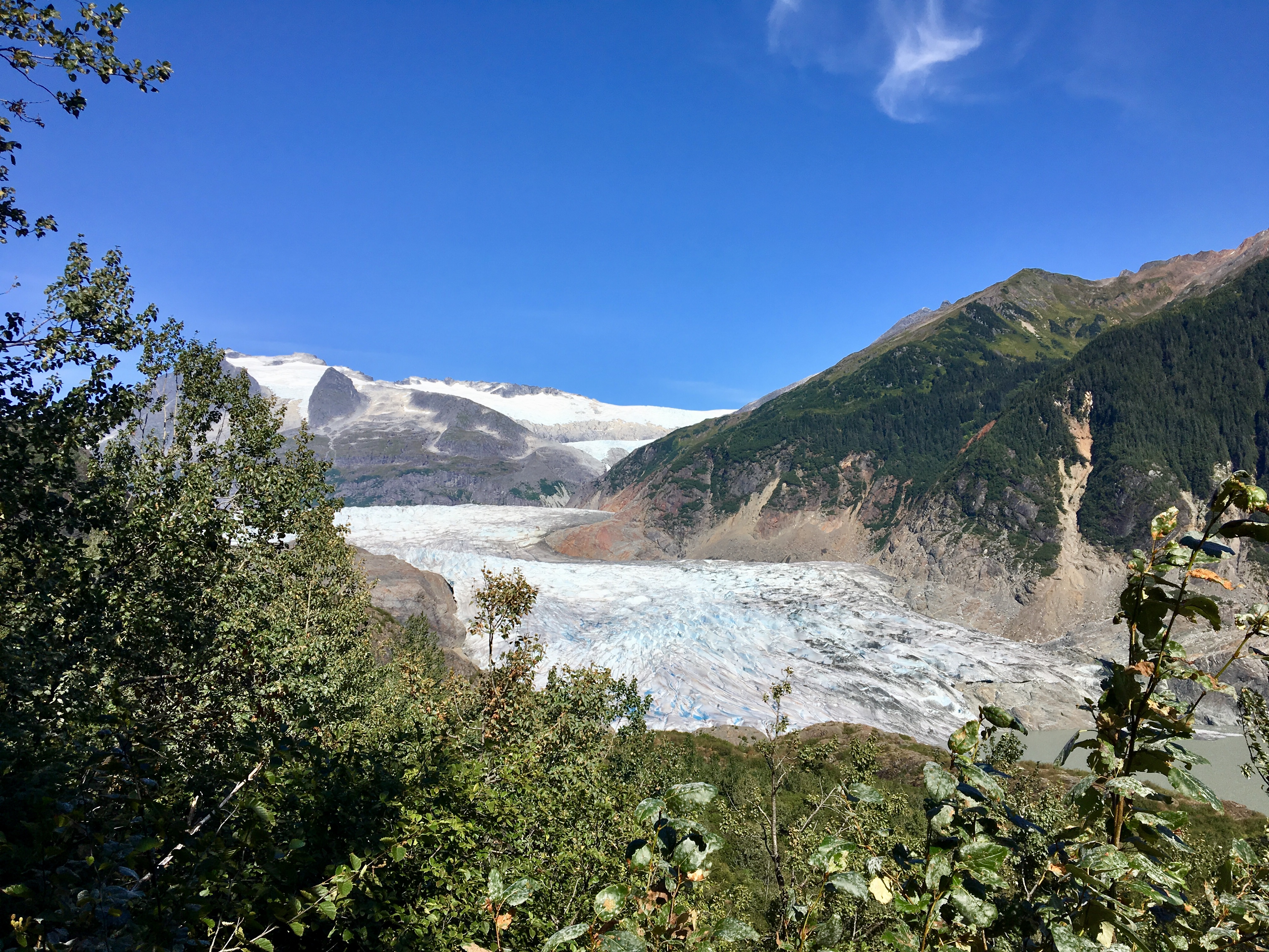
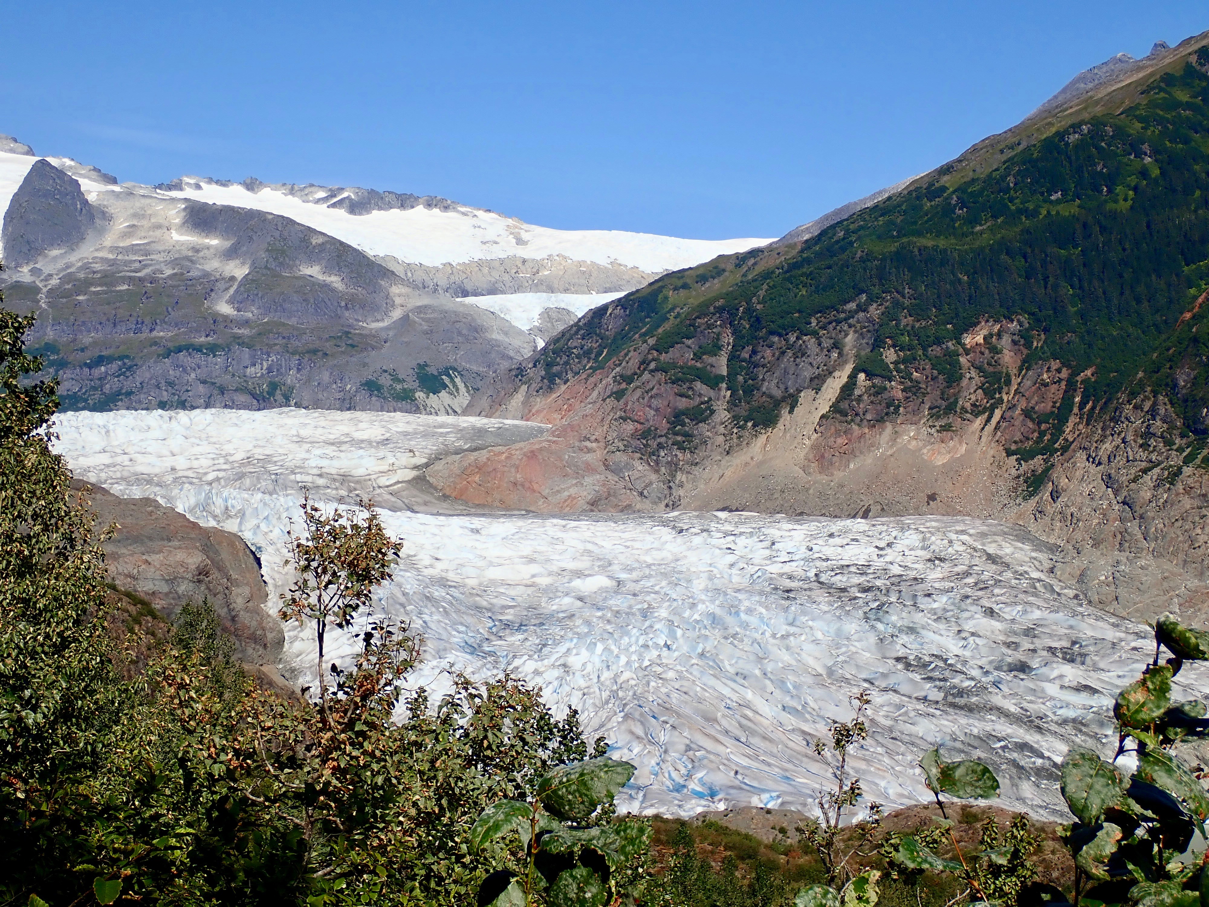
This year’s summer vacation was a cruise to Alaska. I packed some trail shoes so I could take advantage of a hiking opportunity if it came up. As it turned out, one of the excursions offered was a guided hike during our stop-over in Juneau, Alaska. Gastineau Guiding Company was the provider, and our guide was a young man named Mischa – a California kid transplanted to Alaska. The hike followed a trail leading to a viewpoint nearby the Mendenhall Glacier, a short distance from town.
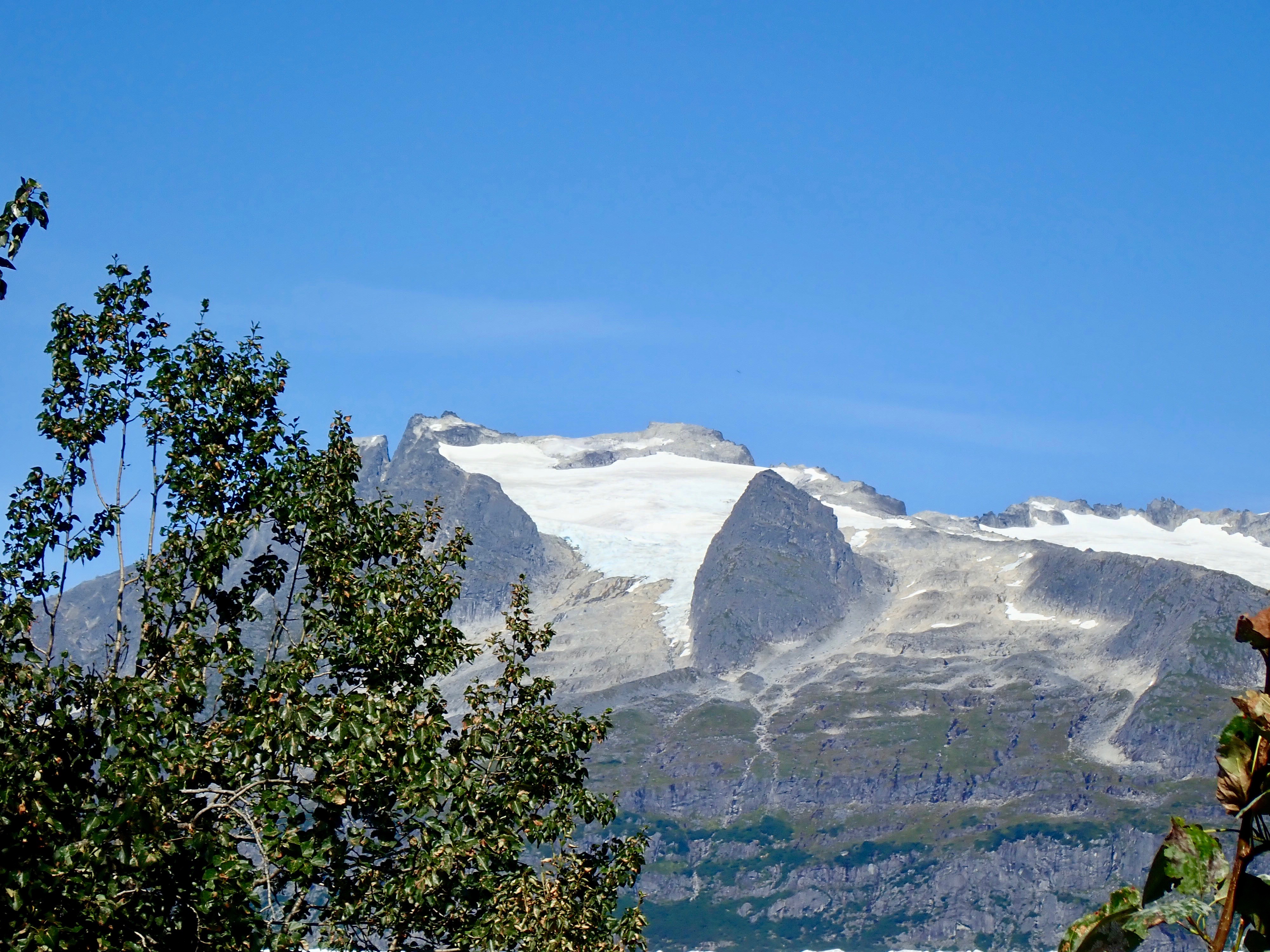
The trail was actually quite fun to hike. Mischa stopped from time-to-time to point out interesting vegetation and to discuss the process by which forest reclaimed land which had been vacated by the retreating glacier. Aside from nice views of the glacier itself, the best part was the steep shortcut trail we used to quickly ascend a portion of the route.
Mendenhall Glacier is, for some reason, named after a physicist from Ohio. The Tlingit (the First Peoples of the Alaska panhandle) called it Aak’wtaaksit – the Glacier Behind the Little Lake.
Apparently, there’s another trail which is sometimes selected for this excursion which has no steep ascent but offers far less dramatic views. If you find yourself calling in Juneau during a cruise, check this excursion out and ask to do the West Glacier Trail.
Click on the pictures below for full-sized images.


At the time (1892) the glacier was named for Mendenhall, he was the superintendent of the U.S. Coast and Geodetic Survey (1889 to 1894). It was the custom in those days to name things for whoever was in charge of a survey or an exploration. Even if it already had a native name…
LikeLiked by 1 person