August 27, 2020. Late summer scrambling on the Alberta/BC border.
- Region: Crowsnest Pass. Traditional territory of the Blackfoot and Ktunaxa First Nations
- Elevation of Objective: 2549 m
- Total Ascent: 1500 m due to my wandering off course. Accounts of uncomplicated ascents put it at 1100-1200 m
- Distance: 16.1 km due to my wandering off course. Accounts of uncomplicated ascents put it at about 14.2 km
- Total Time: 7h 17m
- Safety and Disclaimer

August 27 was one of those days that everything didn’t go as planned. After ascending, descending, then re-ascending part of Mount Tecumseh’s south face, I had the summit in sight 300m ahead of me and decided to abort. My legs felt fine, but my brain felt done.
Mount Tecumseh shares a massif with slightly-shorter Phillips Peak, which sits on the continental divide. It makes for an impressive sight from Hwy 3 westbound, as well as from other peaks and trails in the region. My favourite view of it is from the Star Creek Falls trail:

There’s a fairly popular scrambling route to the top of Mount Tecumseh starting from Phillips Pass, which runs between Tecumseh/Phillips on the north side and Crowsnest Ridge on the south. An old dirt and gravel road runs through the pass – the modern incarnation of the first formal road crossing the continental divide in Canada. Some interesting historical background about the pass has been posted by Discover Crowsnest Heritage. Older trip reports describe an approach from the east, but this crosses private property. The most recent edition of Kane’s Scrambles in the Canadian Rockies acknowledges this and suggests approaching from the west side, which is what I did.
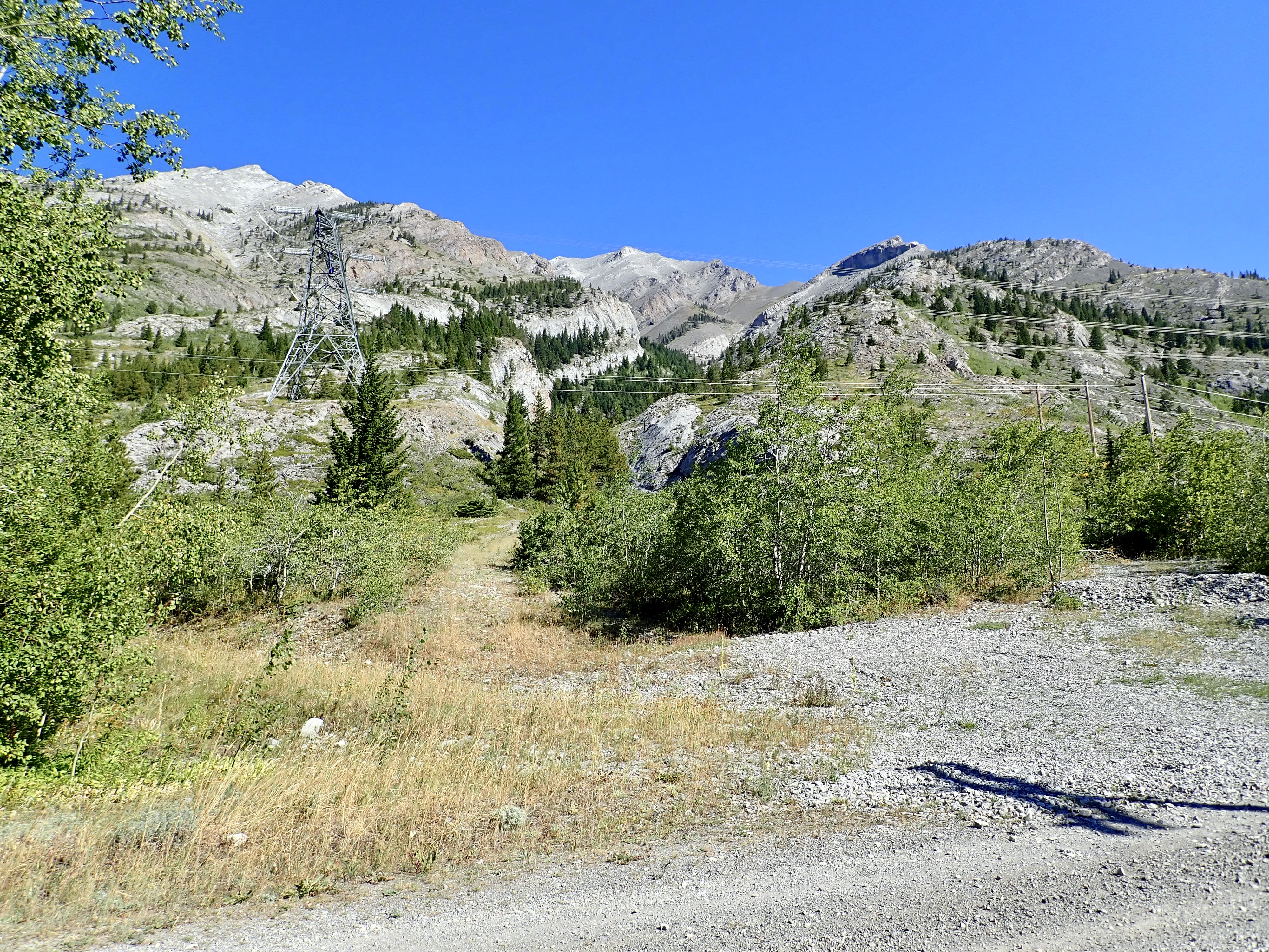
The route starts from the Crowsnest Provincial Park parking area off Hwy 3, just to the west of the Alberta/BC border. There’s a big parking area with some toilet facilities and picnic tables. Search for it by name or click here and Google Maps will drop a pin on it. At the northwest end of the parking area there’s a locked vehicle gate. The route starts there, following an old road that hooks around and heads east, into Phillips Pass and back over the provincial border.
I brought my bike, since Kane commented that it may be useful, but didn’t find the terrain suitable for my level of cycling fitness. After 2 km of struggling to ride the thing or pushing it up inclines, I stashed it by the side of the road. Walking along the road was pleasant enough – it ascends fairly steadily then levels off after curving around the western contour of Crowsnest Ridge. About 3 km along, the road passes by Phillips Lake which sits right on the provincial border, then continues past a fenced-in metal building which Kane mentions as a landmark. A little over 1 km from the lake, a rocky drainage beneath power lines intersects the road from the north. This is the start of the ascent route.
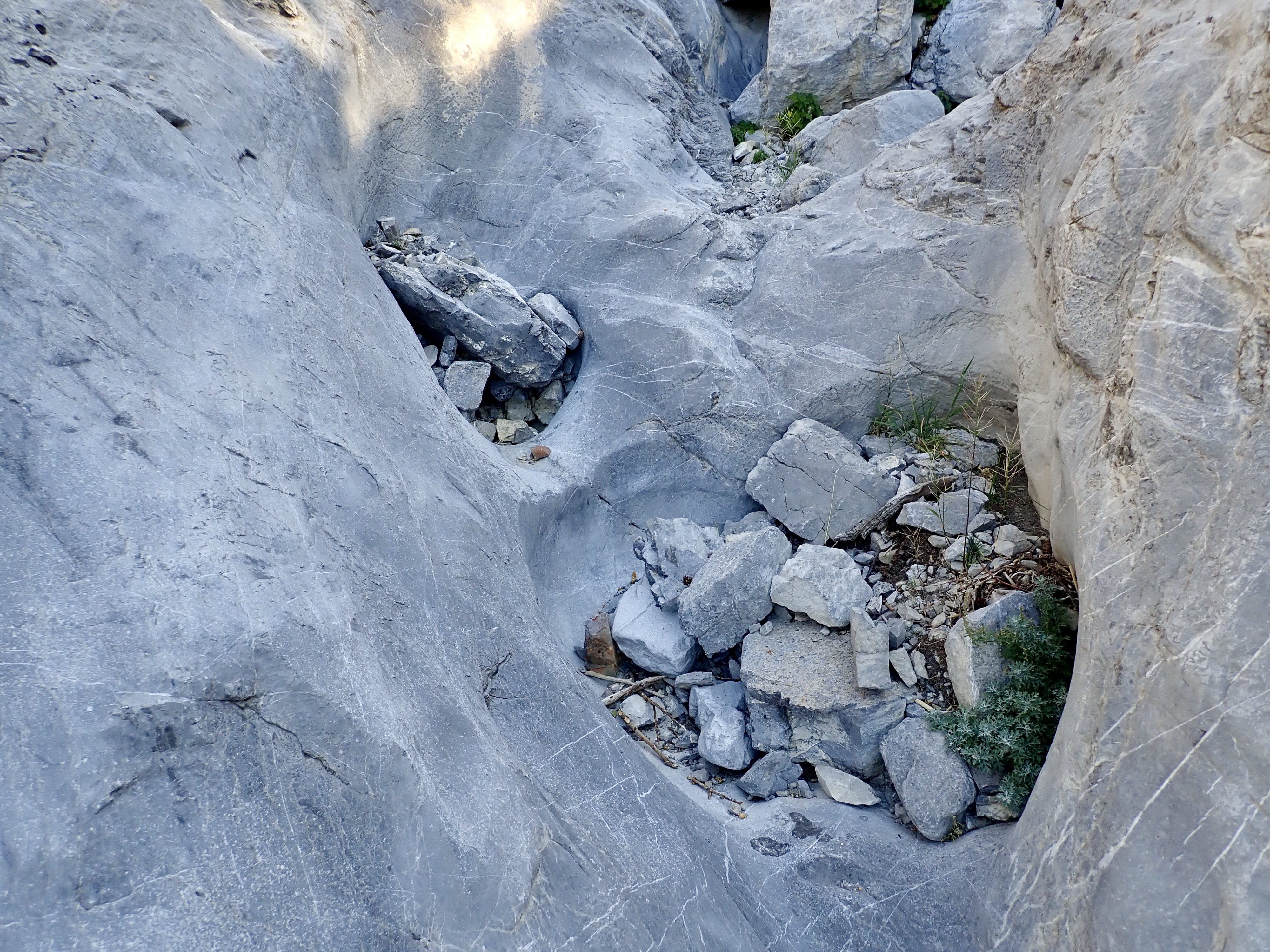
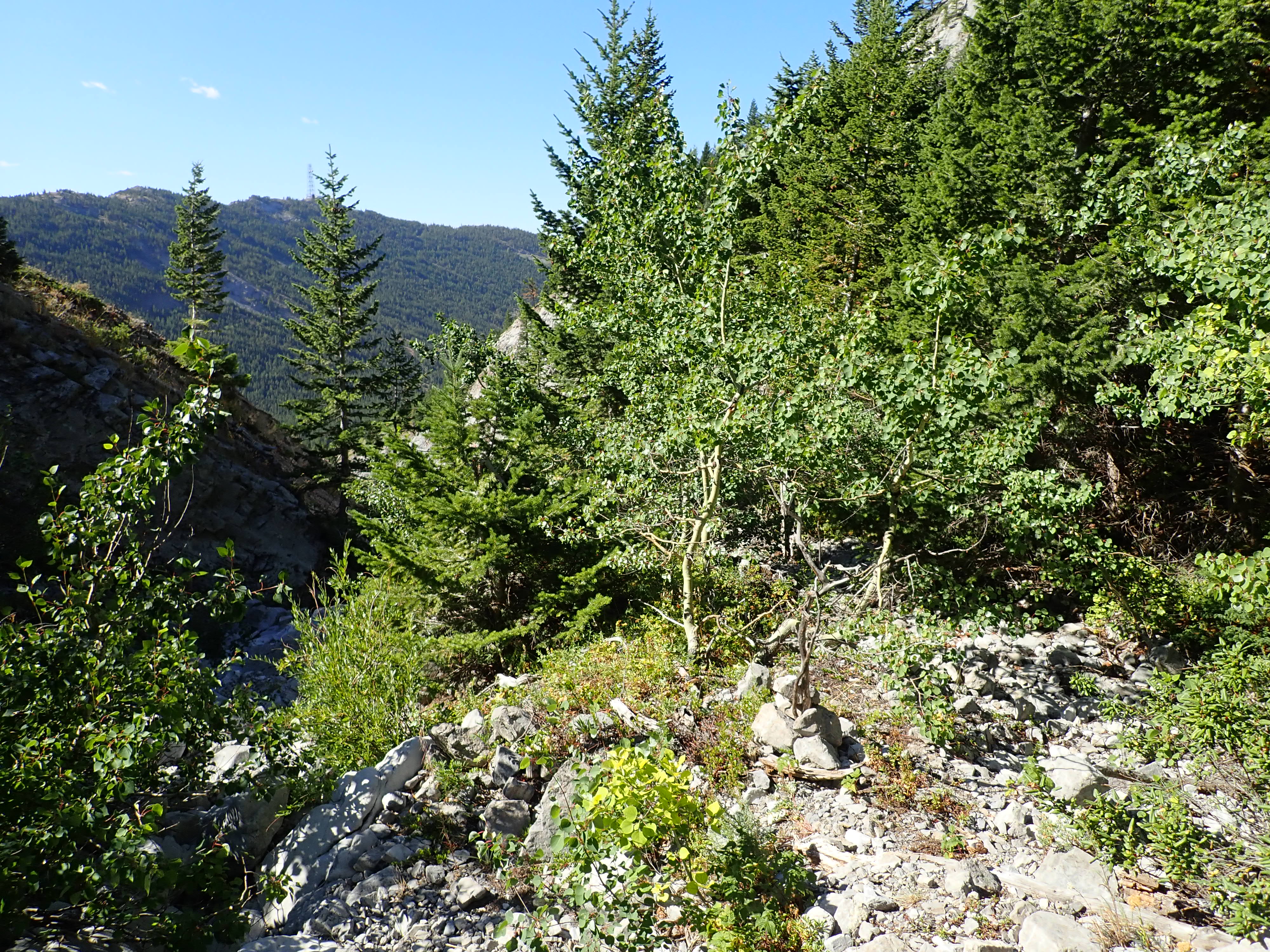
The initial ascent follows a fascinating creek bed along a course that varies in depth from slight depression to small canyon. In places it’s simply a collection of rubble and debris, but frequently it features the bare limestone of the mountainside, worn into smooth slopes, slides, and pot formations by millennia of water and swirling rocks. At the time of my visit the creek was completely dry, so I just stayed in the creek bed and enjoyed scrambling up the terrain. In a couple places I left the creek bed and deviated left to avoid steep drops, but made sure I didn’t wander off too far – the easiest and best way seems to be to stay right next to the creek and return to it ASAP. I did find a couple of cairns in the creek bed itself which seemed to mark good spots to deviate onto the banks on the ascent and descent, but given their small size and location I’m not sure they persist year-to-year.
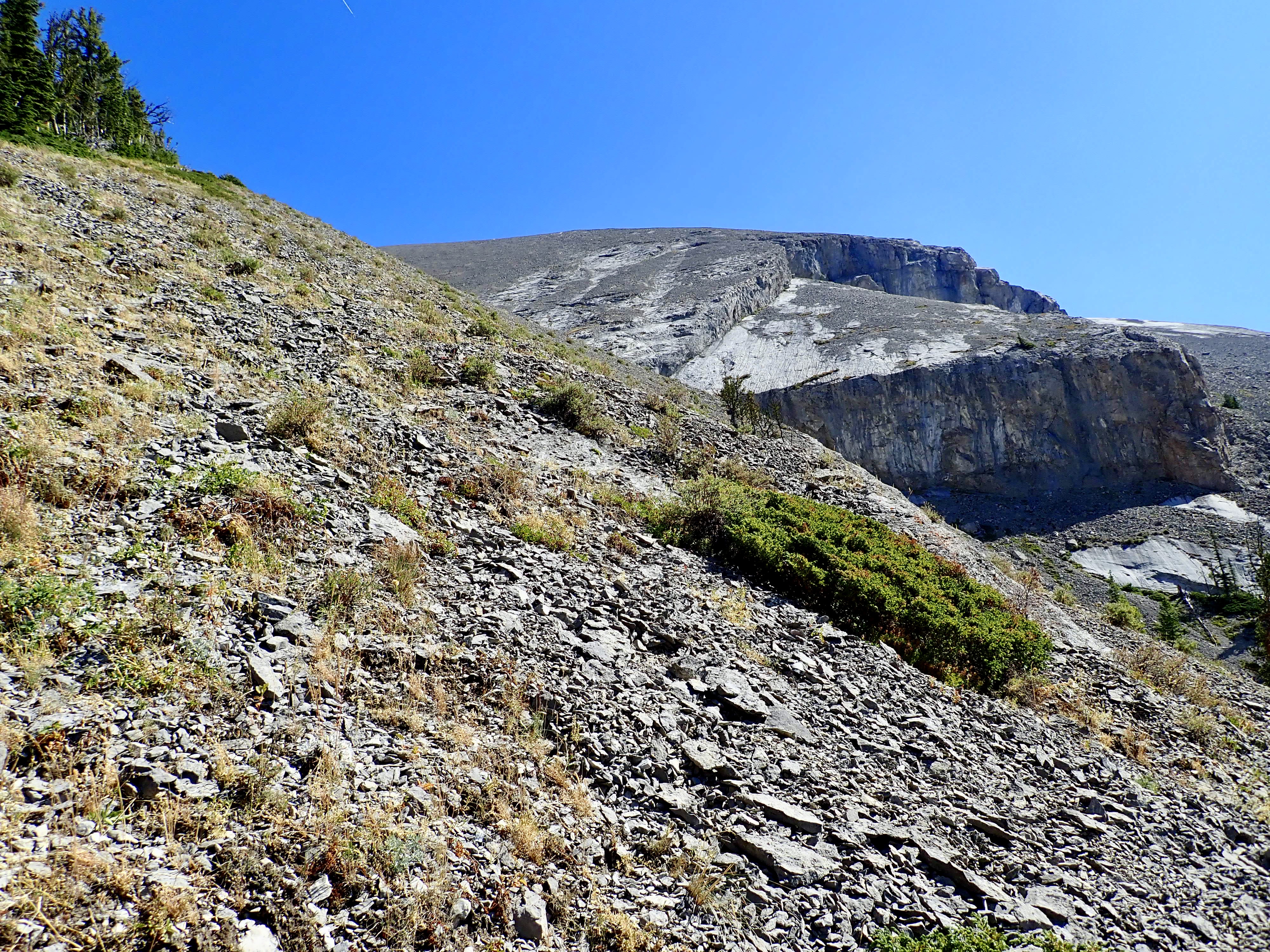
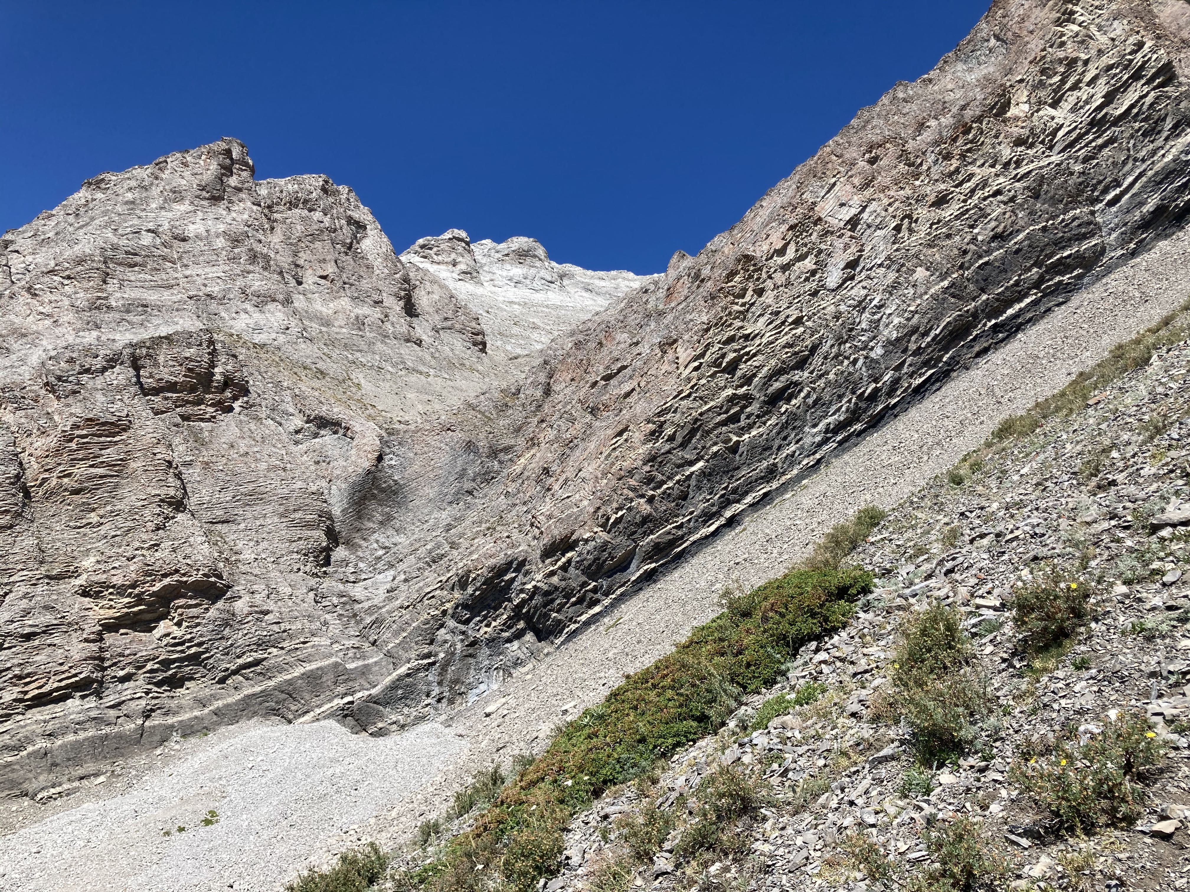
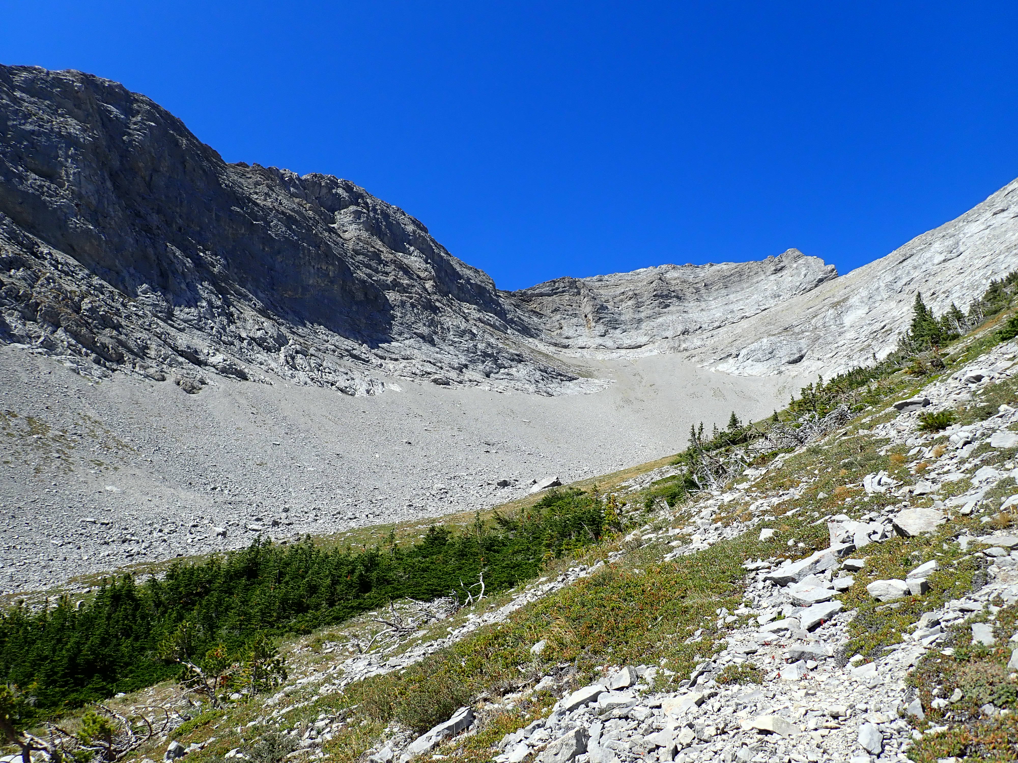
A little under 1.5 km horizontal distance and 400m elevation gain from the base of the ascent, I entered the large scree and boulder field under Mount Tecumseh’s southern face. Here’s where I went off-course. All route descriptions emphasize that the best way to approach the summit is to deviate into a scree basin off to the left of the direct line toward the summit.
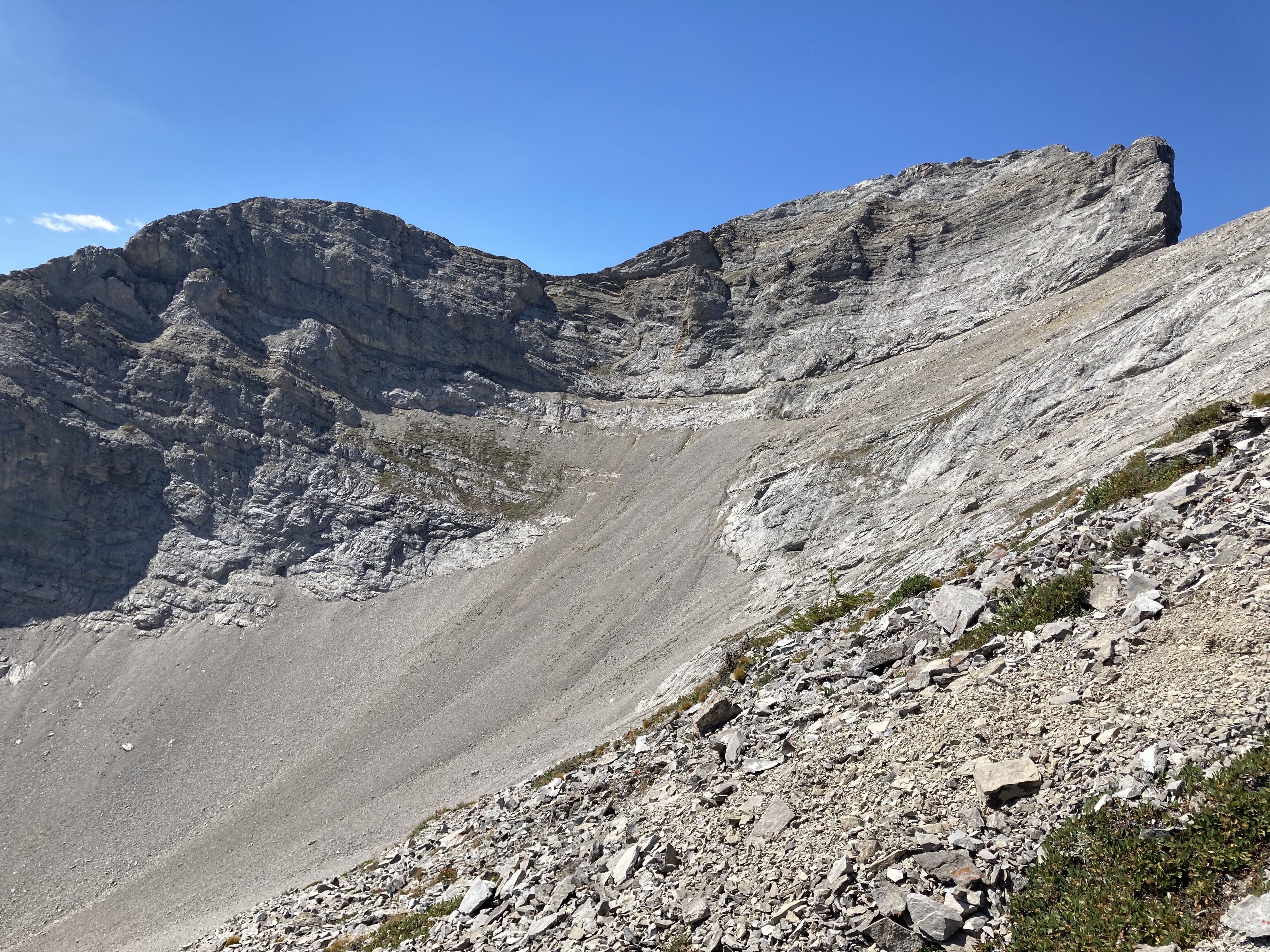
This is definitely what I intended to do. I just waited too long before trying to do it, and found myself in the right-most of 3 parallel scree slopes separated by long rocky ridges – I should have been in the left-most. I climbed one of the rocky ridges to get a look around. What I saw left me with the impression that crossing through the middle slope, or descending down it before crossing to the left-most one, would be unwise because I couldn’t see the whole route. So, I climbed back down below all three slopes and traversed to the left-most one. This turned out to be the right decision – the bottom of the middle slope featured a 50′ drop. At the end of the day, on my descent, I discovered a cairn marking the best spot to head to the left when ascending. I probably walked within 10 meters of it earlier in the day and didn’t notice.

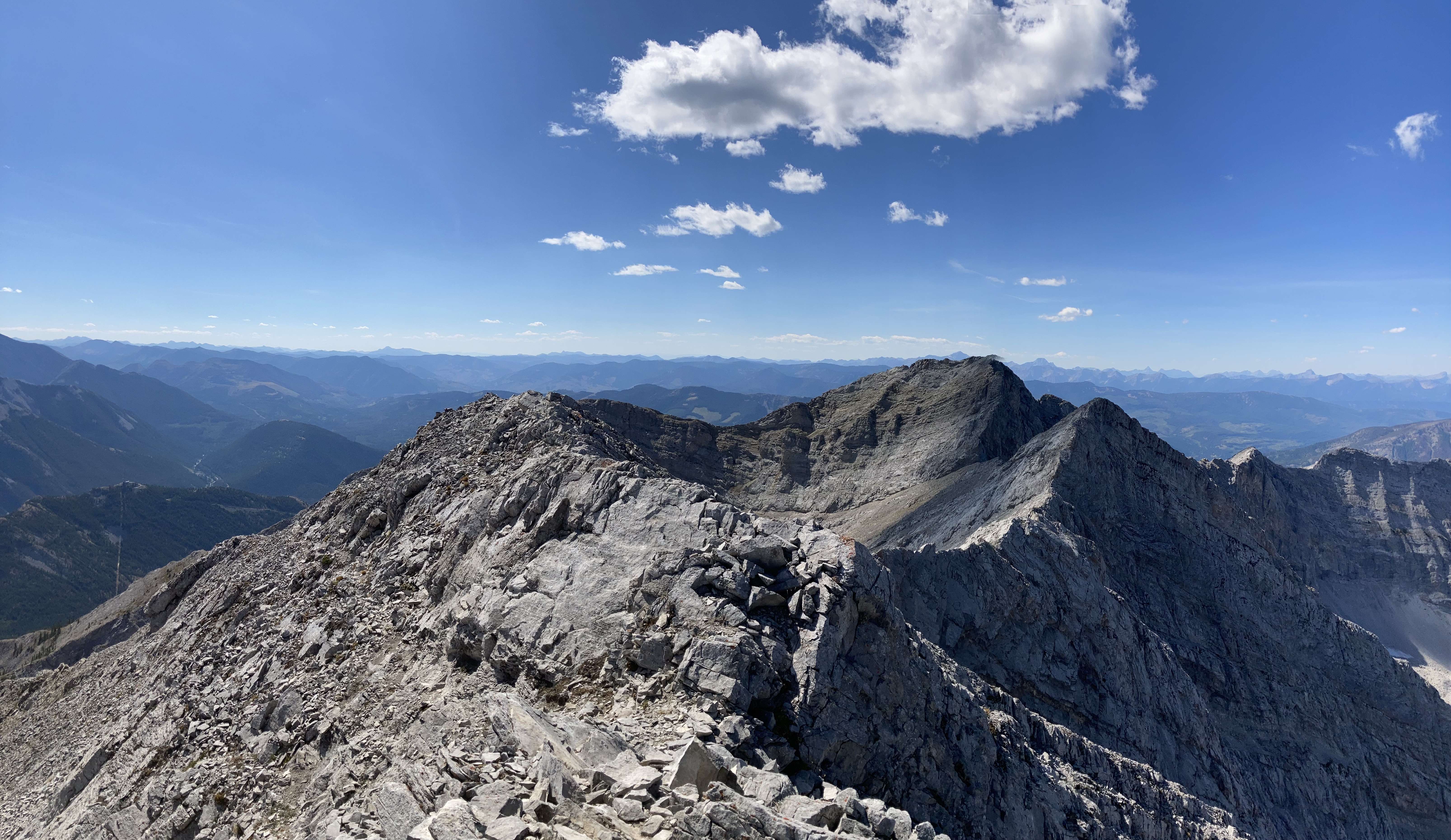
I merrily headed off in the wrong direction, distracted by the colossal cracked rock slab off to my right. After toiling up scree and seeing I was off track, I descended, traversed to the proper scree slope…and toiled up more scree until I reached the summit ridge, a short distance west of the summit. By this time essentially all the vertical was behind me, and I was something like 300m from the summit. For some reason, though, I just felt like I was done. I’m hardly a grizzled mountain expert, but I know enough to listen to my gut feeling when it says “you’re done”.
I had a seat on the ridge and enjoyed the views for a time before descending. I stopped every so often as I descended back to the boulder field to piece together how I went off track.
Click on the pictures in the gallery below to access full-sized images.


Thanks Par for sharing your hike.
The scenery is beautiful. Your illustration literally takes the reader to the site.
Love you.
LikeLike