August 23, 2020. A scramble to the summit of Spread Eagle Mountain and its impressive western outlier in the Castle Wilderness.
- Region: Castle Wilderness. Traditional territory of the Blackfoot, Tsuu T’ina, and Ktunaxa First Nations
- Distance: 17.8 km round trip (I estimate that omitting the outlier summit would shave about 2-3 km off that distance)
- Total Ascent: 1300 m (tagging the 2nd summit involves some altitude loss and regain)
- Elevation of Objective: Summit: 2486 m, Outlier Summit: 2444 m
- Total Time: 6h 39m
- Safety and Disclaimer


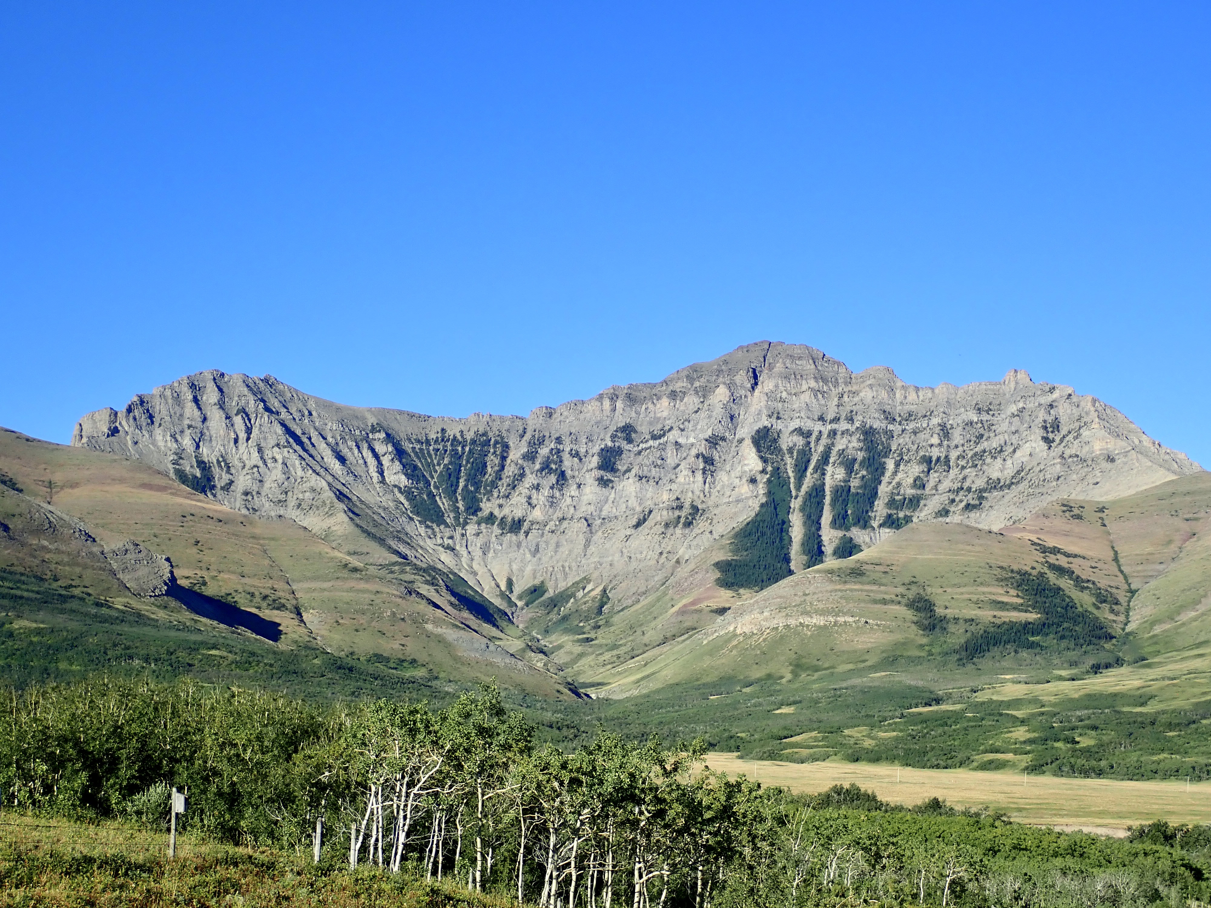
Summer 2020 is in its final week (not the astronomic summer, the real summer) so I decided to bag the summit of Spread Eagle Mountain – the south-most of the 5 parallel ridge lines forming the Castle Wildland’s southeast environs. Having already climbed Victoria, Pincher, Drywood, and Loaf, Spread Eagle cried out for a visit.
It’s worth taking a moment to discuss names here. The peak is known locally as Spread Eagle Mountain, but guide books like Nugara’s More Scrambles in the Canadian Rockies 3rd ed refer to it as Mount Roche. Meanwhile, some maps simply label the entire ridge line Spionkop Ridge. Peakfinder has a bit of an explanation here. Basically, the ridge is Spionkop Ridge (named for a battle in the Boer War). The distinct peak at its eastern end was to be named for Richard Roche from the British Boundary Commission. The name never stuck, and the locals refer to it as Spread Eagle Mountain, for its distinctive shape when seen from the east (and, as I discovered, also from the west). The access road is called Spread Eagle Road, and since I’ve never been a fan of eons-old stone in Alberta being named after a distant war or surveyor du jour in the 1800’s, I’ll refer to it as Spread Eagle Mountain.
Nugara does describe a scrambling route to the summit in his book, but I was more attracted to the route described by Bob Spirko. This basically used Nugara’s descent route (which is also part of the ascent route for Nugara’s “Spionkop Ridge Traverse”) to gain the summit ridge. Spirko also described an exciting extension to visit the summit of a western outlier. I spent my spare minutes in the last couple of weeks reviewing Spirko’s report, and I decided to give it a go.
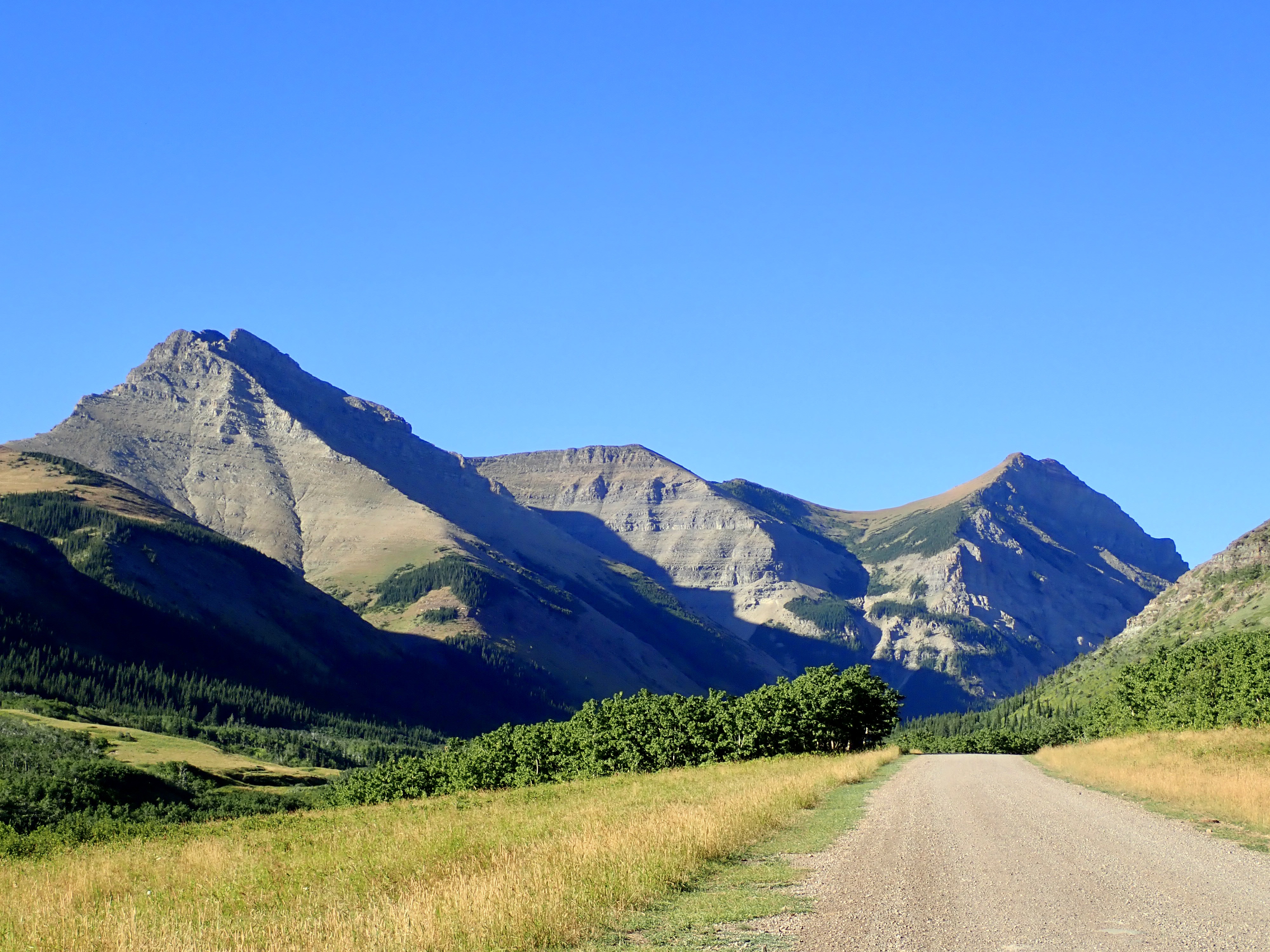
Access is similar to Yarrow Ridge – north of Waterton Lakes National Park on Hwy 6, before reaching Twin Butte, turn west onto Township Road 34 (it is actually marked out with signs on the highway as “Spread Eagle Road”). Approaching from Pincher Creek, the turn-off is (obviously) just after Twin Butte. Follow this gravel road west, over a bridge, to a T-intersection and turn right (north). The road heads north, turns west, descends and crosses a bridge, then makes a hairpin turn to ascend to the northeast. As soon as the road comes out of the shallow valley there’s a closed gate to the left, along with a parking area. A little kiosk sits at the parking area, but as of my visit there’s no information posted. Put these coordinates into Google Maps and it’ll drop a pin on the parking area: 49.253292, -114.001121.
The initial approach is 4 km along a broad gravel road which goes past a few gas well sites and involves a reasonably gentle ascent. I brought my bike for this portion. At about 4 km the road forks, with the left-hand fork descending to cross Spionkop Creek and continue to a gas facility on the other side of the creek. I left my bike at the fork in the road and descended along the road toward the creek. A culvert directs the creek under the road. After passing over the culvert I left the road and headed left. There was a faint trail paralleling the creek. This soon got me to the rocky (and dried up) drainage descending from the huge rocky bowl of Spread Eagle’s northwest aspect.
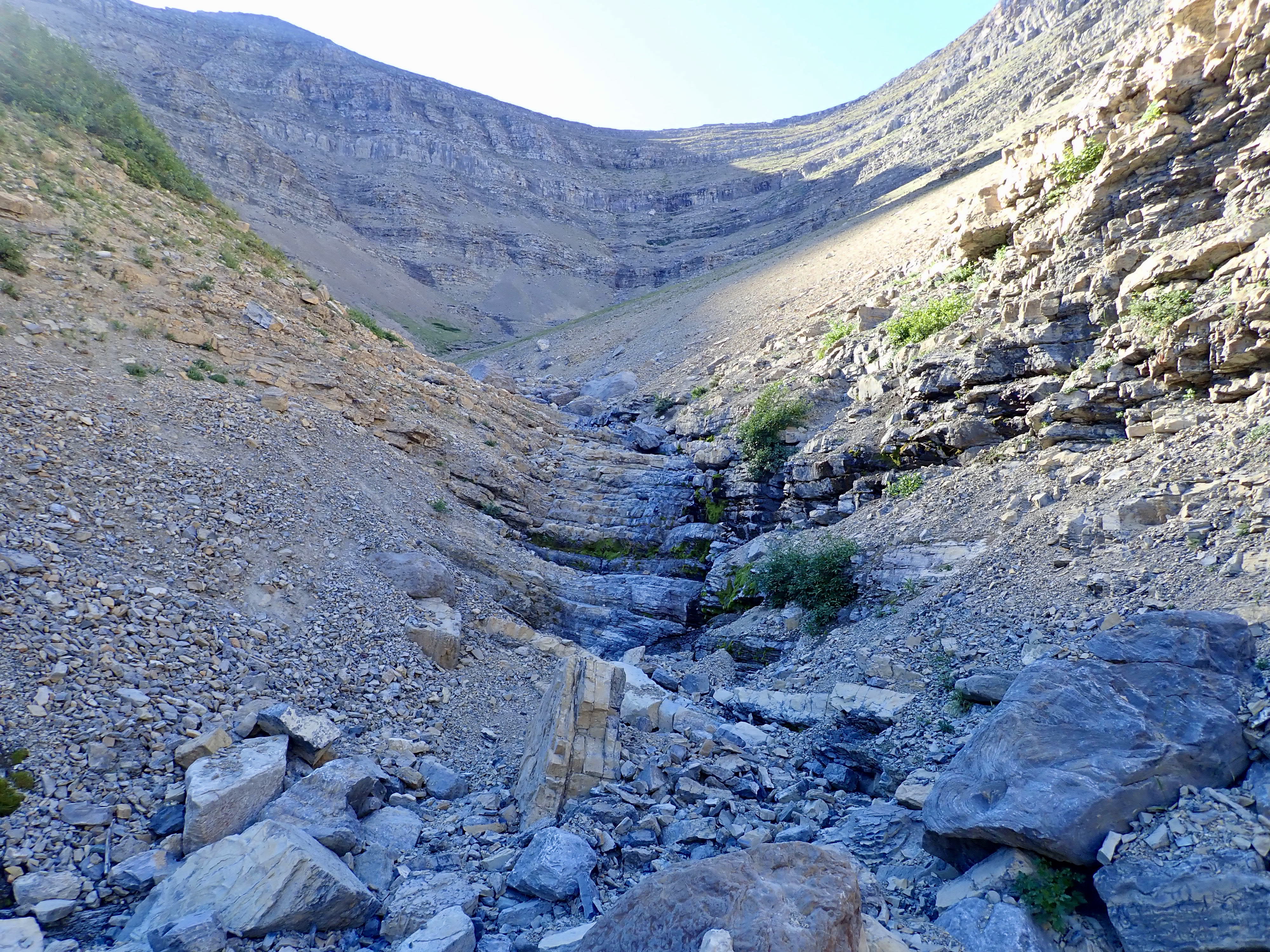
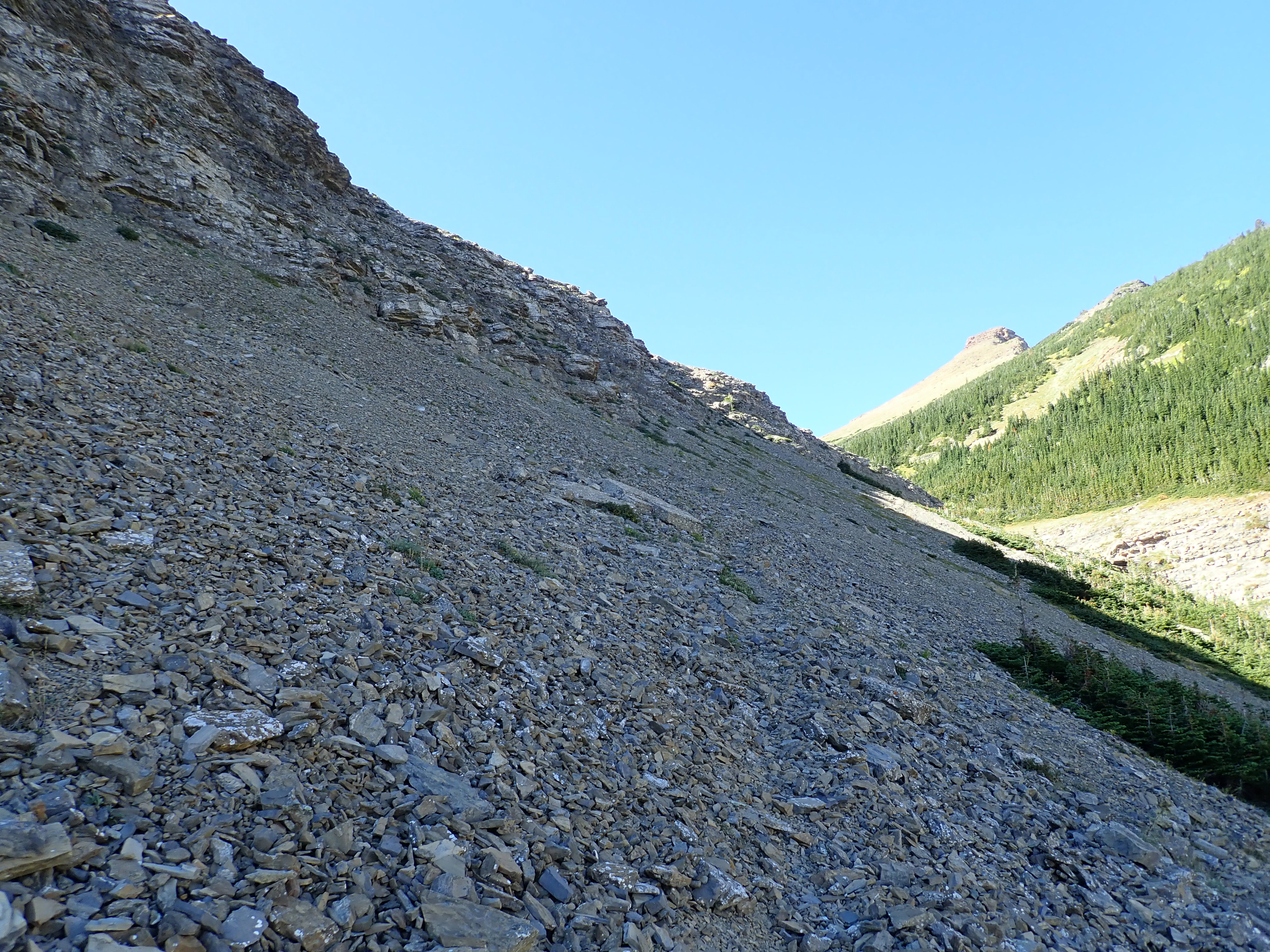
I followed this drainage up to the bowl, enjoying a bit of rock-hopping and climbing up a few short rock walls that must form a cascade of waterfalls in the spring. Once I reached the bowl, I turned right and ascended the scree slope, heading for the base of the cliffs to the southwest. Looking at this part of the route during my approach along the gravel road, I though it looked awfully steep. Turns out it was. Climbing this was quite the slog. The line I took had areas of treadmill scree, but other areas of very superficial debris sitting on top of packed underlying earth. Those spots were a little treacherous, and I wasn’t looking forward to descending that terrain – so on my way down I didn’t take quite so direct a line, and traversed a little further into the bowl before heading down.
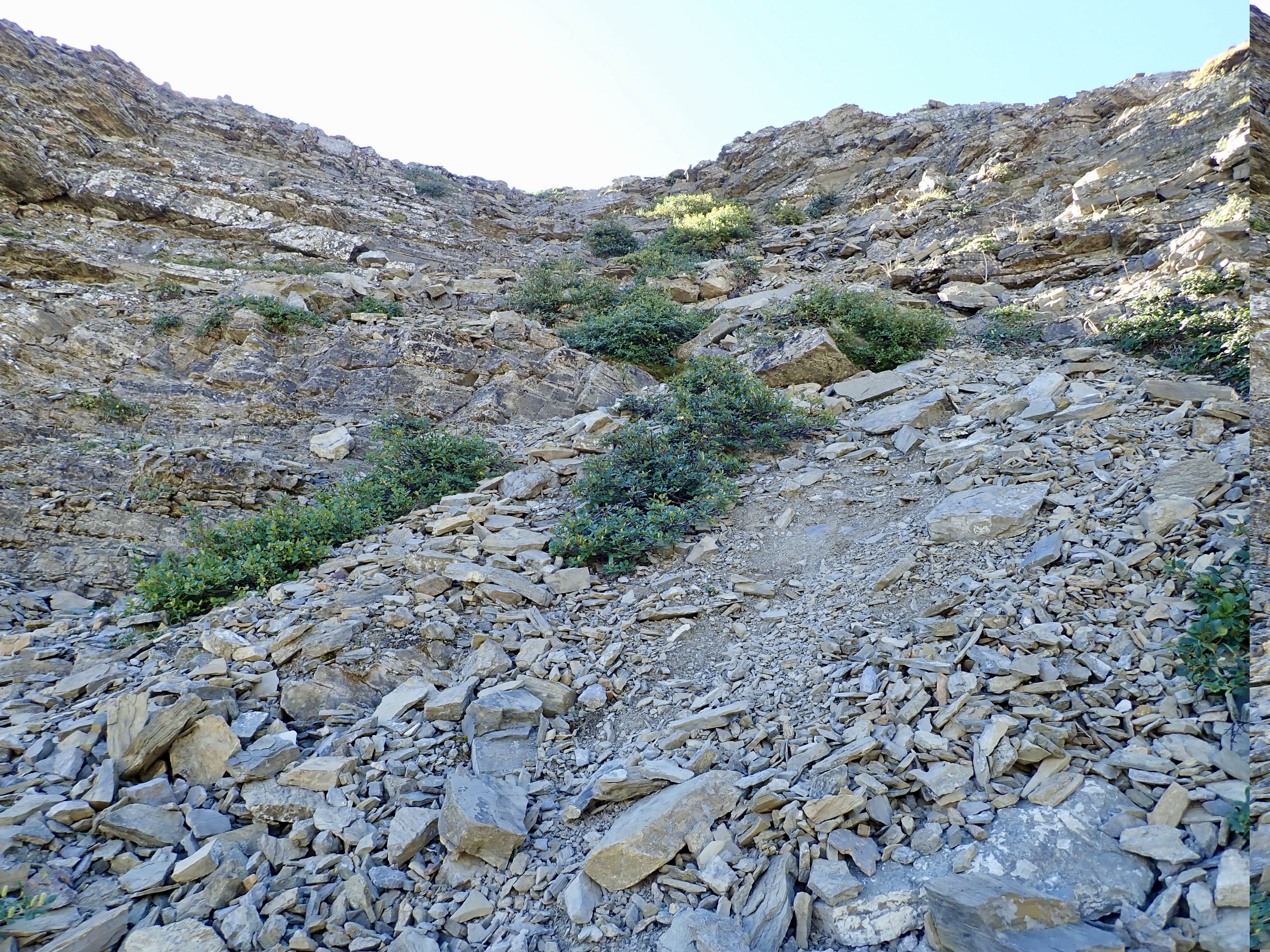
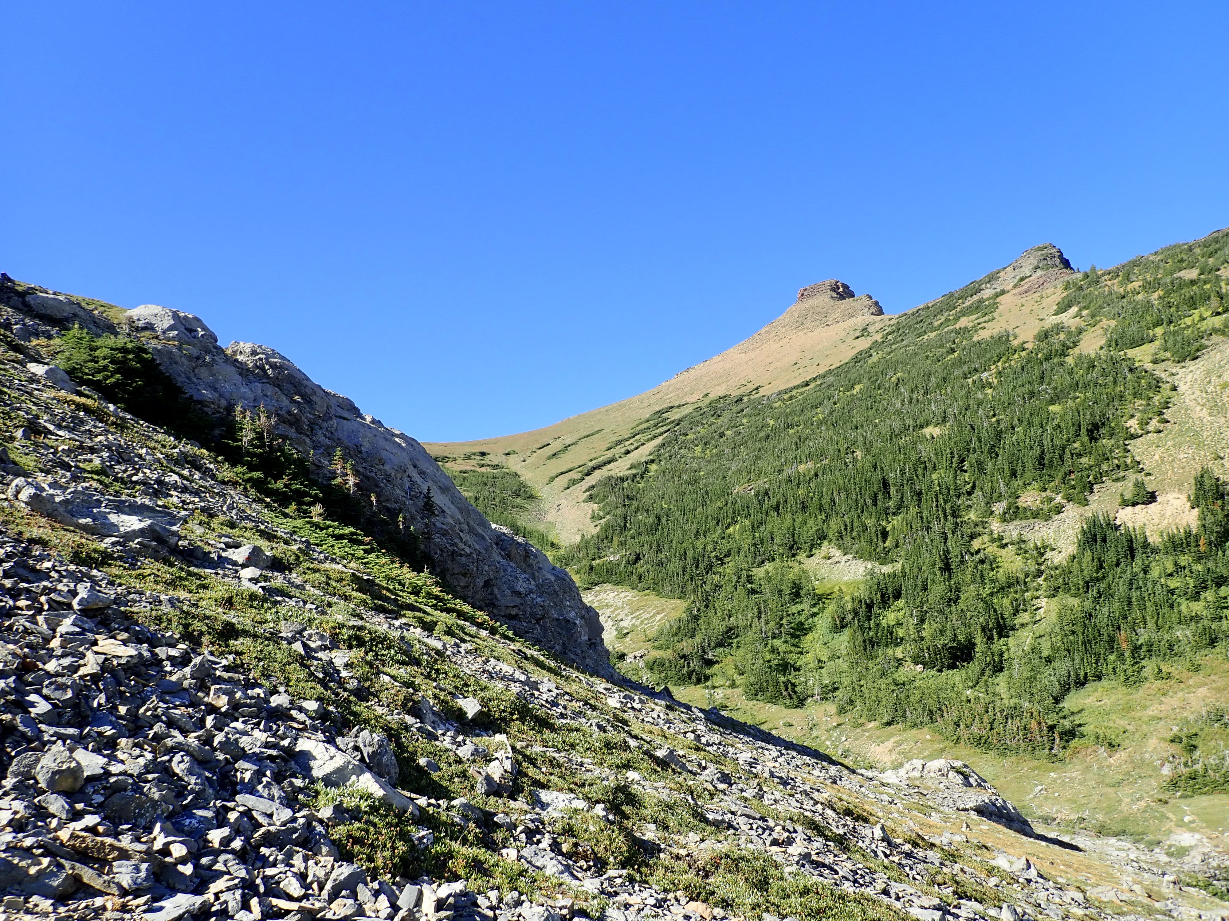
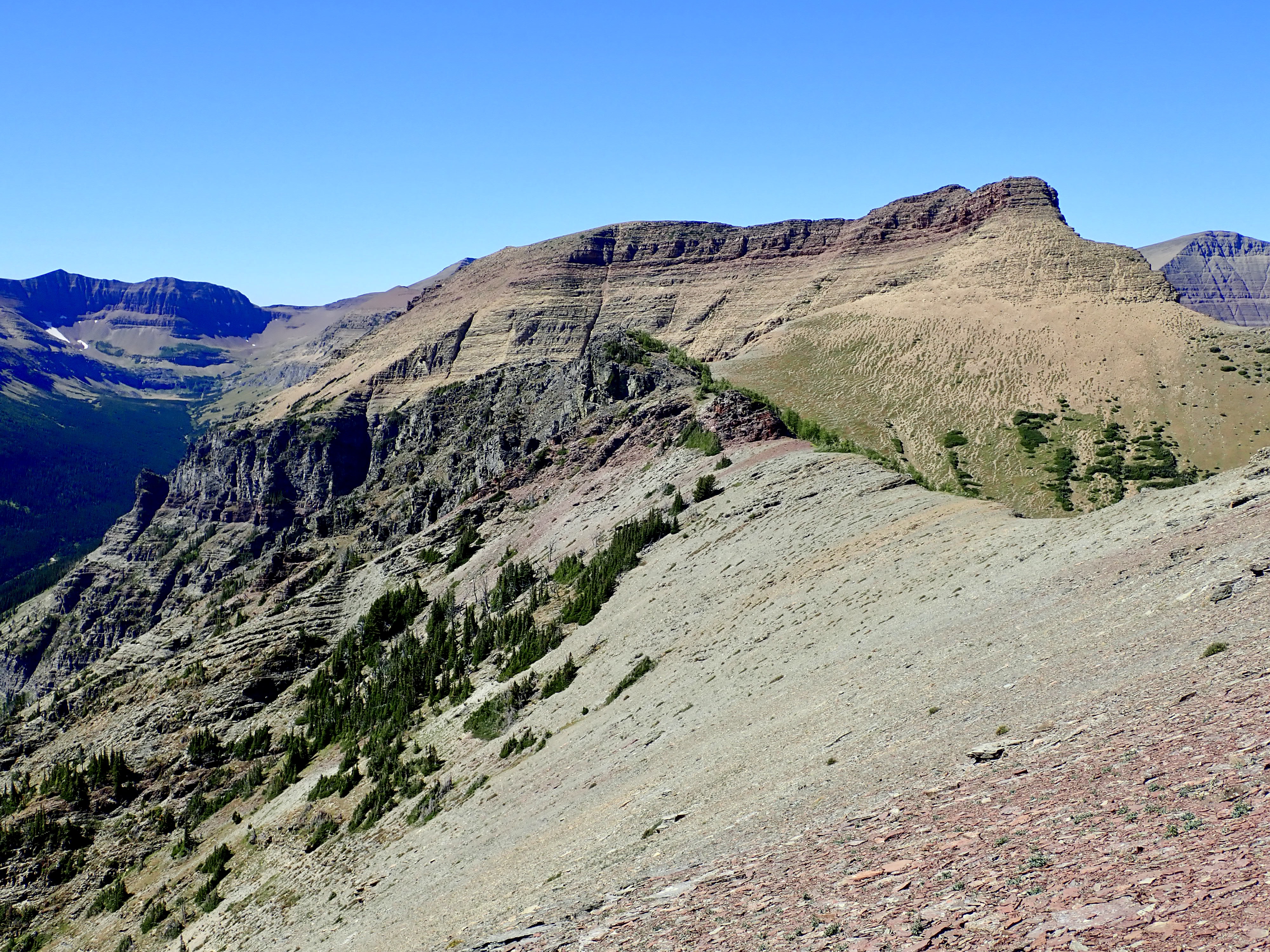
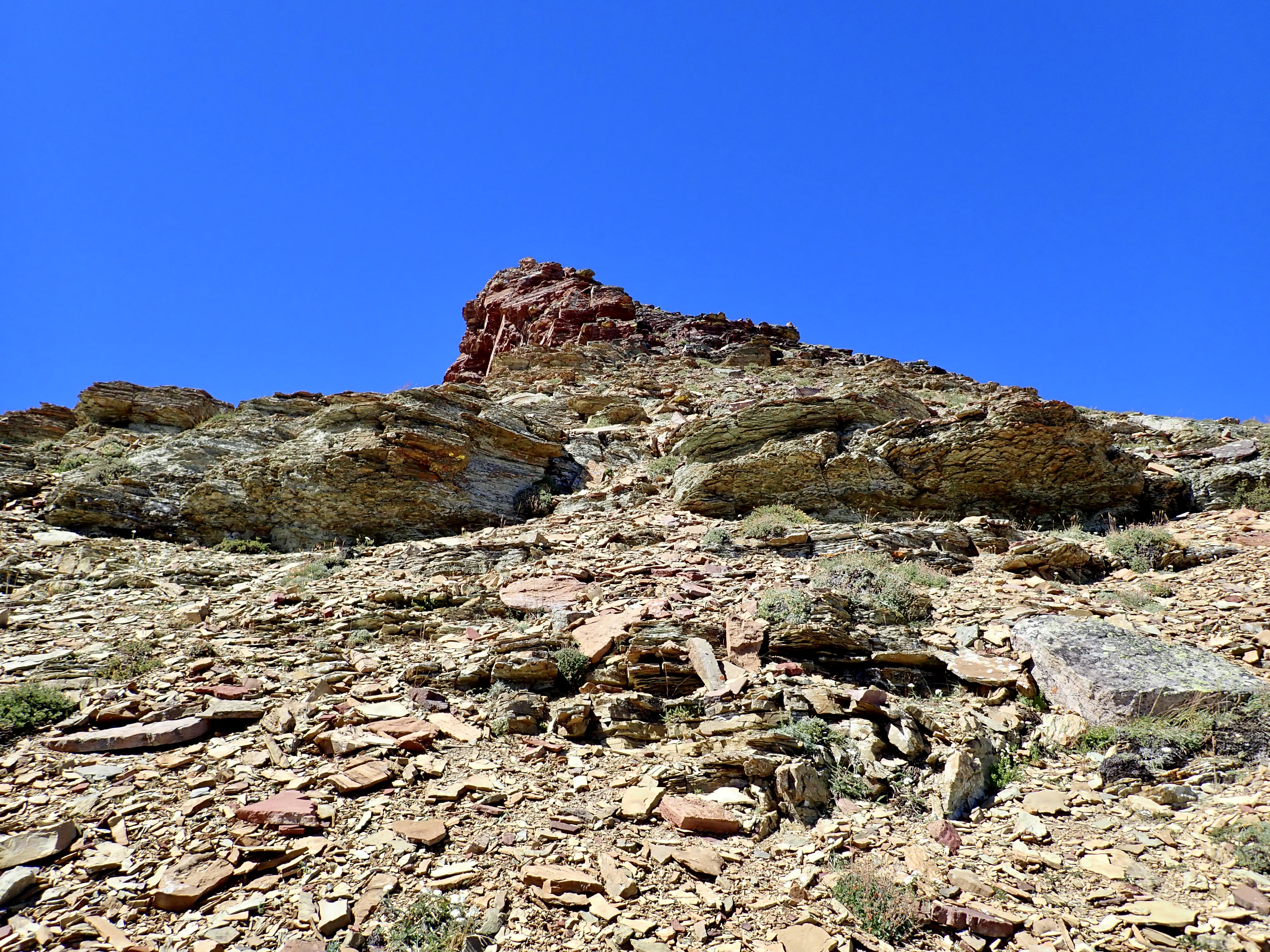
Once at the top of the scree, I found a pretty obvious trail that traversed under the cliffs and headed into a bit of a hanging valley. Eventually the stark rocky peak of Spread Eagle’s western outlier came into view. Once I reached an obvious weakness in the cliffs to my left I left the trail and ascended towards the ridge. This wasn’t particularly difficult – there was some tricky footing passing through the cliffs, but the worst part was that the sun was in my eyes the whole way. As it turns out, if I’d followed the trail a little further, it would have bypassed most of the rocky ascent in this area. I didn’t mind the ascent, to be honest, but the descent would have been easier if I’d avoided these rocks.
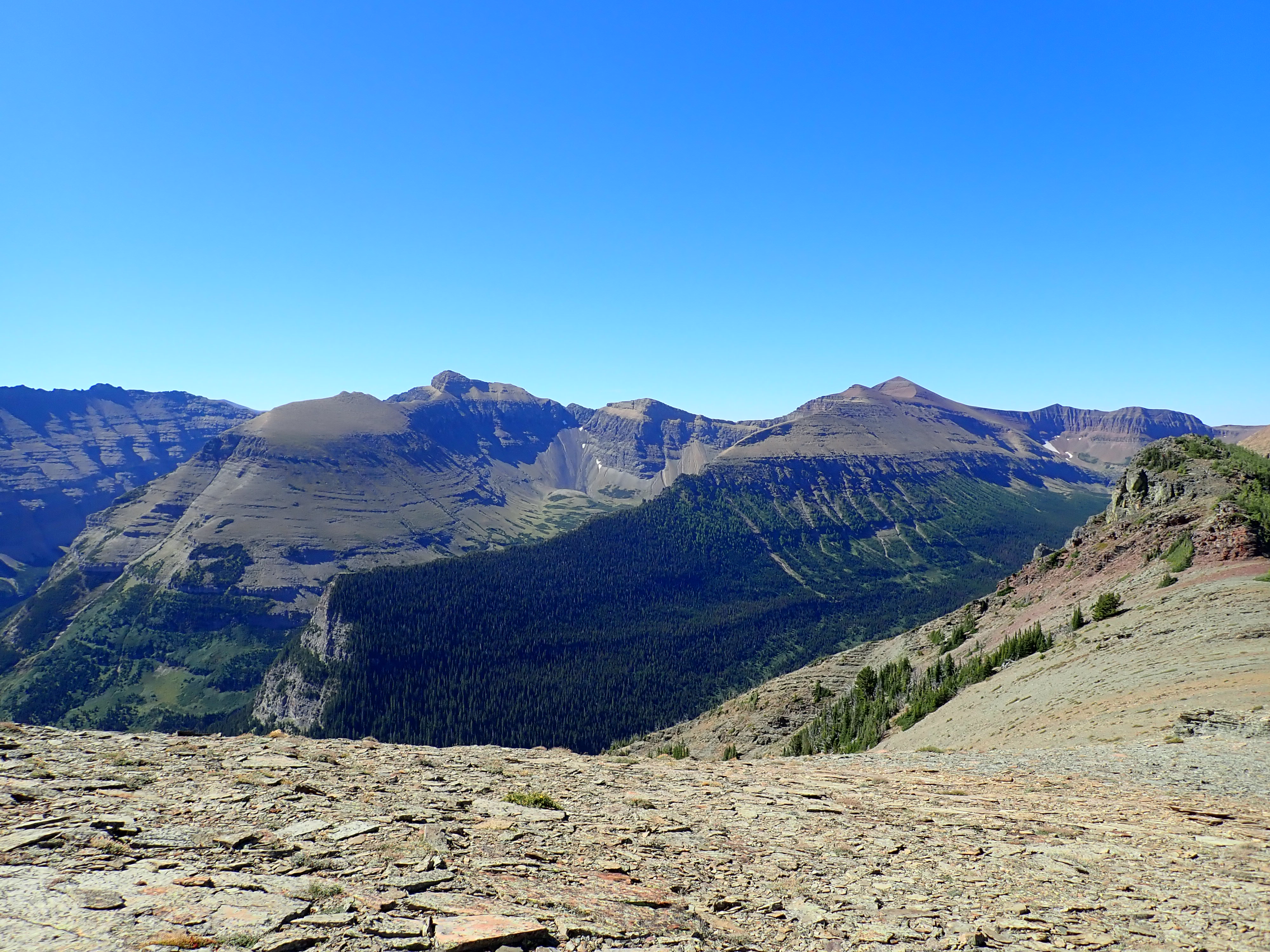
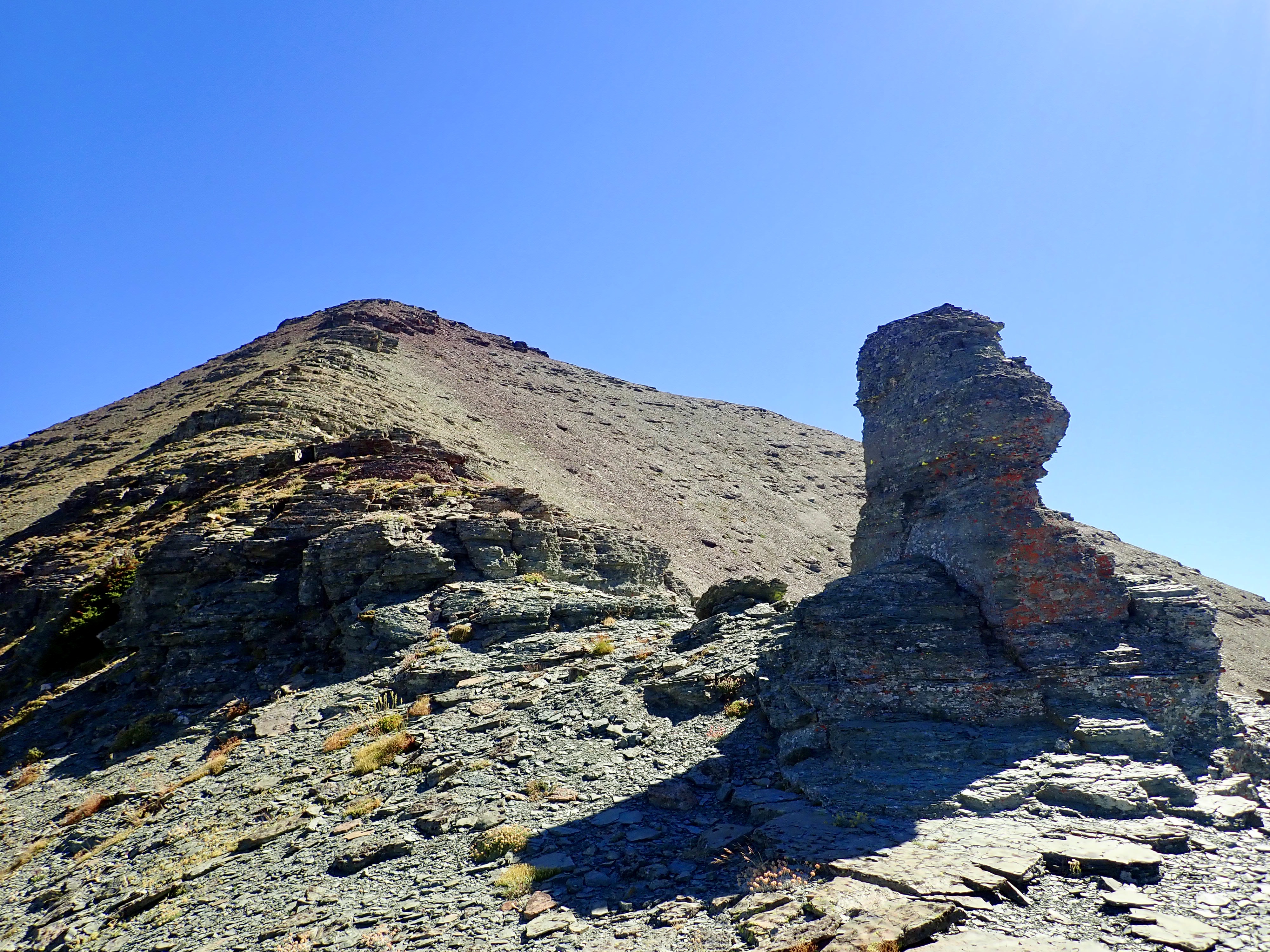
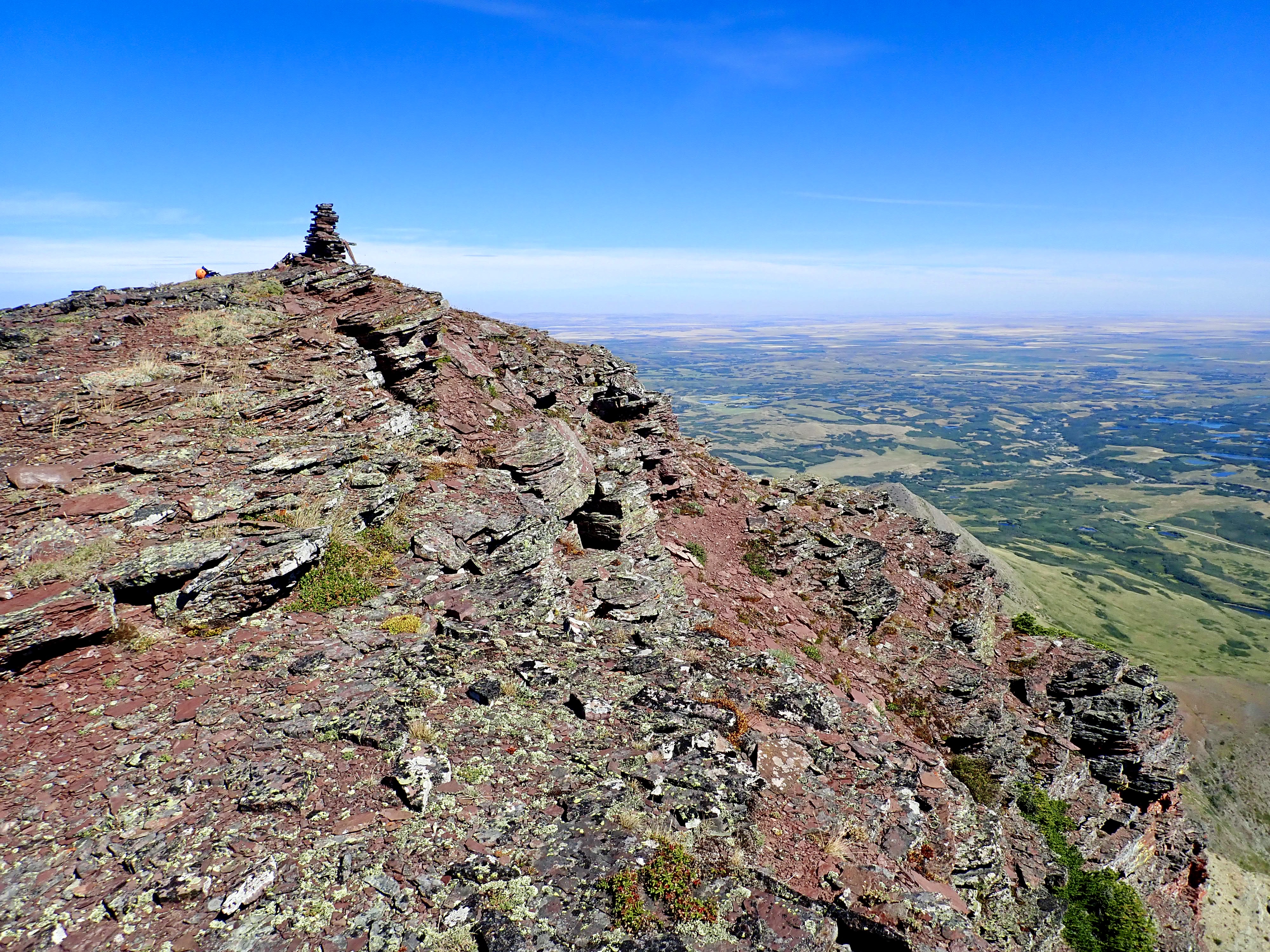
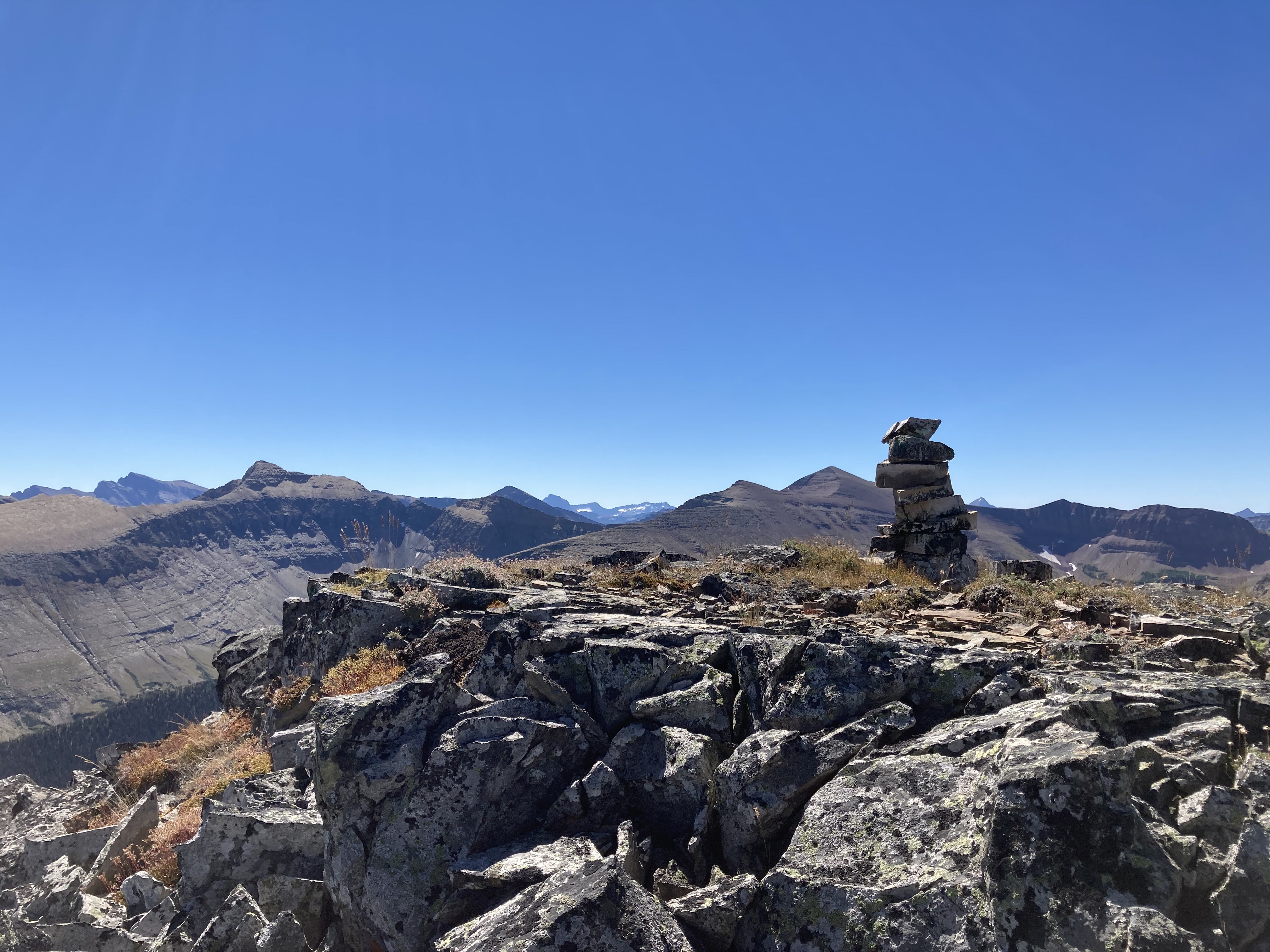
Up on the ridge, I turned left and headed for the summit. The way was obvious, and I took some time to check out a couple of interesting rock formations along the way. I reached the summit cairn at 3 hours 8 minutes. The views were a pleasing mix of distant peaks and nearby rocky terrain. Checking out the summit register, I could see that there weren’t a whole lot of ascents this summer.
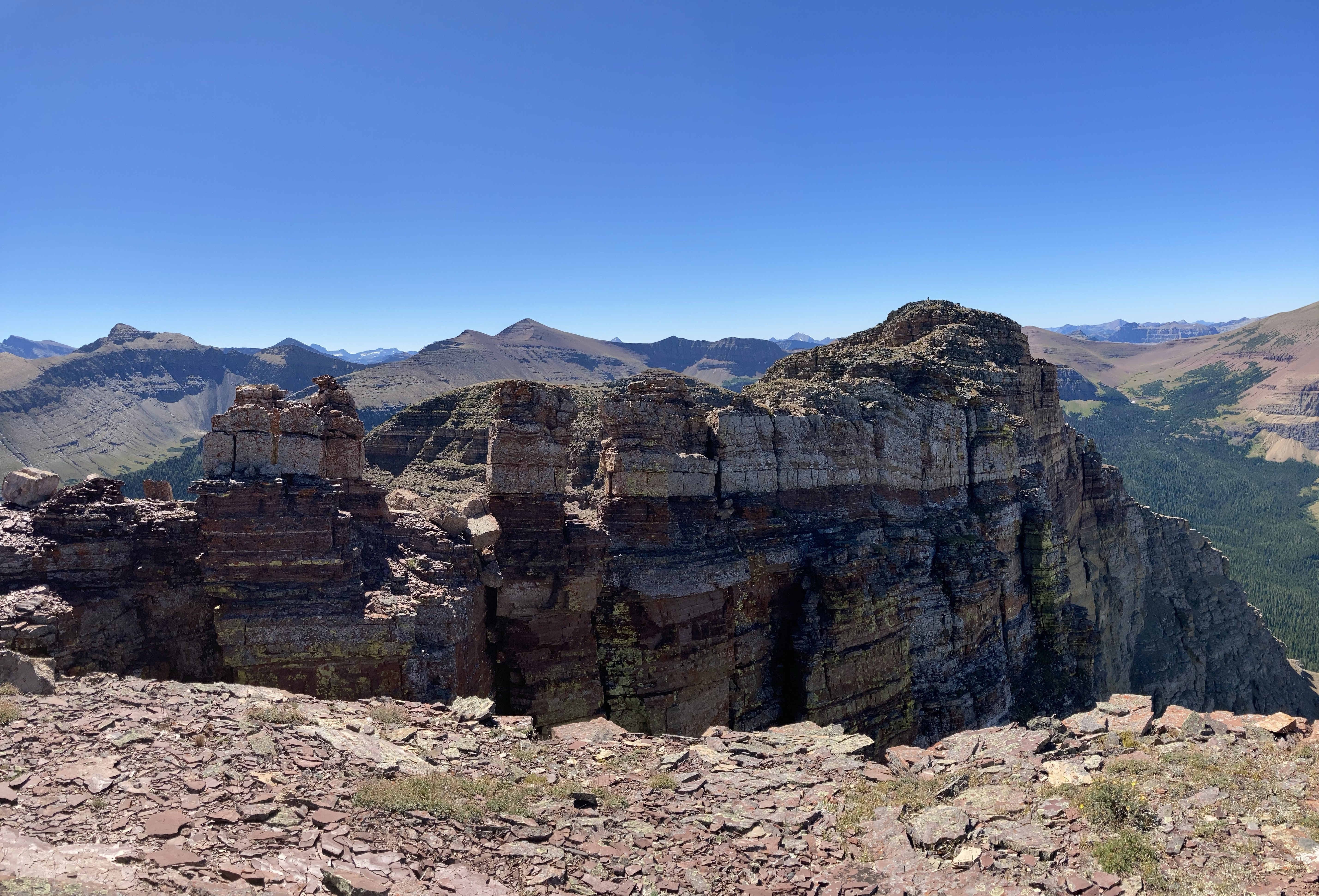
From there, I carried on toward the western outlier. Descending back to where I’d initially gained the ridge, I continued toward a tree-covered rocky outcrop. It’s possible that there may be a good way up and over it, but I went around it to the right. After a short time in the bushes I came out at the bare saddle at the top of the hanging valley and below the rocky spire guarding the outlier’s summit. These rocks look pretty impressive from afar, but actually make for some fairly friendly scrambling territory. At the top of that ascent, a clutch of distinct rocky pinnacles greeted me, with a cairn visible in the distance beyond them. It turned out there was no way to skirt these pinnacles – there was a death-drop to the right, and a distinct lack of horizontal footing to the left. I climbed on top (a maneuver that caused some degree of nervousness) and found myself on flat rocky terrain, with the summit cairn in the distance. As I walked along, I found a small marker-cairn at the top of a rock chimney, which I think is where Spirko and Bou ascended.
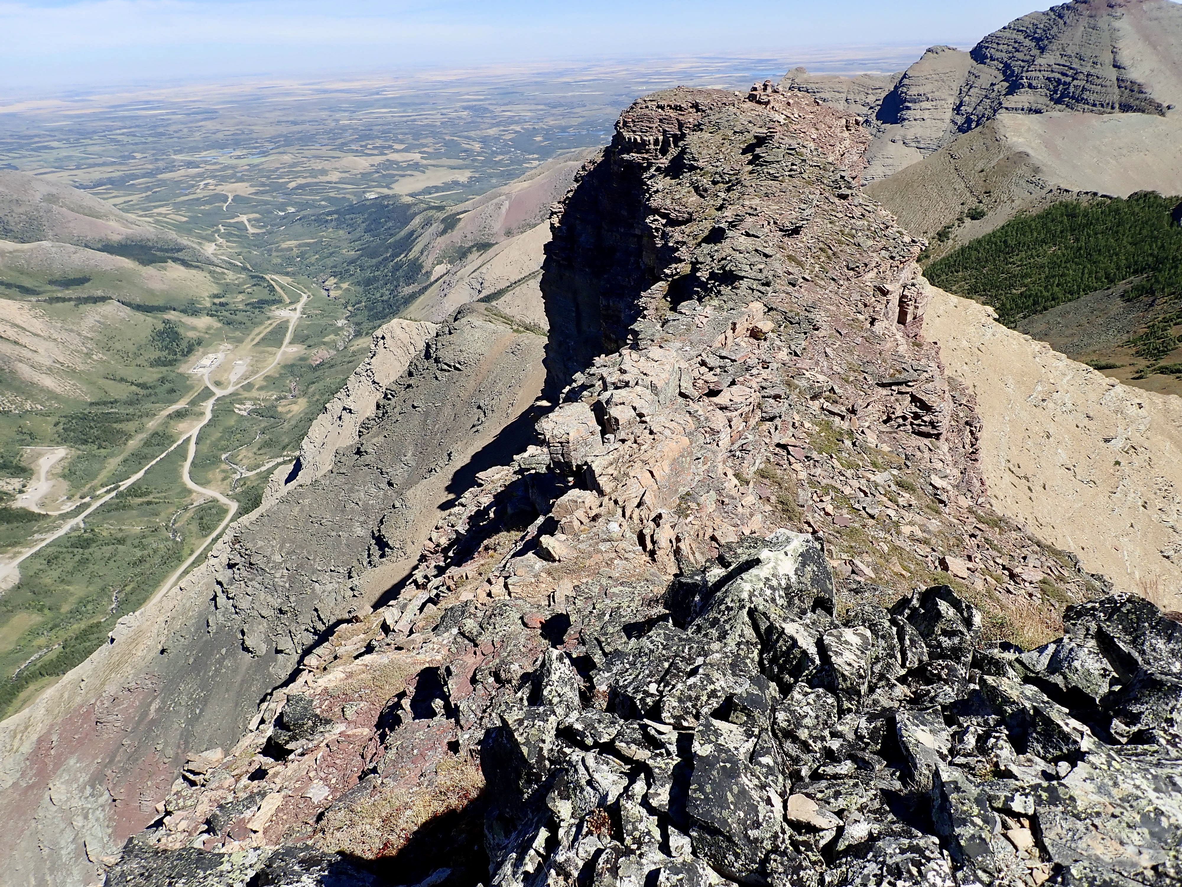
The views from the outlier summit are similar to those from the true summit, though the sight of Spread Eagle Mountain from the west is pretty impressive. The sheer drops off either side of the ridge also make for some exciting scenery. It took me 4 hours 47 minutes to this point.
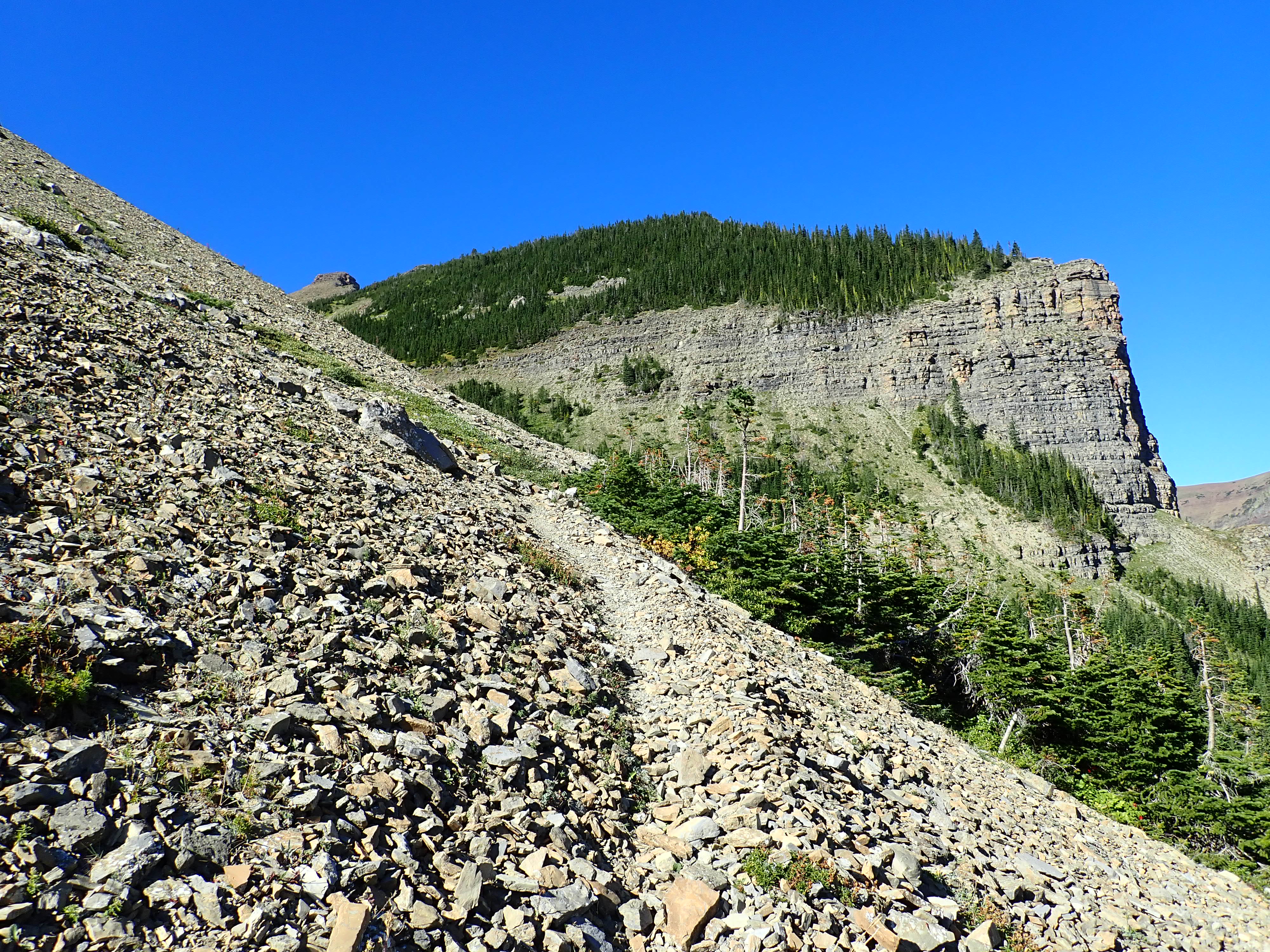
I made my way back down, taking dozens of pictures of the rocky spires and the surrounding brutal scenery. Once I started descending back into the hanging valley, I trended left on the descent – heading down into the valley rather than back to the saddle. Once I intersected the drainage, I followed it as it eventually became a rocky creek bed. Water bubbled up from the ground and cascaded along beside me for a few hundred meters before disappearing into the ground again. The greenery, water, and wildflowers were a welcome change from the heat, sun, and rocks. Eventually I found my way back to my original trail and followed it the rest of the way back down.
Click on the pictures in the gallery below to access full-sized images.


Par, this is one of the very interesting climbs you have done.
The rock formation, the vertical rock walls, the ridges, the bowl, the valleys and so on.
Beautiful pictures too.
Great job.
Always play safe, even if you have to go a bit longer route.
Thanks.
Bal
LikeLiked by 1 person
Once again a great pleasure to read your post !Fabulous pics.!
Enjoy the next one. Stay safe Par.
LikeLike
Thanks for reading, and for the kind words!
LikeLike
I always enjoy reading your blog when considering a peak I have not done. Thanks for sharing!
LikeLiked by 1 person