For my first hike in the Fernie region I decided to climb Mount Proctor. The trail starts right next to the visitors centre, it is well-maintained with ample signage and, although there were reports of snow remaining along the descent route, I had been told that it would be passable with a little route-finding. On the day of my visit the weather was unsettled. Looking at the forecast I decided that I had to be descending by 12 noon to be safe. As a result, I moved a little faster than I would have liked on the ascent but managed to beat the weather and be safely in the valley descending by the time sustained precipitation arrived.
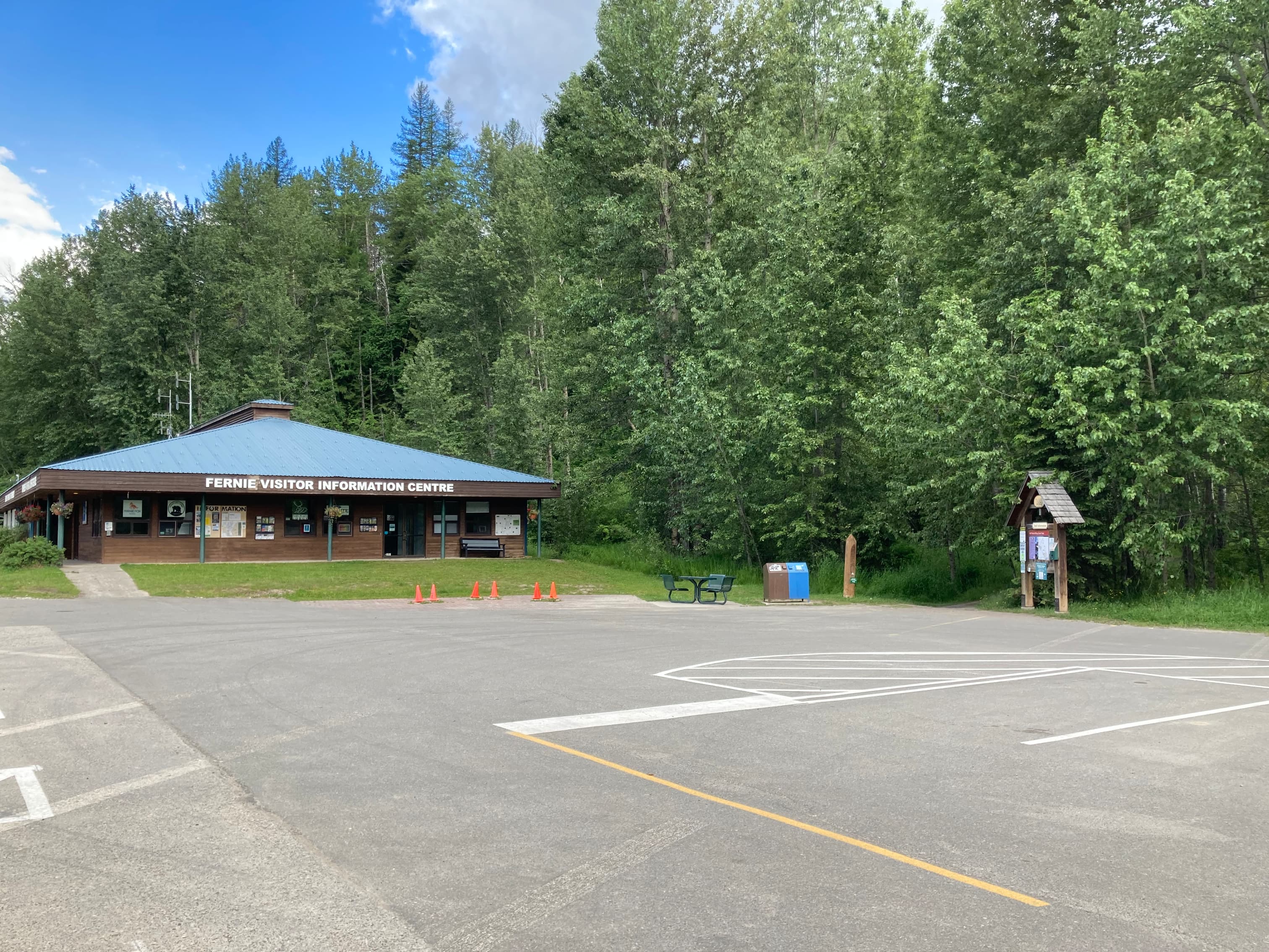
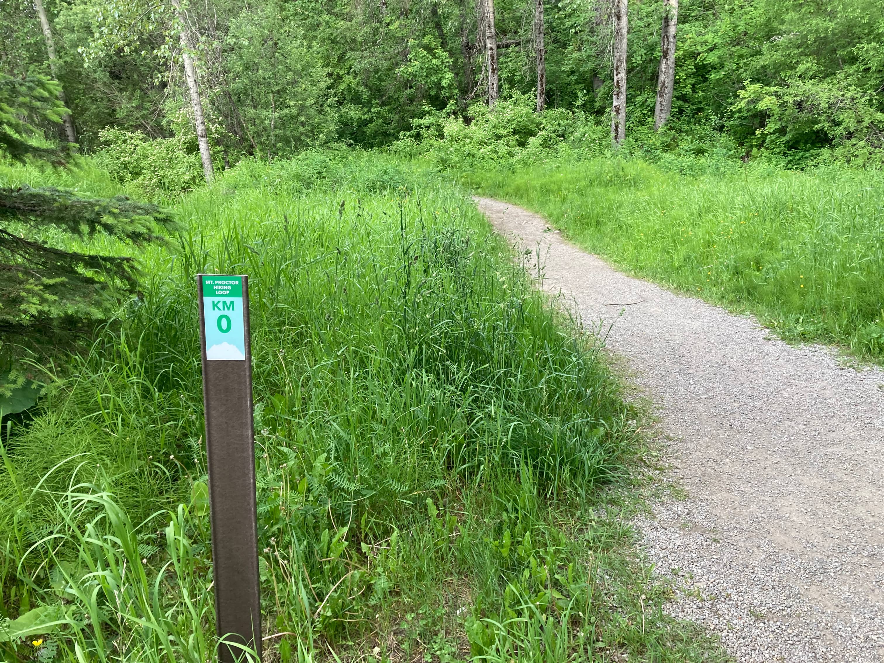
As mentioned, access is from the Fernie Tourism center. There are pit toilets in the corner of the parking lot in case you arrive before the building opens. A kiosk with trail information sits next to the parking lot. The lower parts of the Mount Proctor Loop overlap with other hiking and multi-use trails. Although there is lots of signage to direct you along your way, it was nice to have a map so I could understand exactly what direction I was ultimately headed in. Setting out, I was surprised to see that the Fernie Trails Alliance had placed distance markers along the loop route for Mount Proctor which count up or count down depending on which side you’re looking at. The numbers ascend following the route clockwise, so if you’re doing the recommended counter-clockwise direction you’ll be looking at descending numbers once you depart from the part of the route where ascend and descent overlap.
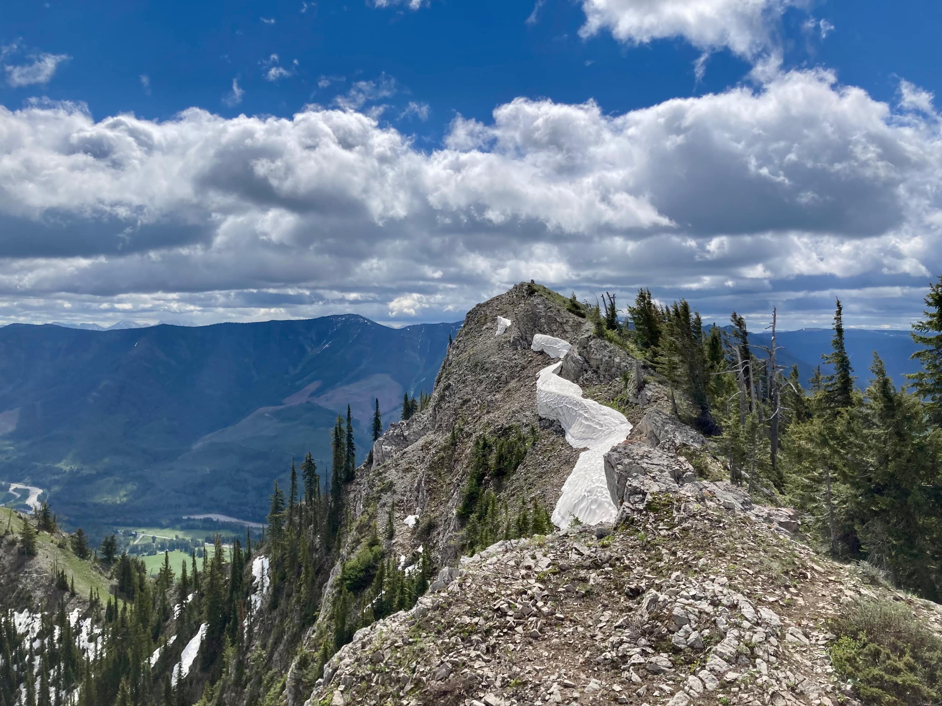
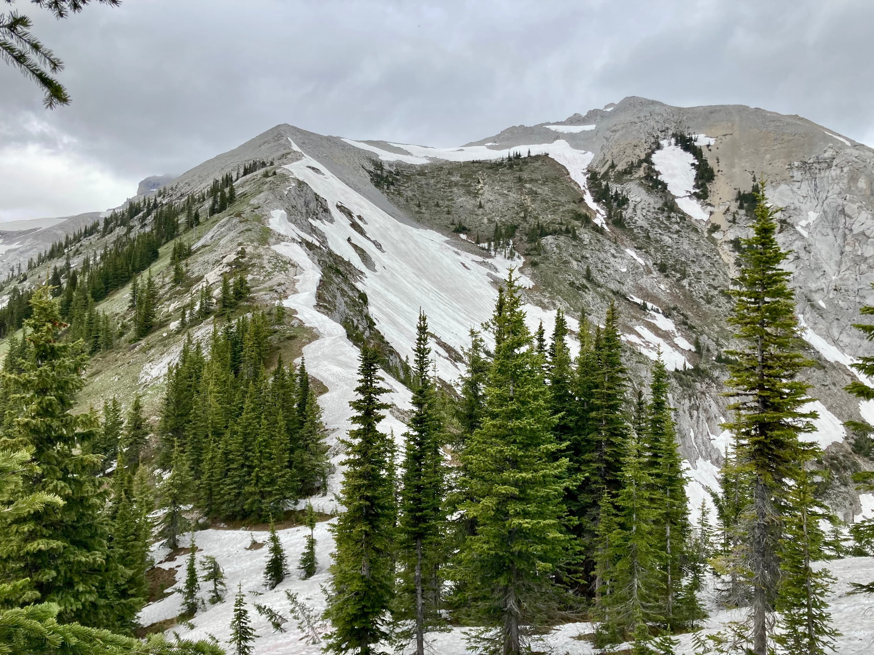
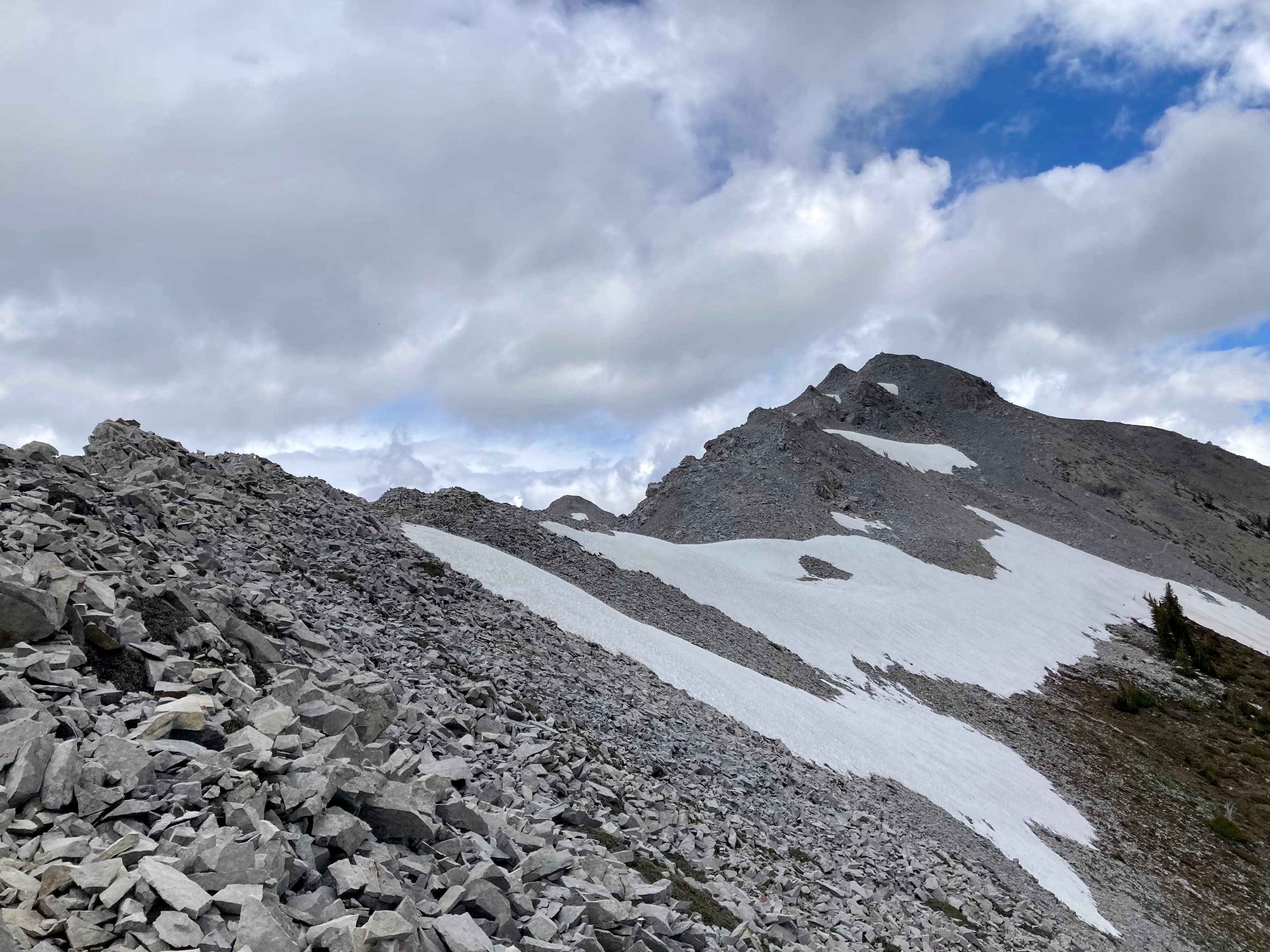
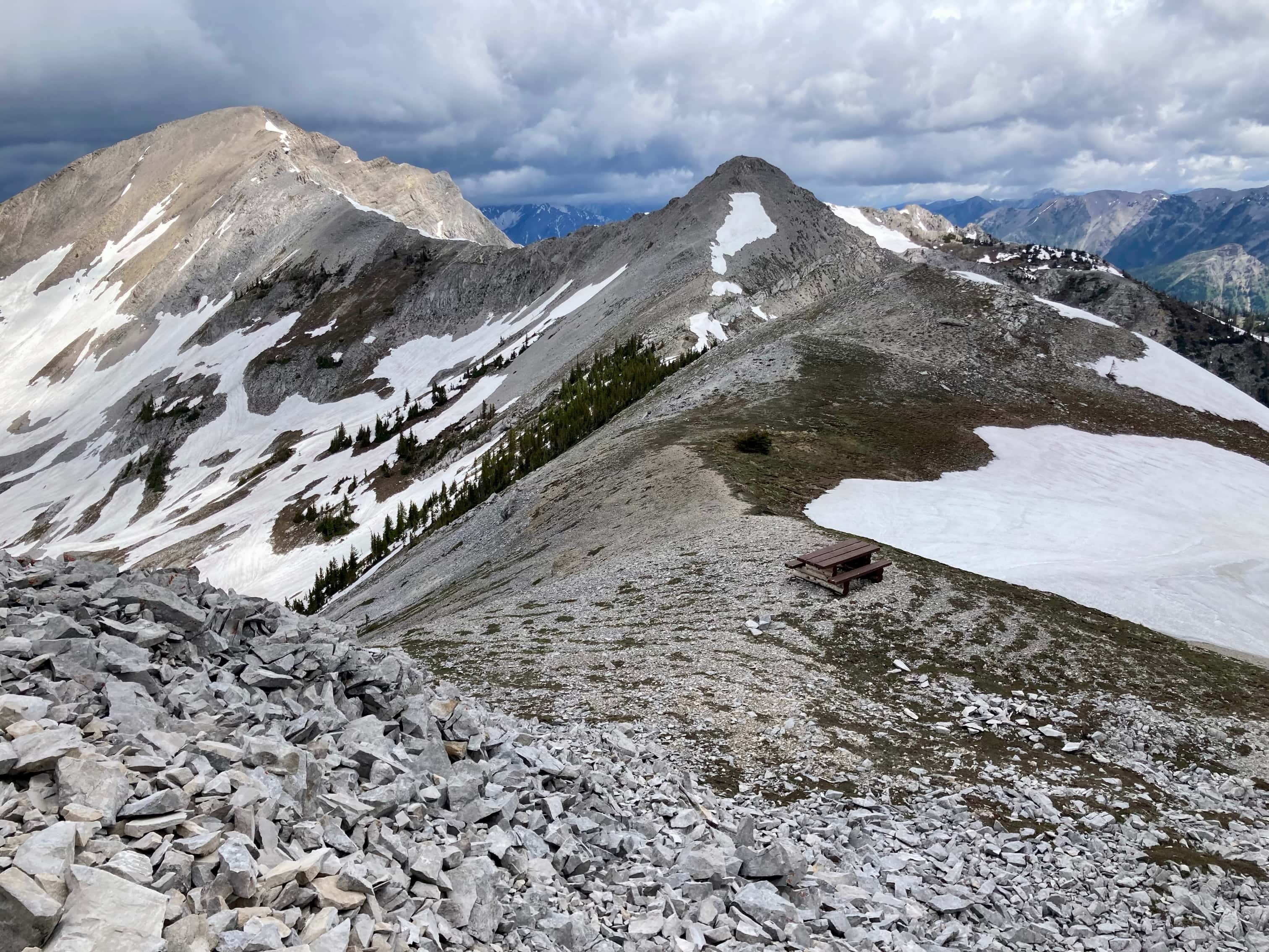
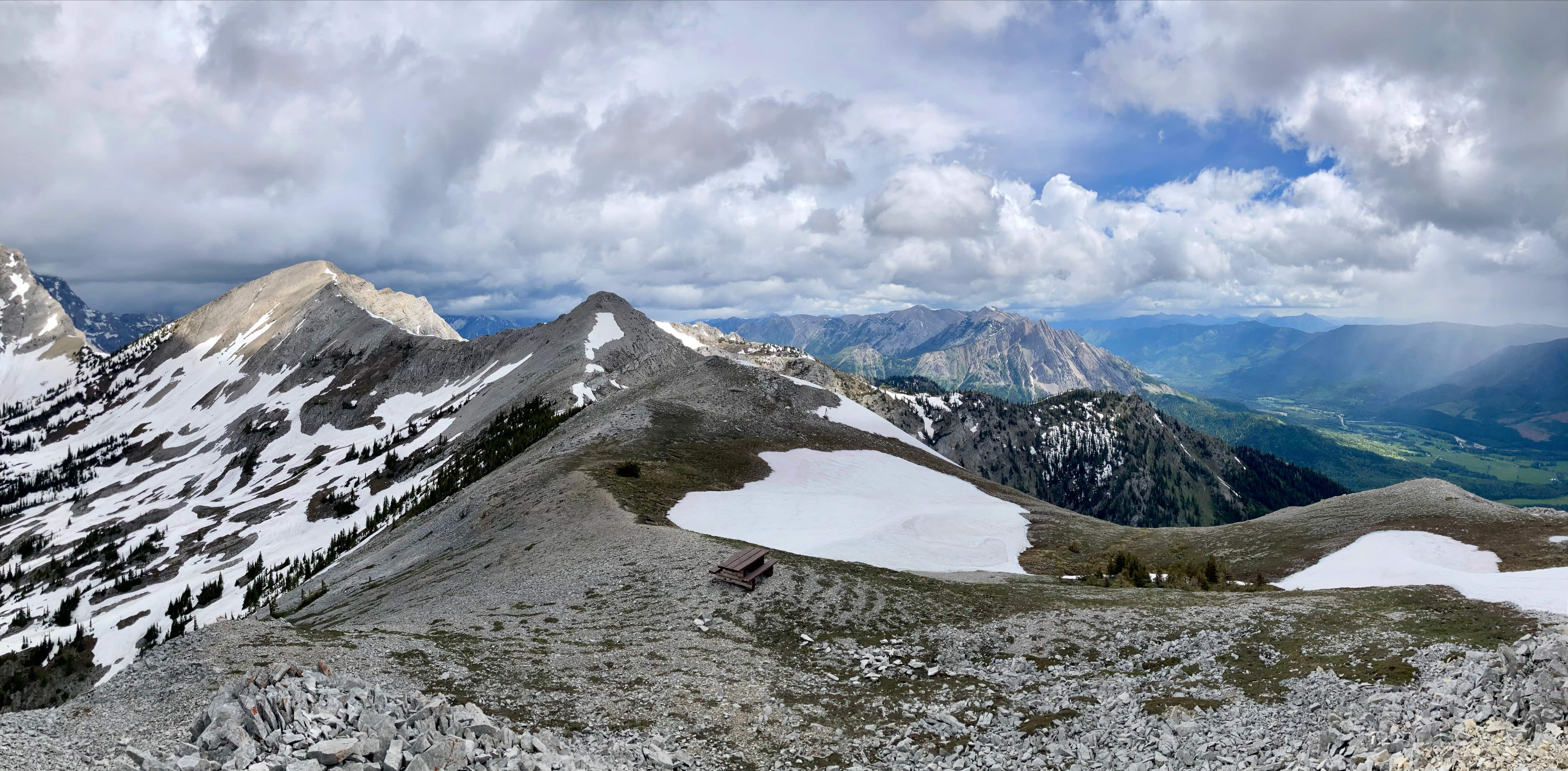
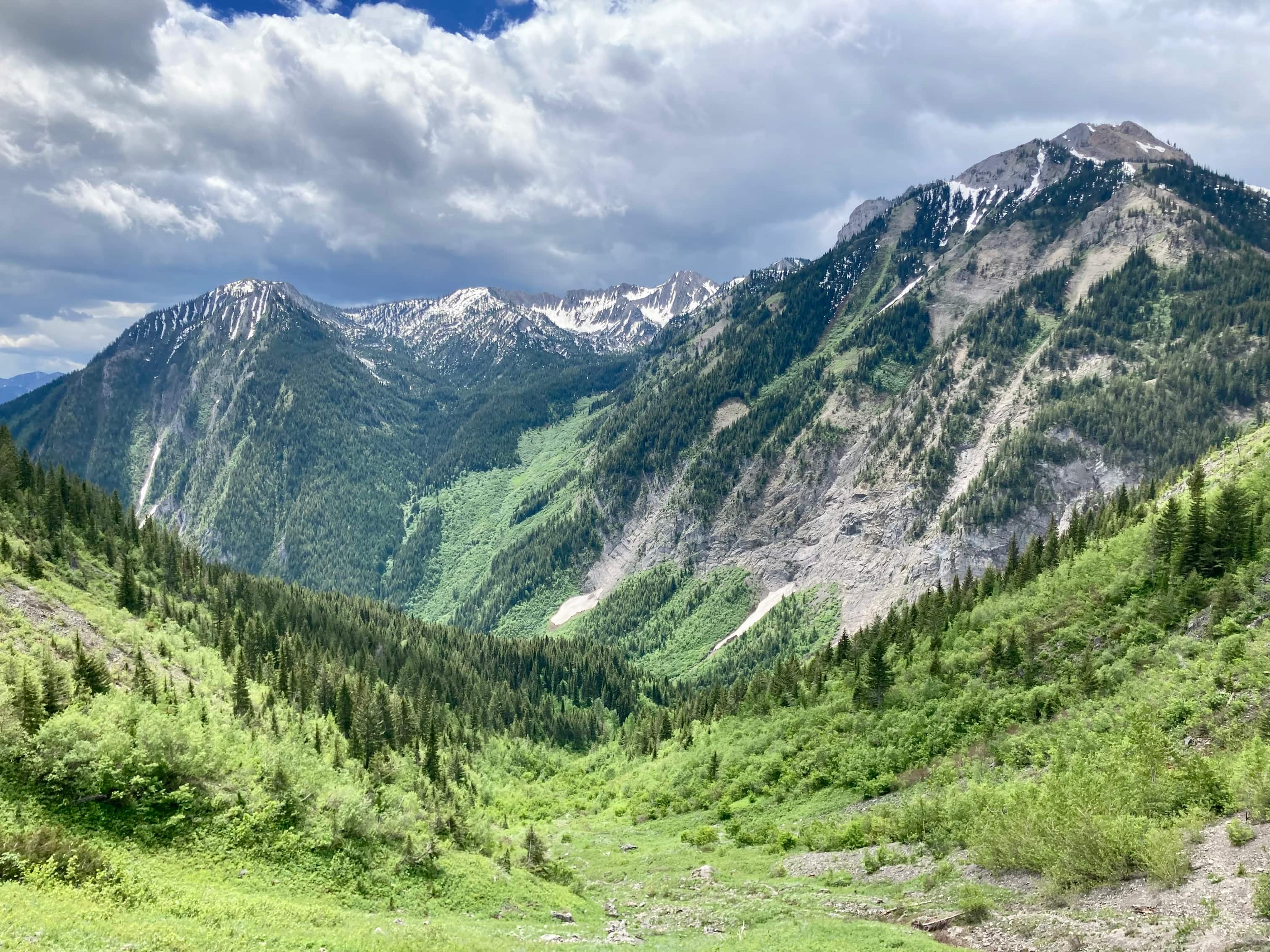
The route initially follows the Fairy Creek Trail, then follows “Swine Flu” to a bench with a nice view overlooking Fernie. From the bench the trail stays in the woods but starts to ascend more steeply along the south ridge of Mount Proctor. Eventually a southern outlier comes into view but the trail doesn’t go up and over it. Rather, it skirts around the west side arriving at a col between the outlier and the summit. From there the route is outside the trees and the way is clear. As I ascended the lower parts of the trail there was some wind and patches of brief rain, so being in the trees was actually pretty nice. The frequent and clear signage was impressive. After the final ascent to the summit I was amused to see yet another sign post, complete with QR code, and a full-sized picnic table a short distance away.
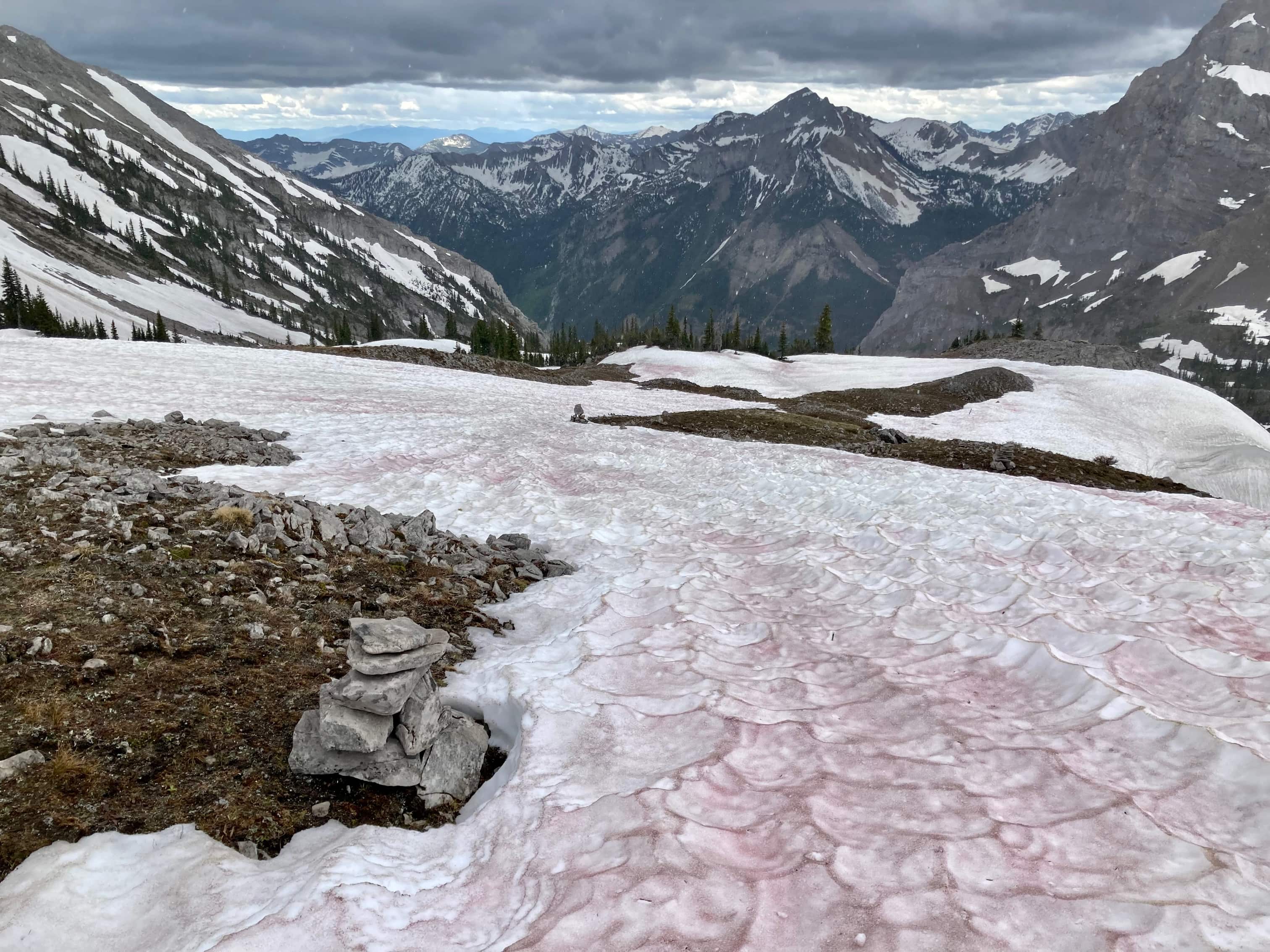
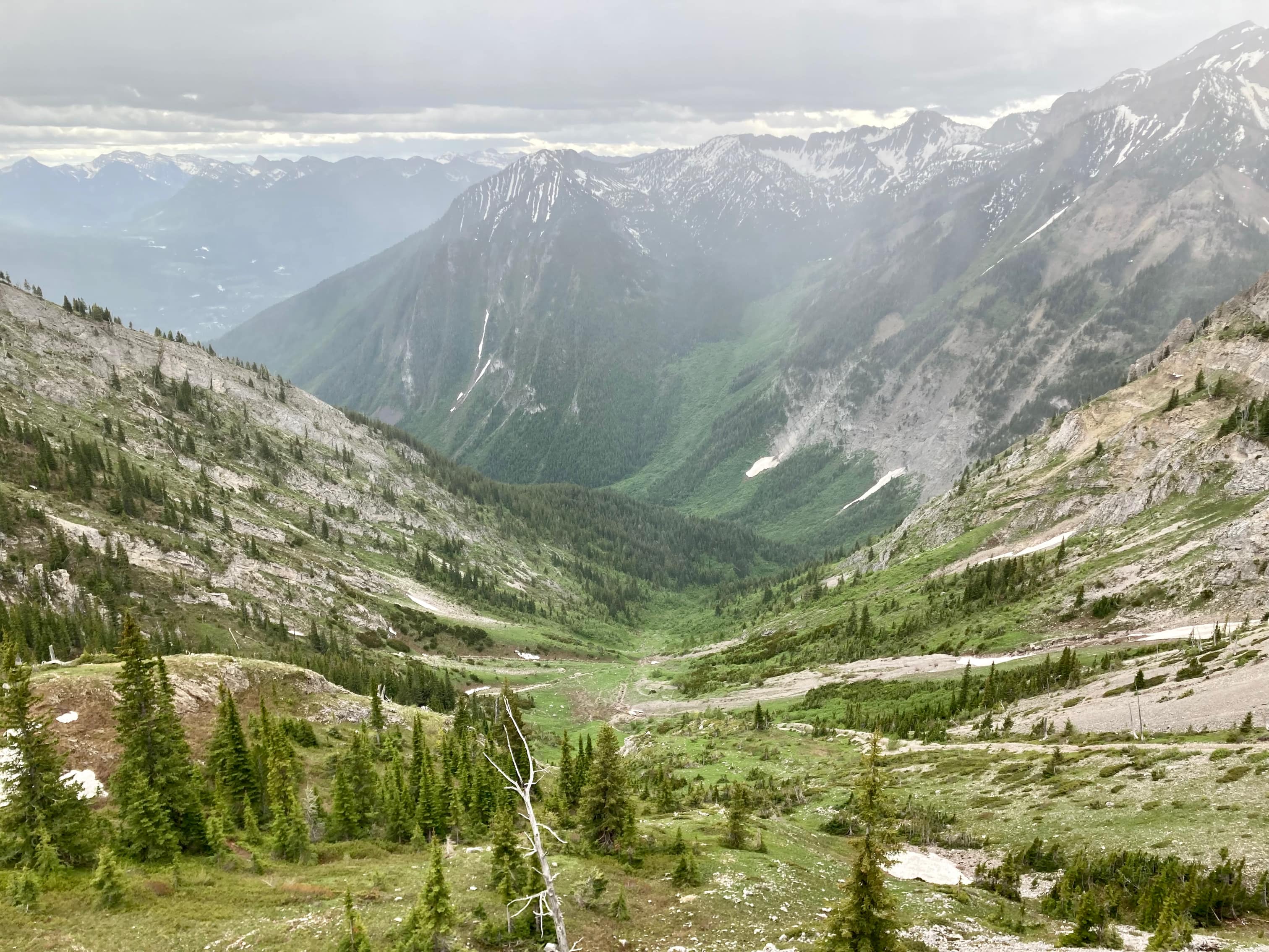
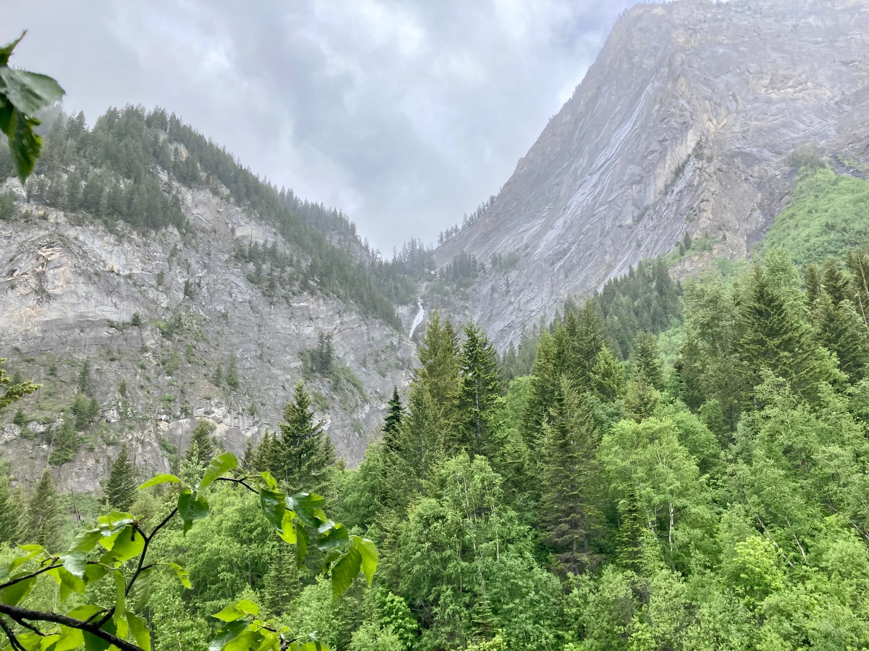
After taking in the views, especially of Three Sisters looming directly across the valley to the northwest, I had a seat at the picnic table to put on my gaiters to prepare for the descent through the snowy valley west of the summit. As I descended, more sustained precipitation arrived. High on the mountain it was in the form of ice pellets which stung a little, but were preferable to rain. Navigating down through the snowy valley wasn’t too difficult. Trail markers could still seen here and there but I lost the trail at some point. I directed myself to the southern outlet of the valley and eventually saw the trail again. As I got lower the precipitation turned to rain. By the time the trail brought me down to Fairy Creek Falls it was raining pretty steady which added an interesting ambiance to the waterfall. A few more kilometres on the friendly Fairy Creek Trail brought me back to the visitor centre.
Despite the weather, this was a great day out. I’m particularly impressed with the dedication shown by the Fernie Trails Alliance in maintaining the trail and providing excellent signage. You can voluntarily purchase a “pass” via their website to help support their work. The QR codes on the signage will direct your smartphone to the site. I was a little unsure whether I should categorized this as a “hike” or “scramble”. In the end I decided on “scramble” but I can see the argument that this is more of a hike. Whatever you call it, it’s worth doing if you can handle the ascent.
Click on the pictures in the gallery below to access higher resolution images.
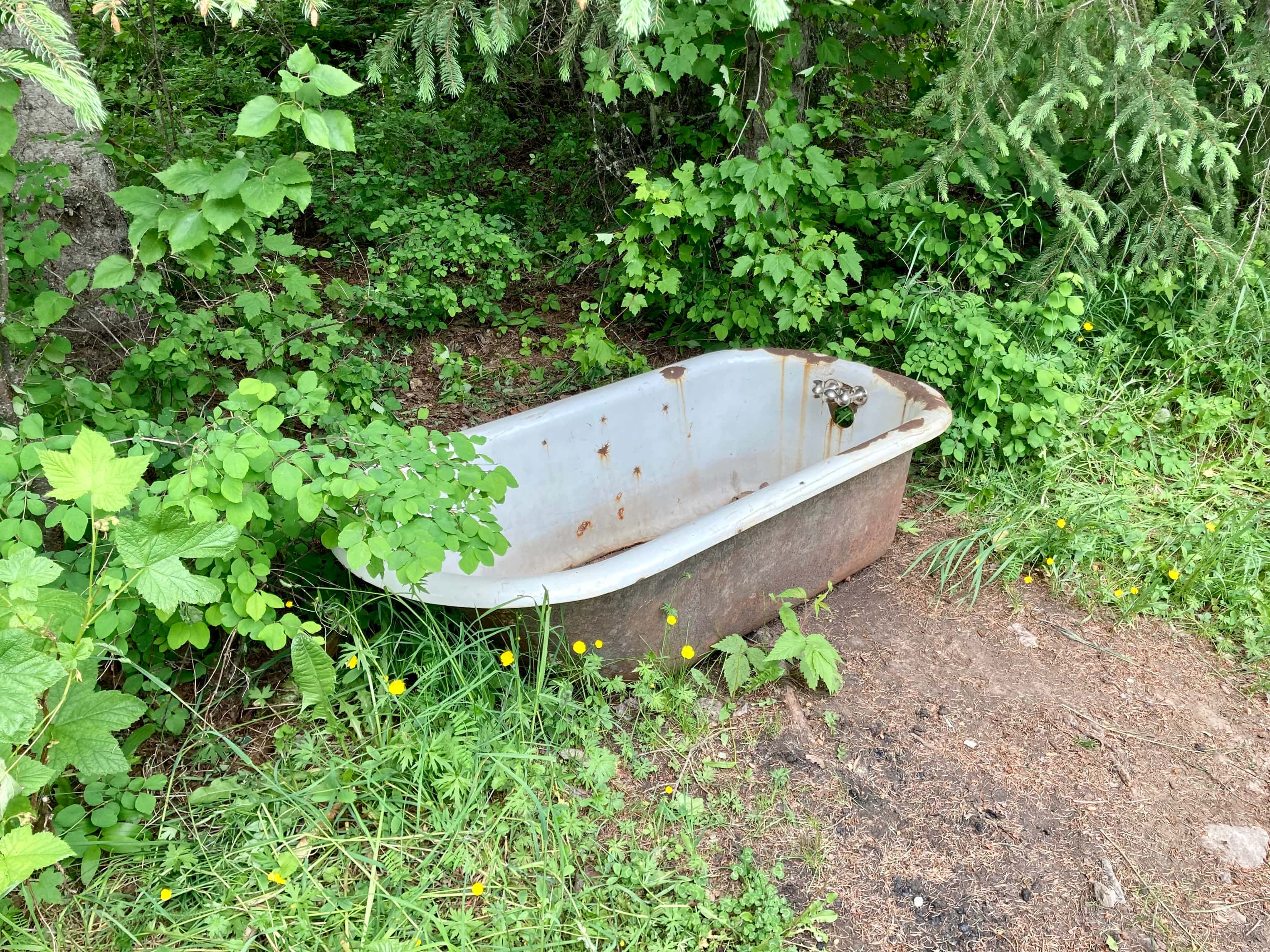
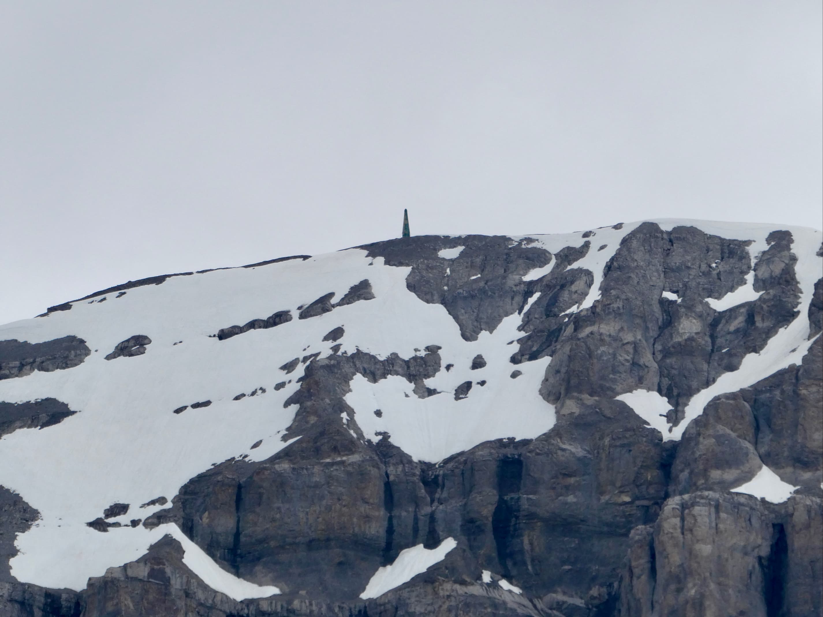
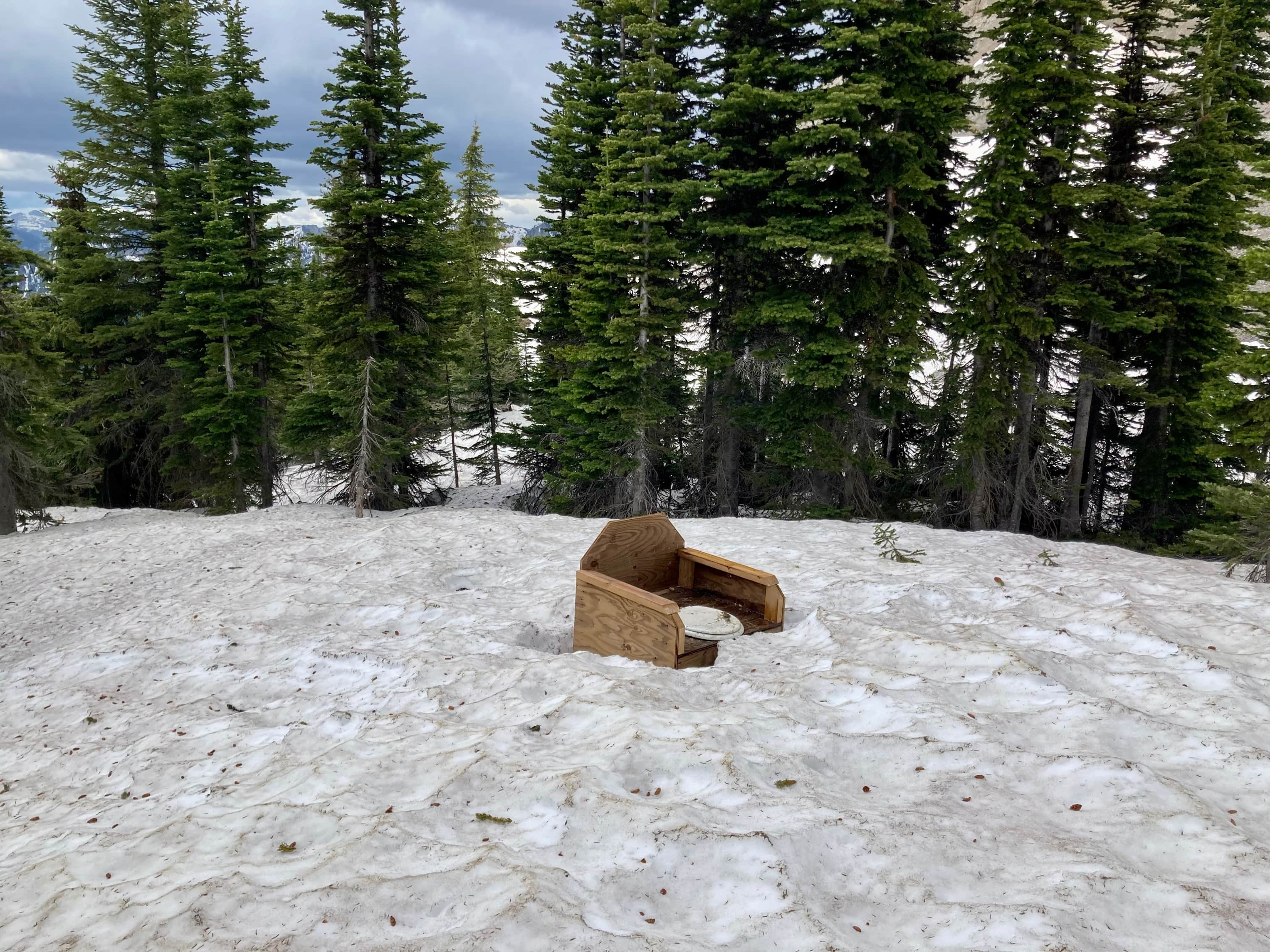
Route overview looking east.Three Sisters and Mount Proctor as seen from the town. From most angles the summit of Mount Proctor is hidden from the townsite, but in this picture you can see it beyond the V formed by the outlier and false summit.The parking lot at the Visitor Information Centre. The map kiosk sits next to the start of the trails.The excellent signage begins a few steps beyond the kiosk. On the back side of this marker the sticker shows “KM 20”. The ascent and descent routes overlap at first, so initially the numbers were counting up. But once the routes diverged the numbers I saw were counting down, since the kilometres were marked ascending clockwise along the route but the recommended direction of travel is counter-clockwise.This would be the first bathtub I’ve ever encountered on a hiking trail.An example of the good signage. The Mount Proctor route is marked with the little green signs. The Fernie Trails Alliance (FTA) triangle is used as a marker on trees on the higher reaches of the trail to help keep you on track. Orange paint spots also appear in a few places.A little further along. The Mount Proctor trail is not the “Easy Way”, though you could likely go that way and rejoin the Mount Proctor trail if you knew which paths to take.This bench and smiling pig/donation box await at the top of Swine Flu. The Mount Proctor trail carries on up the ridge.The view from the bench, looking down on Fernie.The trail follows the ridge, but doesn’t always stay right on the edge. A few places you come out of the trees and get a look uphill.Eventually the trail reaches this clearing below the southern outlier.A nearby bench. Patches of rain can be seen moving down the valley.The southern outlier as seen from the bench. The route doesn’t go up and over that but skirts it to the left.Looking south from the bench. Skies were looking more friendly that way.I think that’s Mount Fernie directly across the valley the west. The Lizard Range is in the background.Skirting the outlier.Three Sisters and a false summit come into view.Nearing the col between the outlier and the false summit. The true summit now in view at the right.Down on the col. This cairn had managed to melt the snow all around it.Grizzly tracks, I think. My size 12 boot for reference. The bear walked over the col fairly recently.Off to the false summit. Staying on the ridge I got to do a bit of scrambling. Some of it can be avoided by bearing left.The cairn on the false summit.Looking south, back towards the col.Setting off toward the summit.A last bit of climbing.The summit cairn on Mount Proctor and……another helpful sign post!I climbed 1400 meters to a picnic bench?Panorama looking east. Vern Dewit’s report of his ascent of Mount Proctor included ascending the peak at the far left. He found one reference to it as “Planner Peak”. Mount Hosmer/Ghostrider Mountain is in the sunlight just right of centre. The picnic table just sits there, taking it all in.Mount Hosmer/Ghostrider MountainSeven Sisters and Crowsnest Mountain in the far distance, partly obscured by intervening rain.Panorama looking south. Fernie Ridge is directly across the valley. In the far distance are numerous peaks in Alberta and Montana.Panorama looking west. Mount Fernie is across the valley left of centre. The tall peak right of centre doesn’t seem to have a name.A closer look at the tall nameless peak.Ski runs of the Fernie Alpine Resort with some interesting peaks of the Lizard Range beyond.Panorama looking north. Three Sisters dominates the view.Another look at Three Sisters. A navigation beacon of some kind is visible on the summit.A closer look at the structure.Time to get off the summit. I started along the ridge line towards the start of the descent into the valley.To the Info Centre!Looking down into the valley. Still plenty of snow left, but thanks to the cool weather it was pretty supportive.Following the cairns as ice pellets start to fall.Still seeing cairns sticking up from the snow.After a while I lost the cairns, but the general direction of travel to get down was obvious.Three Sisters has a different look from down in the valley.Well, I already found a bathtub on this trail. It makes sense that I’d stumble across a toilet, right?Quite the view from this throne.The ice pellets turned to rain as I descended further. I eventually saw the trail coming down from my left and rejoined it. The wet grassy slopes made for some tricky footing.A break appeared in the clouds as I neared the trees.Raining again. Looking up at a waterfall through a break in the trees. There was another picnic table nearby this spot.Mountain Lady SlipperAfter a long descent I was finally down to Fairy Creek Falls. There was another bench and another lovely donation box.Fairy Creek FallsA short distance downstream of the waterfall there was this pond alongside the creek with what looked like a dam at one end with water flowing up and over it.Looks like the work of beavers, doesn’t it?Definitely looks like bite marks. I meant to ask more about it at the information centre but it slipped my mind.Another sunny break caused beads of water to light up on the leaves. The last few kilometres walk back to the parking lot was easy and pleasant.
Thank you for this amazing write up! My husband was the driving force behind this and put in a LOT of hours rerouting and rebuilding the trail — with MANY FTA volunteers joining in — so that we get to enjoy the trail and the spectacular views.
Your trip choices and descriptions are so well done! Just the right details and great photos. My friends and I are planning to summit Tecumseh this Sunday (if we can stay on track) and I now have this on my 2022 list as well.


I hope to do this this summer. Hopefully, when the snow has melted. Thanks for this!
LikeLiked by 1 person
Thanks for reading!
LikeLike
Thank you for this amazing write up! My husband was the driving force behind this and put in a LOT of hours rerouting and rebuilding the trail — with MANY FTA volunteers joining in — so that we get to enjoy the trail and the spectacular views.
LikeLiked by 1 person
My thanks to your husband for his hard work, and to you for reading!
LikeLike
Your trip choices and descriptions are so well done! Just the right details and great photos. My friends and I are planning to summit Tecumseh this Sunday (if we can stay on track) and I now have this on my 2022 list as well.
LikeLiked by 1 person
Thanks for reading! I hope you have a great day on Tecumseh.
LikeLike