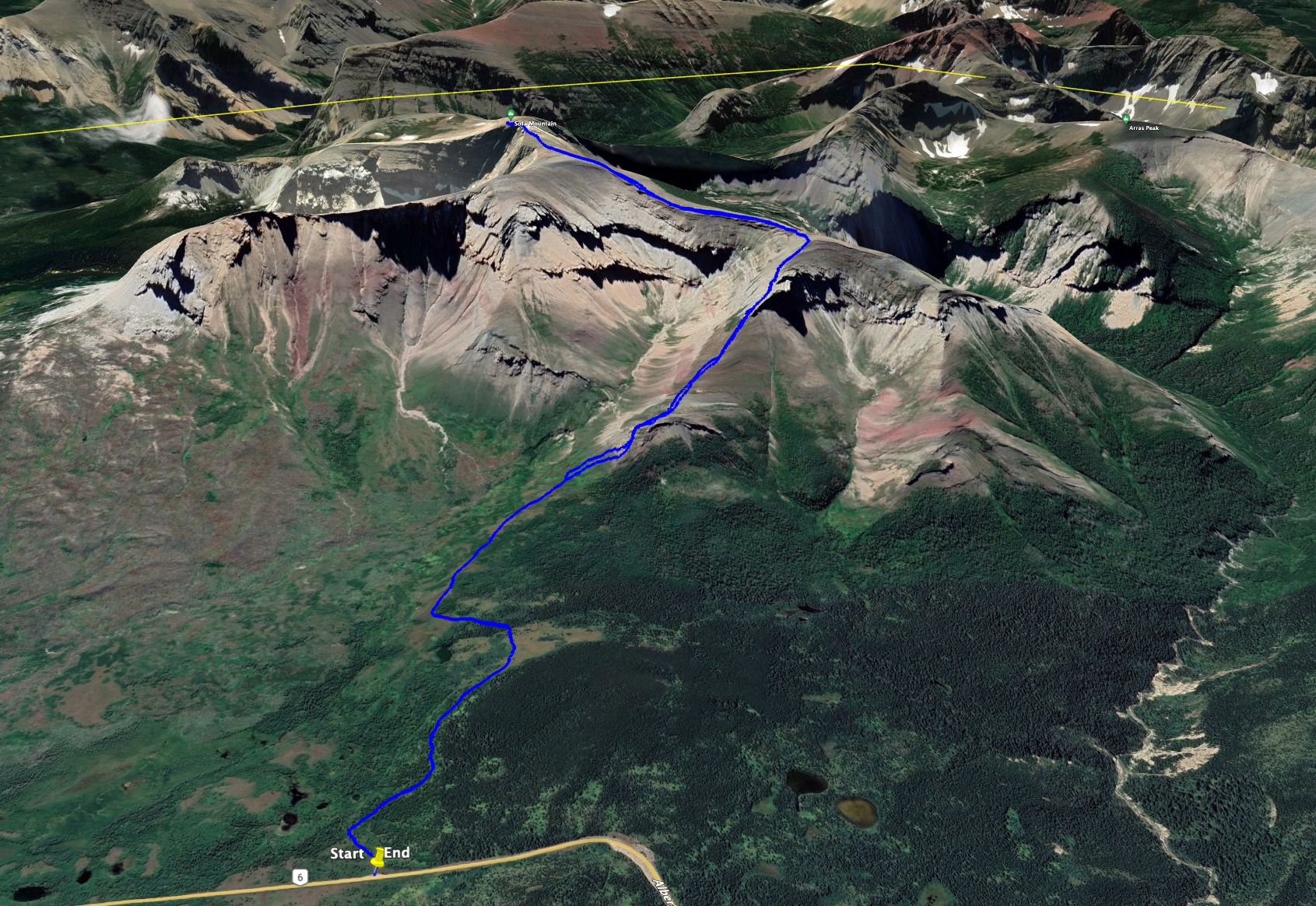
Sofa Mountain is a fairly frequently visited scrambling objective, if social media posts are anything to go by. I’ve been wanting to climb it for a long time, but it’s on the east side of the Waterton lakes – an area where I’ve experienced a lot of bear encounters. So, I was saving this for a group trip some time. That intention went out the window this weekend when I saw the weather forecast for Waterton: no wind and partly cloudy. Those kinds of days are rare in the southern Rockies, so I decided to just get out there and climb the mountain on my own. Nugara describes two possible ascents in More Scrambles in the Canadian Rockies 3rd ed. He also suggests descending the same route you ascended, though I know many people put the two together as a loop. I figured I’d just get to the mountain and decide how to proceed once I got there.
Access is from Hwy 6. Coming in from Cardston on Hwy 5, look for the signed turn-off heading south towards the Chief Mountain border crossing. If coming in from Pincher Creek, continue past the turn towards the park gate and look for the turn to the border crossing. After a few kilometres there’s an impressive roadside viewpoint with interpretive signs and pit toilets. A short distance beyond that there’s a paved pull-out with marked angle parking. Click here for the Google map. There’s no signage there right now but it’s the start of the route. Apparently, this was once an officially maintained cross-country ski trail. Given the recently-paved parking area maybe they’re planning to make it official once again.
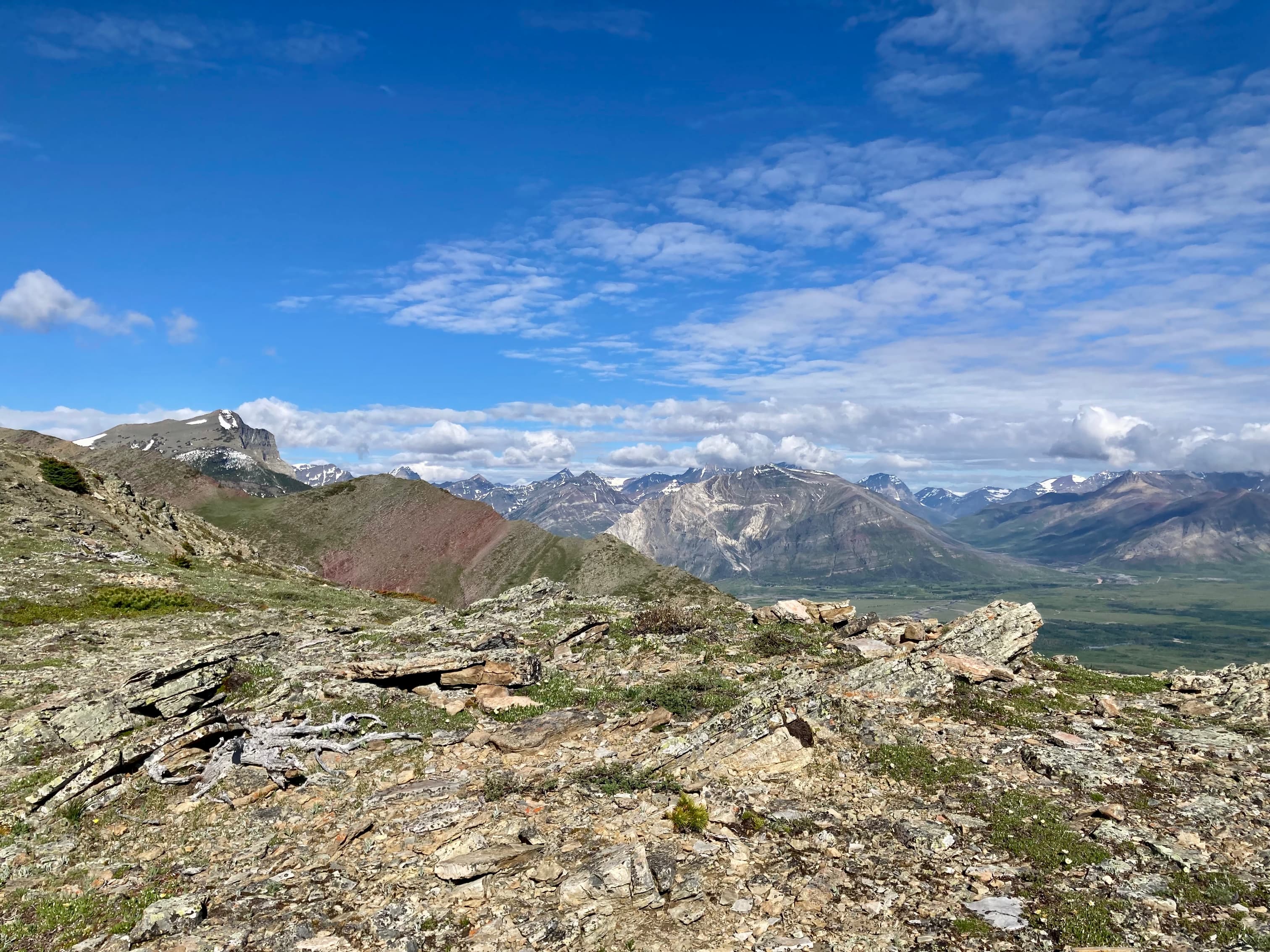
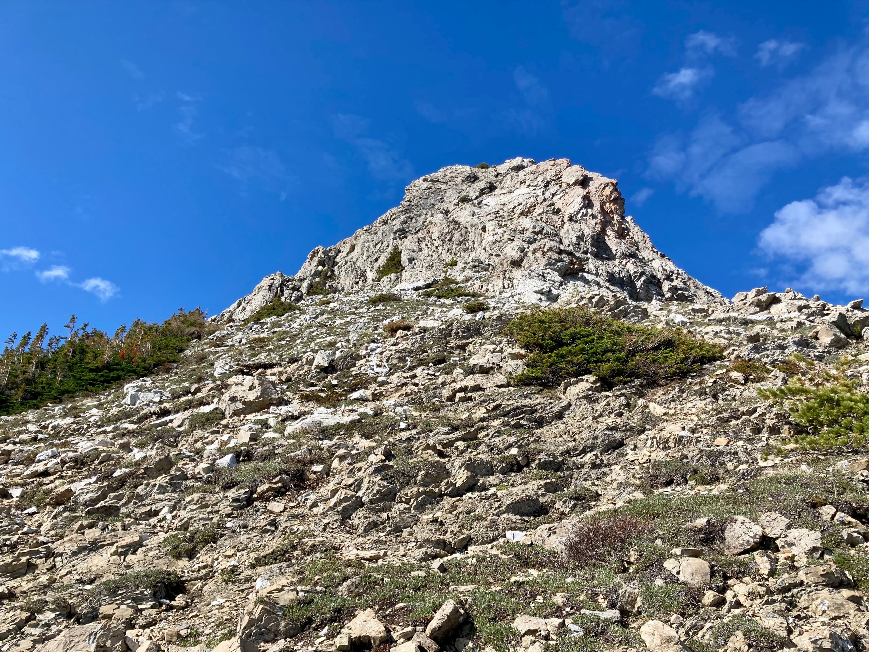
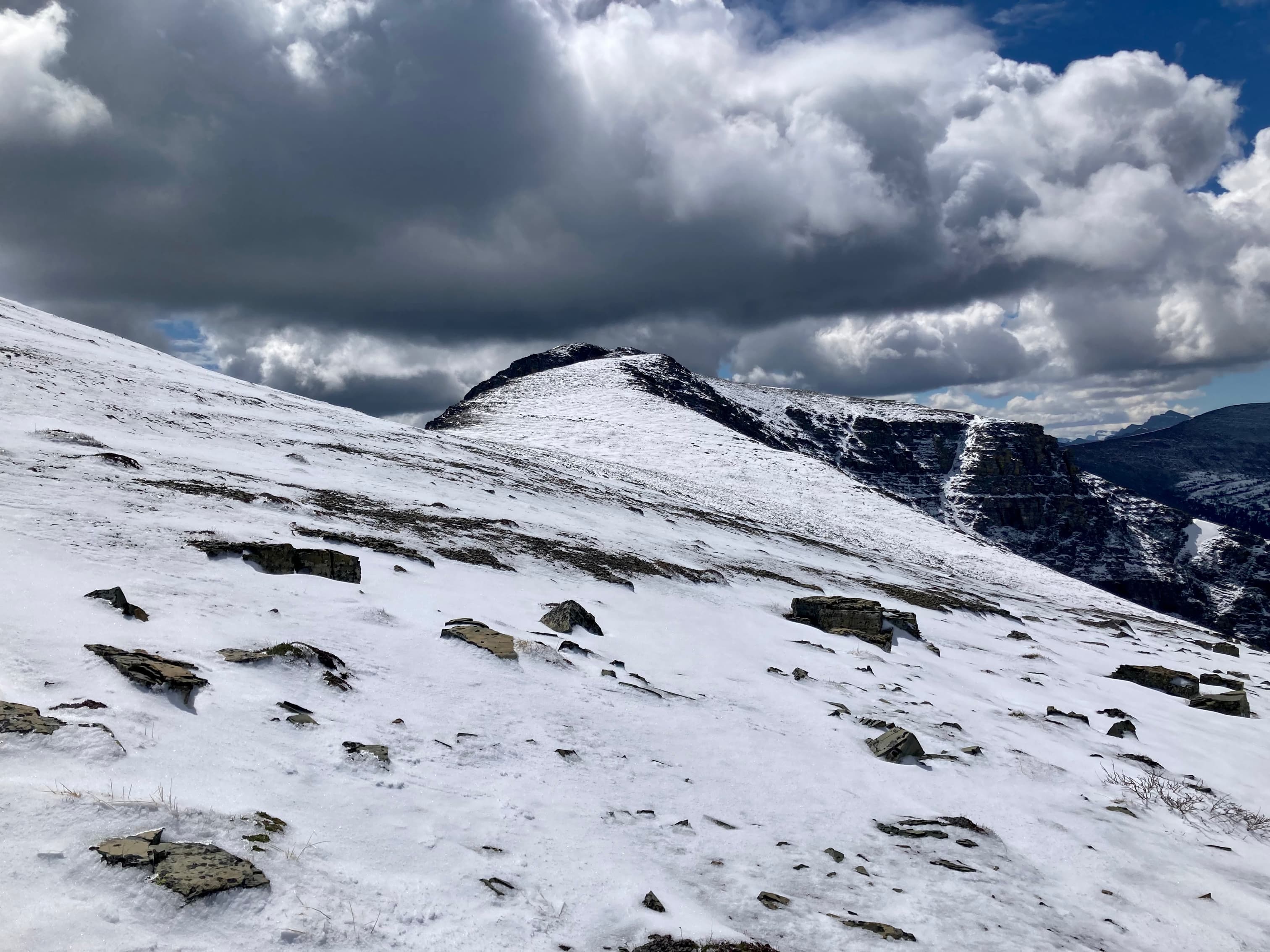
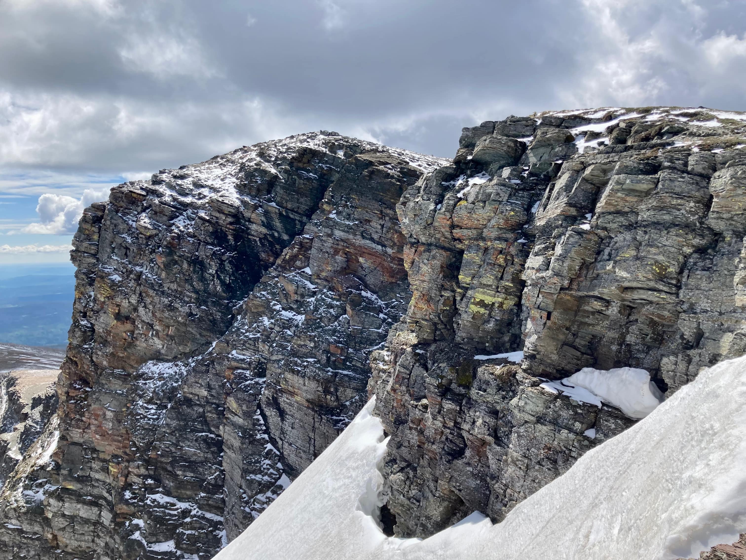
The trail is very well defined and goes through pleasant forest and clearings. Areas of the trail were quite crowded in by vegetation and I imagine those spots being a little claustrophobic later in the season. Soon I was able to see Sofa Mountain’s northeast aspect along with a waterfall in the valley between the northeast ridge and what Nugara refers to as the “east of northeast” ridge. Once a clear path was visible to the foot of the northeast ridge I departed the trail and began to ascend. Proceeding up the ridge, I climbed steep grassy slopes then encountered the first rock bands. Above those was a broad shoulder leading to the next steep grassy slope below the next set of rock bands. These are the main attraction of the ascent: 3 sets of solid grey rock which allow for enjoyable hands-on scrambling. Above those, the route joins the broad summit ridge and it’s a 2 km walk southeast to the summit.
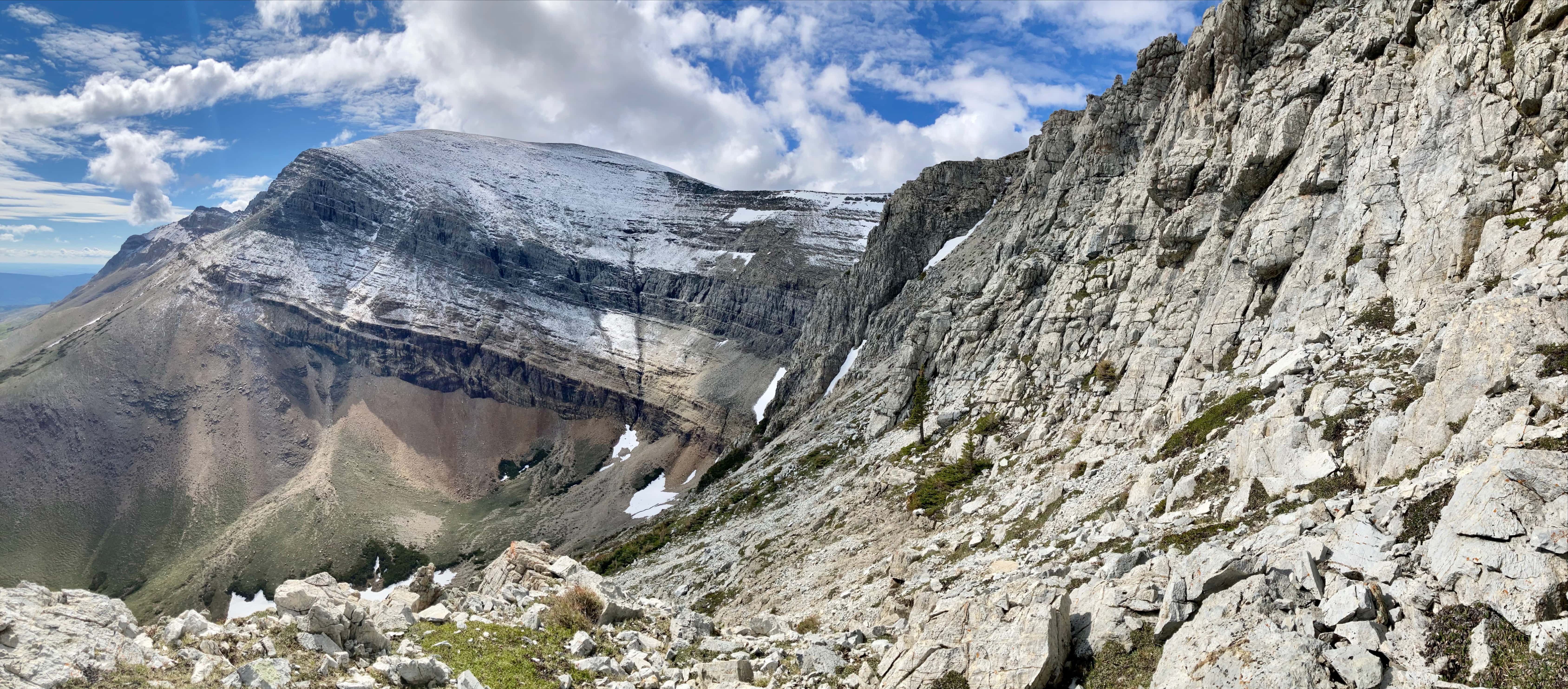
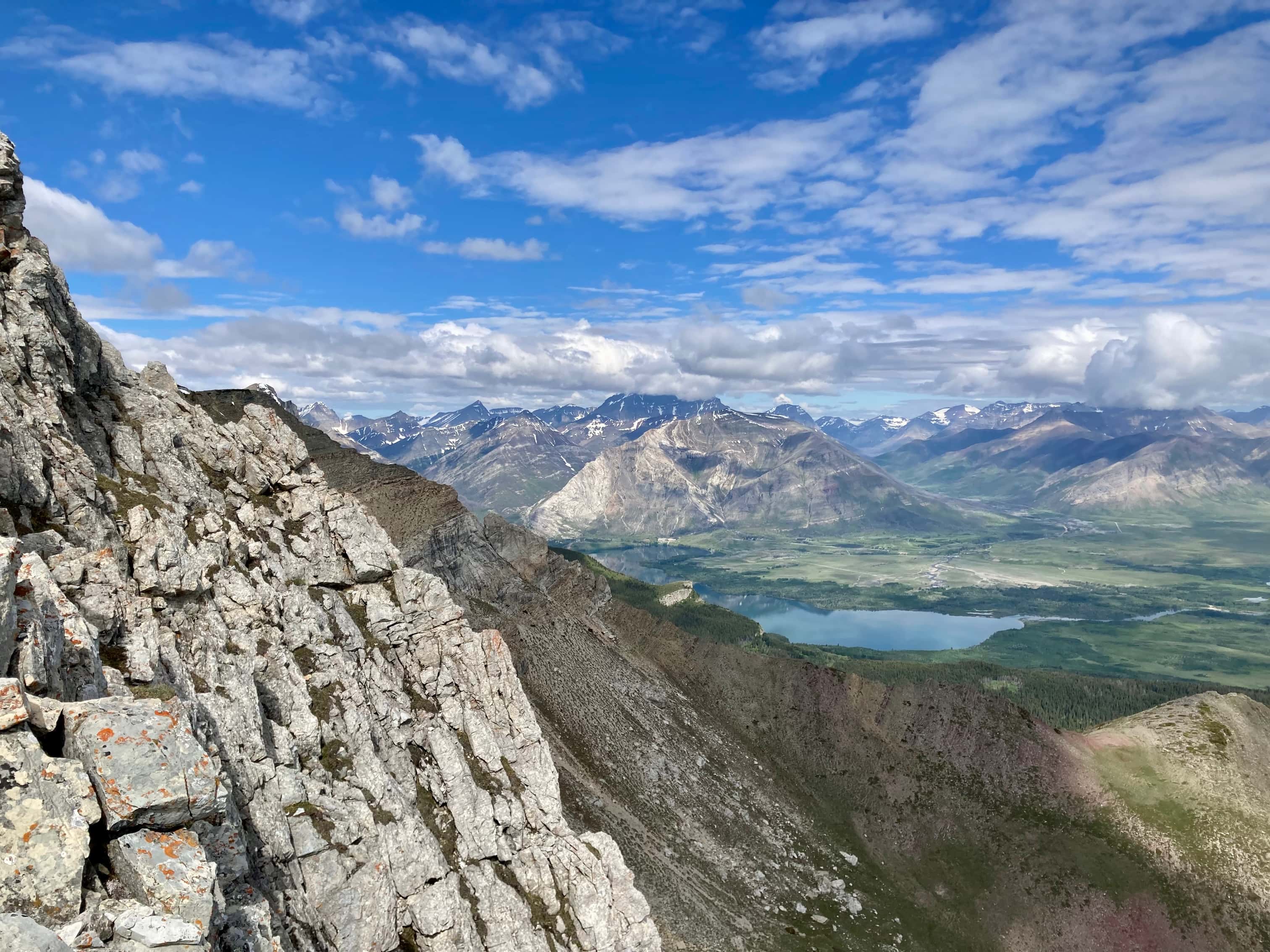
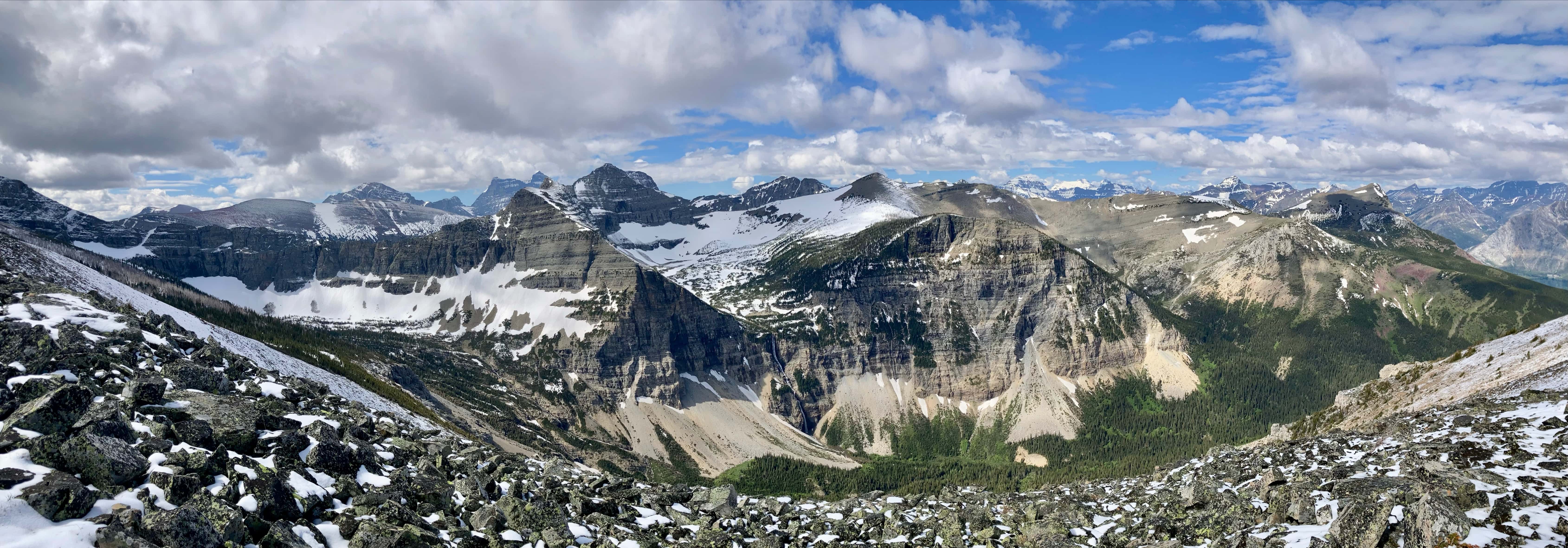
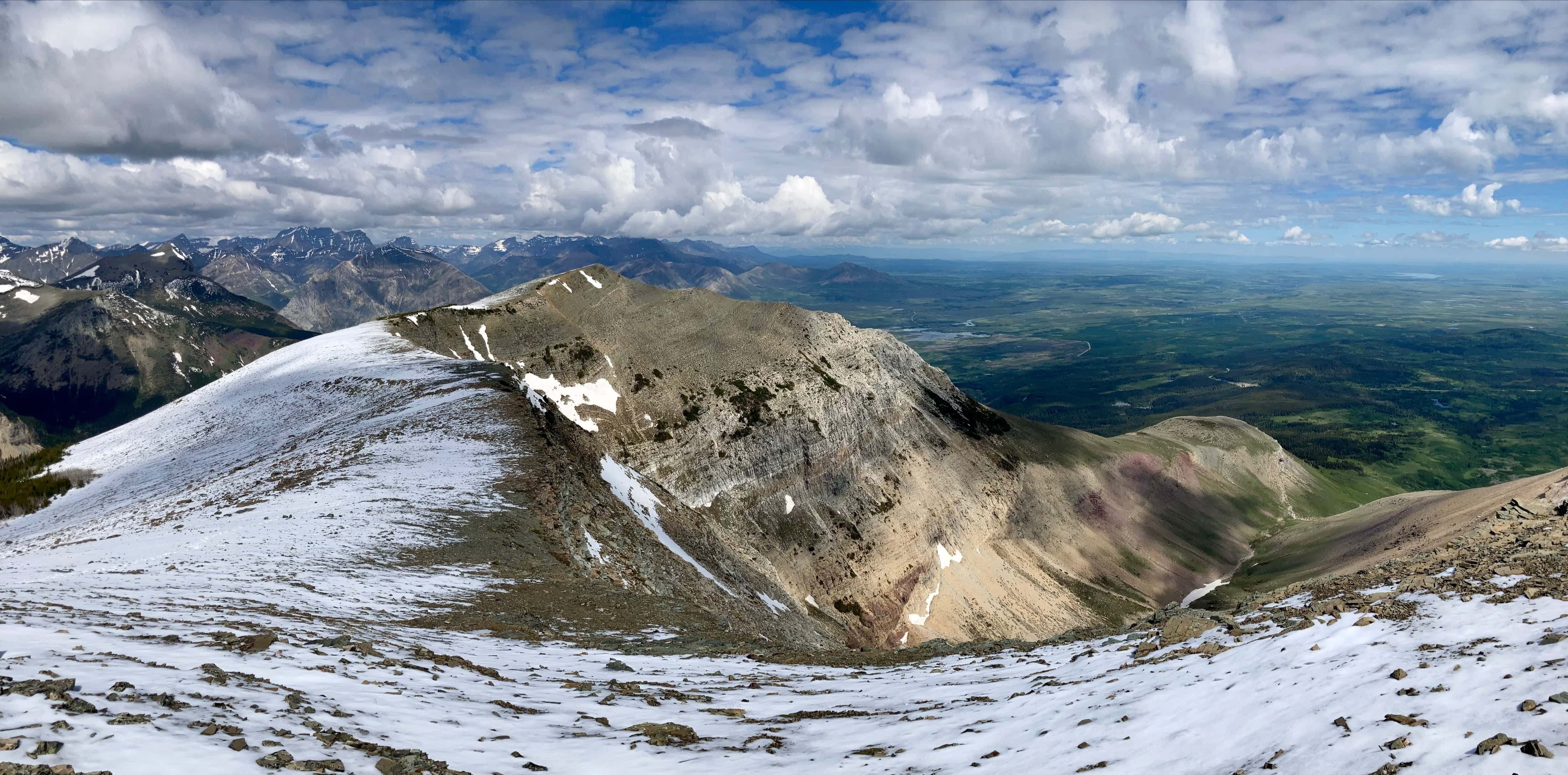
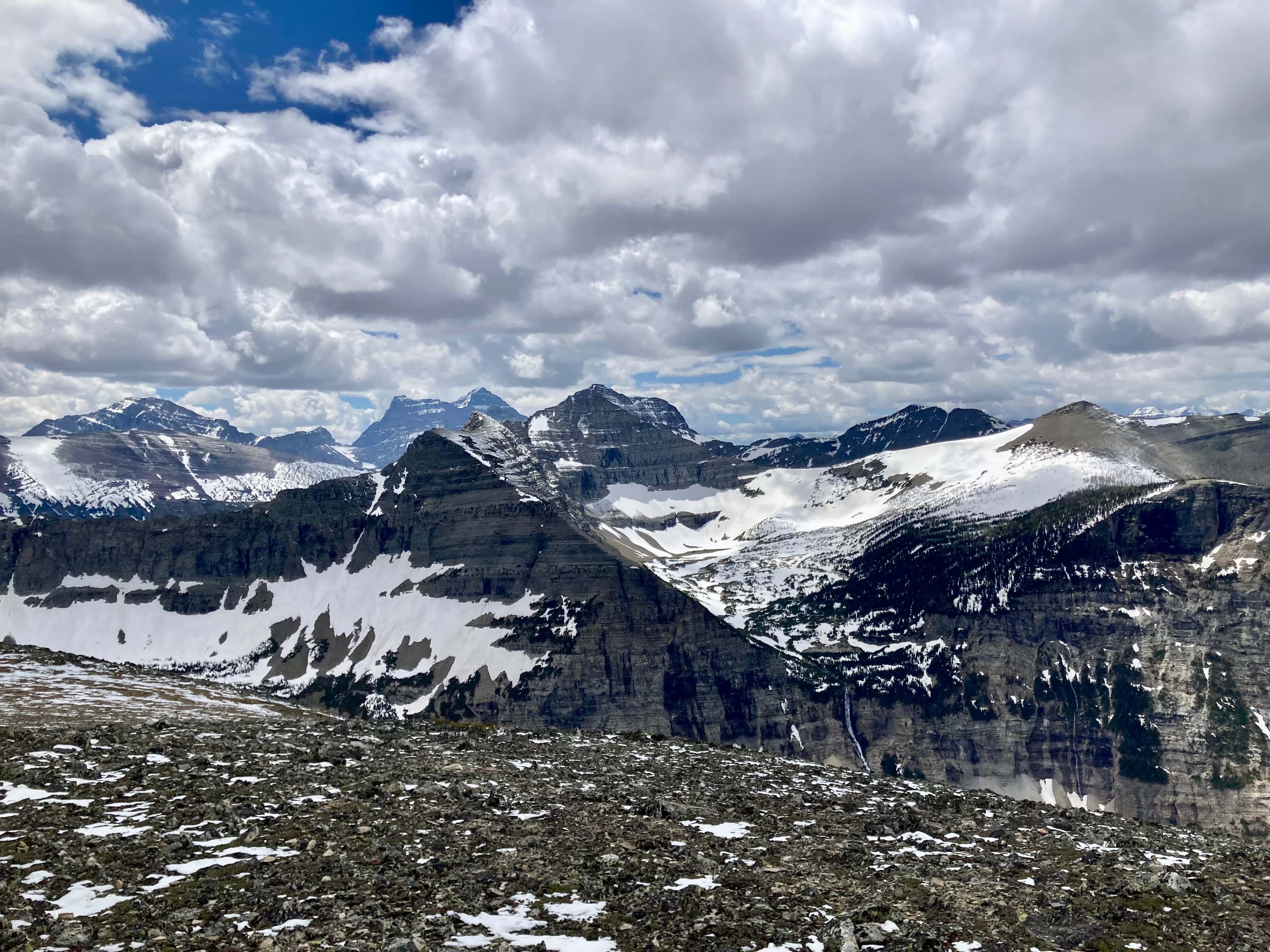
The views during the ridge walk and from the summit are excellent. Being on the east side of the Waterton lakes, Sofa affords a different perspective than most peaks in the park. This year’s late melt along with a dusting of snow from the night before added to the alpine asthetic of the scenery. I spent a long time on the summit, enjoying the lack of wind, and peering at various peaks in Waterton and Glacier National Parks as the slowly moving clouds accented different parts of the scenery with shifting light. For my descent I retraced my steps. As mentioned, I had considered making it a loop but the snow on the summit changed my mind. Looking over towards the “east of northeast” ridge during my ascent I could see that there was some snow on the route. Not knowing if that had any implications for the safety of the downhill scramble by that route I decided to return on terrain I knew was clear and dry.
Click on the pictures in the gallery below to access higher resolution images.
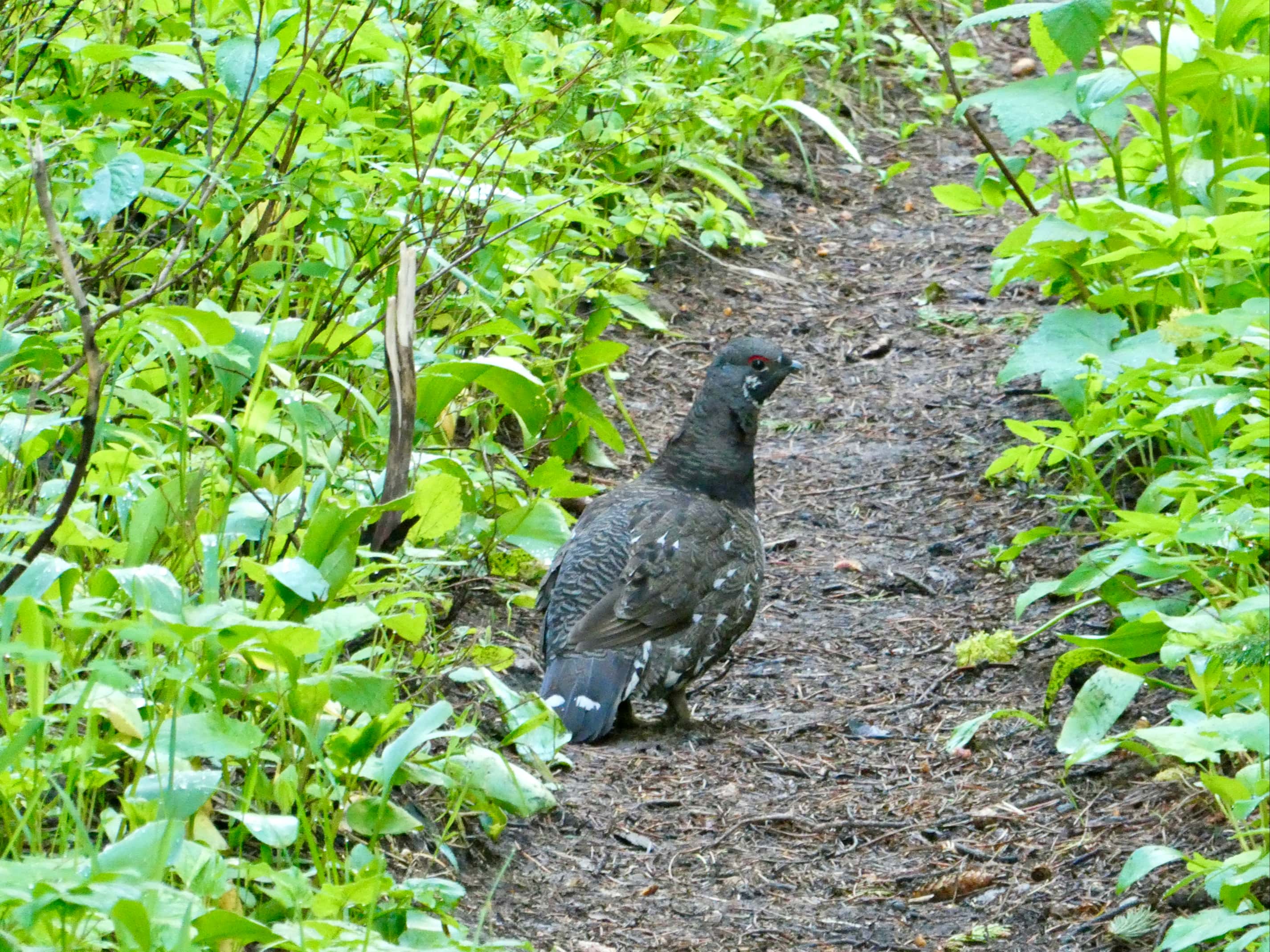
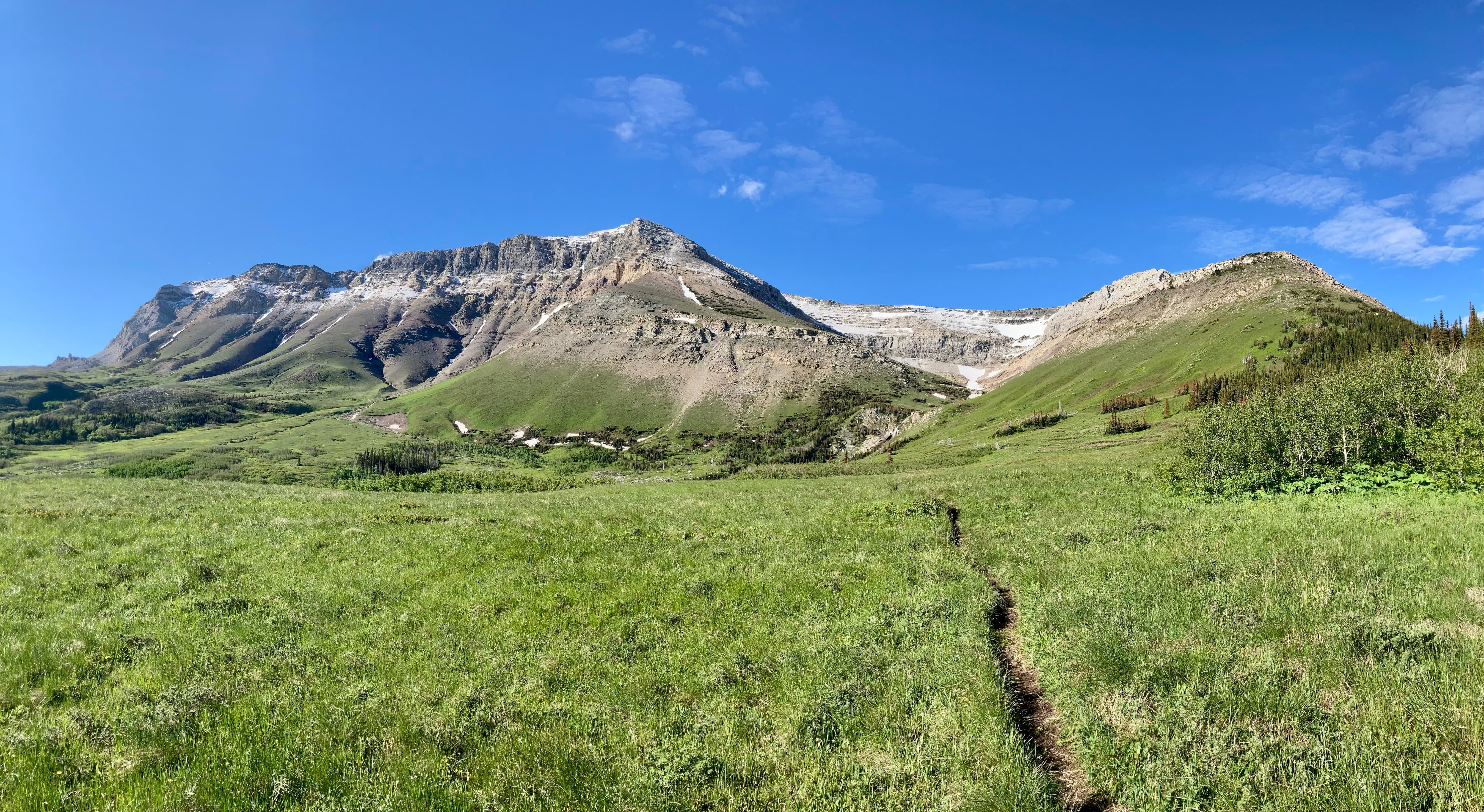
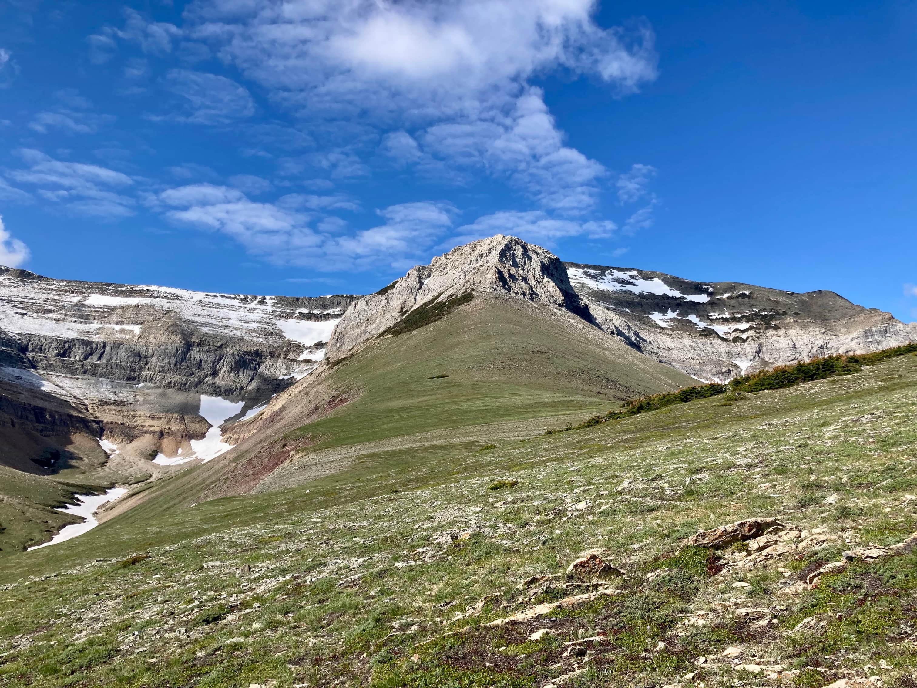
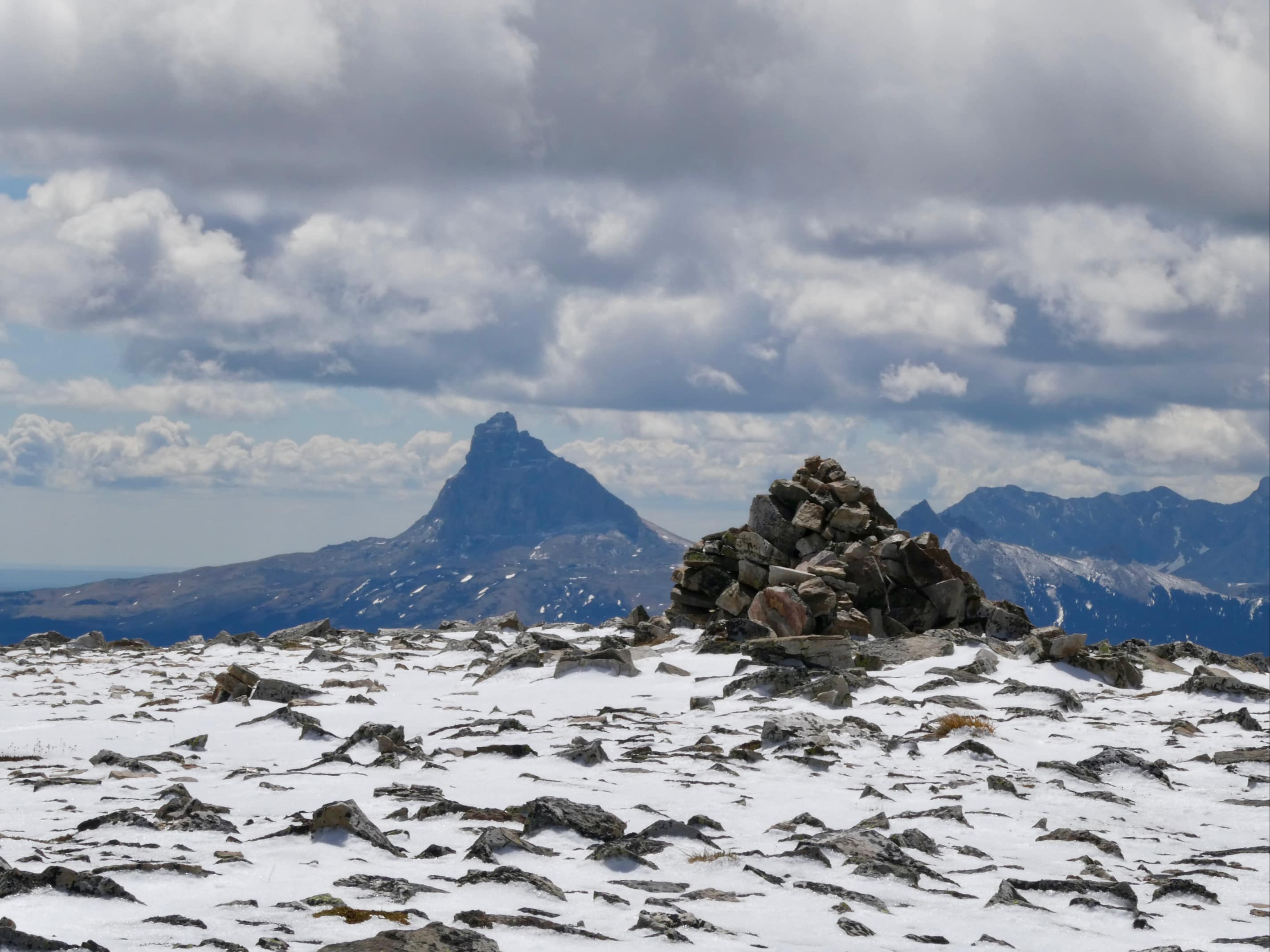
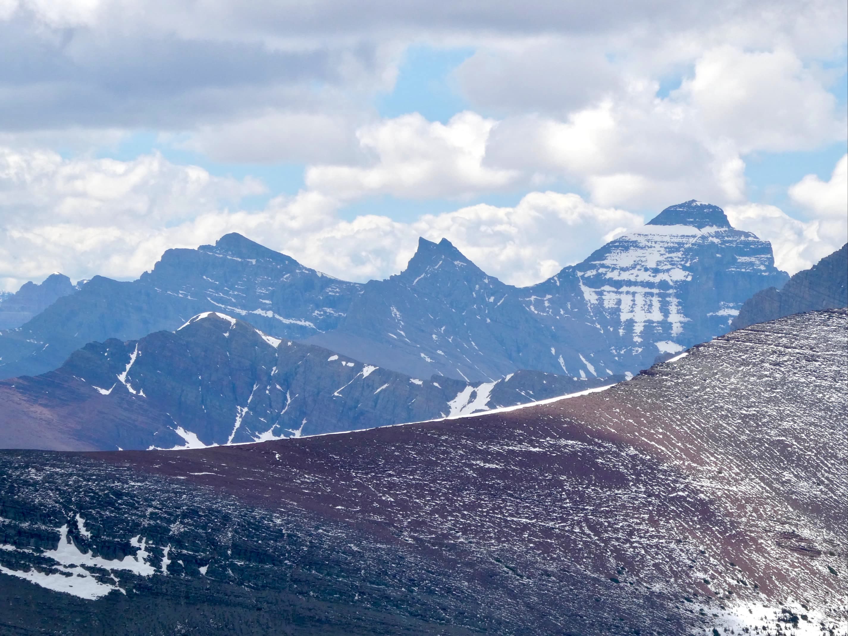
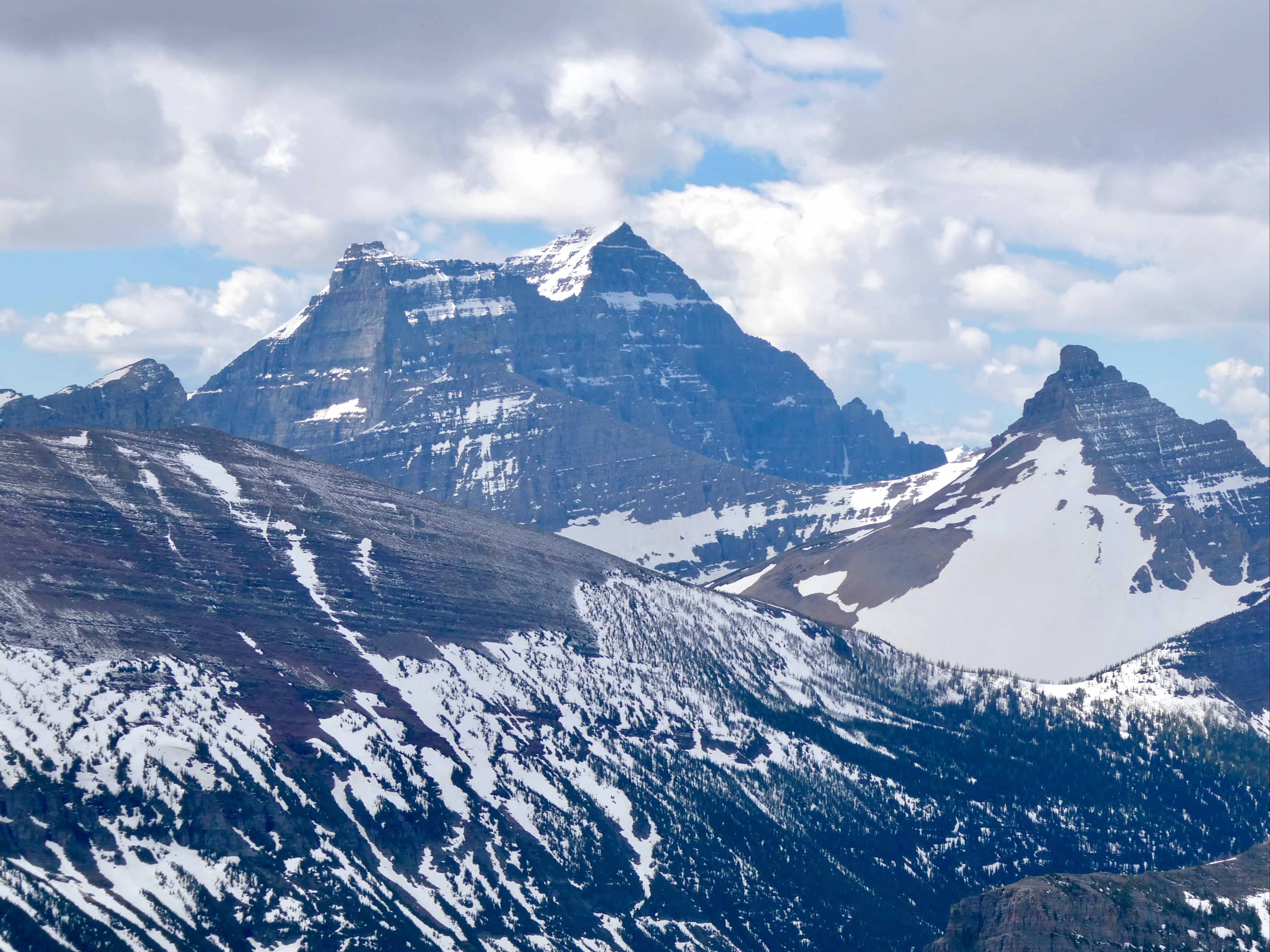
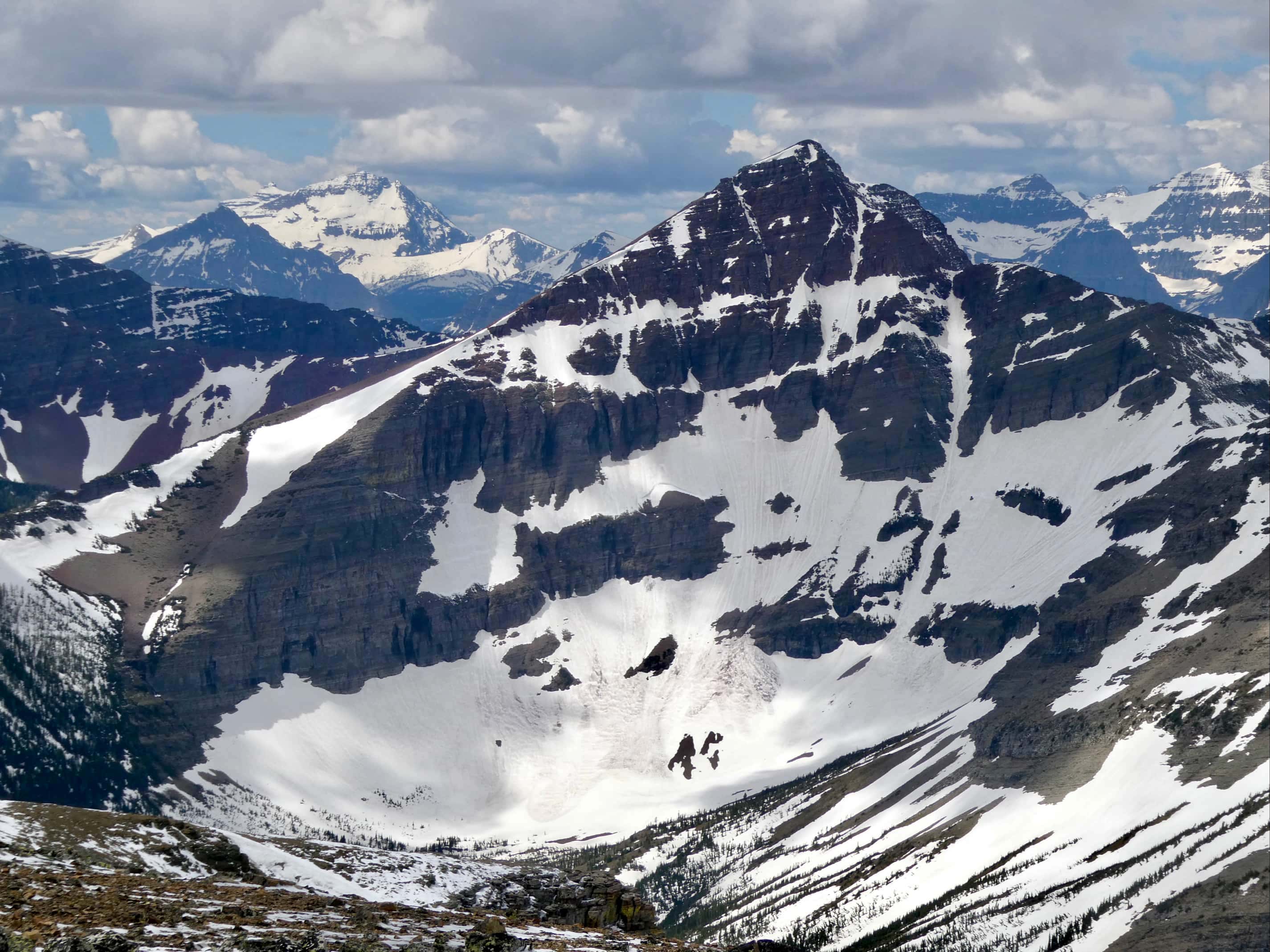
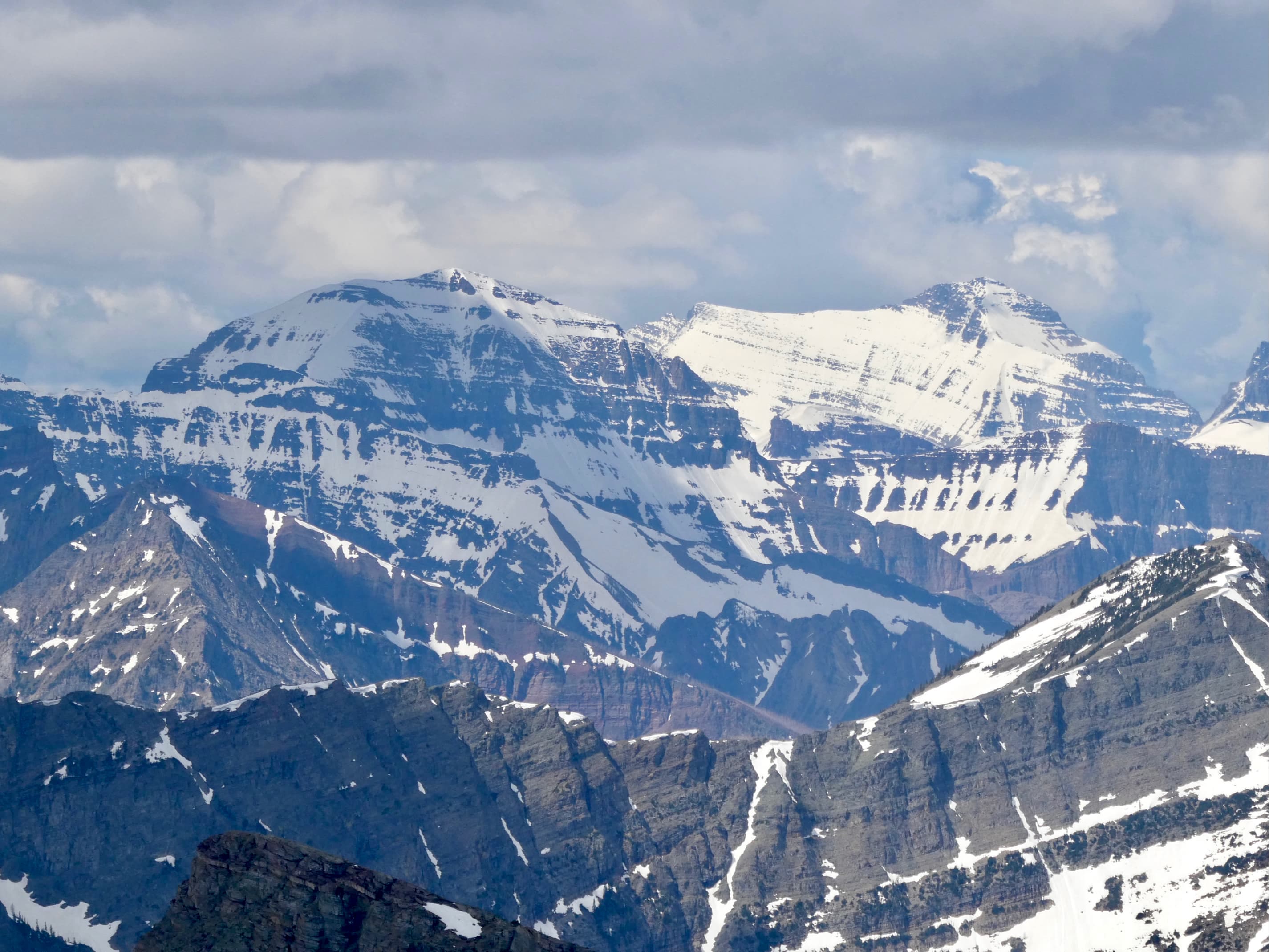
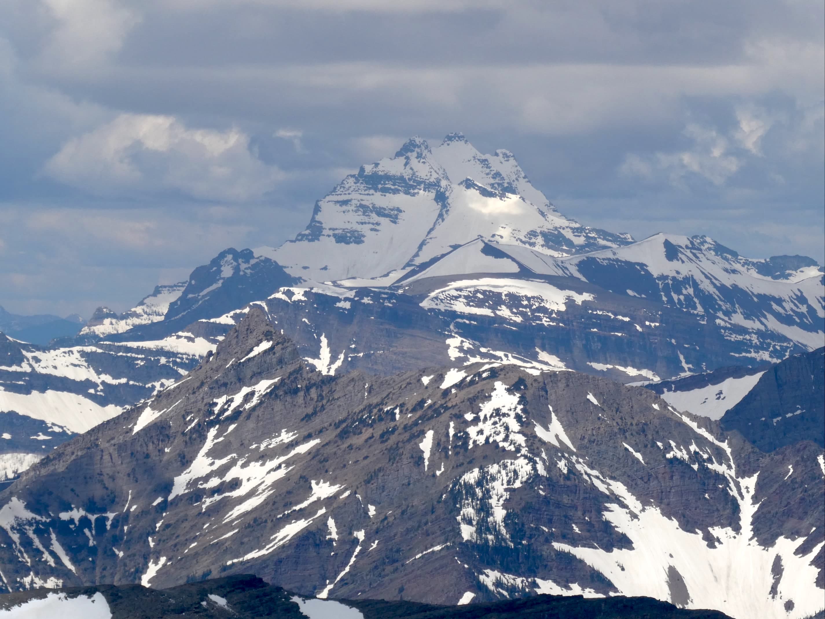
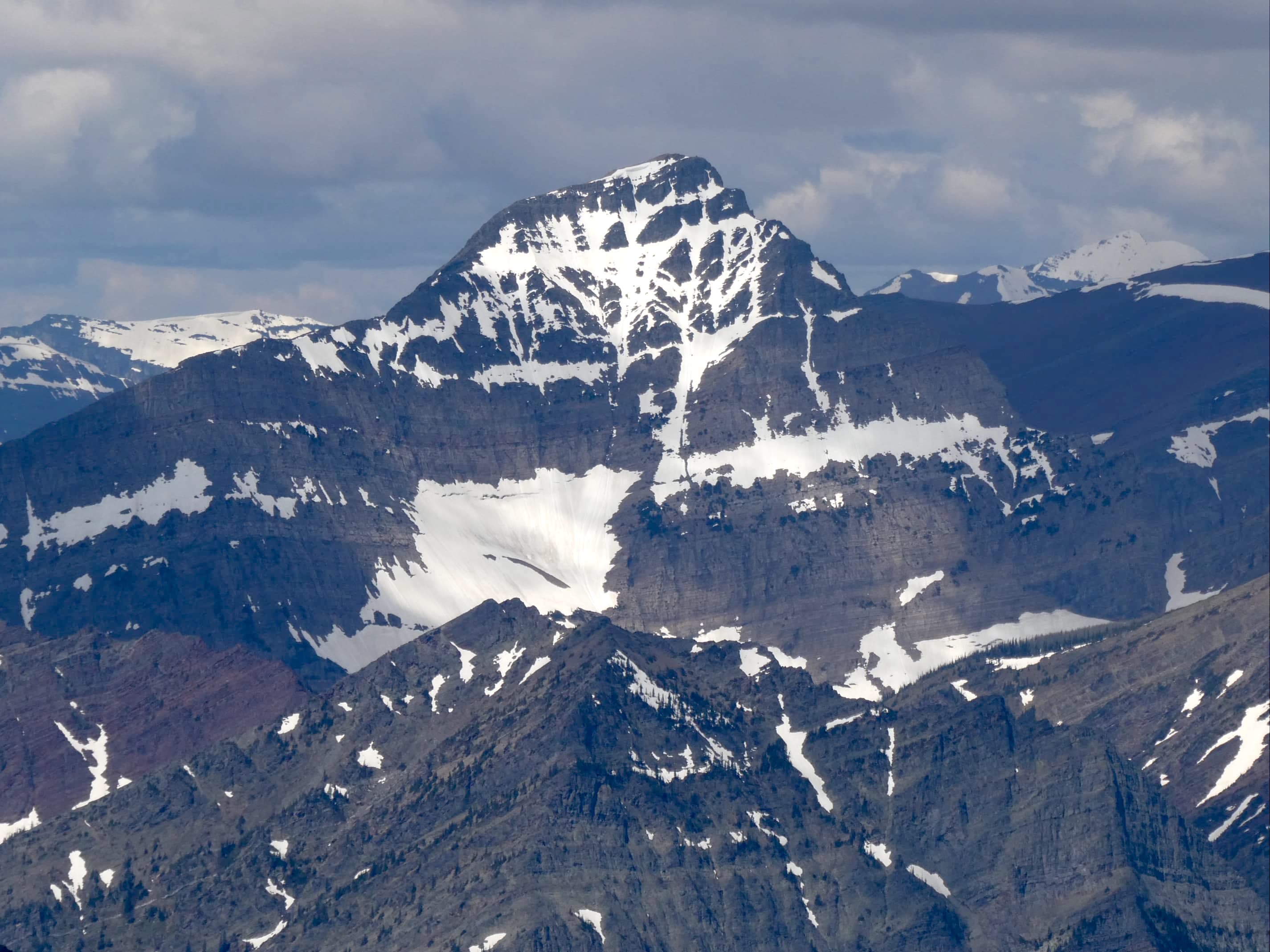
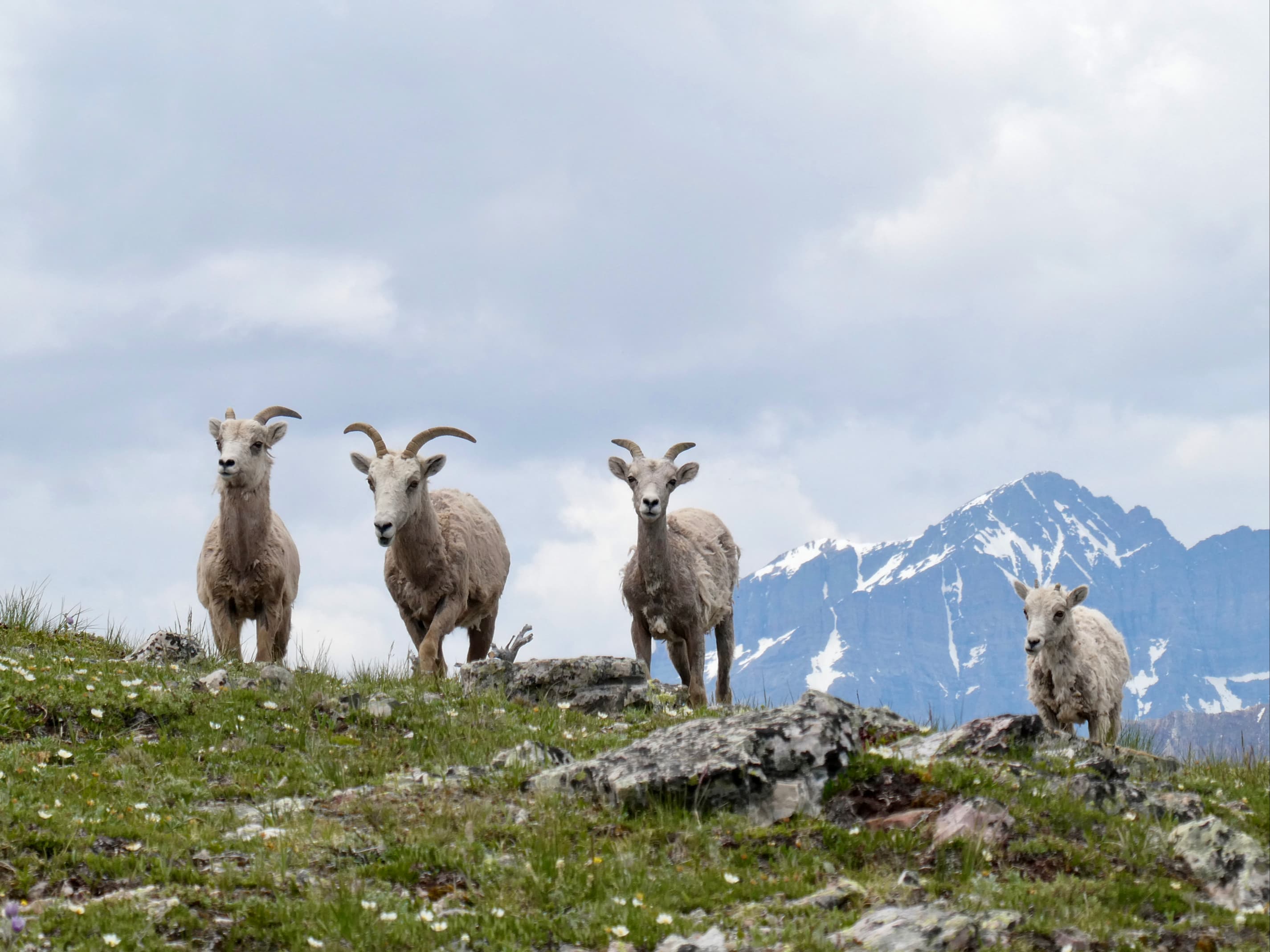
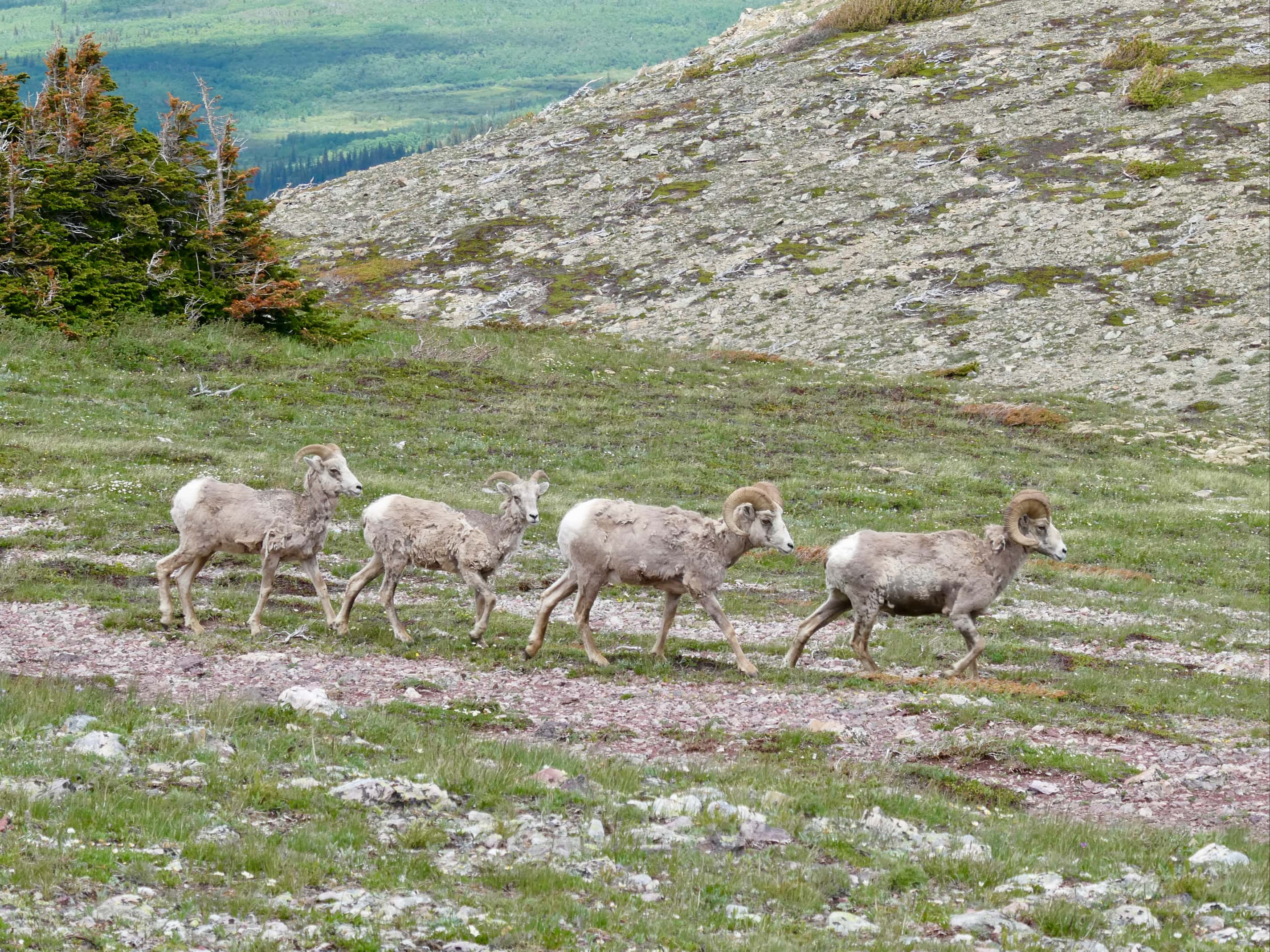
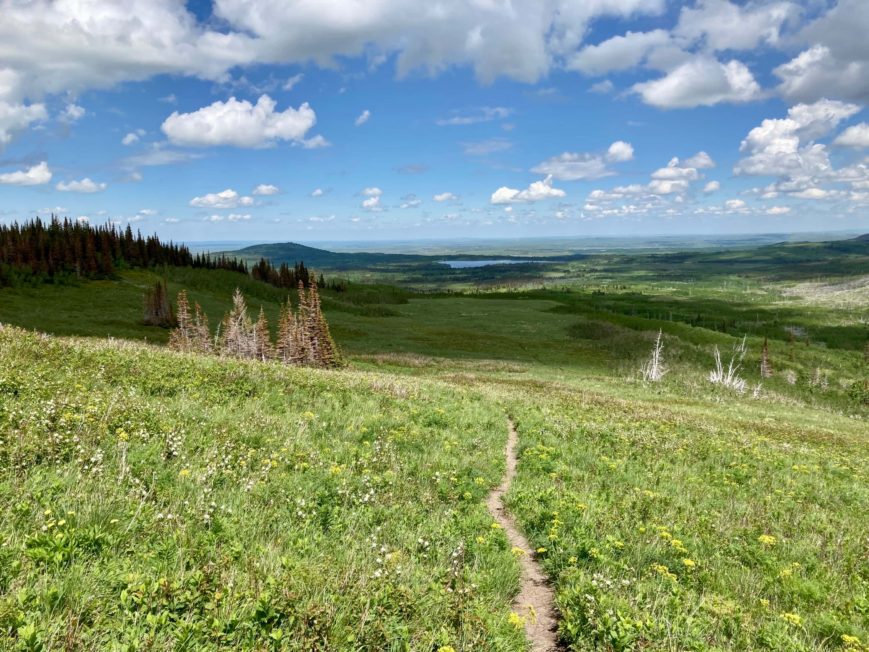
Route overview looking south.The parking area. Sofa Mountain is in the background.The approach trail is quite clear and goes through patches of forest and several clearings.Spruce grouseThe approach hike was actually really pleasant. Wildflowers were abundant.A Northern Geranium, I think.Boreal SandwortScarlett PaintbrushMountain Forget-Me-NotPretty Shooting Star (yes, “pretty” is part of its name)Alberta Wild RoseA telephoto view of the northeast ridge. From a distance the lower rock bands, the shoulder, and the three sections of the upper rock band are visible.Eventually there was a direct line of sight to the base of the northeast ridge (right). The waterfall coming down from the valley was also visible.A closer look at the waterfall.Leaving the trail and heading up grassy slopes to the lower rock bands.Looking back down from part way up.Far to the south, sticking up from a rockfall at the base of another part of the mountain, I saw these interesting rocks.The scramble up the lower rock bands was very straightforward.Up on the shoulder. Another steep grassy slope and upper rock bands ahead.Looking west from the shoulder.Getting close to the start of the more sustained scrambling section. Each section seemed to have a number of viable ways up. You could go head-on up the ridge or find weaknesses to the left.Scrambling up a chimney.The rock on the right gave the impression of a precariously balanced boulder.Another section of scrambling.Lots of handholds and footholds. No major exposure, but each section was tall enough that a fall could result in injury.Looking across the cliffs to the other side of the valley.A closer look at a little waterfall coming down the middle of the cliffs.Looking west. Aahkoinimaiistak (Mount Blakiston) had its head in the clouds most of the day.Next scrambling section.And some more scrambling.Eventually the rock bands peter out. From there it’s an uphill hike to where the northeast ridge intercepts the summit ridge.It’s roughly 2 km to the summit.Looking south from the ridge. Vimy Ridge is directly across the valley. A towering waterfall was coming down from a central hanging valley.A closer look at the waterfall.Looking back the way I came from partway along the summit ridge.Continuing towards the summit.To the south, Nii’tsitsspitaa (Mount Cleveland) was looking good that day. I think the slender peak to its right is Miche Wabun Peak. The reddish peak to the right of Miche Wabun had my attention through the day as changing light conditions attenuated its colour, but I don’t think it has a name.Cliffs below the summit. The route is on gently ascending terrain to the right of these, but it’s worth wandering over to enjoy the scenery, provided there’s no wind trying to blow you over.The large cairn on Sofa Mountain’s broad summit. Ninaiistako (Chief Mountain) in the background.The cairn and Ninaiistako.The cairn and Nii’tsitsspitaa (Mount Cleveland). The Blackfoot name means “The only tall person”.The cairn and Aahkoinimaiisták (Mount Blakiston).Summit panorama from southeast to northwest.NinaiistakoGable MountainNatoas Peak and Mount Merritt. The central jagged peak is, I think, part of Mount Merritt’s massif.Kaina MountainNii’tsitsspitaa and Miche Wabun PeakVulture Peak. Kootenai Peak and Redhorn Peak are the two lower peaks on either side.Un-named red argillite peak. I believe this sits right on the international border.The Guardhouse and Mount Carter are the two big peaks at centre.Chapman Peak and Kintla PeakKinnerly Peak and Mount CusterLong Knife Peak. Mount Richards is in the foreground.Mount Alderson. Akamina Ridge in the background to the left. Starvation Peak in the background right.Bertha Peak is the darker coloured mountain in the foreground. Buchanan Peak is the lighter one behind Bertha. The dark ridge beyond is part of Lineham Ridge.Mount LinehamWhen I started to descend, Aahkoinimaiistak finally got her head out of the clouds. Saikimao’pii (The Person Who Sits Across the Valley, Mount Crandell) is on the right.A last look across the valley at Vimy Ridge before leaving the summit ridge.Descending the scrambling terrain.Sheep grazing on the grassy shoulder.I gave them lots of room and only briefly drew their attention.These two with the big horns were moving on towards the valley.This bunch were content to stay up on the shoulder.Almost back to the base of the mountain.Walking out.


Lots of scenic photos of many peaks, Par. Good job!
Bal Boora
>
LikeLiked by 1 person
Just did this today. Lovely scramble! Did the loop. Your website and reviews were invaluable as always!
LikeLiked by 1 person
Glad it was useful. Thanks for reading!
LikeLike