Note: This data is for the full Hawkins Horseshoe route, but the trip report will be split up into multiple posts.
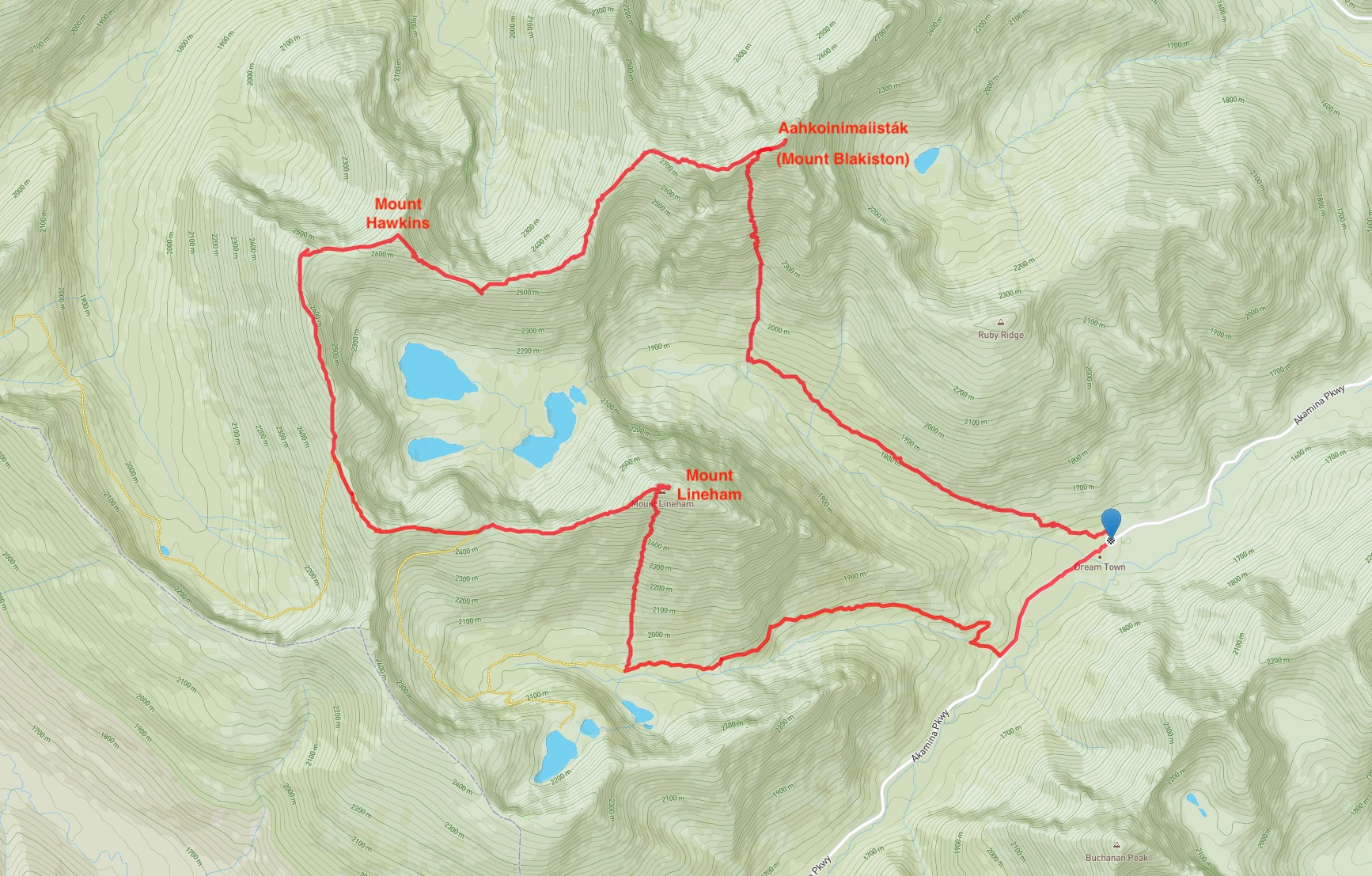
I’ve been waiting to do this trip for a long time but between work, weather, family, and forest fires the time never seemed right. So as July 2022 neared its conclusion, and I had a free day which was forecast to be scorching hot but clear, I knew I had to get this one done. The Hawkins Horseshoe is a full day ridge walk, which starts with a scramble to the summit of Aahkoinimaiisták (Mount Blakiston), which is the highest peak in Waterton. From there the route continues around the “horseshoe” ridge which encloses the sapphire Lineham Lakes on the north, west, and south. Mount Hawkins is tagged along with way, and the ridge walk concludes at the top of Mount Lineham, Waterton’s 2nd highest peak. The beginning of the trip is on the Lineham Falls trail, and the end is on the Rowe Lakes trail. The trip is Waterton’s scrambling tour de force.
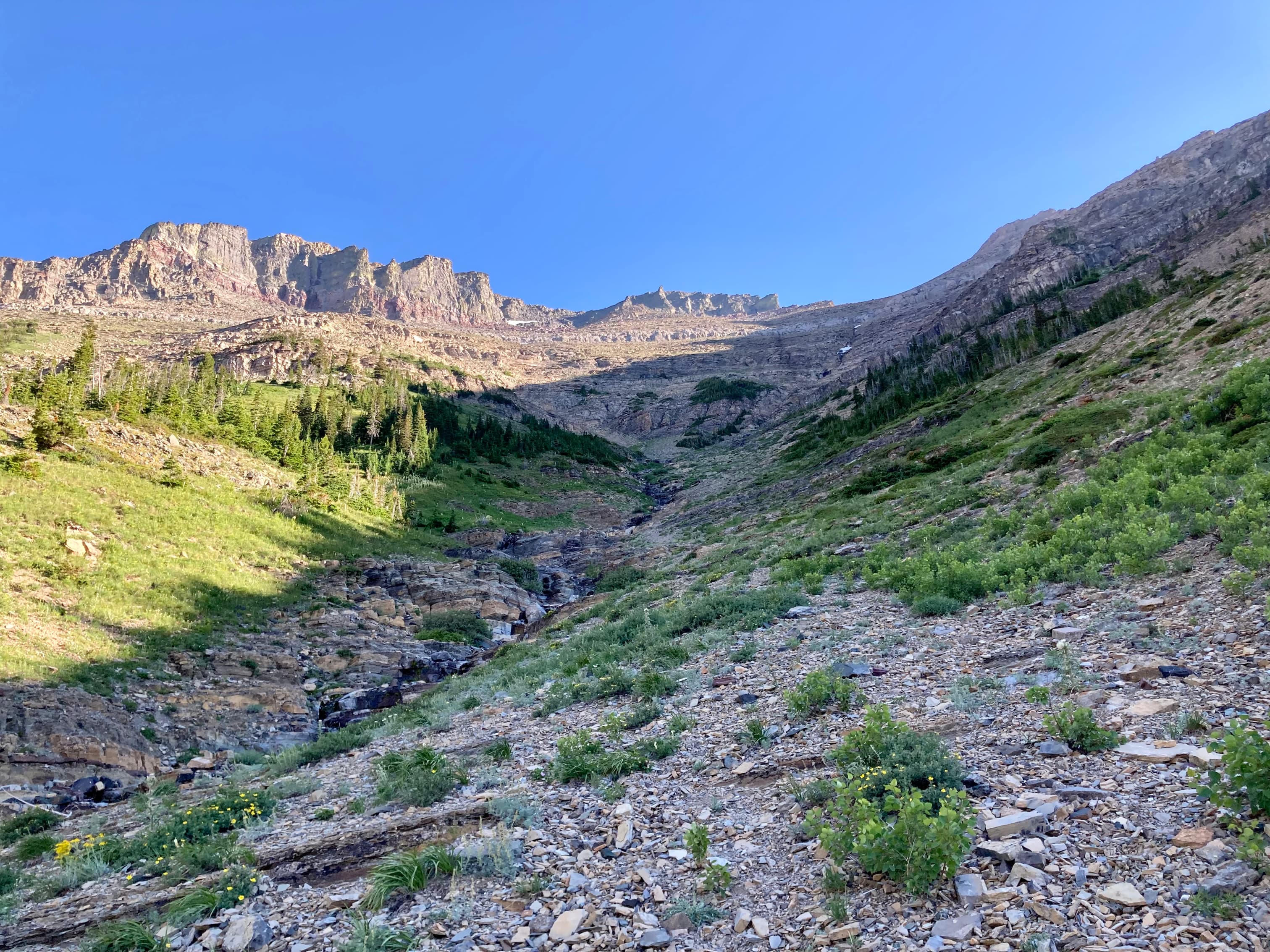
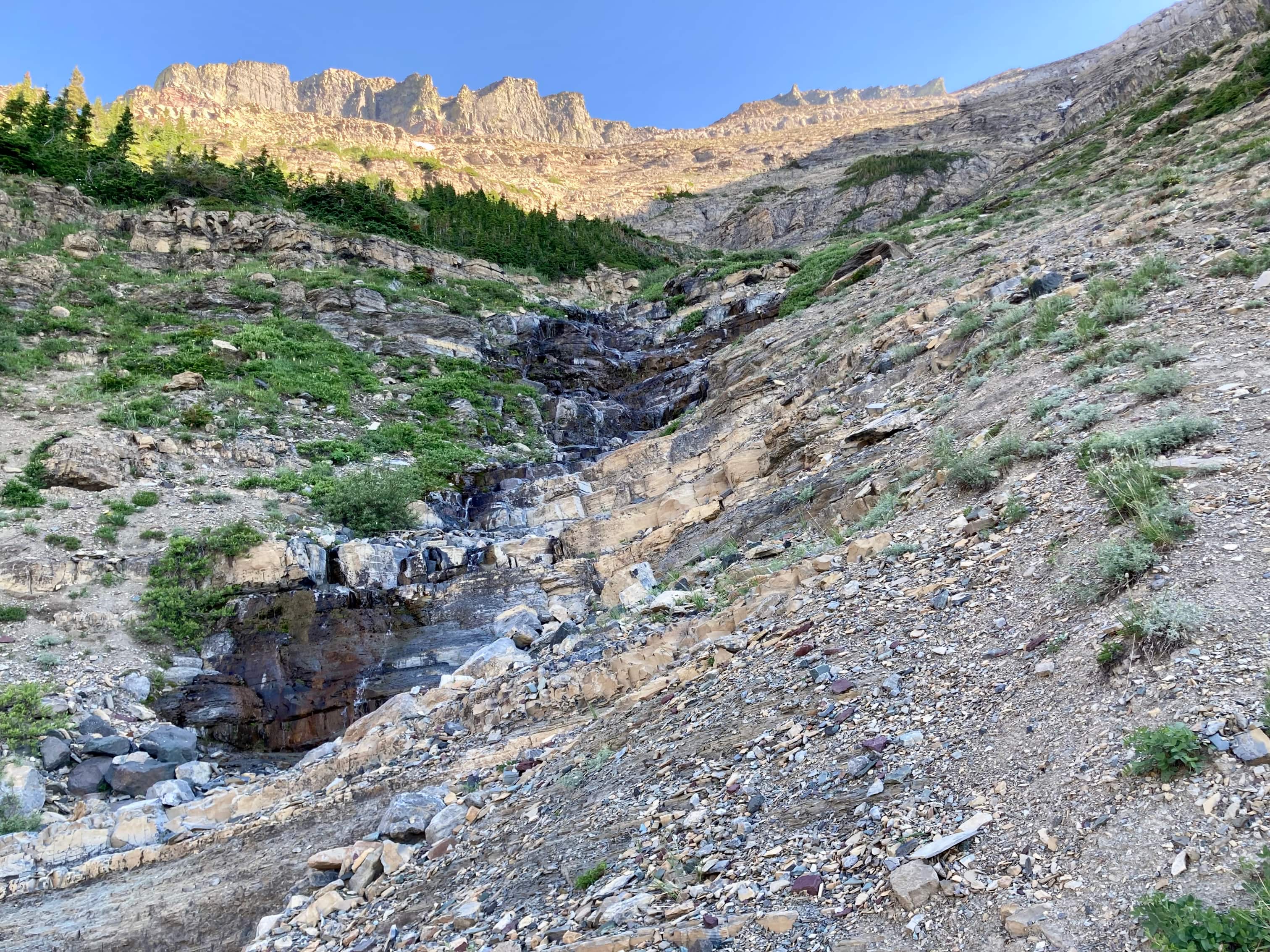
The route begins at Lineham trailhead. The large, clearly signed parking area is about 9 km up the Akamina Parkway from the Waterton townsite. At roughly 3.4 km the trail emerges from the trees and you get a clear view of Lineham Falls in the distance. The clearing is one of the major drainages/avalanche pathways coming down from Blakiston’s south face. The scramble starts here. I ascended along the right side of the drainage, seeing signs of a trail here and there. I knew that I wanted to direct myself to the right side of the huge black summit block far above. As I ascended, the block went out of sight, but I continued ascending along the easiest route visible, eventually bearing a little left and finding myself on decent scrambling terrain, intending to veer right eventually. I carried on like this until I could once again see the black rocks of the summit, and could also see that I was fairly far left of where the usual ascent route was.
I continued climbing and bore right somewhat, but soon after I realized that I could actually see a clear path up to the summit ridge just above me. I ended up completely missing the dramatic couloir described in Kane’s book which ascends through the black rocks. I was a little disappointed, since I’d been looking forward to climbing that. On the other hand, the way I’d gone was a very rapid ascent and I had spent almost no time toiling on scree. It was a pretty satisfying scramble. I walked up to the summit ridge, turned right and walked 200 metres to the summit. It took about 3 h 20m from the trailhead.
Aahkoinimaiisták features no substantial cairn or register. There was a small pile of rocks marking the summit and I didn’t feel the urge to build it up. The air was almost totally still, even at that altitude. Although it was a little hazy I still had great views in all directions. After taking some time to ponder the surrounding vista I set off to the west towards Mount Hawkins. The trip report will continue in Hawkins Horseshoe Part 2: Mount Hawkins.
Click on the pictures in the gallery below to access higher resolution images.
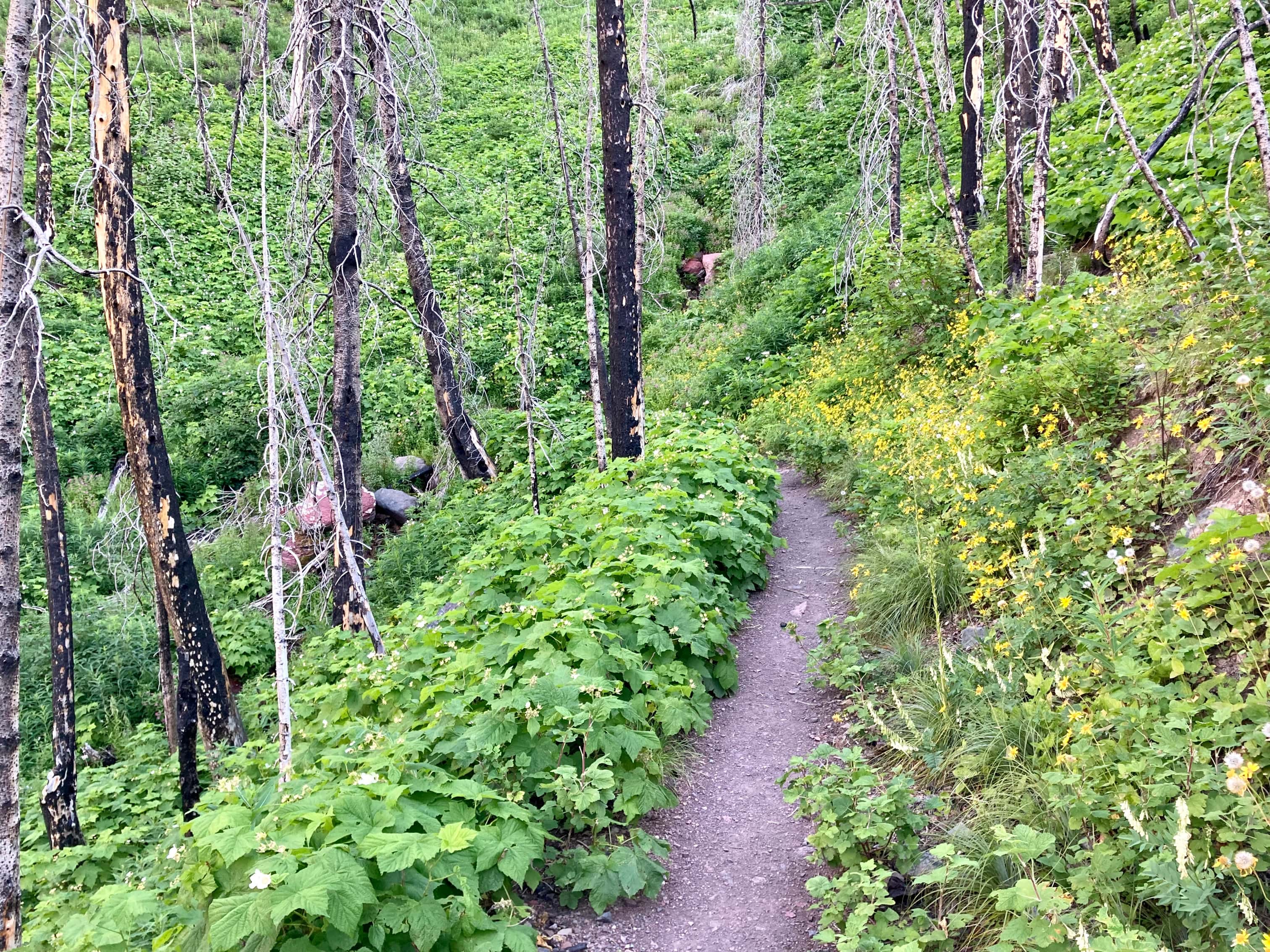
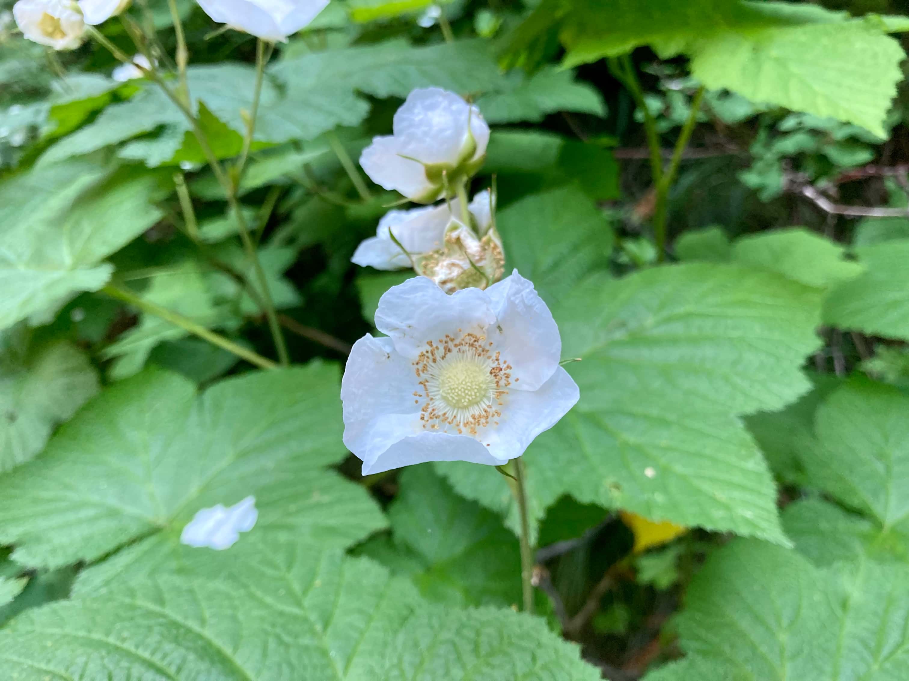
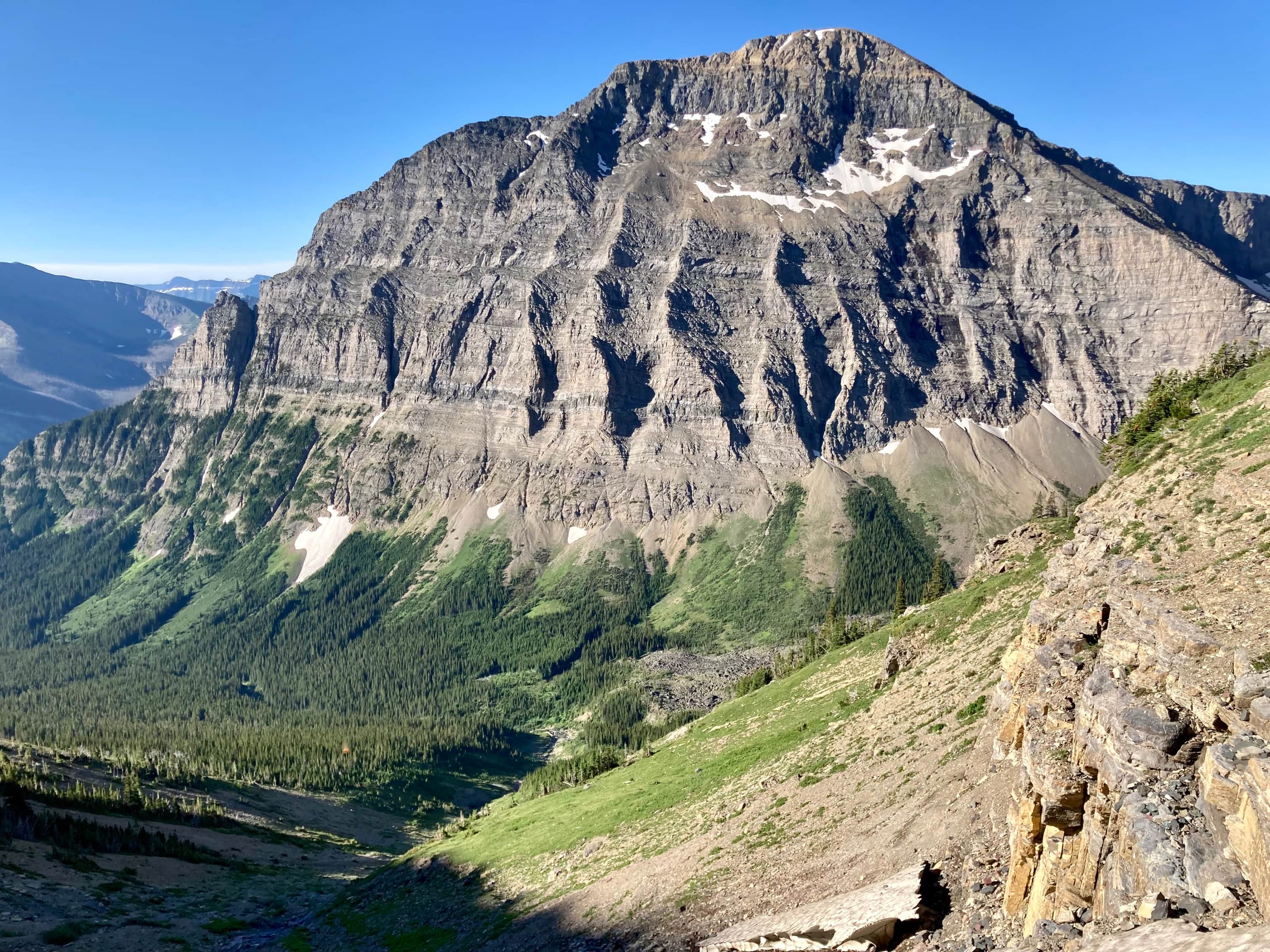
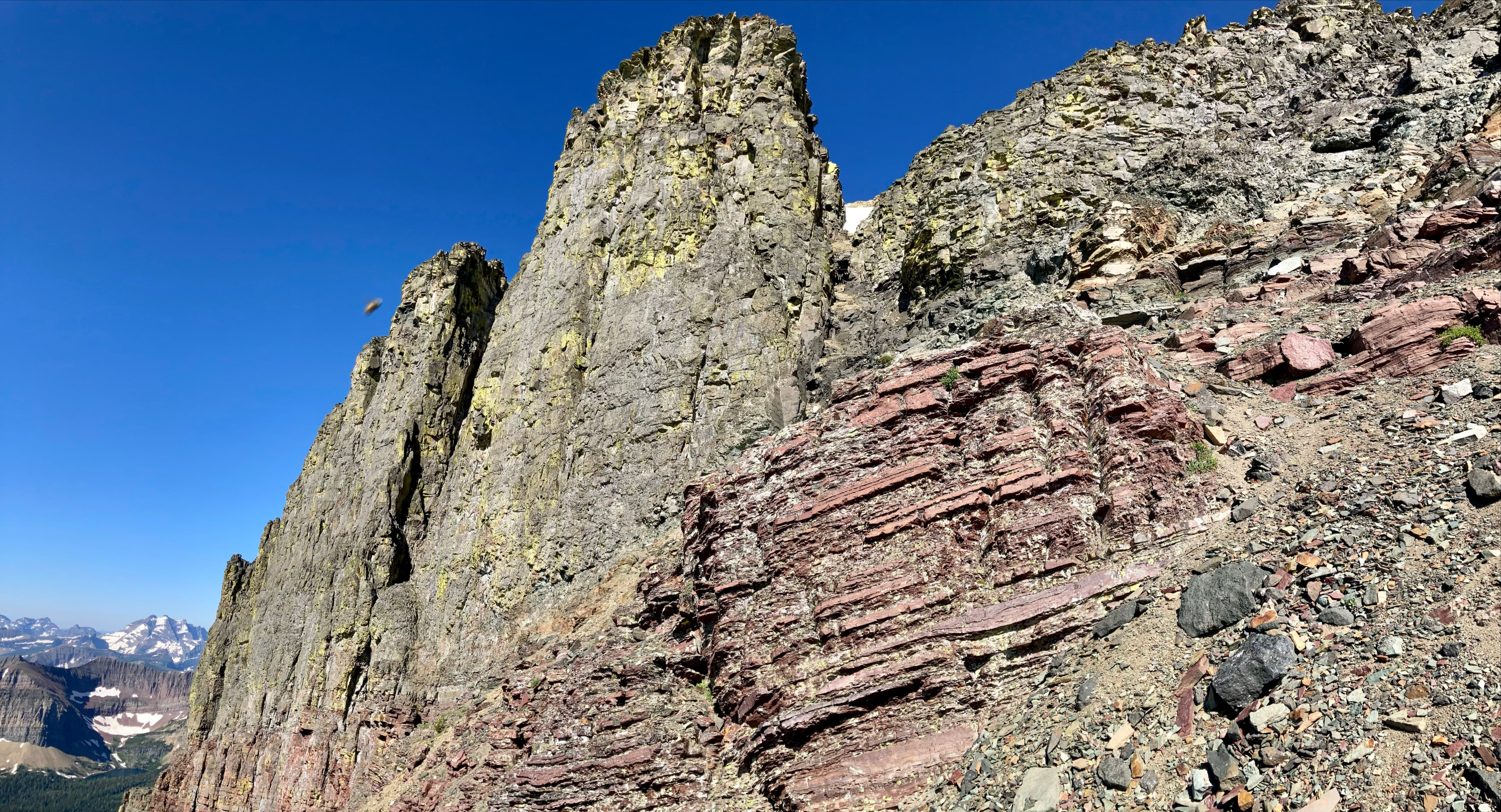
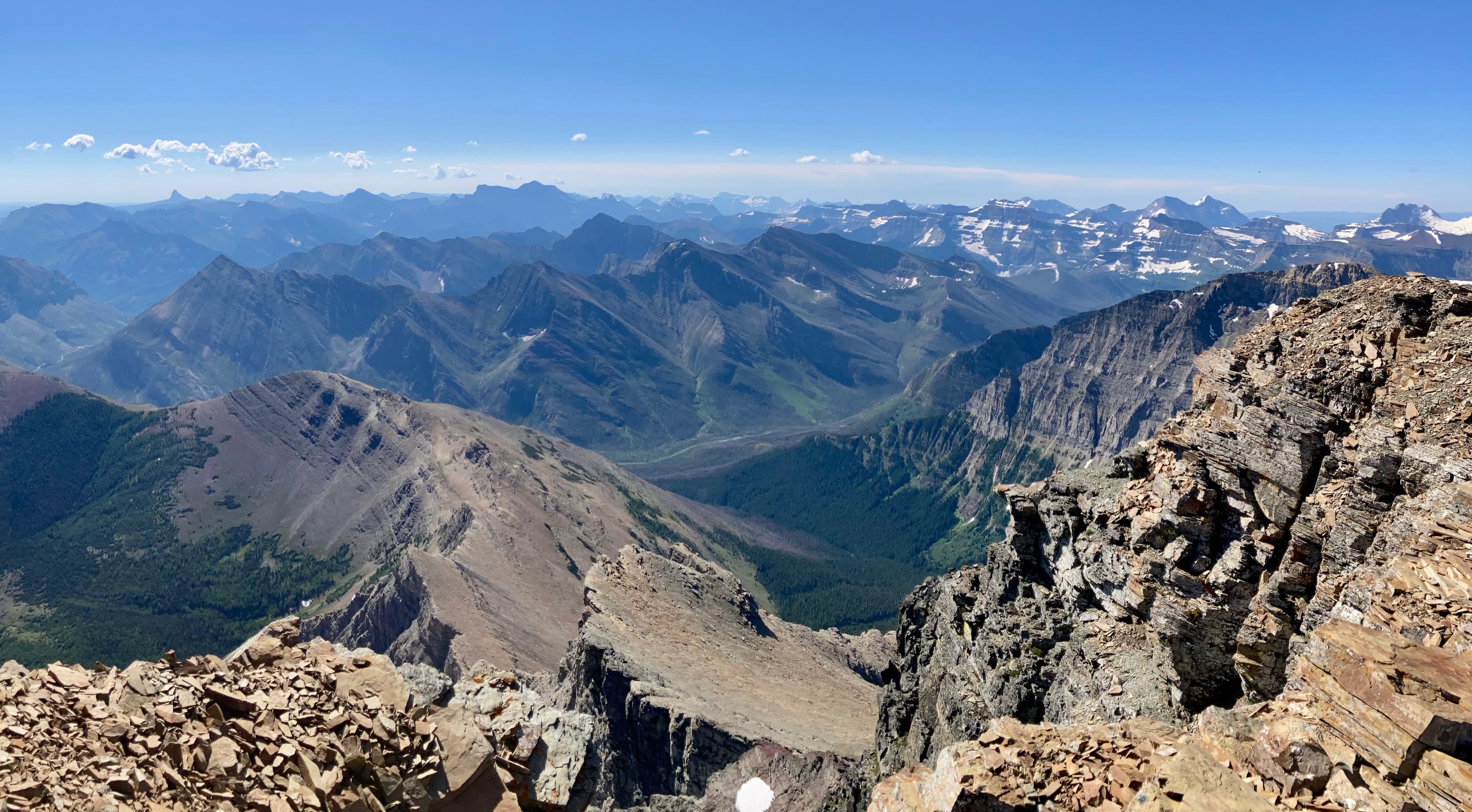
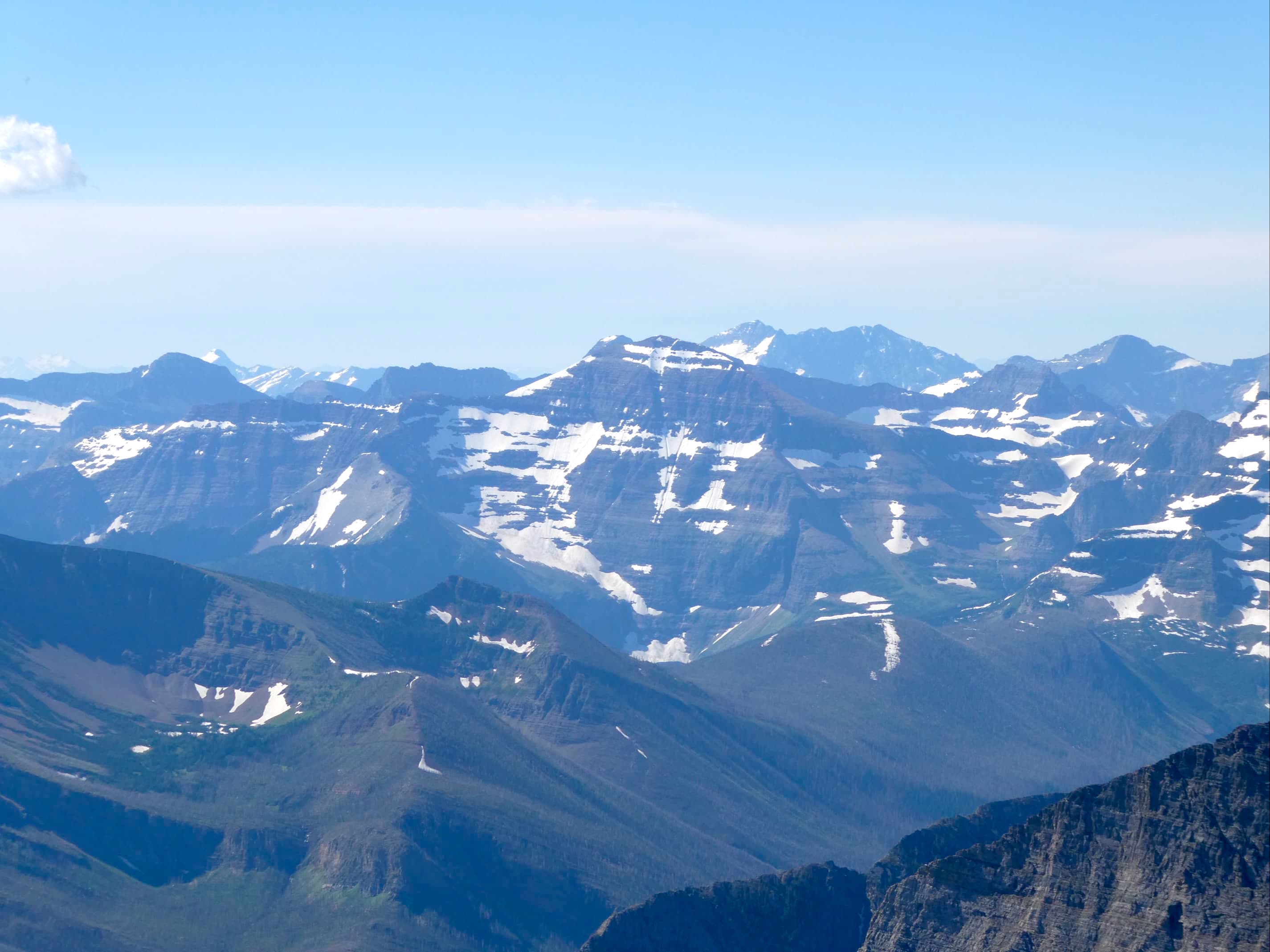
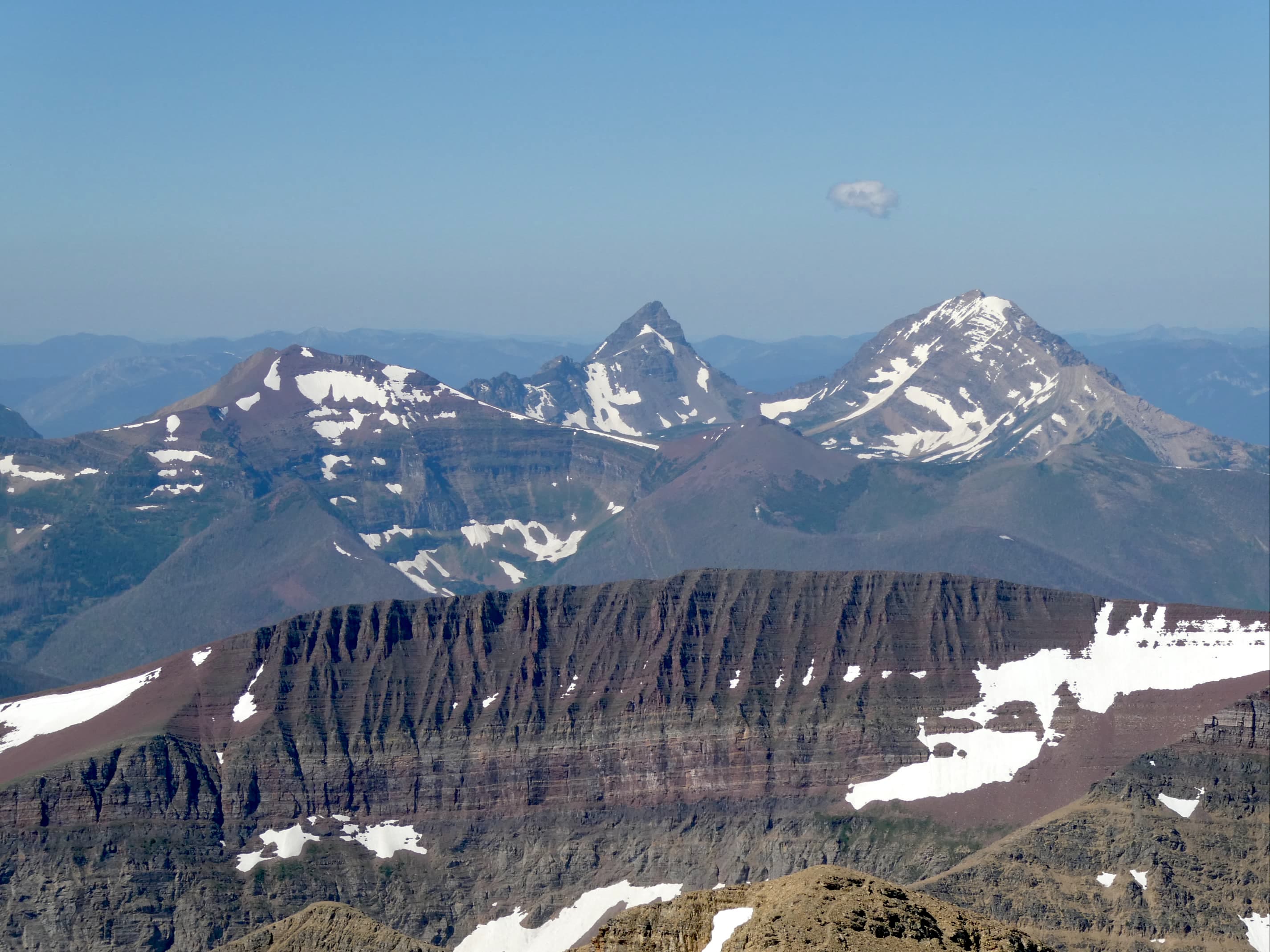
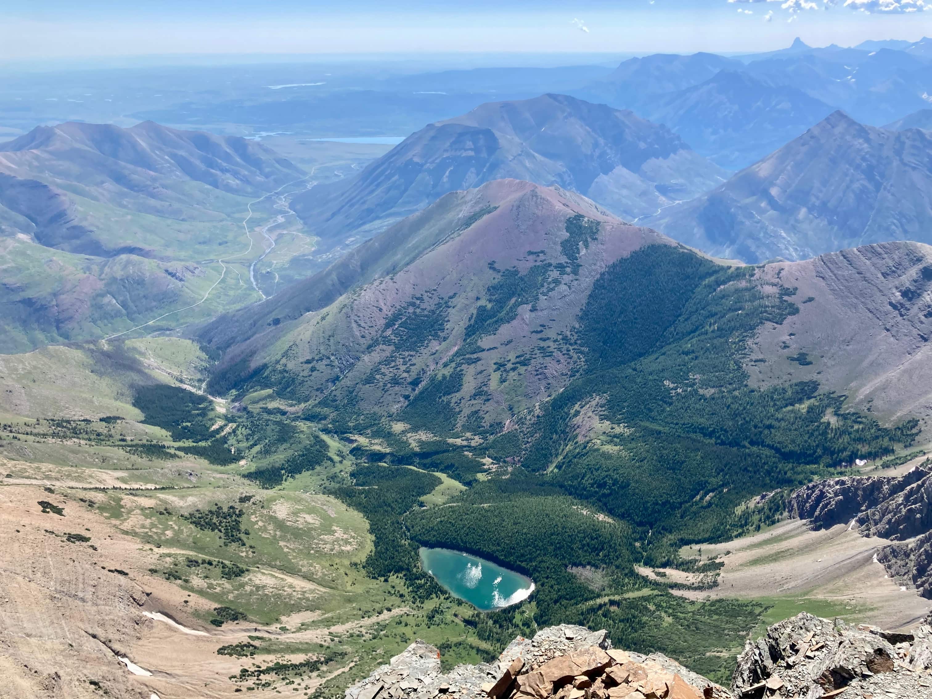
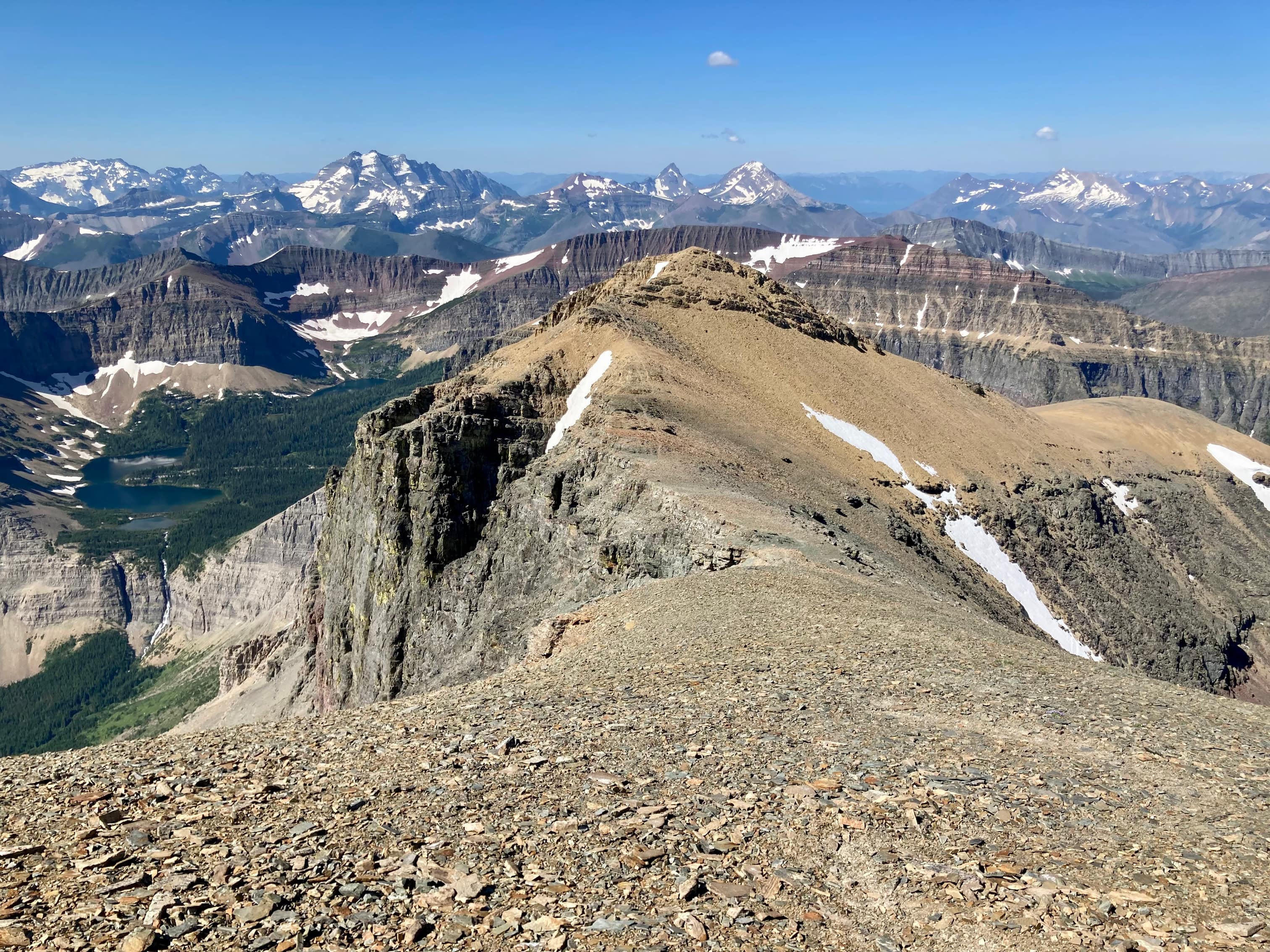
Overview of the entire Hawkins Horseshoe Route, travelled counter-clockwise.If anyone’s interested in how my route deviated from the “usual” one, here’s my track (blue) and the track from Topo Maps Canada – which I think is Bob Spirko’s (red). At the spot were the ascent drainage splits around an island of trees, I carried on following the leftward limb instead of cutting hard back to the right.Early morning on the Lineham Falls trail. Mount Lineham’s north face is lit up.On my own again. After several weeks of group outings, I was back in my usual state.A portion of the Lineham trail goes through burned forest. The underbrush was growing vigorously.Thimbleberry bushesThimbleberry flowersThe first clear view to Lineham Falls coming down the headwall at the end of the valley. Just past here the trail descends into the avalanche pathway.A closer look at the falls. Hiking to the foot of Lineham Falls makes for a great outing in itself.Looking up the ascent drainage. Aahkoinimaiisták’s Summit block is at centre. The foreshortened view makes the mountain seem somewhat squat in a photograph. The summit is still something like 1100 vertical meters above this point.Ascending to the right of the drainage. As I got higher the angle of the mountain slope resulted in a loss of line-of-sight to the summit block, but at this point the route was clearly visible.Staying close to the drainage allowed for a steep but easy ascent, with areas of step-like rock.Where the exposed rock of the ascent drainage fizzles away there’s this view of two subsidiary drainages descending on either side of a treed rocky outcrop. The summit block is now out of sight – the tall cliffs to the left of centre are west of the summit. I decided to go through the obvious weakness on the left and then angle back towards the right. Turns out I didn’t angle back enough (or at all). I ended up just continuing to climb straight up.Moderate scrambling territory without any major exposure.Taking a break to look back at Mount Lineham.With some more climbing I soon got to the very well defined stratum of the Purcell Sill. I knew that the tall rocks to the left were not the summit, nor the prominent rocks to the far right. I figured I’d see the summit block once I got over the Sill.Looking towards Lineham Falls, I could see that I had climbed above the level of the headwall and could see into the Lineham Lakes’ hanging valley.Up against the Purcell Sill. The usual route ascends through it some distance to the right. At this point I was still blithely doing my own route-finding so I climbed up a short ways left of here. Above the Sill. The black rocks of the summit block come into view but now I can see I’m too far to the left to be on the usual route.I took a little break to check out some flowers. I haven’t successfully identified this one.Admiring the rock towers as I close in on the summit ridge.Looking at Lineham Falls again. I had climbed high enough that peaks in Glacier National Park were visible beyond the intervening ridges.Carrying on, I could see that I was a short and easy climb away from the summit ridge. At this point I did take out my GPS and confirmed my suspicions of my location.This high point came into view on my left and I could tell I was running out of mountain to climb.Once I was up on the ridge, I turned right and walked up to the summit.The summit of Aahkoinimaiisták (Mount Blakiston).Looking southeast. Ninaiistako (Chief Mountain) is seen at the left. Just left of centre is Nii’tsitsspitaa (Mount Cleveland). Buchanan Ridge is across the valley.Chapman PeakMount Carter and Rainbow Peak in the distance. Mount Custer is at centre just in front of them.Looking southwest. Mount Peabody, Kintla Peak, and Kinnerly Peak on the left. Long Knife Peak, King Edward Peak, and Starvation Peak near centre. Miskwasini Peak, Kenow Mountain, and Langemarck Mountain on the right.Mount Peabody and Kintla Peak with the Agassiz Glacier between them. Kinnerly Peak is right of centre blocking out part of Kintla Peak.Long Knife PeakKing Edward Peak and Starvation Peak.Miskwasini Peak, Kenow Mountain, and Langemarck Peak.Looking northwest. Anderson Peak is at centre. Newman Peak, Mount Glendowan, Cloudy Ridge, and Mount Dungarvan are beyond Anderson from centre to right.Looking southwest. Mount Galwey is near centre. “Rogan Peak” is to Galwey’s left along the ridge. Mount Dungarvan is to the left of Rogan. Ruby Ridge is across the valley to the right. Mount Crandell is right of centre, beyond Ruby Ridge. A little off the summit I had a better line of site to the west. Mount Lineham is across the valley. Lineham Lakes and Falls are to the right.A closer look at the lakes.Looking directly east and down. Ruby Lake sits in its little valley between Aahkoinimaiisták and Ruby Ridge.Setting off to the west. Part 2 of this trip report will detail the ridge walk to Mount Hawkins.


Wow, this looks absolutely incredible! The views are just amazing. Also, the unidentified purple flower is called Sky Pilot!
LikeLiked by 1 person
Thanks for identifying that for me!
LikeLiked by 1 person