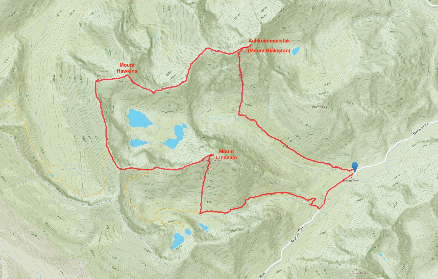
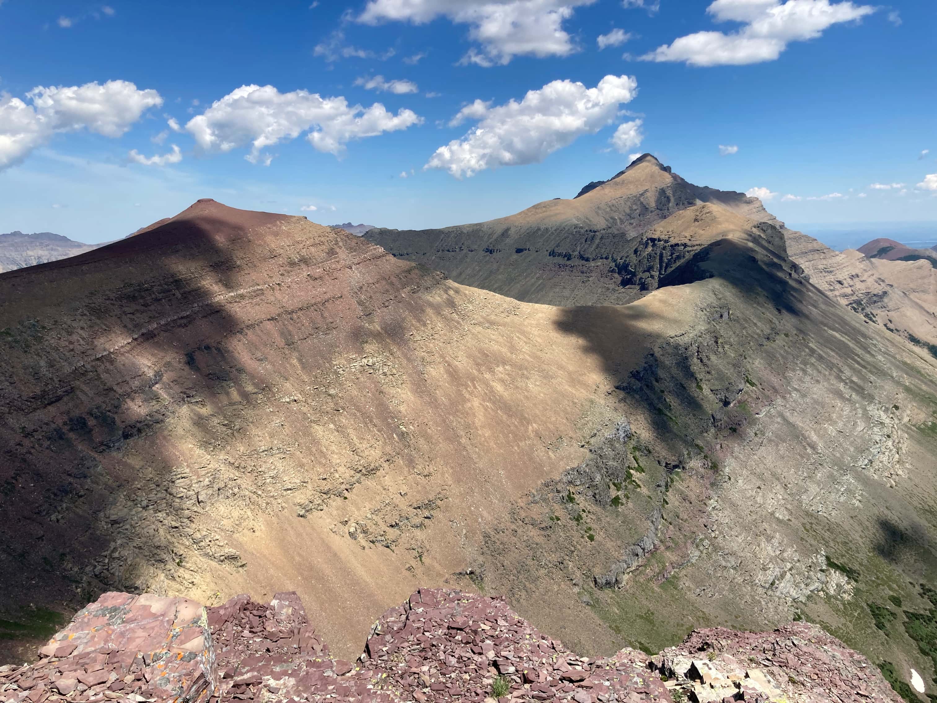
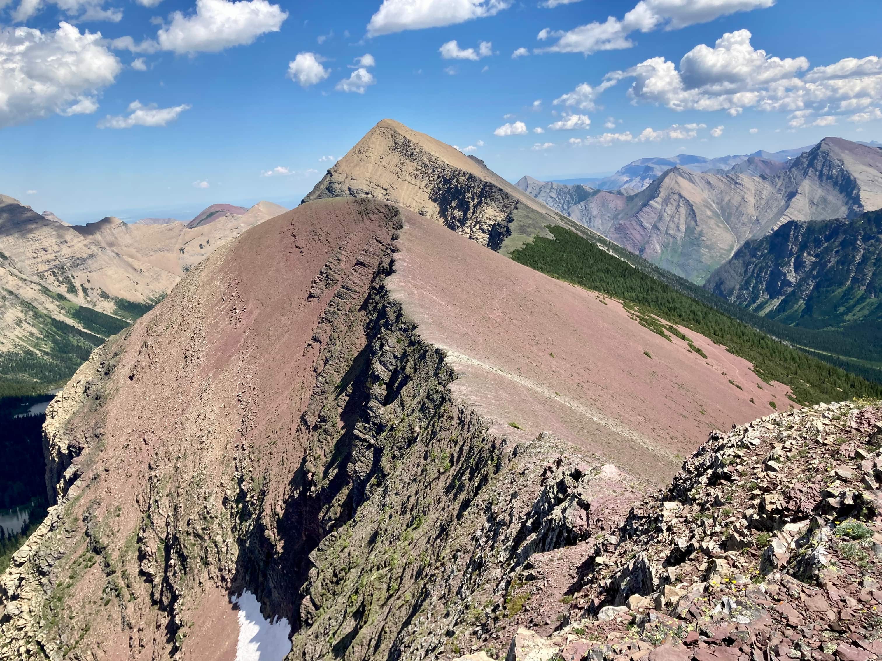
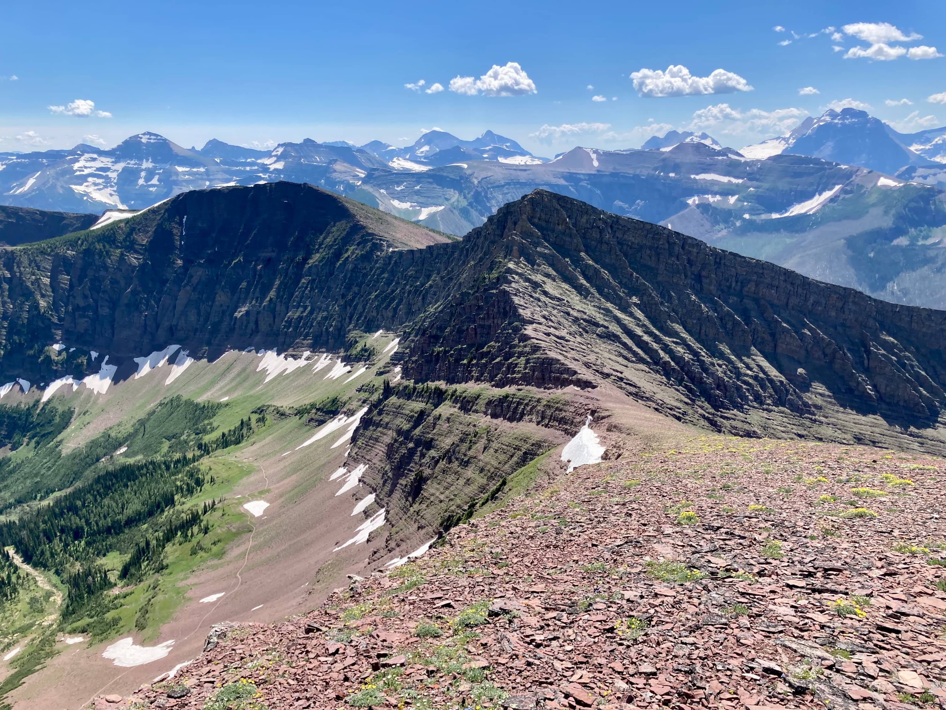
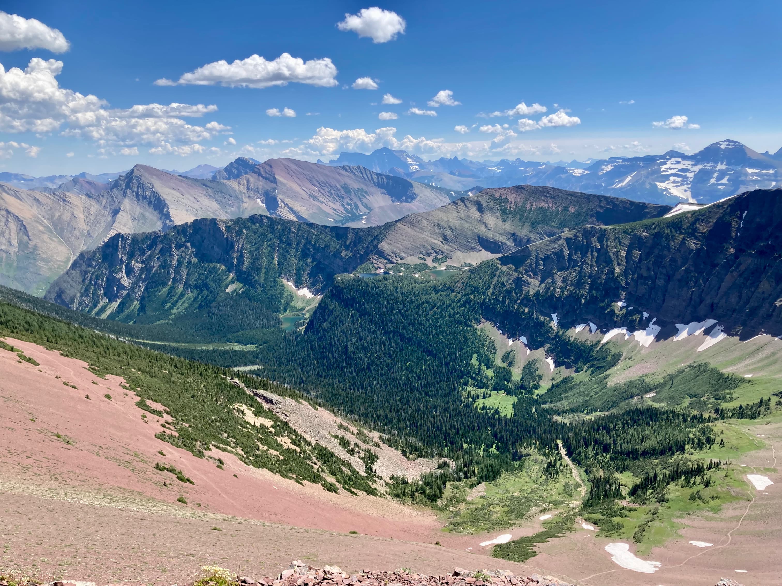
From Mount Hawkins to Mount Lineham there’s no more scrambling to be found, just a very pleasant ridge walk south and then east on Lineham Ridge and a final ascent to the summit of Mount Lineham. Part way along the southbound leg, the route joins the Tamarack trail. After complete solitude through the trip so far, I encountered a few parties once I was on the Tamarack trail. One group was planning to visit the Lineham Lakes via a gentle southeast facing slope descending from Lineham Ridge. The others were up on the summit of Mount Lineham, having ascended from the Rowe Meadow side (which is an excellent trip in itself – see this post for details).
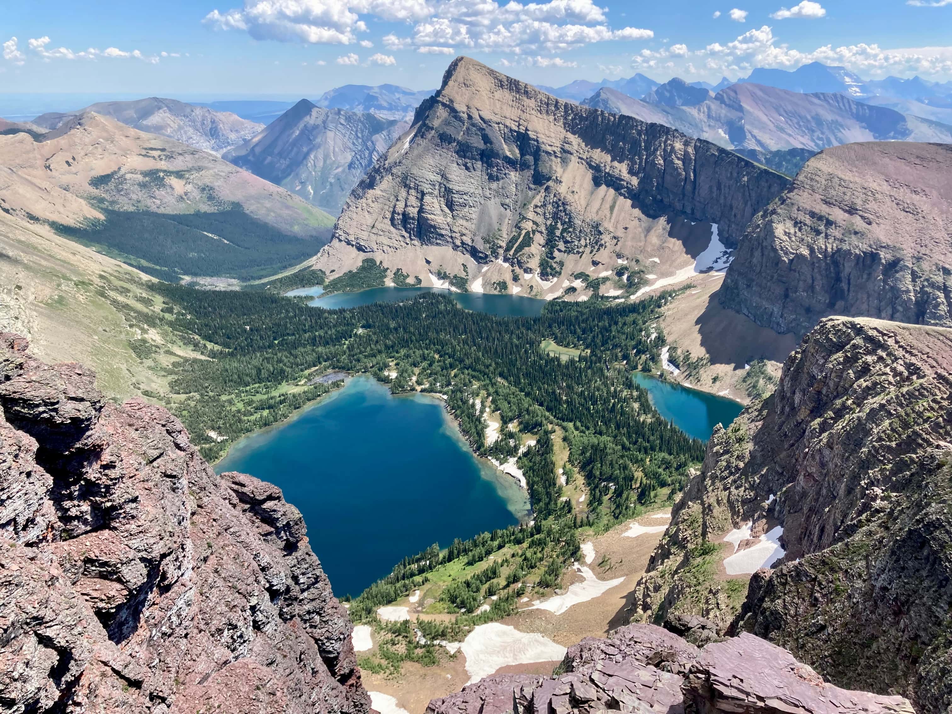
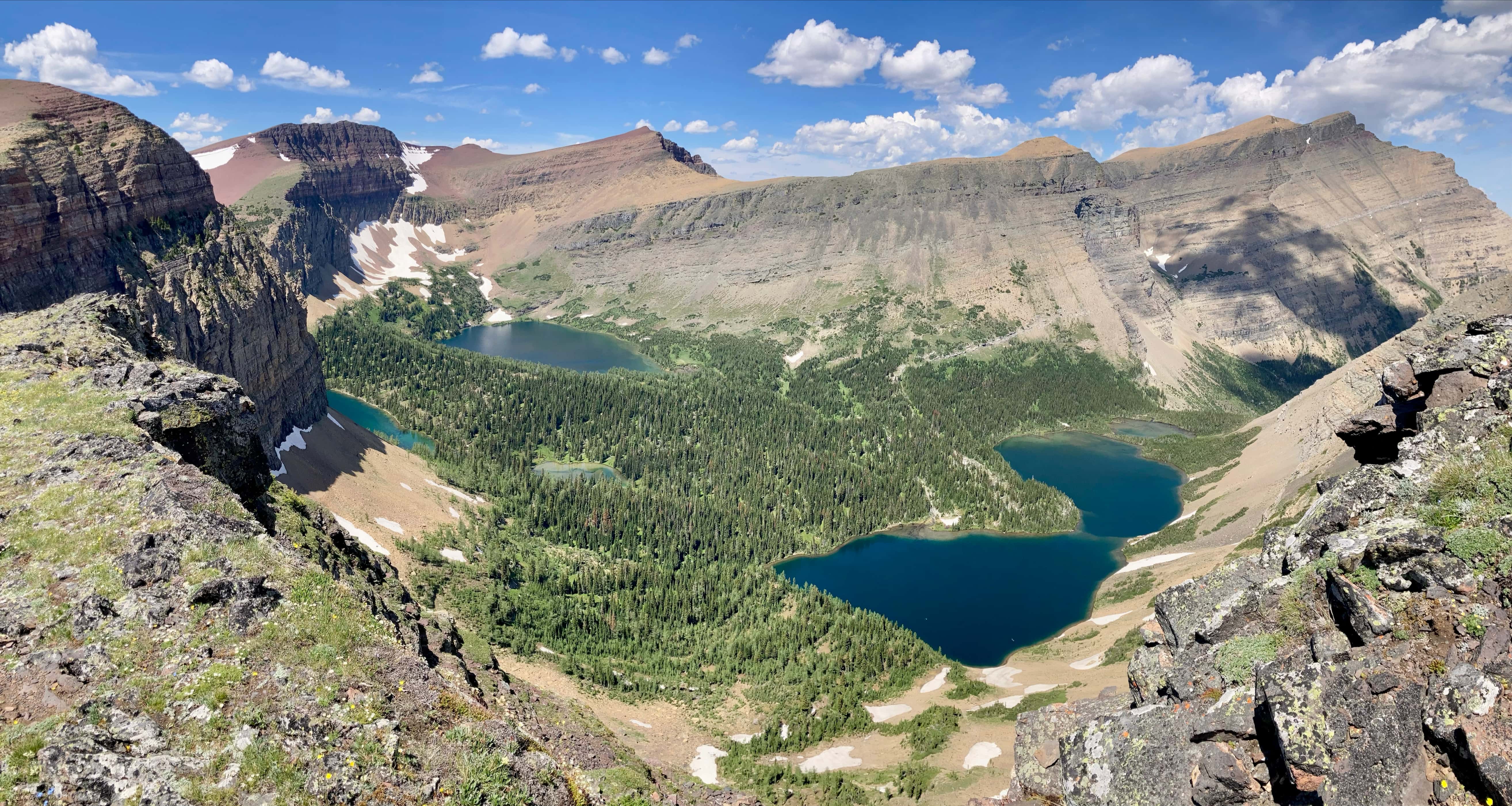
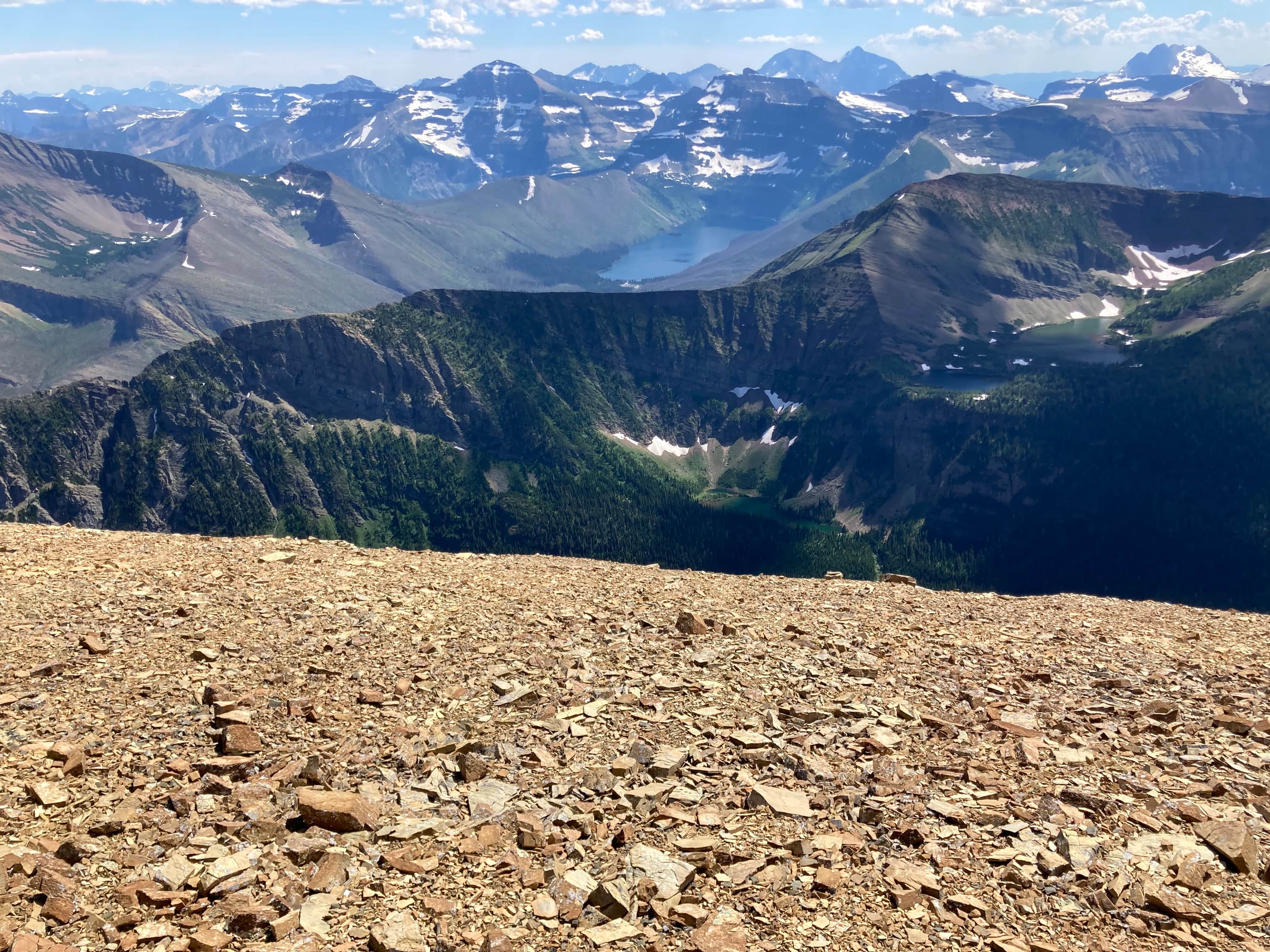
By the time I was ascending to Mount Lineham I was starting to tire and the day had become quite hot. It was a bit of a slog climbing the last 100 metres to Lineham’s massive summit cairn. I rested there for a while enjoying the unique views to the south – from this vantage Cameron Lake and the Upper and Lower Rowe Lakes are all visible simultaneously.
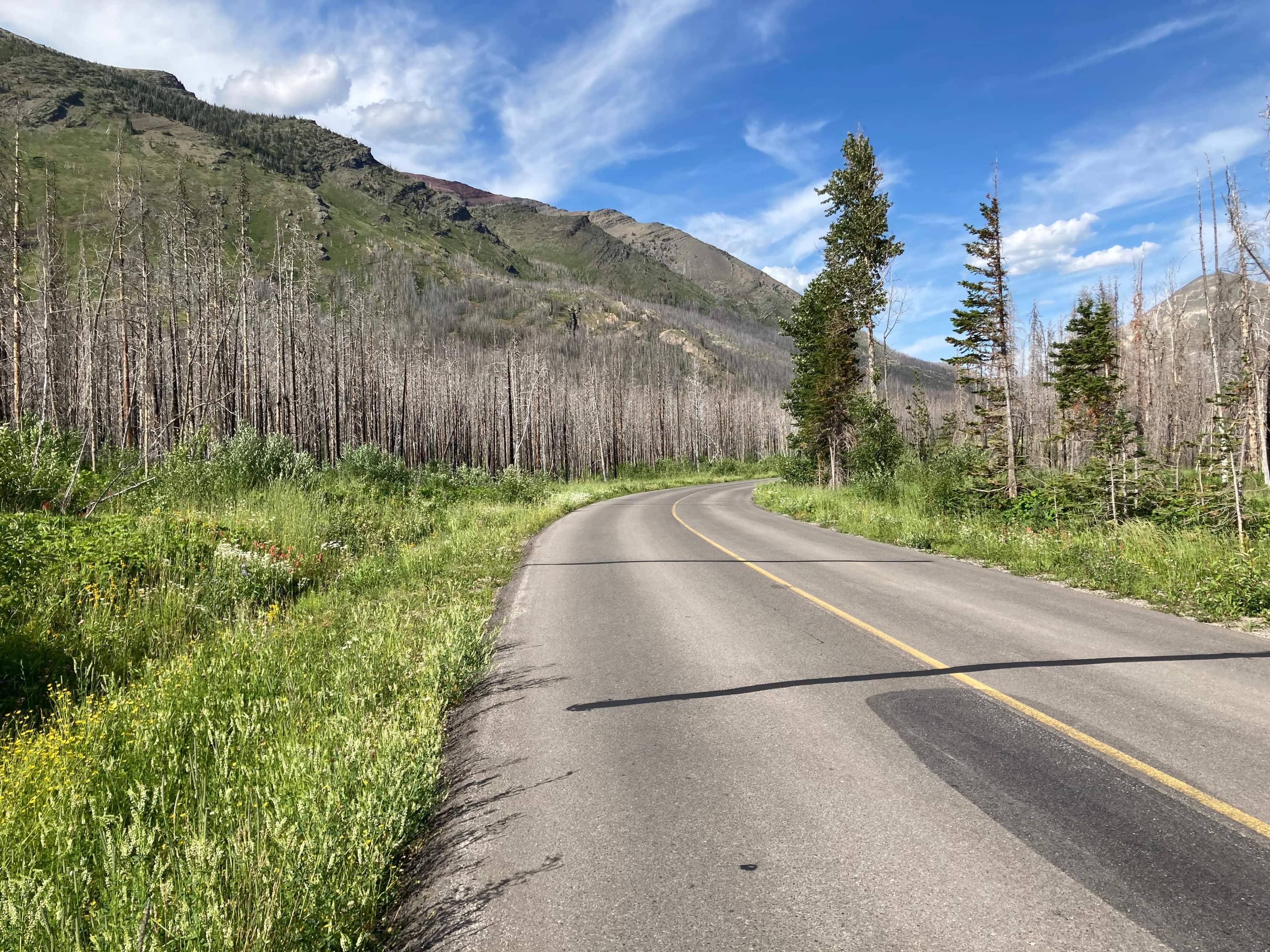
For my descent I went directly down the avalanche pathway south of the summit back to the Rowe Lakes trail. Short rock bands and sections of rubble on slabs kept this from being a carefree scree skiing descent but it was quite rapid. Other parties were ahead of me and the steep slope meant I had to deviate a little off the best line just in case I knocked any rocks downward. Once down to the valley floor there was a bit of a bushwhack to get to the trail but there was a faint animal trail visible which made things easier. After following the Rowe trail back to the parking area I walked 1.3 km back along Akamina Parkway to my car at the Lineham trailhead.
Click/tap on the pictures in the gallery below to access higher resolution images.
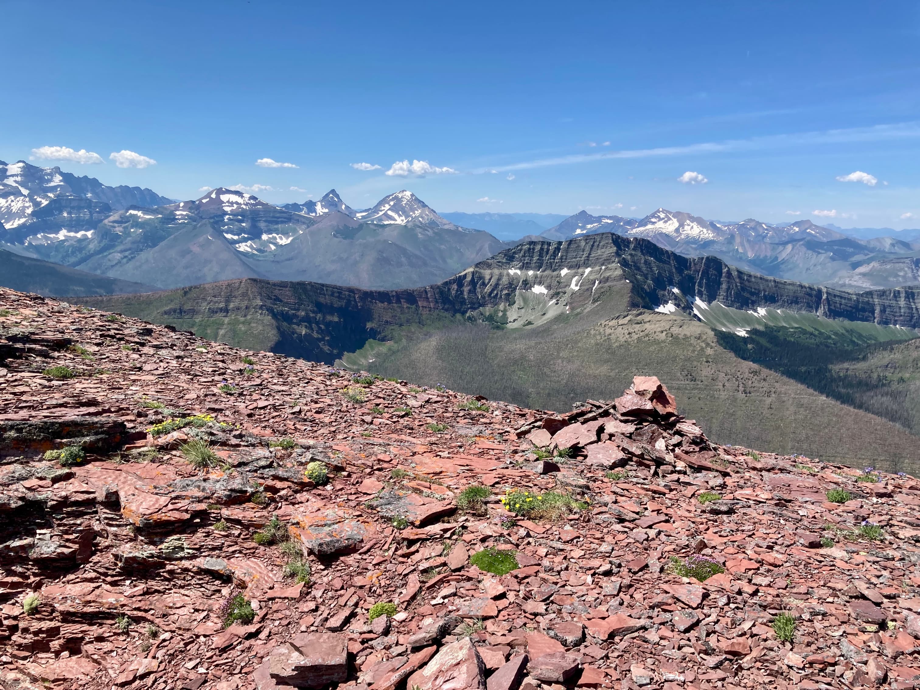
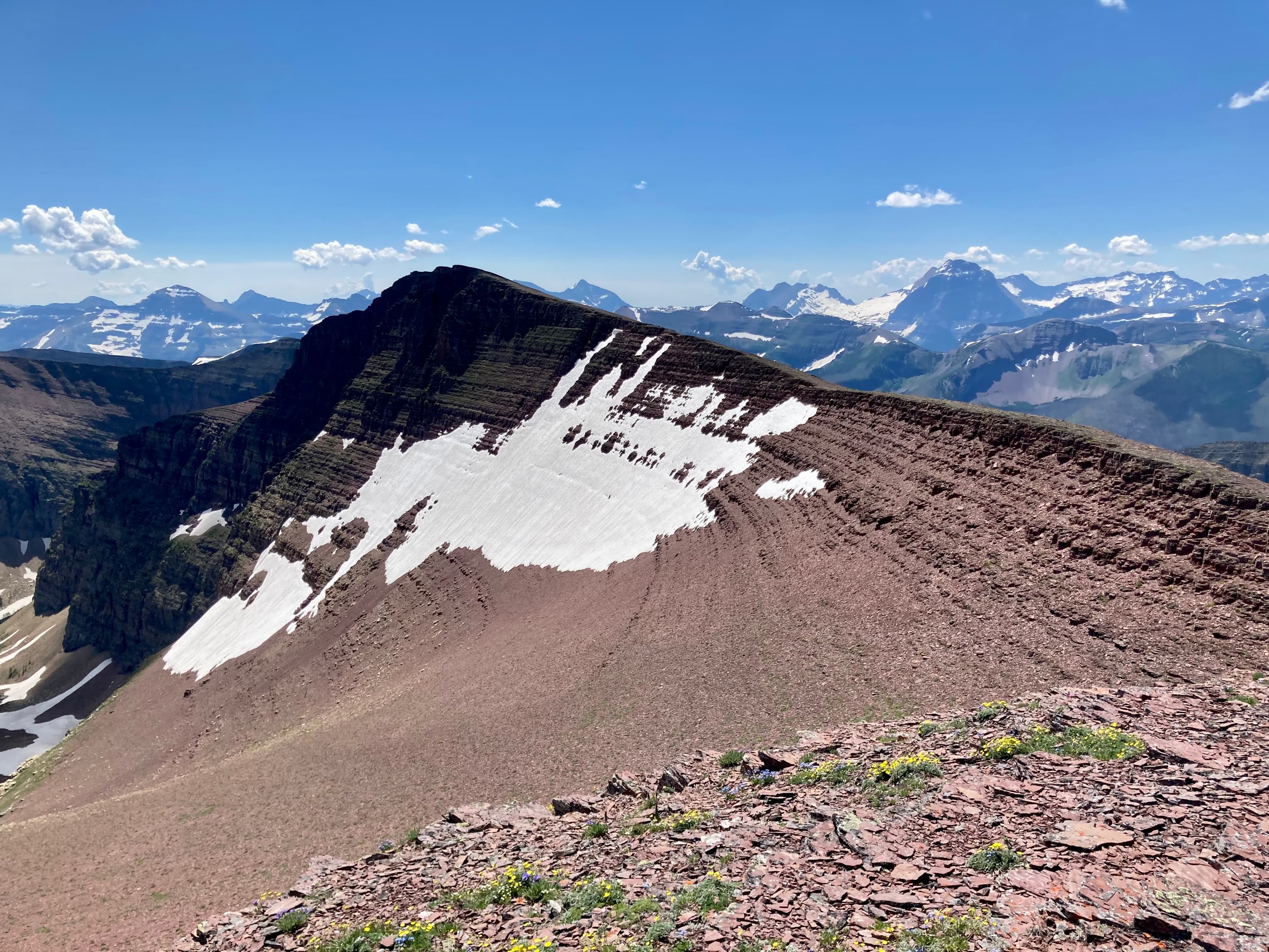
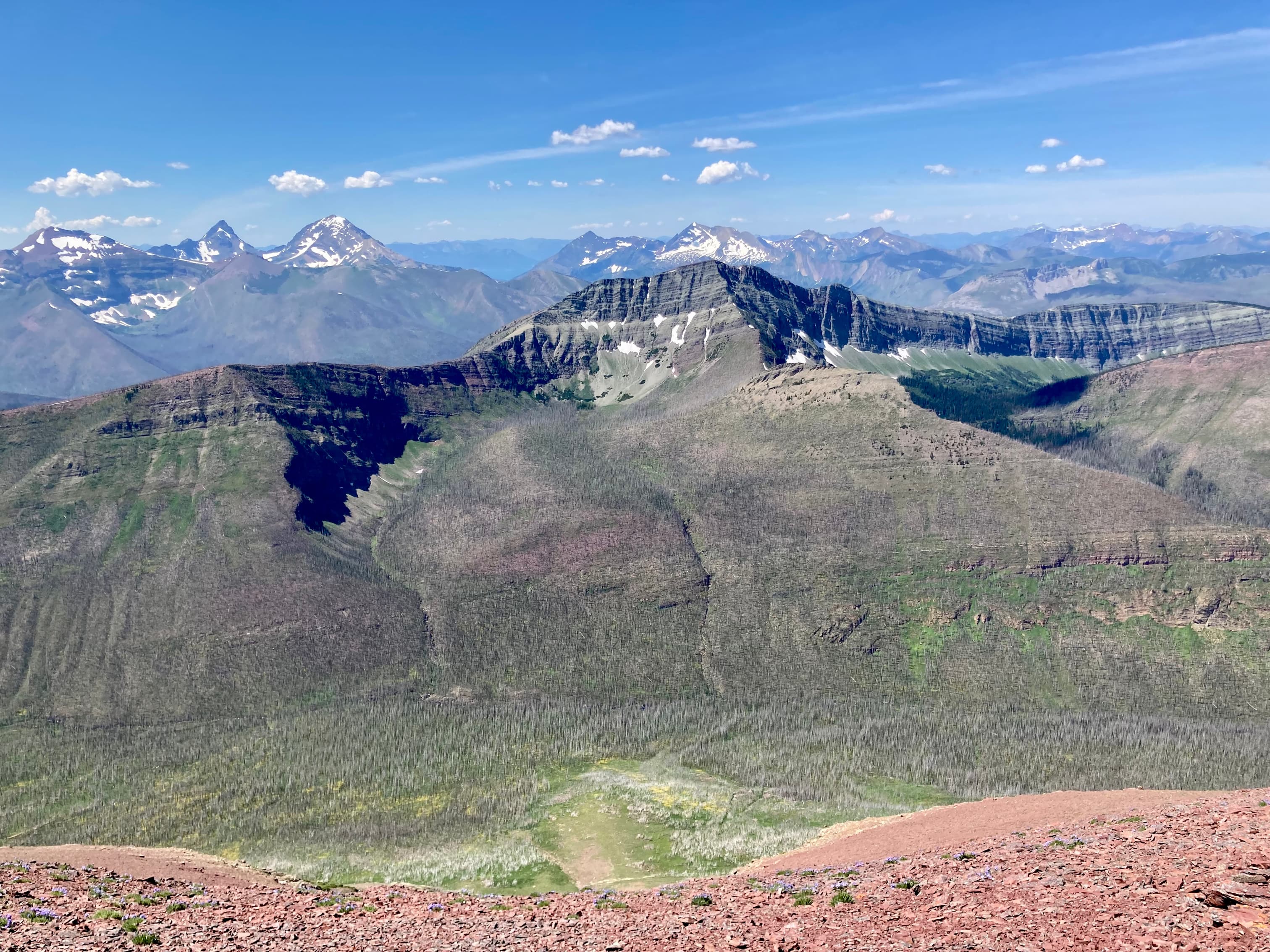
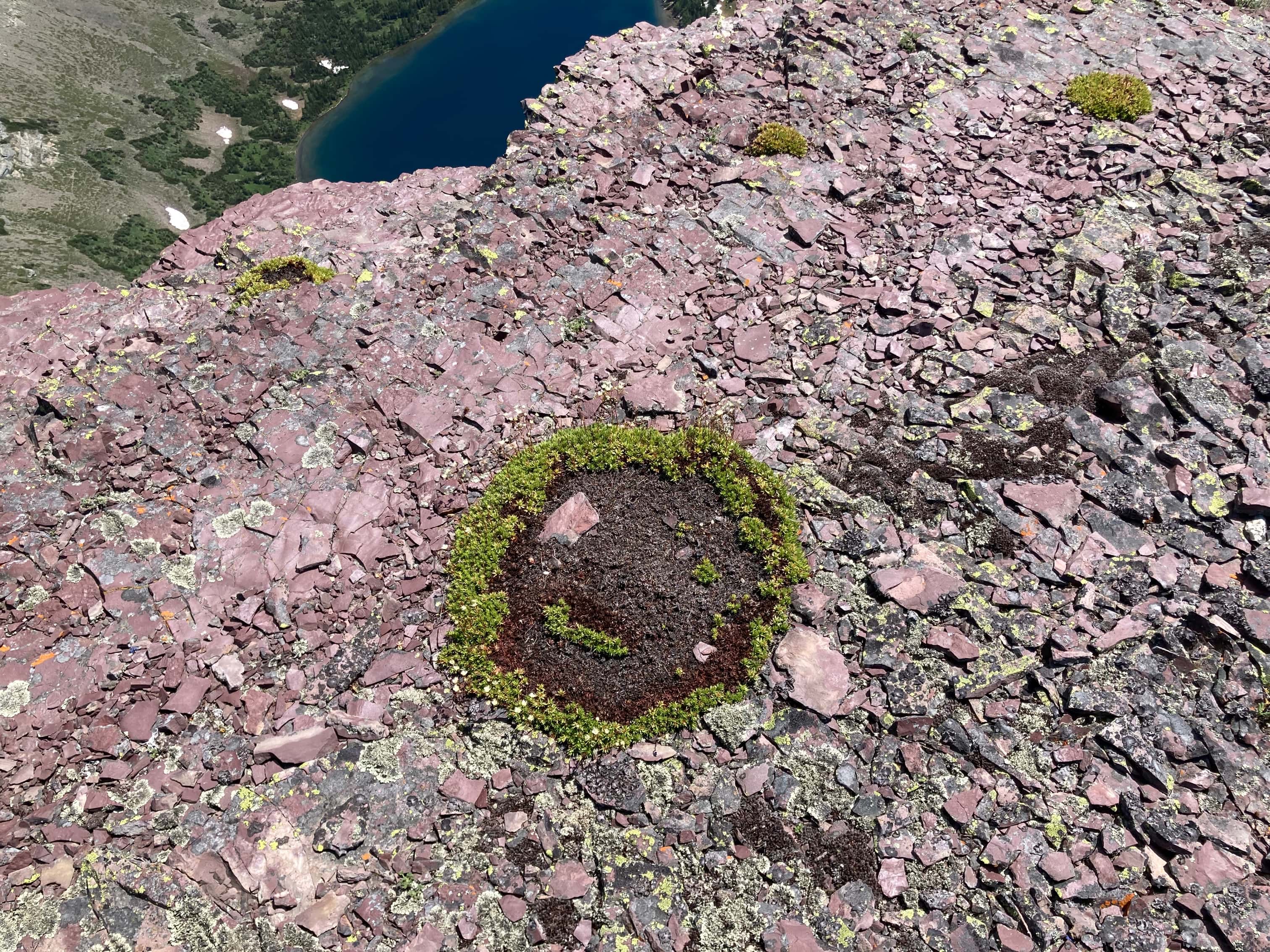
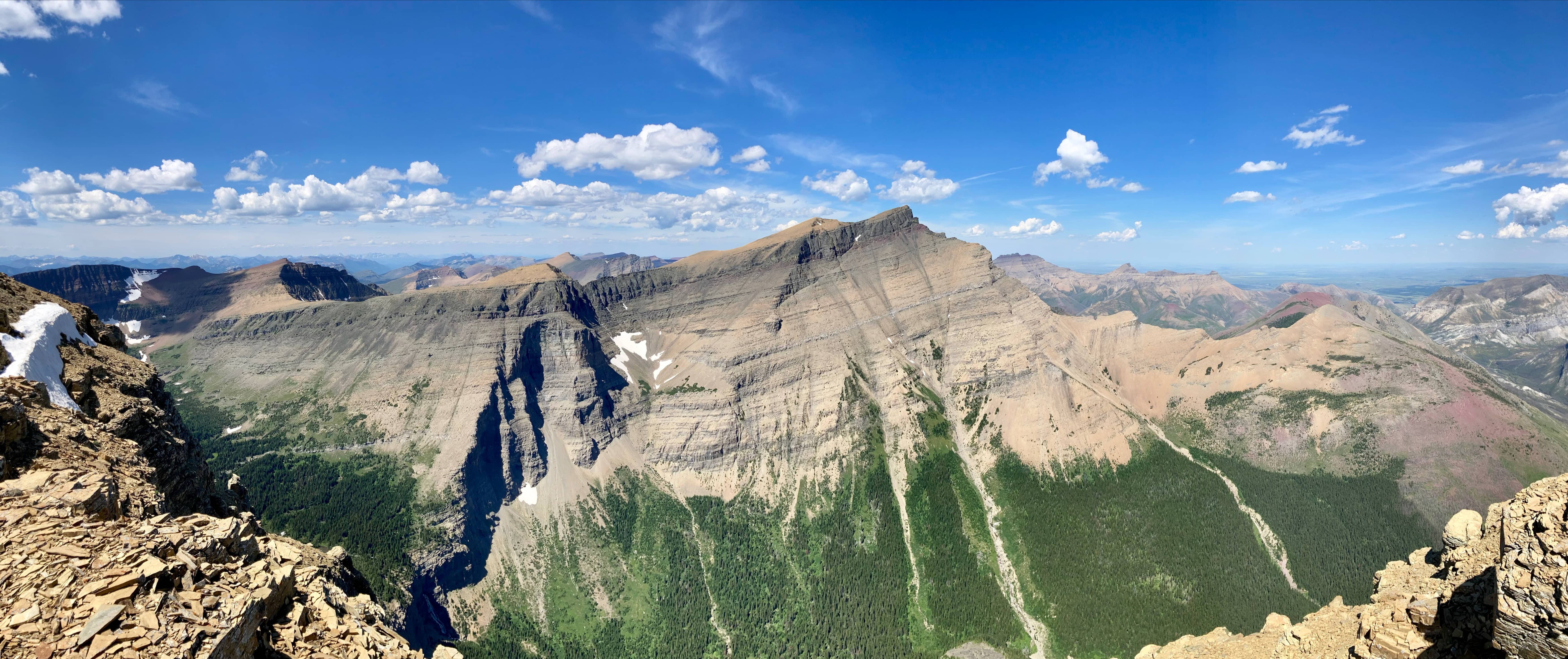
Setting off for Lineham Ridge. A faint trail was visible in the rocks. I followed it for the most part but deviated when I felt like visiting a high point or staying along the edge of the ridge.A cairn sitting on a low point along the ridge. Mount Festubert is in the background.Getting onto Liheham Ridge.Looking at Mount Lineham on the far side of the lakes.The view back towards Mount Hawkins and Aahkoinimaiisták/Mount Blakiston.Mount Festubert to the west.A cairn on one of the high points along the ridge.Looking along the ridge as it continues south. Mount Lineham on the far side of the lakes.Looking back again.Looking northwest towards the South Kootenay Pass. Lone Mountain and Mount Bauerman are nearby at centre. Kishenena Peak is beyond them. Mount Matkin’s distinct shape is in the distance. Mount Darrah is in the distant background just right of centre.Peering over a cliff.This happy patch of moss is winking at passers-by.Still lots of snow patches down in the valley.Continuing along the ridge.Looking west at the vast rock wall which forms part of Waterton’s western border. It also marks the Continental Divide, and thus the provincial border.Ascending to another high point.At the high point, looking towards Mount Lineham.Rounding the southwest corner of the route. Ahead are two high-points which I visited on the Festubert Mountain route. Down in the valley on the left the Tamarack trail can be seen ascending to Lineham Ridge.The Rowe Lakes trail can be seen passing through Row Meadow far below. The Upper and Lower Rowe Lakes are visible.Kinnerly and Kintla Peak visible beyond the ridge. On the Tamarack trail. Mount Lineham ahead.The start of the ascent. There’s no official trail to the summit, but the route is well-trafficked and there’s a visible path for much of it.The final opportunity to get a good look at all of the Lineham Lakes is just as the ascent of Mount Lineham begins. Just left of centre is a silty tarn with a bright blue line of visible current passing through the middle of it.The last bit of climbing for the day.The summit cairn on Mount Lineham.Panorama looking south. This is one of my favourite views anywhere in the Rockies. Cameron Lake is just left of centre. Just right of centre and below are Upper and Lower Rowe Lakes. Another shot of the lakes.Panorama to the north with Aahkoinimaiisták/Blakiston at centre. The ascent route goes up the middle of the three drainages. It looks ridiculously steep from this vantage point, but that’s just due to the viewing angle. Dave McMurray described a route that ascends the drainage on the right, which would be fun to try some day.For context, this is what the ascent route looked like from the bottom.Looking over at Lineham Ridge and Mount Hawkins.Time to descend.Higher up along the descent path there are some low rock bands to negotiate around.Pretty steep.A last look at the lakes before I drop too low.Grassy slopes below the scree. Further down there is a bit of a bushwhack before you can get onto the Rowe trail. There is a faint path through the underbrush that makes things easier.On Rowe trail, descending to the parking area. I was very happy to be in the shade.The day concluded with a walk along the road back to my car at the Lineham trailhead.


I enjoyed all three posts Par. Thanks for posting all your adventures on your blog. We are looking at doing this hike soon.
LikeLiked by 1 person
Thanks for reading, John. Looking forward to reading about your trip.
LikeLike