I climbed Mount Chester on what was forecast to be a very hot day, so I started quite early in the morning to beat the heat and the crowds. The mountain’s location next to one of the most popular hikes in K-country ensures that it sees plenty of visitors. I managed to get there early enough to have the summit to myself.
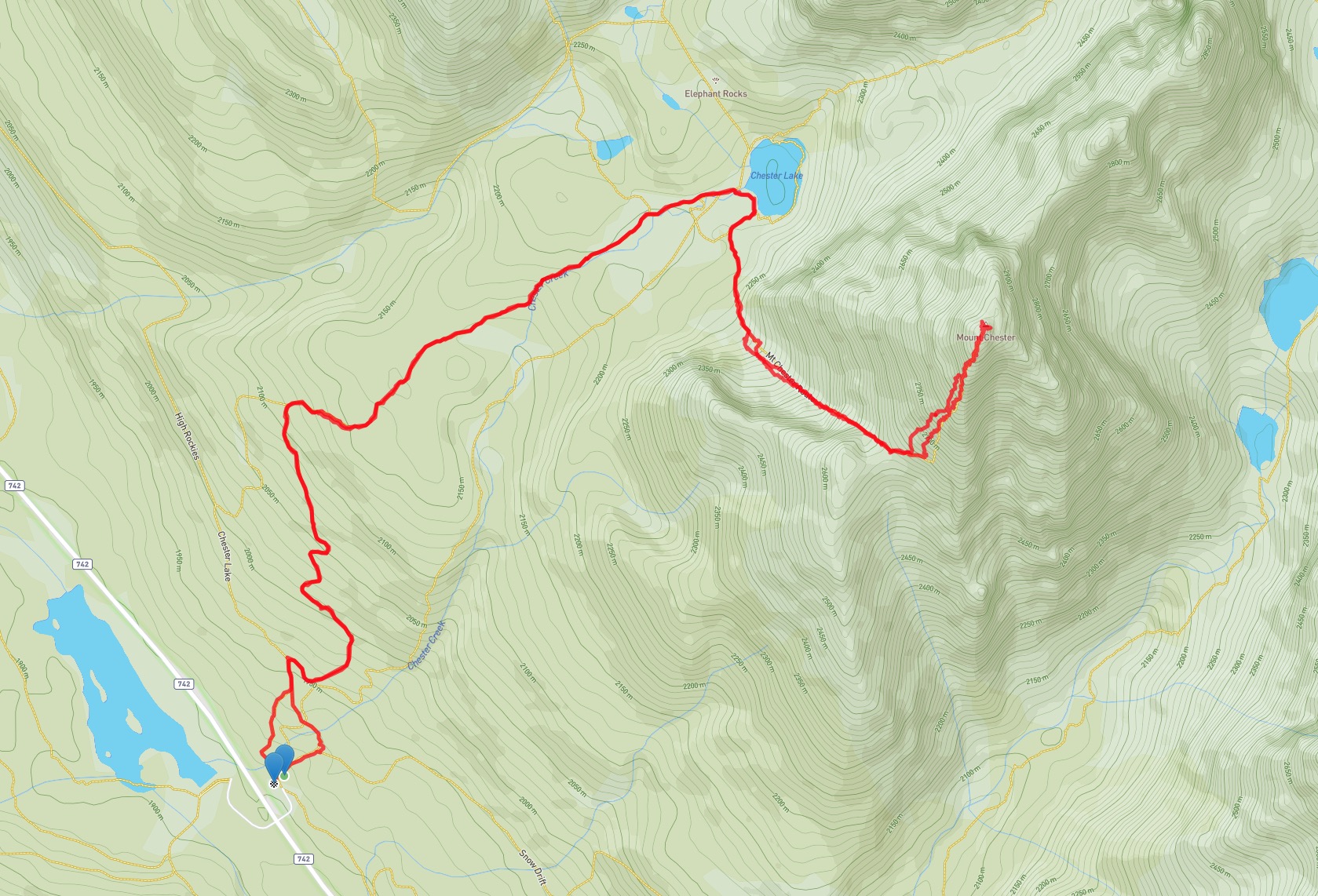
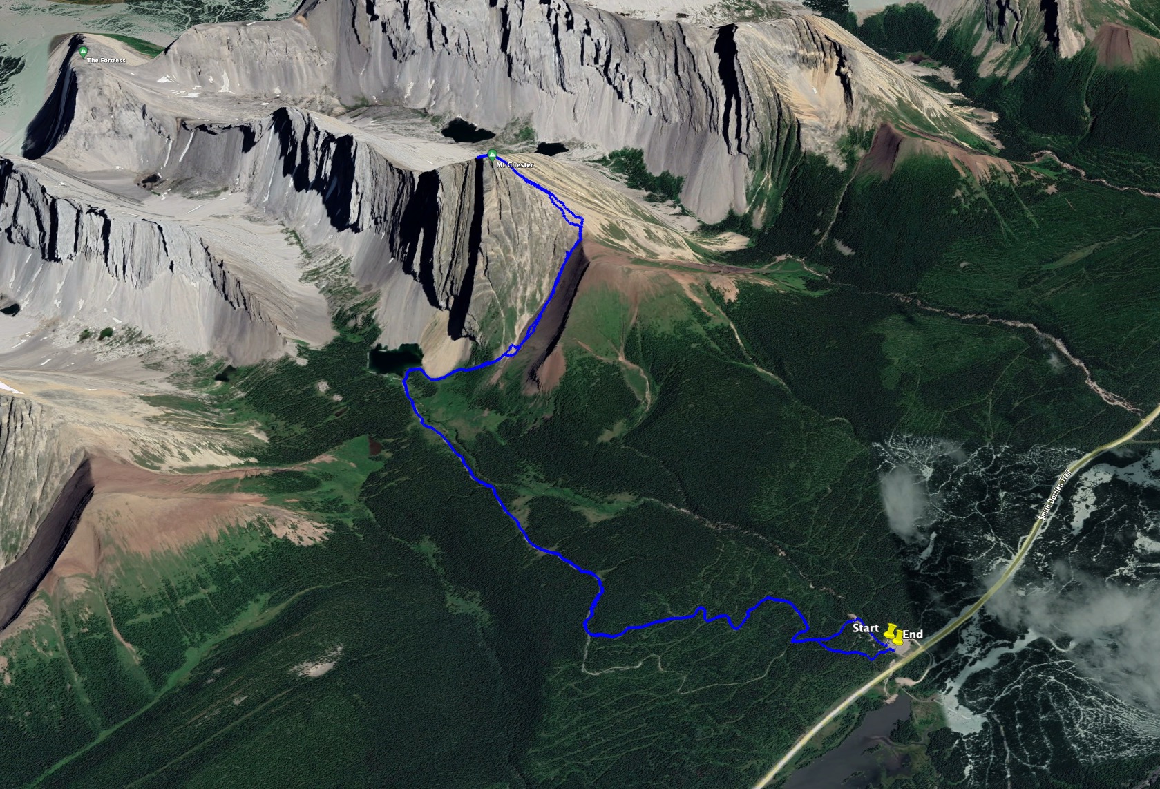
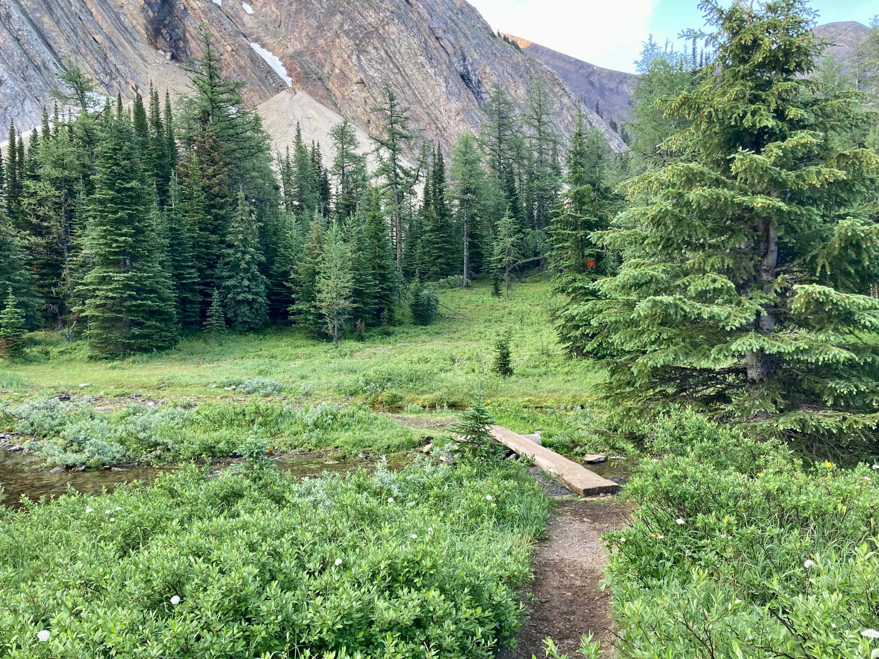
Access is from the Chester Lake trailhead on the Smith Dorien Trail (Hwy 742). I’d been there twice before to do hikes to Chester Lake as well as the Headwall Lakes. After following the trails up to to Chester Lake I found the little plank bridge across the outlet stream on the west side of the lake. After crossing over that, I followed the trail counterclockwise along the lake shore until encountering an obvious trail heading to the right. It was marked by a tree with a couple of Christmas ornaments on it. The trail skirted around a fan of rockfall then continued south to pass through some trees before arriving at the base of a long gully heading up to a col on Mount Chester’s southwest side.
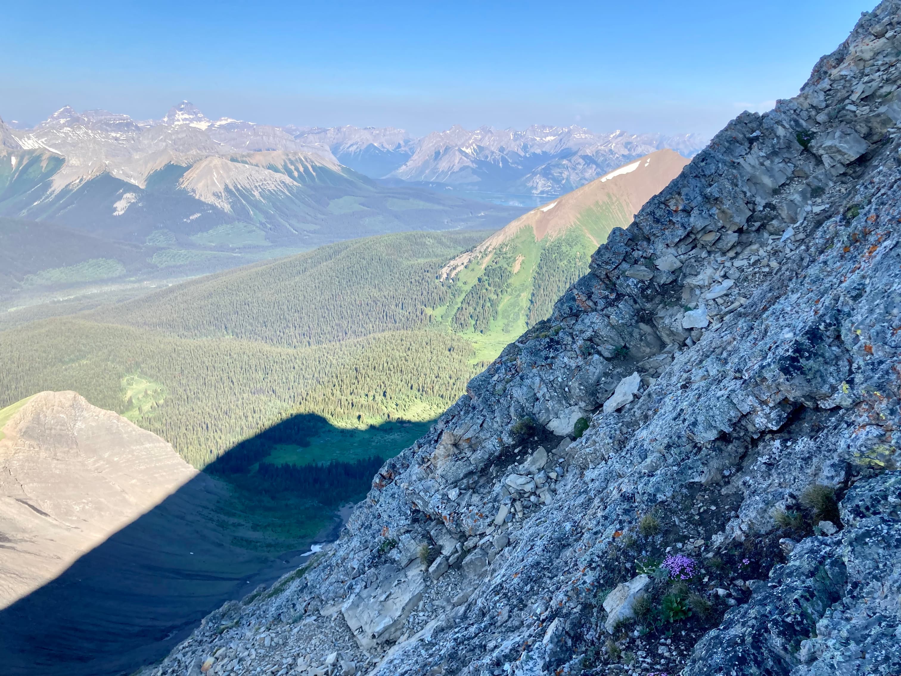
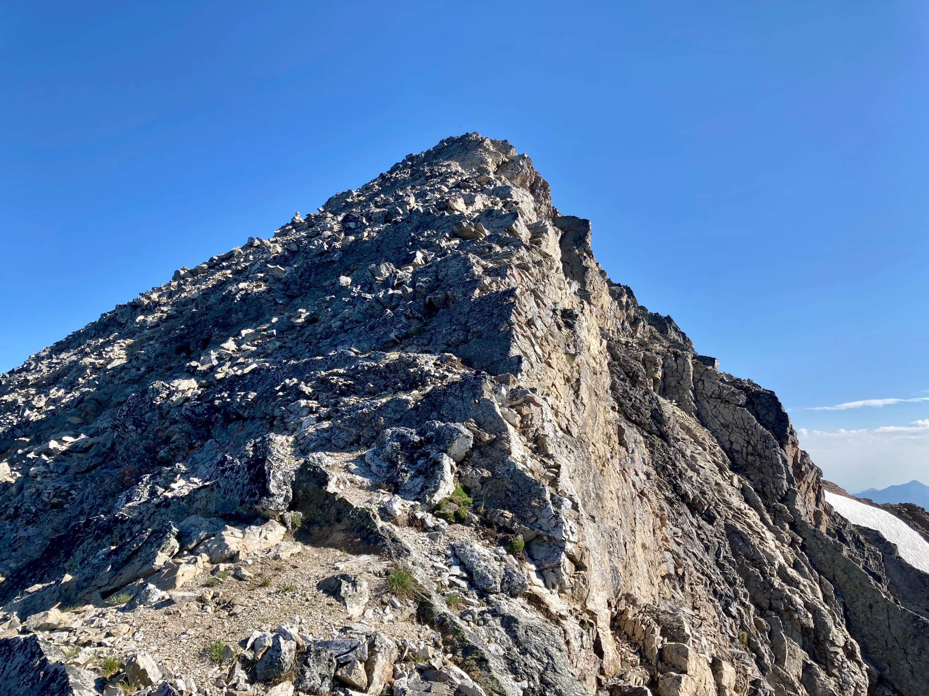
There was still snow in the gully, but there was more than enough bare ground to allow for a safe ascent. After a 400 m climb on dirt and gravel I gained the col and took a quick break to enjoy the views and put on my helmet. Above the col is where the scramble begins. To your left as you arrive at the col is the scrambling terrain up Chester’s southwest face. There are cairns here and there that were helpful in reassuring me that I was on track, but there isn’t really too much route finding. The farther left you are, the more of a scramble you’re in for. The farther right you are, the more of a scree slog you’re in for. I think the usual approach is to stay left on the ascent then take the scree down, which is what I did. If you’re feeling like you’re dealing with too much exposure it’s likely because you’re too far left. The scrambling is moderate – handholds are required but there’s no major exposure or tricky moves. I managed to reach the summit 2h 40m after setting out.
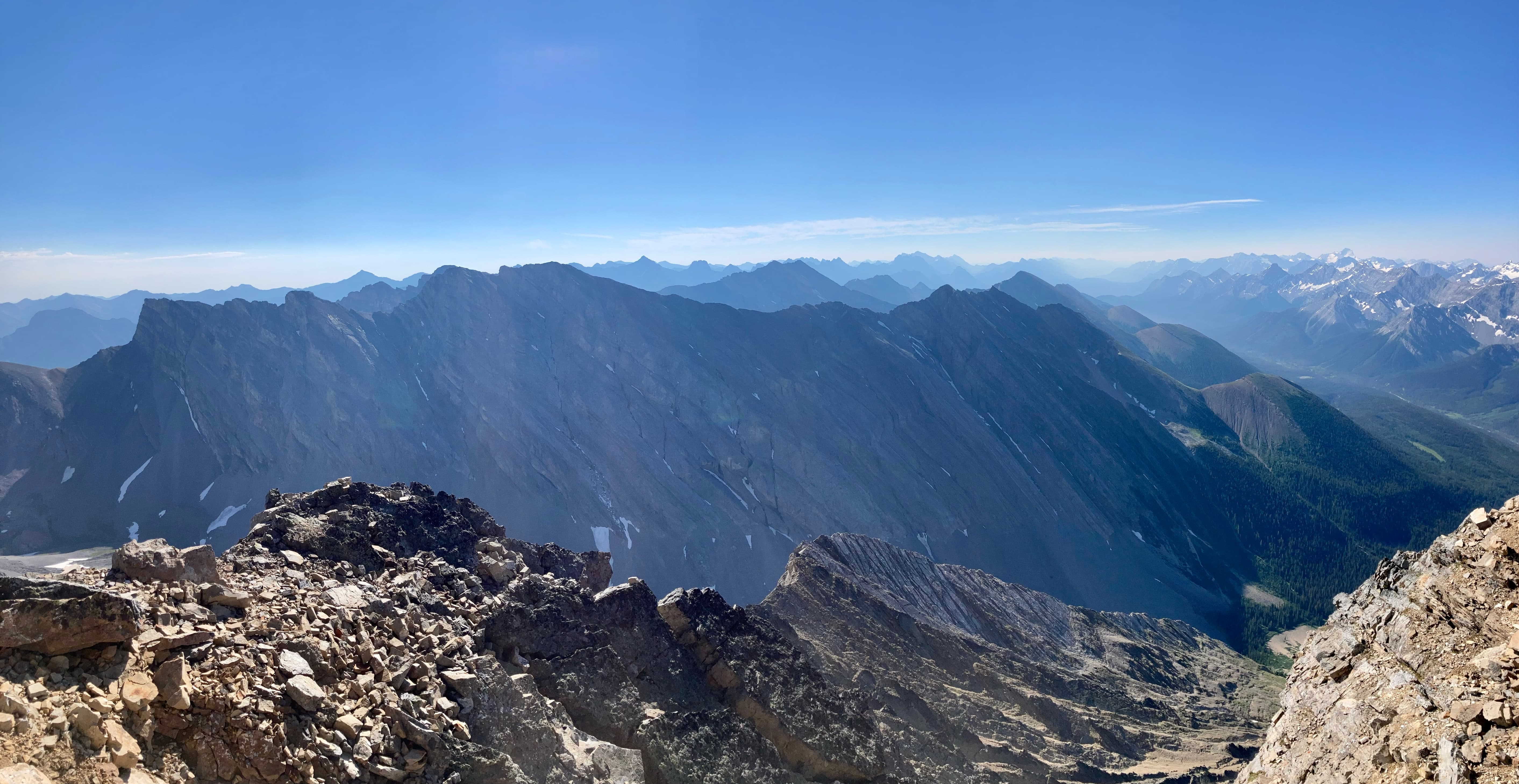
Since I had the place to myself I took a nice long break up there. The views were excellent, particularly to the south and west where Mount Sir Douglas and Mount Assiniboine caught the eye. Closer by to the north were Mount Galatea, Gusty Peak, and The Fortress. Down in the valleys I could see Chester Lake and the Headwall Lakes. As I started to descend I saw another party had made it to the col. I stayed well to skier’s’ left. The terrain wasn’t difficult but the rockfall was alarming – despite making every effort not to knock rocks down I sent a few larger ones tumbling. There was nobody below me but it was still pretty distressing. Once down to the col I had no difficulties descending the gully and making it back to the lakeside trail.
Click/tap on the pictures in the gallery below to access higher-resolution images.
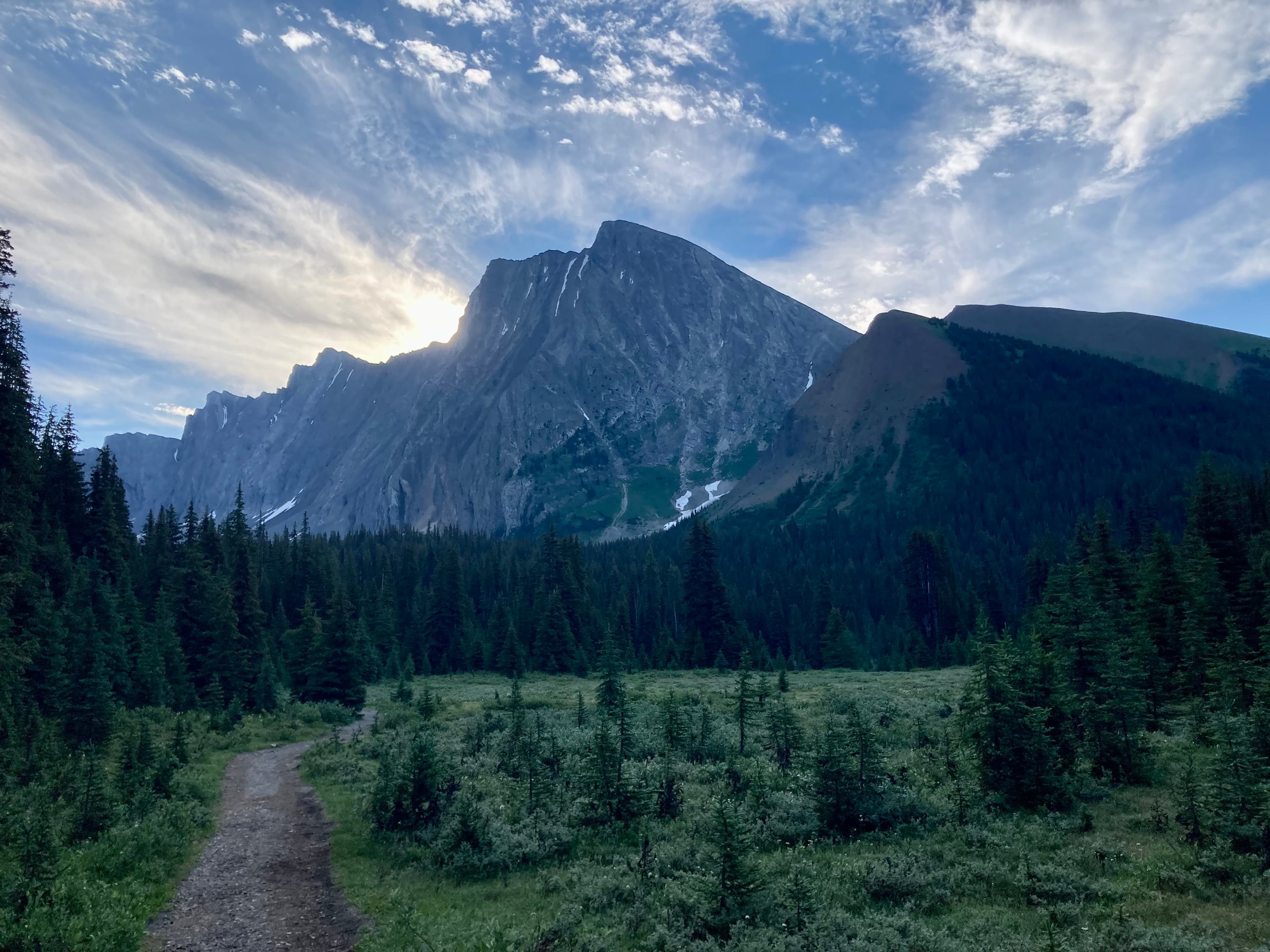
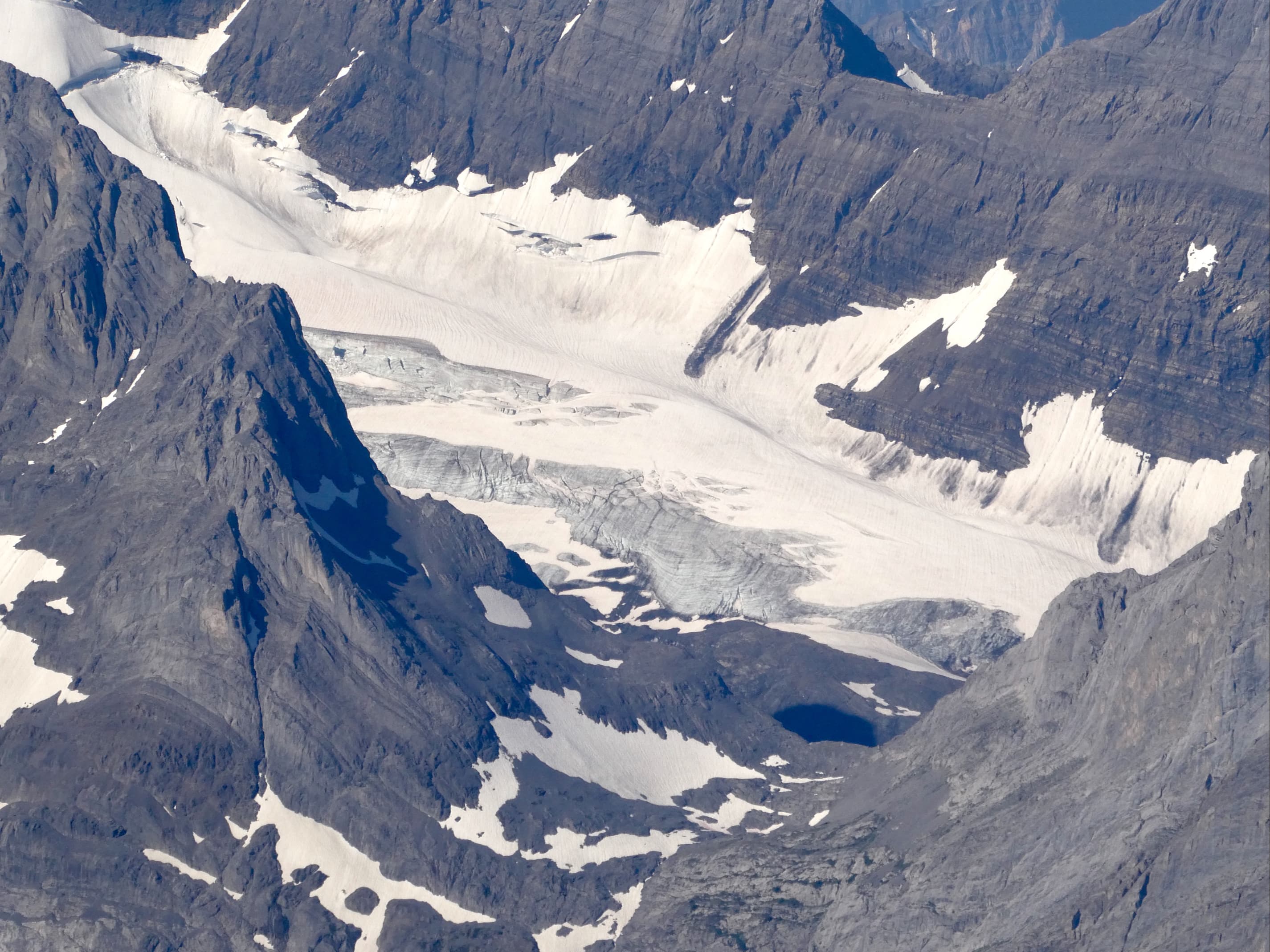
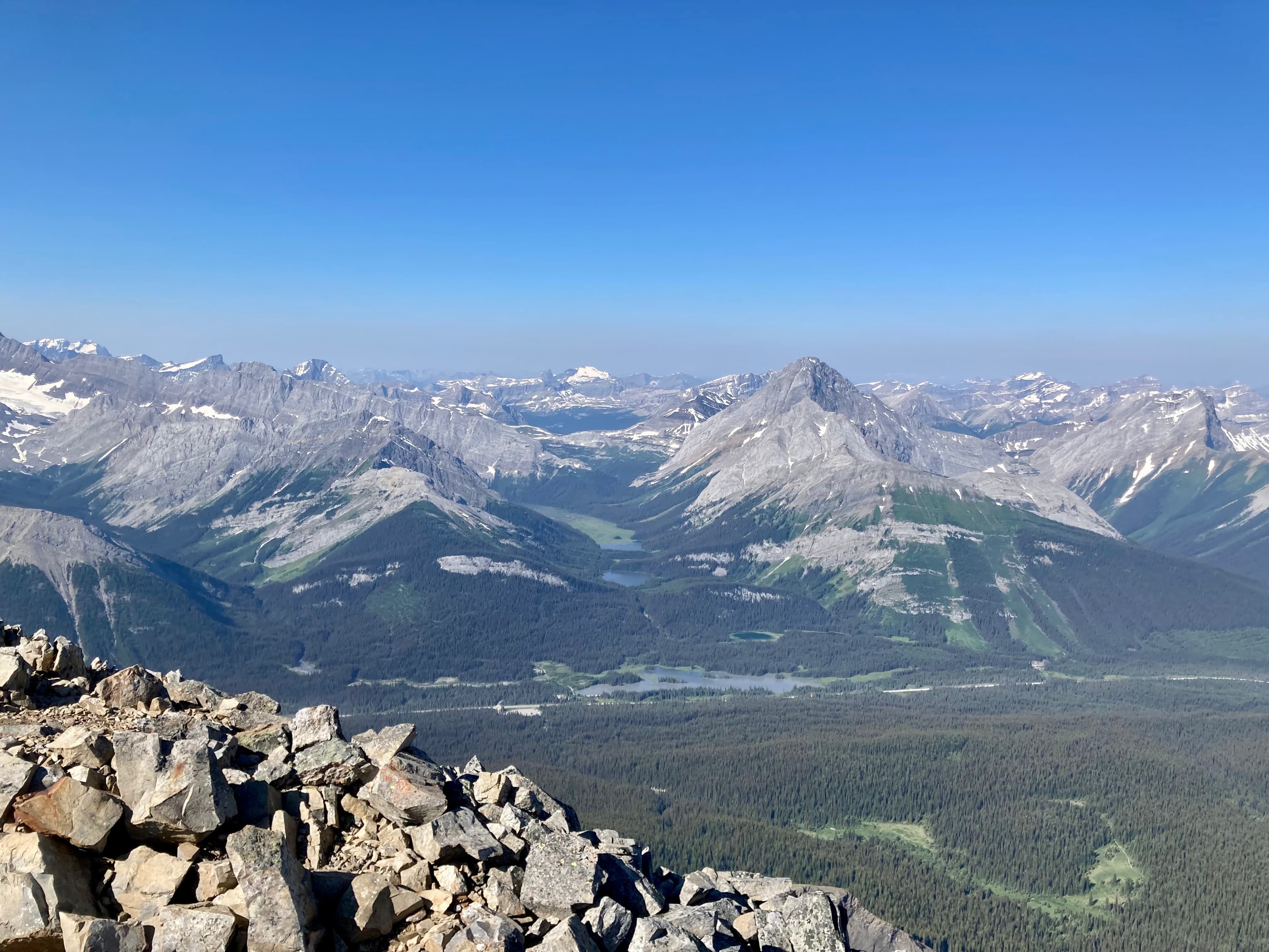
Route overview looking east.The day’s first clear look at Mount Chester.A little further along the trail I could see the fan of rockfall and the ascent gully. Gusty Peak is to the left.There was snow in the gully but it looked like it would be avoidable.Just before the trail arrives at the lake shore, I saw the little plank bridge off to the right and crossed over.Chester Lake. I was in a hurry to ascend before the day got hot, but I spent a little time on the lake shore. It was perfectly calm and nobody else was up here yet. Just as I arrived a huge bald eagle took off from a tree at the lake’s edge and flew into the forest on the far side.I followed the trail counterclockwise around the lake until I found this obvious fork heading to the right. Note the Christmas ornaments on the tree.I like this method of marking a trail much better than flagging. This also reminded me that I’ve been meaning to visit this area in the winter.The trail soon skirted around this broad fan of rockfall.Past the rockfall, the trail entered the woods for a short time. There was some fresh bear scat here. I did a lot of shouting as I walked along.Arriving at the base of the big ascent gully.Near the top of the gully I finally entered the sunlight.Arriving at the col I was greeted by this view to the south.A closer look over at Mount Murray, Mount French, Prairie Lookout, Mount Robertson, and Mount Sir Douglas.Looking back the way I came. I realized I’d be able to see Mount Assiniboine from here.Mount Assiniboine, peeking up from behind Mount Shark.I traversed a short distance along the face before staring to ascend.Starting to climb. The grade was fairly steep but not nearly as steep as this picture makes it look.Looking left. This give a better idea of the grade.One of the many cairns along the way.Almost to the summit.The summit of Mount Chester.The view to the southeast. The long ridge line immediately across the valley doesn’t have a name I can find.Mount Joffre, far to the south.The view to the southwest. At 3406 metres, Mount Sir Douglas Stands out just left of centre. Mount Birdwood and Mount Smutts are across the valley to the right.Mount Smith-Dorrien, Mount Murray, Mount French, and Prairie LookoutMount Sir DouglasPart of the Haig GlacierThe view to the northwest. Left of centre, Mount Assiniboine stands out in the distance. On the right, Mount Galatea is immediately across the valley. The Tower and Old Goat Mountain are in the distance beyond Galatea. In the distance at the far right of the frame is Mount Sparrowhawk. Very clear reflections are visible off Spray Lakes Reservoir just right of centre.A closer look towards the reservoir.Telephoto due west. Triangular Eon Mountain just left of centre, Aye Mountain is to its right. The Fist is at the bottom of the frame left of centre.Mount Assiniboine with its Red Band visible.Looking due north. Mount Galatea, Gusty Peak, and The Fortress.Gusty Peak and The Fortress.A closer look at the summit of The Fortress.Looking down at Chester Lake, west of the summit.Looking down at the Headwall Lakes, east of the summit.Mud Lake and Burstall Lakes in Burstall Pass to the south.Mount Birdwood with Commonwealth Peak just in front of it.Time to descend. Looking over towards Assiniboine one more time.Staying left on the descent – very steep scree.Back to the gully. Everything’s in sunshine now.Back down in the valley. Walking out.


Very nice pictures of your hike, Par. Once again, Always keep safety in mind!
Bal Boora
>
LikeLike