July 10, 2017. A solo hike to high mountain lakes in Kananaskis country.
- Region: Kananaskis Country. Traditional Territory of the Stoney, Tsuu T’ina, Ktunaxa, and Blackfoot First Nations
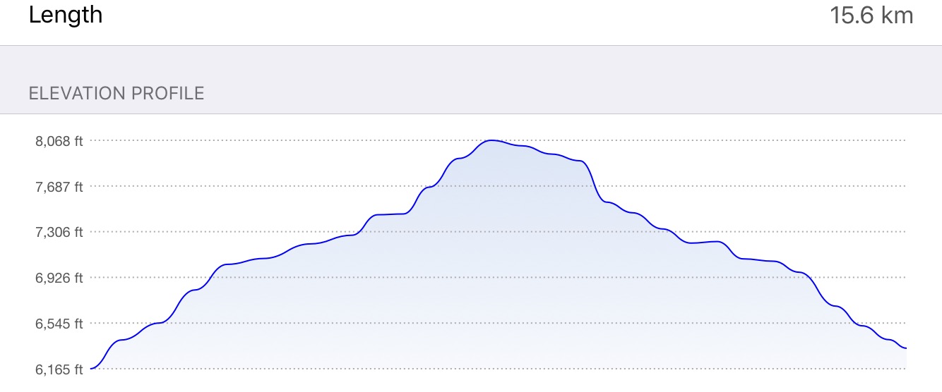
- Distance: 15.6 km round-trip
- Total Ascent: 600 m
- Elevation of Objective: 2460 m
- Total Time: 4h 31m
This post was updated July 27, 2021 with some map improvements to more closely match the format of later posts. No other changes have been made.

My wife, who is both intelligent and stunningly beautiful, told me that I could leave the family behind today and hike on my own. This was a departure from our original plan for the 3 days we’d have in Kananaskis, which was to do a hike with the kids every morning. However, yesterday’s events took some of the wind out of the sails of the kids, and a day of swimming and snacking seemed to be what was best for them. When the wife suggested I set off on my own, I didn’t argue and started poring over my guidebooks and maps.
My original plan had been to climb Mount Allan. This is the mountain where the Nakiska ski area is located. It’s steep and takes a relatively long time to finish, but the payoff is reported to be worth it with amazing views and cool rock formations to see. As a bonus, the trail begins very near our hotel. I had to change plans this morning, though, when I woke to thunder and lightning. The rain passed, but the forecast called for more rain through the day, and a “chance” of thunderstorms all day. Not wanting to be that guy that’s caught out on a high mountain ridge when the lightning strikes, I modified my plan and set out for Chester Lake and Three Lakes Valley.
The Copelands (of Don’t Waste Your Time in the Canadian Rockies fame) describe this hike in their Where the Locals Hike guidebook. They describe it as a “premiere” destination and say that it’s the most popular hike in K-country. When I saw the size of the parking lot at the trailhead, I had no choice but to believe them. They also name it as one of their recommended rainy day hikes. I gotta say: they’re right, this is a premier hike, and a great choice for a rainy day.
Access is easy via Highway 742 (aka Smith-Dorien/Spray Trail), which you can get onto from the north (via Canmore) or south (via Highway 40, to Kananaskis Lakes Trail, to the Highway 742 turn-off). Highway 742 is gravel, but very well maintained – it’s wide and reasonably smooth. The turn-off to the trailhead is very clearly signed. There are pit toilets at the parking lot, as well as aother toilet up at Chester Lake.
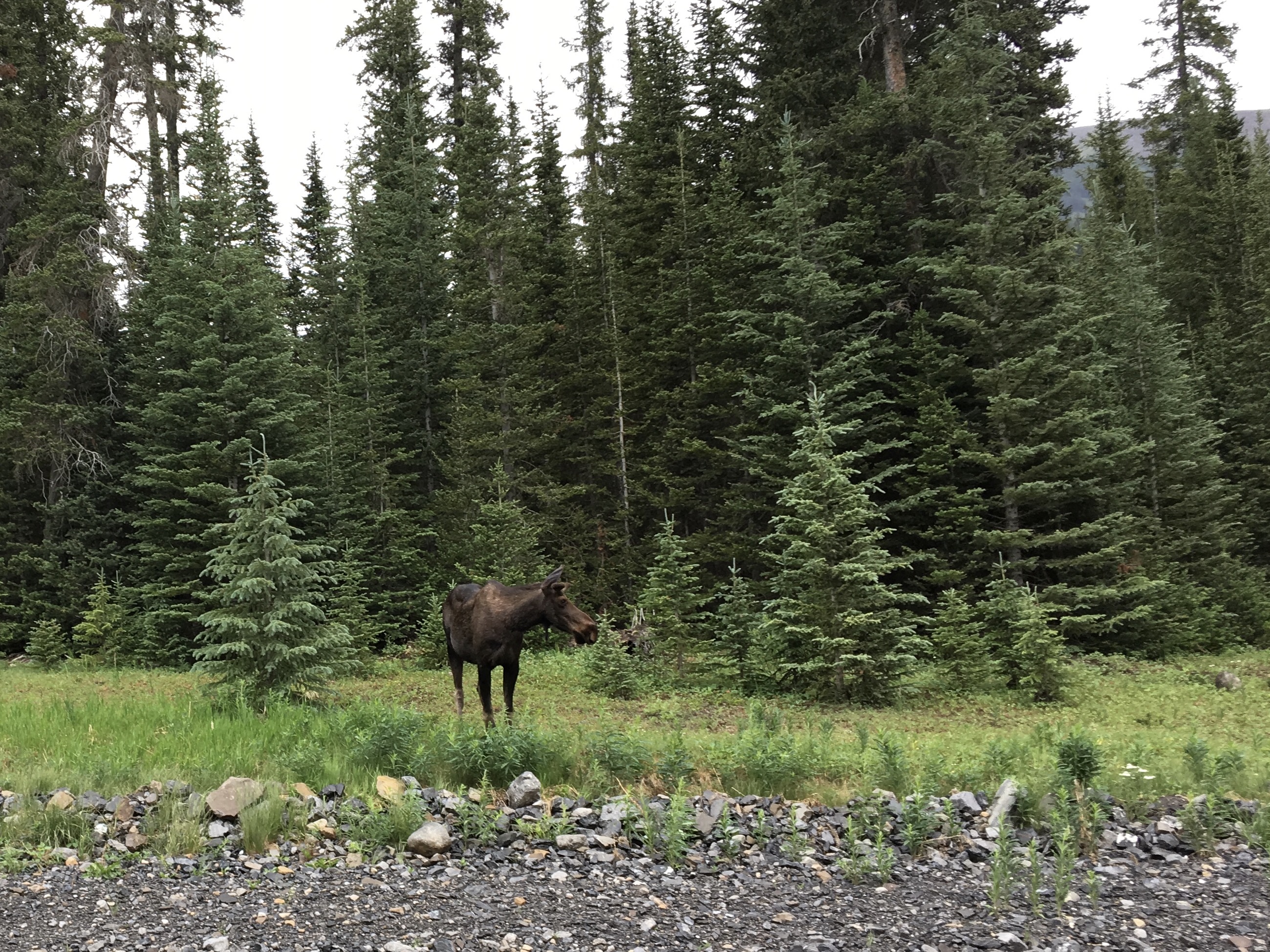
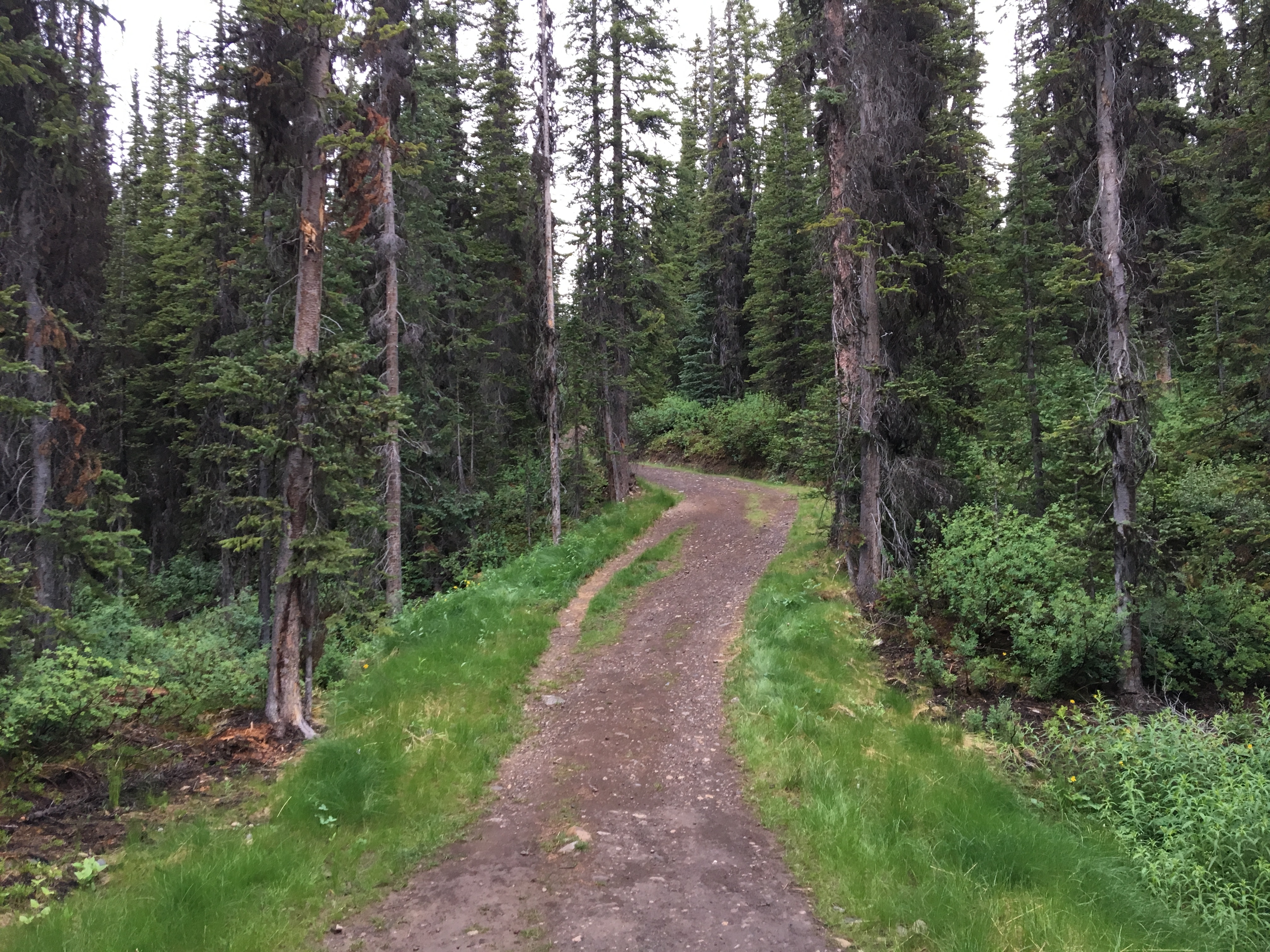
Off the start, you head up an old logging road, with a pretty steady altitude gain. You’re in amongst the trees here, and today the mosquitoes were out in force. There was a drizzle of rain as I set out, so I was covered by my rain jacket. Between the jacket and a bit of Deep Woods on my exposed skin, I ended up with zero bites. On my way down I encountered some folks in T-shirts and shorts. They inquired about the trail and I mentioned the dense mosquitoes. They didn’t have any bug spray, so I offered mine. They declined, saying that they were “used to” mosquitoes. I can only assume they were from Manitoba.
The trails heading up to the lake are used by hikers, as well as cross-country skiers and snowshoers in the winter. The hiking trail follows the ski trail. A short way up, the trail splits in two. You can go either way – both trails join one another again a short distance below the lake. I went left and came back down via the right trail, making a small loop on this section of the track.
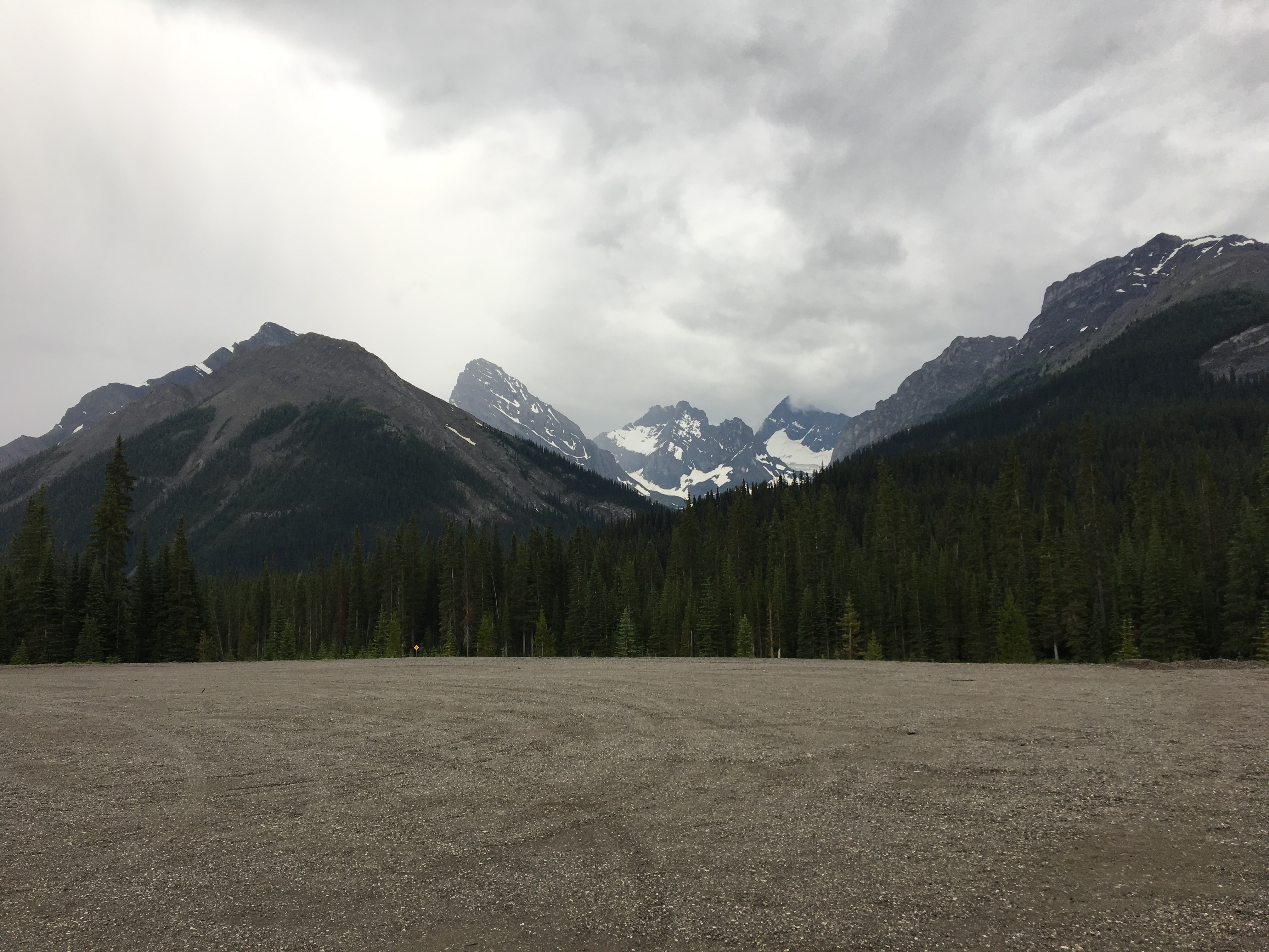
After the trails join together again, at about 2.2 km from the trailhead, you are about 700m from the first clearing and your first views of Mount Chester and the nearby peaks. Press onwards to another clearing at 3.9 km. Here, you’ll encounter several branches of a meandering stream and get clear views of Mount Chester. Not long after, you’ll pass an elevated pit toilet on your left and arrive on the shores of Chester Lake. Moving at a steady clip, I reached the lake in 1h 5m.
The lake itself is a pleasant, crystal-clear mountain lake. Opposite the trail when you arrive is Mount Chester with a talus slope spilling into the water. When I got there the rain started to fall a little harder, so I hid out under a tree to snack on a sandwich and check my map. When the rain eased up, I decided it was worth continuing up to Three Lakes Valley.
Soon after the main trail arrives at Chester Lake, proceeding clockwise, you’ll encounter a log bridge over a small stream. About 60m beyond, there’s an obvious fork, with the left trail heading away from the lake, and the right fork continuing along the lake shore. Take the left fork and begin ascending north-east, up and away from Chester Lake. In a little less than 300m, you’ll encounter some interesting boulders, which Daffern calls the “Elephant Rocks” in Kananaskis Country Trail Guide Vol 1. These are interesting boulders that look a little bit out of place. The effect is sort of ethereal, and on the way back down the trail (when the rain had moved off) I encountered a group of yoga enthusiasts unrolling their mats on the grassy clearing next to these rocks. The trail veers left of the boulders and continues climbing. At around this point in my trip, the clouds parted and the sun came out. The sunshine highlighted the vibrant green vegetation and the white of the rushing stream nearby the trail.
Soon after the Elephant Rocks, a rocky shelf comes into view up ahead, with the big peak of Mount Galatea peeking over. A short climb later, you arrive at the first of the 3 lakes. I was about 1h 50m into the hike at this point. The first lake is a pleasant, transparent blue-green tarn, sitting under the ridge of Gusty Peak. The trail continues around the left of the water and begins to climb.
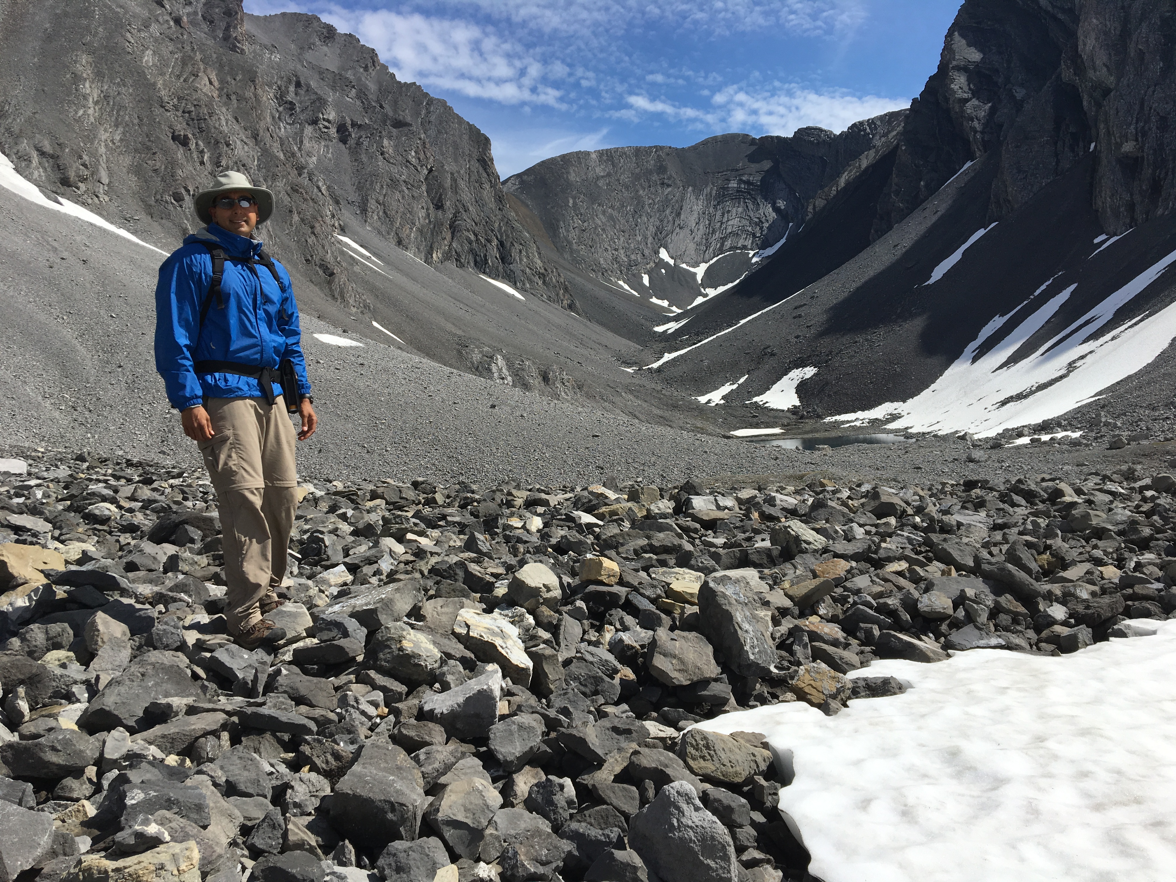
When you gain the rocky lookout above the first lake, the views back down the valley become awe-inspiring. You can see down onto the first lake, and beyond are the big peaks of the Continental Divide, with Mount Sir Douglas and the Robertson Glacier dominating the view. The trail continues into a rocky moon-scape, leaving most of the greenery behind. Eventually the trail vanishes and cairns appear, guiding you to the second and third lakes. The second lake and its environs are the best part of the hike. The third lake is small and not particularly impressive, but it is huddled in the austere, almost brutal beauty of the talus fields below Gusty Peak and Mount Galatea. There is one final large cairn that looks down on this third lake.
This was an amazing hike. In part this was because of the views. In part it was because of the solitude. I did this one on my own and arrived at the trail well before anyone else. I think I had the valley to myself for a couple of hours at least. There’s a reasonable chance that, while I was on the shores of the 2nd lake, I was more physically isolated from all other people than I’d been in my life. I only encountered one other hiker when I was making my way back down from Three Lakes Valley. I met several more parties below Chester Lake.
I have to say, though, that if your intent is just to go to Chester Lake and not continue beyond, then you may consider doing Elbow Lake instead. It’s further south down Highway 40. Like Chester Lake, the trail is an old logging road that proceeds at a steep pitch through the trees. But the uphill slog though trees is shorter on the Elbow Lake trail, and the lake is more impressive. I have read about the options for venturing beyond Elbow Lake (Tombstone Lakes looks like a great trip) but I haven’t actually done any of them.
Click on the pictures in the gallery below to access full size images.


2 thoughts on “Chester Lake & Three Lakes Valley”