July 22, 2019. A fantastic Kananaskis hike featuring high mountain lakes and waterfalls.
- Region: Kananaskis Country. Traditional Territory of the Stoney, Tsuu T’ina, Ktunaxa, and Blackfoot First Nations
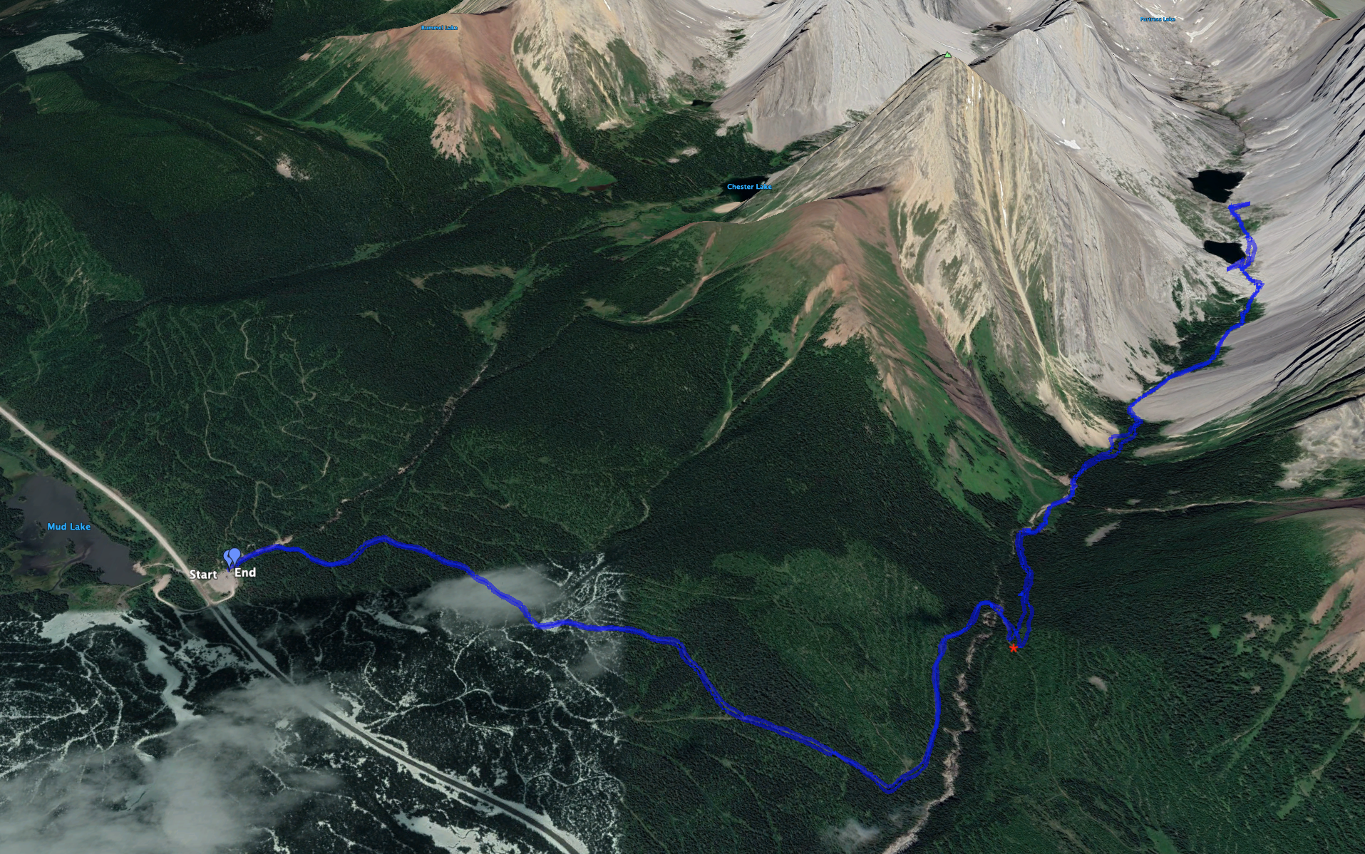
- Distance: 15.9 km round-trip*
- Elevation Gain: 475 m
- Elevation of Objective: 2350 m
- Hiking time: 5h 46m
- Safety and Disclaimer
*The 3 apps I was running to track this hike gave 3 different values for the distance. This was what my Garmin InReach tracked. Published trail descriptions give a distance closer to 14 km.
Continuing with the theme from our previous day of hiking lesser-visited trails that share trailheads with much more popular trails, my daughter and I decided to hike up to Headwall Lakes. Sharing a trailhead (and enormous parking lot) with the ultra-popular Chester Lake trail, Headwall Lakes seems to get kudos from those that have made the journey but that doesn’t seem to translate into massive popularity. On our day out, we had the trail to ourselves on the way up and most of the way down, despite finding lots of cars in the parking lot on our return.
Access is via Highway 742 (aka Smith-Dorien/Spray Trail), which you can get onto from the north (via Canmore) or south (via Highway 40, to Kananaskis Lakes Trail, to the Highway 742 turn-off). Highway 742 is a wide gravel road. As of this writing, parts of the road don’t seem particularly well maintained with deep ruts and clusters of potholes. It’s nothing a minivan couldn’t handle, but extra care was needed during the drive. The turn-off to the Chester Lake trailhead is very clearly signed. There are pit toilets at the parking lot along with a map kiosk.
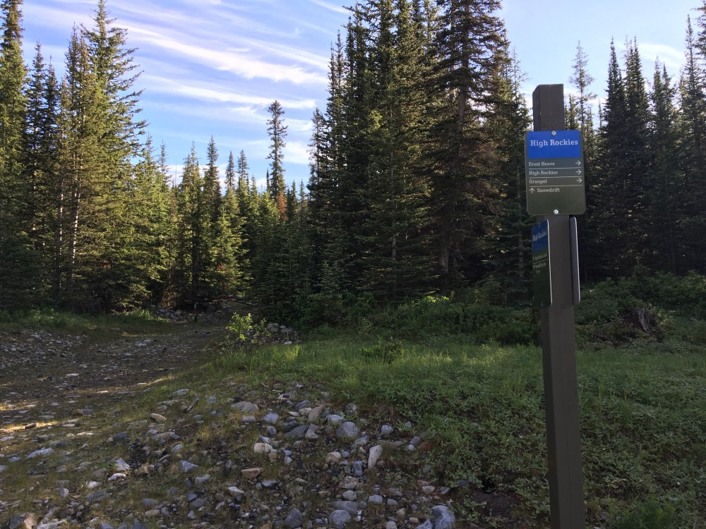
The initial part of the trip goes through the forest on wide trails that are currently being maintained as snowshoe trails. “Snowdrift” is the trail to follow – the trail names are on sign posts down by the parking lot. Trail descriptions in my hiking books mention a color-coded trail designation system that seems to have been abandoned. Snowdrift heads southeast and gently ascends for roughly 2.4 km. It then turns abruptly north and parallels Headwall Creek before descending down to creek level and crossing over a sturdy bridge. The trail then turns back to the south and ascends steeply. In 200 m, watch for a cairn and (as of my visit) a large arrow assembled out of stones pointing left into the woods and marking the departure of the Headwall Lakes trail from Snowdrift.
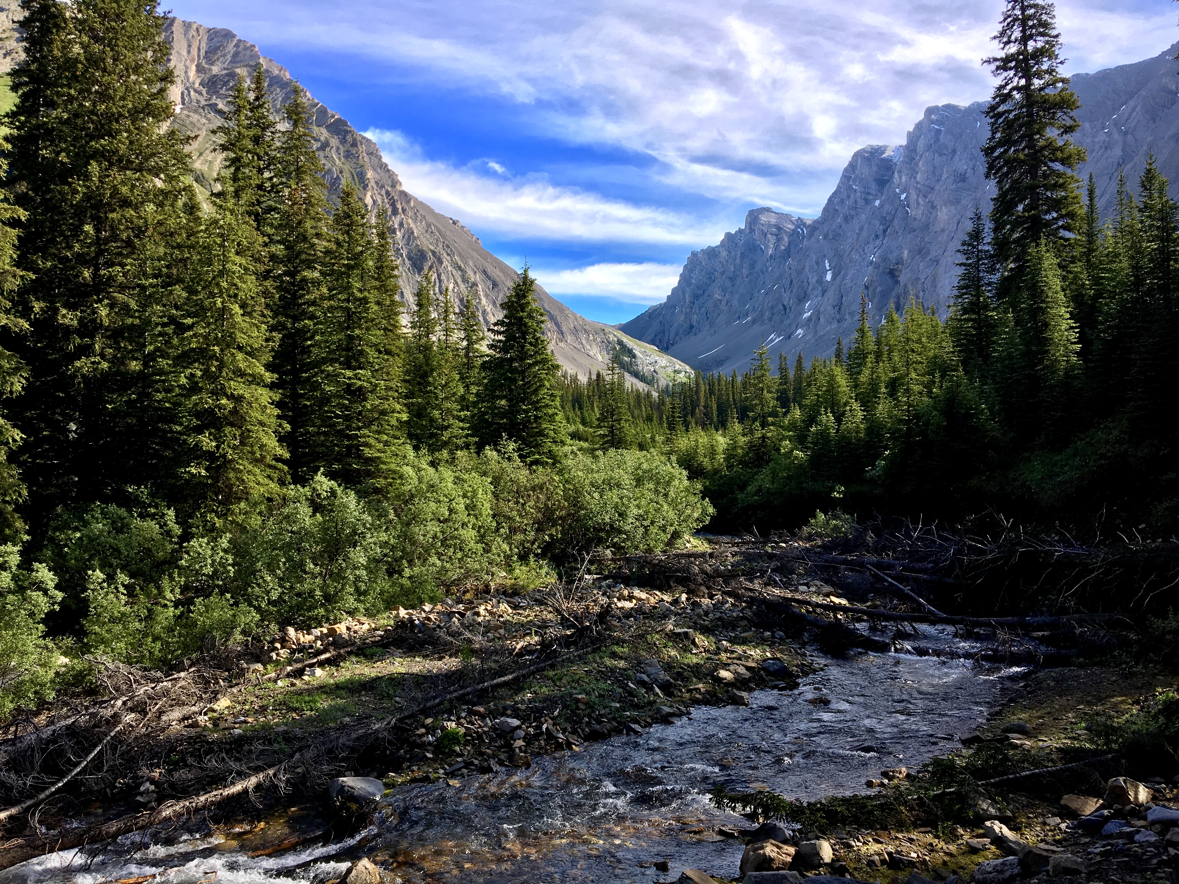
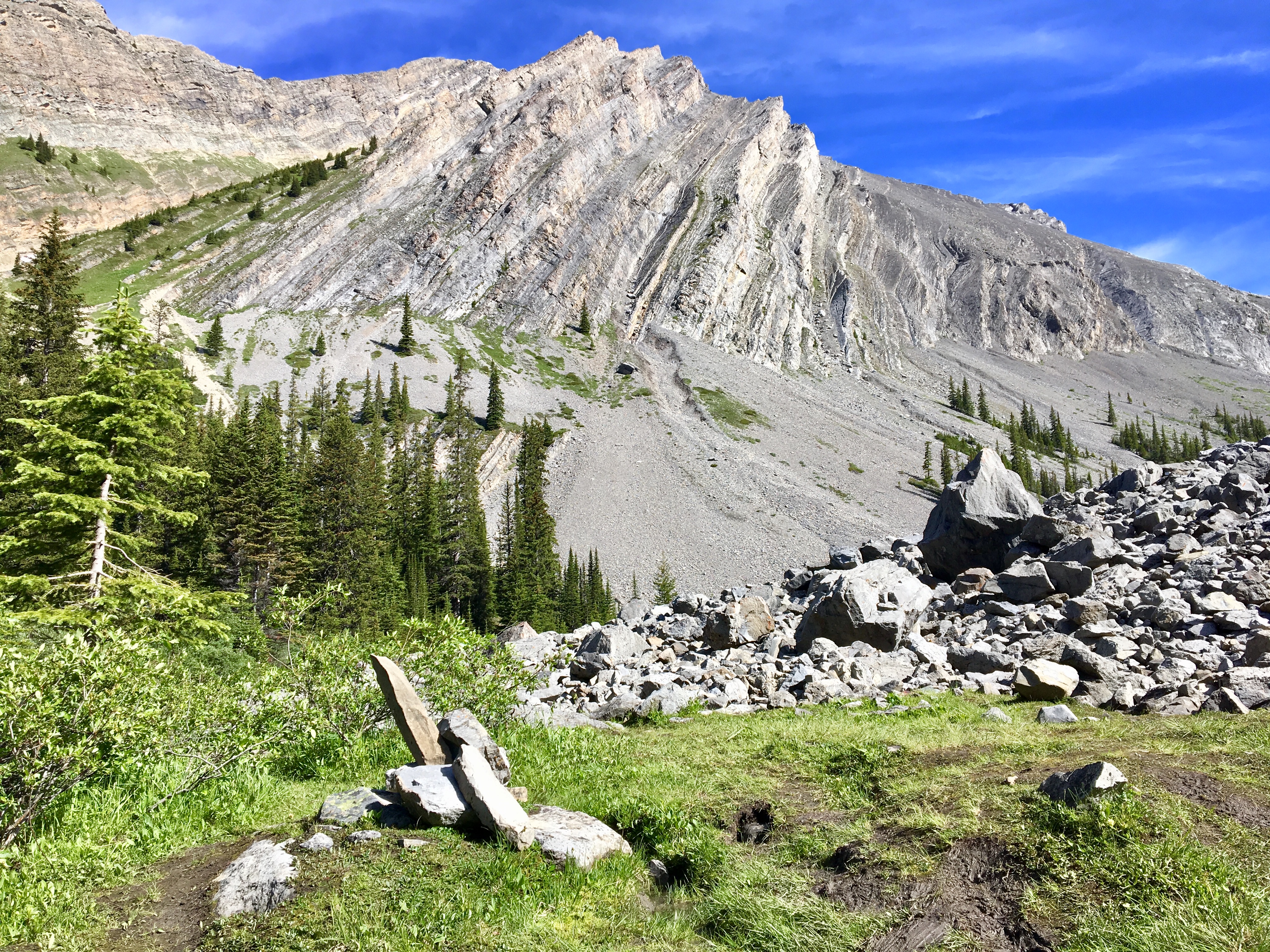
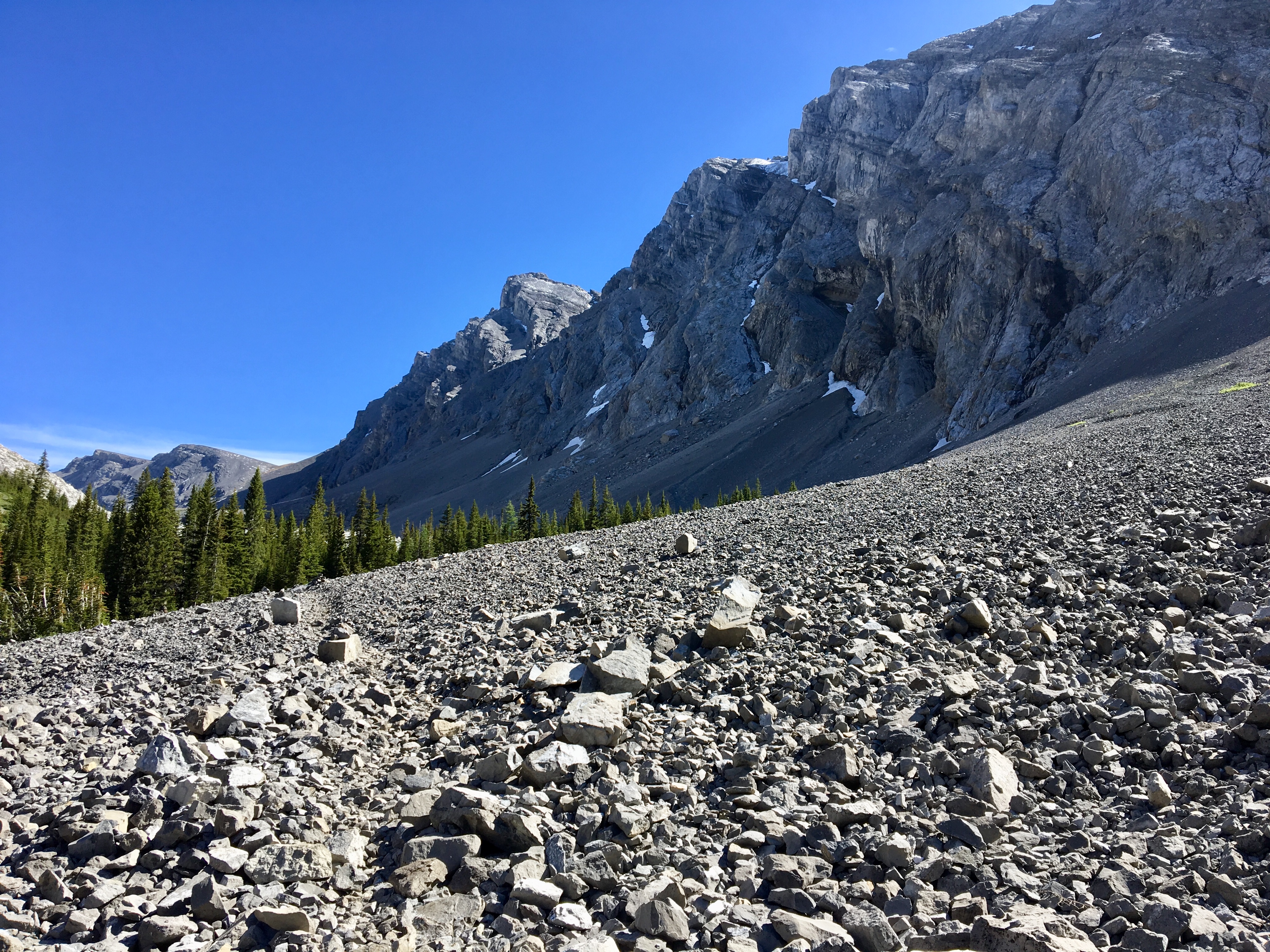
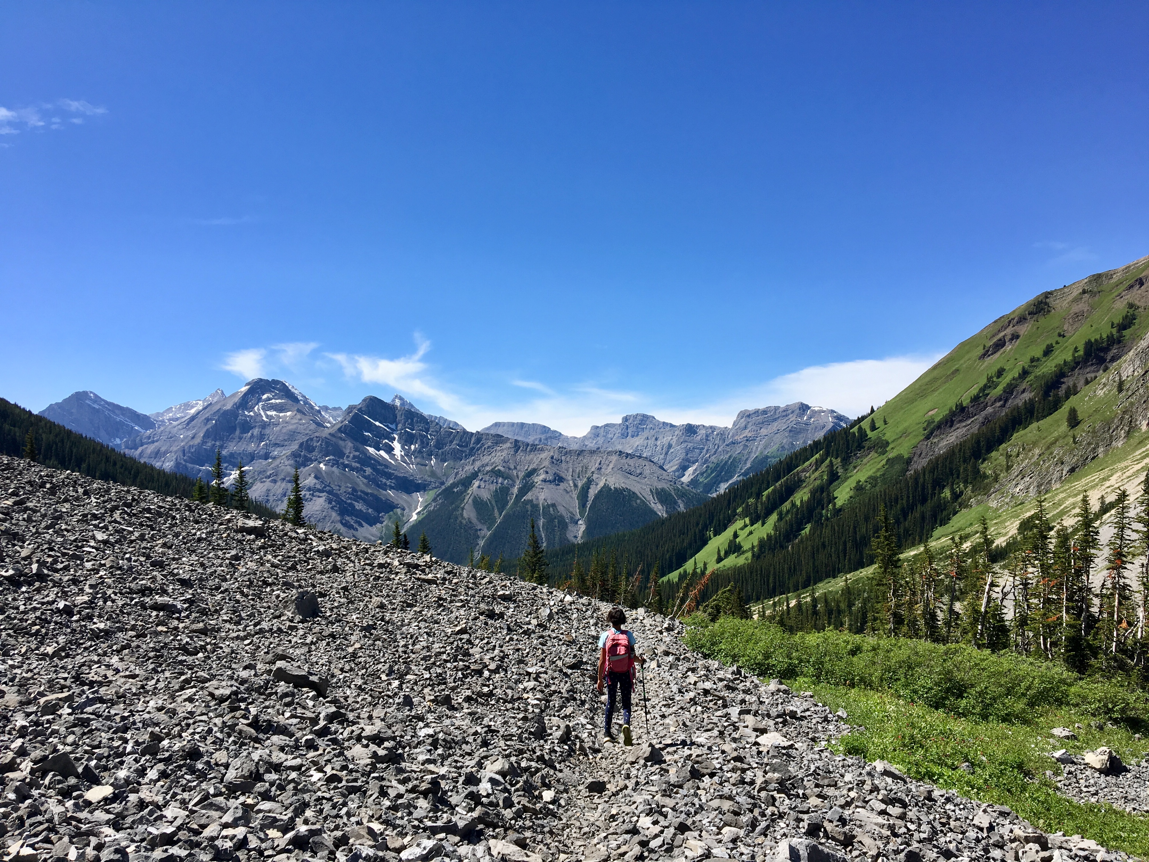
The trail was easy enough to follow for the next 500 m or so, and then it rejoins Headwall Creek. From there, it’s apparent that the 2013 floods played some havoc with the route. I didn’t have any major issues following the trail, but there were a couple of places where I found it indistinct. Sometimes it’s right next to the creek, sometimes it goes a short way into the woods. About 45 minutes from the turn-off from Snowdrift, the trail brings you out of the trees to a distinct cairn and vast field of boulders and rubble. The peak of Mount Chester (northwest) becomes visible here.
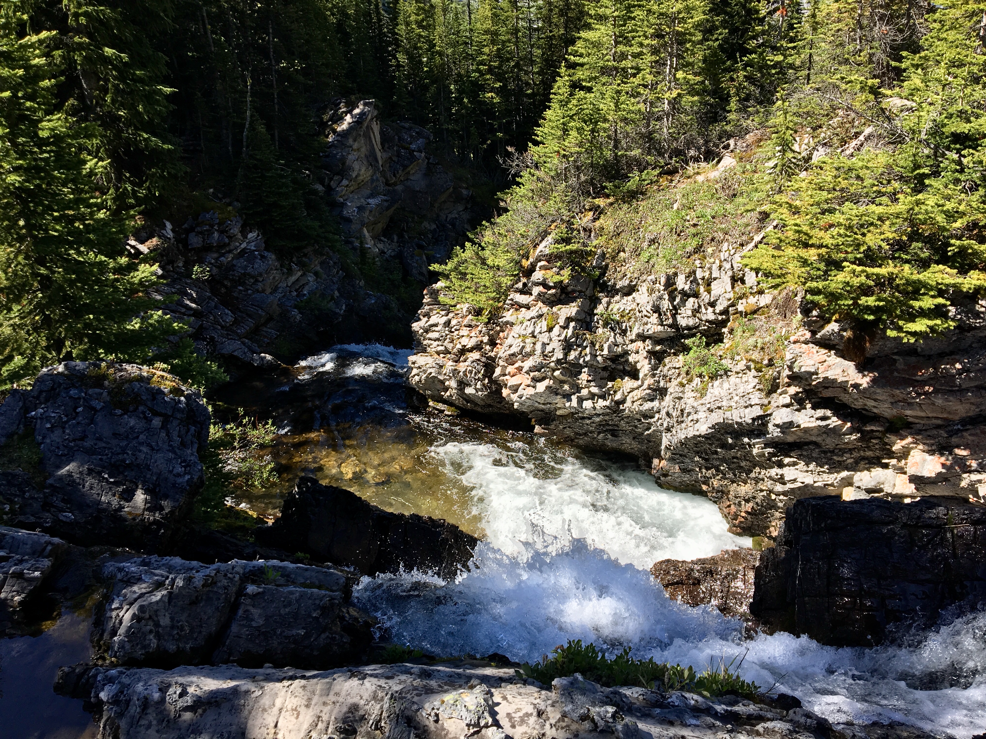
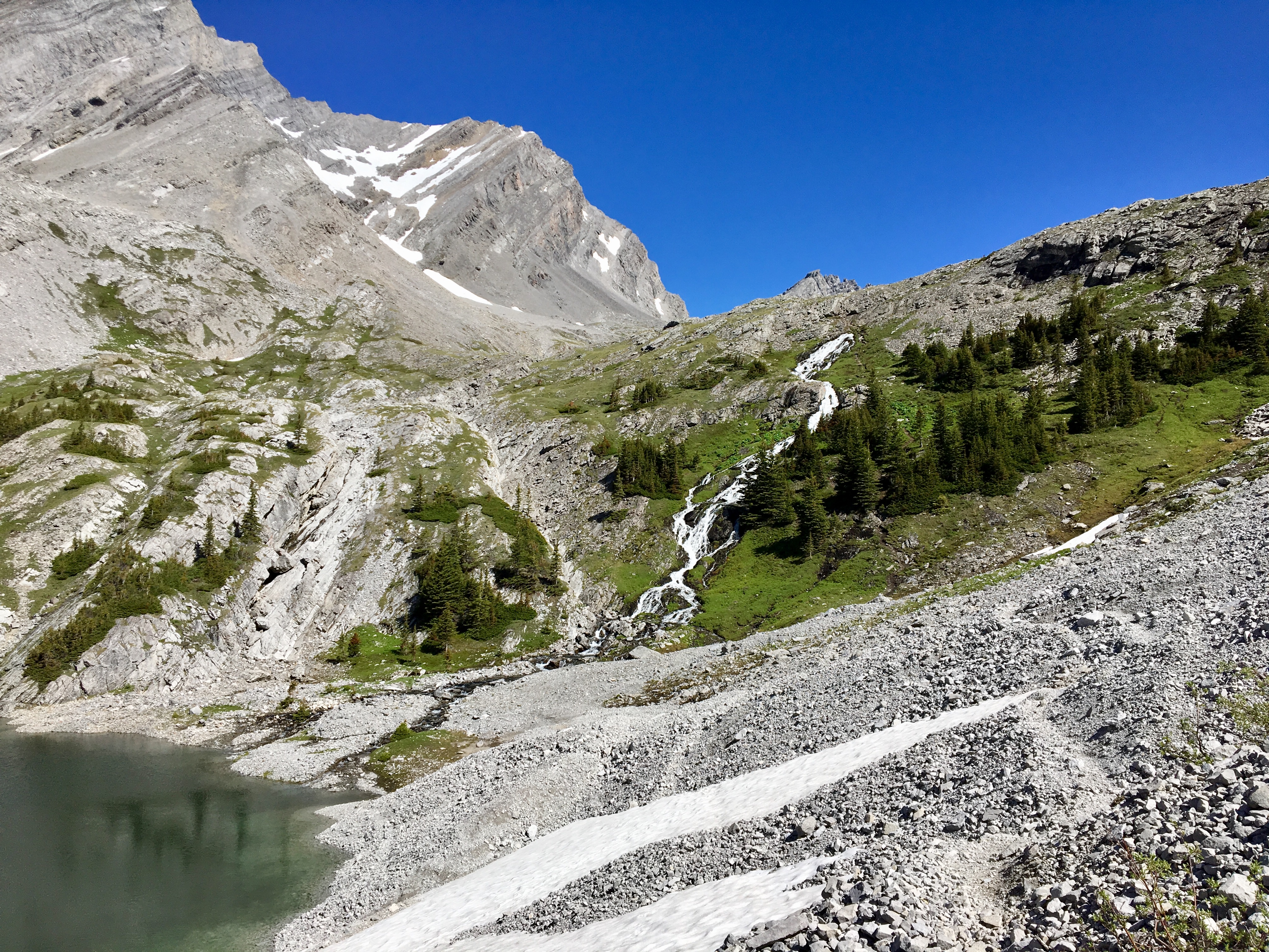
The trail skirts the edge of the boulder field and a waterfall coming down a treed slope becomes visible. It’s mostly obscured by trees, so the distant views aren’t great. At the end of the boulder field, the trail bears right, enters the trees and climbs. A second debris field is crossed and then the trail goes into another stand of trees eventually coming close by the top of the waterfall. A short detour from the main trail allows for a visit to the top of the falls. The portions of the trail climbing through the treed areas include some pretty steep sections with tricky footing. In the rain I think those sections would be fairly hazardous.
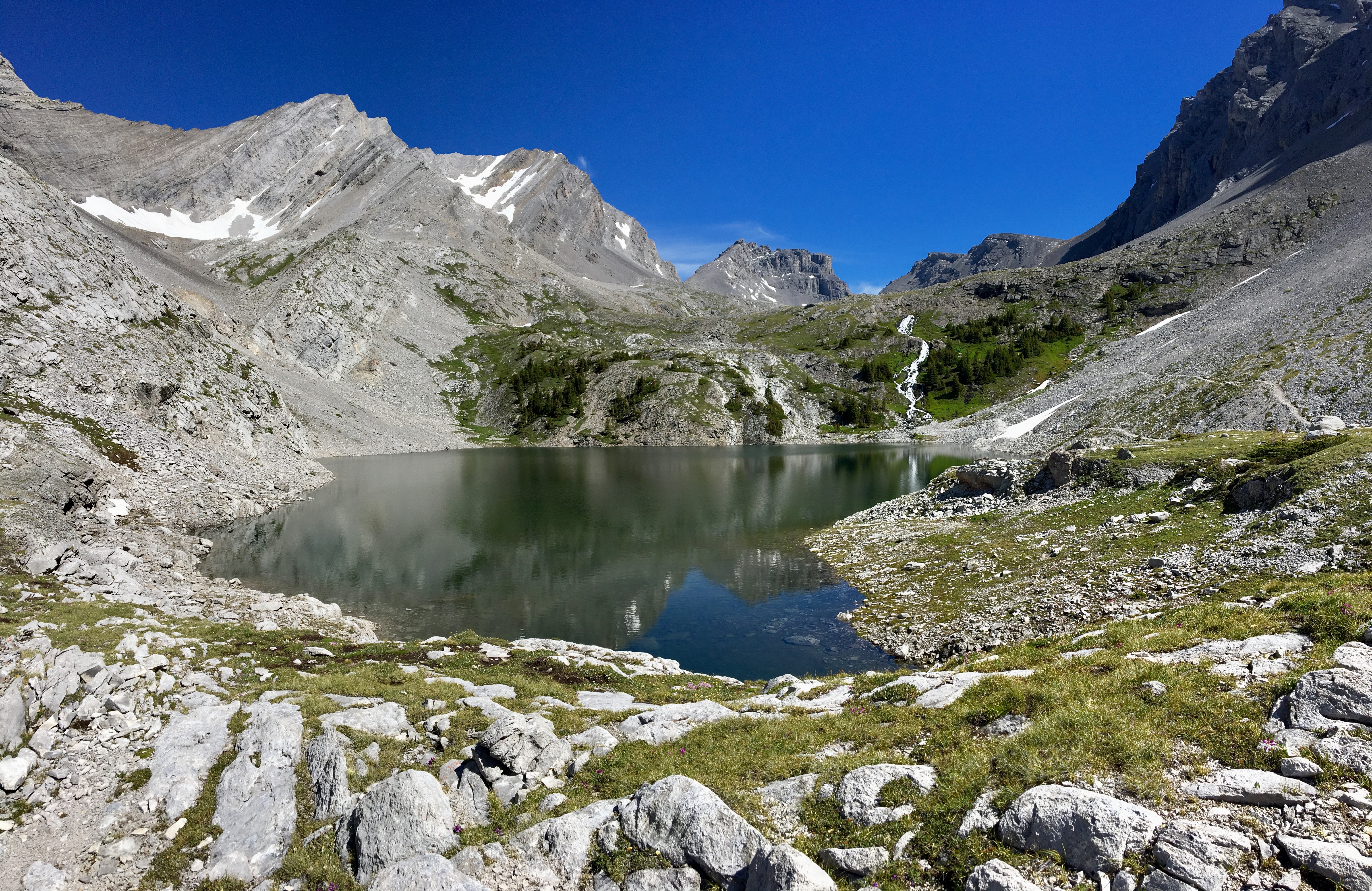
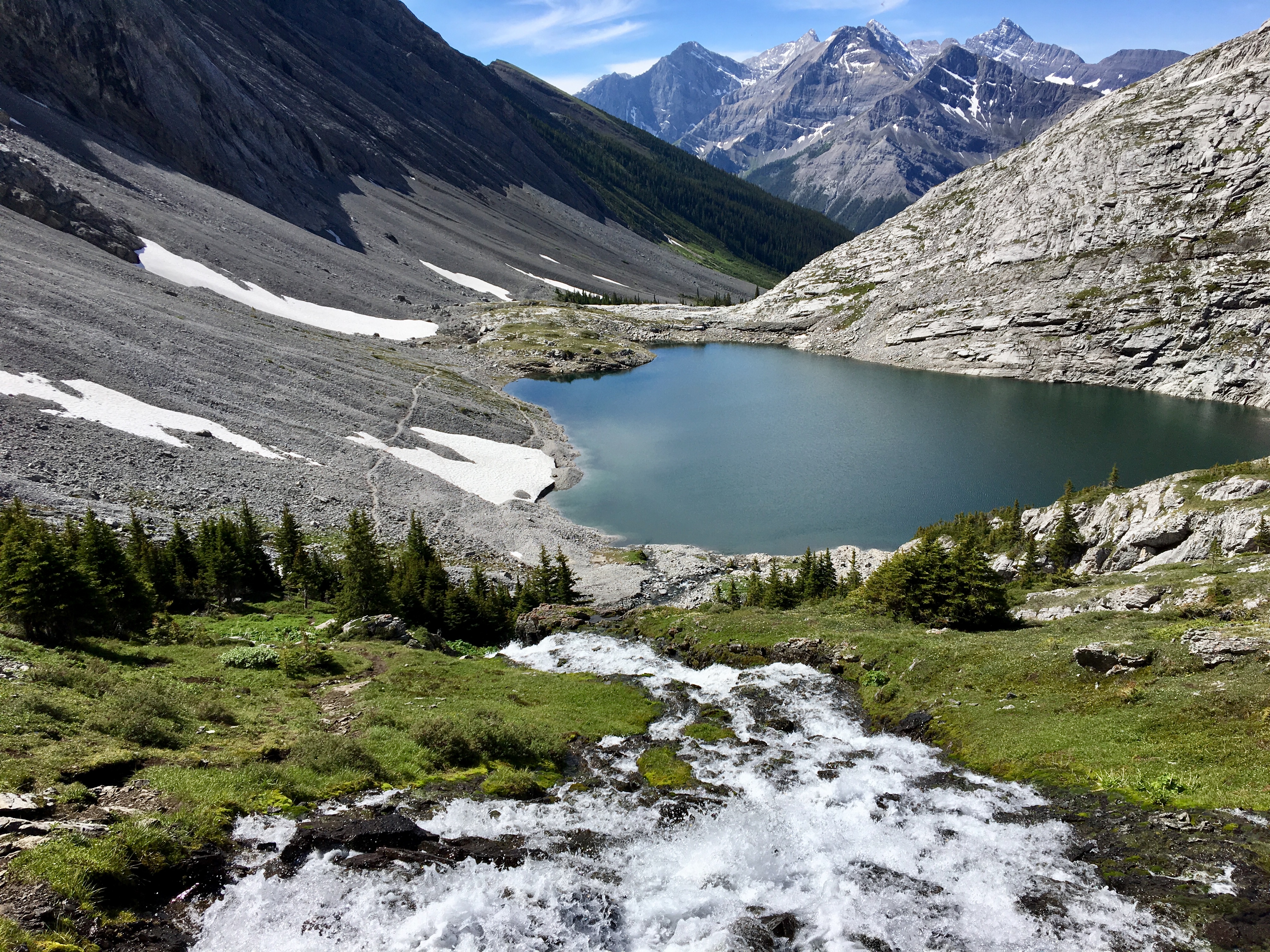
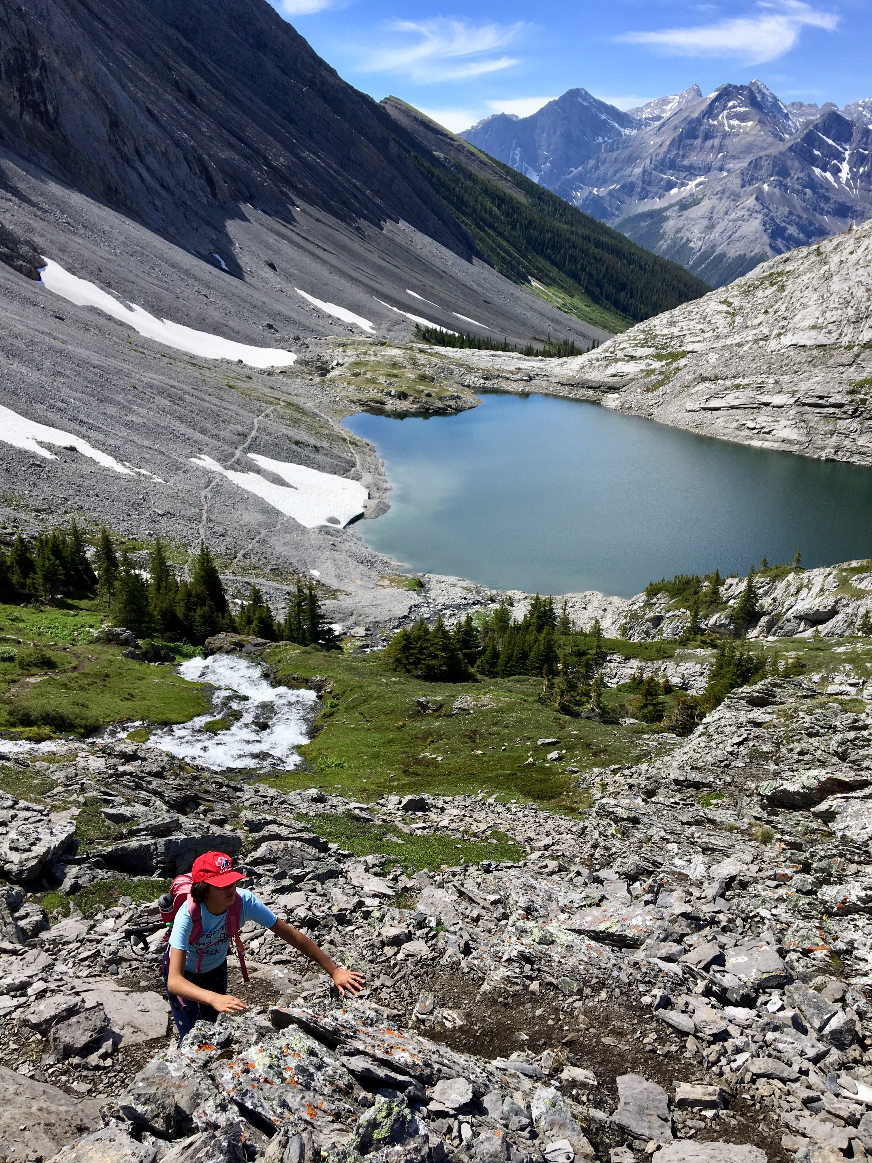
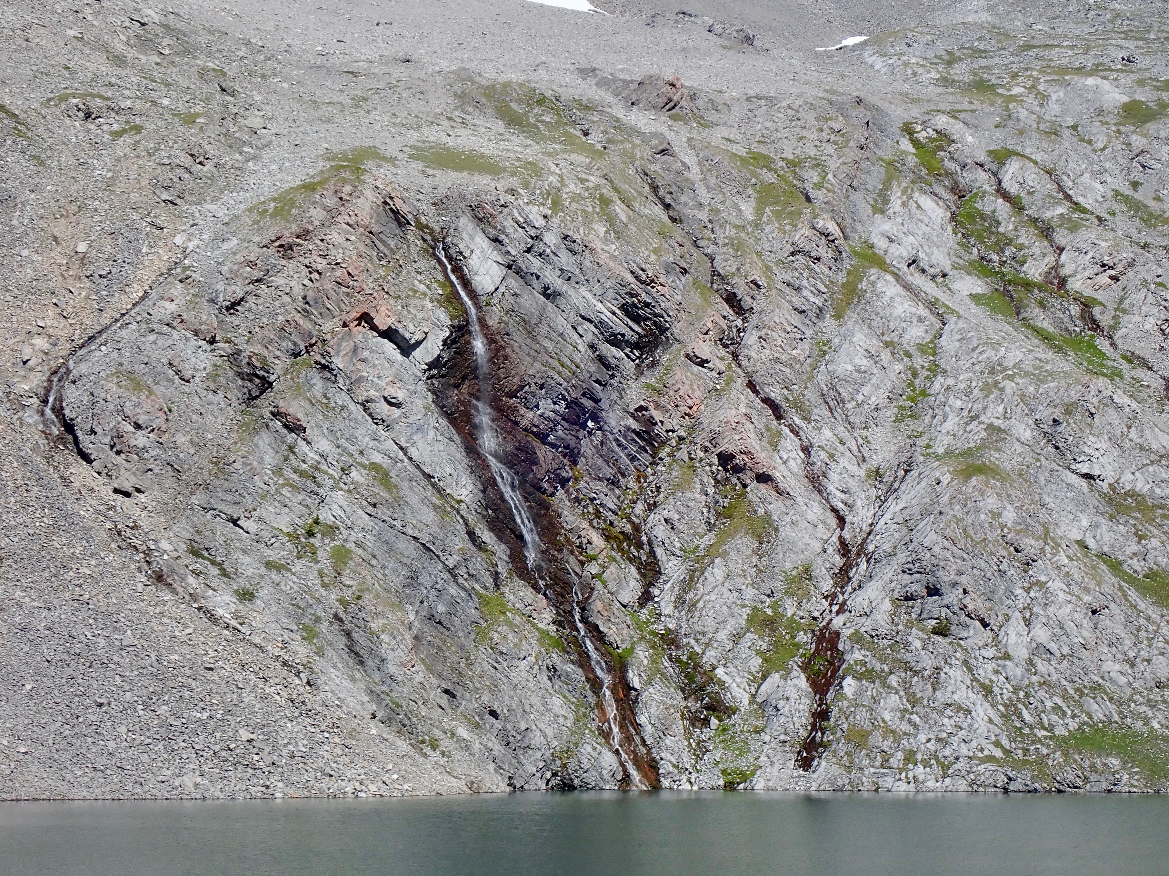
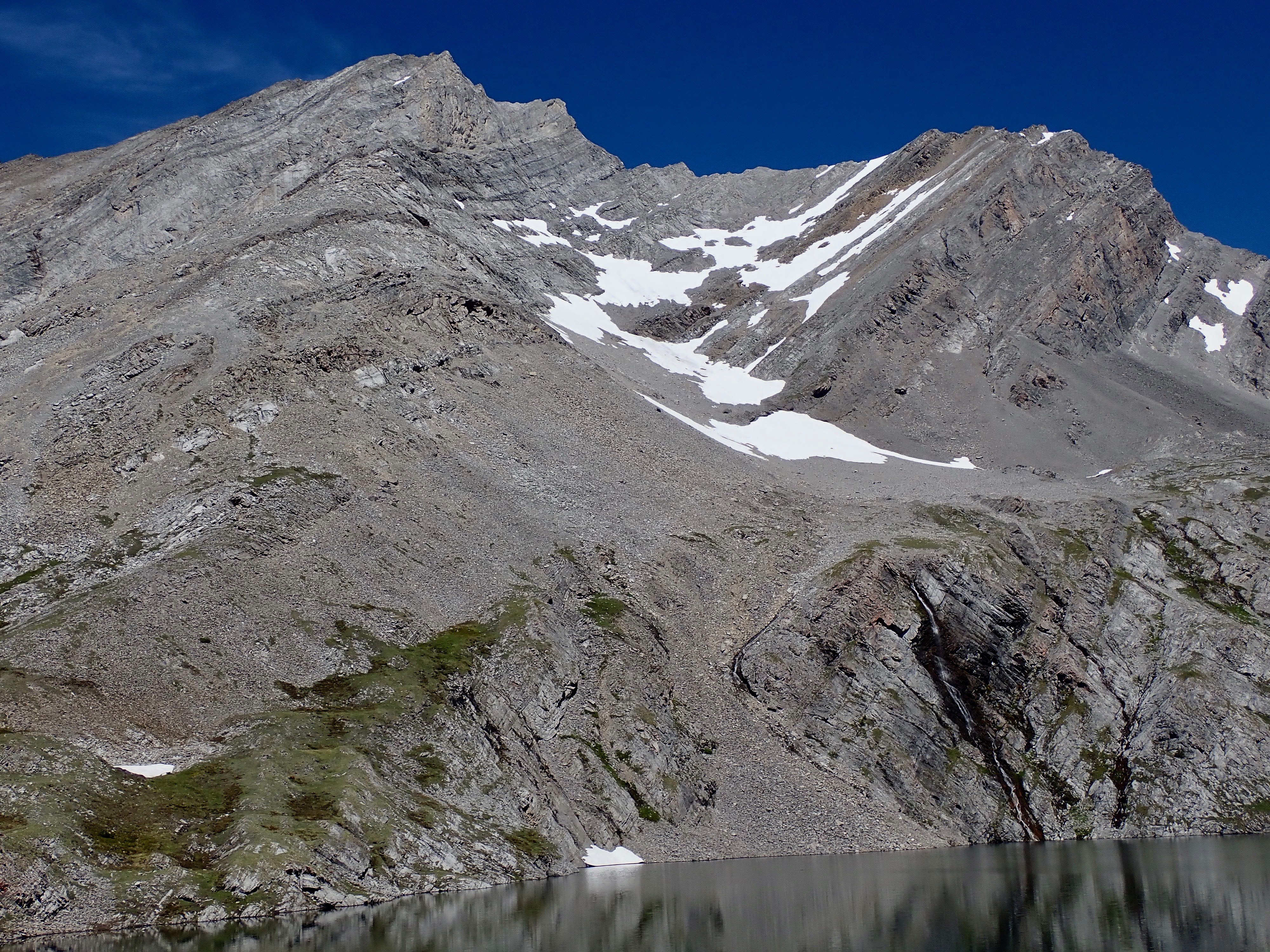
Leaving the trees again, the trail takes you to the first headwall and another debris field. One more quick climb, and the first of the Headwall Lakes comes into view. At the far end of it is a second, much more spectacular waterfall. The trail continues around the lake and ascends parallel to the waterfall, eventually crossing over directly above the point where the falls emerge from the rock. After a little more climbing, the trail reaches the second of the Headwall Lakes.
The lake sits in a spectacular valley, surrounded by Mount Chester to the west, The Fortress the the north, and the unnamed 3000m-high ridge separating Mount Chester from Mount James Walker to the east. Out the south end of the valley is an amazing view across the Smith-Dorrien Valley to high glaciated peaks on the continental divide.
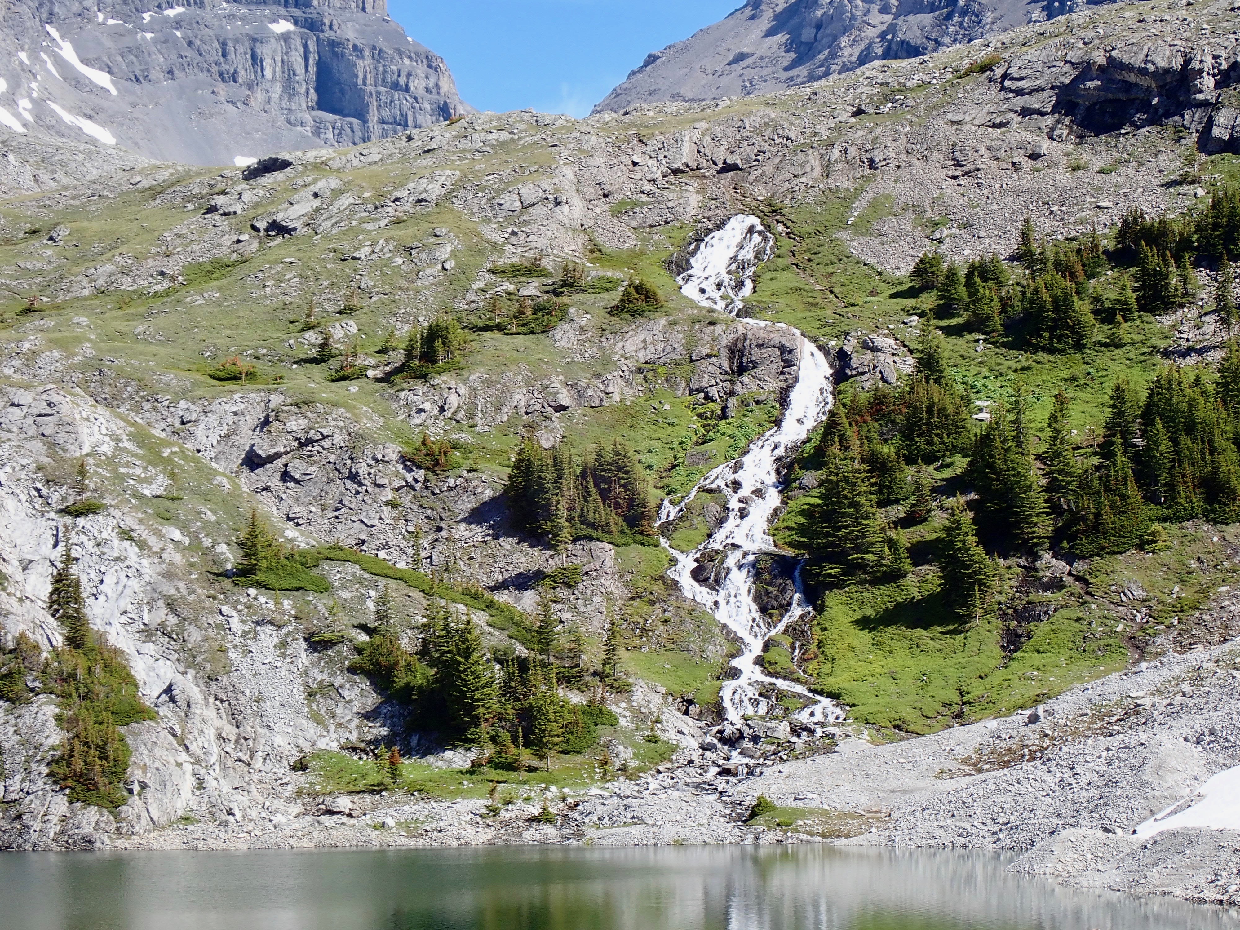
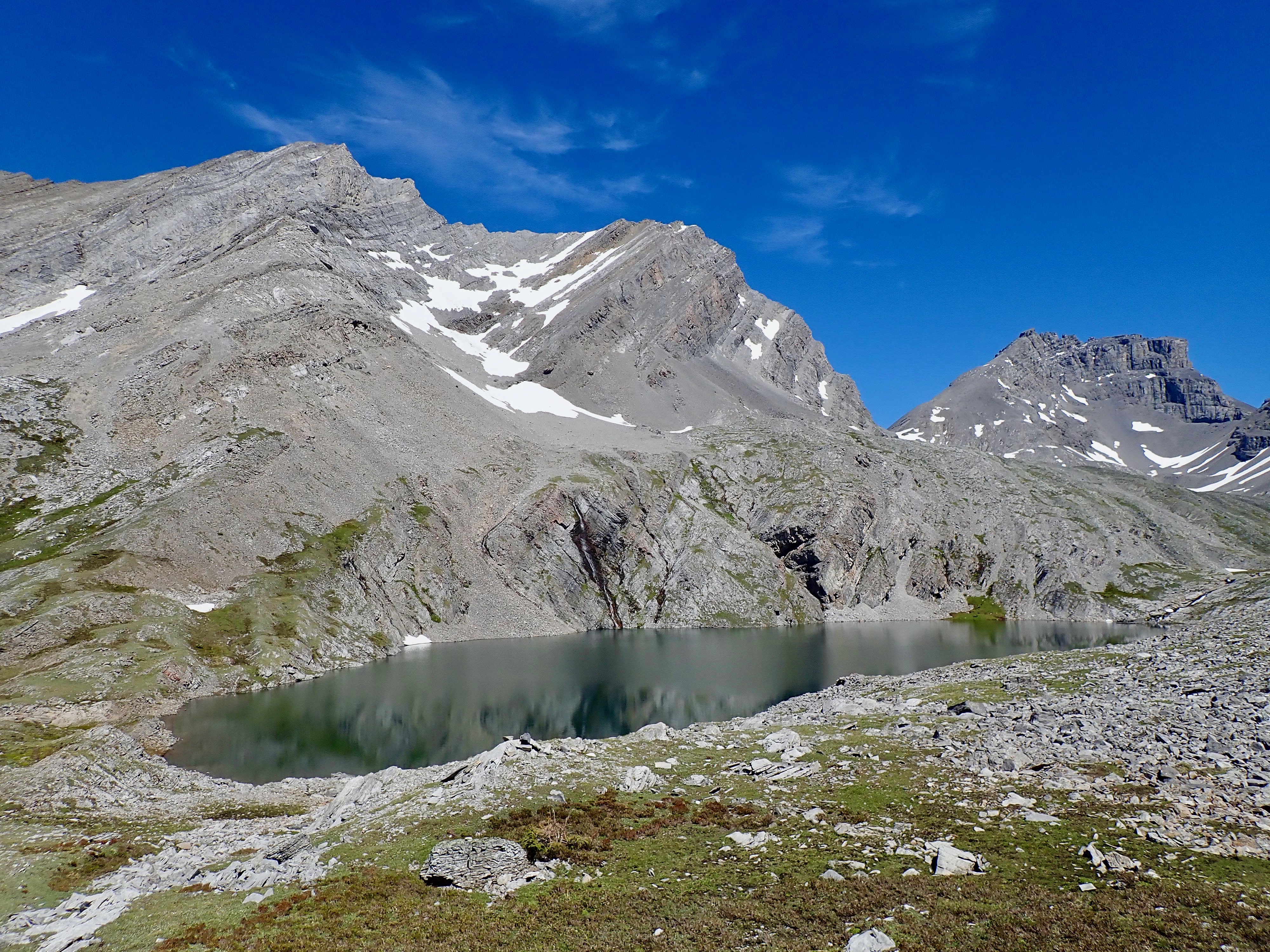
It’s possible to continue the journey, north past the 2nd lake, to check out another little waterfall and get a better look at the cirque under The Fortress’ southern face. We felt like we’d had a good day out, though, and didn’t press on. An epic loop route is possible involving continuing up the valley, then scaling the col between Mount Chester and The Fortress. After crossing over the col you can descend into the adjacent valley and head southwest to Chester Lake, and from there return to the parking lot. Something to keep in mind for another time.
I did this trip with my 11 year-old daughter, but wouldn’t really call this a kid-friendly hike. A fit and motivated pre-teen can definitely handle it, though.
Click on the pictures below for full-sized images.


One thought on “Headwall Lakes”