June 2, 2021. The easy scrambling route to a popular summit in the Crowsnest Pass.
- Region: Crowsnest Pass. Traditional territory of the Ktunaxa and Blackfoot First Nations
- Distance: 11 km
- Total Ascent: 1155 m
- Elevation of Objective: 2420 m
- Time: 4h 43m
- Safety and Disclaimer

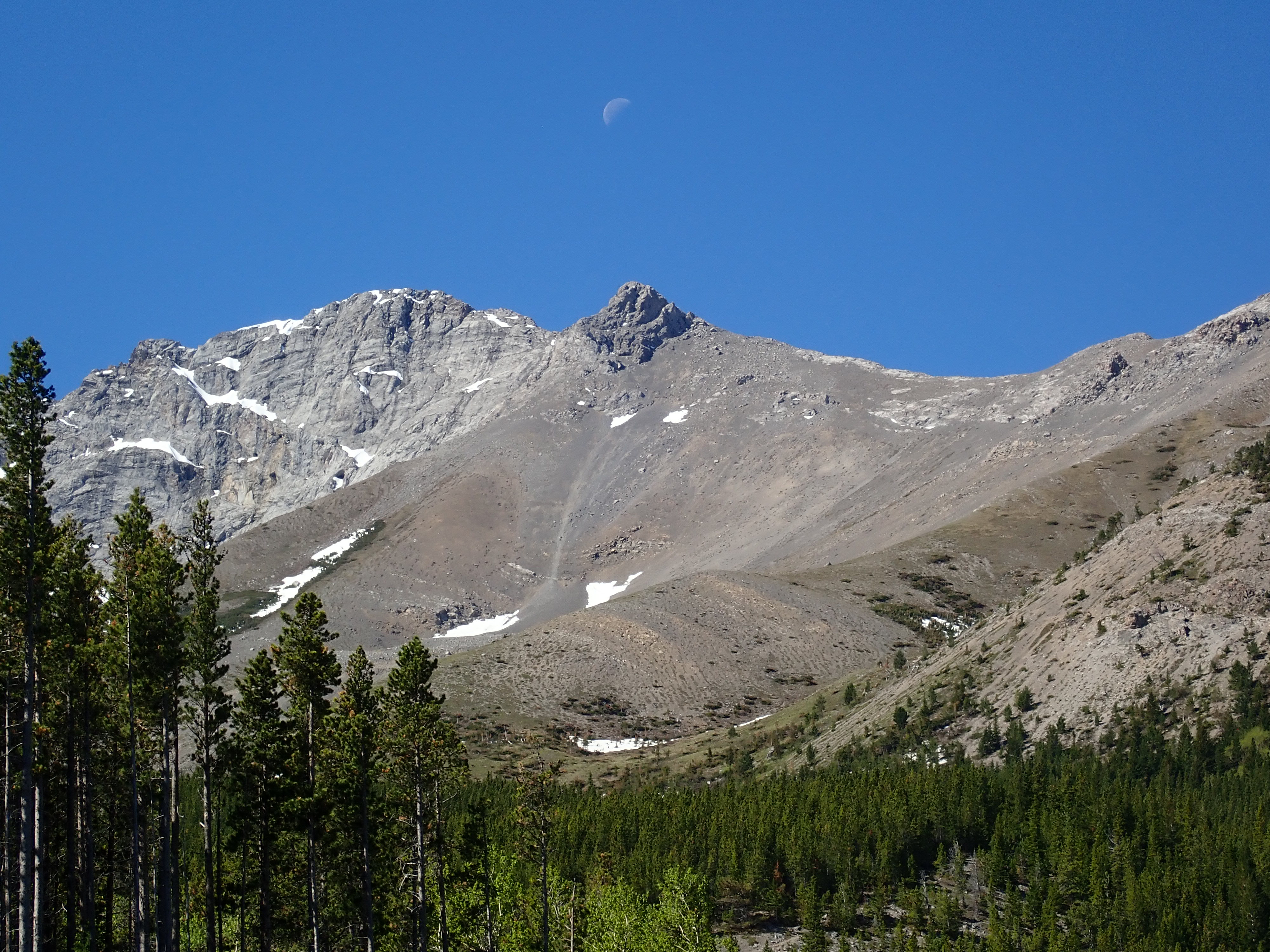
For my first trip to Sentry Mountain, I decided to use the eastern slopes approach which Matthew Clay describes on his blog. It’s also the route which Nugara has in his new book Popular Day Hikes: The Castle and Crowsnest. Typically, scramblers use the west ridge approach but that involves crossing a creek and I didn’t feel like doing that on a hot spring day when the flow was potentially problematic. The eastern route proved to be easy to access and provided me with an excellent day on the mountain.
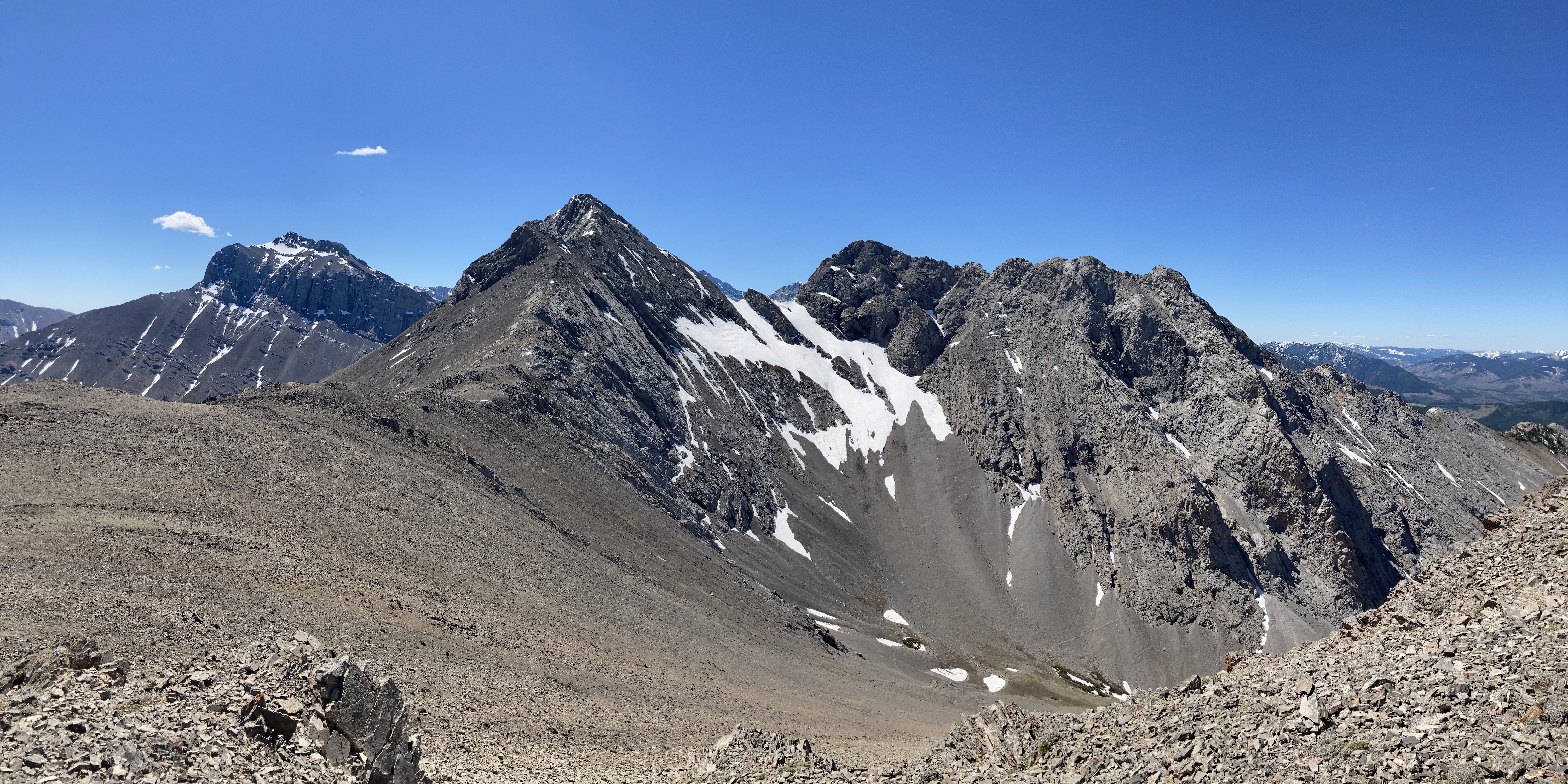
A note on naming: This peak is sometimes called Mount Sentry instead of Sentry Mountain. I’ve gone with the latter since that’s the name that appears in Kane’s book, Nugara’s book, and on the Adventure Guide and Topographic Map of Southwest Alberta which I picked up a few years ago from the tourist information centre in Coleman. Some online maps, including those from Garmin, give the name Sentry Mountain to the peak sitting on the ridge between this peak and Chinook Peak. I’m not sure why that is. In scrambling circles that summit is typically referred to as “Ostracized Peak” – a name which So Nakagawa bestowed upon it several years ago.
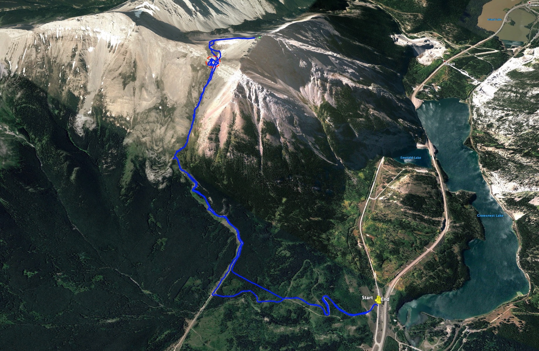
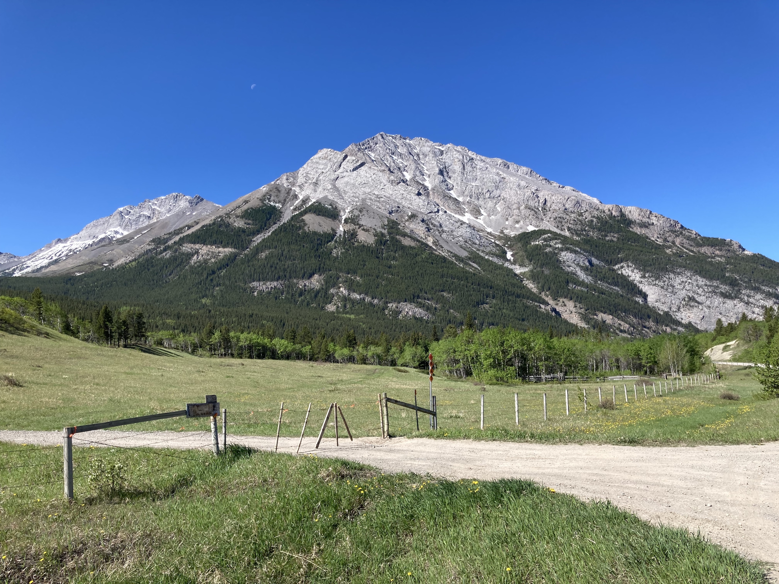
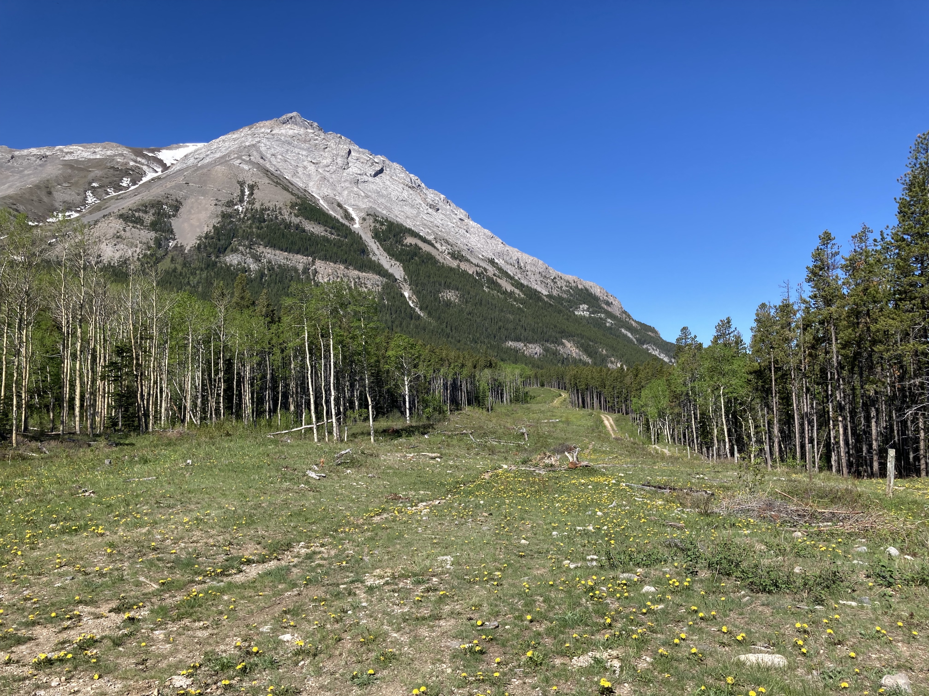
Access is from Hwy 3. Driving west from Coleman, just before the highway gets to Crowsnest Lake, there’s an unsigned left turn onto a parallel road. This used to be the access point for a now decommissioned tourist information centre. Turn left off the highway, then immediately right (the only way you can go now, the parking lot to the left is blocked by barriers). About 400 m along this road there’s a barbed wire gate to the south. This apparently used to have a sign on it regarding contacting a leaseholder for access. That is no longer the case and I found it marked with OHV symbols. This is the start of the route. You can park off to the side here or go a little further down the road to another parking area. Click here to see the spot on Google Maps. The gate is not locked, but held closed by some wire loops. Undoing the loops might be a little tricky. Remember to close the gate again when you’re through.
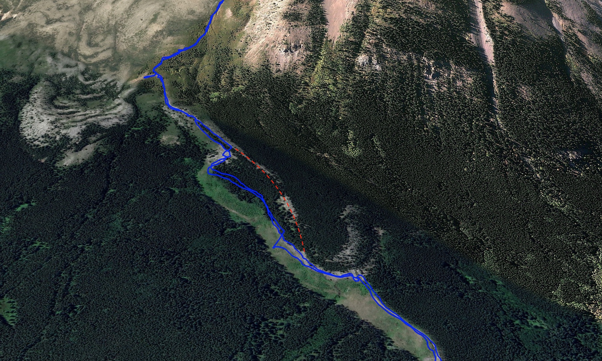
I followed the road up along a broad switchback, past an open barbed wire gate, and finally to a broad east-west cut line where there was a Texas gate. If I had been paying attention and looked to my right as I went through the first open gate I would have seen a narrow cutline heading due south. This would have taken me to the broad cutline in a more direct fashion, though I only lost about 5 minutes by missing it. I did use this narrow cutline on the way back. Once at the broad cutline, I couldn’t remember whether I was supposed to go through the Texas gate so the barbed wire fence was on my right, or if I was supposed to follow along the old road at the edge of the cutline, thus keeping the fence on my left. I decided to take the opportunity to go through the gate. This ended up working out fine, though staying on the road then passing through the barbed wire later on would have allowed move faster.
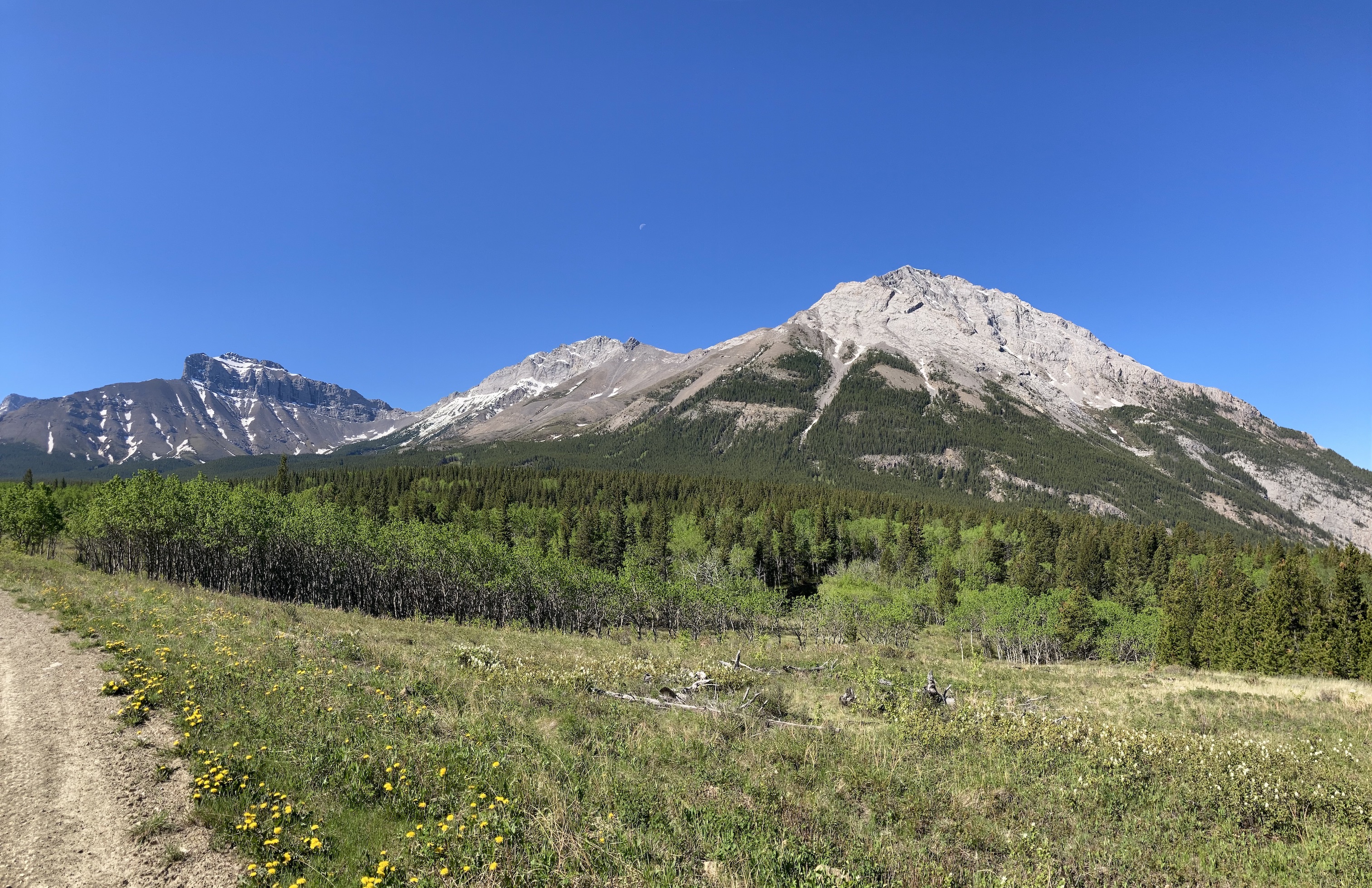
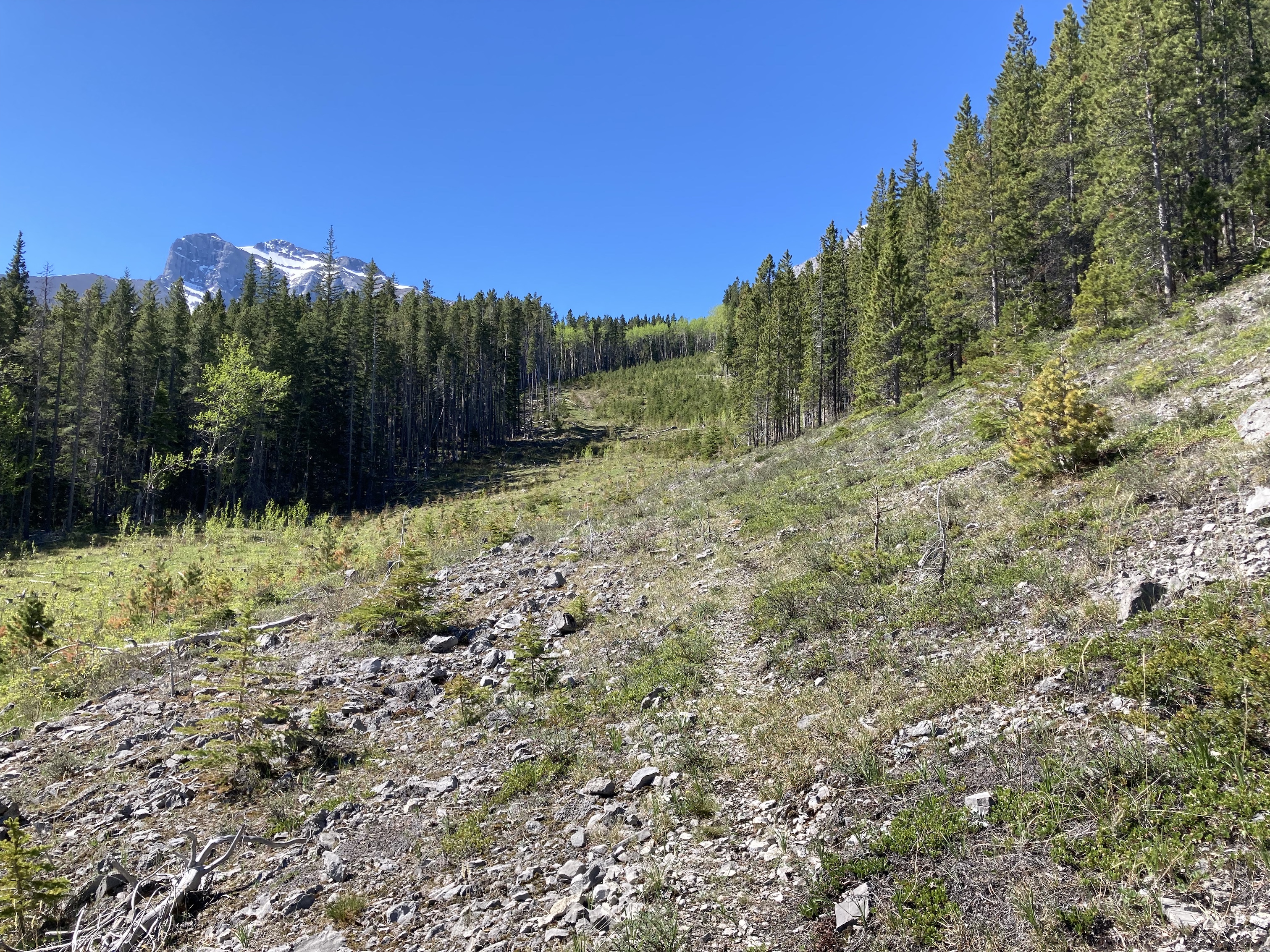
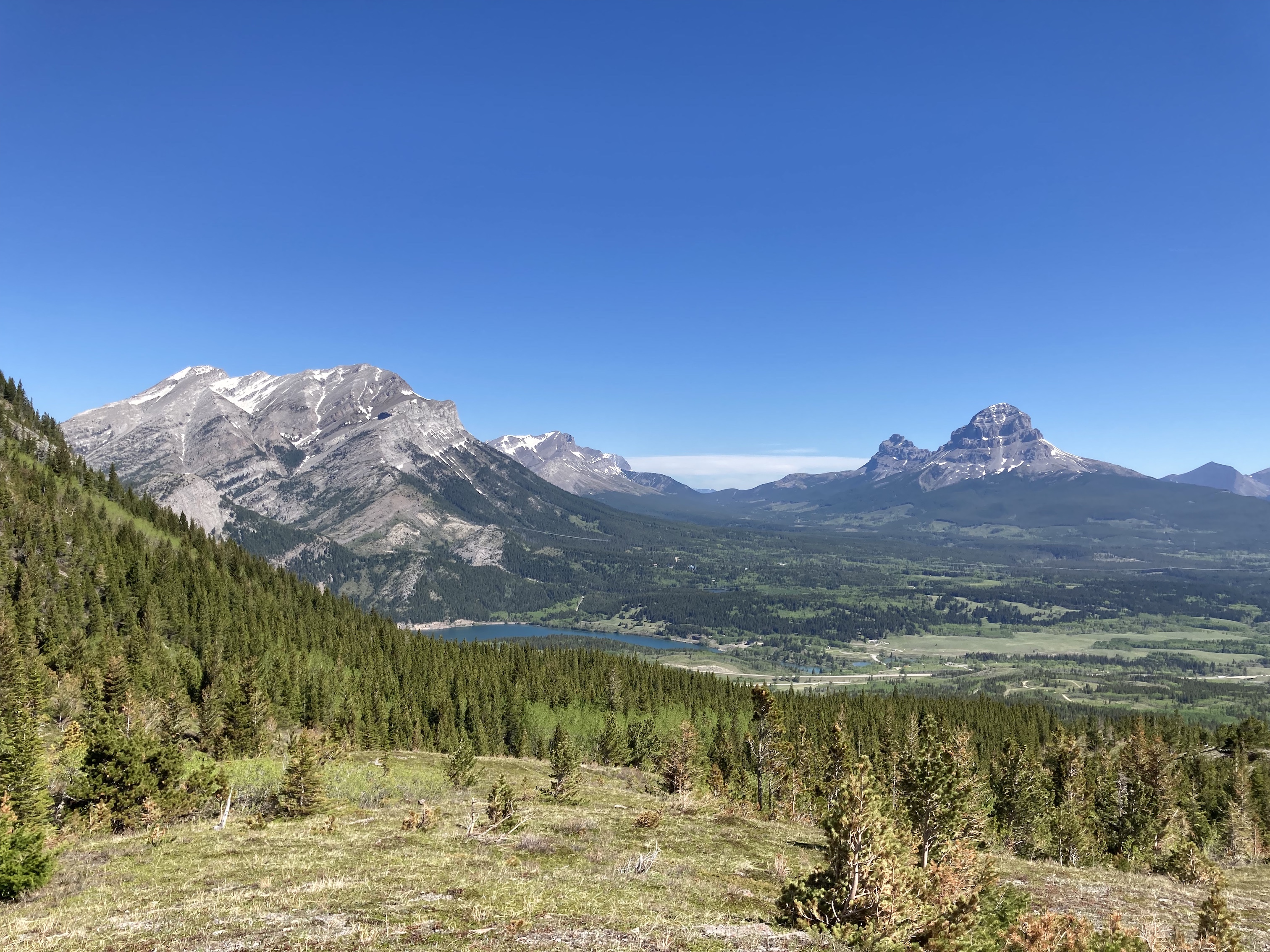
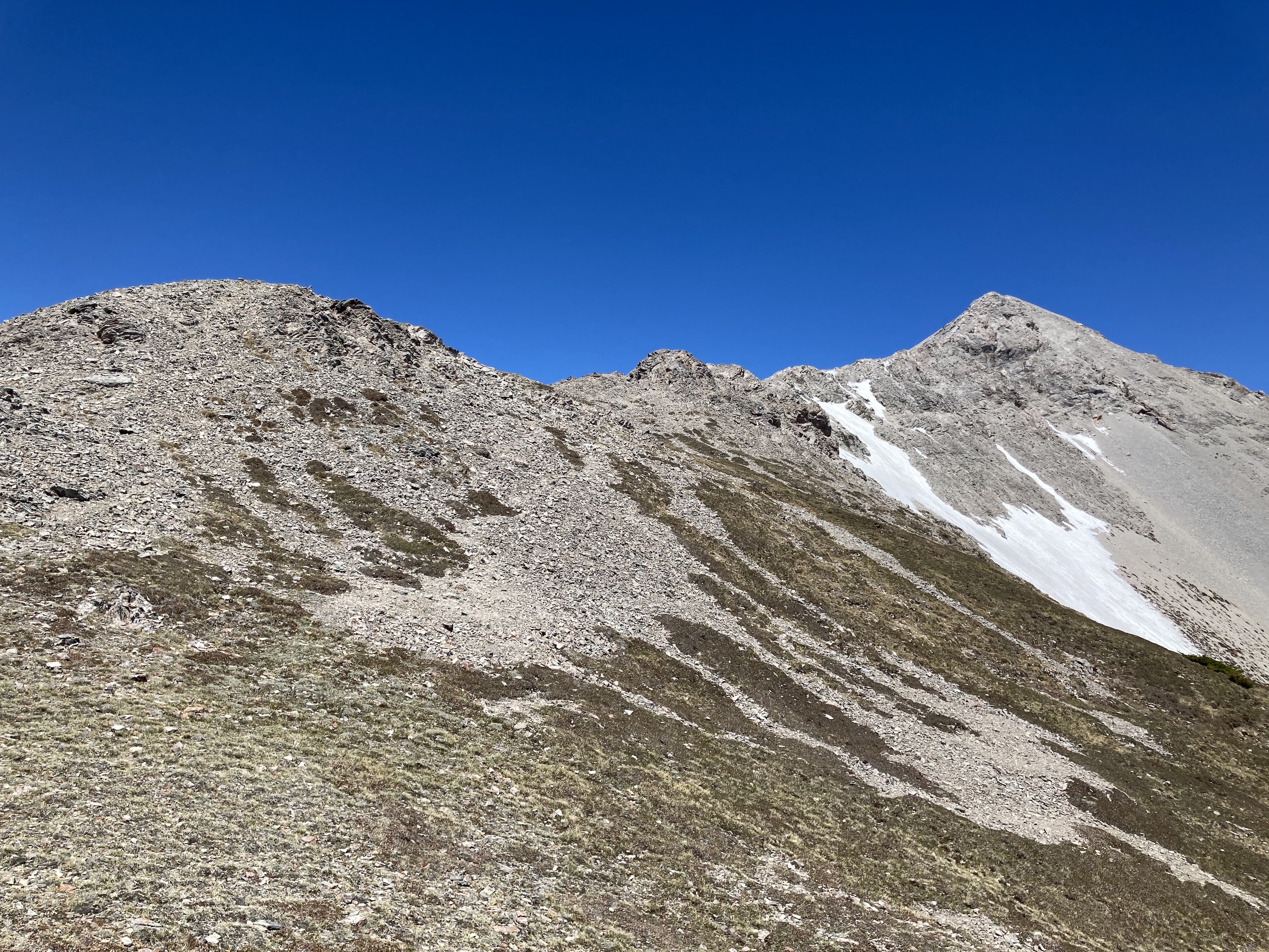
I walked along in the broad cutline for about 500-600 meters then followed along its right side as it curved south. At this point there was a trail visible in the stones and dirt which was reasonably easy to follow. It eventually entered the trees alongside the clearing and passed through the woods for a short time before emerging back into the open. Here the uphill terrain to the right was also in the open, and I could see a track heading straight up. This ascent was fairly short and I found myself on a low berm which ran in a north-south. Walking on the apex of this berm the views started to open up. I eventually made my way to what Nugara calls Sentry Hill – a clear high point with excellent views all around. This, incidentally, would make for a fine destination for anyone not inclined to ascend the entire mountain – it’s only about 3.5 km from the parking area with about 360 m elevation gain.
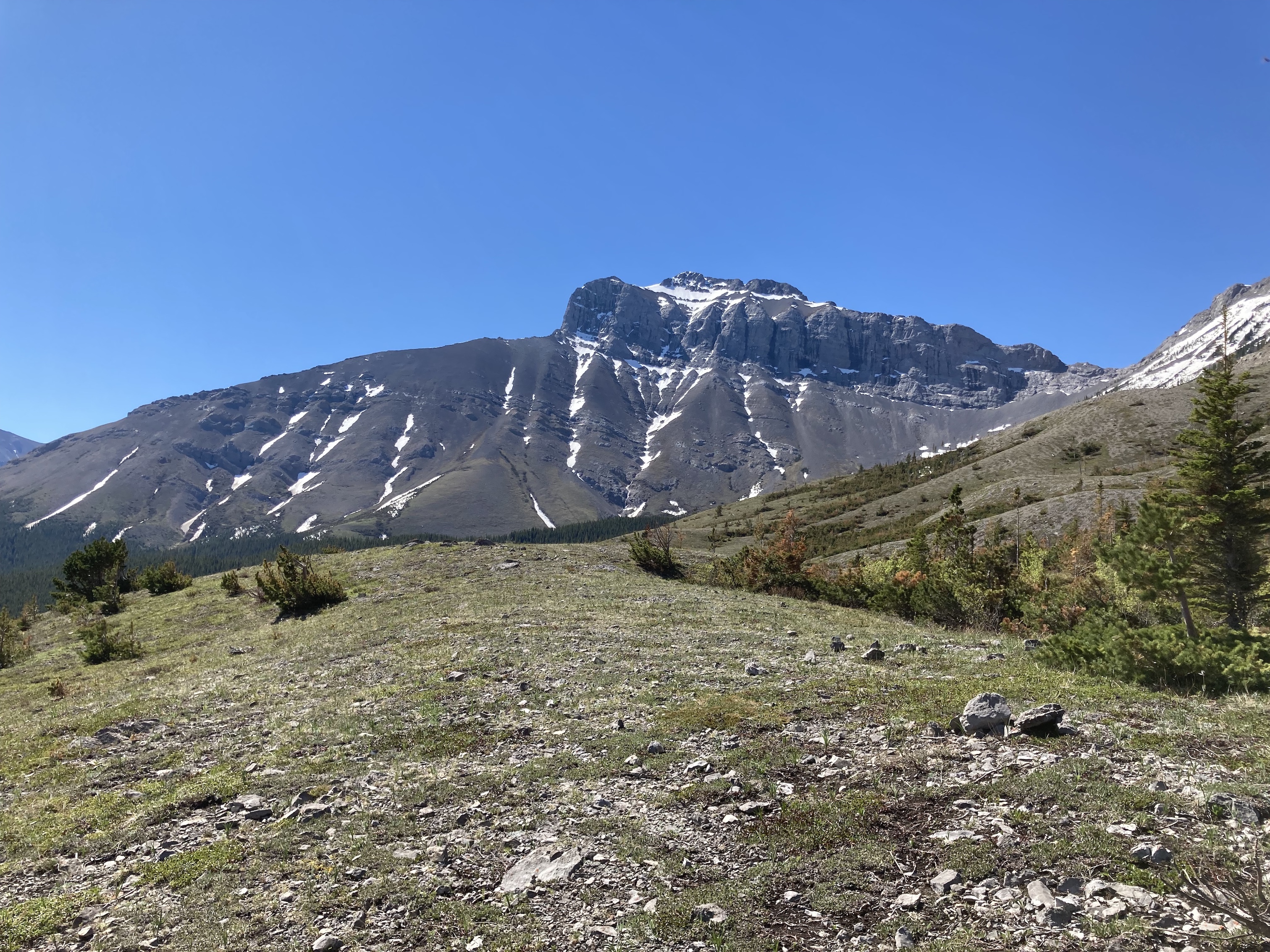
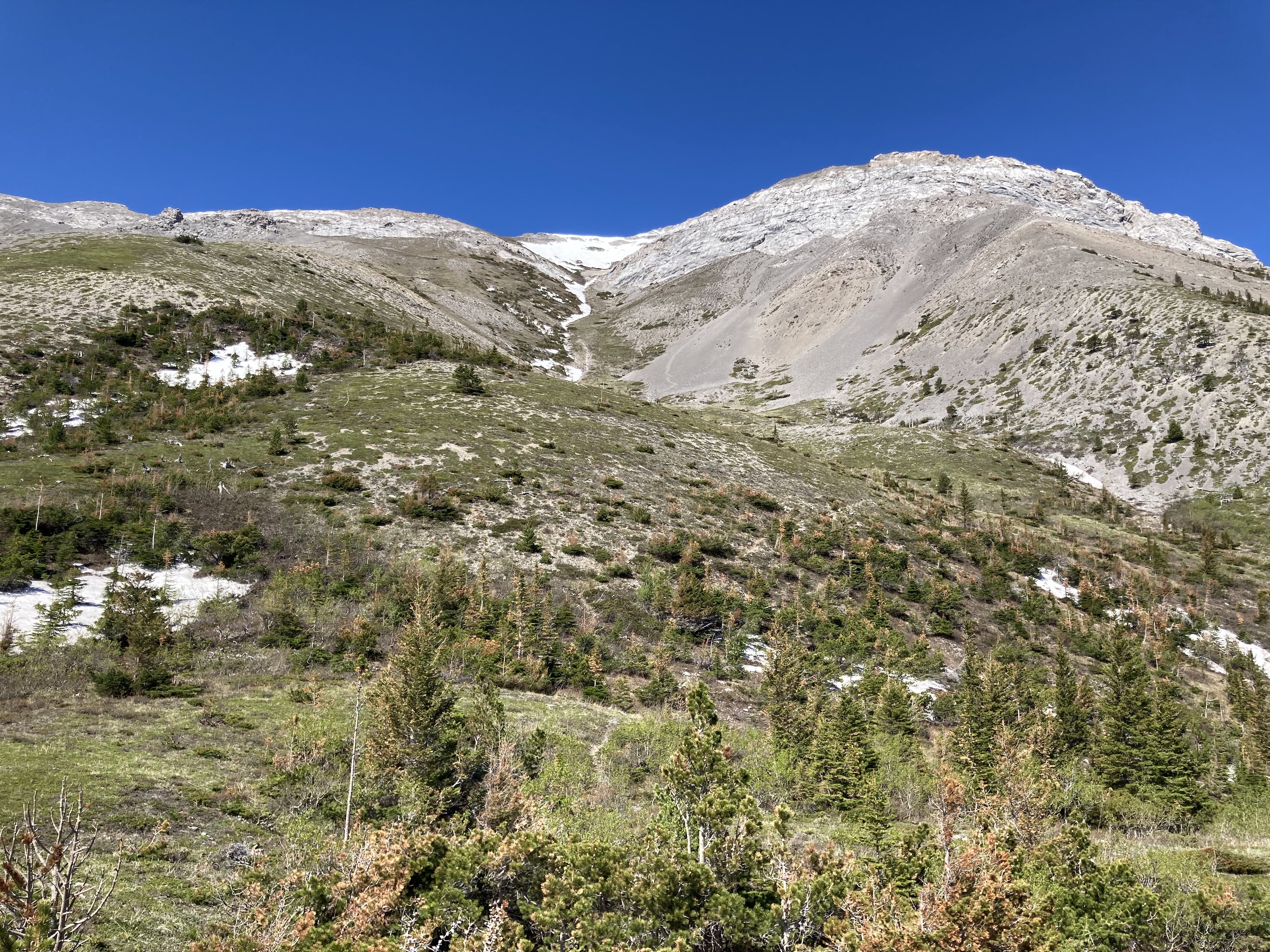
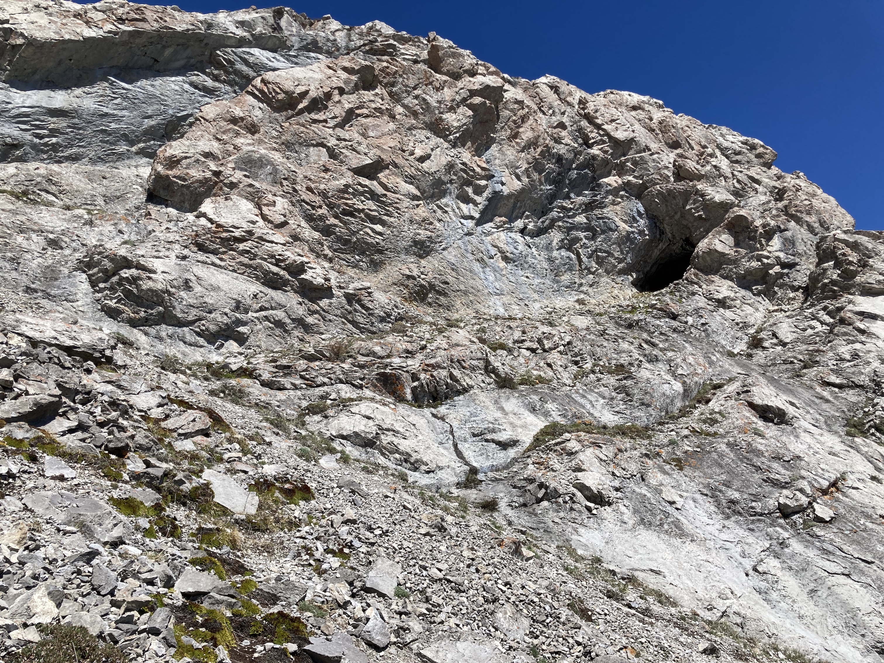
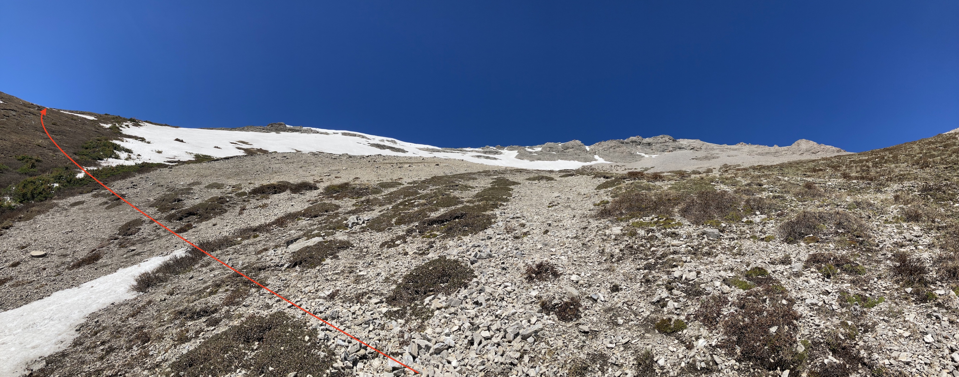
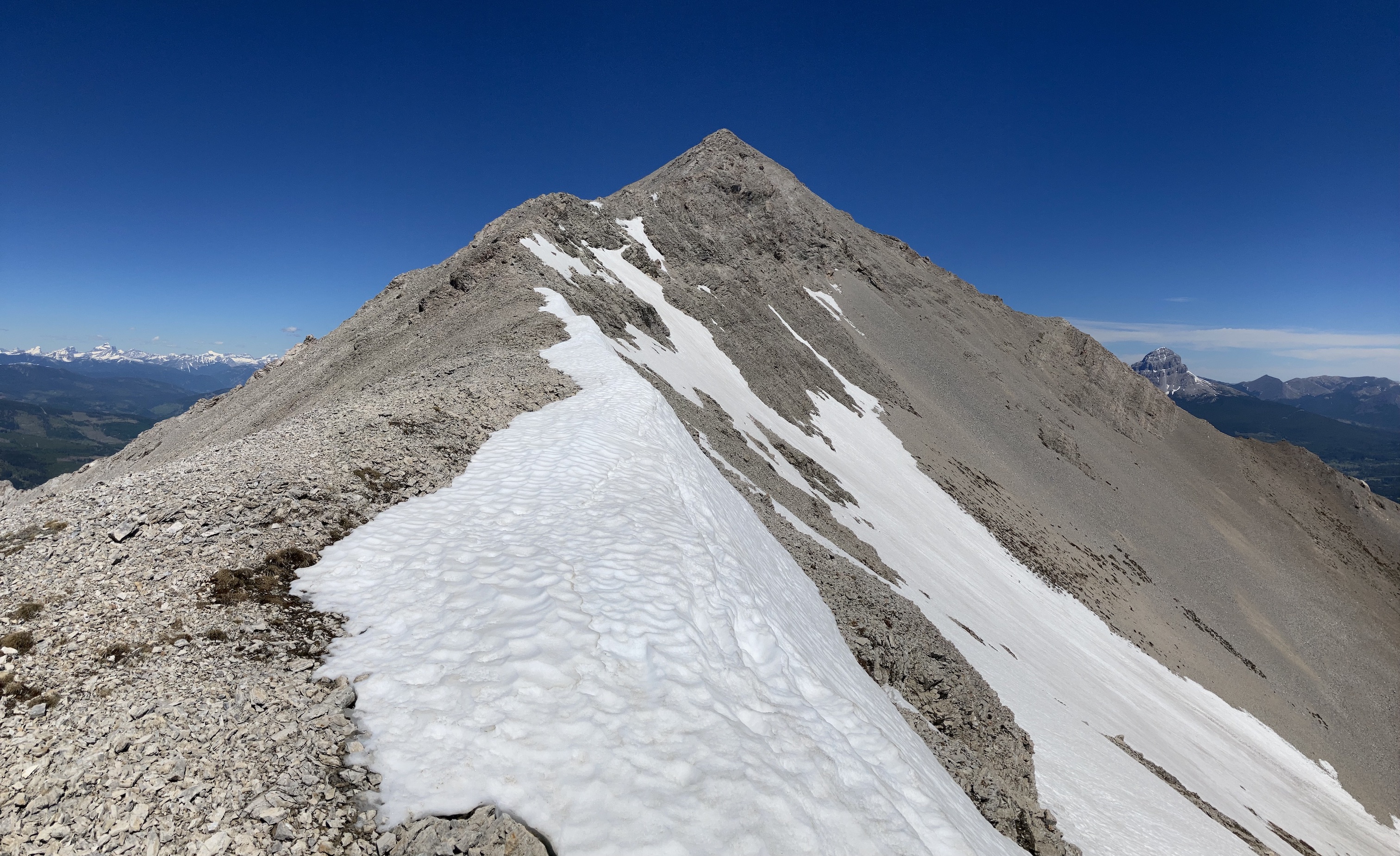
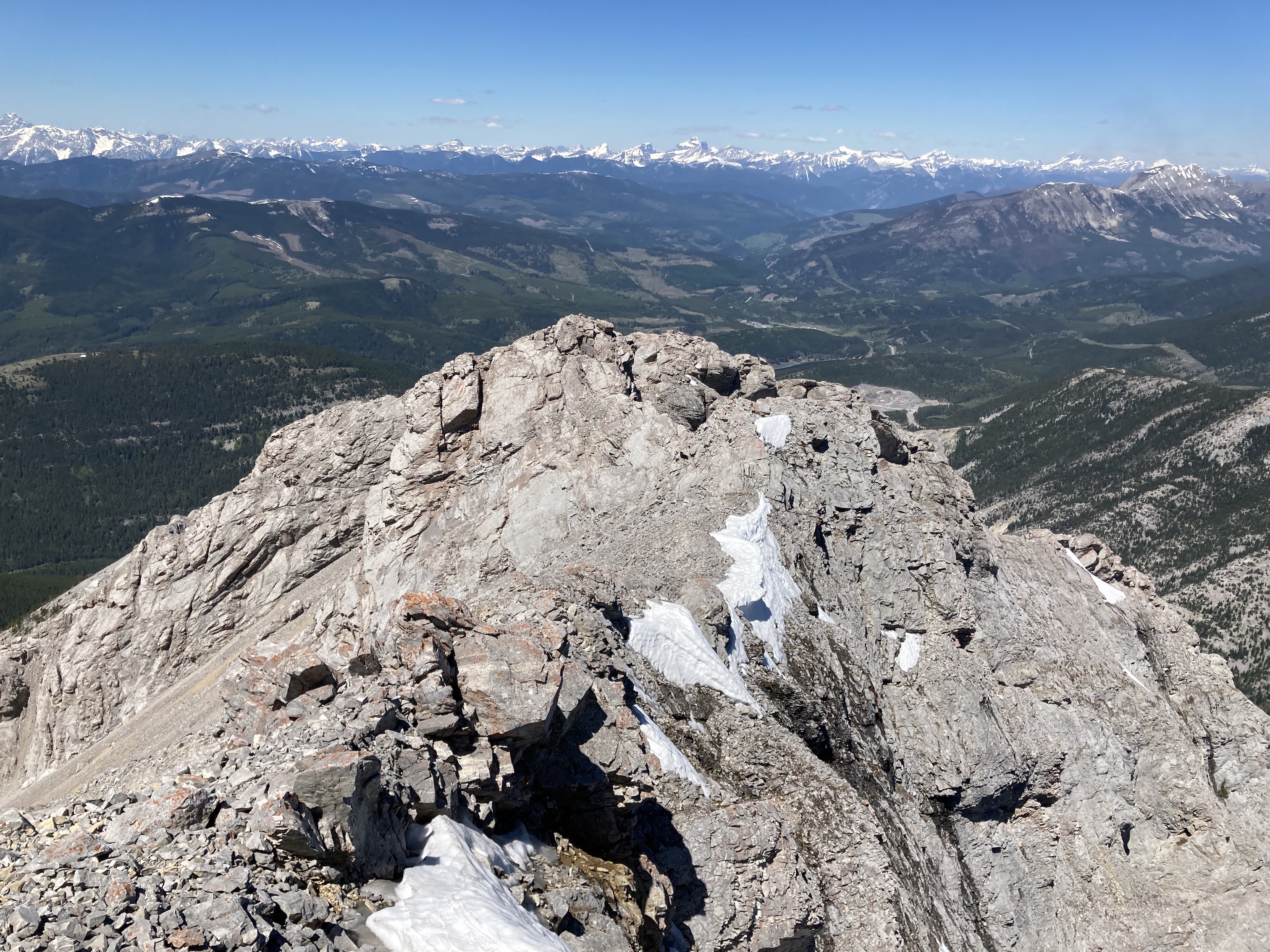
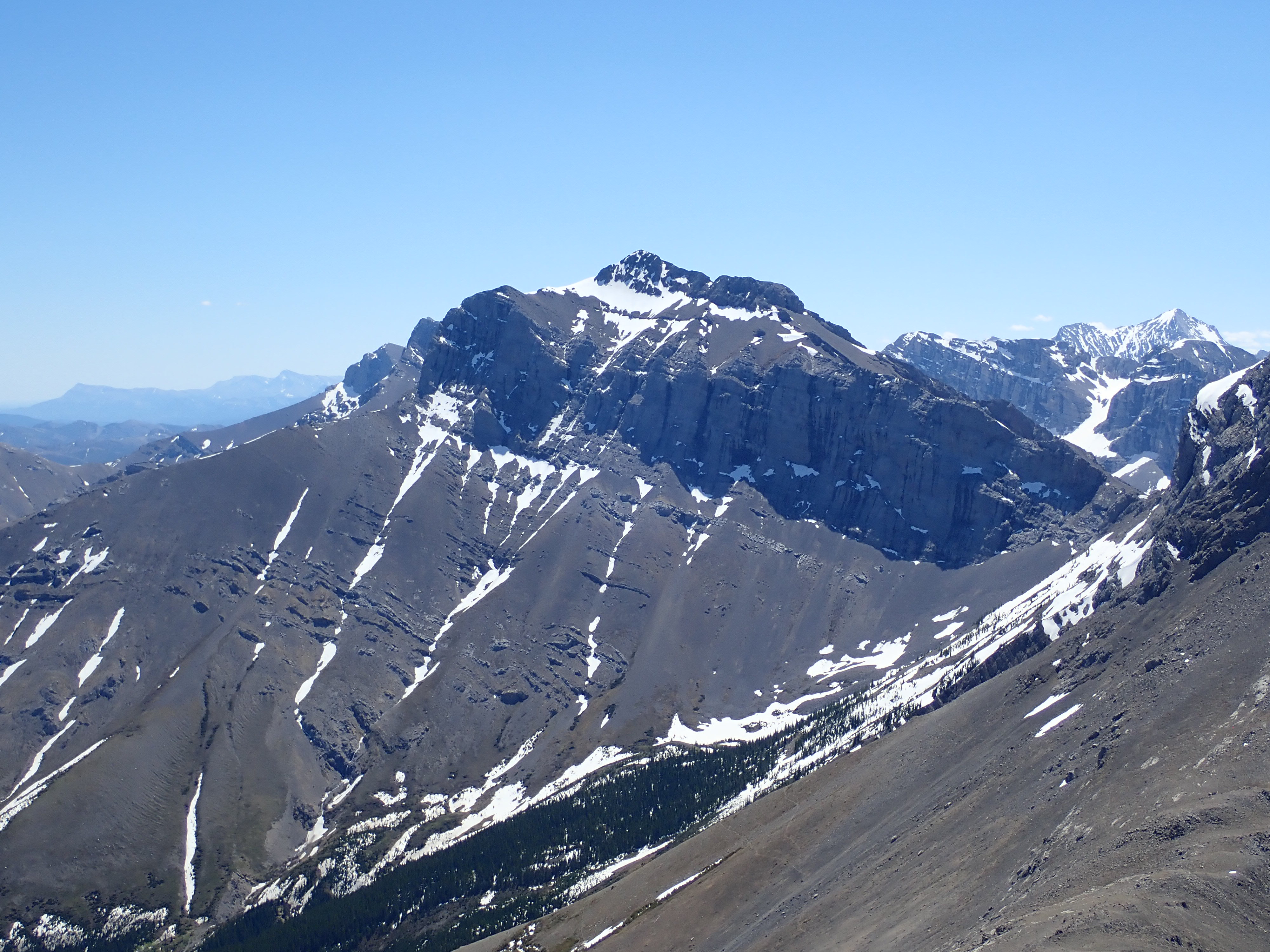
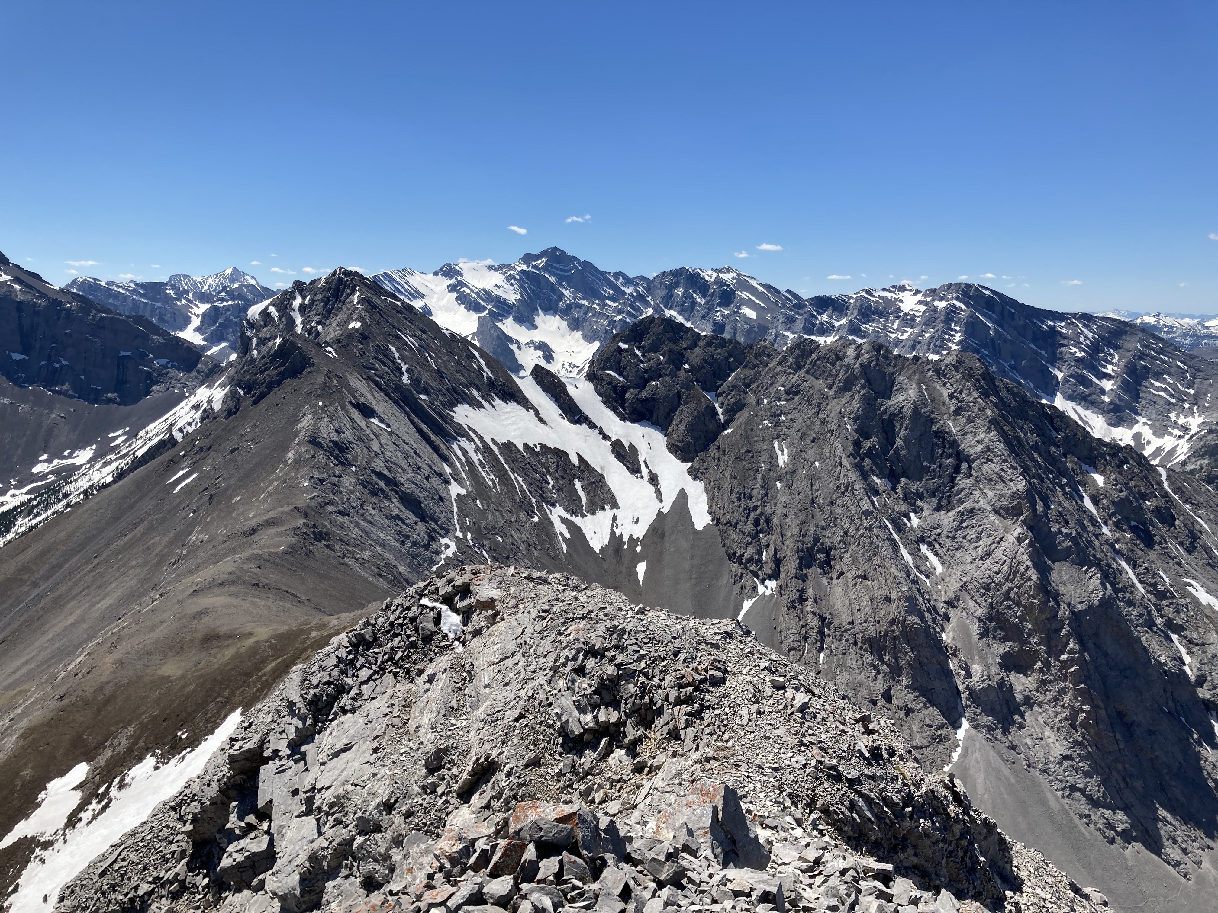
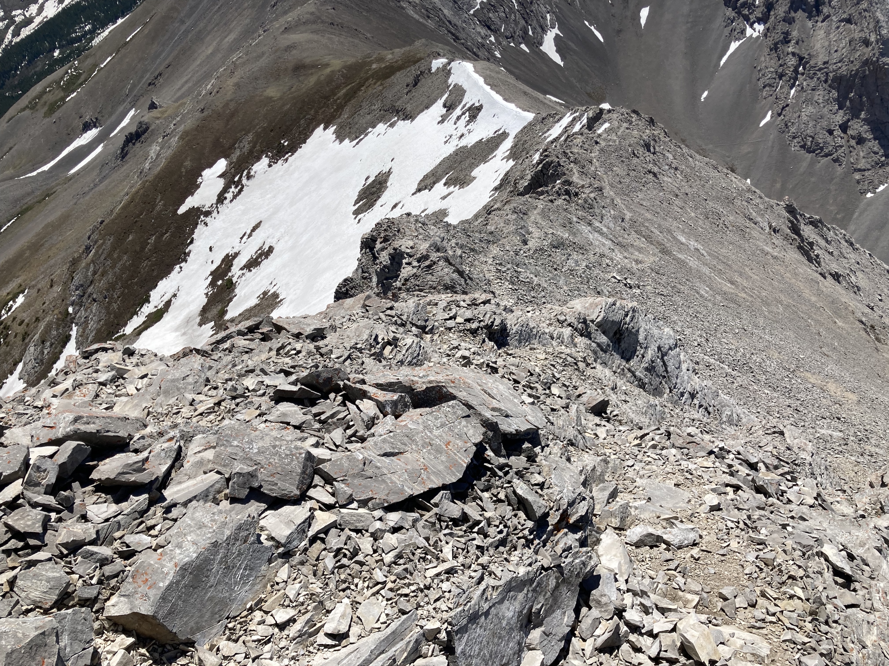
From this point the eastern face of Sentry Mountain is clearly in view. I began to ascend, heading to a drainage that still had some snow in it. I kept to the right of this drainage on my way up and boot-skied it on the way down. The ascent is quite steep and leads to a rock face. When I reached there I found a small cave which sits a short distance up the face. I checked out the cave entrance, which was absolutely carpeted by animal droppings, so not really that pleasant a place to visit. After climbing down from the cave I continued up the slope beyond the rock face. The summit rocks came into view above and to the right, but I bore left towards the low point of the col between Mount Sentry and Ostracized Peak. Once on the col, I turned right and enjoyed some easy scrambling to get to the summit. It took 2 hours 24 minutes to ascend.
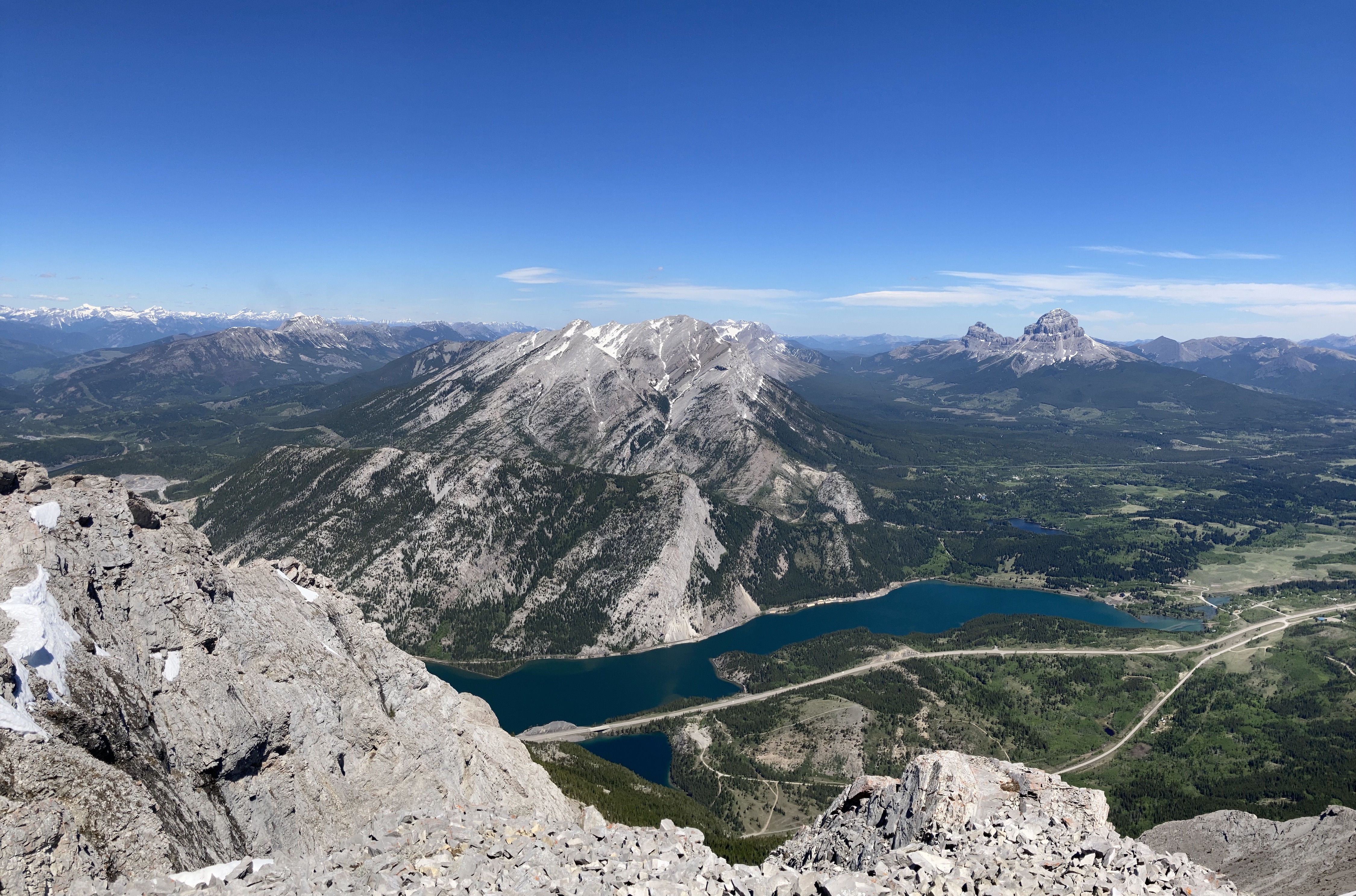
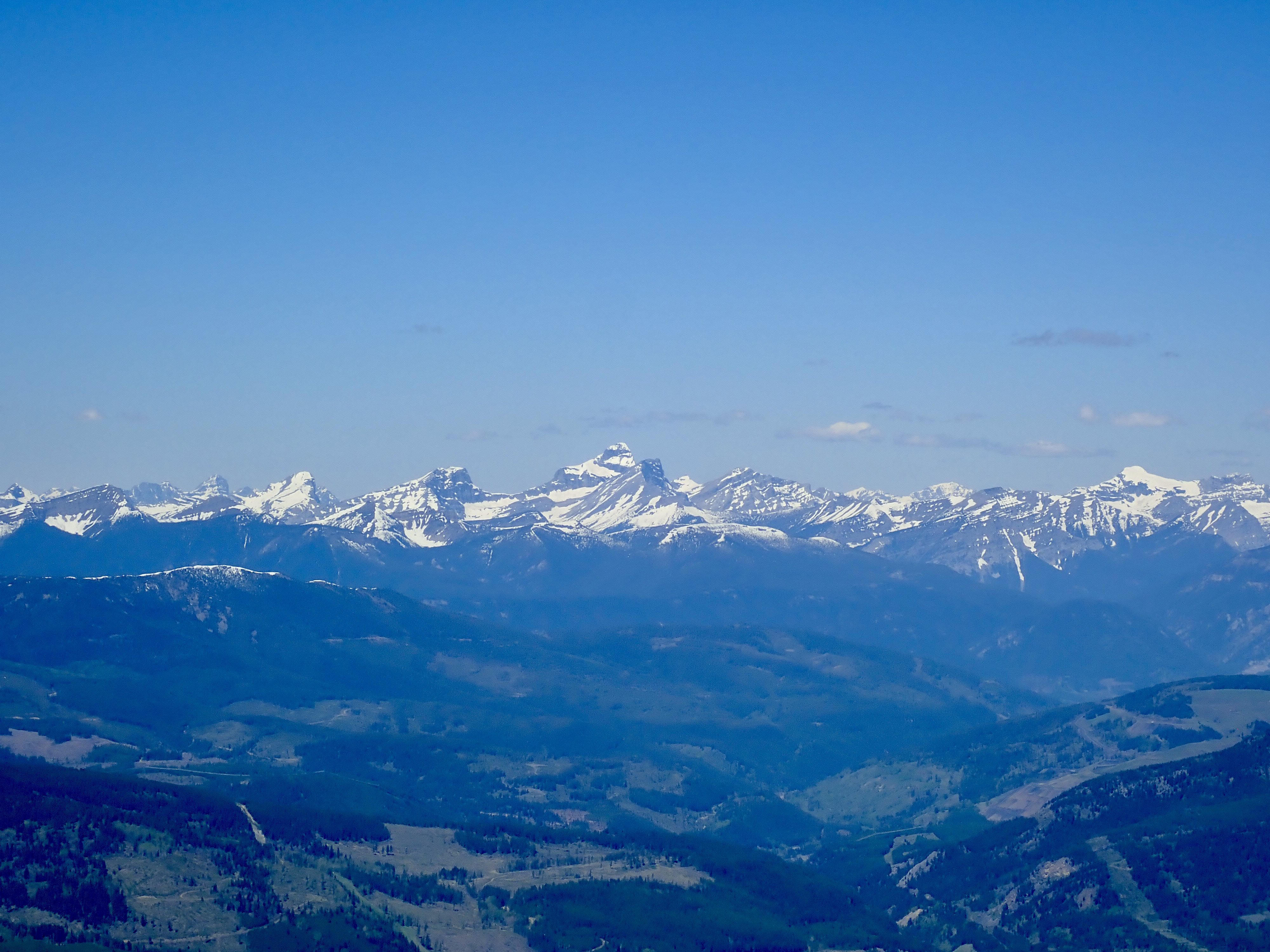
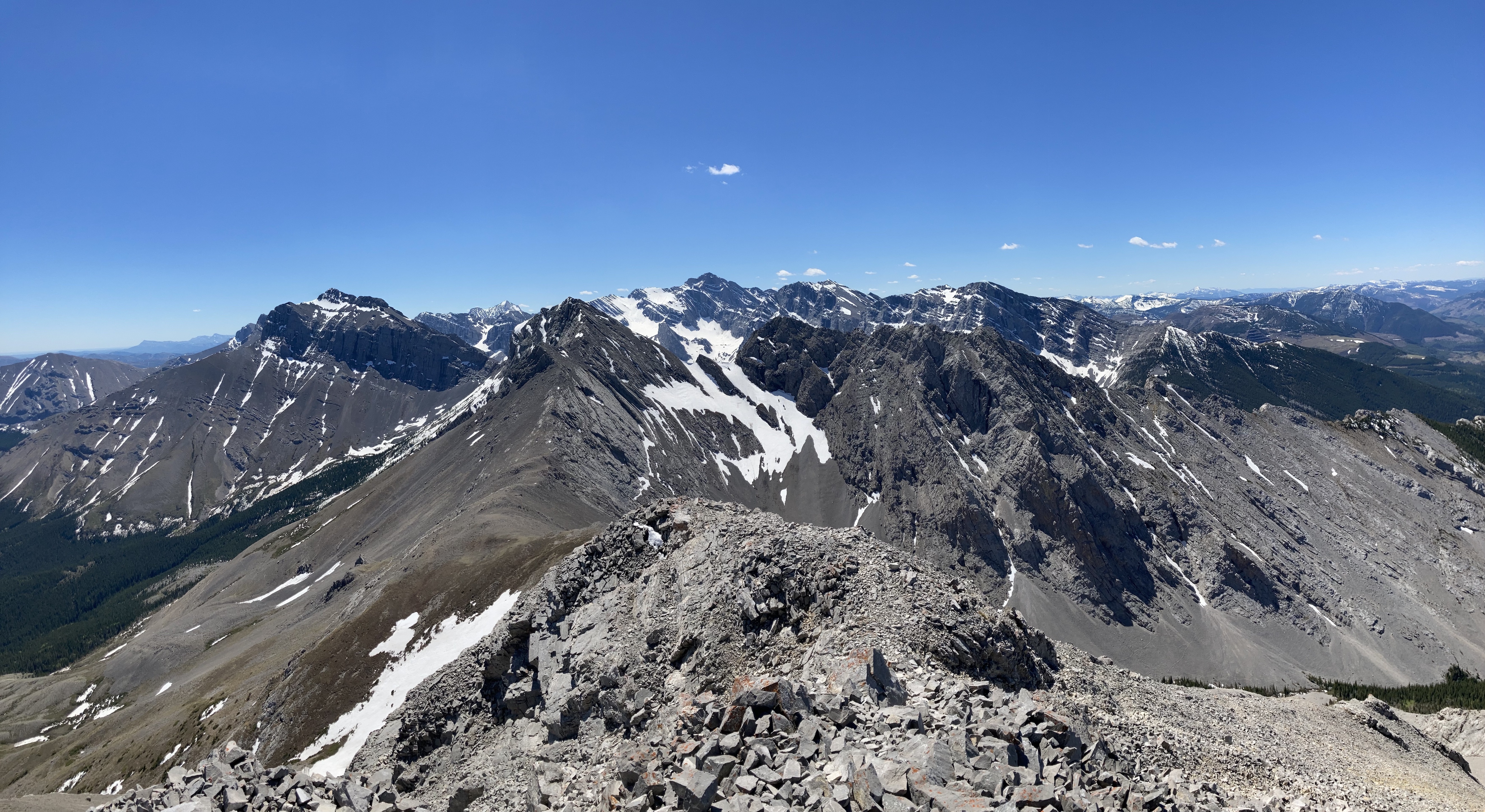
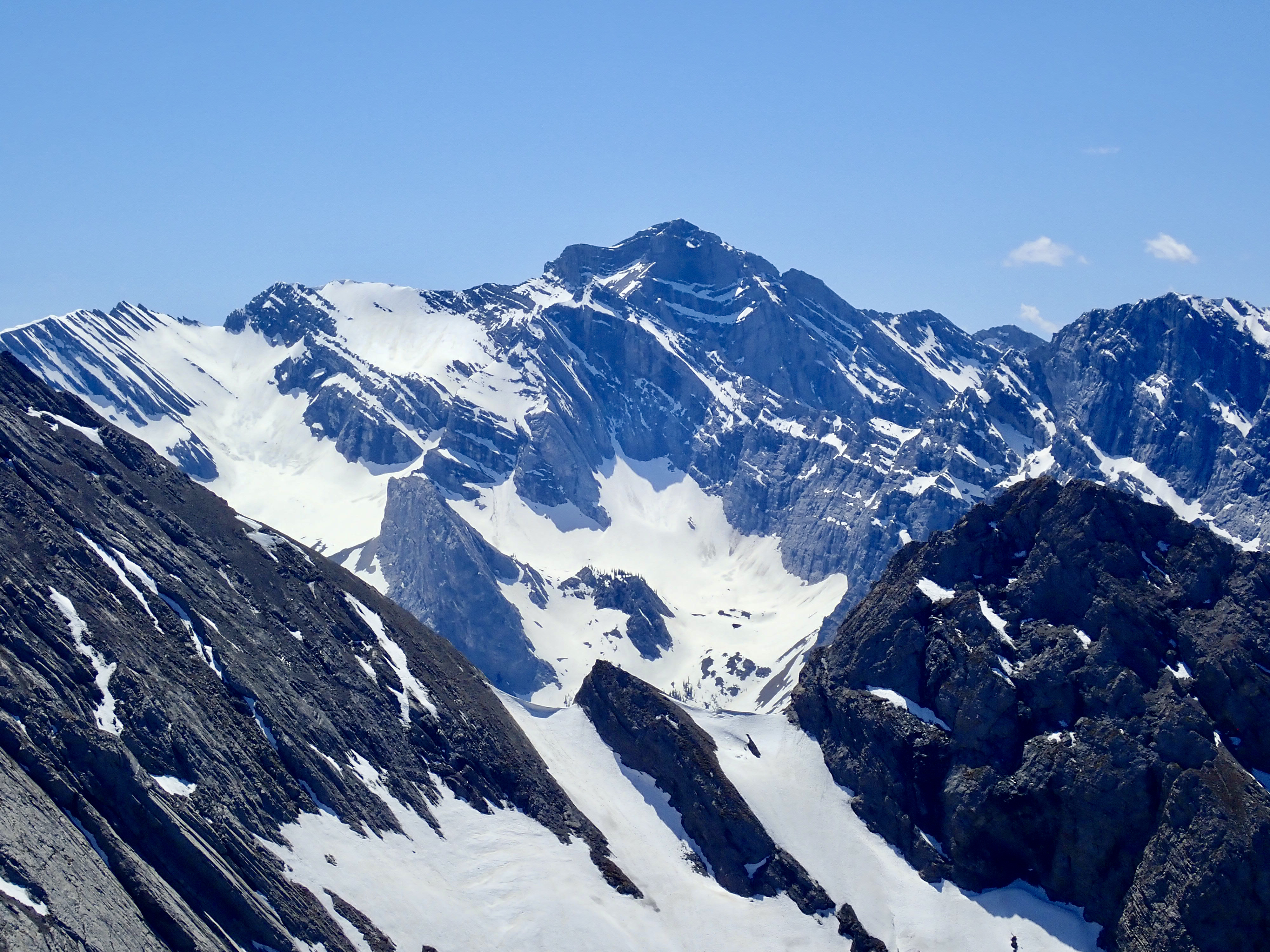
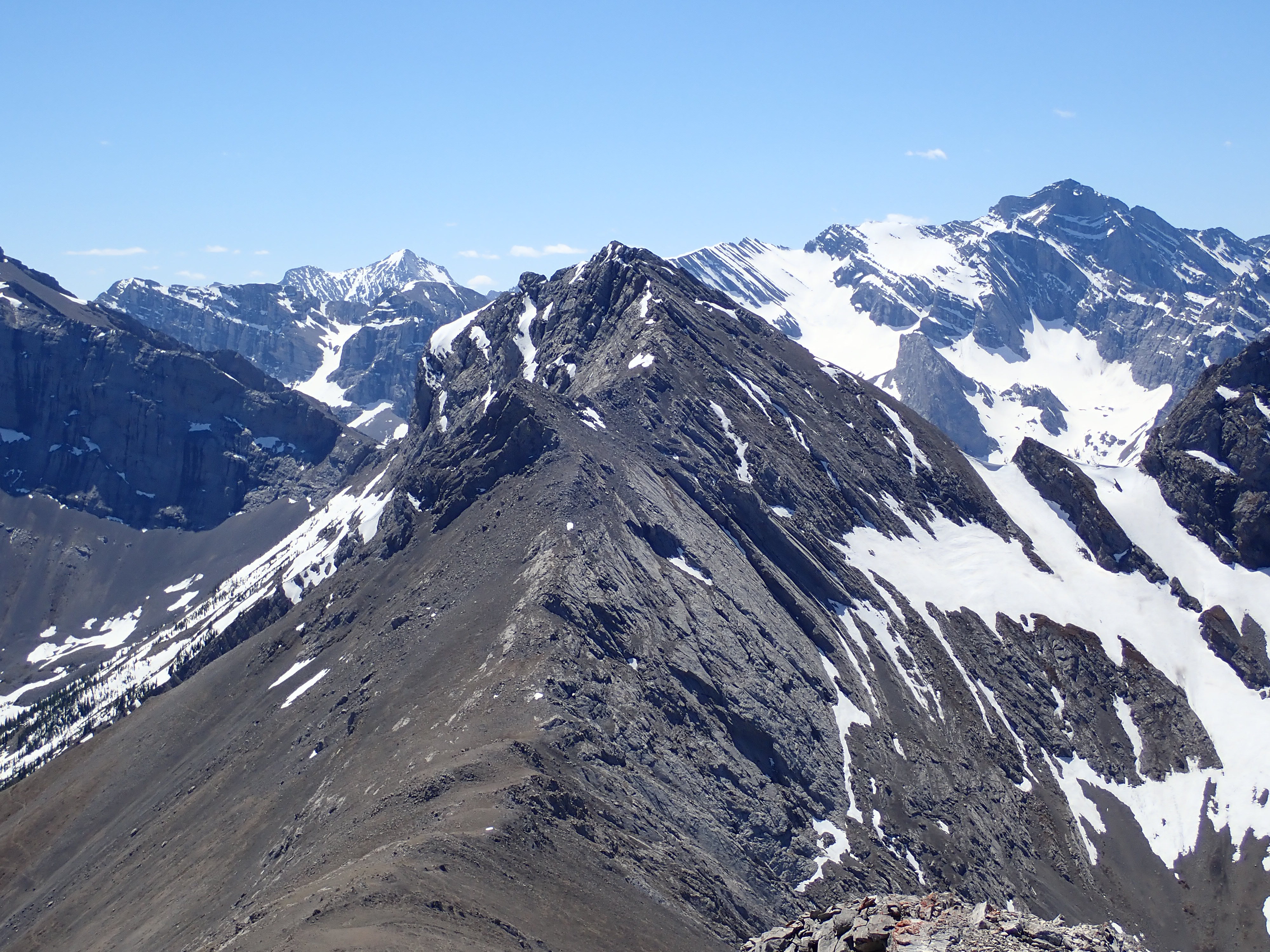
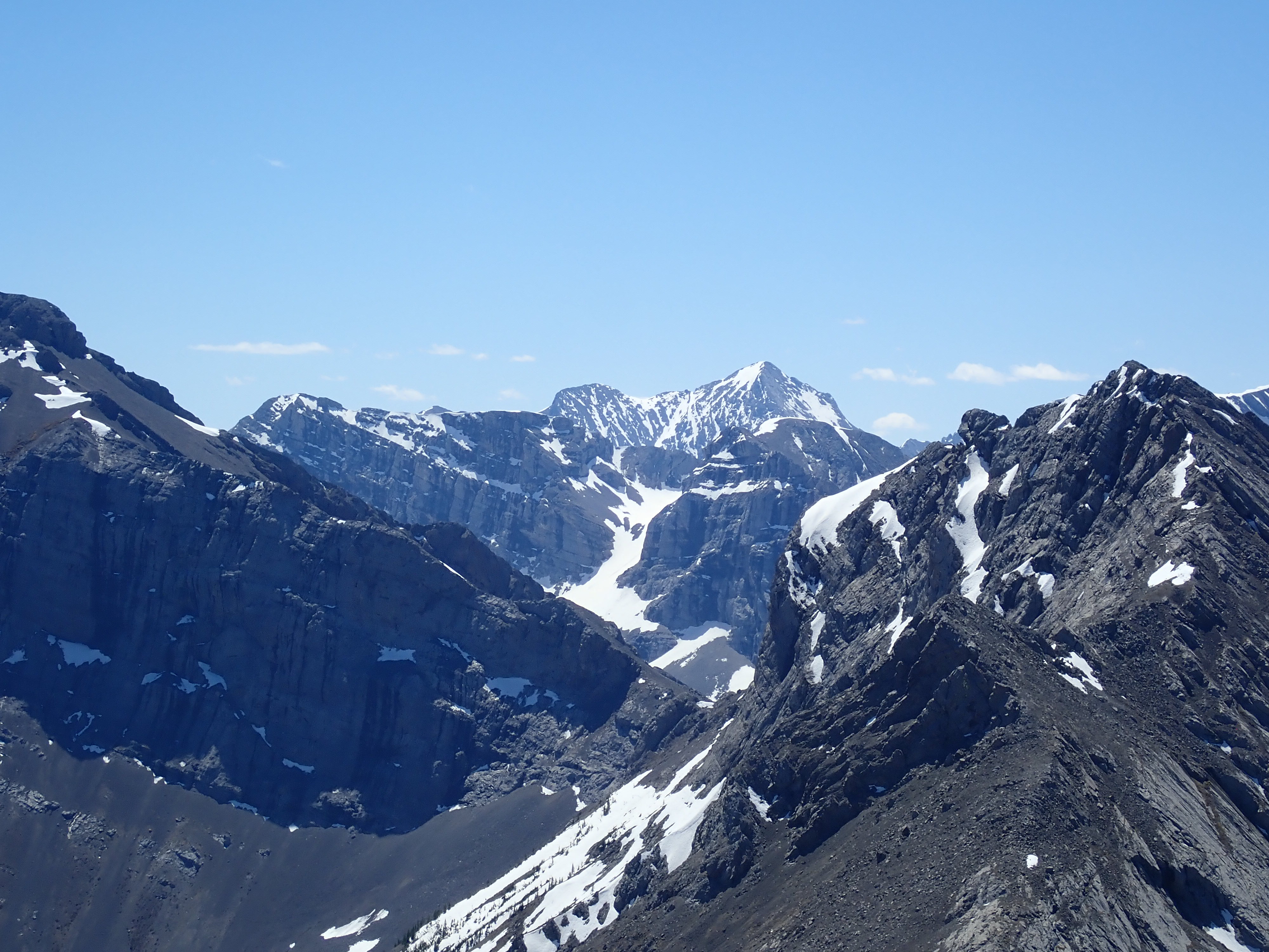
From the moment I got to the col I was treated to amazing views, culminating in a final northward panorama upon reaching the summit. I had a look at the summit register and noted that the day before Matthew Hobbs from http://www.on-top.ca had visited the summit. Several others had ascended in the previous week, but I had the mountain to myself on that day. My return followed the same route except for using the narrow cutline as mentioned above. I found that the cave was a useful landmark for directing my descent from the col. When I was on the berm looking for the place to descend back to the trail through the woods, I noted that the trail on top of the berm carried on. I suspect I could have just followed it to another spot to descend back to the broad cutline.
Click on the pictures in the gallery below to access full-sized images.


Thank you once again for sharing your hikes and all the pictures. I truly enjoy reading about your expeditions.
LikeLike
Thanks for reading!
LikeLike
Beautiful pictures of the mountains.
LikeLiked by 1 person
One more great post from you
You always have some great photos of various peaks and ridges. I really enjoy scrolling through your posts.
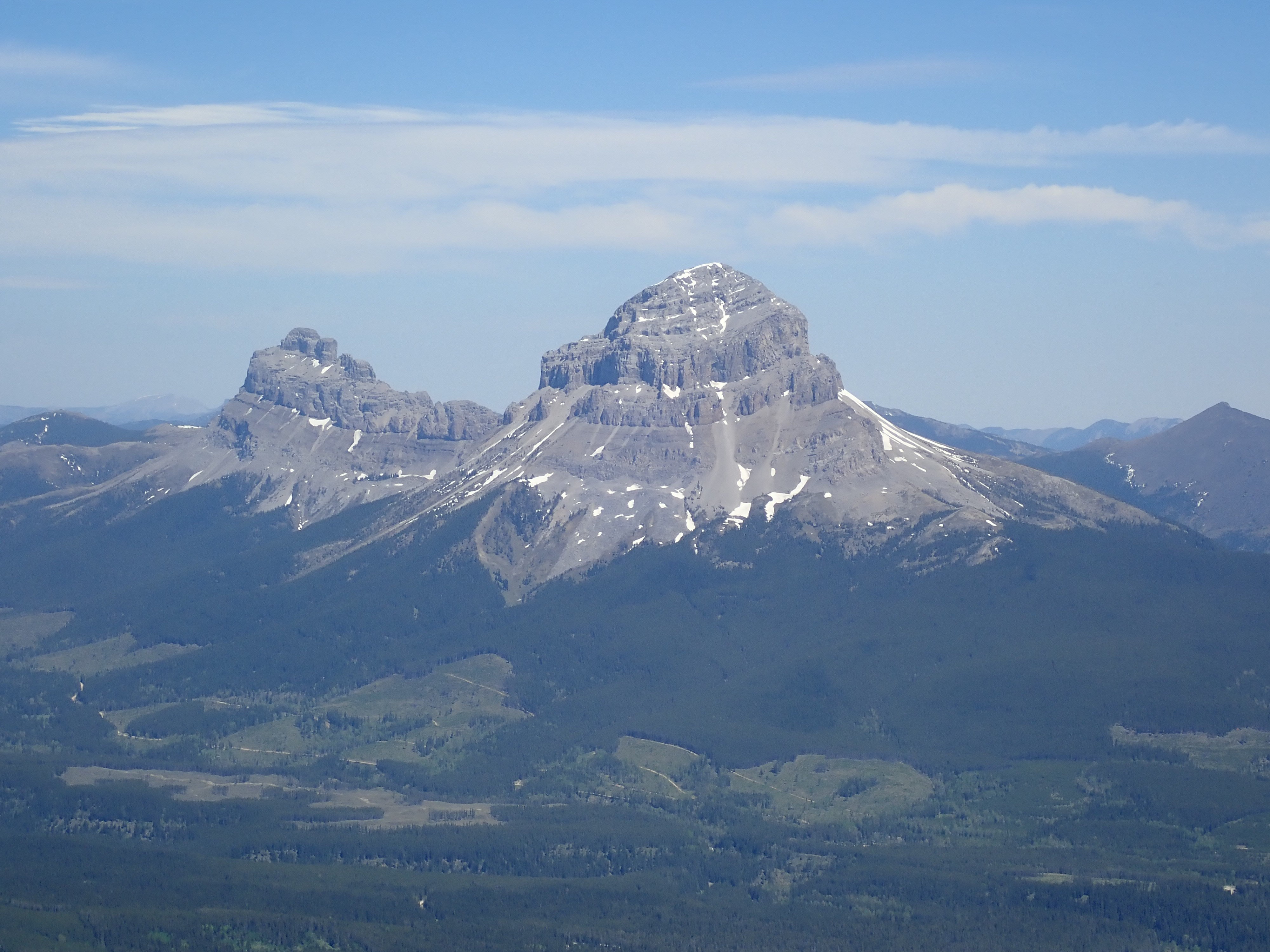
The close-up of Crowsnest Mountain looks really nice and the view to the south, as you also say, is amazing!
LikeLiked by 1 person
Thanks for the feedback, Olympus! I’m going to see if I can climb one or more of those mountains to the south later in the summer.
LikeLike
I will certainly check out again your blog (as I already do regularly), for your future mountain climbs.
LikeLike
Par, thanks for the great write up and pictures! We followed your route up Sentry and it was a great day!!
LikeLike
I’m glad it was useful – thanks for reading!
LikeLike