July 20, 2019. A rainy day hike hike to one of Kananaskis Country’s most popular waterfalls and one of its lesser-visited lakes.
- Region: Kananaskis Country. Traditional Territory of the Stoney, Tsuu T’ina, Ktunaxa, and Blackfoot First Nations
- Distance: 1.1 km one-way to Sarrail Falls; 6.1 km one-way to Hidden Lake (this seems to be the distance most closely matching the Gem Trek map, another app on my phone said it was 6.6 km)
- Total Ascent: Approximately 75 m
- Elevation of Objective: 1745 m (Hidden Lake)
- Total Time: 2h 1m one-way to Hidden Lake
- Safety and Disclaimer
This year’s family hiking holiday in K-country was supposed to start off with a trip to Sarrail Falls with a continuation to Rawson Lake. We’d visited these places before with our kids and knew that everyone would be able to handle it. Moreover, it was raining and was likely to keep raining all day. A visit to known objectives along an obvious trail seemed best. Unfortunately, the trail to Rawson Lake was closed due to bear activity. We decided to salvage the day with an expedition to find Hidden Lake.
I hadn’t read about Hidden Lake at all before that morning. After the trip I did some searching online and found only a few trip reports. Finding Hidden Lake seems to be a challenge for some, particularly since the established route to the lake was disrupted by flooding (I’m guessing in 2013). The lake will also drop its water levels precipitously in dry conditions, leaving behind an un-inspiring mud flat. For most, it seems to be a nothing more than a checkpoint on the way to Aster Lake. Notwithstanding others’ less-than-amazing experiences, Hidden Lake proved to be a picturesque, almost ethereal objective on that rainy day.
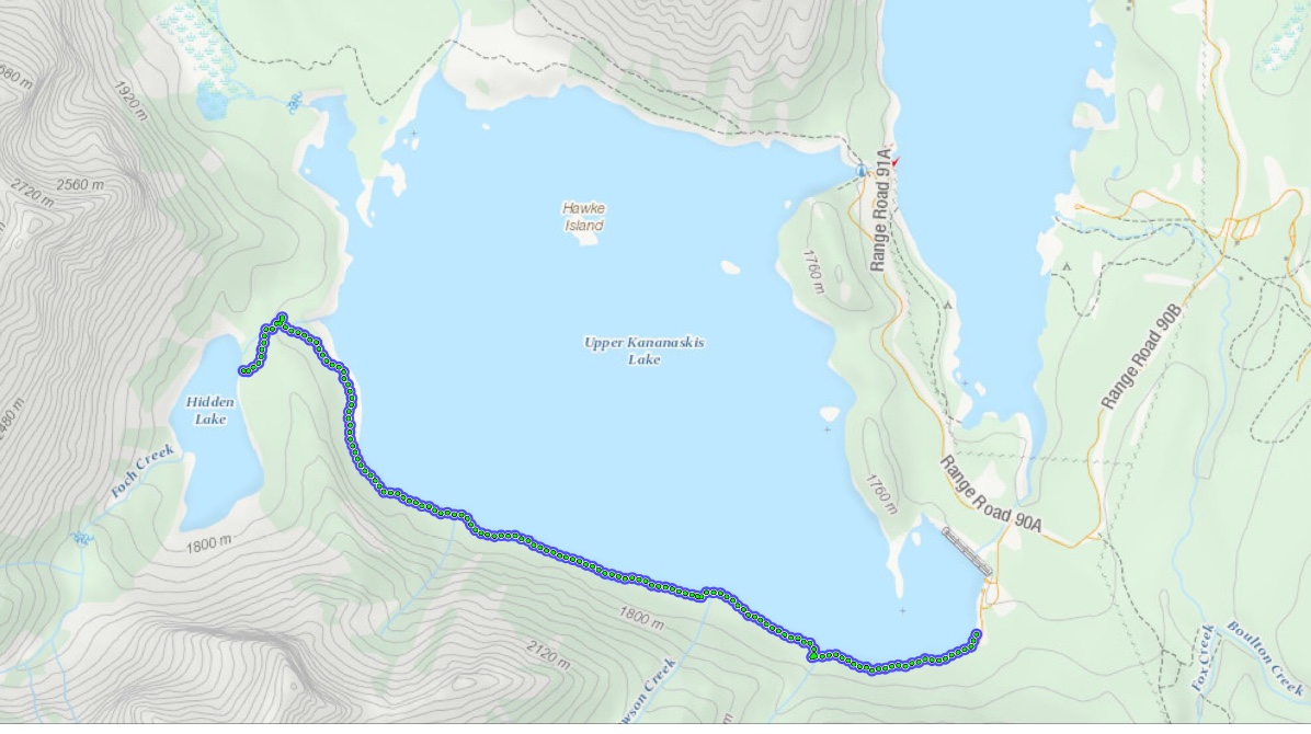
Access is via the southern-most parking lot for the Upper Kananaskis Lake Day Use Area. Pit toilets and a map kiosk sit at the south end of the parking area and the Upper Kananaskis Lake trail sets off southwest along the southern edge of the lake. The trail features some ups and downs, but there’s no net elevation gain to speak of. After about 1.1 km the trail reaches the newly-built bridge over Sarrail Creek, next to picturesque Sarrail Falls. This bridge is a replacement for one which was destroyed by the 2013 floods.
For small kids, Sarrail Falls is a fine objective in and of itself. We wanted to push farther, though. About 100m past the falls, the trail to Rawson Lake departs and then there’s another little bridge further along which crosses over the creek draining Rawson Lake. My youngest (7) made it this far (roughly 2 km) and was ready to be done. My wife gave my older daughter (11) and myself the thumbs-up to press on at a quicker pace and find Hidden Lake. The rest of the party would return to the parking lot at a leisurely pace.
At about the 4km mark the trail starts to hook northward, starting up the western edge of the lake. Shortly, the trail departs from the lake shore and climbs somewhat. At 5.5 km I spied an un-signed dirt trail heading left (roughly south-west) from the main trail. This is the way to Hidden Lake. The best landmark is a distinctive large boulder which is just beyond where the dirt trail takes off. If you’ve gotten to the boulder, you’ve gone too far. There’s a bridge beyond the boulder, too, which is another cue you’ve gone too far.
On the Hidden Lake trail, there is a warning sign a short distance into the forest from the branch-point, notifying hikers that they’re entering the backcountry. The trail is narrow and a little rough, but very obvious. The lake isn’t visible until you’re very nearly on it. When it did appear, cloaked in clouds and pelted by rain, it was an amazing sight. I felt like it was a good use of a rainy day, and my daughter seemed to really enjoy it as well.
Click on the pictures below to access full-sized images.


One thought on “Sarrail Falls and Hidden Lake”