June 21, 2020. A straight-forward scramble with impressive views in the Crowsnest Pass.
- Region: Crowsnest Pass. Traditional territory of the Ktunaxa, Tsuu T’ina, and Blackfoot First Nations
- Distance: 4.8 km round-trip from the east shore of Window Mountain Lake
- Total Elevation Gain: 651 m from Window Mountain Lake
- Elevation of Objective: 2567 m
- Total Time: 2h 45m round-trip from Window Mountain Lake
- Safety and Disclaimer
About 2 years ago I paid my first visit to Window Mountain Lake in the Crowsnest Pass. At the time, I had a look across the lake to the start of the Mount Ward scrambling route. It was May, so there was still quite a lot of snow on the slopes. My legs were tired from biking in on the Atlas Road, so even without the snow I didn’t think I could manage the ascent and I left it for another time. Two years later, on the first day of summer, I decided to return to the lake and take a shot at summiting Mount Ward.
The scramble starts off at Window Mountain Lake, and the access remains the same as described in my prior post. This time around I had a vehicle that could manage the Atlas Road. Every year the road deteriorates further, though, and I’m not sure anyone has plans to maintain it over the long-term. I decided not to drive the last 1.5 km after the turn-off from the main road up towards the little parking area. I remember seeing some big trucks almost founder in mud puddles on that road during my last visit and didn’t feel like complicating my day by having to arrange a rescue of my vehicle.
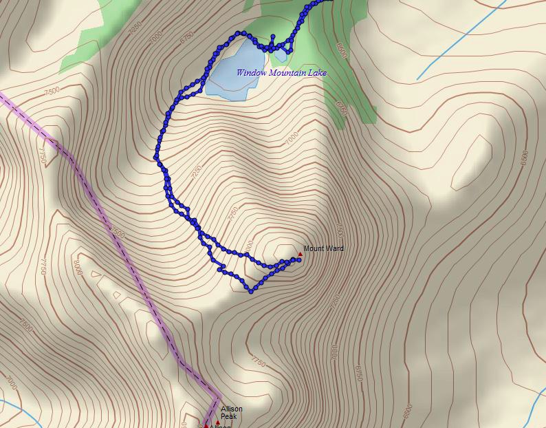
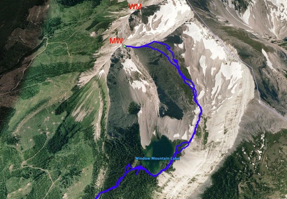
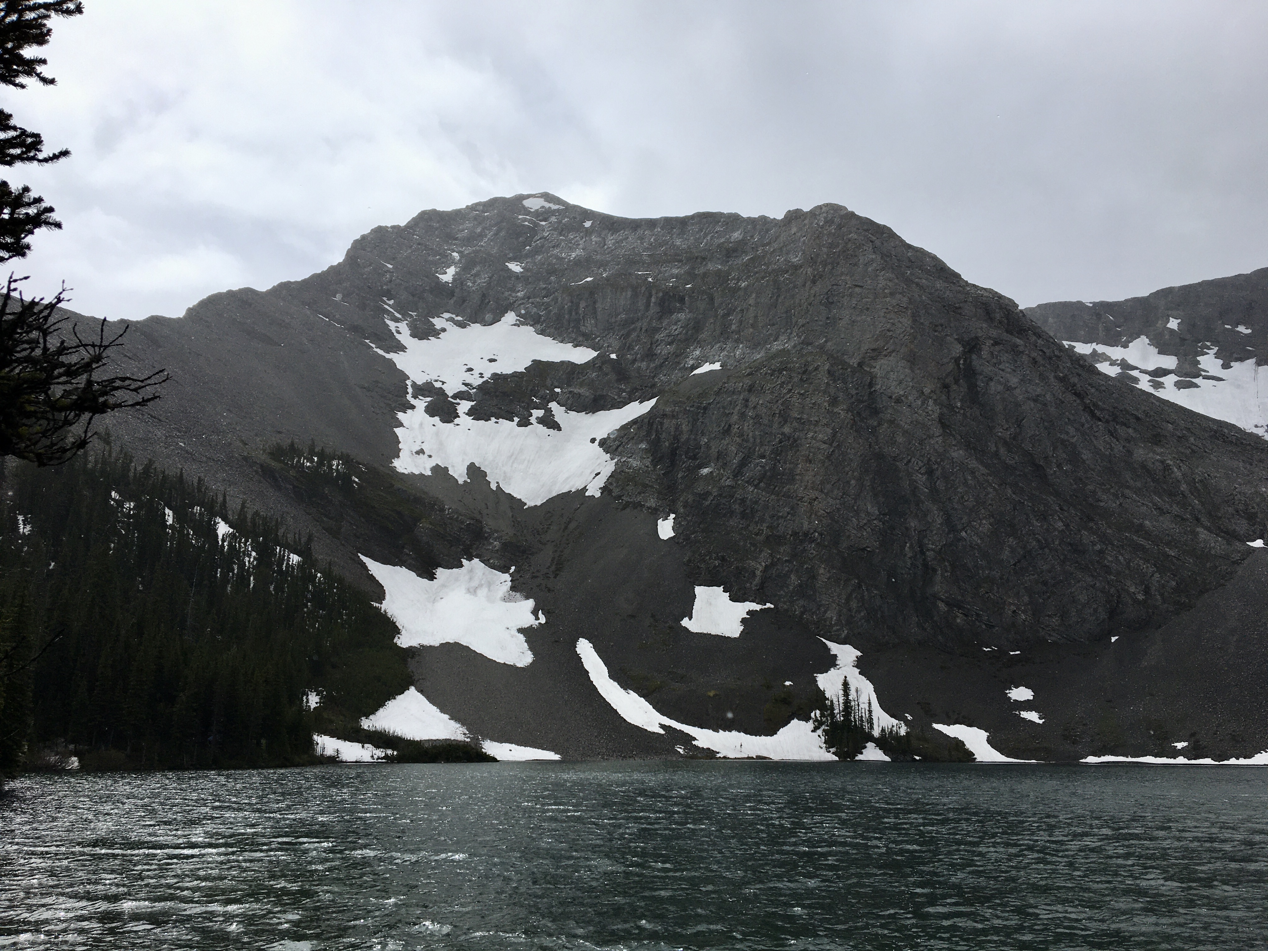
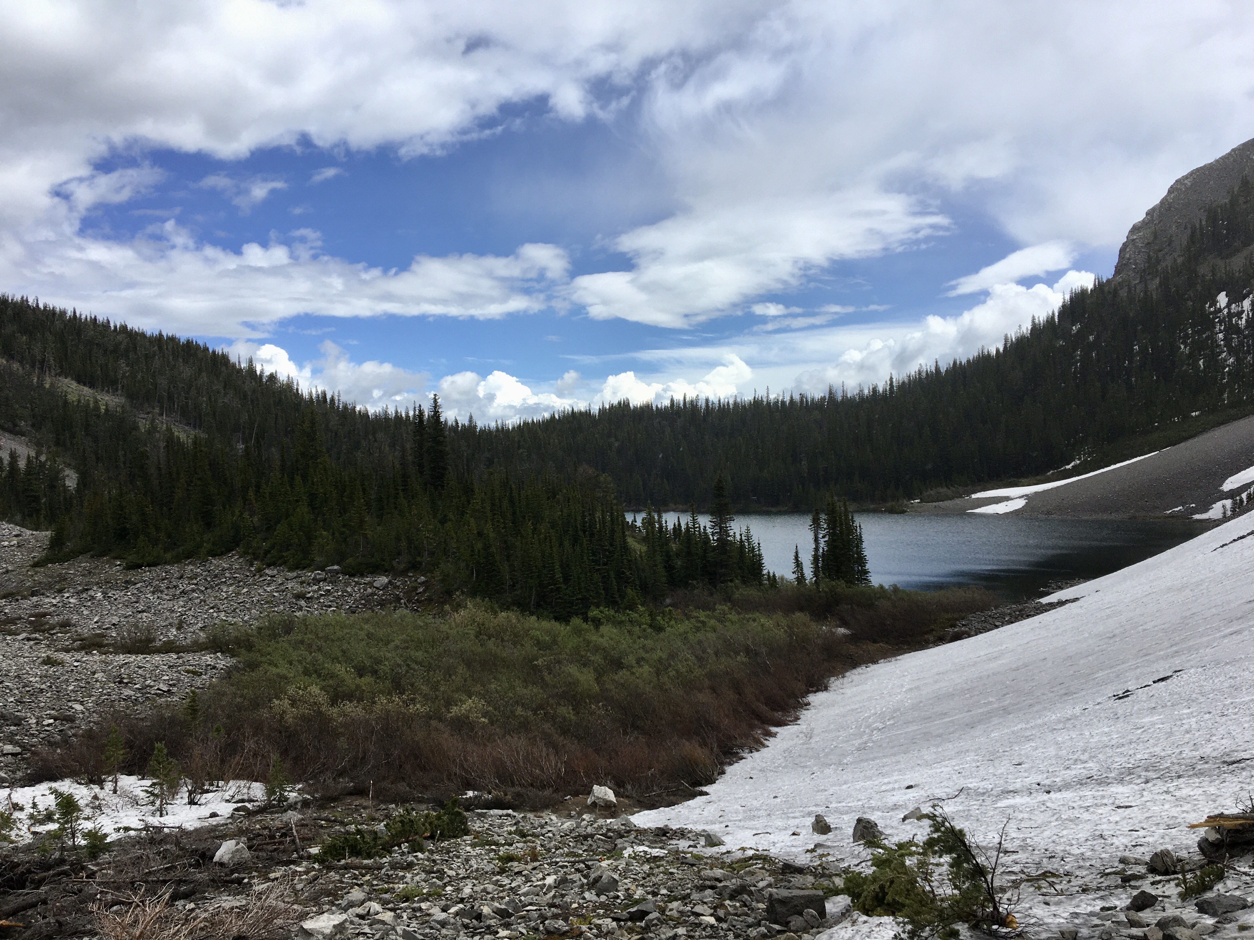
Parking at the turn-off I ascended up the road to the parking area and carried on up to the lake. Similar to my prior visit, the lower sections of the trail to Window Mountain Lake were basically a shallow creek. Once I was up at the lake I saw there was still some snow left on the slopes below Mount Ward, but nothing that would be impassible. From where the trail arrived at the east shores of Window Mountain Lake, I headed to the right and followed a rough trail around the lake to the opposite side. Here, I found myself pushing through a short zone of tall, woody shrubs. The trail entered it, then petered out into animal paths. The bushwhacking didn’t last long, but it was annoying. On my way back I circumvented the shrubby area, skirting around it to the left.
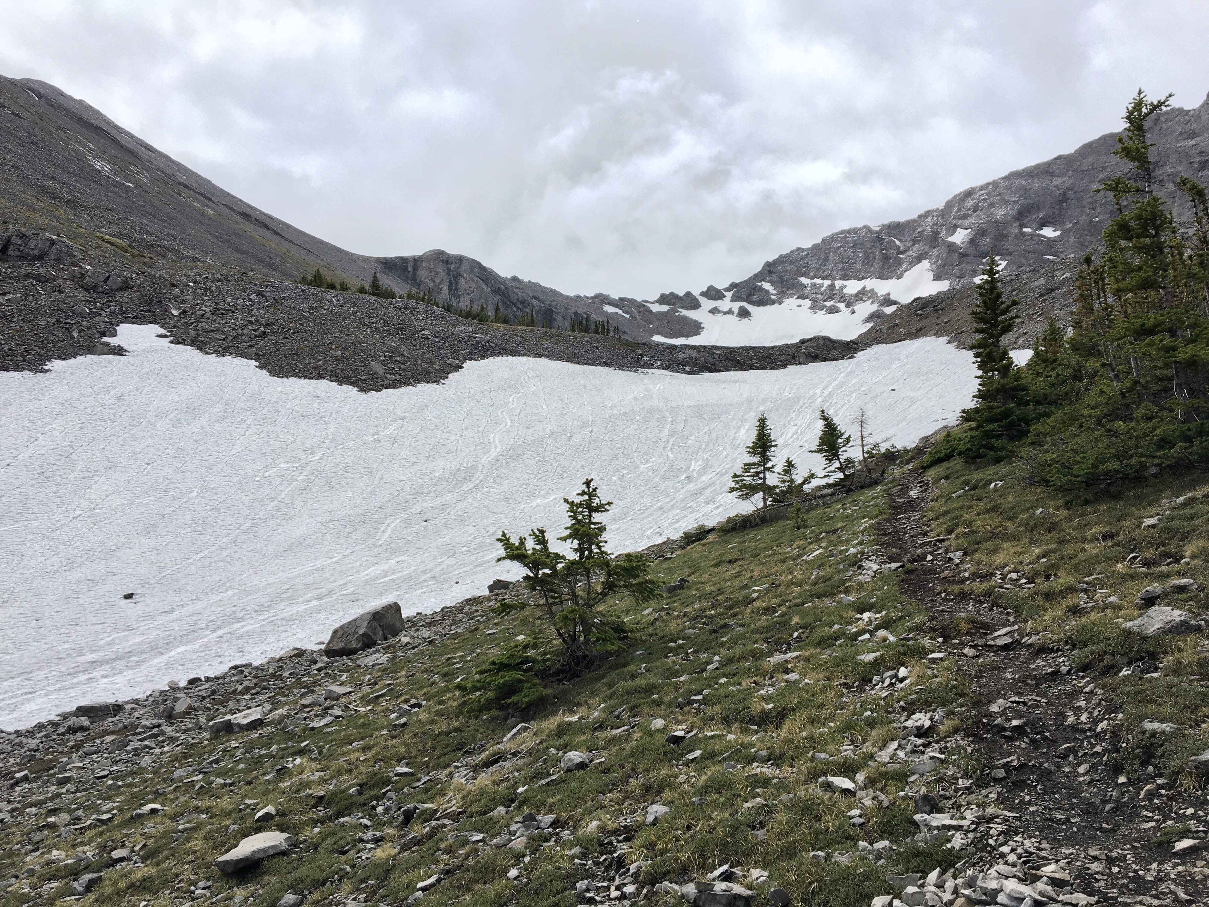
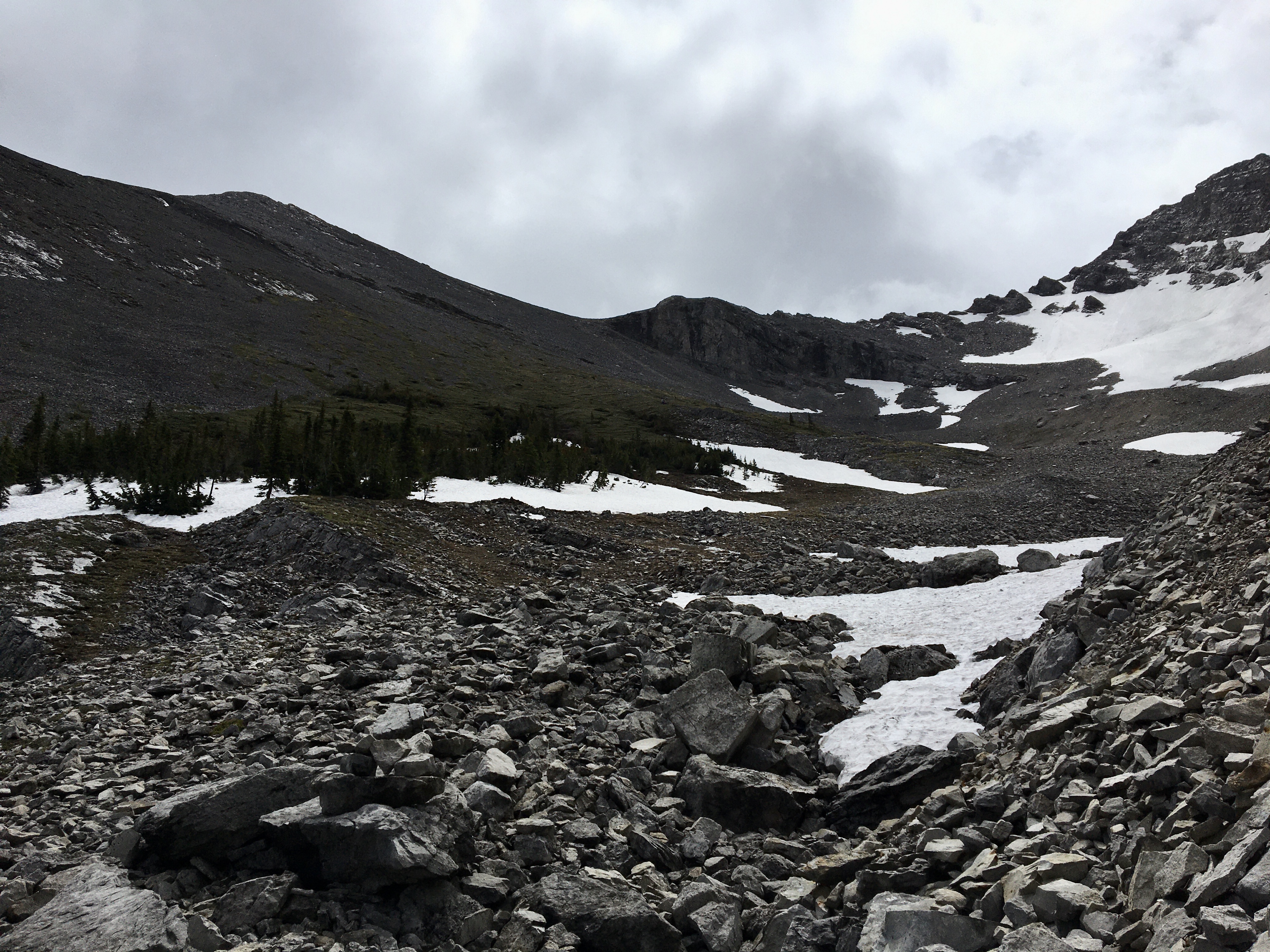
From the lake, I ascended southwest, staying on the right of some remnant snow. At the top of this steep ascent the route enters a cirque, and the east-west ridge line between Mount Ward and an outlier of Allison Peak comes into view.
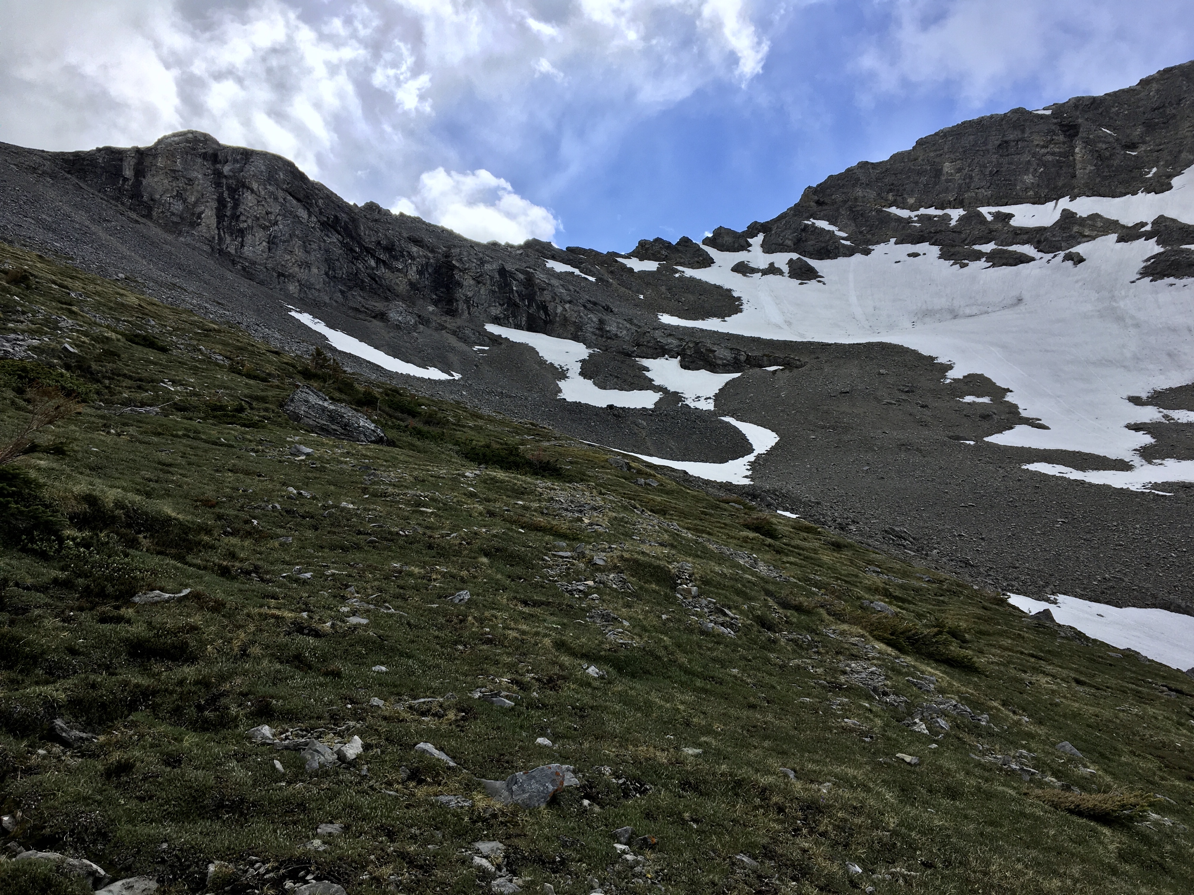
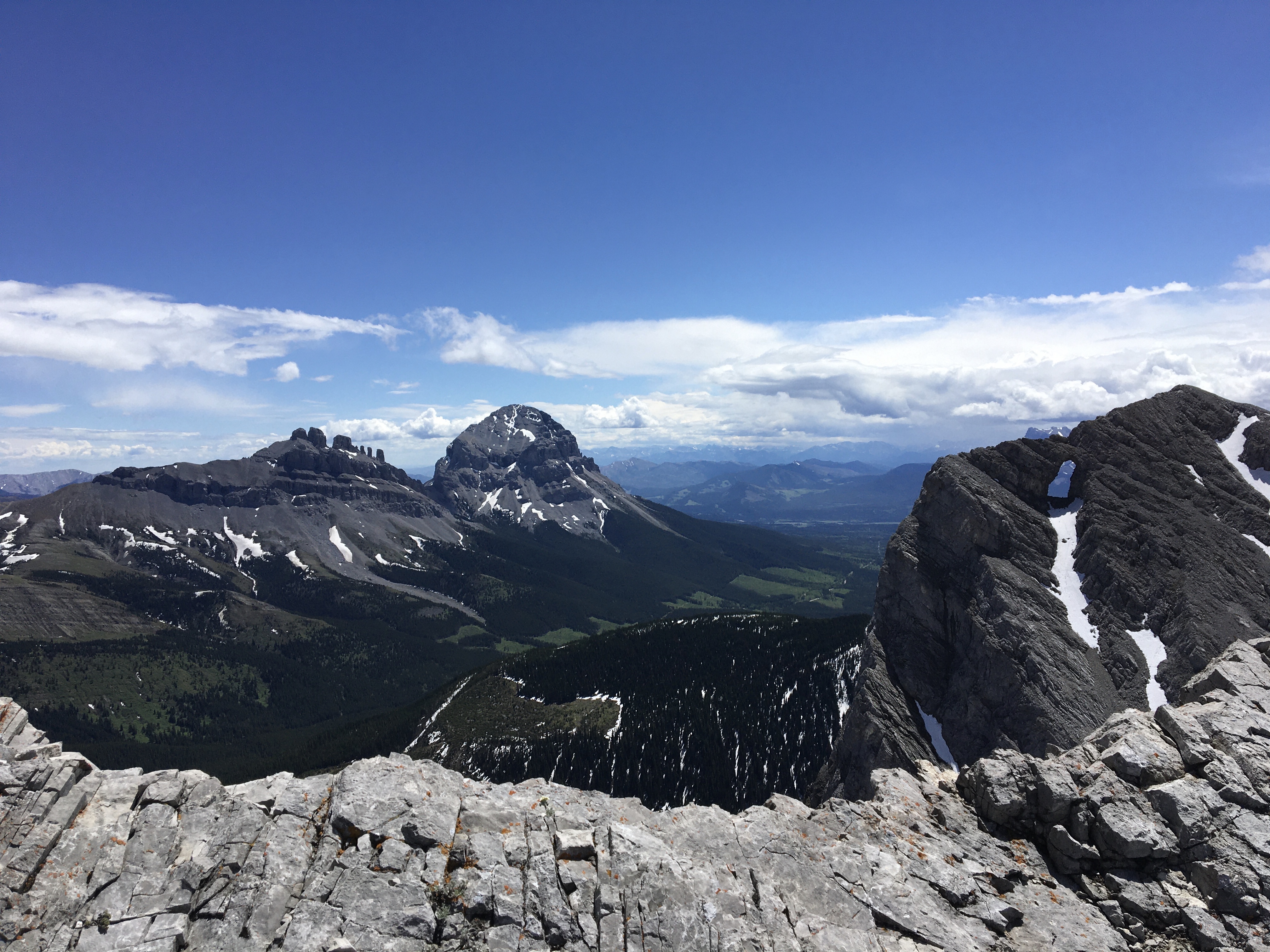
The wisdom of thousands of booted feet (and probably hooves) has left behind traces of a trail which follows a pretty reasonable route. I found the trail sometimes faint and sometimes obvious. There isn’t any significant route-finding involved in this ascent, since the slopes are nice and open and you can see all the way up to the ridge line. A direct climb towards Mount Ward’s summit would probably be doable, but it would be a slog and would deprive you of a great view of the rock window of Window Mountain which is best seen from the col along the east-west ridge line. Therefore, I’d recommend directing your ascent to the col, which is easy to make out from below.
The main hazard during this trip would be rock fall – the slopes are covered with rubble which is easily dislodged and could tumble down onto climbers below you.
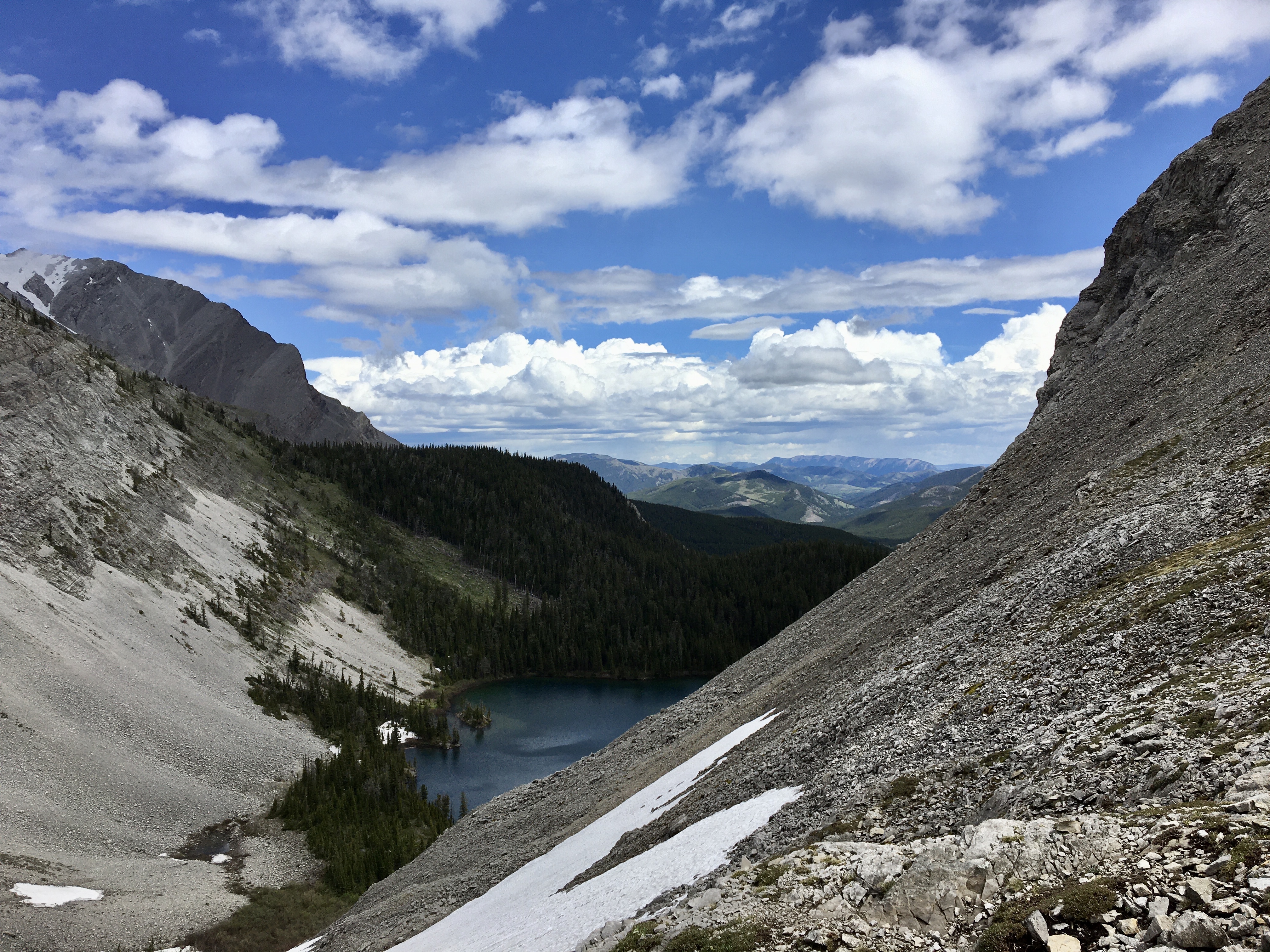
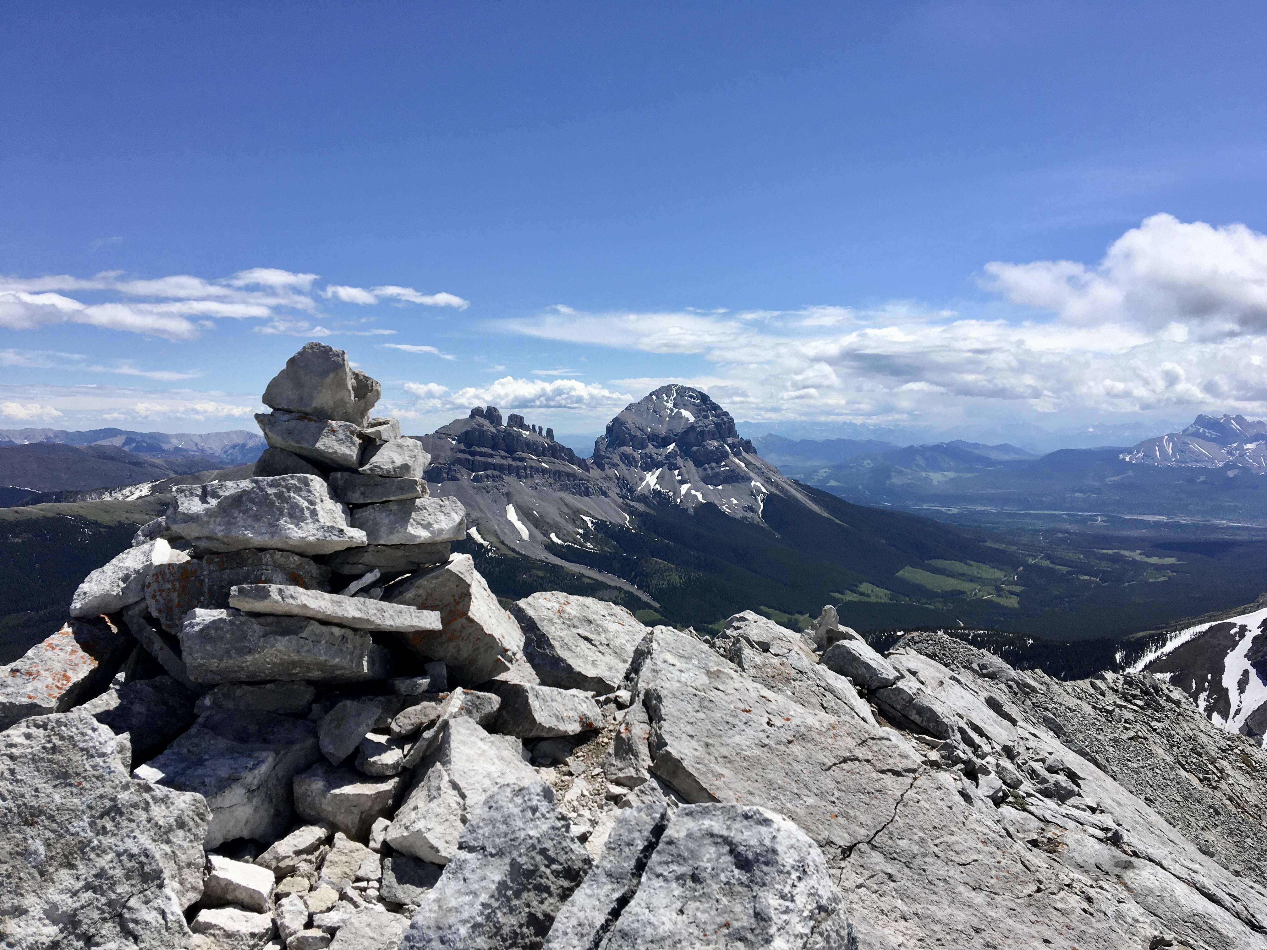
Once on the col I was treated to an amazing view looking south across an adjacent valley. Directly across the valley was the rock window of Window Mountain. Crowsnest Mountain and Seven Sisters were clearly visible in the distance. Allison Peak was to the south west.
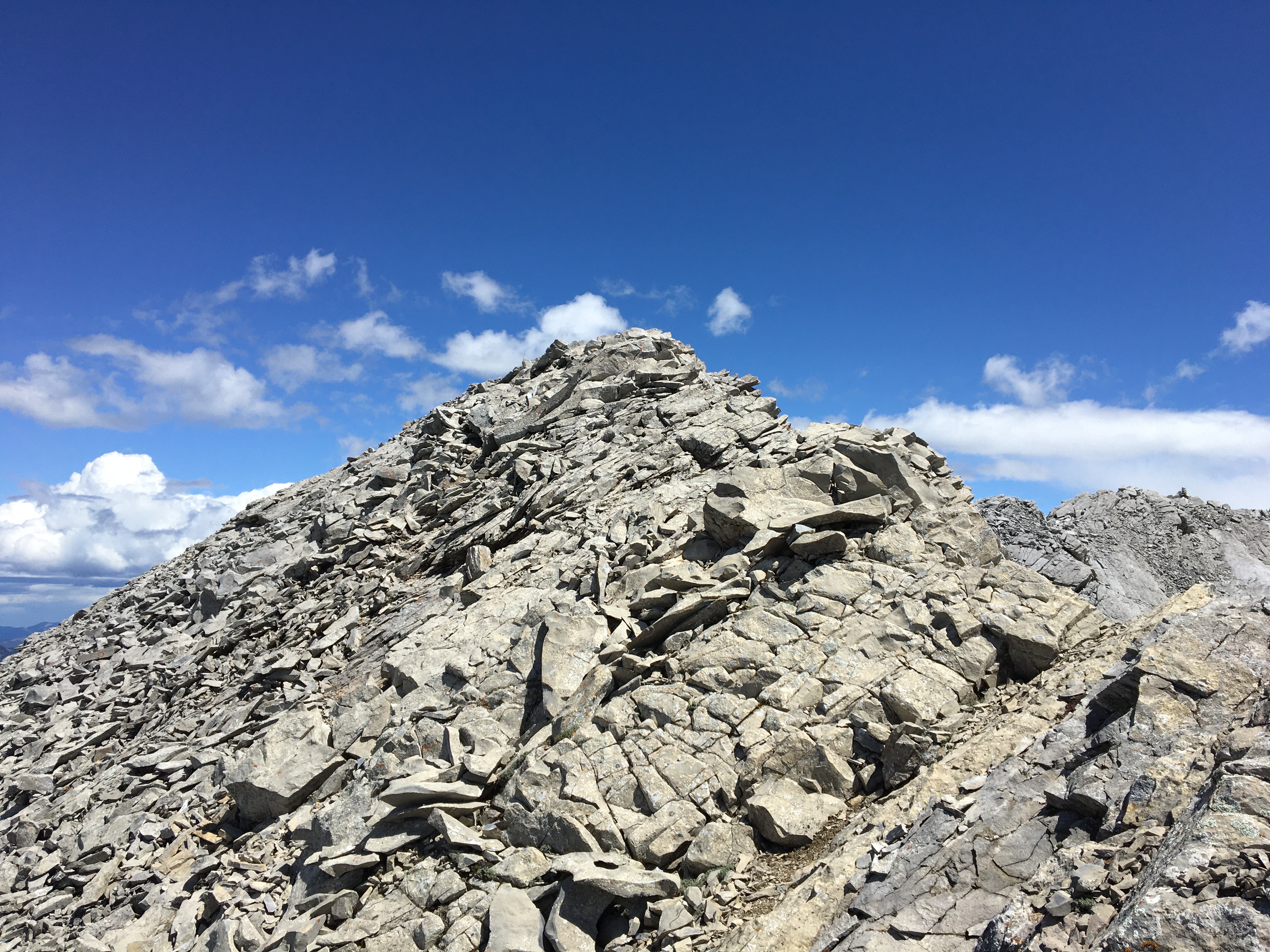
Turning left (east) at the col, I walked up the ridge toward the false summit. There’s a rock cairn here, and it would be a reasonable ultimate destination for any party. However, once you’re up there, you can see that the true summit is a short distance further, across a narrow and somewhat exposed ridge. Someone has built a slightly taller cairn on it, as if to goad you on. I crossed over to the summit with some nervousness, but no difficulties. My main anxiety was the wind, but it had died down by that point. If it had been a typical gusty day in the Pass, I’m not sure I would have gone ahead with this last bit of the route.
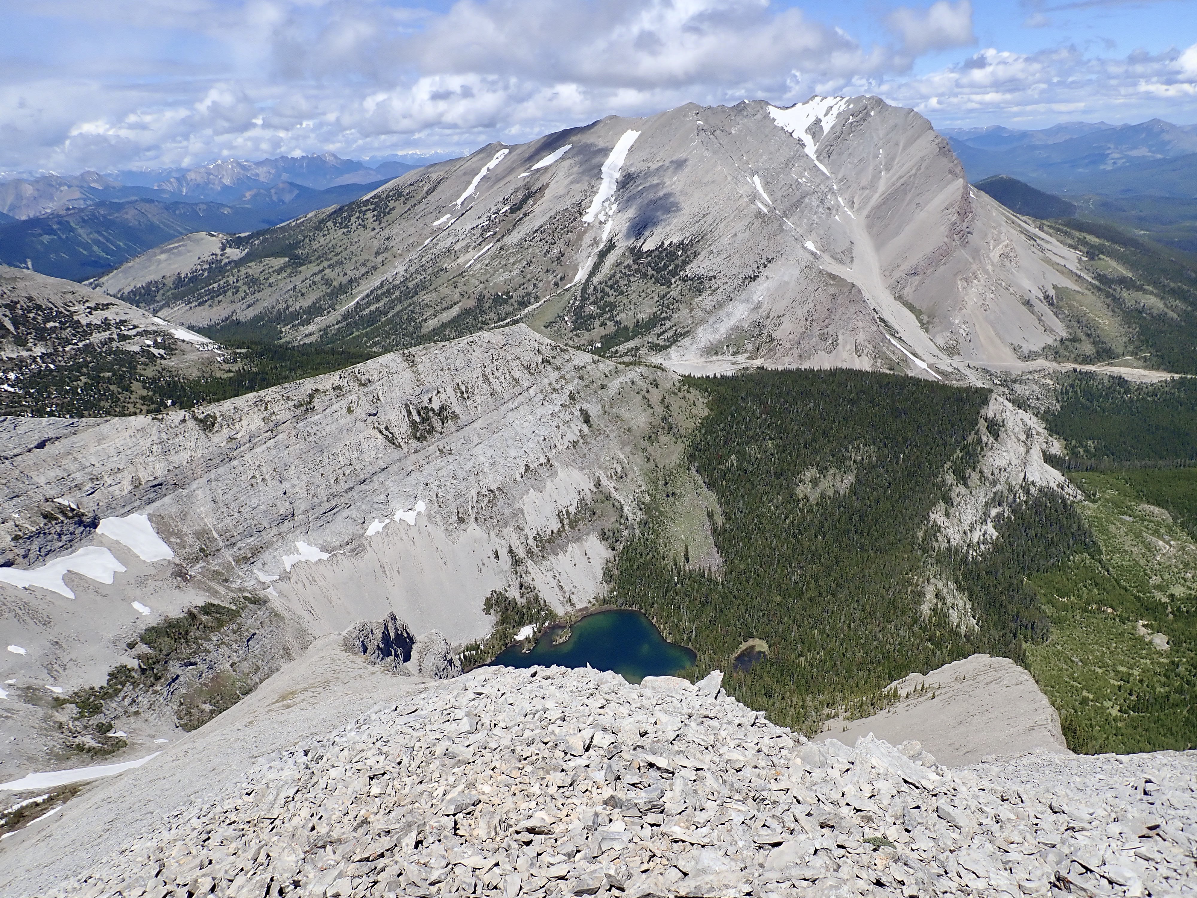
The view from the summit is satisfying, but not drastically different from the view at the col or the false summit. The rock window is still visible, but the angle is such that you’re looking through it onto an adjacent mountain slope so the impact isn’t quite as dramatic.
I didn’t spend too much time on top – rain had been passing through in patches through the day, and from the summit I could see more rain approaching. I didn’t completely retrace my route back to the col before descending , but I did go a short distance back that way so I wouldn’t end up above some short rock bands that I’d seen from below. Once back at the floor of the cirque I descended back to the lake, and circled left around the shrubs, before finding the trail again and heading back to my car.
The stats at the top of this post are just for the scrambling portion of this trip. The total trip to and from my car took 4h 36m, and covered approximately 14 km.
Click on the pictures in the gallery below to access full-sized images.


Lovely mountains
Lovely photos
Great post
Thanks for sharing
LikeLiked by 1 person
Awesome. Thank you for sharing!
LikeLike