June 22, 2020. A bike and hike to a high mountain ridge on the northern border of Waterton Lakes National Park.
- Region: Waterton Lakes National Park. Traditional territory of the Ktunaxa, Tsuu T’ina, and Blackfoot First Nations
- Distance: 21.6 km round-trip (approximately 10 km on bike)
- Total Elevation Gain: 886 m
- Elevation of Objective: 2370+ m
- Total Time: 5h 32m
- Safety and Disclaimer

The closures following the fires of 2017 and 2018 have sadly limited access to many of Waterton’s best trails for 2 summers. But, things are slowly re-opening and this summer the Red Rock Parkway was re-opened to vehicle traffic. To celebrate, I decided to visit Avion Ridge.
Avion Ridge is accessible from either the Goat Lake trail or the Lost Lake trail. I decided to go via Goat Lake and, as opposed to my prior visits, I decided to bike the ~5 km portion of the route which follows Snowshoe Trail from the Red Rock Canyon parking area. Having now done this as a bike and hike, I can say that I find this approach far preferable to walking the whole way.
Access is unchanged since before the fires. The Red Rock Parkway goes north from the park access road a short drive beyond the park gate, just before the road crosses the bridge at Pass Creek. The parking area at the end of the Parkway either survived the fires just fine or has been rehabilitated. There are toilet facilities here along with interpretive signs and trail maps.
I set out along Snowshoe Trail on my bike. I’m not a skilled mountain biker, but I didn’t find any area too rough to navigate. There are 2 creek crossings that required a dismount. Being June, the creeks were running quite high. The fire has left its mark in the valley, with the trees burned and the underbrush thinned dramatically. The sign marking the Goat Lake trail is still present, though it looks a little beat up. I stashed my bike here and climbed up to the lake. The journey to the lake is the same as it was in my prior post.
The camp site at Goat Lake has been destroyed. There is still some signage up there, pointing up the valley towards Avion Ridge. The trail was obliterated in many places, though I imagine as the season goes on the increased traffic will help define it again. There was also quite a lot of snow left on the ground, covering large portions of the route. This made things a little tricky, since I wanted to stay more-or-less on the same course as the obliterated trail, but I also had to avoid areas of deep snow and stay well clear of snow-bridges over creeks of meltwater.
This is not to say that there’s complex route-finding involved here, but there is an optimal path to follow. Reaching the ridge-top involves ascending the valley and climbing 2 headwalls, before finally starting an ascending traverse on a scree slope that takes you to the objective. I didn’t feel like wandering around looking for the best points to ascend the headwalls or find the traverse so I tried my best to stick to the path.
As it turned out, the snow was really the main difficulty to contend with, but I managed to eventually climb above it all and ascend to the ridge top, where a little sign still stands directing hikers onwards to a loop route back to Snowshoe, or 1.6km back down to Goat Lake.
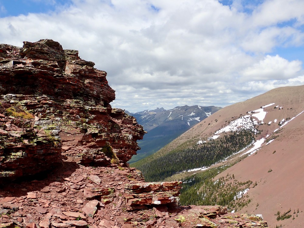
From the arrival point on the ridge I climbed up and to the left (southwest), surmounting an area of easy rocky terrain. Finally, I relaxed for awhile and admired the view: south down the valley toward Goat Lake, north into the Castle, and West beyond the continental divide into BC.
I returned by more-or-less the same route, but I spent some extra time detouring to the two waterfalls tumbling down the two headwalls. The uppermost of the two was cascading into a snow tunnel under a large remnant snow pack. The lower (and taller) of the two was particularly picturesque, swollen with June snow melt.
After returning to the Snowshoe trail, I was pleased to be able to bike back to the parking lot instead of trudging along the valley bottom for an additional hour. I did encounter a black bear on my return. I hung back for a while as it ambled around the area of the trail for about 10 minutes, then walked off into the woods.
Click on the pictures in the gallery below for full-sized images.


Dear Par,
The pictures are awesome. I may not ever go there but it makes me aware of the beautiful sites in the majestic Canadian Rockies.
Thank you.
Bal Boora
LikeLiked by 2 people