July 8-12, 2018. I have recently returned from an excellent 5-day stay in Iceland. The island is a hiker’s paradise, and I’d planned on hiking two of the more popular trails during my visit (Mount Esja and Glymur waterfall). Unfortunately, the weather didn’t cooperate. There was rain and low cloud in the Reykjavik area and all over the west coast for the entire duration of my stay. My wife and I did see some great scenery, though, via 2 well-conducted bus tours that took us to popular sights with short walking trails.
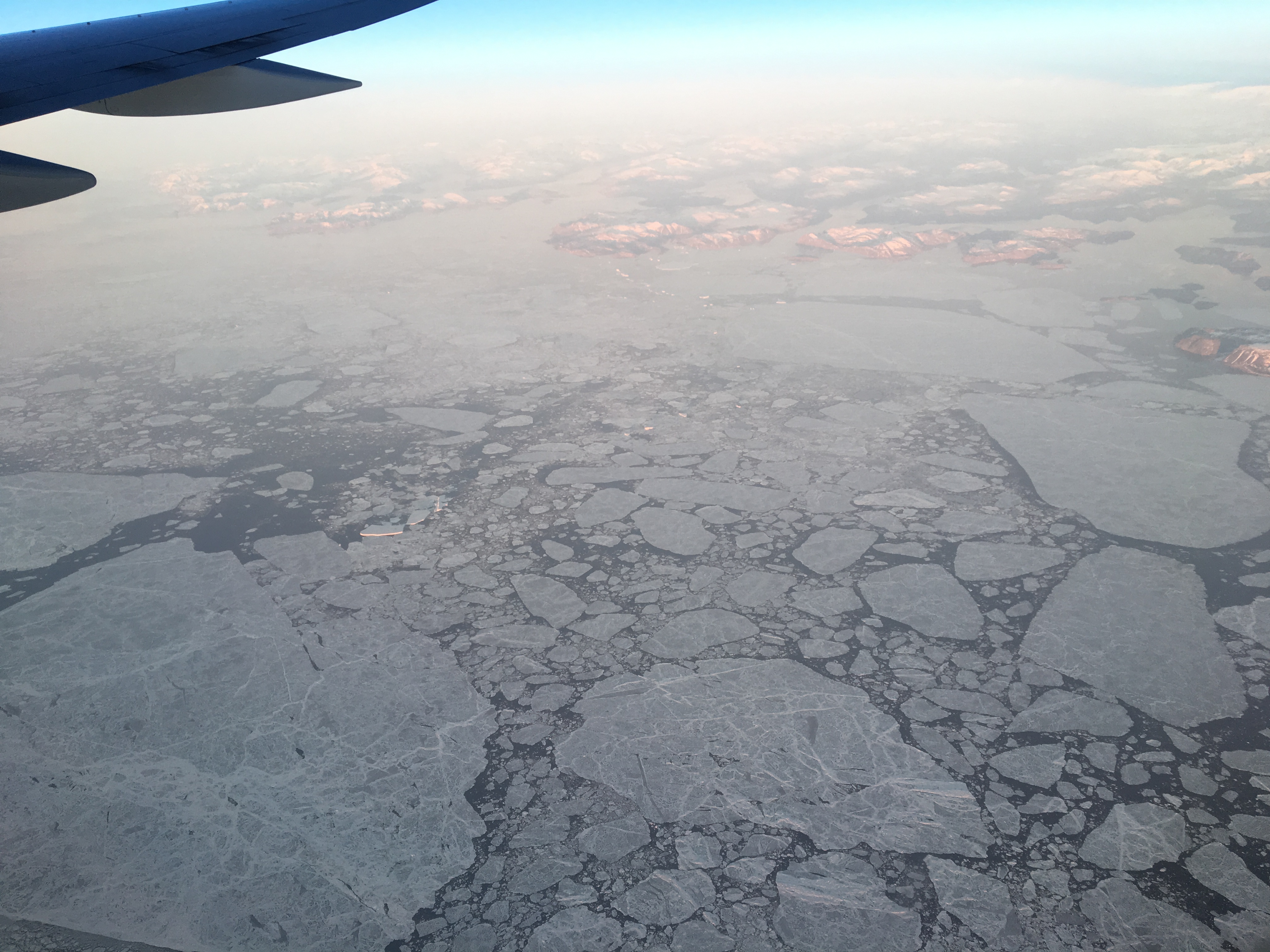
An icy sea between Nunavut and Baffin Island.
The Golden Circle
Nearby Reykjavik is the Golden Circle, a popular tour route that includes a visit to Geysir, the geyser for which all others are named; Gullfoss, the highest volume waterfall in Europe; and Þingvellir (pronounced THINK-ved-leer), a rift valley where the viking settlers held parliament and the Eurasian and American tectonic plates are moving apart. There are short trails at each location, and masses of tourists. It’s something like a Banff/Lake Louise tour in Alberta: it’s crowded, but also a “must see”. Þingvellir was particularly fascinating because there are narrow fissures where the tectonic plates are pulling apart and you can stand straddling them – one foot on the Eurasian plate, one on the American.
This is Geysir. It no longer erupts, but when it was active it apparently could shoot water 80 m in the air. Nearby, a smaller geyser named Strokkur still erupts every 4-5 minutes.
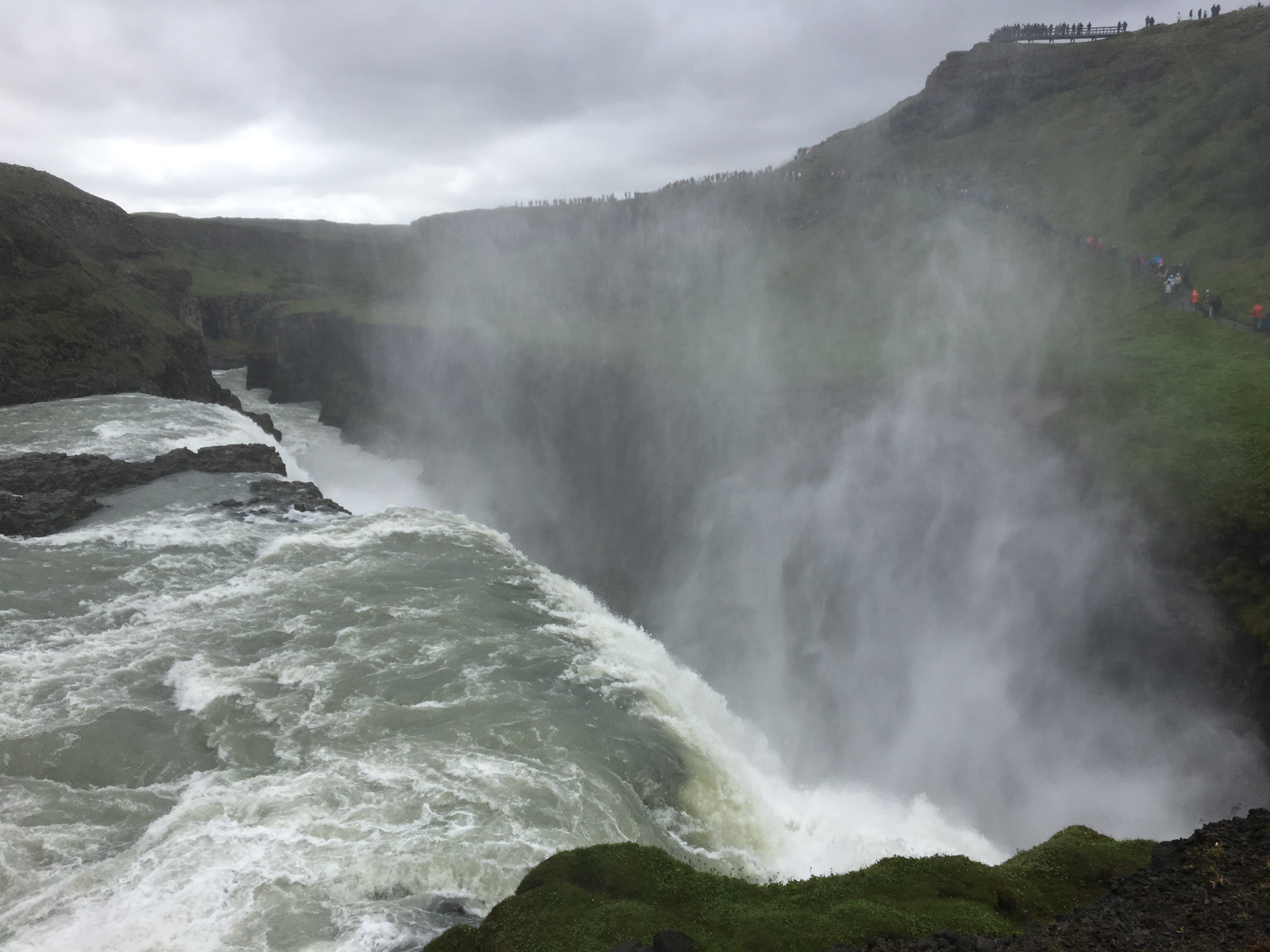
Video of Strokkur erupting.The massive 2-step waterfall Gullfoss.Just below the first step.Just above the 2nd step.
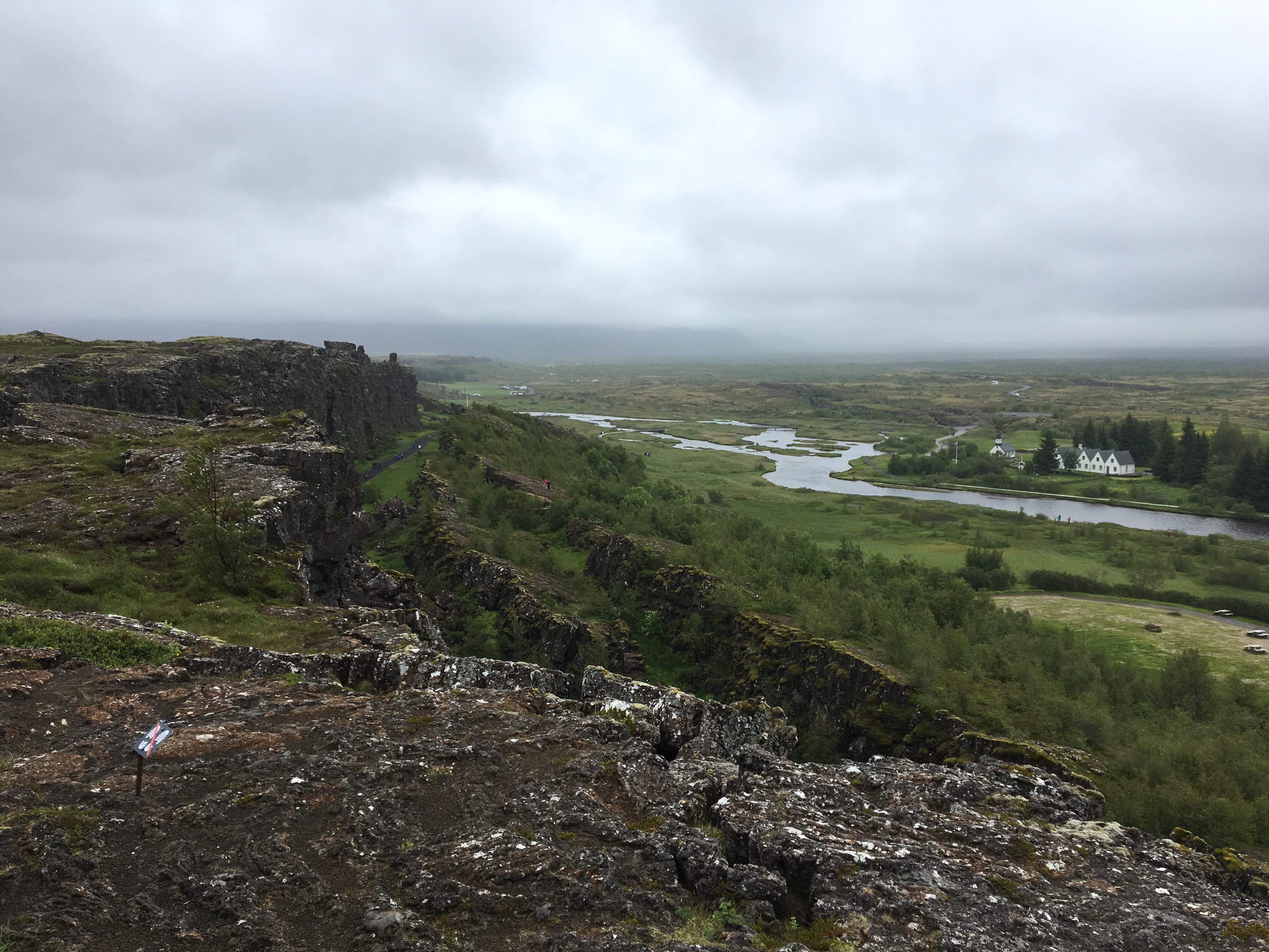
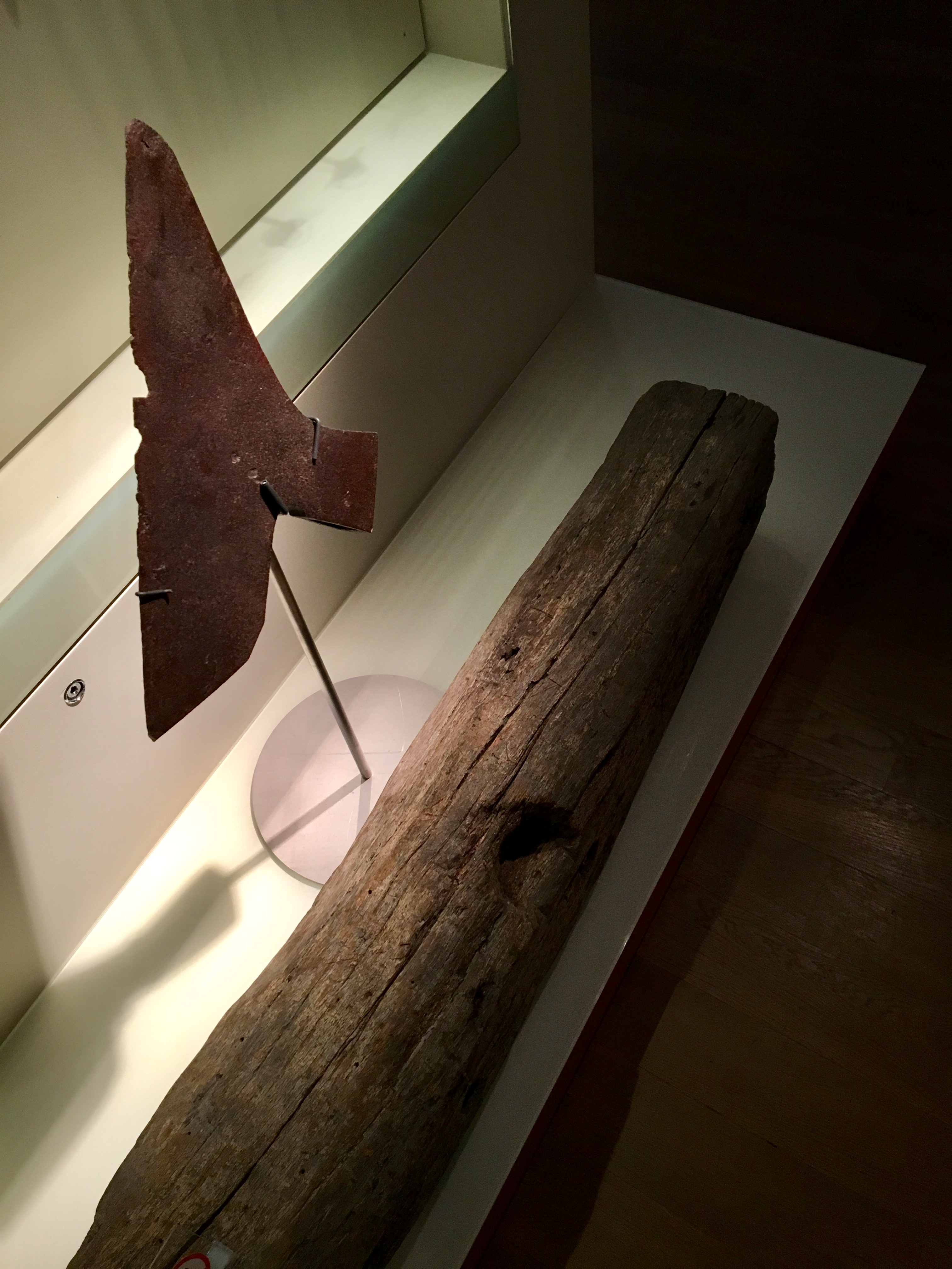
Video of Gullfoss.Þingvellir. A flagpole is visible in the distance (click for full-sized image). This was where the speaker would stand when parliament was assembled. By speaking loudly towards the cliffs, his voice could carry to the assembled masses.This picturesque site in Þingvellir is called the Drowning Pool. Women found guilty of adultery were put in a sack and drowned here. Apparently 18 women met that fate. Adulterous men were beheaded. That fate also awaited convicted murderers. Thieves were hanged. Witches were burned. Interestingly enough, convicted witches in Iceland were typically men.OK – it has nothing to do with hiking/walking/scenery, but it relates to that last picture. This is the actual axe-head and block which were used in the last beheading in Iceland. They are preserved in the National Museum in Reykjavik.Looking east across the rift valley over Lake Þingvallavatn.Left foot is on rock pulling off with the American tectonic plate, right foot is with the Eurasian plate.
Snaefellsnes Peninsula
Having explored the Golden Circle, we arranged a trip to the Snaefellsnes Peninsula. This area of Iceland features mountains, lava fields, seaside cliffs and the vast Snaefellsjokull glacier. Due to the cloudy weather, much of the scenery was obscured. We did get a couple glimpses of the glacier, but nothing that could be adequately captured with photographs. There were numerous walking trails of various lengths at our stops in Hellnar, Arnarstapi, Djupalon Beach and Kirkjufell. Our tour group would move along every 45 minutes or so, so we didn’t do any lengthy walks. We saw some amazing scenery, nevertheless.
The oft-photographed church in Hellnar, with its small cemetery overlooking the sea. Many trails set out from near here, following along the coast above cliffs and through lava fields.Fascinating patterns in the rock of the sea cliffs near Hellnar.The faces of several “trolls” were visible in the rocks near Hellnar. This one was my favourite.Looking across an ancient lava field near Hellnar. Spongy moss is typically the first thing to start growing among the stones.Sea cliffs near Arnarstapi. I thought this looked like the flipper of an island-sized sea turtle.A fascinating natural arch in the cliffs near Arnarstapi.An arch and window in the seaside cliffs.Panorama looking onto the ocean near Arnarstapi.A statue of Bardur Snaefellsnes near Arnastapi. He came to the peninsula in the early days of Icelandic settlement. He was said to be half-troll and is the legendary protector of the area.
Panorama of the dramatic black rock and sand at Djupalon Beach on the Snaefellsnes Peninsula.
Kirkjufell Mountain, which appears in several films and TV shows.While we were near Kirkjufell, the clouds lifted somewhat and we finally got a tiny glimpse of the glacier at the heart of the peninsula. Click for the full sized image. In the centre you can see clouds rolling over the top of the mountain and glacier.A small waterfall near Kirkjufell. The glacier and mountain top is visible at the top-right.A panorama of Vatnaleith, a north-south pass through the mountains of the peninsula. There was a very cold wind blowing through and the clouds were beginning to lower again, so we didn’t spend too much time there.
So, while we weren’t able to do any half-day or full-day hikes, we did get to see a lot of Iceland’s natural beauty. In between all this, of course, we were happily exploring Reykjavik. I’m sure we’ll be back again someday, and hopefully the weather will be more cooperative.
Flying home, looking down on the forbidding Greenland landscape. Glaciers were running down from the icecap here, into the fjord at the centre of the picture.


Very unique landscape and scenery, Par.
Thanks for sharing.
LikeLike