June 24, 2017.
- Region: Castle Wilderness. Traditional territory of the Ktunaxa, Tsuu T’ina, and Blackfoot First Nations
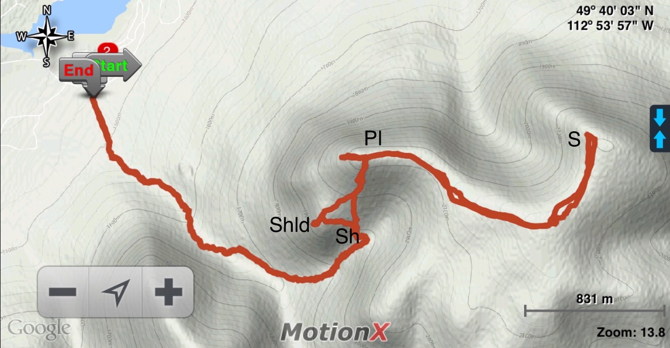
- Distance: 14 km round-trip (this is based on my own tracking, others have tracked this hike as only 10 km)
- Elevation Gain: 739m
- Elevation of Objective: 2225 m
- Total Time: 5h
- Safety and Disclaimer
June 2025 update: There have been no notable changes on the route except that there are picnic tables and a kiosk at the trailhead and the cairn on the “shoulder” has been pulled down. The post has had minor updates of format and content.
Table Mountain is in the Castle Wilderness area in Alberta, overlooking Beaver Mines Lake. It’s a challenging hike/easy scramble, with variable options to get to the top. Ambrosi describes the on-trail approach in his Southern Rockies Trail Guide, and Nugara describes a scramble route in More Scrambles in the Canadian Rockies. Since this was our first visit to the mountain, we decided to take the trail. (Update: I later returned and tried the scrambling route. Check out the post here.)
The weather was slightly cool, but amazingly still for the southern rockies. We were lucky enough to have only partly cloudy skies, and when the sun was shining it felt hot along the trail. I think on a typical hot summer day, this hike would be a scorcher.
The trail head is very easy to get to. From Pincher Creek take Hwy 507, then turn onto Hwy 774. There will be signs for the Beaver Mines Lake campground at about 14.7 km. Follow them, turning left onto a good gravel road which takes you to Beaver Mines Lake and the campground. If you continue along the main road, you reach a small parking area with a marked trailhead for both a short interpretive trail and for Table Mountain.
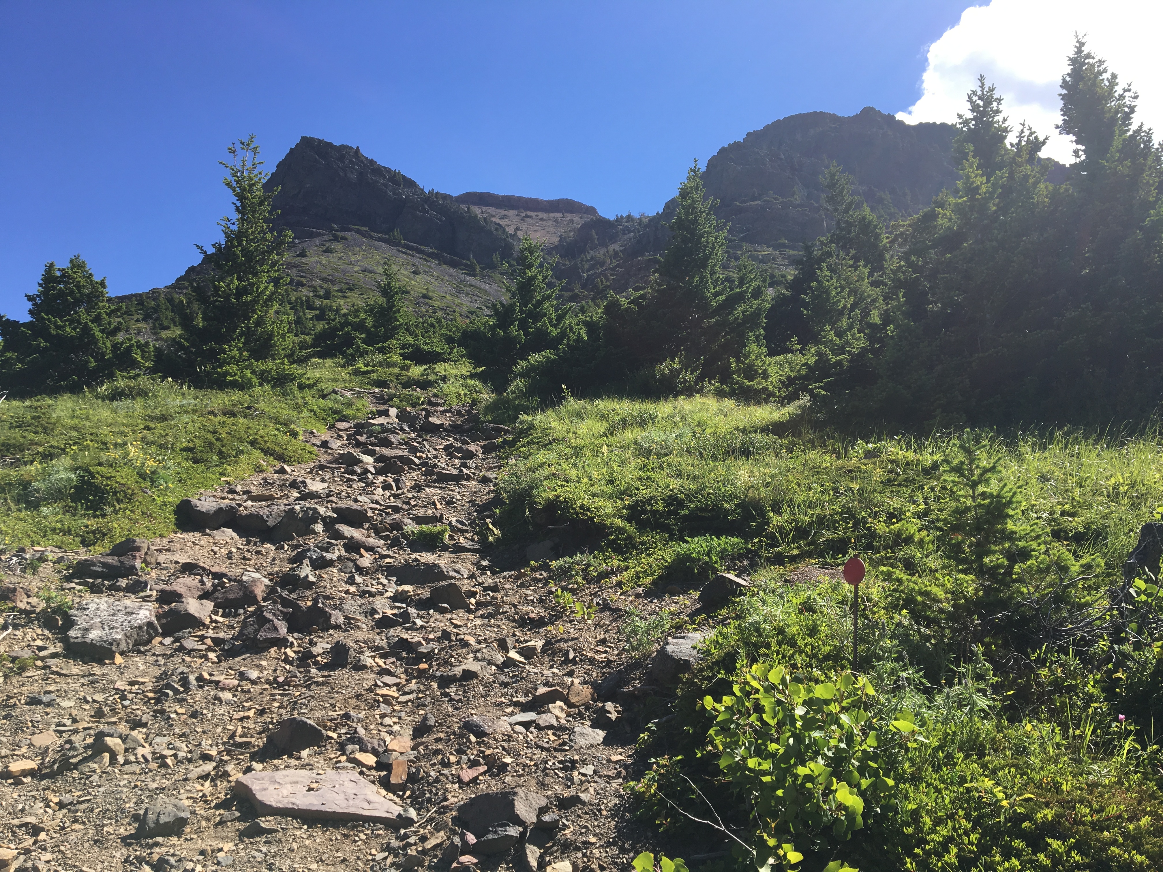
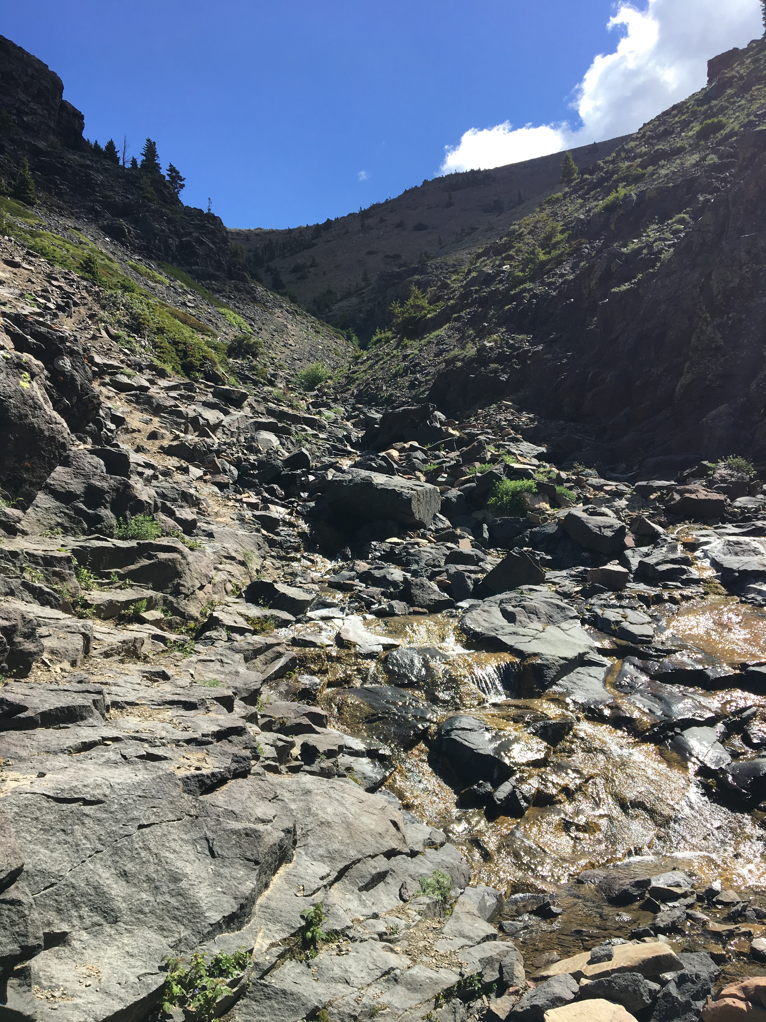
You start out in cool aspen forest. A gentle climb slowly becomes more pronounced, eventually getting you above the level of the trees and onto a traverse on open slopes. The traverse ends upon reaching a gully with a tumbling creek, where your climb begins again. Along the way from here, there are 4 “milestones” that I’ll show in pictures and on the map below: the Shelf, the Shoulder, the Plateau and the Summit. Any one of them would be a reasonable goal depending on your group’s mood and ability.
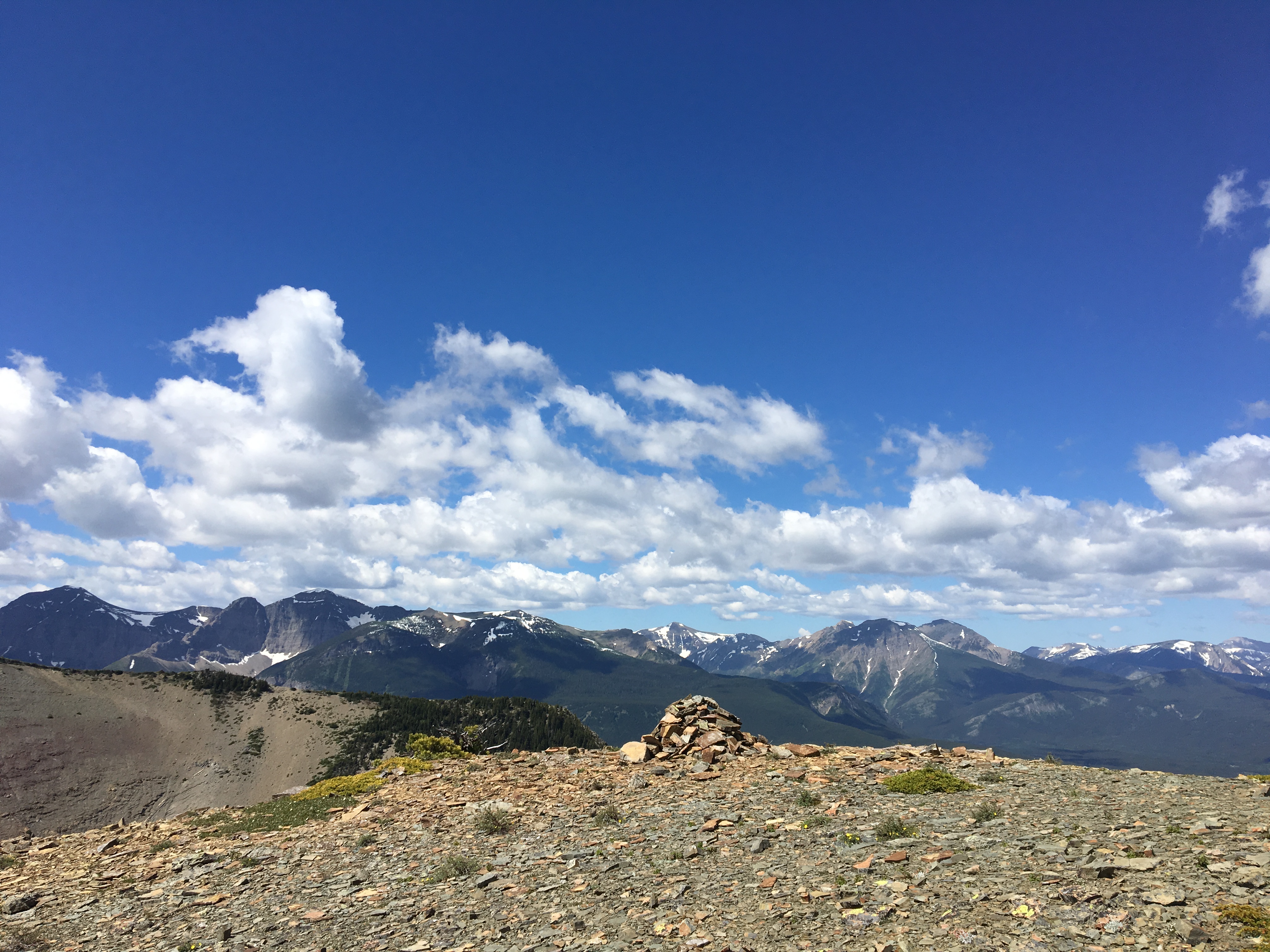
The trail takes you to the Plateau with its amazing views. The Summit is beyond and requires a bit more hiking to attain. However, by the time you’ve reached the Plateau, you’ve done most of the tough climbing and reaching the Summit is quick and worthwhile.
Note that there is a shortcut that you can take during the down-climb that significantly speeds up your descent provided you’re comfortable “boot-skiing” on scree and dirt. I recommend it. Details below.
Click on the pictures in the gallery to access full size images.


Great photos!
LikeLike
Very nice and scenic.
LikeLike