For my first outing in Bob Creek Wildland, I decided to visit Thunder Mountain. Nugara includes it in More Scrambles in the Canadian Rockies 3rd ed., and All Stone Adventures over on YouTube had a great trip report last fall. The trip qualifies as a scramble, though there’s sufficient traffic that numerous boot (and hoof) trodden trails can be seen along the way. With the forecast calling for an unusually calm day in the Southern Rockies I decided to give it a shot.
The land on which this trip takes place holds special significance for the Blackfoot people. I wrote more about that in a companion post on my other blog, which I hope you’ll check out.
Access is off of Hwy 22. Turn west onto Township Road 101 immediately south of the bridge over the Oldman River. There will be signs pointing toward a number of campgrounds before the turn: Recehorse Creek, Dutch Creek, Oldman River North, and Livingstone Falls. This road isn’t too bad to drive – it alternates between gravel and pavement. A little under 18 km from the turn, after passing signs notifying that you’re entering the Bob Creek Wildland, the road turns sharply north then bends gradually back to the west coming alongside the Oldman River. Look to the left for a parking area at the base of a ridge. Ask Google Maps to drop a pin on 49.873484, -114.354953, or click here.
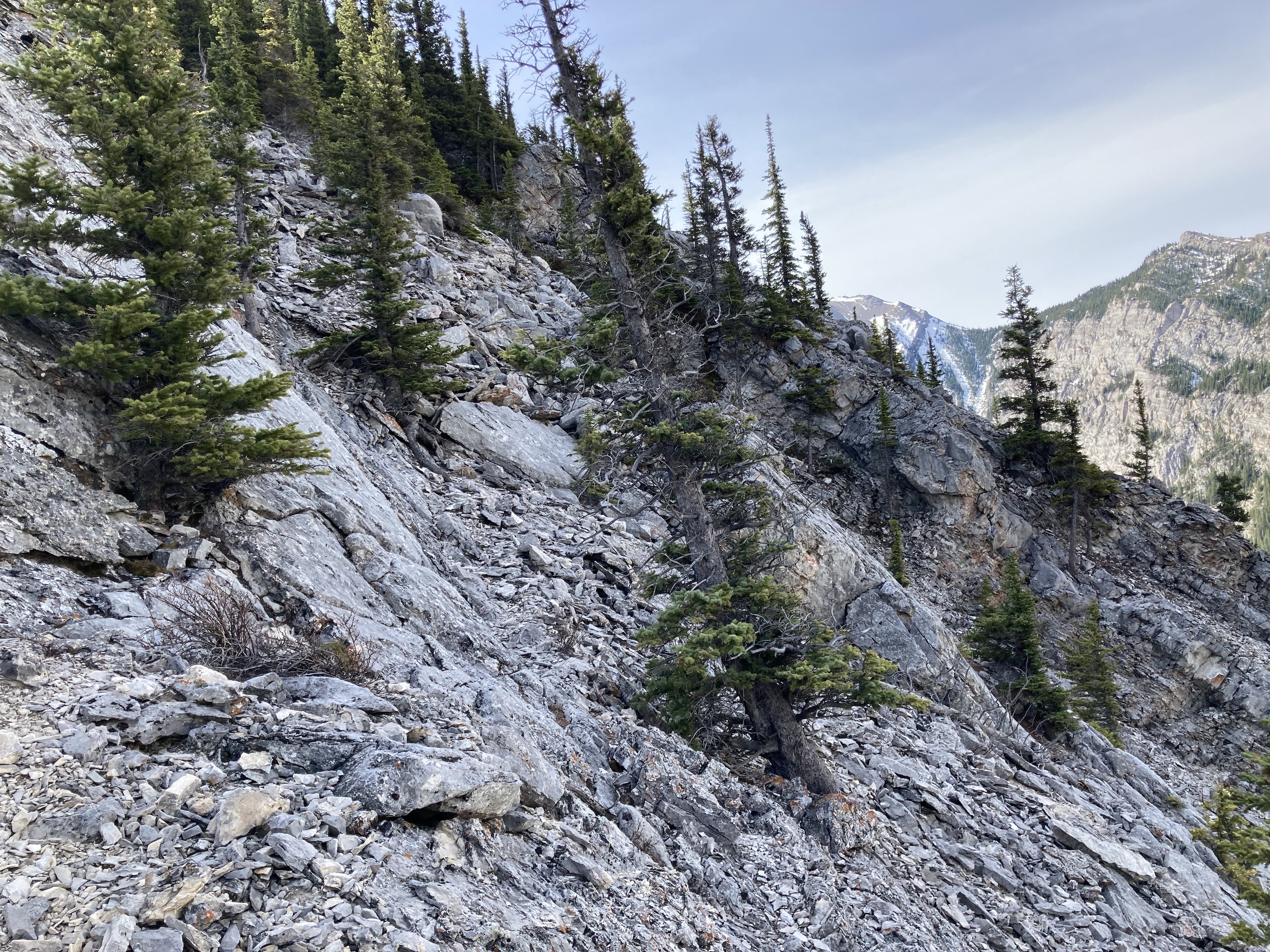
The parking area is at the foot of a ridge which extends south, all the way up to the summit of Thunder Mountain. A path sharply ascends a few dozen meters from the parking area to flat area adjacent to low cliffs and a field of rubble. I saw an evident path in the rubble and followed it to a steep dirt track alongside the cliffs. The damp ground, with its exposed roots and very steep grade actually made this the most treacherous part of the trip. On my ascent, I slipped and fell on my face (that’s not a figure of speech – my face hit the ground). On my descent I careened into a tree and scraped myself up pretty good.
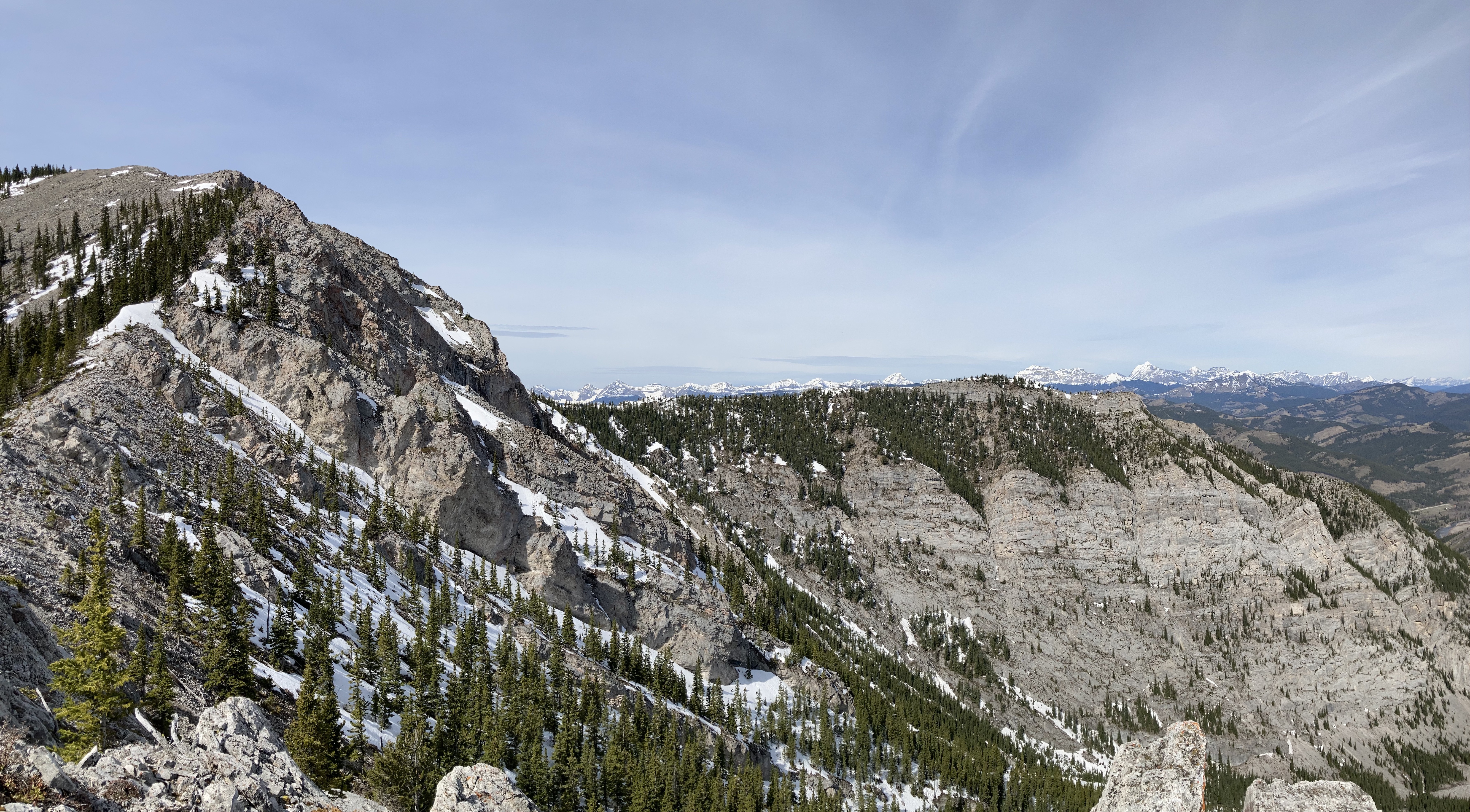
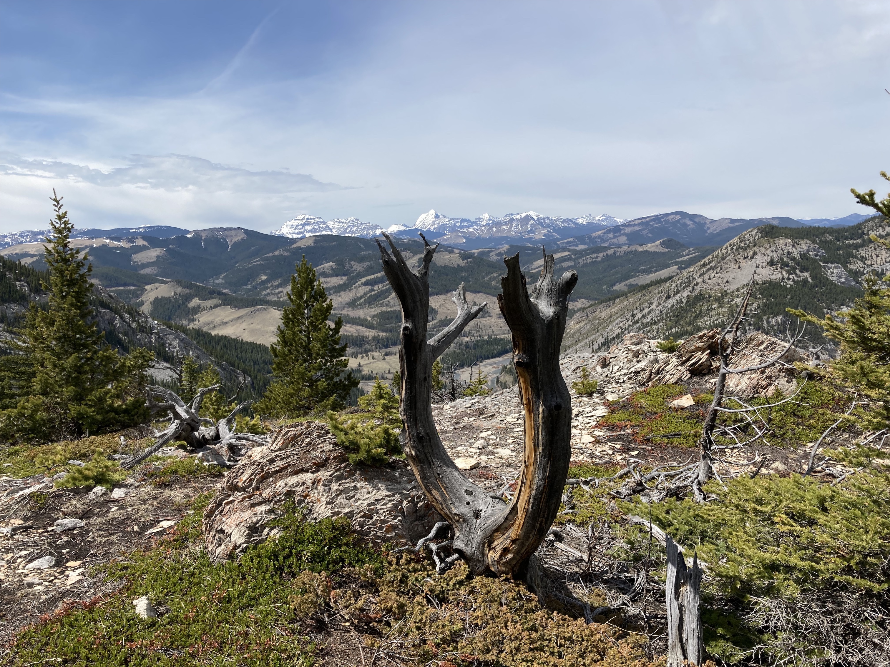
The initial ascent leads to a rocky shoulder featuring a collection of cairns. From this point it’s possible to trend right and ascend, which involves a bit of scrambling, or head left into some trees and eventually encounter a tree with flagging wrapped around it which leads the way to a hiking trail ascending through the woods. On my ascent I went the scrambling route, and I took the trail through the woods on my descent. On the way up, I found myself doing an ascending traverse, with occasional sharper ascents to go above the level of some intervening gullies. This eventually got me to a broad, clear area of the ridge. For about 1 km the grade was much more gentle, with footpaths criss-crossing around the terrain. More distant views start opening up around here, with the big peaks on the Continental Divide becoming visible to the west.
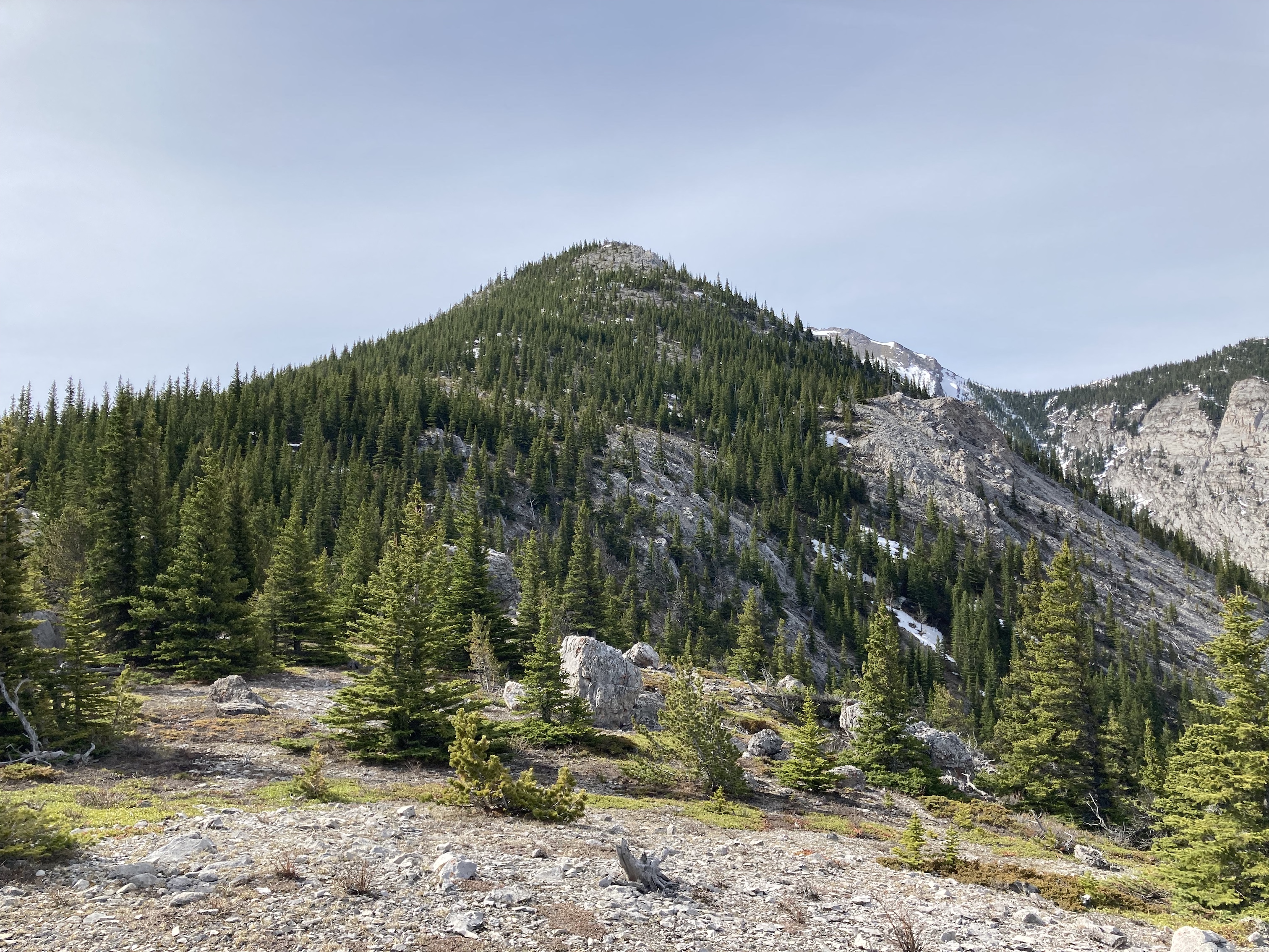
Beyond this area, the ridge ascends sharply and is tree-covered for a time as it heads toward a high point. Here, I ended up going a little to the right, but ended up having to crash my way left (uphill) after a while because it was clear I was on the wrong line. On my descent, I found a nice trail in the trees, indicating that I should have trended a little left on the ascent through his area. Whatever route you take, the bottom line is that you need to ascend towards the exposed rock outcropping at the apex of the high point. Beyond there, the next visible high point is a false summit. The best strategy is to stick to the rock on the ridge all the way to the false summit and beyond. Here and there it’s necessary to deviate left or right to avoid gaps in the rock or avoid a few precarious places but overall I found it safe, easy, and fun to stay on the ridge top.
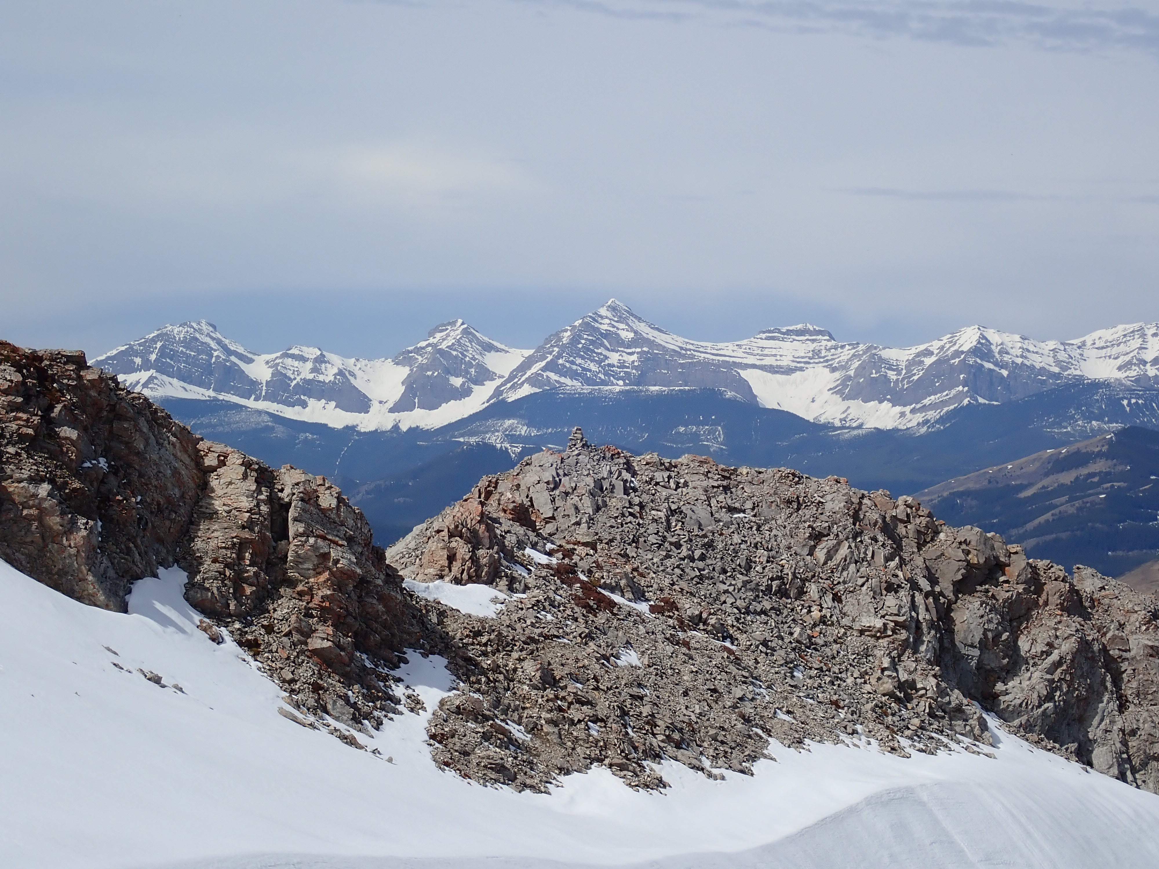
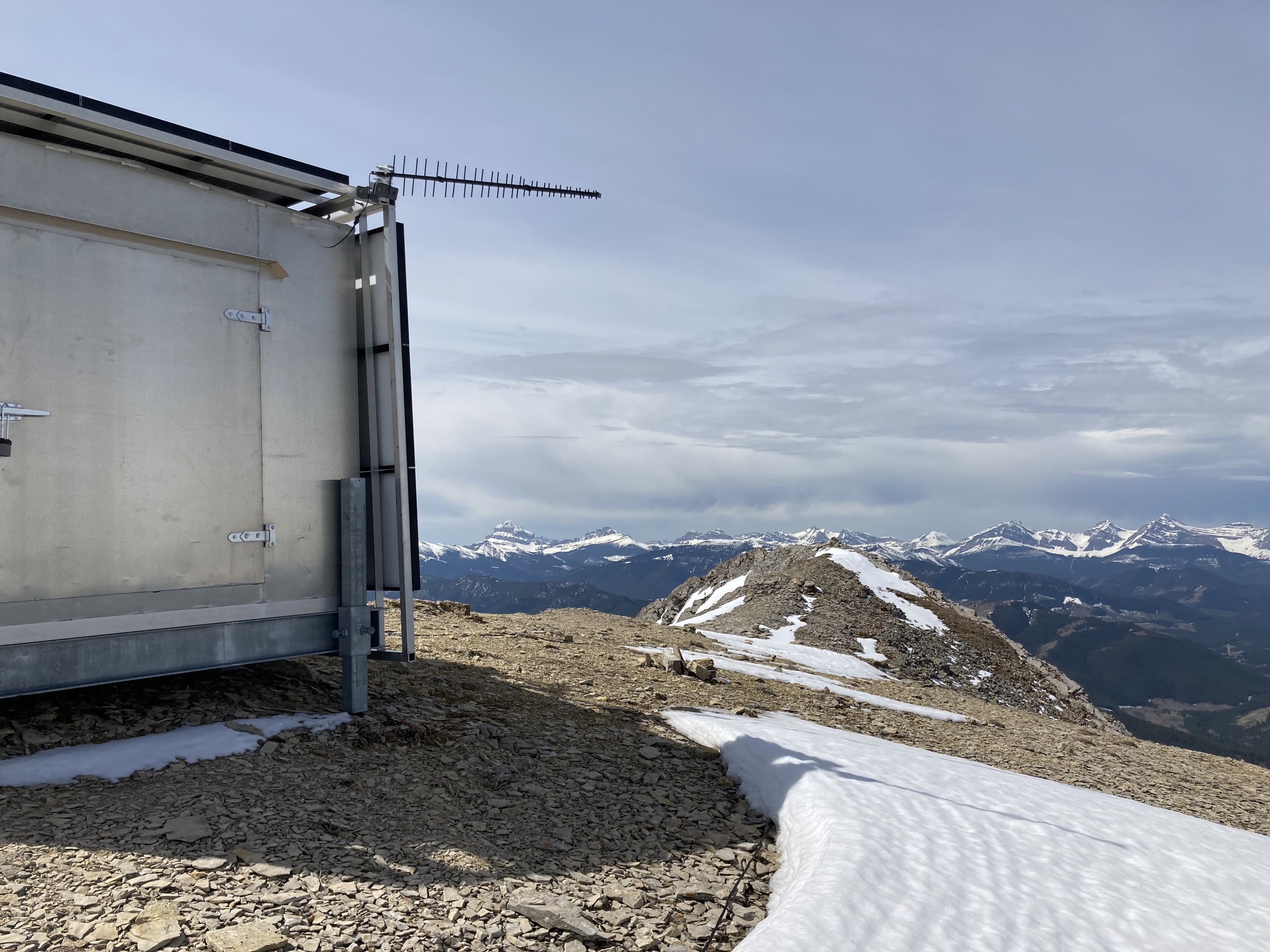
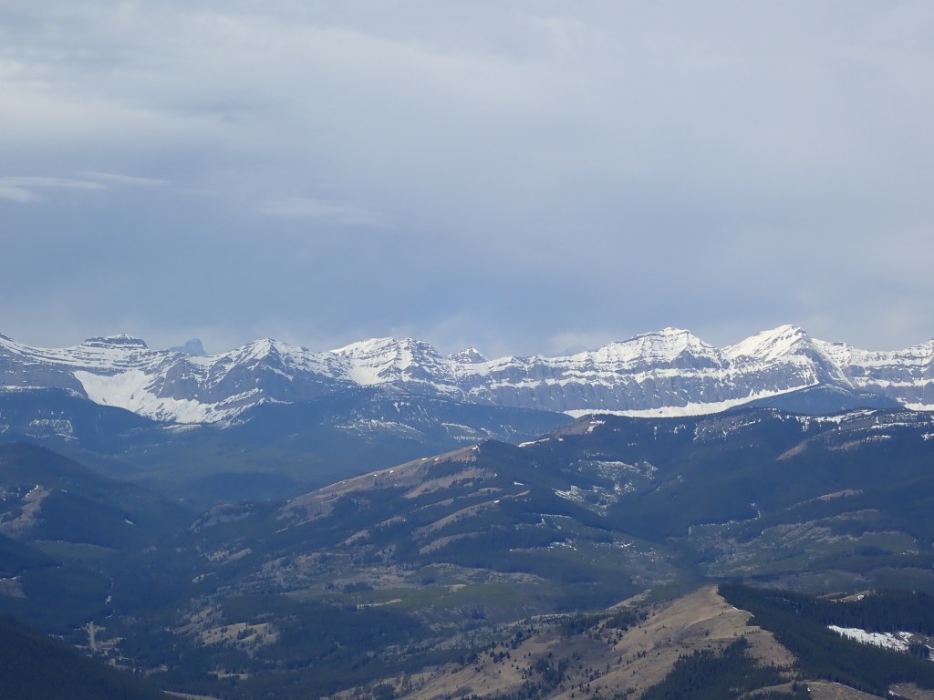
Once at the false summit, the true summit comes into view with a little sensor station perched on top. Climbing up to the station, I saw that there was a slightly higher spot a short distance away with a small cairn perched on it. I reached the summit cairn at 2h 55m which included a fair amount of stopping to take pictures. I was astounded to find that there was no wind on the summit. I actually took a video recording just to prove it. The views were great, with the Livingstone Range stretching off to the south. Crowsnest Mountain and Seven Sisters were easily seen – the usually very familiar peaks looking a little different when seen from the north. In the far distance I could see familiar peaks in the Castle region. Referencing my maps I made myself familiar with peaks like Mount Secord, Mount Eris, Gould Dome, Tornado Mountain, and Beehive Mountain to the west.
I made my descent after a nice long stay at the summit. I did end up taking slightly different lines on the descent in a couple of places, which I describe above. Remember that the cairns on the initial rocky shoulder mark the spot where you should head right on the descent, into the trees to find the dirt trail that takes you back along the base of the cliffs to the parking area. I overshot and had to wander a bit before finding the right place to descend.
Click on the pictures in the gallery below to access full-sized images.
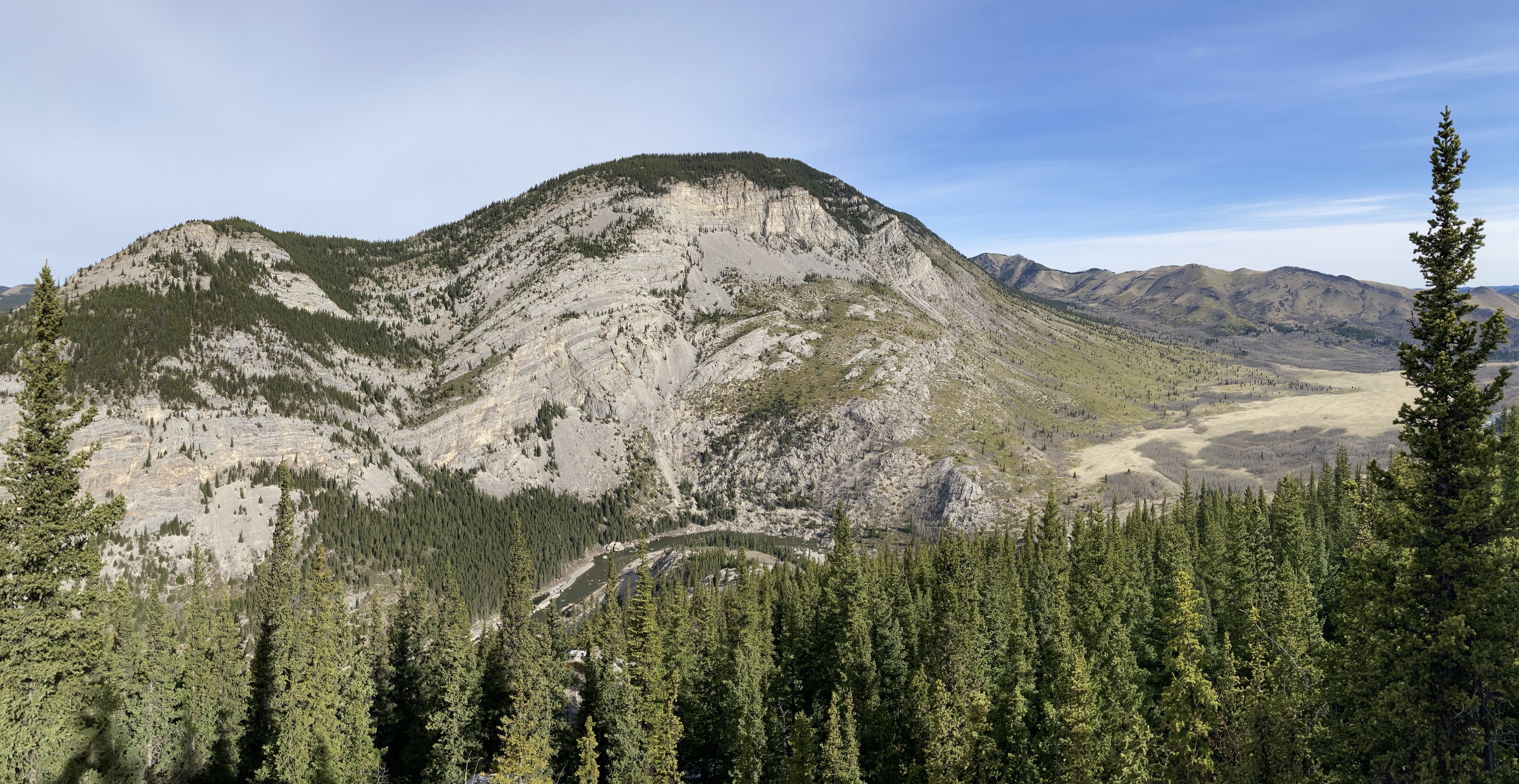
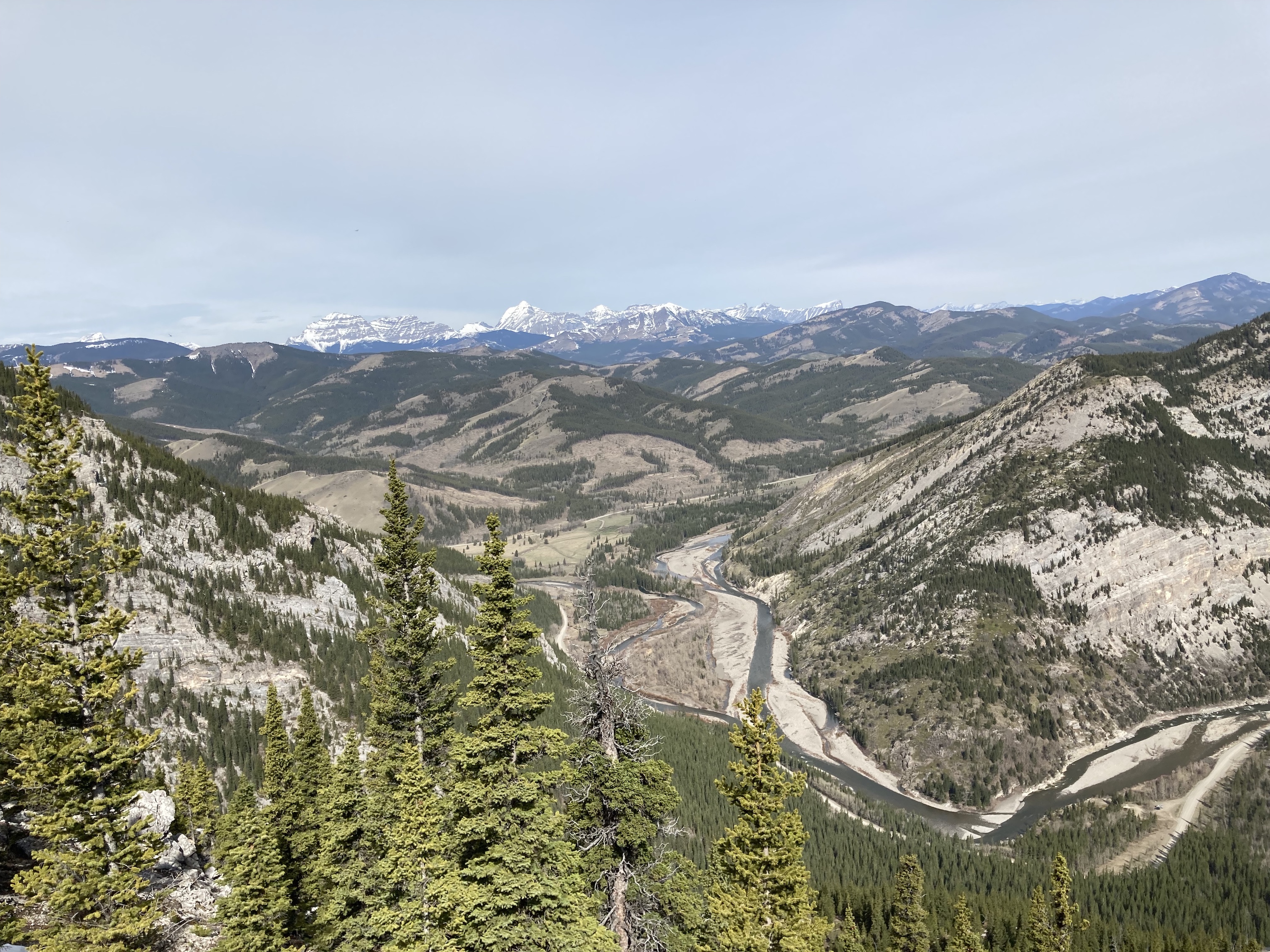
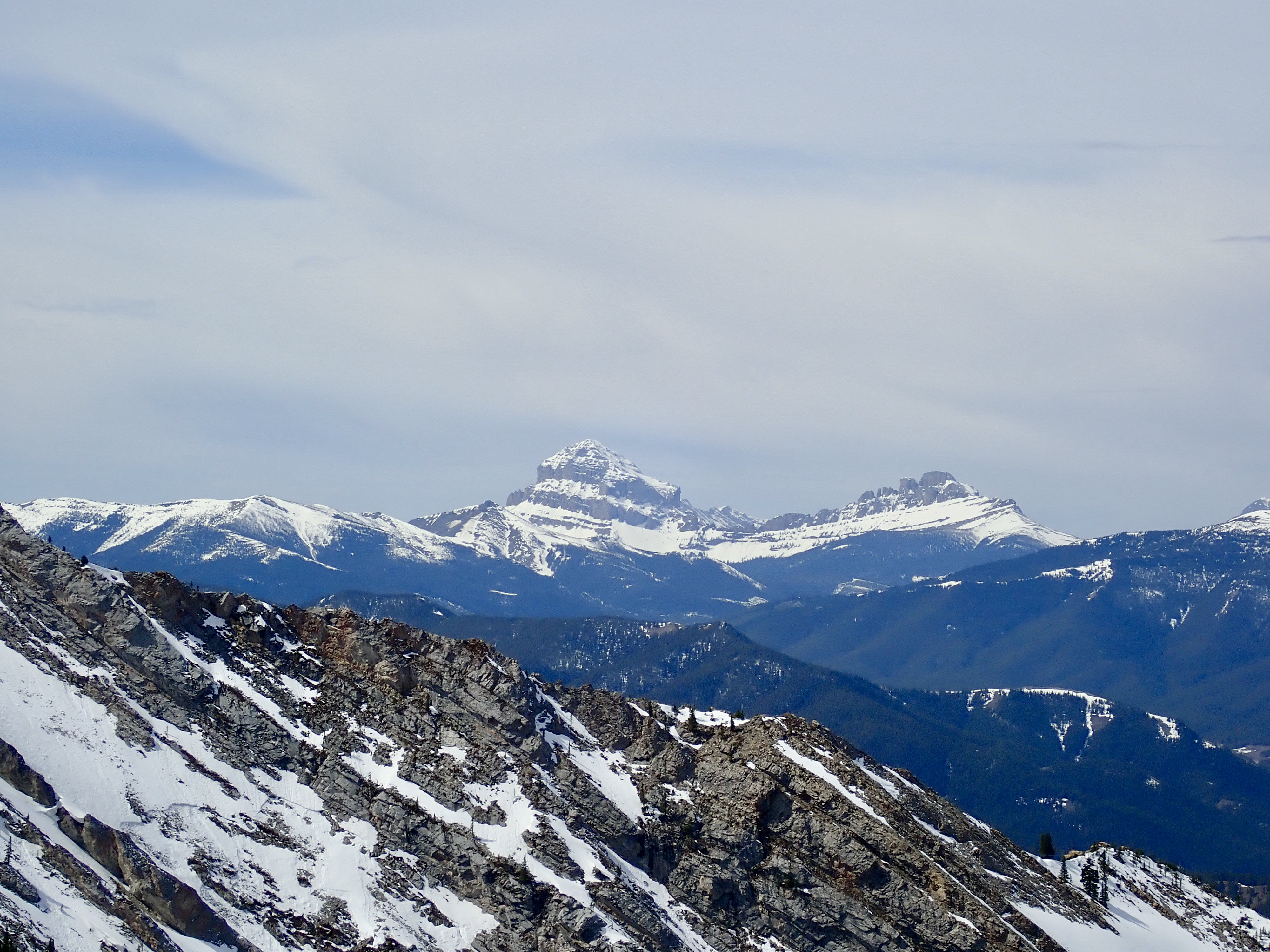
Route overview looking west.Route overview looking south.Thunder Mountain, as seen from the access road.The parking area, and the low cliffs at the start of the route. A trail goes up the rubble to the base then goes up through the trees.The start of the trail. Someone has built a little fort in the trees to the right.The initial rocky shoulder. The false summit is in the distance, partly obscured by the slope. The other peak is the high point of a parallel spur. I bore to the right here, but there’s also a trail through the trees off to the left. It’s marked with flagging and intermittent cairns.If you decide to go left from the cairns on the rocky shoulder, you pass through some trees. Eventually you should come across this tree with flagging wrapped around it. I discovered it on my way down.Some of the terrain along the scrambling route. Nothing difficult or exposed. I just kept ascending and traversing.Taking a break to look down at the Oldman River.A little higher now. The Oldman River winds through “The Gap” in the Livingstone Range. I think this gap is due to a cross fault, but I’m definitely not sure about that.Up on the broad, clear area of the ridge. For about 1 km the slope is minimal and the terrain is fun to traverse. The false summit is now clearly visible. Those who don’t feel like mounting an expedition to the summit could while away a sunny afternoon here, picnicking and exploring.Looking west towards the Continental Divide. Two shark fin profile mountains stand out. The one of the left is Racehorse Peak. The one on the right connects to a ridge and another peak. I can’t find names for these anywhere.Beyond the broad open area, the ascent gets steeper as it heads towards the high point ahead. The route goes back into the trees for a time. It’s best to go a little to the left here. The big boulder up ahead, and the even bigger one partly obscured by the trees beyond it will be visible from above in the next pic.Looking down from part way to the high point, back the way I came. The boulders from the prior picture are visible slightly right of centre, down on the flat portion of the ridge. Across the gap, Thrift Peak is now visible. The Oldman River snakes through the gap, heading to the prairies.Looking west from the same spot, Gould Dome and Tornado Mountain are visible. Almost up to the apex of the high point.Up ahead is the apex of the high point. The fissure ahead is easily avoided to the left. The false summit is in the distance to the right.Checking out Gould Dome and Tornado Mountain through the fissure.Beyond the high point, the entire ridge ascending to the false summit is visible.Closer to the false summit now, above the level of the spur across the valley. The peaks to the west once again came into view.From the false summit, a cairn was visible on a high point at the top of the adjacent spur. I didn’t end up going that way, but it would make for a straightforward way to extend a day on the mountain.The view of true summit from the false summit. The character of the terrain changes pretty abruptly, becoming more stark and rubble-strewn. Crowsnest Mountain, Seven Sisters, Allison Peak, and Mount Ward are in the background on the right.My first good look at Crowsnest Mountain and Seven Sisters from the north.There are piles of flat rock fragments like this beyond the false summit. Here, someone made something like an inukshuk. Almost to the summit.Up on the summit next to the sensor station. The summit cairn is nearby, on a slightly higher spot.The summit of Thunder Mountain.The summit cairn and the view to the northwest.Summit panorama taking in all the mountains on the western horizon.The Livingstone Range stretching south. This range was named by Thomas Blakiston after the famous British explorer.Lightning Peak, with Centre Peak beyond.The Flathead Range.Crowsnest Mountain and Seven Sisters. Again.Alison Peak and Mount Ward.Racehorse Peak and its un-named neighbours to the right. Just left of Racehorse Peak is the snow-covered “Mount Racehorse”. They sit on either side of Racehorse pass.Mount Secord and an outlier of Mount Eris. The summit of Mount Washburn is silhouetted in the distance on the left.Mount ErisGould Dome. The summit of Mount Harrison (3360 m) is in the distance to Gould Dome’s left.Tornado Mountain. This mountain originally bore a name similar its neighbour: Gould’s Dome. The story of its first sighting and naming by colonial explorers takes place near “the gap”. According to Irene M. Spry’s The Palliser Expedition, “Through the gap in the mountains through which the river flows, they could see a high, dome-shaped peak; Blakiston called it ‘Gould’s Dome’ after a celebrated naturalist.” The “dome” descriptor applies to the very top of the mountain, which would have been the only part visible from lower elevations. According to Peakfinder, the mountain was renamed in 1915 by the Boundary Commission after they experienced impressive storms in the vicinity. The old name shifted over to the mountain’s southerly neighbour and the possessive ‘s was dropped.Beehive Mountain. The dramatic drop of its stark eastern cliffs is apparent when seen from this angle. The gentle curve of Mount Lyall’s summit rises behind it. Gass NE1, Mount O’Rourke, and Mount Pierce are to the right.Mount O’Rourke, Mount Pierce, Mount Farquahar, Courcelette Peak, Mount Aldridge, Mount Etherington, Baril Peak (centre frame), Twin Peaks, and Monola Peak.Looking up the valley to the north. The ascent ridge is in the foreground. The Oldman River meanders down from its source on the Continental Divide. Mount Livingstone is at the top right.Looking downslope to the west. The Livingstone Range is mountainous in form, but its geology is actually that of the foothills (so says Ben Gadd in Canadian Rockies Geology Road Tours). Hence, you can see there are foothills sandwiched in between it and the geologically “true” mountains in the distance.Time to descend. They’d only be a few pixels in this image, but I could see another party on their way up the ridge.“Napi is very old every winter”, he said, “but he becomes young every spring. He has travelled all along the Rocky Mountains, and there are various marks on the mountains which remain as relics of his presence.” (The words of Blackfoot leader Big Plume as recorded by missionary Edward F. Wilson. From Hugh A. Dempsey’s Napi: The Trickster.)
I’ve seen trip reports of successful scrambling ascents of Tornado Mountain. Looks quite challenging, though and the approach is difficult/time consuming. Thanks for reading!
Tornado is a really great climb, steep at the end but well worth it. And there’s some amazing little places to camp near its base, right on the BC & Alberta boundary.


Another great post from you and again I see so many interesting peaks from your photos!
Amongst others, Tornado mountain looks very promising for a climb.
Thanks for your efforts to report your hikes in such good level of detail.
LikeLiked by 1 person
I’ve seen trip reports of successful scrambling ascents of Tornado Mountain. Looks quite challenging, though and the approach is difficult/time consuming. Thanks for reading!
LikeLike
Great photos and map/earth views.
I’ll be heading up there at the end of June while camping nearby.
LikeLike
Tornado is a really great climb, steep at the end but well worth it. And there’s some amazing little places to camp near its base, right on the BC & Alberta boundary.
LikeLike