May 14, 2021. An extension beyond the end of the popular Turtle Mountain North Summit trail, scrambling to the south (true) summit.
- Region: Crowsnest Pass. Traditional territory of the of the Blackfoot, Tsuu T’ina, and Ktunaxa First Nations
- Distance: 1.2 km one-way from the north summit
- Total Ascent: 200 m (requires some loss and regain of elevation)
- Elevation of Objective: 2205m
- Time: 1h 5m one-way from the north summit
- Safety and Disclaimer

After 2 prior visits to Turtle Mountain I had yet to make the traverse to the true (south) summit. The first time I turned back because of strong winds and uncertainty about my scrambling abilities. The 2nd time I didn’t like the look of the snow. This time I had a perfectly calm day, and enough of the snow had melted that I was more confident that I could pick a safe path through the giant cracks and fissures which are present all along the traverse.
Access to Turtle Mountain and the ascent to the north summit have been described previously. Take a look and please excuse the quirks of formatting – WordPress has changed somewhat over the years.
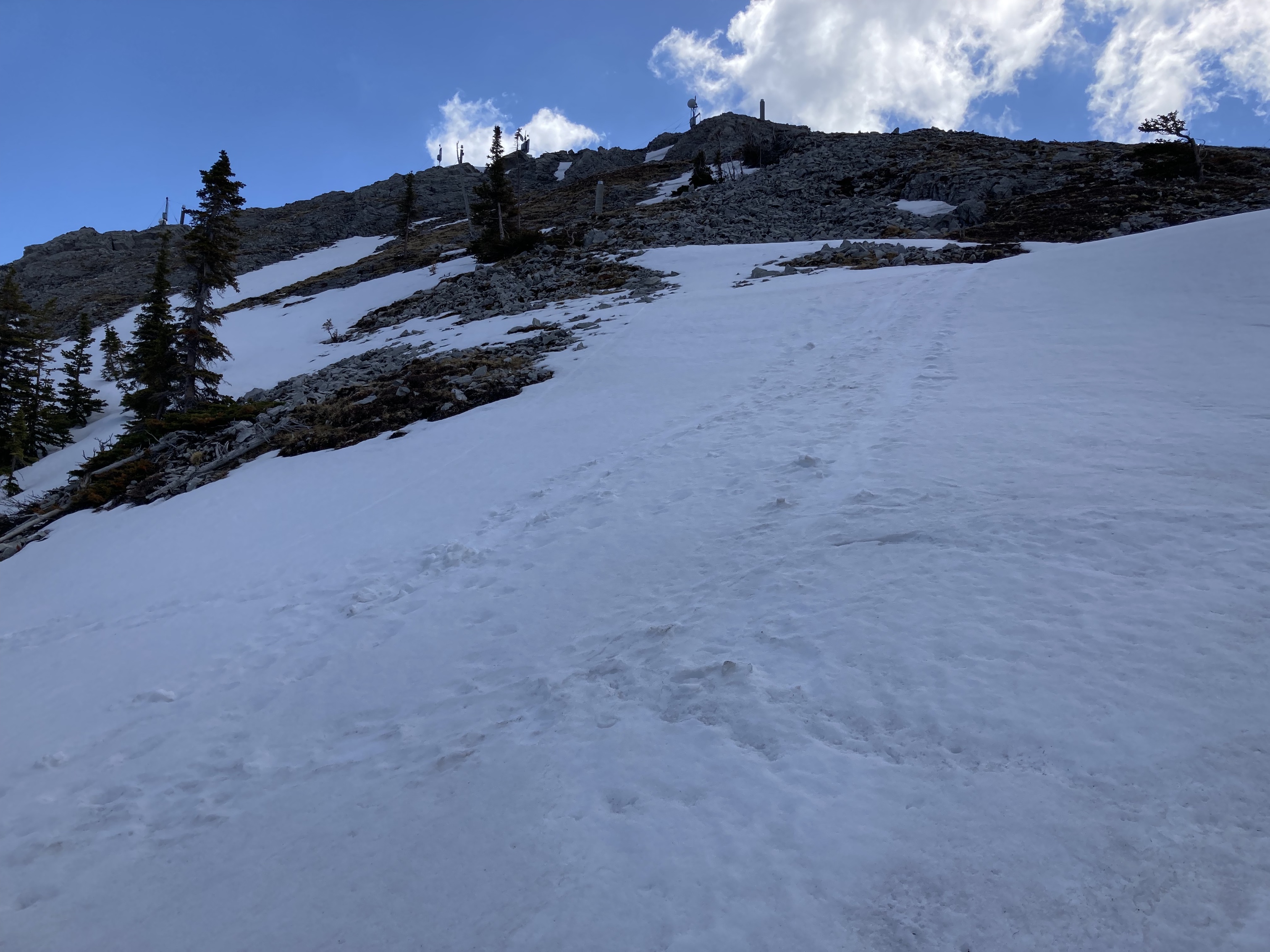
Looking south from the northern summit, there’s a steep but straightforward climb down to a footpath in the rubble. Paths like this will branch, join, and disappear here and there. Sometimes a cairn is seen, though it wasn’t always clear to me in exactly what direction the cairns were directing me. The basic thing to keep in mind is that the further left you are the more you’ll be amongst the exposed solid rock of the mountain as well as the giant cracks that plunge varying depths. These hazards are sometimes partly obscured by snow. The further right you are the less likely you’ll encounter the cracks, but the more you’ll be dealing with steep scree-covered terrain.
I took what I thought to be an in-between route. I stayed off the snow as much as possible, since it was obvious to me that a crack of any depth could be hidden under a snow bridge. A fall deep into the rock would be a definite possibility. By staying on the exposed rock I got to enjoy some fun scrambling, eventually making my way almost to the false summit before finally having to traverse an area of snow. Luckily it was solid and supportive. As I got closer to the false summit, sensor equipment set up by the Alberta Geological Survey came into view and I stopped to check out 2 informative placards. From the false summit, the true summit was an easy ridge walk away. At the summit there are 2 areas of roughly equal elevation. One is very slightly lower and features a large square wooden platform. The slightly higher one is featureless – I didn’t see a cairn.
The view is more or less the same as from the northern summit except for improved views to the south. The wind was calm and the parade of fluffy cumulus clouds made for a highly photogenic day in the Pass. On my return I tried to retrace my steps, but did get off track about half way down, finding myself well below where I wanted to be and navigating though some trees on steep scree. I had to cross some snow that was soft and fairly deep near the edges. I probed around with a pole for a while to convince myself it was safe but then crossed without difficulty. In retrospect I tried to bypass a high rocky area split by a fissure when what I should have done is climbed up and over, paralleling the fissure.
This was quite an enjoyable extension to the usual Turtle Mountain ascent. There’s no real tricky technical scrambling here – it’s just hazardous terrain. Any particular snow patch could conceal a deep fissure. I know plenty of people ascend in various snow conditions, but I think it’s best to wait until the snow’s mostly gone.
Click on the pictures below to access full-sized images.