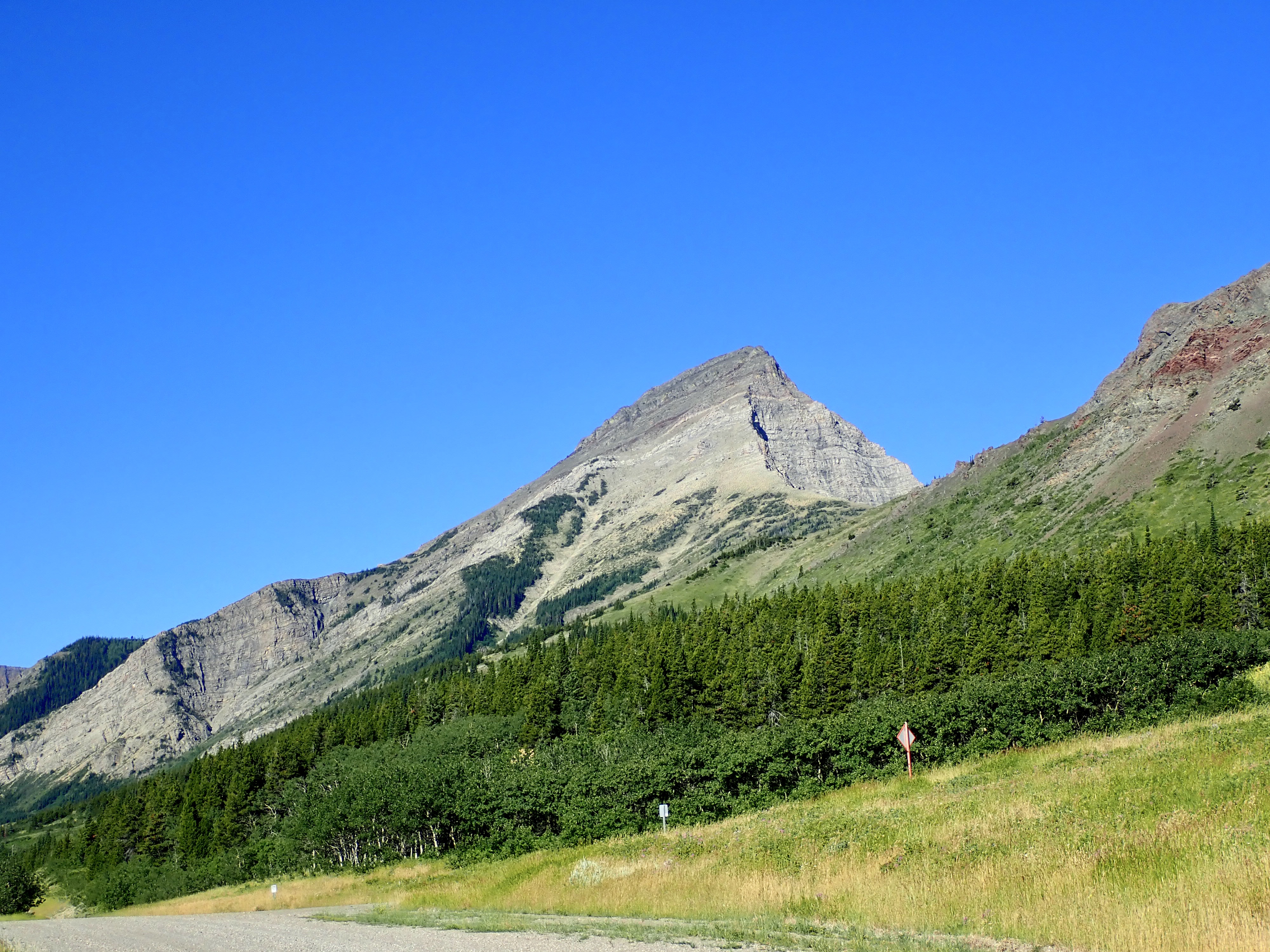
August 4, 2020. A scramble to the summit of a distinctive mountain in the Castle Wilderness.
UPDATE September 3, 2021: This post has been updated to reflect changes to access. Old access instructions have been deleted but time and distance information below still reflects the old route. The new route can’t be bike easily.
- Region: Castle Wilderness. Traditional territory of the Ktunaxa, Tsuu T’ina, and Blackfoot First Nations
- Distance: 12 km round-trip
- Total Ascent: 1100 m
- Elevation of Objective: 2572 m as per my Garmin, Nugara has it at 2587 m
- Total Time: 5h 8m
- Safety and Disclaimer
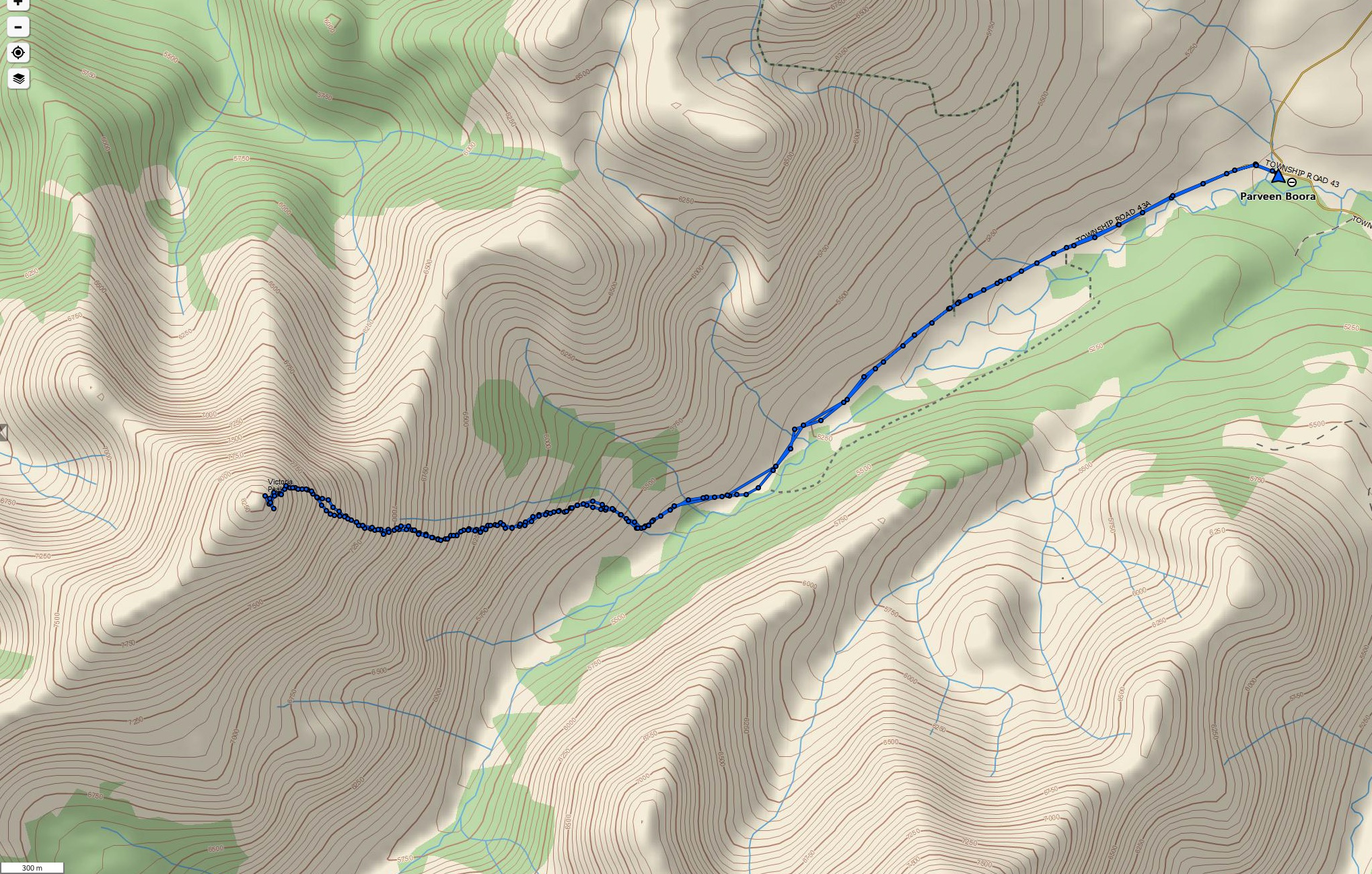
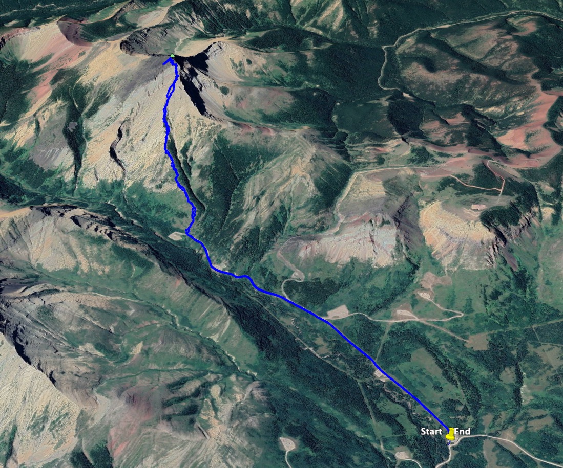
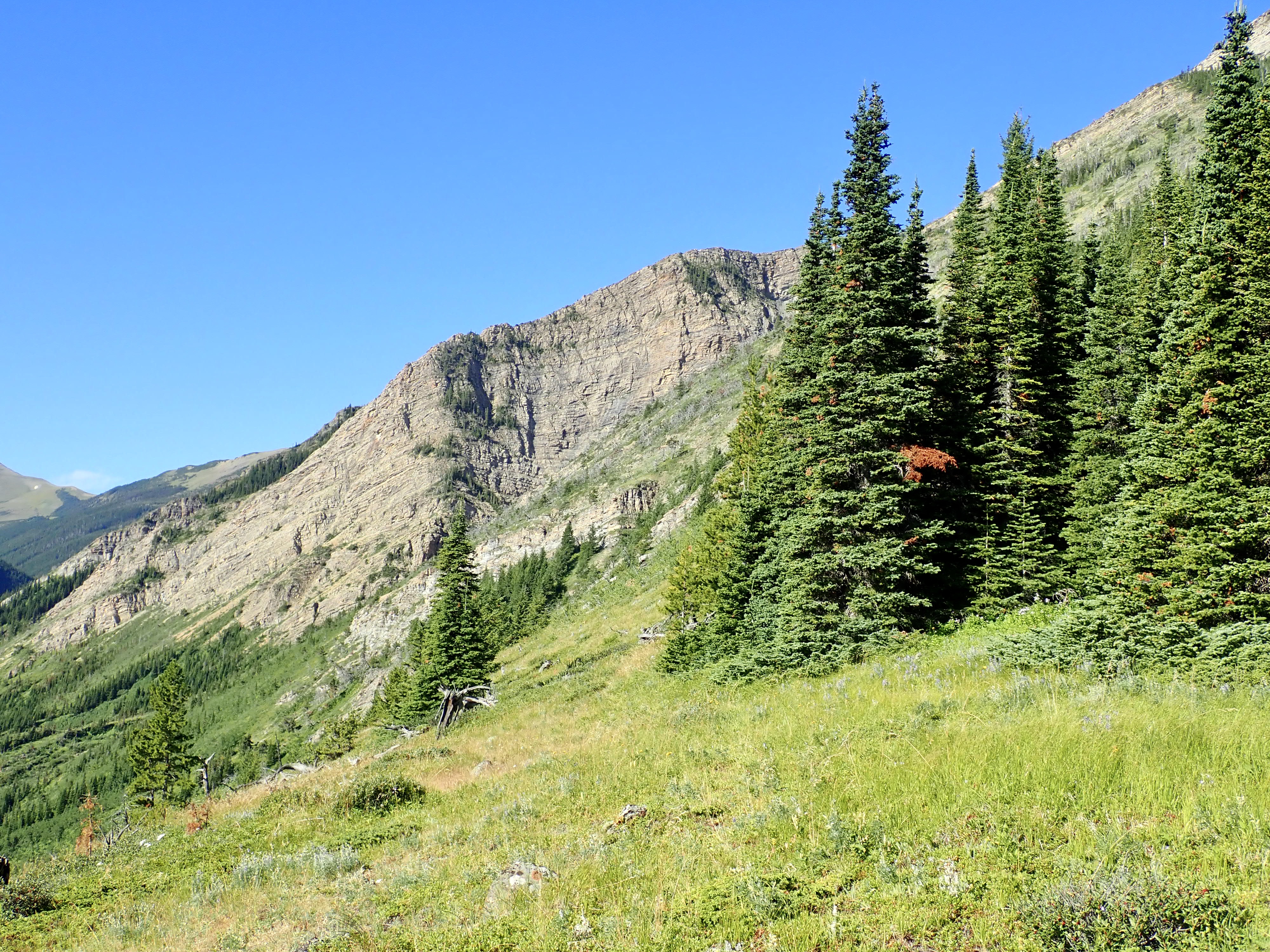
Victoria Peak has been on my mind as an objective since I moved back to Southern Alberta a few years ago. It has a distinctive fang-tooth shape when seen from the east, and it’s visible from my neighbourhood in Lethbridge. A variety of routes are possible. Nugara describes a moderate-difficulty scrambling route in More Scrambles in the Canadian Rockies, and Bob Spirko‘s route seemed to follow a somewhat similar line – though his trip involved a visit to a rock window below the peak. Other routes involve an approach from the south or west along less rocky, but nevertheless steep terrain. I read a particularly impressive blog post by an 11 year-old describing an 11 hour trip plagued with route-finding challenges. I ended up taking a route up the east slopes that was similar to Nugara’s and Spirko’s. It involved a bare minimum of bushwhacking and plenty of great rocky scenery.
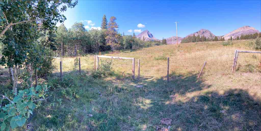
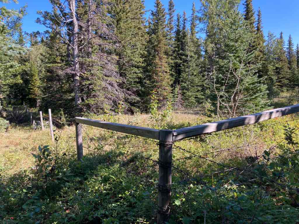
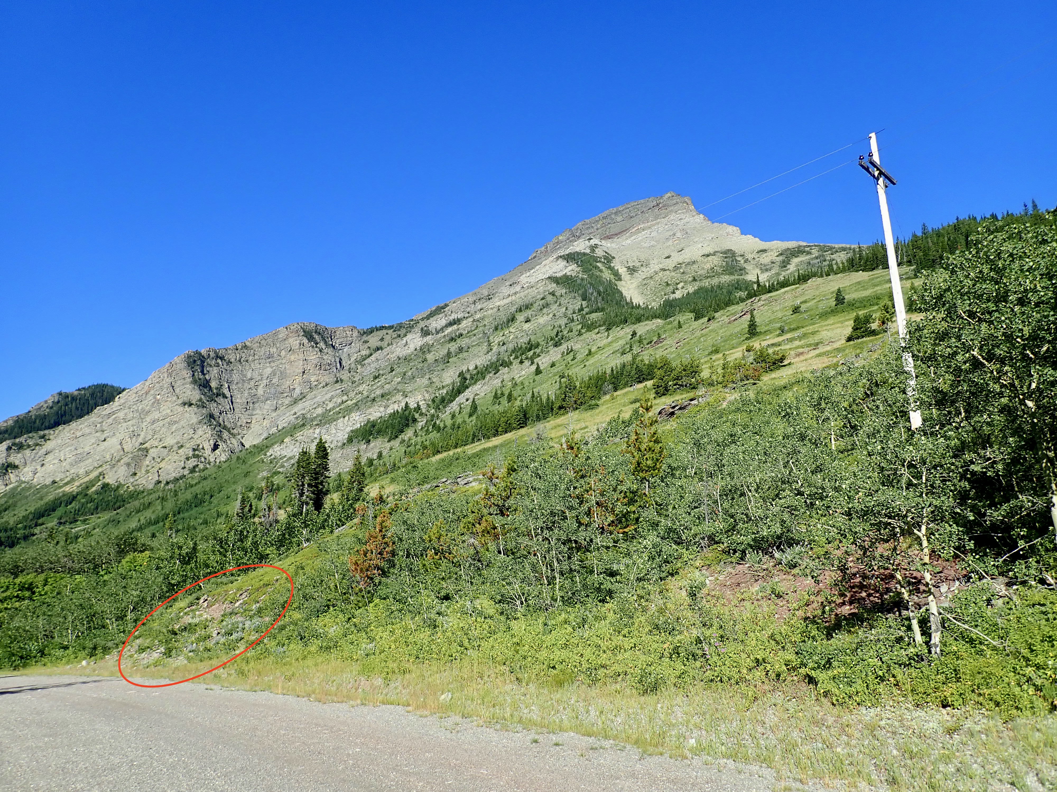
UPDATED ACCESS INFORMATION SEPTEMBER 2021: Access for this hike has changed significantly. The initial part of the route is no longer usable as it enters private property. This is a recent change and guide books published right up to 2021 still describe the old approach, unfortunately. Access still involves using a gravel road that heads to the base of Victoria Peak, but the initial part has to be bypassed on public land. Drive south from Pincher Creek on Hwy 6 and turn at the signs for Butcher Lake and the Gas Plant. Proceed to Butcher Lake and go past. Soon, there’s an intersection with Rge Rd 1-3A. Park near here and head up the road to the left to a well site. I’m not sure if parking is allowed at the well site or not. Click here for a Google Map with a pin on the well site. Follow a trail southwest from the well site and you’ll climb a hill under some power lines. Follow them to the west until you reach a barbed wire fence – this is the property line. The power lines carry on over the private property, but you can go through a gate to the south (close it again after) and then follow the outside of the barbed wire fence. Then proceed as per the picture below:
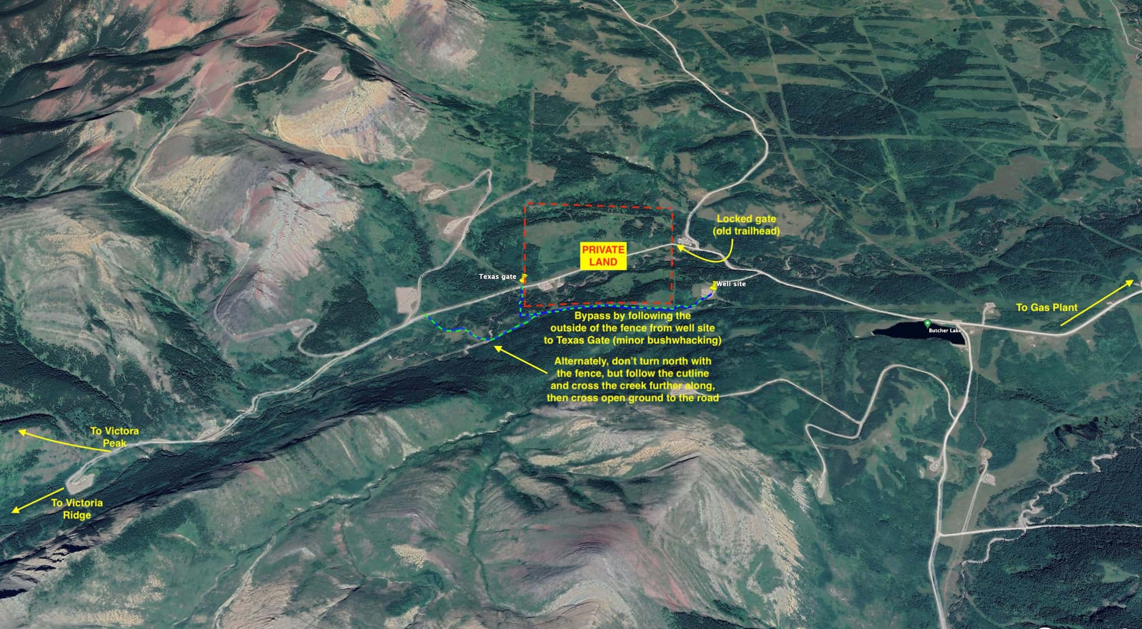
For another perspective, check out this Facebook post from Adam Ess. He had a direct conversation with the landowner, and it seems they may be okay with people rejoining the road sooner than what I have mapped out above.
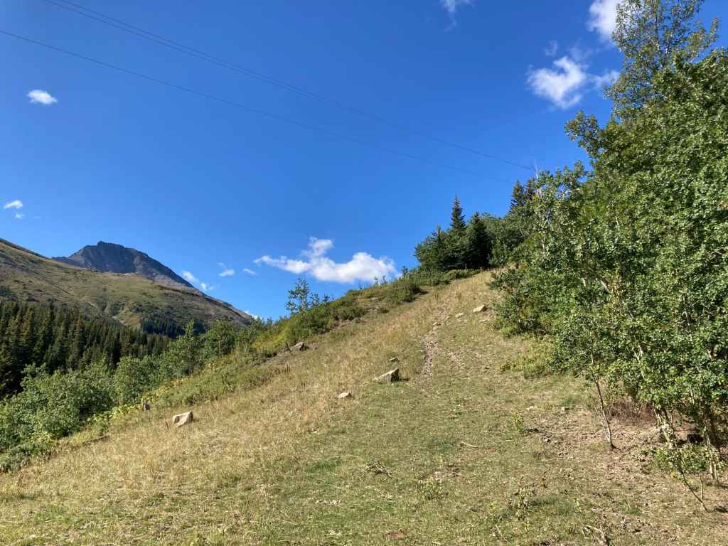
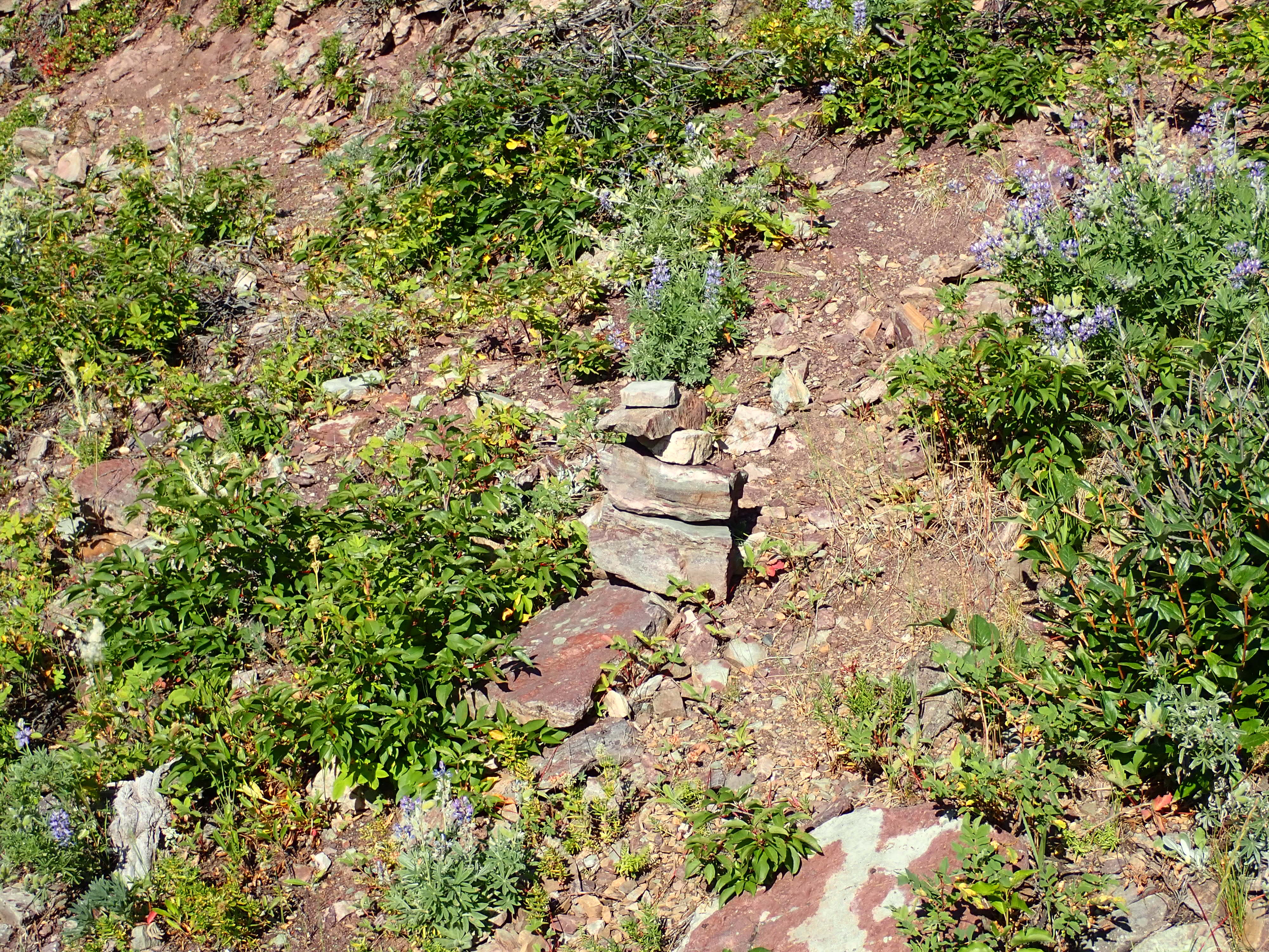
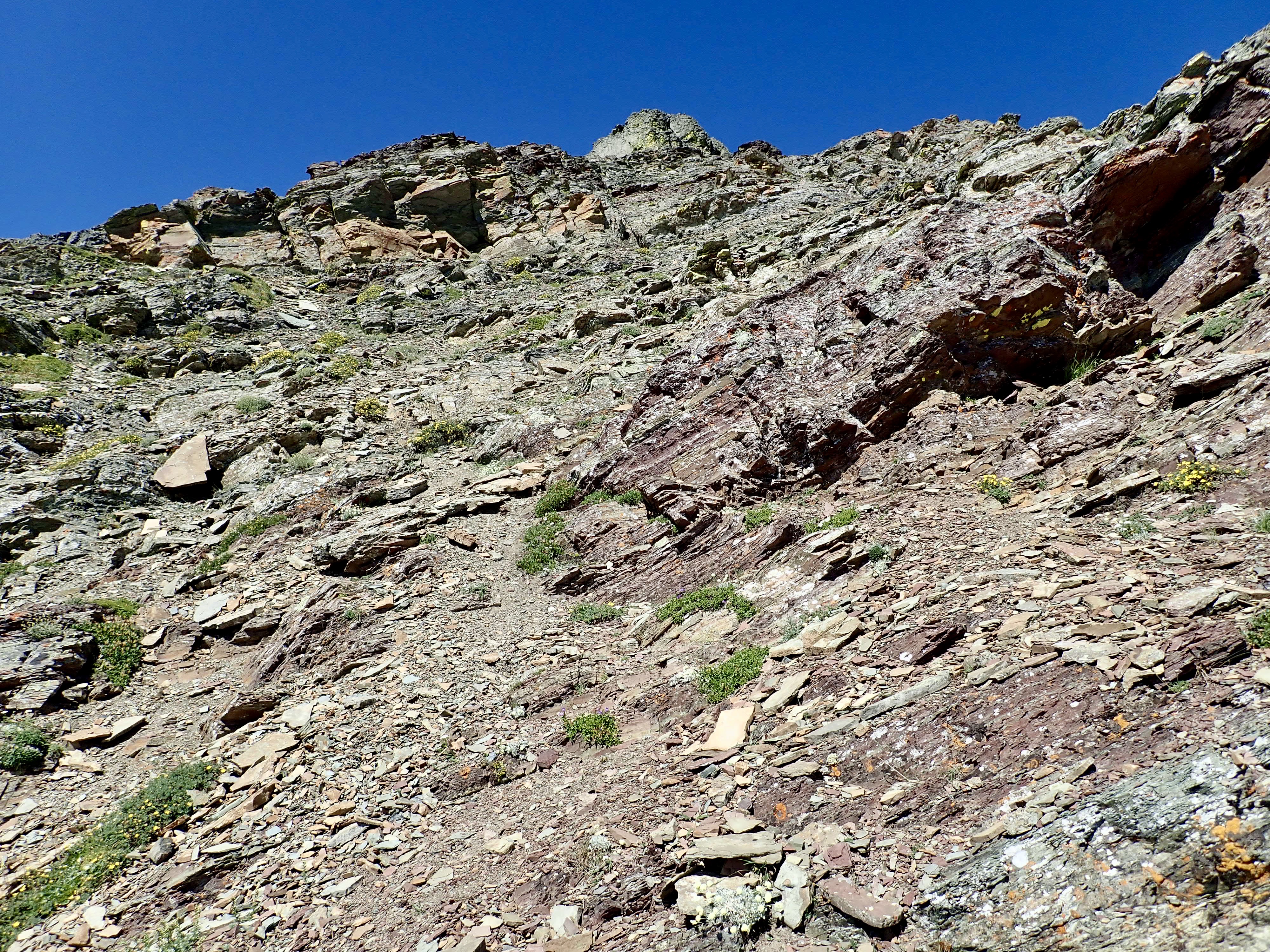
Once back on the road, follow it for a little over 2 km – almost all the way to where it ends in a big gravel area with a shed. Just before the trail descends to that area, look to the right for clear slopes heading up to a line of trees at the edge of the large gully splitting the eastern face of the mountain. There was actually a little cairn off to the side of the road marking the best place to begin ascending.
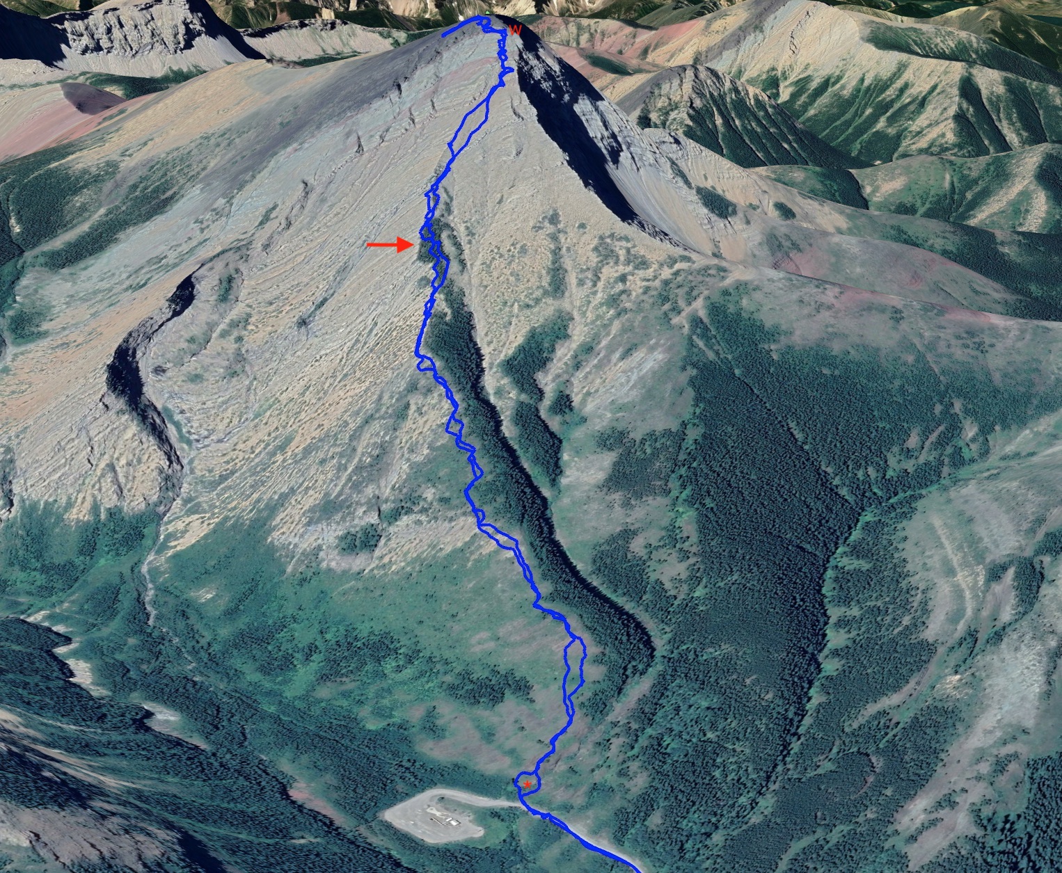
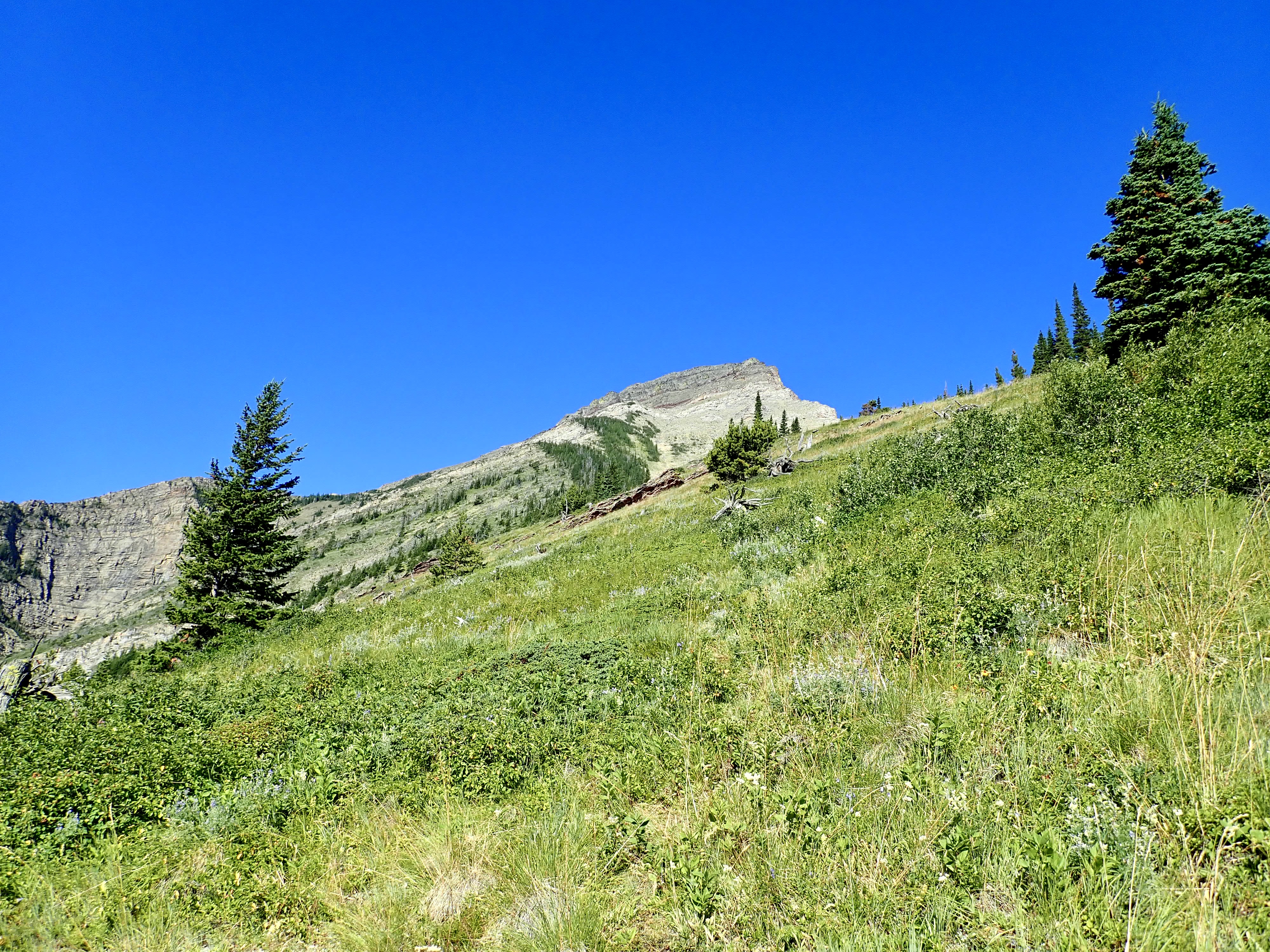
My plan was to follow the edge of the gully for the first part of my ascent, keeping the trees to my right as per Nugara’s description. Right away you need to go through a small area of bushwhacking to get across a little creek. It’s best to cross the creek and its gully immediately because the further upslope you go, the deeper and steeper the gully becomes.
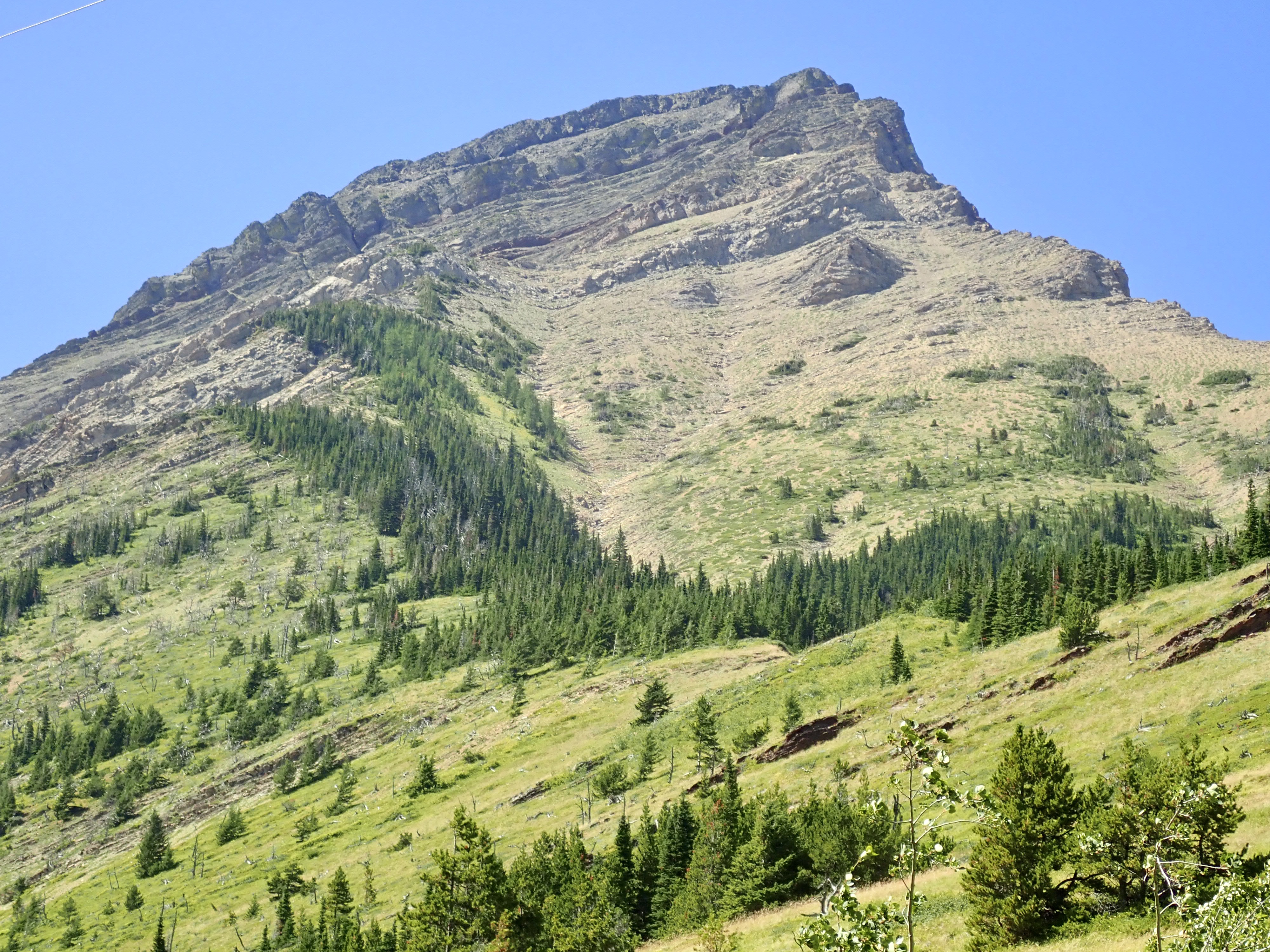
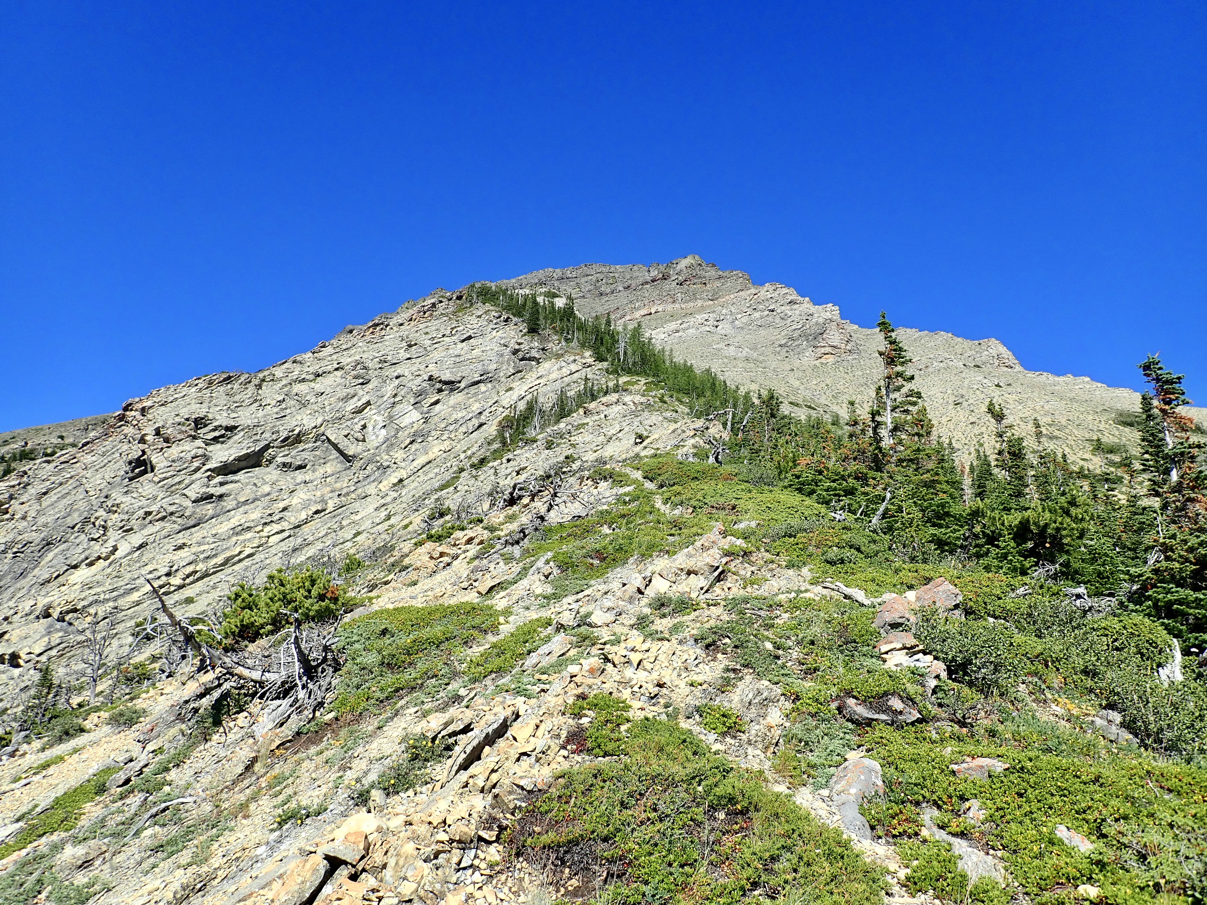
Once on the open slopes, I headed to the line of trees and followed it up. The terrain was relentlessly steep, so when I finally got to rockier ground it was a nice relief for my feet. The line of trees eventually intersected with steep rocky terrain. I carried on along the same line. Eventually my line of ascent took me steeply uphill through the trees for some distance. In retrospect it would have been easier to deviate right before reaching this point, toward the gully, to pass to the other side of the trees so it would be easier to see where I was going. On my descent I even noticed a small cairn that, in retrospect, marked a good spot to cut over.
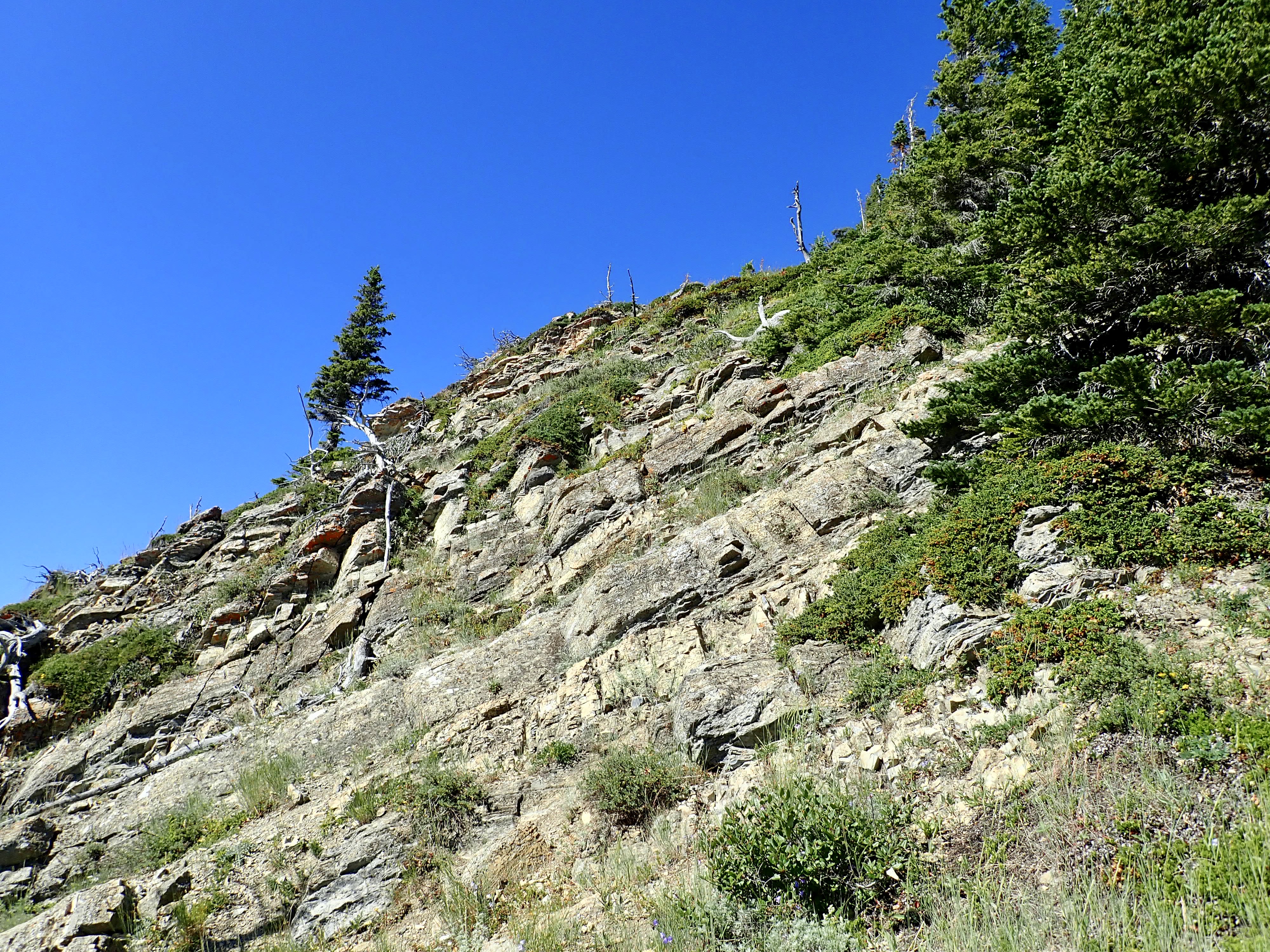
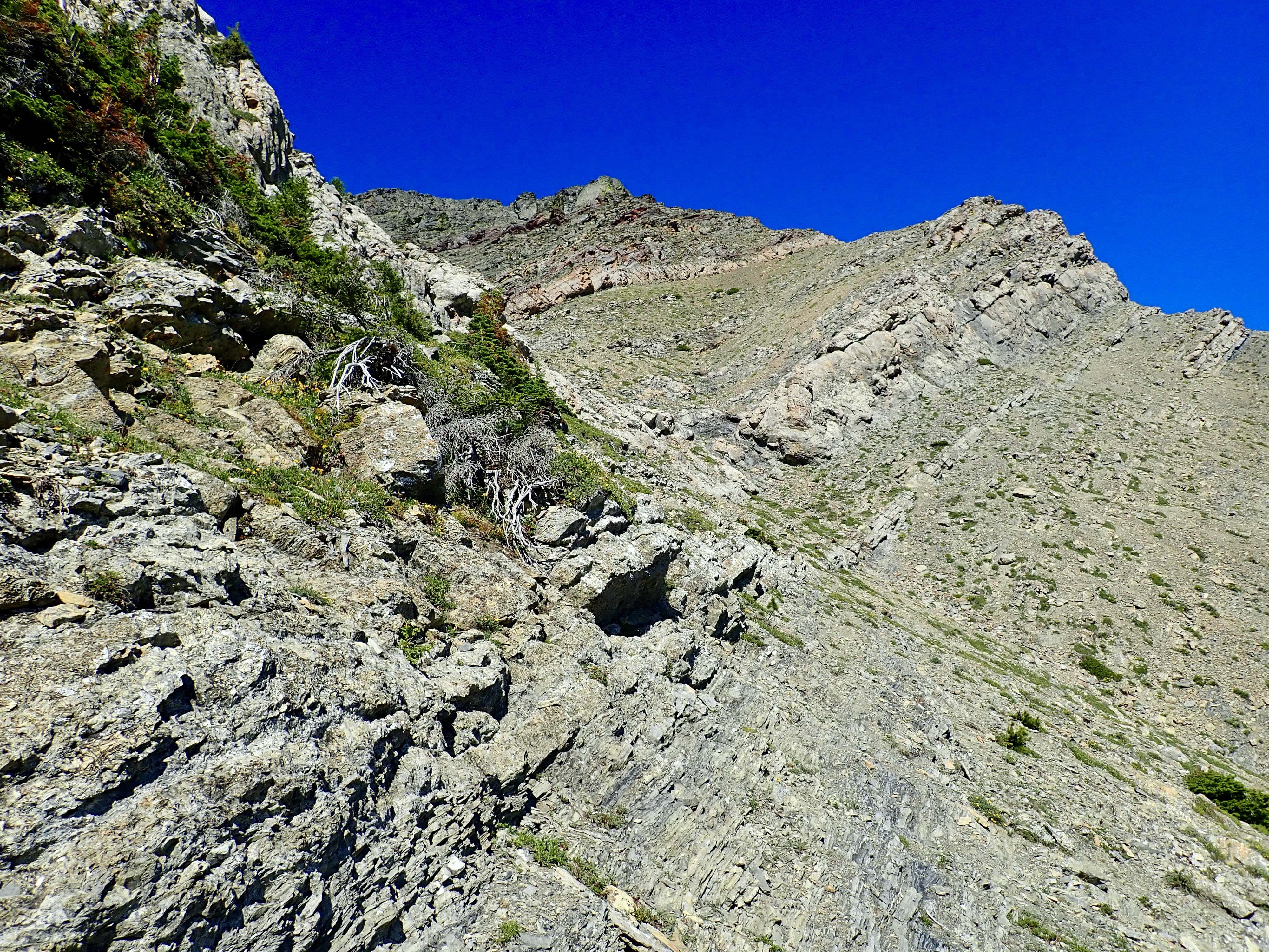
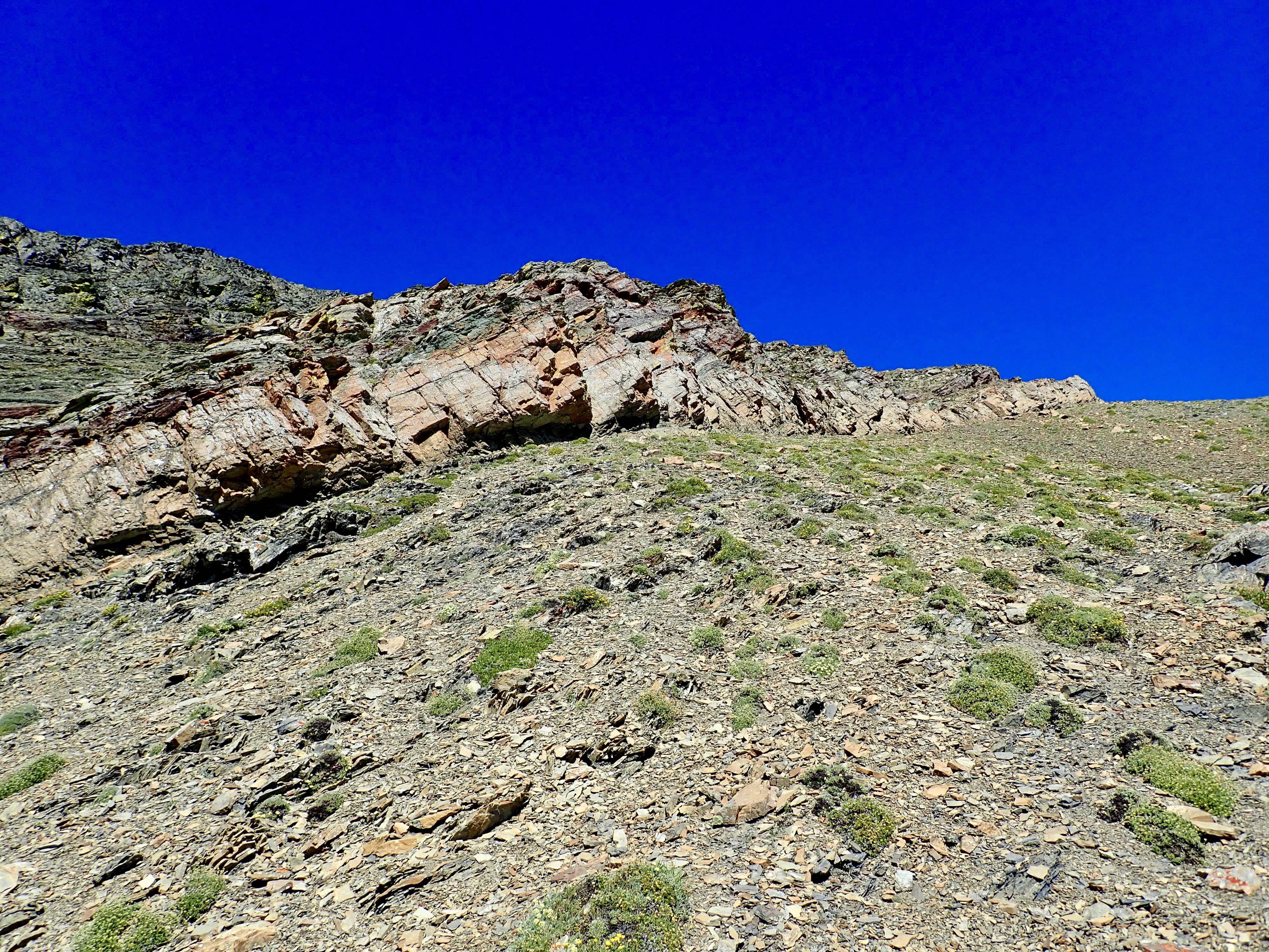
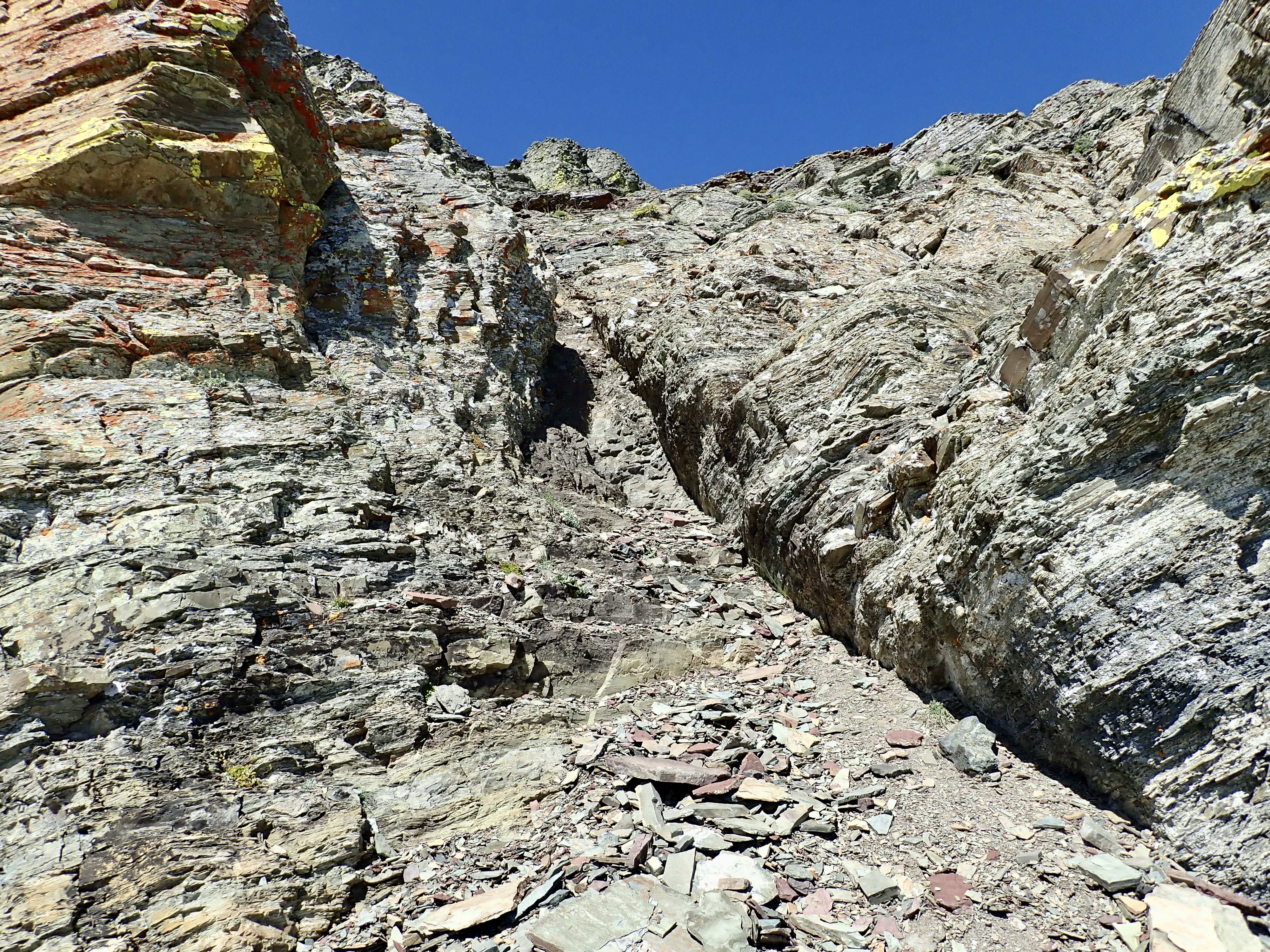
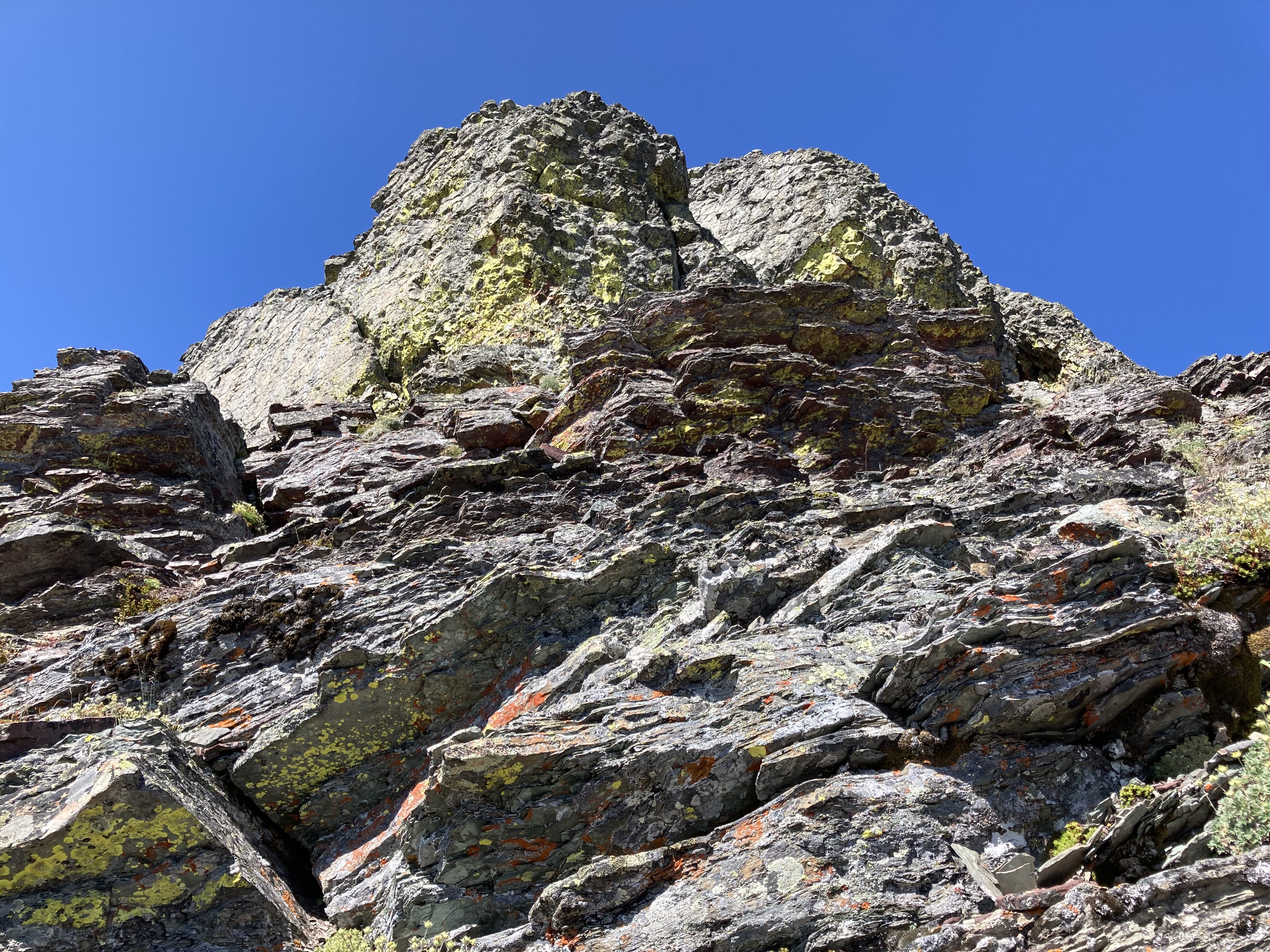
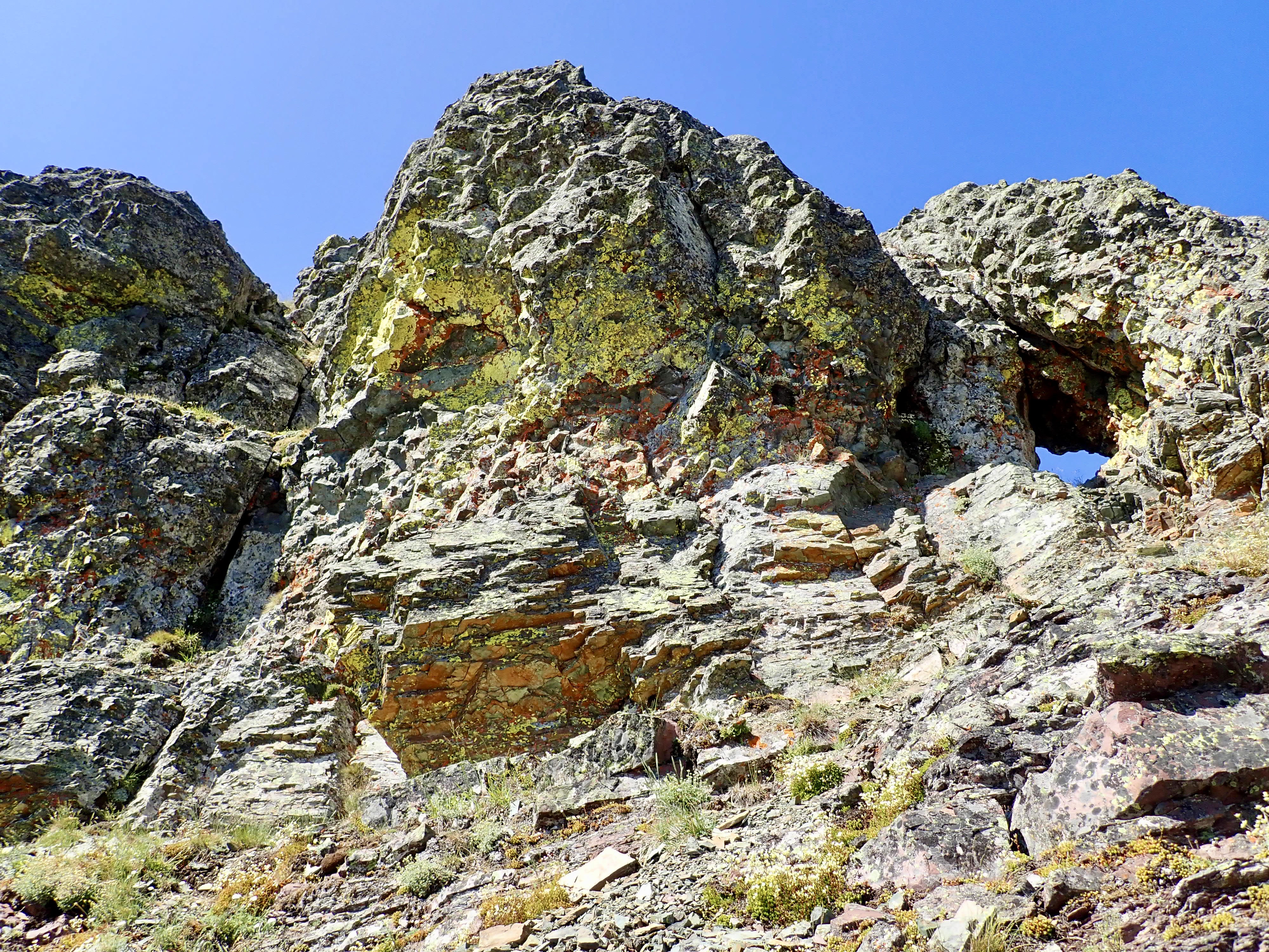
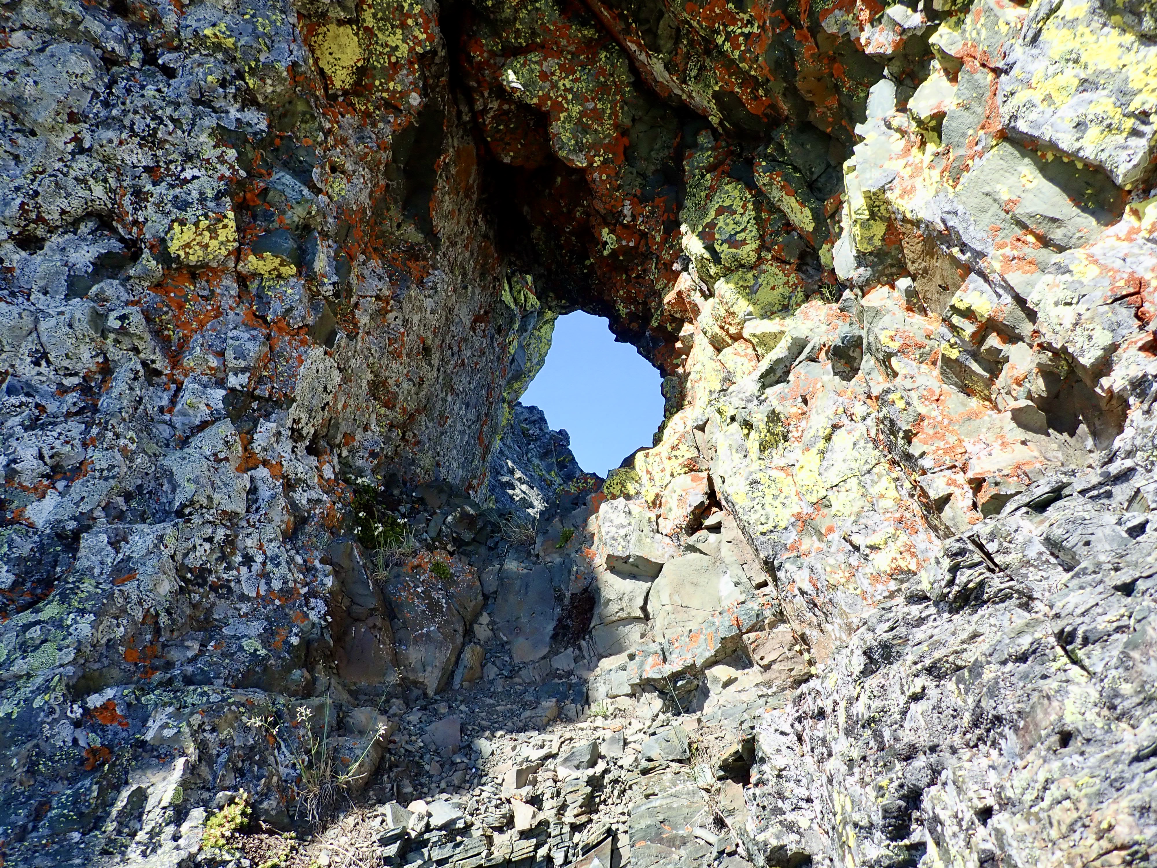
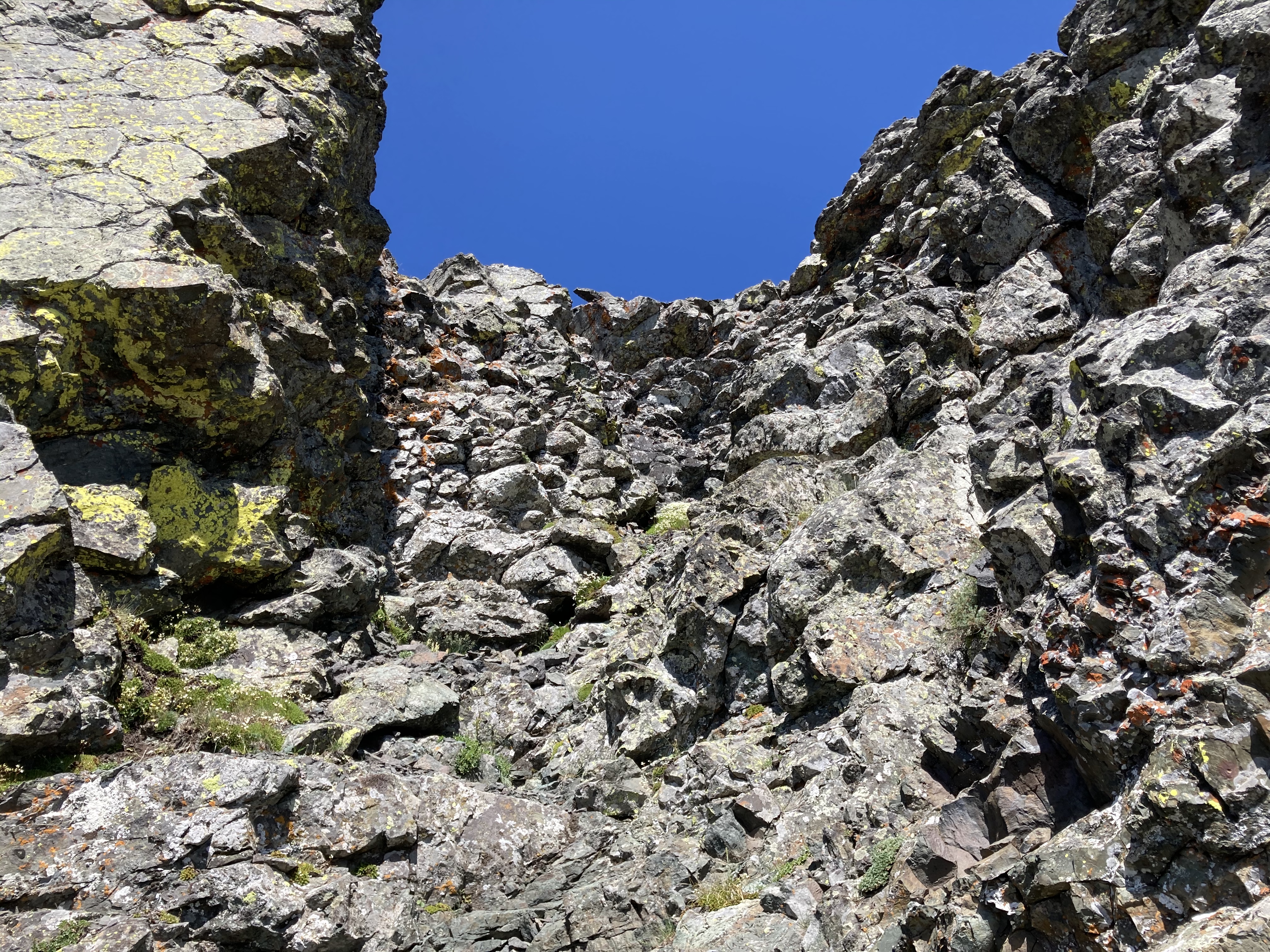
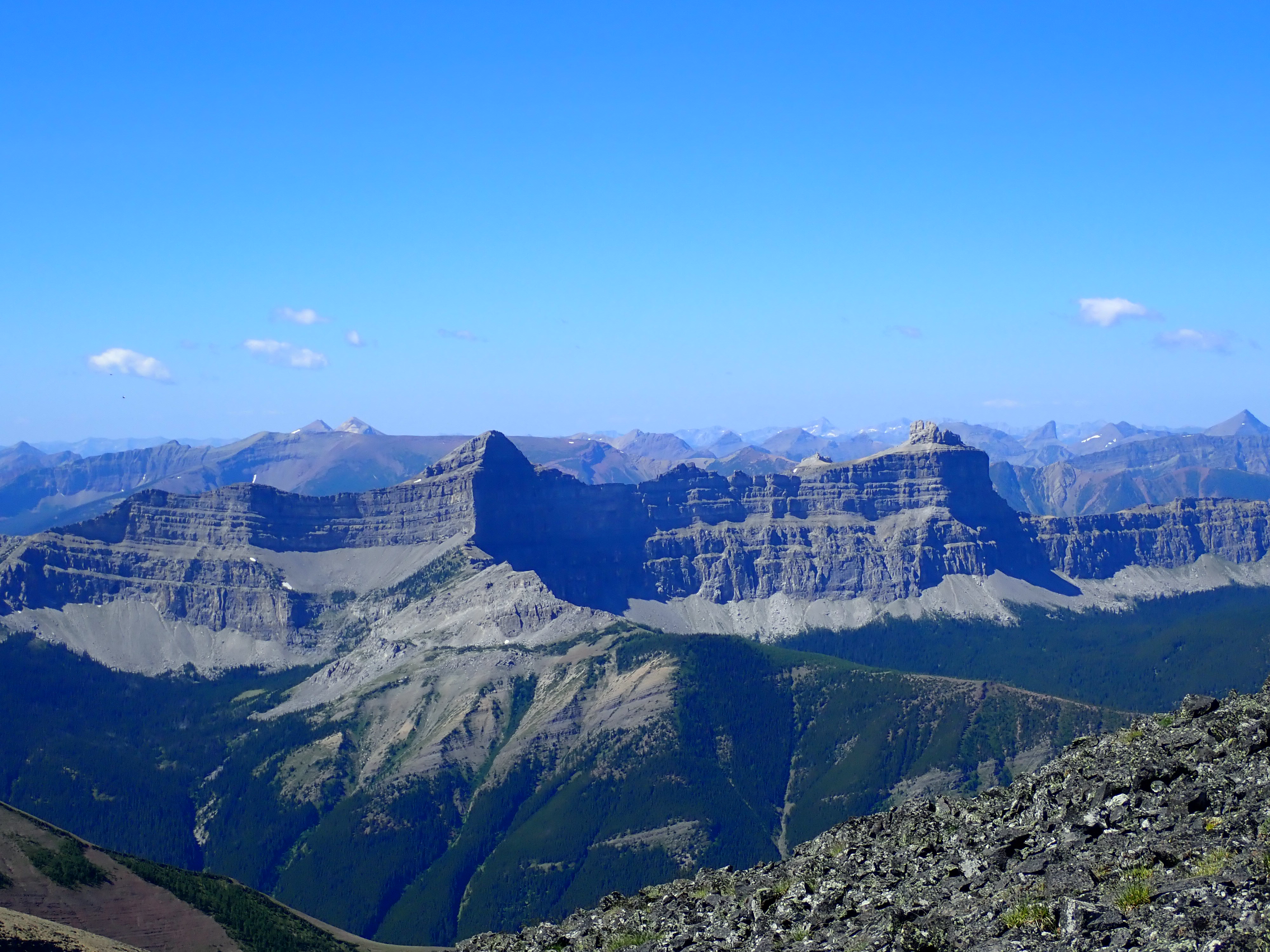
In any event, I eventually got above this last patch of trees and followed the foot of a white rock band to the right and passed through at a very obvious weakness. This spot was basically the top of the huge gully which I’d been following the edge of. Beyond the white rocks, I carried on up some scree, then through additional rock bands. Finding reasonably easy places to climb, my path seemed to go generally towards the right. Eventually a lichen-covered black rock pinnacle came into view and I headed towards it. It turns out this wasn’t the summit, but below it and to the right was the rock window described by Spirko.
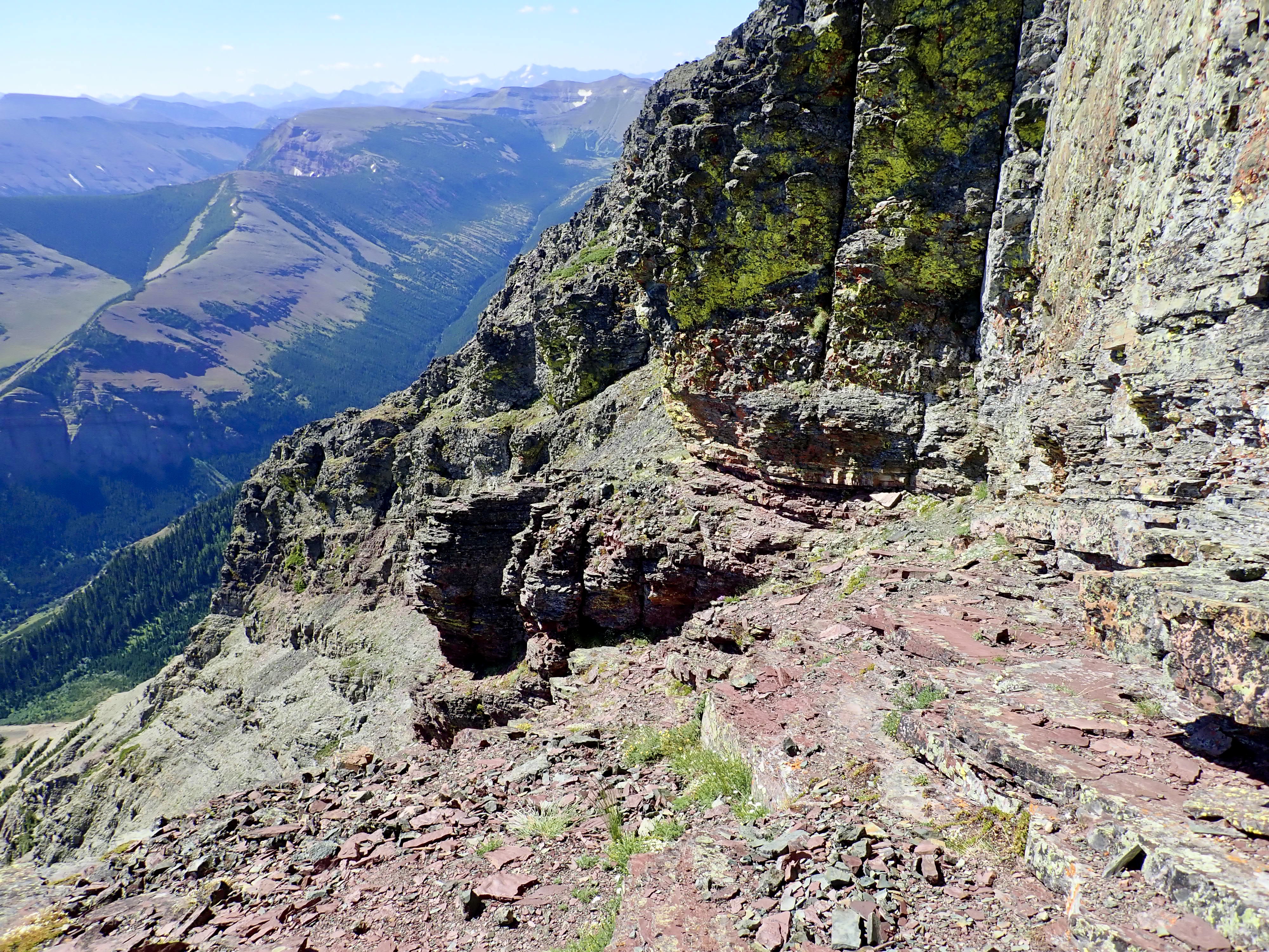
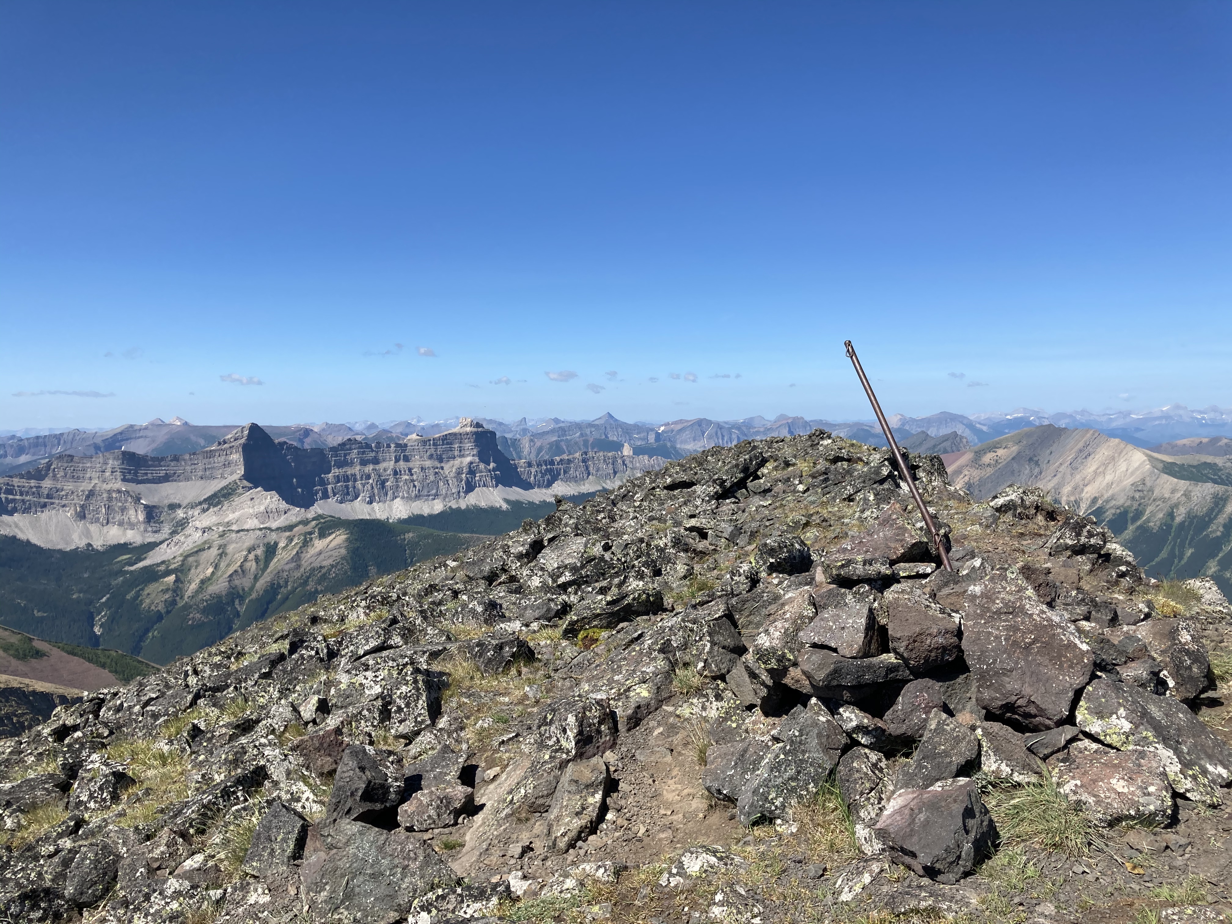
From there I traversed left and around the corner of the large block of black rock. There was one area with narrow footing with a bit of mild exposure below it, but nothing difficult. Eventually I found a weakness that looked like I could safely ascend and descend. Climbing up I was on the summit ridge and made the short walk to the summit marker.
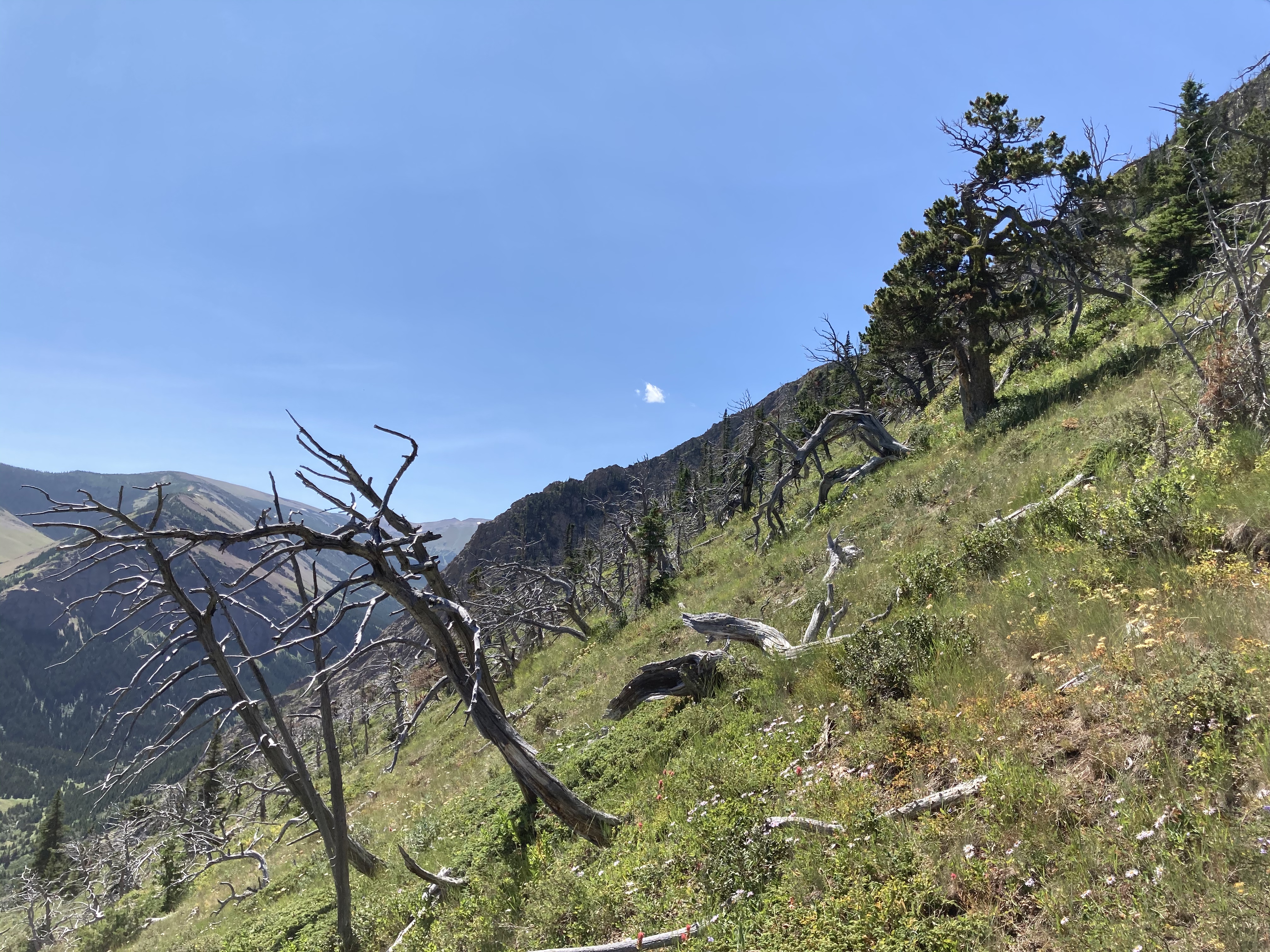
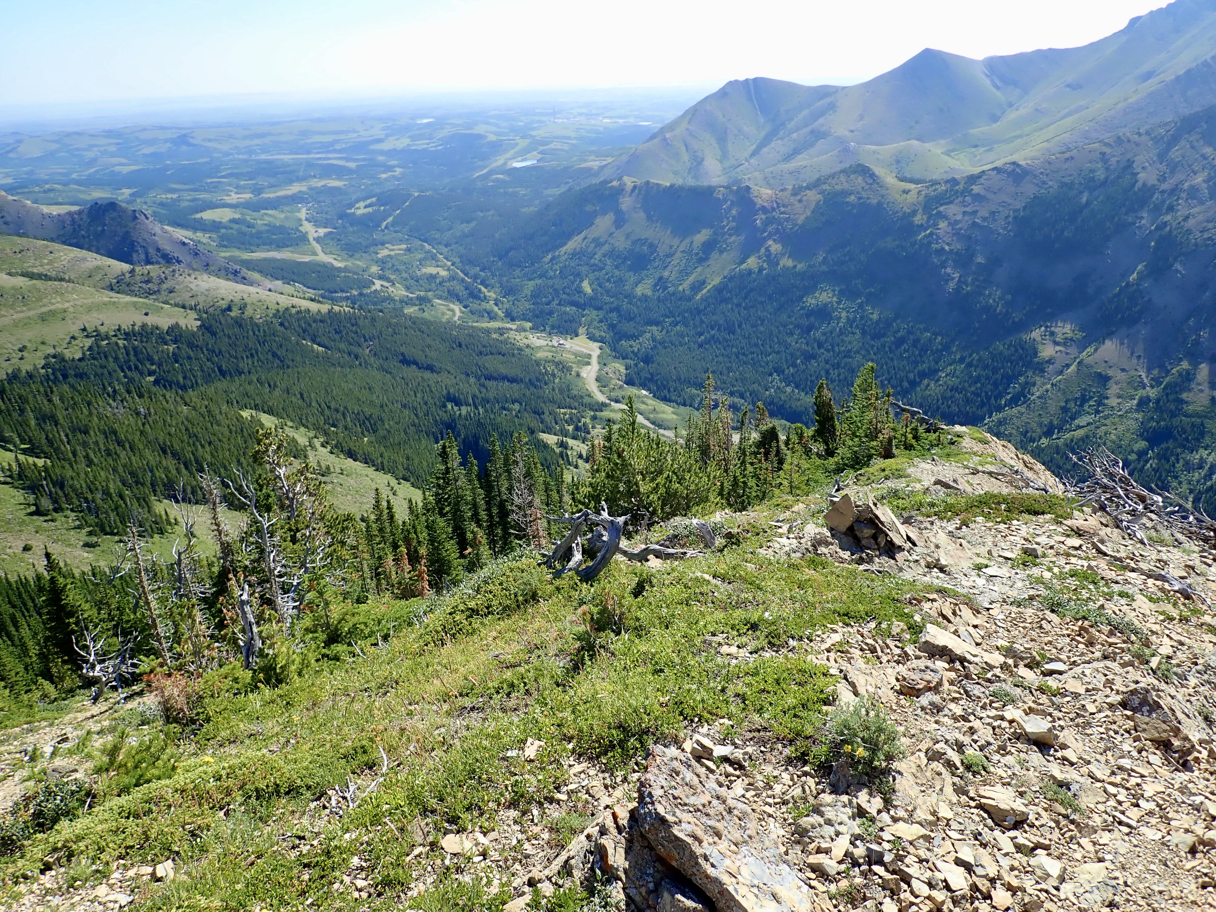
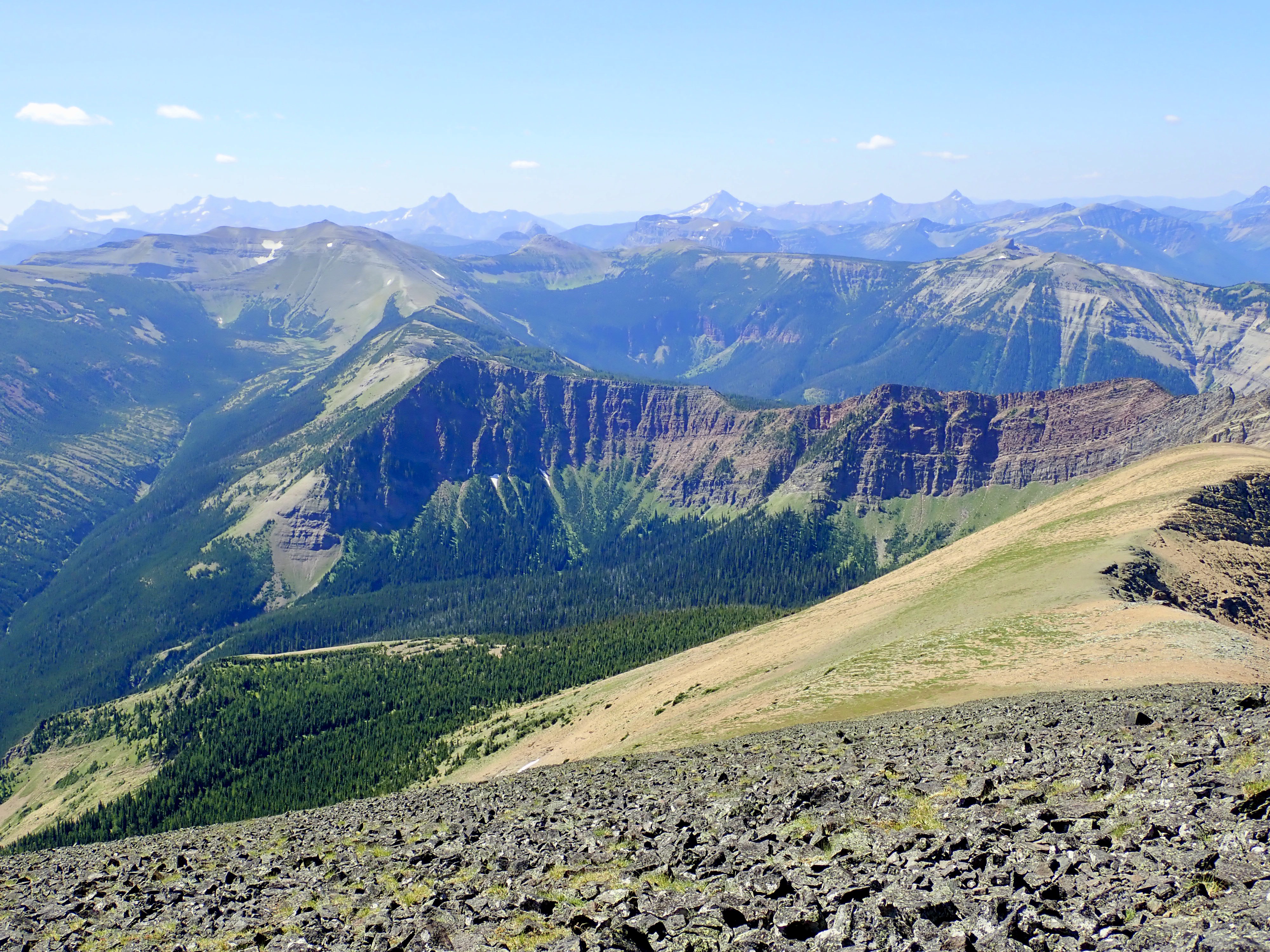
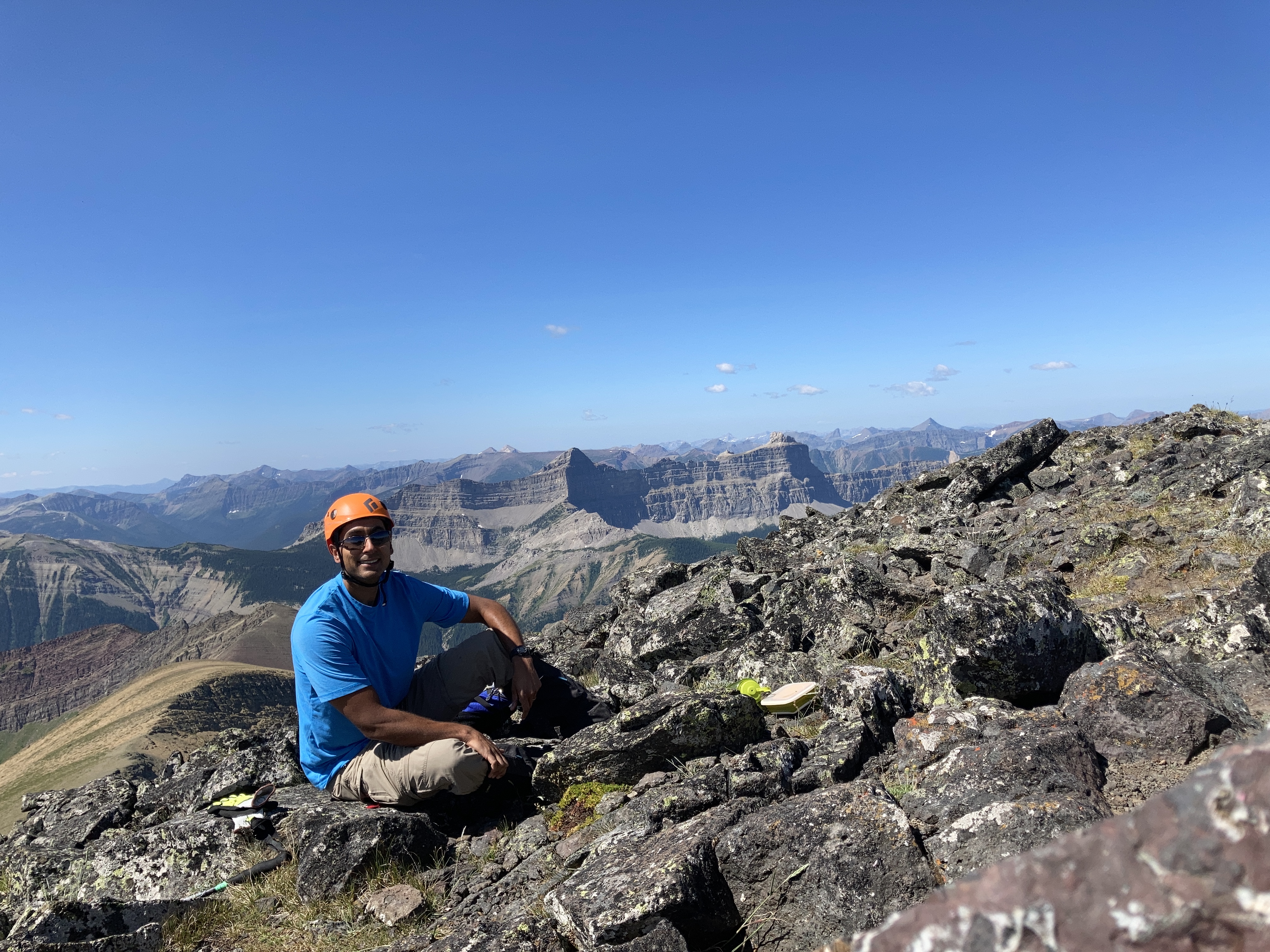
The summit was wide and almost completely free of wind – definitely an unusual situation in the Castle. There was some haze in the air, but I still had distant views in all directions. The highlight, as is frequently the case in the area, were the views of Castle Peak and Windsor Mountain just across the valley to the west. I had the mountain to myself, and spent a nice long time on the summit.
I descended along the same route, except I decided to explore a little further along the summit ridge to see if there was another spot I could have climbed up. There was another area that was mostly steep rubble and I did descend that (very slowly, and keeping to secure rocky footing I could re-climb since I wasn’t 100% sure what was at the bottom). This took me to a spot a little way beyond where I had traversed to when I found the weakness in the black rock that I ascended. All things considered, I much preferred my original ascent route.
I very thoroughly enjoyed this scramble, and could hardly have asked for a better day to ascend. I’m quite sure I’ll return.
Click on the pictures in the gallery below to access full-sized images.


Very nice commentary, Par.
LikeLike
Hi Par. Great write up and pictures. Unfortunately things have changed regarding access. We went to hike Victoria Peak on Friday June 25, 2021 and the MD of Pincher Creek and the land owner confirmed the road passed the gate is on private property. There is now also a no trespassing sign on the other side of the gate. They suggested a different route to access the trail head. Park at Butcher’s Lake and follow the cut line under the power lines that head west towards Victoria Peak. These power lines end up crossing the road close to where the hike starts and following this would allow access to this area without going on the private property.
LikeLike
That’s good to know. Thank you for the update. I wonder how broad an area there is private property and why they started enforcing it. There was a kiosk there for ages with trail information about Victoria Ridge.
LikeLike
The owner said there is a quarter section that is private, after the gate. The kiosk is still there with Victoria Ridge information. I’m wondering if that will be removed at some point. Because it makes it appear hiking or riding through would be ok. But not the case.
LikeLike
Par, thanks for finding the new route to avoid the private land. And for sharing!
LikeLiked by 1 person
You’re welcome!
LikeLike
Great report as always. Even with the updated route you should still ask (required) for permission to access/ cross the lease land.
LikeLiked by 1 person
Thanks for the post and update Par. Always very helpful.
LikeLike