June 9, 2018. A bike-and-hike leading to an easy scramble to the summit of a scenic ridge in the Castle Wilderness.
(Post updated September 3, 2021 to reflect changes to access. Old access instructions have been deleted but time and distance information below still reflects the old route. The new route can’t be biked easily.)
- Region: Castle Wilderness. Traditional territory of the Tsuu T’ina, Ktnuxa, and Blackfoot First Nations
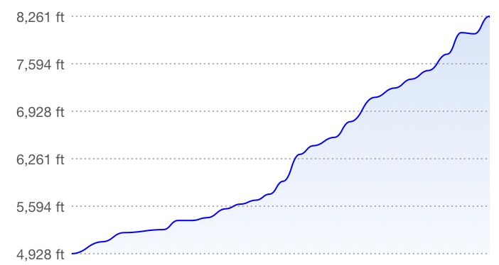
- Distance: 27.2 km round-trip
- Total Ascent: 1075 m
- Elevation of Objective: 2530 m
- Total Time: 6h 30m
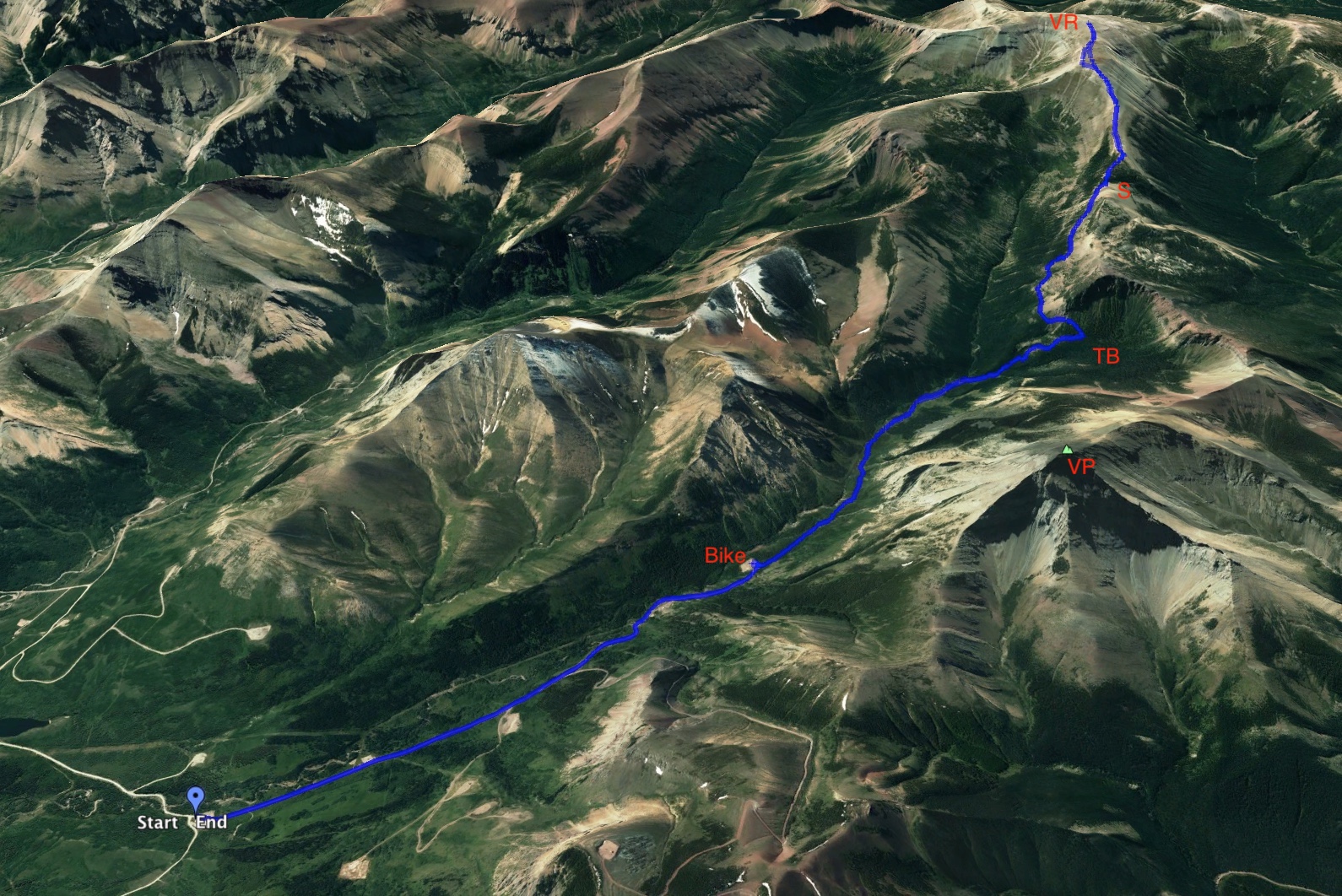
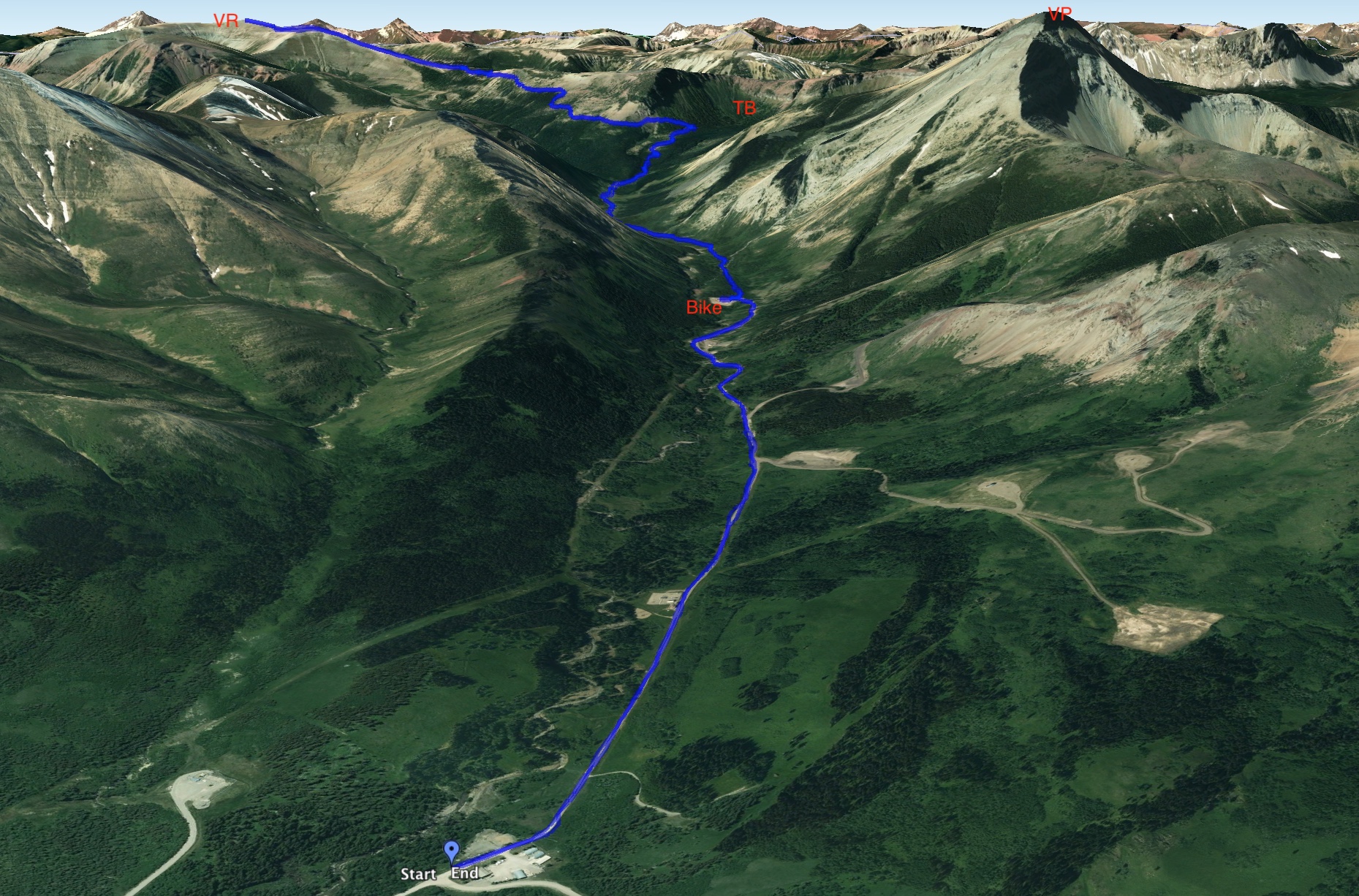
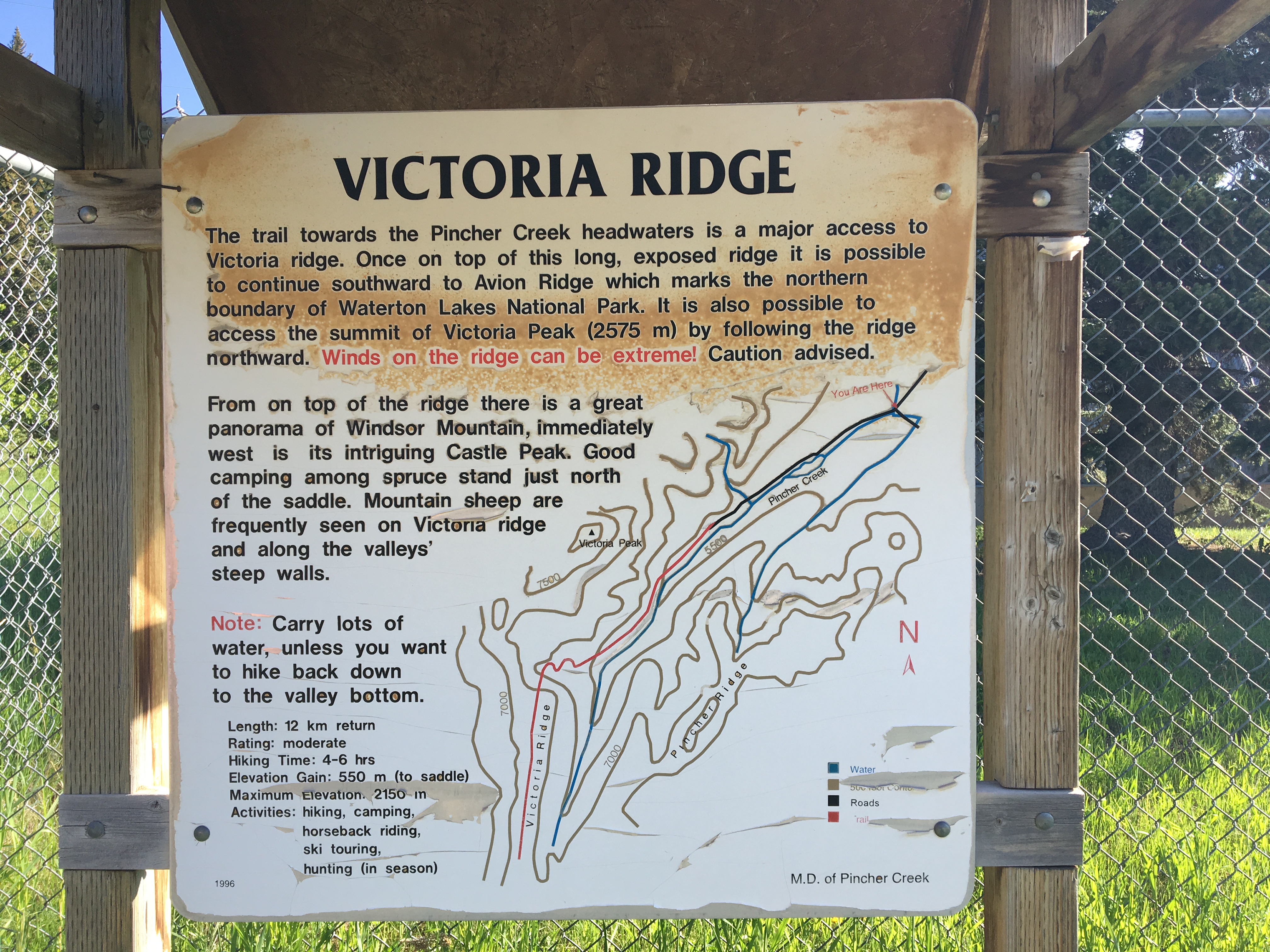
I’ve been eyeing up some scrambles that are rated ‘moderate’ by Nugara and Kane. Foremost on my mind lately has been Victoria Peak, in the Castle Wilderness. The thing is, I don’t want to go solo on a trip like that – it just doesn’t seem sensible. So, while I look into getting together with one or more people to scramble with, I’ve been reviewing the easier, but still interesting, targets in the scrambling books. Victoria Ridge fits the bill perfectly. The summit of the ridge is at 2530m, compared with 2587m at the summit of Victoria Peak. Unlike the scramble up Victoria Peak, the route to the ridge summit isn’t a direct uphill assault. It involves a much longer approach and follows a clear trail up a valley paralleling Pincher Creek (the actual creek, not the town). It then starts up the valley wall, through an area Joey Ambrosi’s Southern Rockies Trail Guide refers to as Thunder Basin, then continues along a long traverse and finally to a saddle on Victoria Ridge. The hiking trail ends at that point, but the summit lies a further 3.6 km southwest along the ridge, requiring roughly 400 m additional vertical gain. The initial 3.7 km of the approach along the valley is a well-maintained gravel road, making this an ideal bike-and-hike trip.
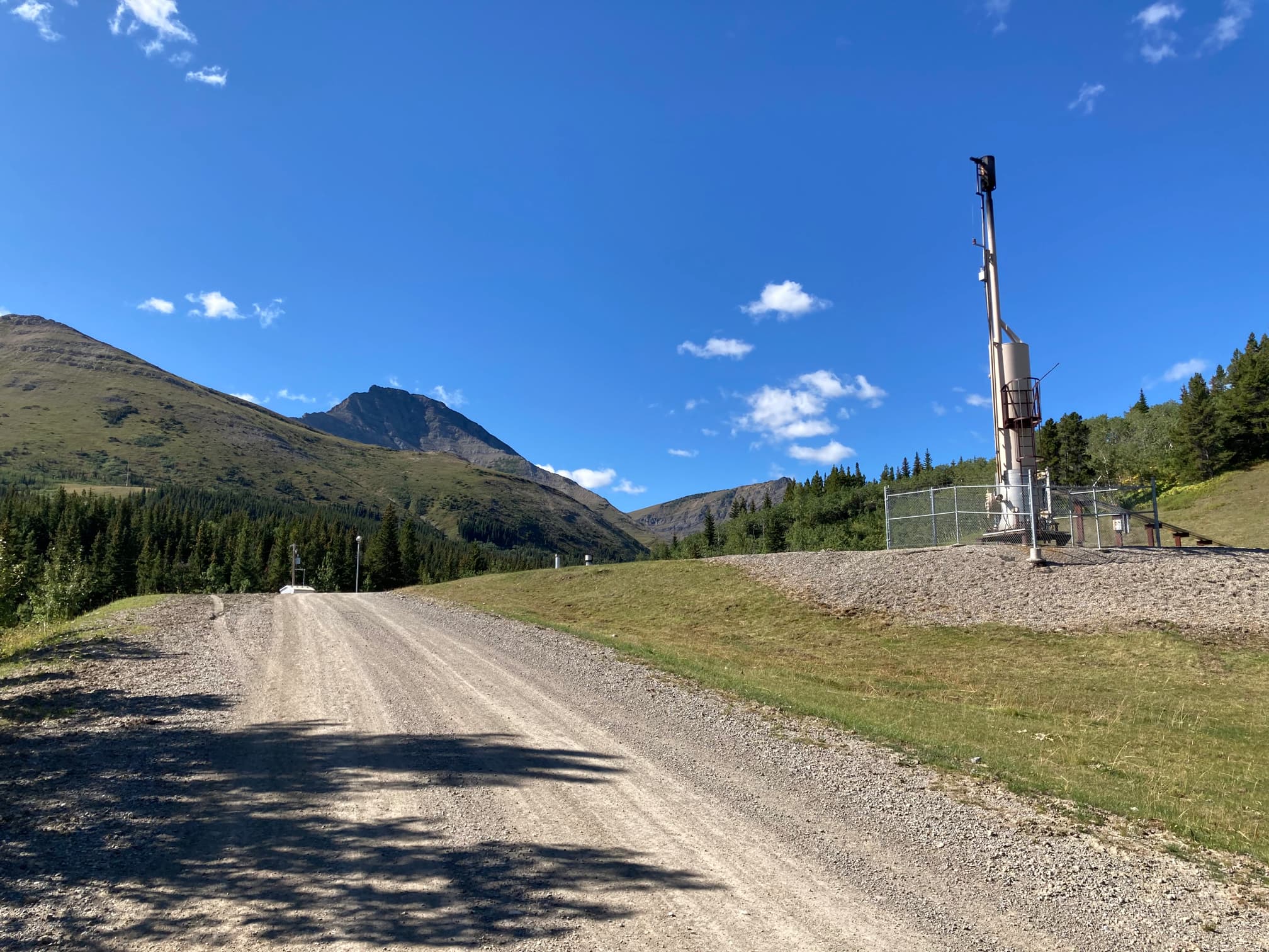
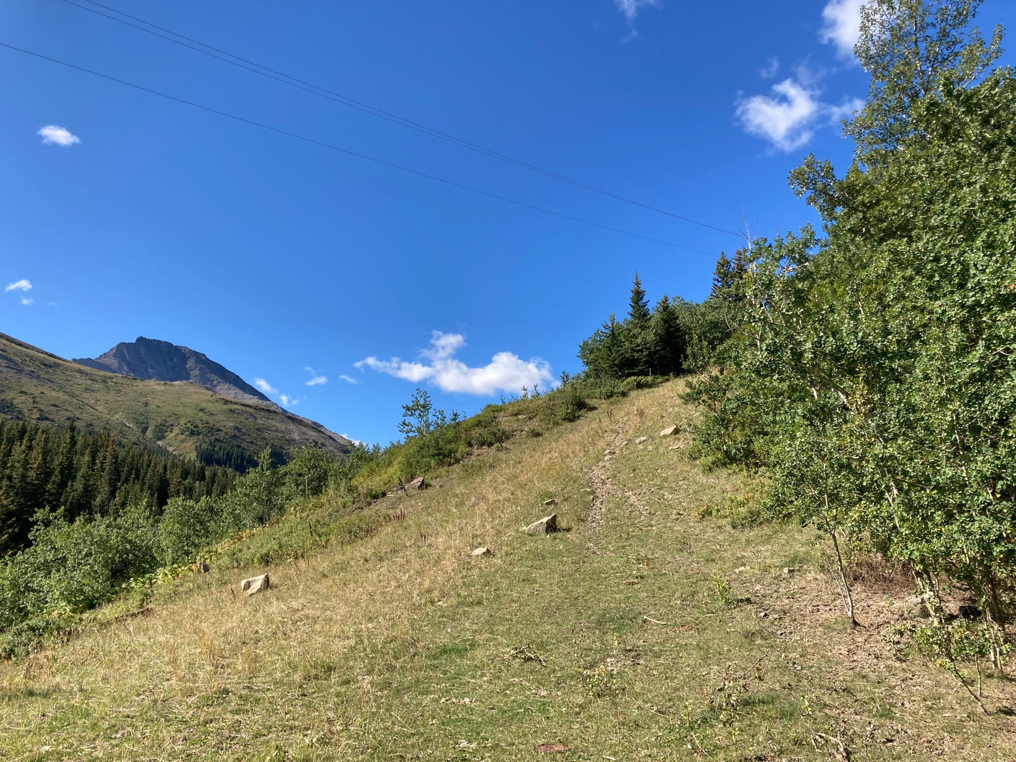
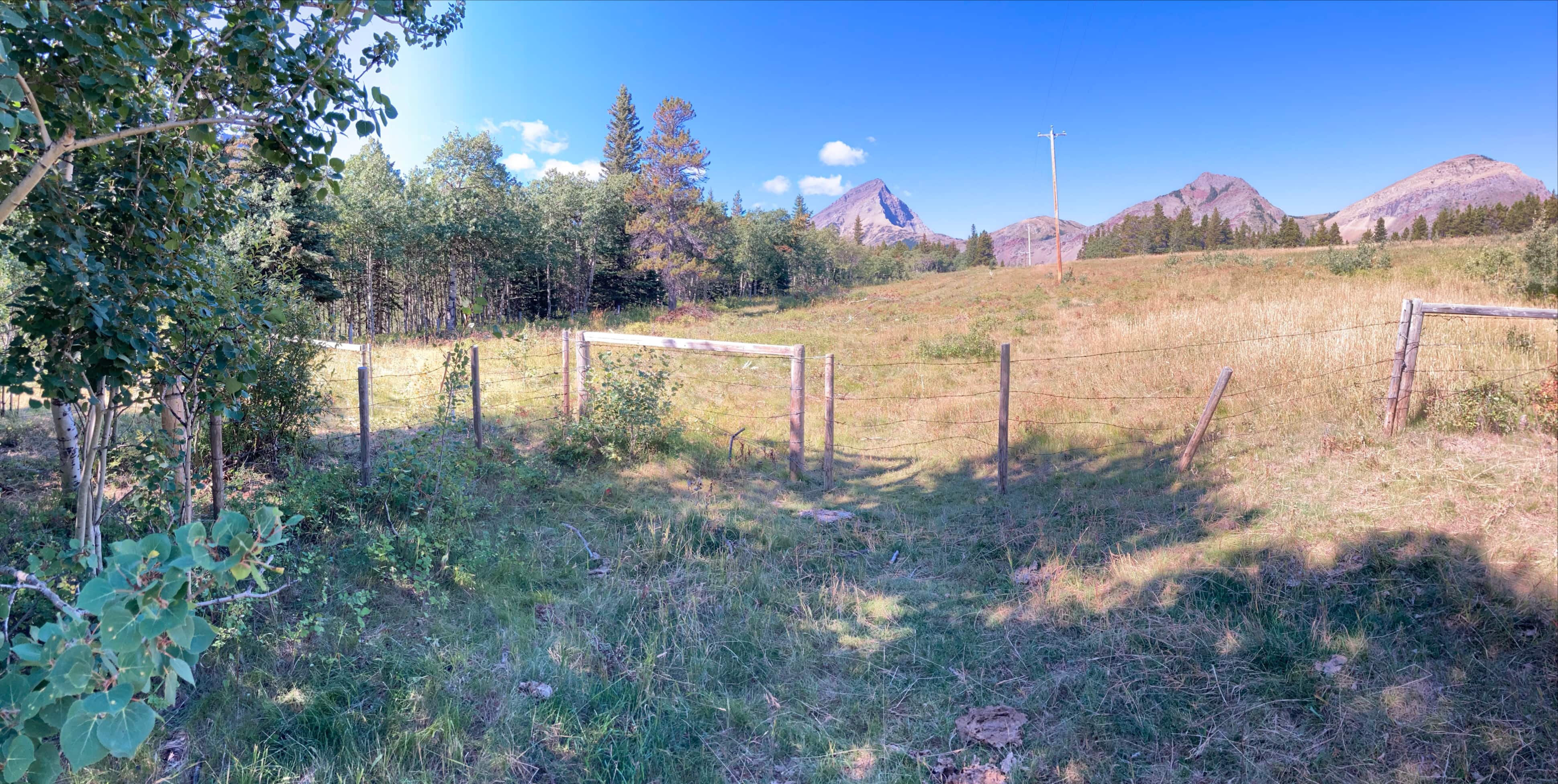
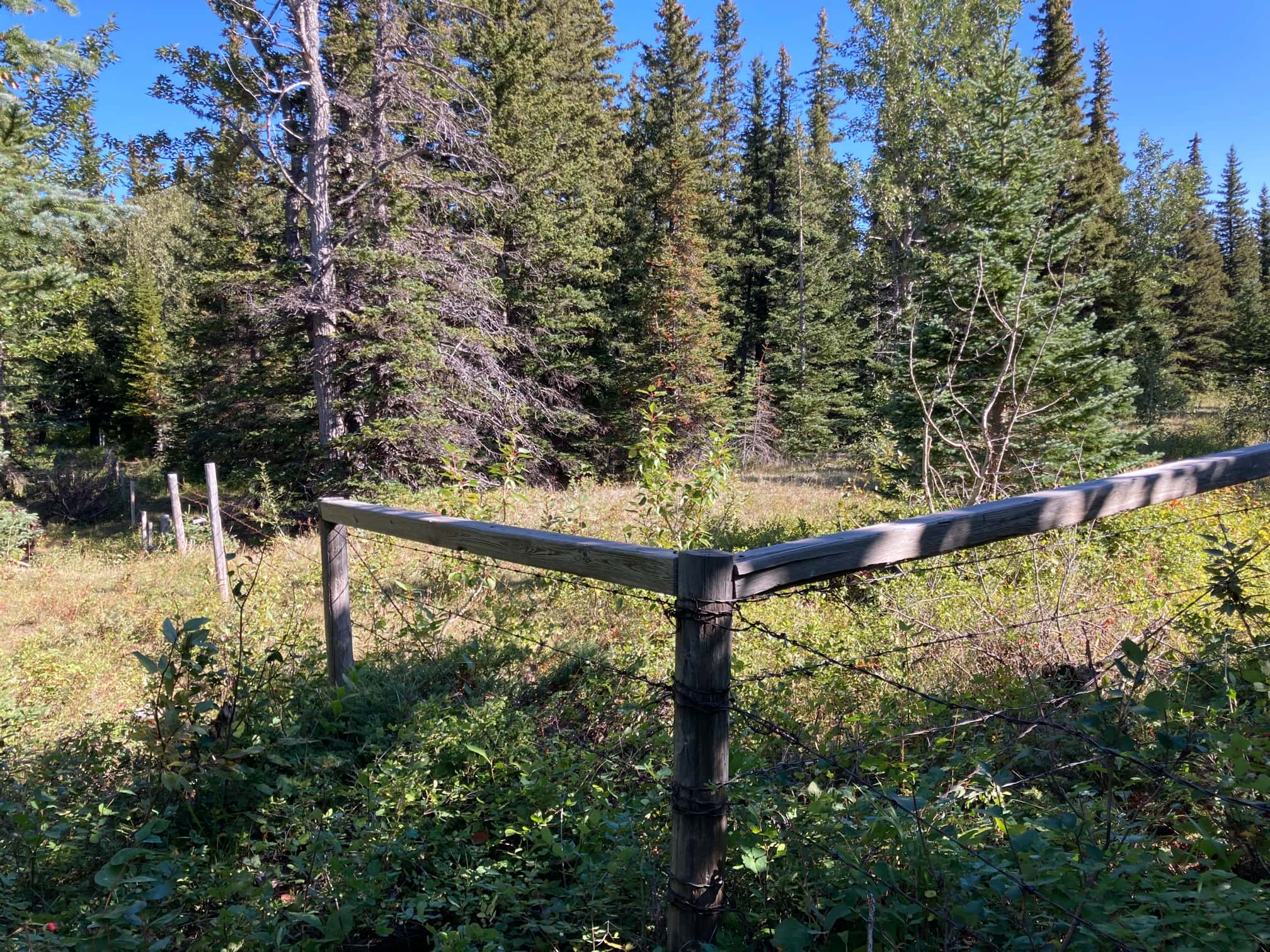
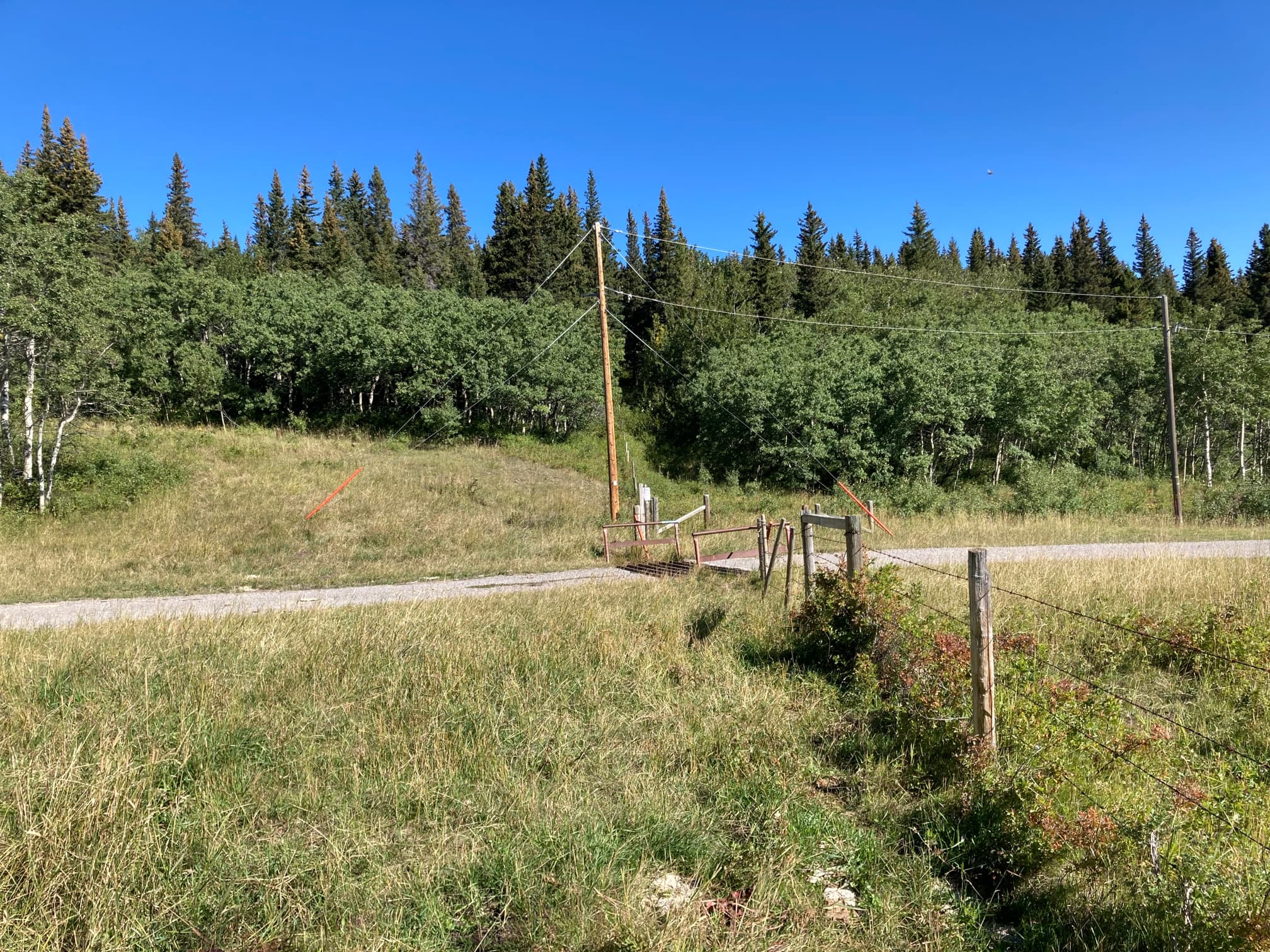
UPDATED ACCESS INFORMATION: Access for this hike has changed significantly. The initial part of the route is no longer usable as it enters private property. This is a recent change and guide books published right up to 2021 still describe the old approach, unfortunately. Access still involves using a gravel road that heads to the base of Victoria Peak, but the initial part has to be bypassed on public land. Drive south from Pincher Creek on Hwy 6 and turn at the signs for Butcher Lake and the Gas Plant. Proceed to Butcher Lake and go past. There’s a left turn onto Rge Rd 1-3A. Park near here and head up the road to the left to a well site. I’m not sure if parking is allowed at the well site or not. Click here for a Google Map with a pin on the well site. Follow a trail southwest from the well site and you’ll climb a hill under some power lines. Follow them until you reach a barbed wire fence – this is the property line. The power lines carry on over the private property, but you can go through a gate to the south (close it again after) and then follow the outside of the barbed wire fence. Then proceed as per the picture below:
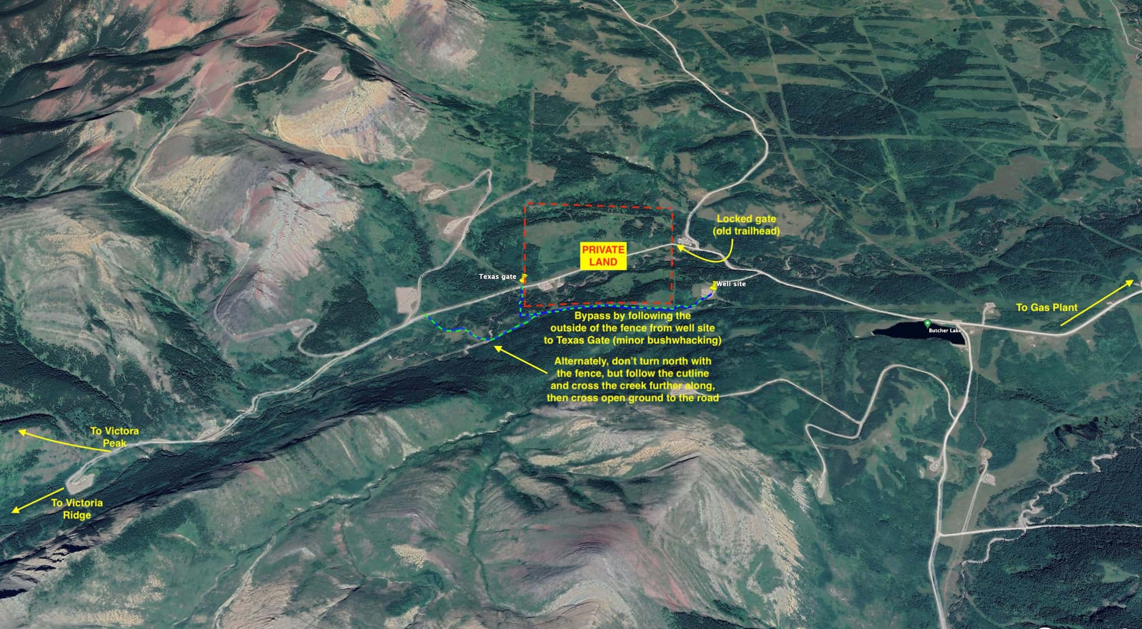
For another perspective, check out this Facebook post from Adam Ess. He had a direct conversation with the landowner, and it seems they may be okay with people rejoining the road sooner than what I have mapped out above.
Once you’re back on the road, follow it to a a big open gravel area with a shed and a flare stack. I found the hiking trail continuing beyond the road at the northwest corner of the gravel clearing and started walking.
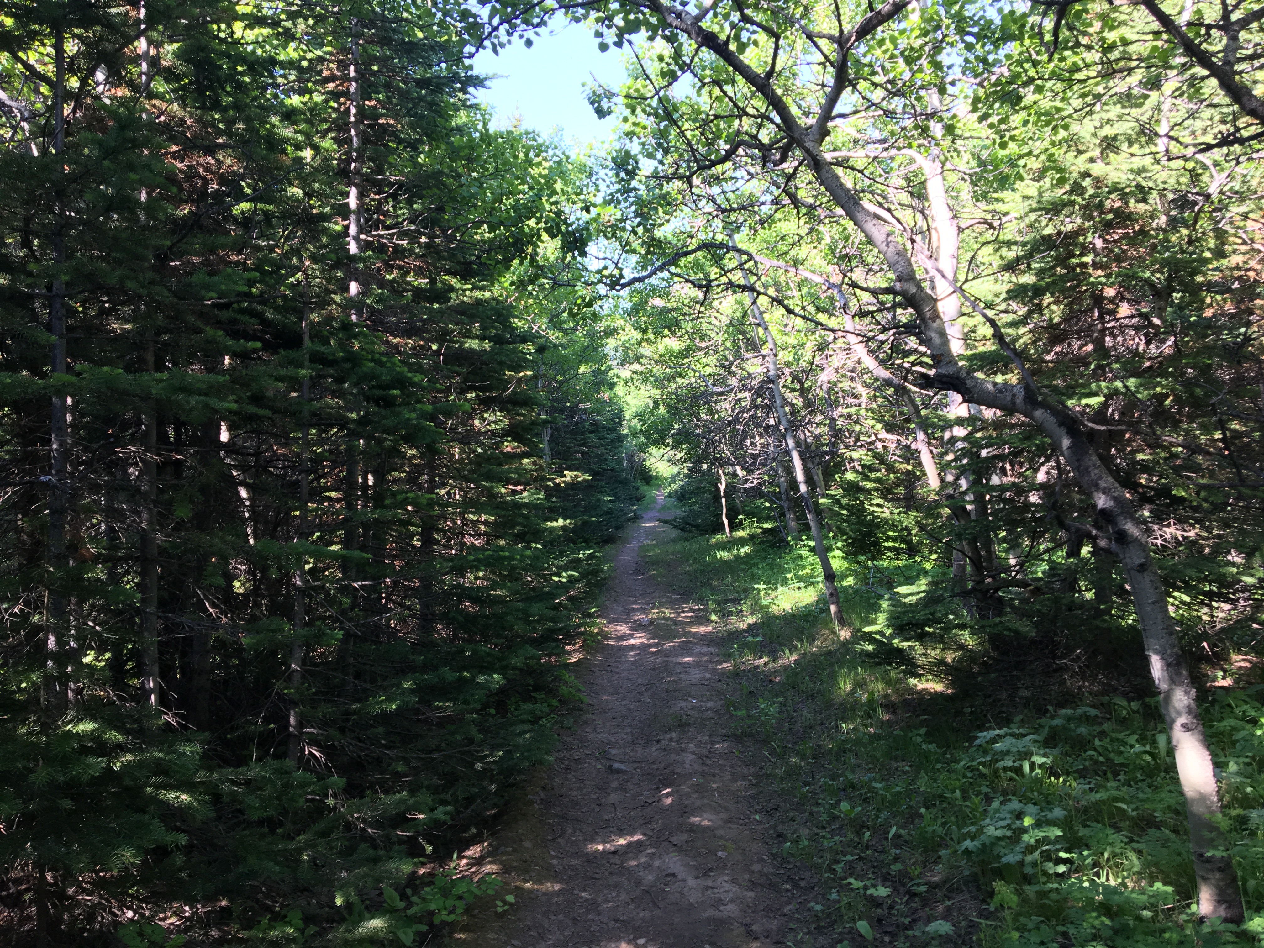
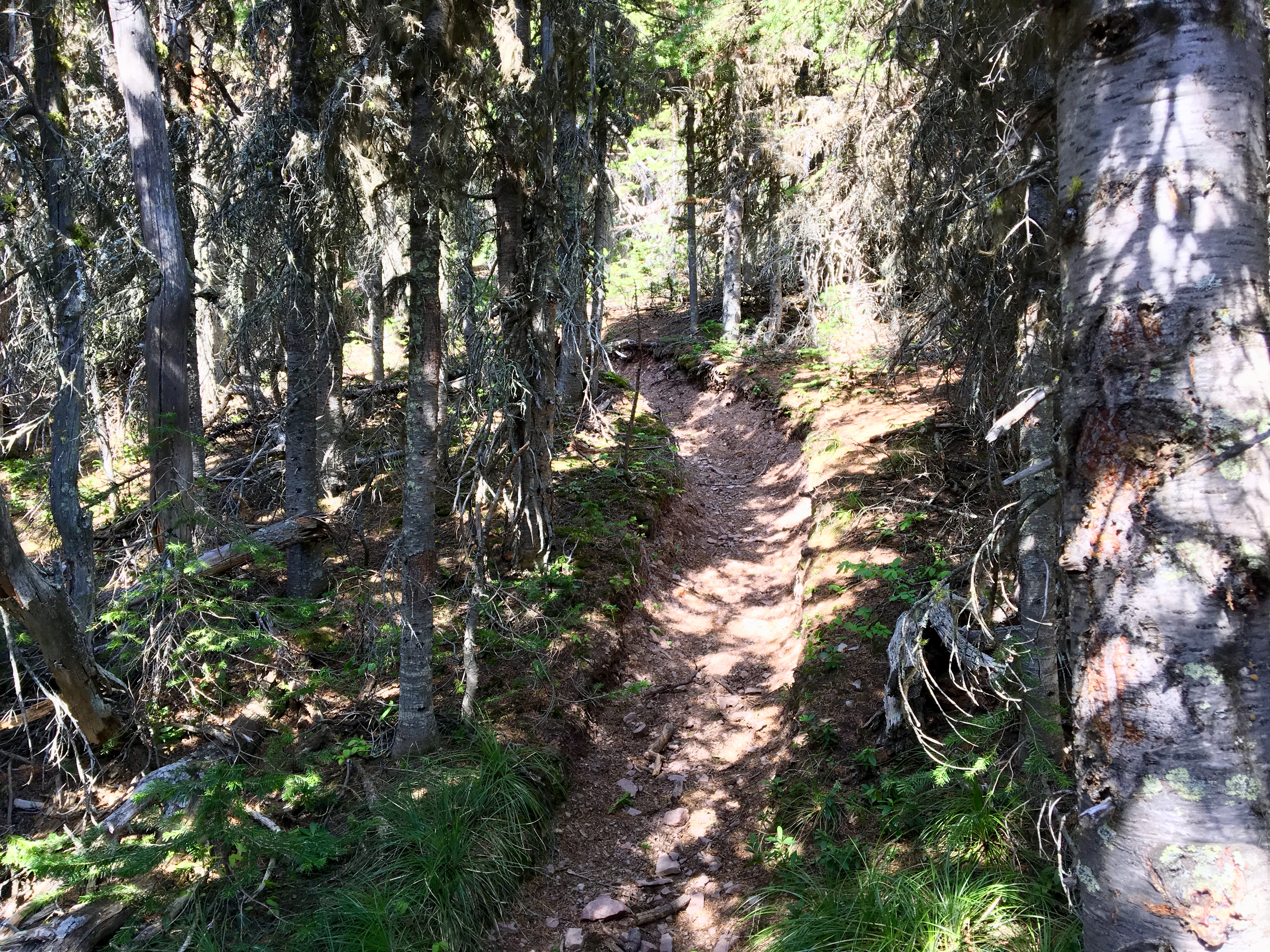
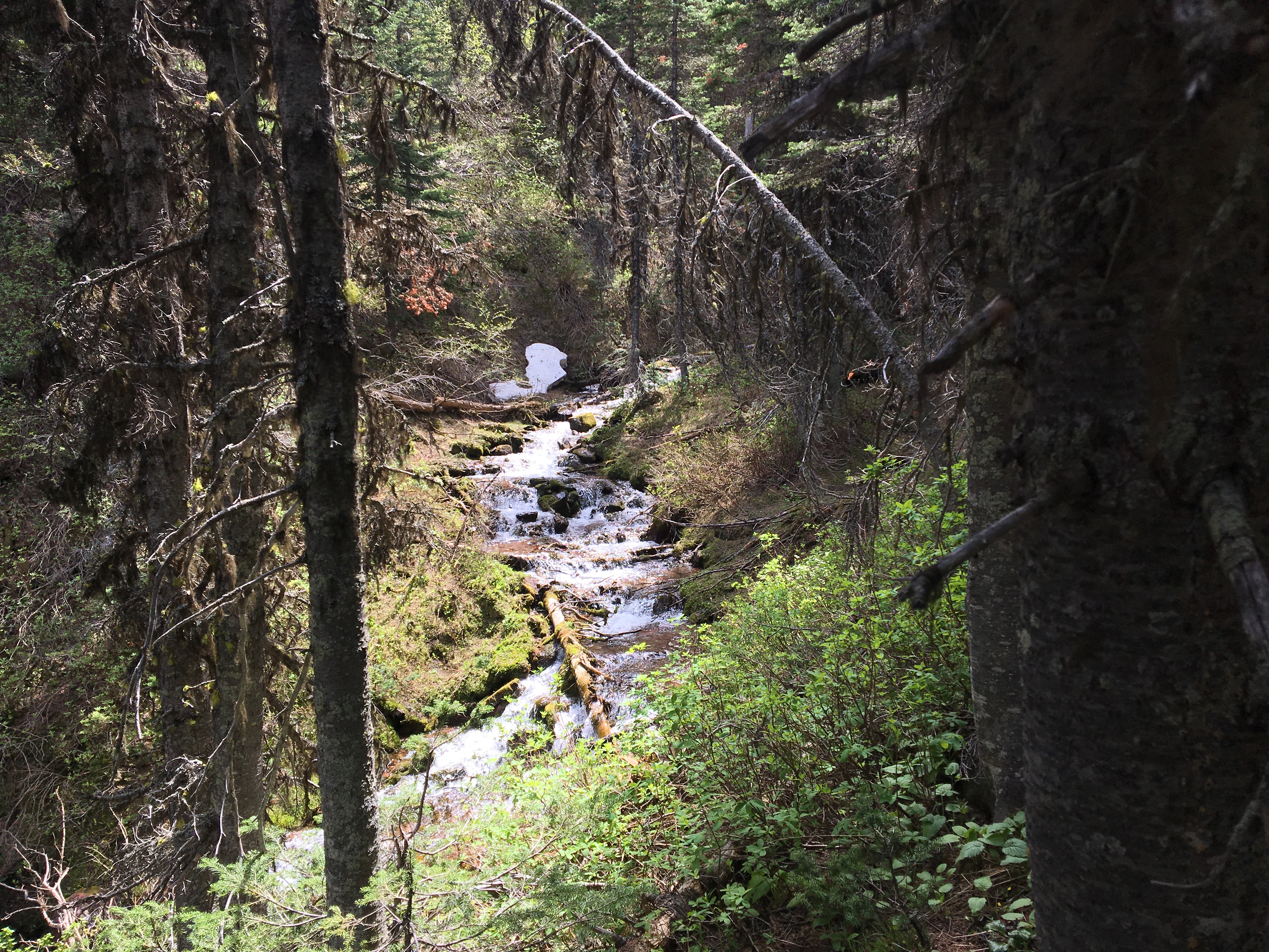
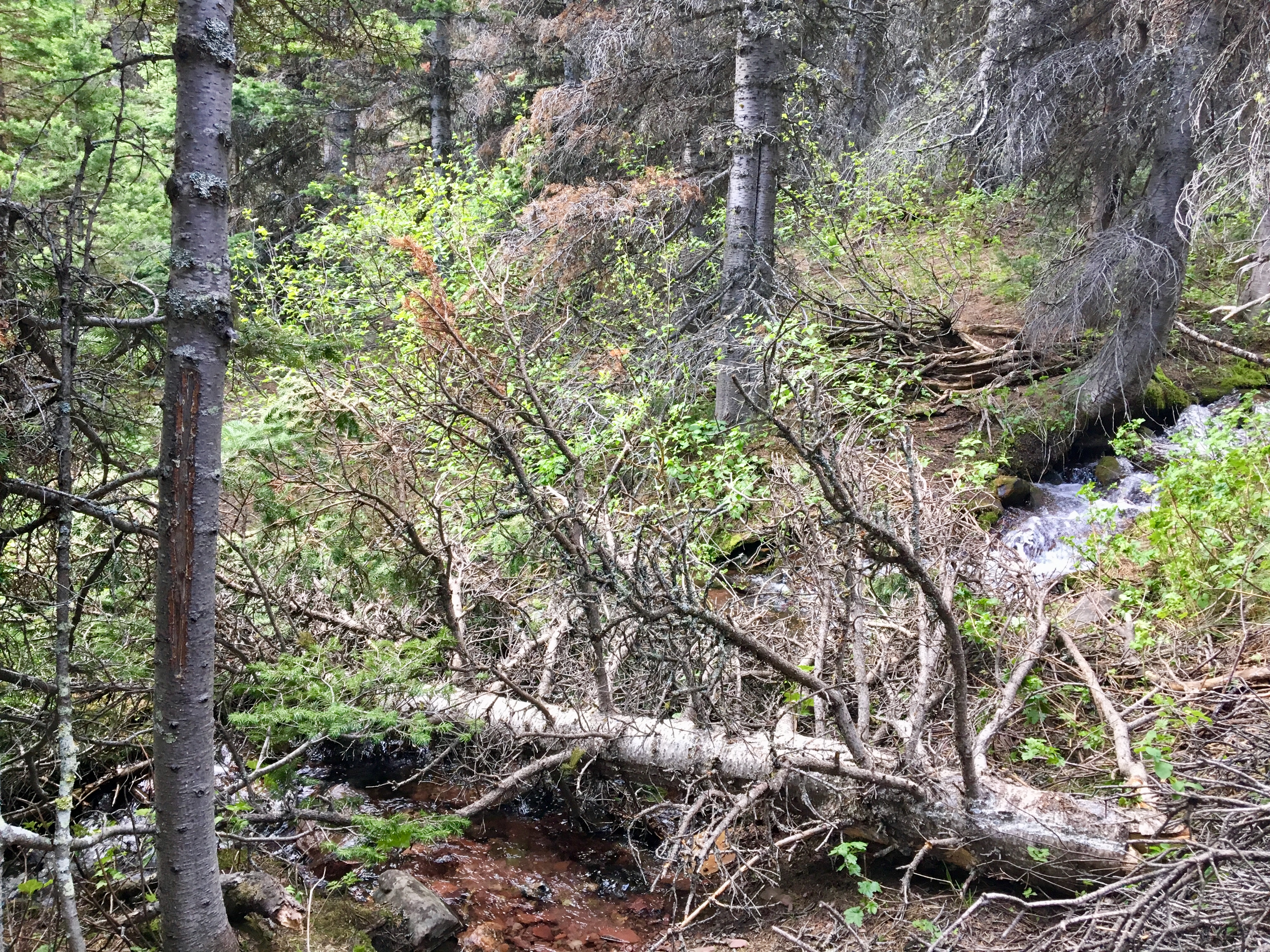
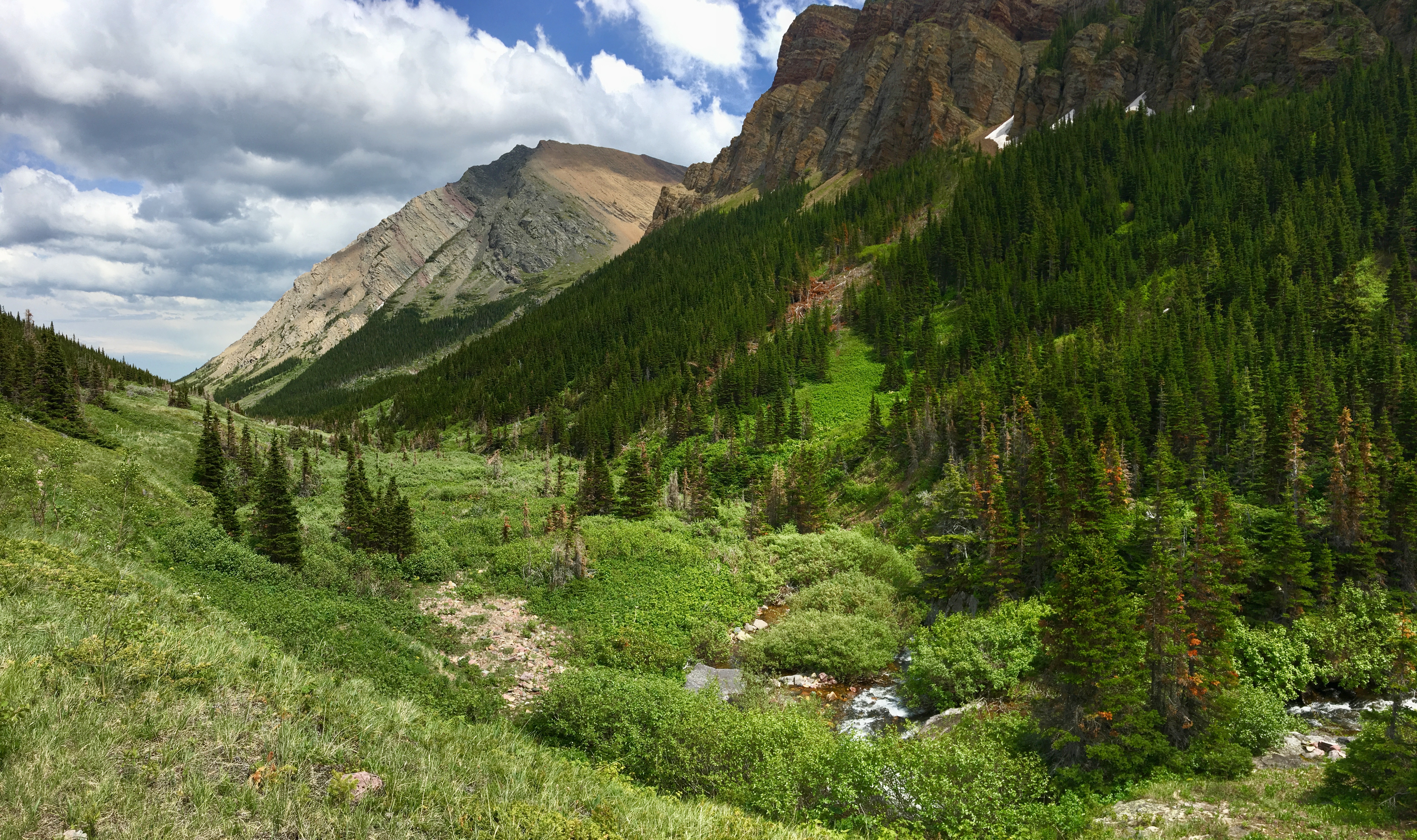
The trail starts out amongst the trees and is fairly flat. Pincher Creek is adjacent, and there are nice views of the creek from time-to-time. Here and there I saw some rapids and small waterfalls. Eventually the trees thin out, and a high point on Victoria Ridge is visible straight ahead. This isn’t the summit of the ridge, and the route actually traverses right to left under the visible cliffs. At the 6.6 km mark the trail departs the valley bottom and climbs steeply off to the right, heading into Thunder Basin. The trail actually remains quite distinct beyond this point, which is important to remember. Here and there a deviation from the trail was required because of deadfall trees. After that kind of deviation, I discovered that if I wasn’t on a very definite trail (there are lots of faint trails up there), I was off-track. An example of this is in the photo gallery.
A few switch-backs bring the trail significantly up in altitude, then the trail turns sharply out of the basin and traverses beneath the cliffs under the high point that was visible from the valley bottom. When viewed from across the valley, the faint trail of the traverse looks kind of precarious, but it’s not. I had no issues up to this point, but then I encountered a significant amount of snow occupying a steeply side-sloping, lightly treed area. This obscured the trail for a fairly long distance. I couldn’t see where the snow ended or where the trail came out of it. There wasn’t any significant exposure there, so a slip wouldn’t have been fatal, but it would have deposited my some distance down the slope, with a tough climb back to the route. Moving slowly and kick-stepping I was able to continue traversing safely and found the trail on the other side.
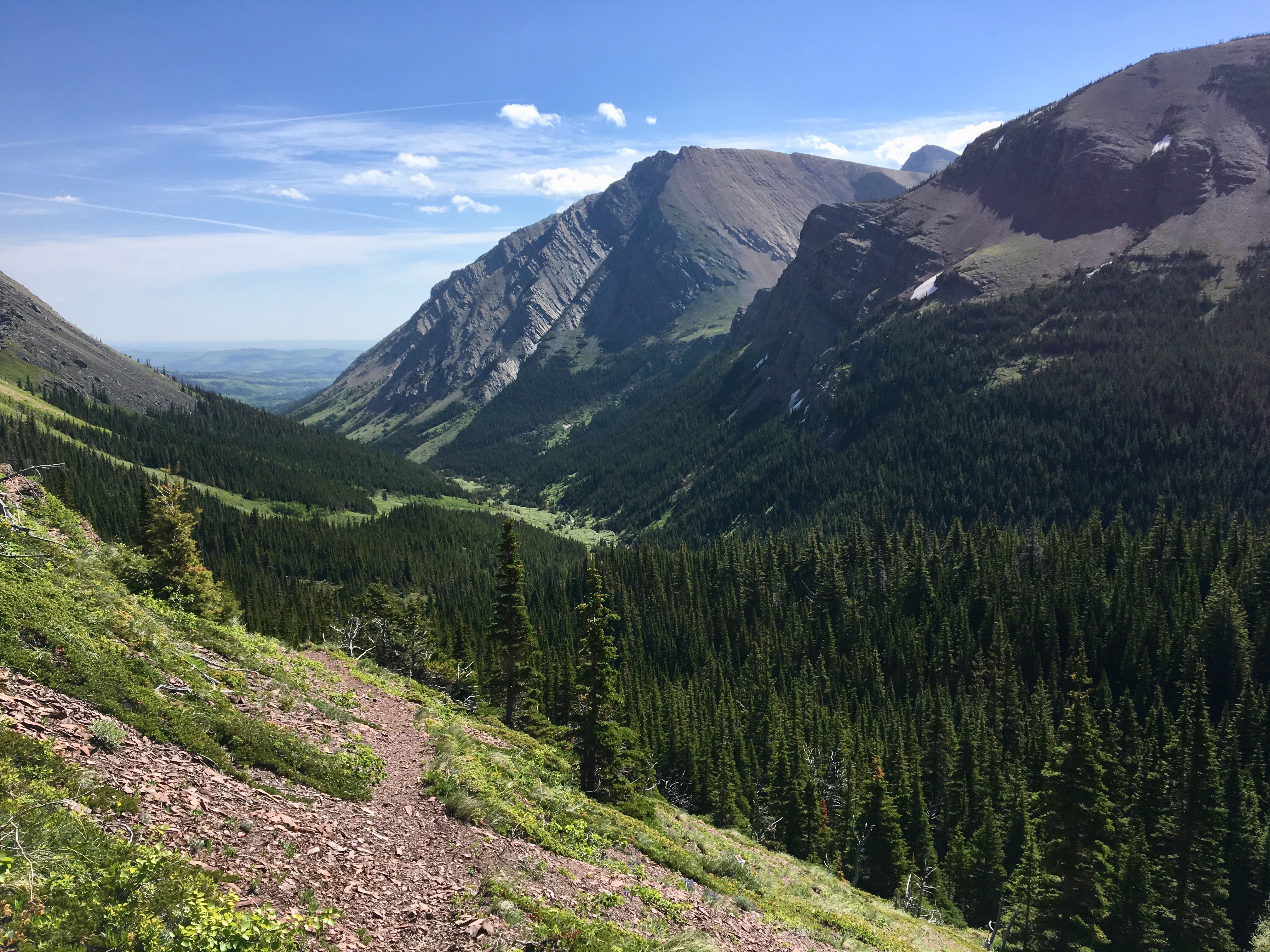
Beyond that point, the trail gently gained elevation, slowly heading to the saddle of the ridge. 2h 36m from my car I gained the ridge and was immediately treated to an amazing view of Windsor Mountain and Castle Peak. The saddle is bordered by a rise on the northeast edge that heads up to a high-point, and a cluster of spruce trees to the southwest. The route to the summit is through these trees.
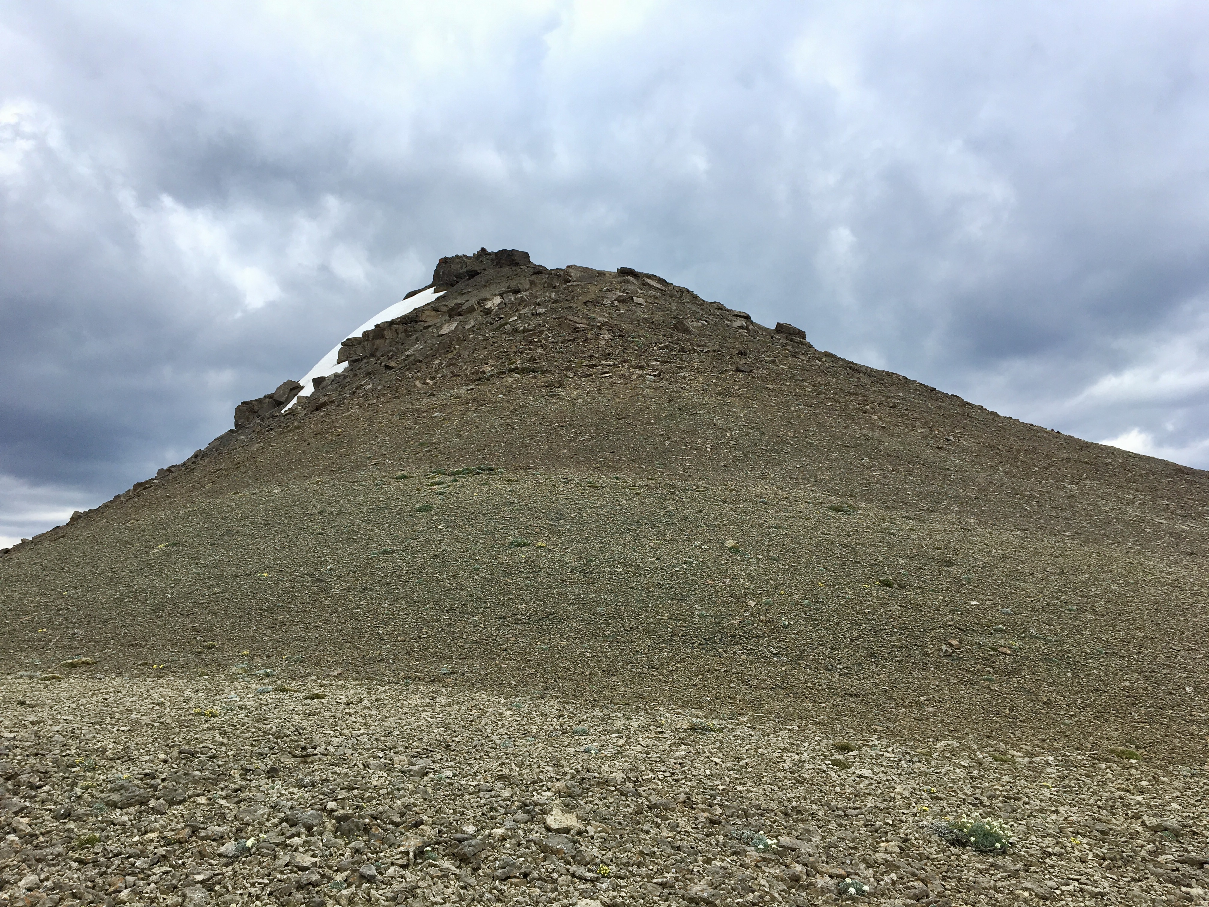
A brief exploration along the edge of the trees led to the discovery of a campfire circle and a faint trail leading beyond it. There was more snow up there, but the terrain was more favourable than on the traverse and I had no trouble continuing. Once beyond the trees, the long expanse of the ridge is visible, climbing towards what seems to be the summit. This is just a high-point along the way, though. The true summit lies beyond and can only be seen once the high-point is gained.
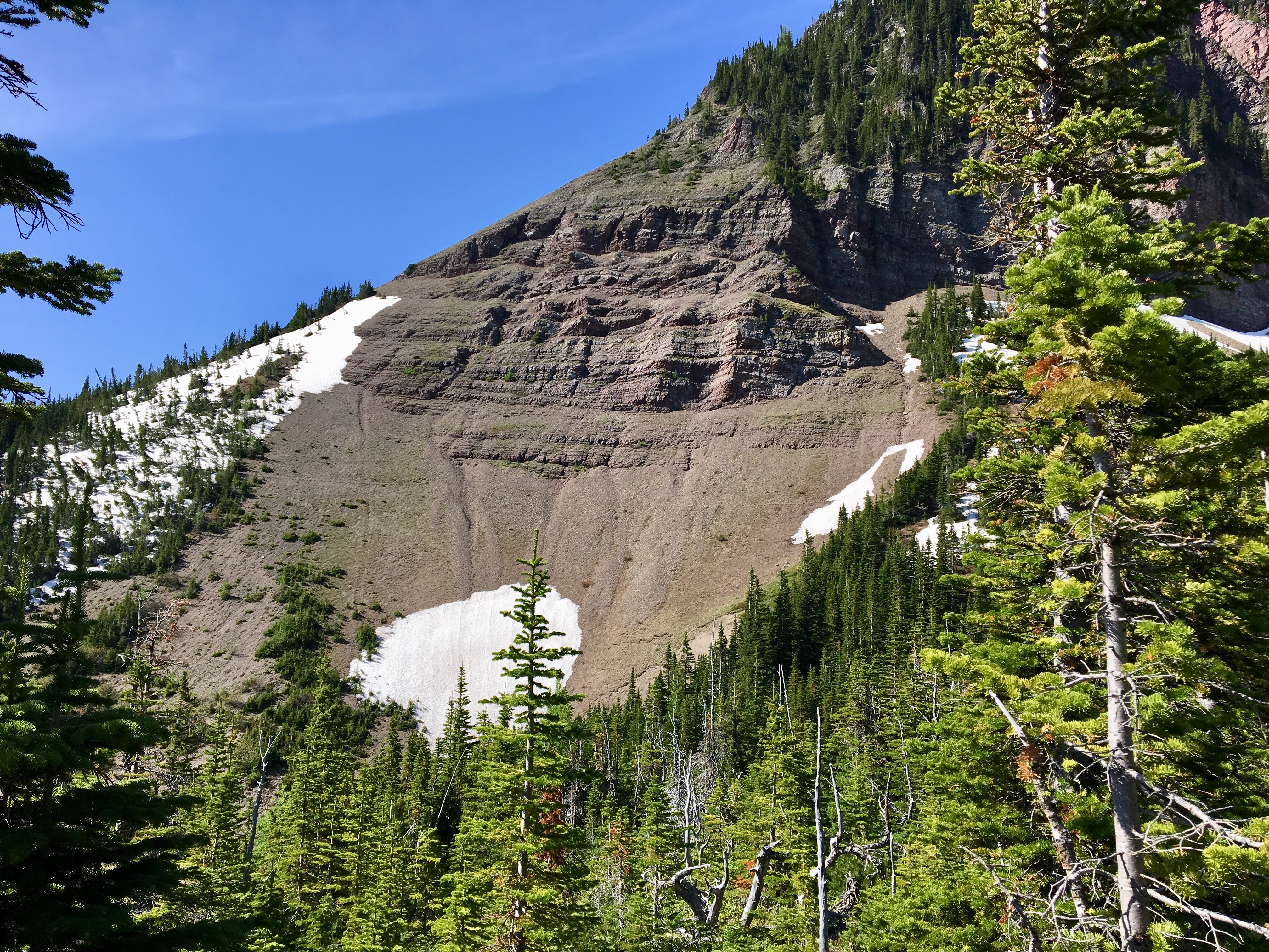
There was still snow beyond that point, but it was all loaded on the leeward side of the ridge. A faint trail was visible, but the route was obvious. The rest of the climb involved straightforward uphill hiking and some fun scrambling over a couple of bolder piles just below the high-point. I understand that there may be a way of circumventing the boulders to the left, but snow was covering that area. Besides, scrambling up the boulders was a lot of fun. Incidentally, there were a lot of deep crevasses between the boulders. If there were any snow cover obscuring the terrain, climbing among the boulders would be extremely dangerous.
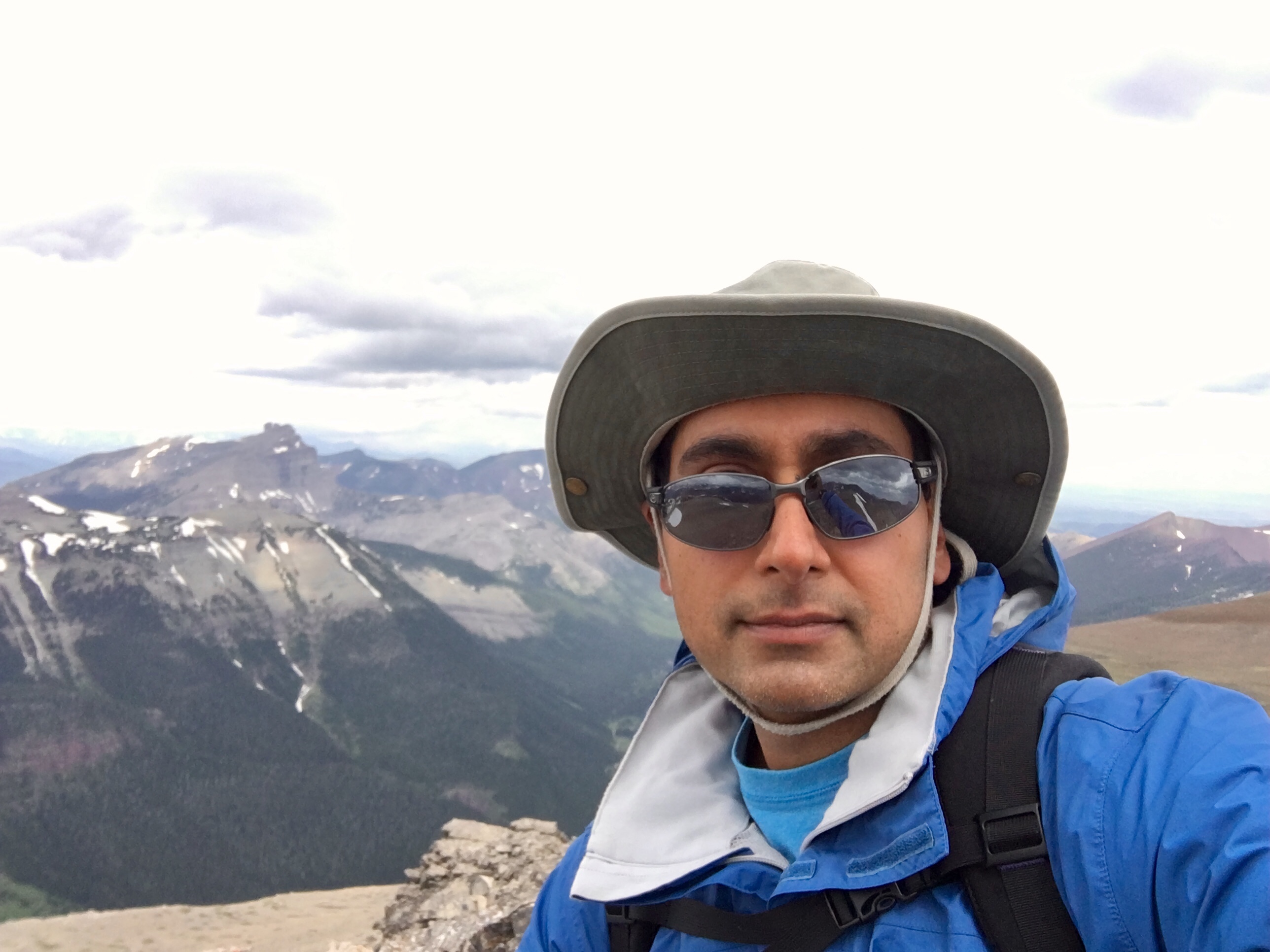
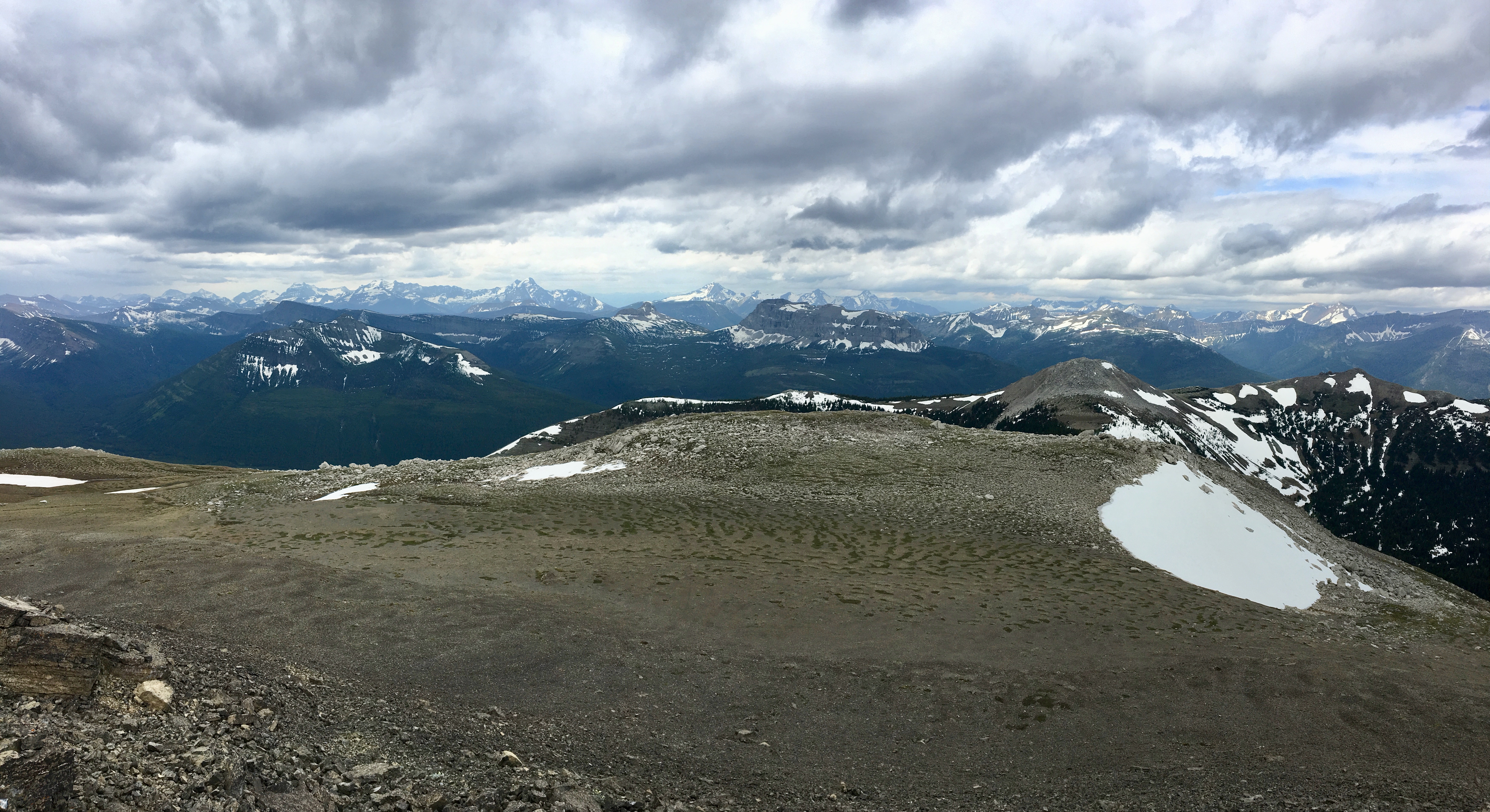
Beyond the high-point, the sharply-peaked summit comes into view. With a bit more uphill trudging, I got to the top after 3h 41m. As I got there, a cold wind picked up and dark clouds started rolling over. The views from the top were great, but obscured somewhat by haze and clouds. To the northeast, the long line of the ridge reaches towards Victoria Peak, and a col connects to Pincher Ridge with its distinctive bulls-eye marking. To the southeast, the ridge curves back out toward the prairie heading toward Drywood Mountain. Northwest is Windsor Ridge and Windsor Mountain (from the vantage point on the summit, Windsor Mountain obscures Castle Peak). Off to the west I could see a sea of unfamiliar peaks. The weather made them look somewhat gloomy, but on a sunny day I imagine the view would be spectacular.
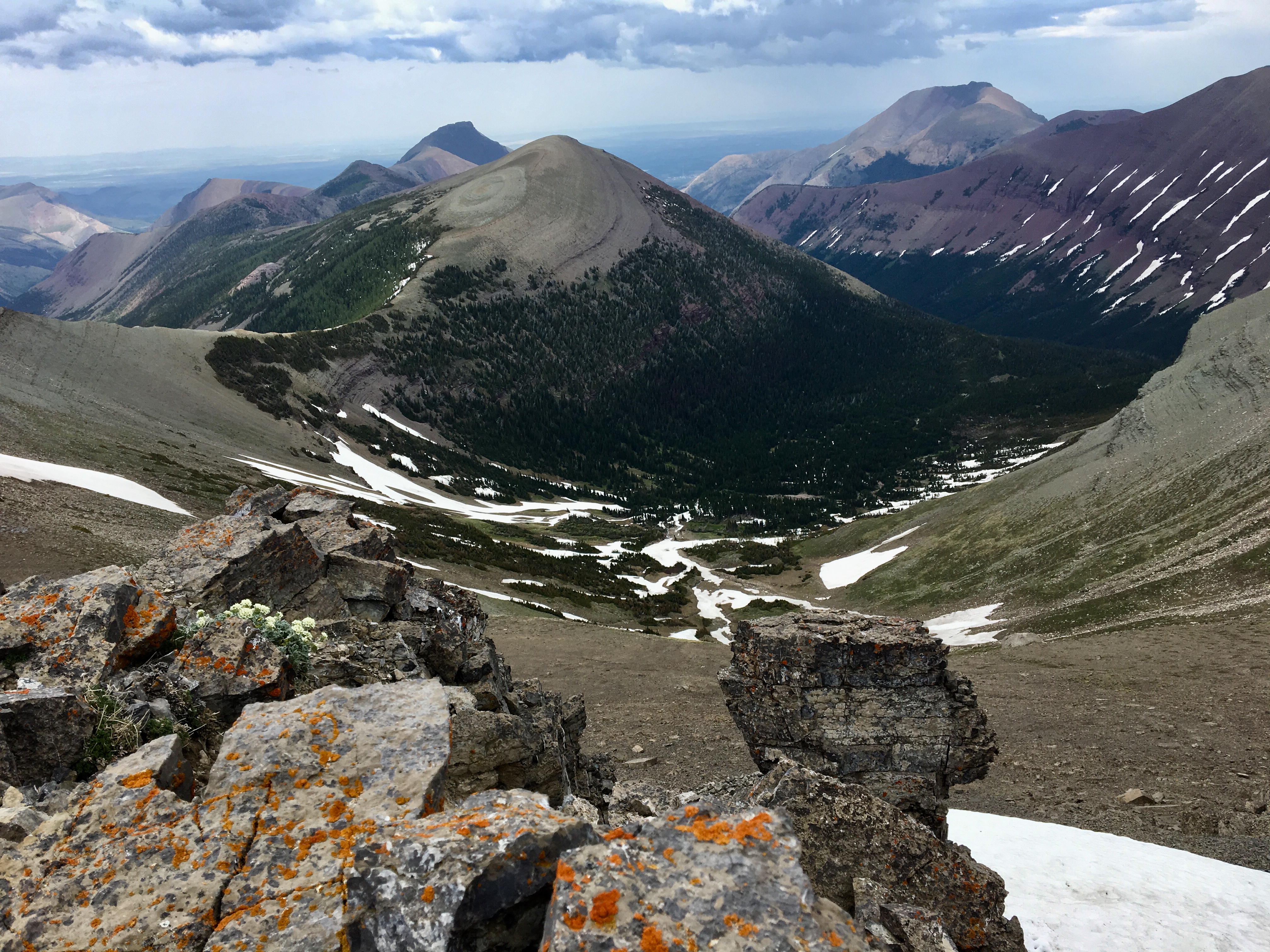
Because of the threatening weather, I didn’t linger on the summit. I took a few pictures, which was challenging because of the buffeting winds, and started down. No thunderstorm developed, and there was only minimal precipitation that touched me after I’d already made my way back to the valley bottom. My descent was slower than I thought it’d be because I kept stopping to take more pictures – the views are best on the descent. My very tired legs were happy to see my bike waiting for me at the end of the trail. I was able to coast most of the way back to my car.
Overall, this was a great trip and I’m surprised more people weren’t on the trail. I only encountered one other party – they were ascending the snowy traverse as I was descending. Access is very straightforward and there are no route-finding difficulties. My only worries involved the snow, so waiting until later in the season may be a good idea. The distances involved and the elevation gain lead me to classify this as a “challenging” hike. There’s easy scrambling involved in getting to the summit, but when the route is snow-free this could be avoided. Some parties would probably be just as happy to reach the saddle of the ridge and relax and explore. The trip is analogous to climbing Mount Lineham via Lineham Ridge, or Avion Ridge via Goat Lake – both in Waterton Lakes National Park. With most of Waterton shut down to hikers in 2018, this trip is worth a look.
Click on the pictures below to access full-sized images.


I love reading your blog and seeing your photos. Looks like a beautiful hike!
LikeLiked by 1 person
Very nice post with many details and of course photos
LikeLiked by 1 person
Hey Par we are going up Victoria on July 28th. This is Kelly – you hiked Vimy with my wife Carrie and Jennifer P last year. We chatted briefly at Twin Butte store over dinner. Love your blog. Hope you can join us on the 28tb. This is a Castle-Crown hosted hike – I believe we hit the trail at 9AM. Cheers 🍻
LikeLike
That sounds awesome! Is there a sign-up?
LikeLike