My smoke-free 2022 hiking season came to an end with this scramble, though conditions weren’t too bad. I wanted to do another peak along the Spray Lakes Reservoir. My first choice was Mount Lougheed but I was advised not to do it on my own, so I went with Mount Sparrowhawk instead. I got an early start and enjoyed good condition aside from the smoke. I think I may have been a little too early, though, since much of the smoke cleared away during my descent.
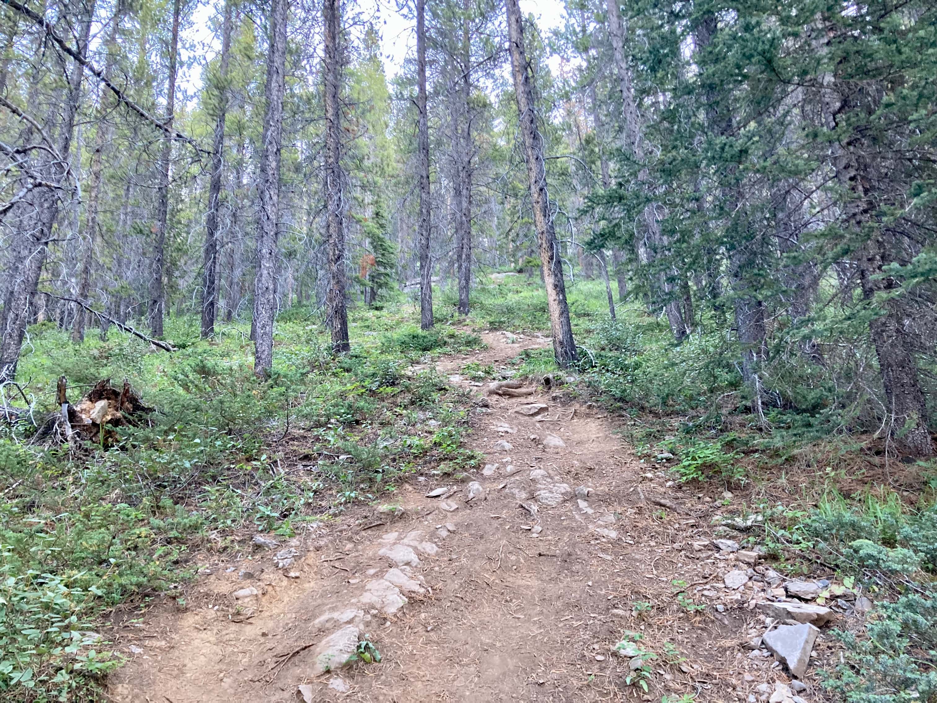
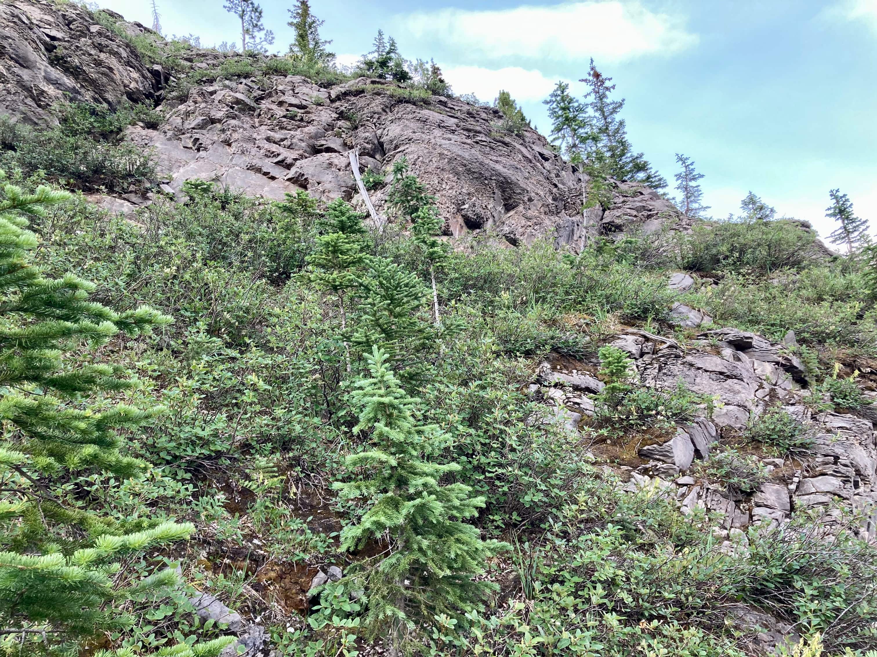
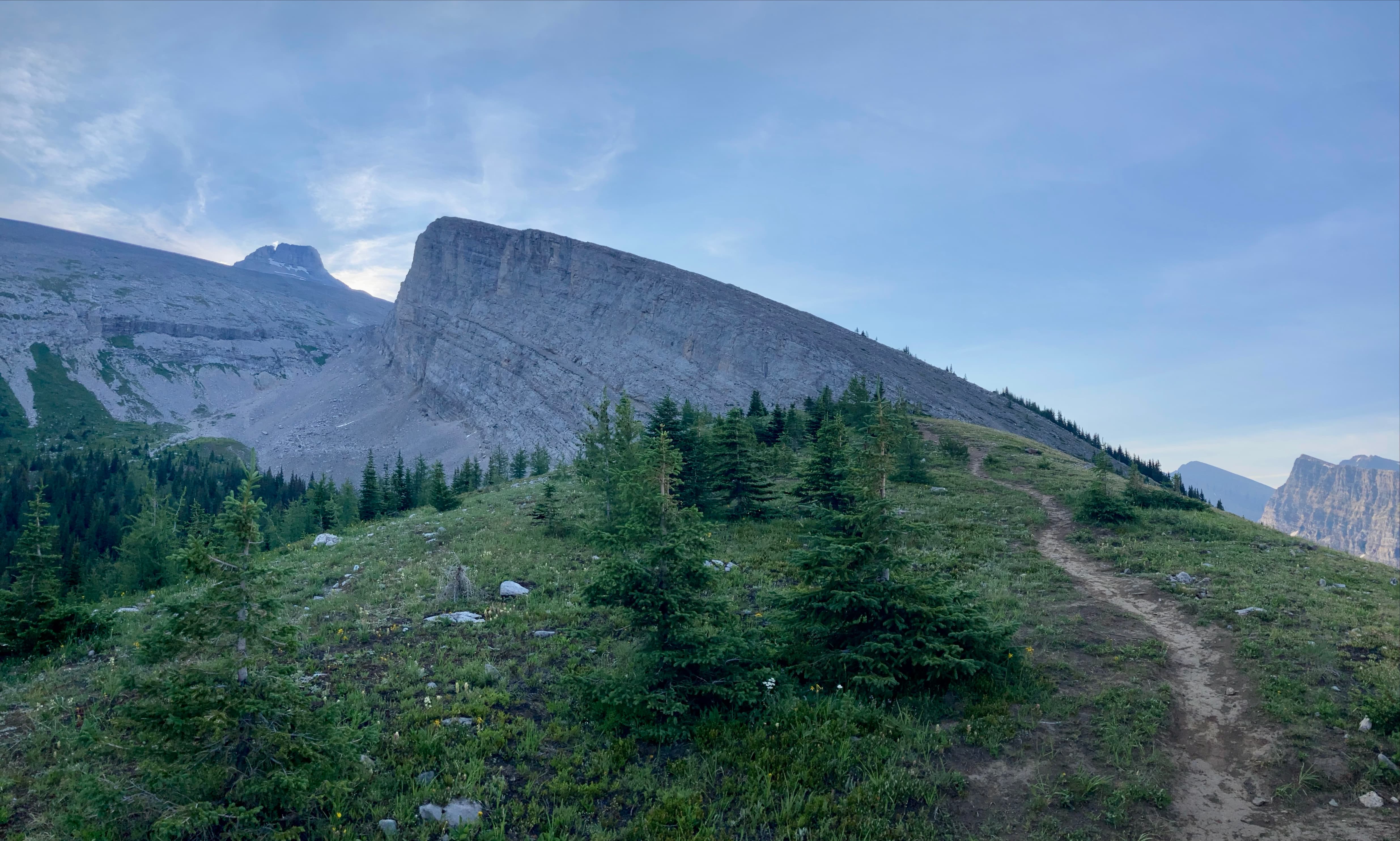
Access is from the Sparrowhawk Day Use Area. Click here for the Google Map. A trail goes from the parking area back to the main road and continues on the far side, ascending into the forest. I took the left fork where the trail passed a pair of benches, then went left again at another fork marked with a cairn. The trail got a little steeper and rougher beyond there and eventually reached a rocky grey slope. Here I could see a trail carrying on forward as well as one coming down from the right side. I ended up going straight ahead. There was flagging along this trail, and it eventually turned right (uphill) and seemed to parallel a higher ridge. It went through the woods for a time and eventually fizzled out (or I missed a turn). I turned toward the ridge which I could see had been slowly climbing away from me. With a bit of scrambling I was up on the ridge and joined another obvious trail. On my way down I would follow the trail on the ridge all the way down and confirmed that it led to the original uphill fork I didn’t follow. The terrain on that rocky slope was actually very steep and the exposed rock somewhat smooth and slippery. Perhaps the flagged route I’d followed on the way up was intended as a bypass.
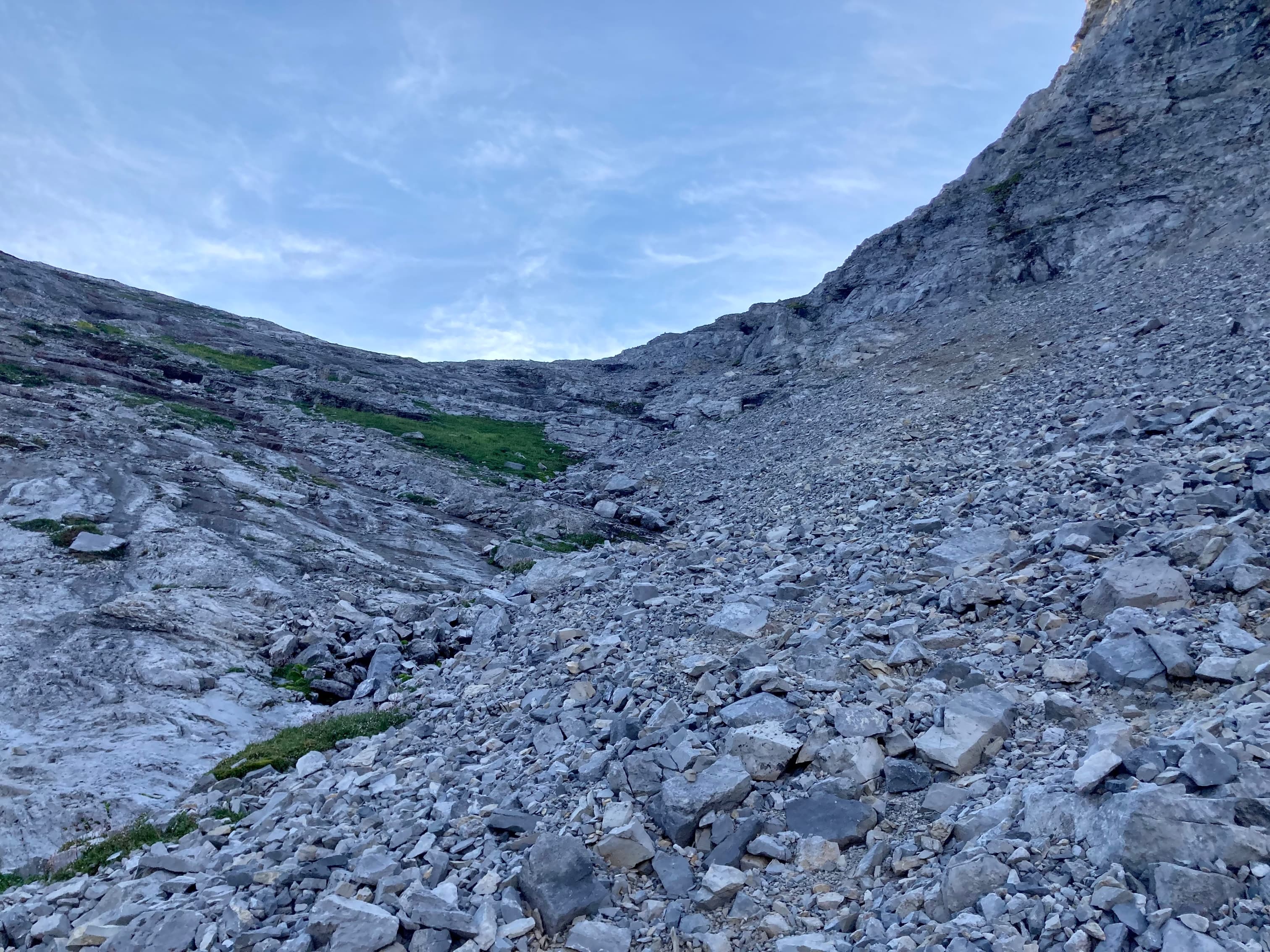
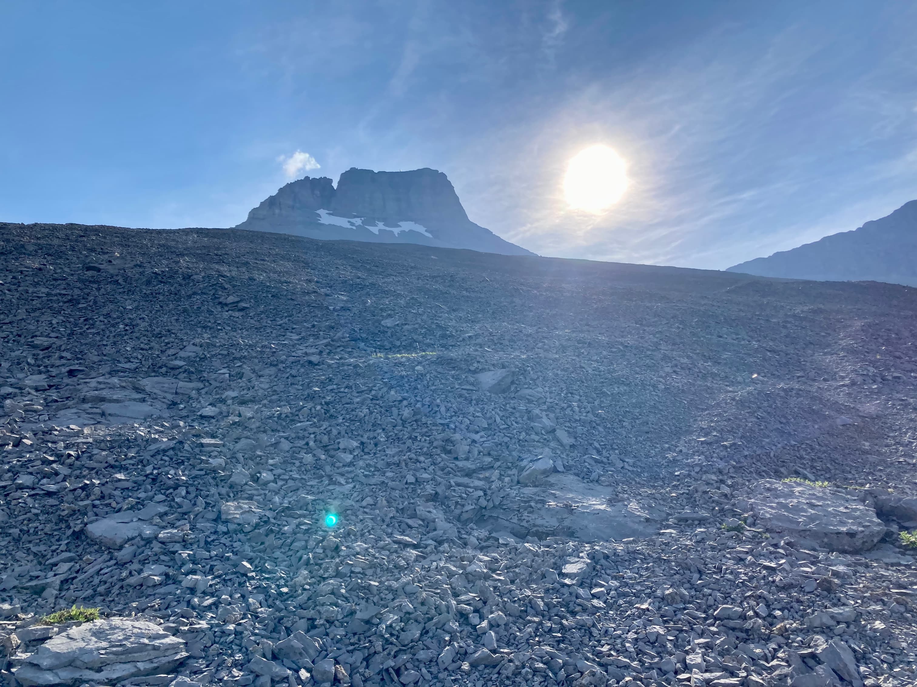
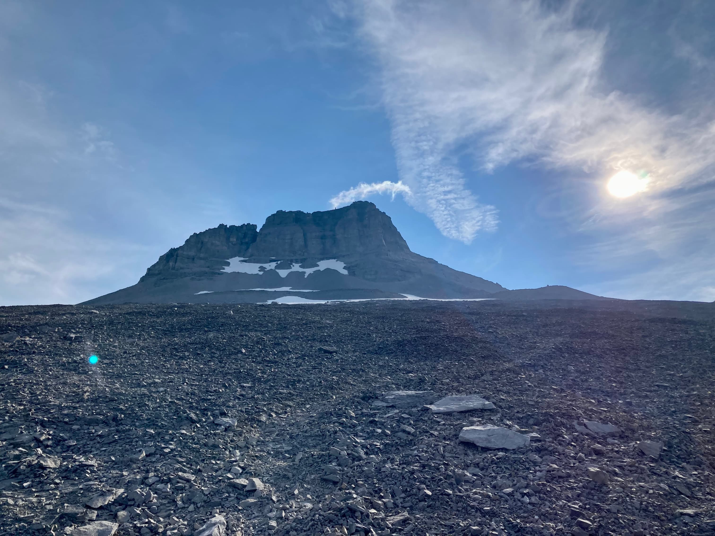
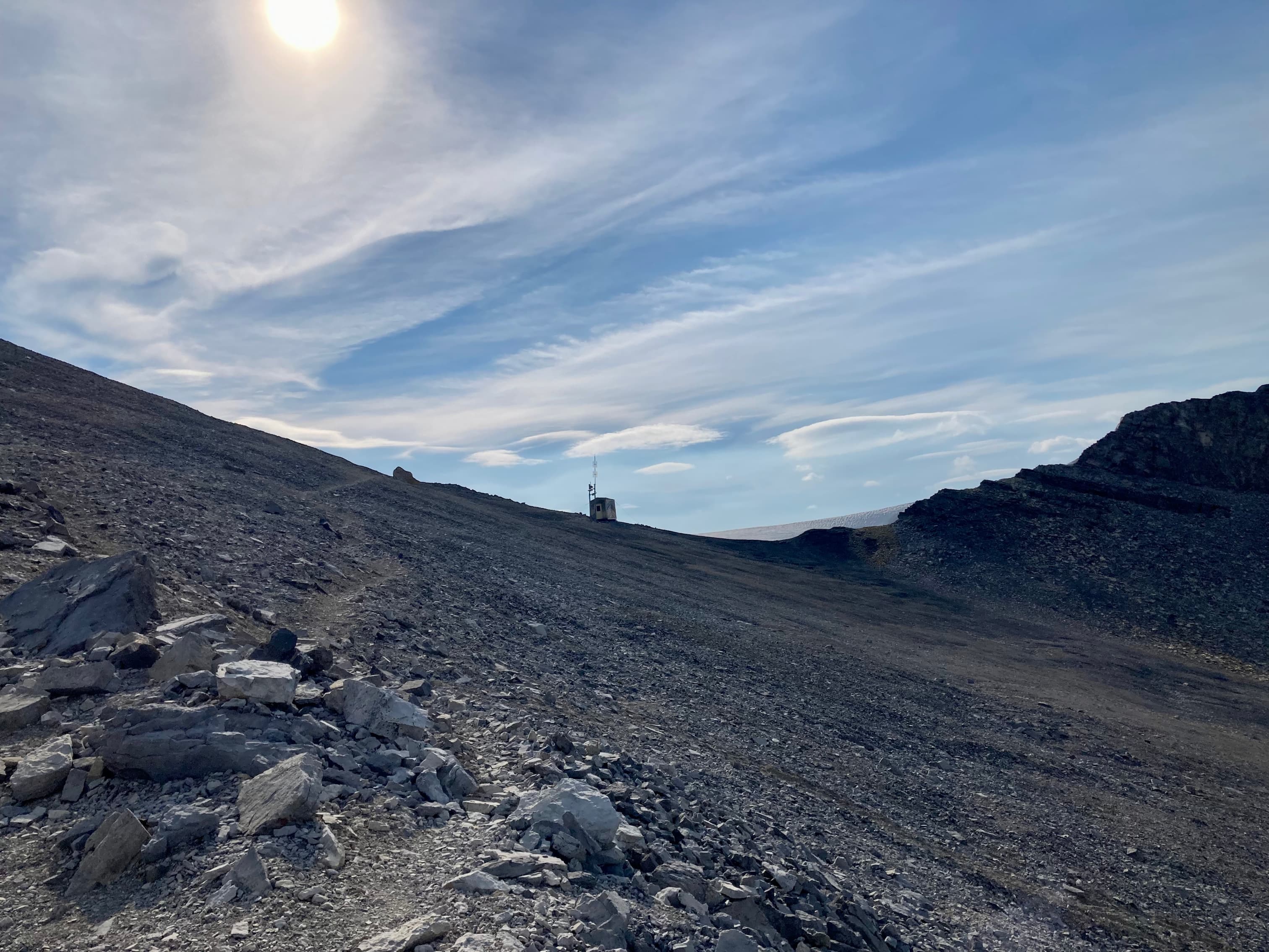
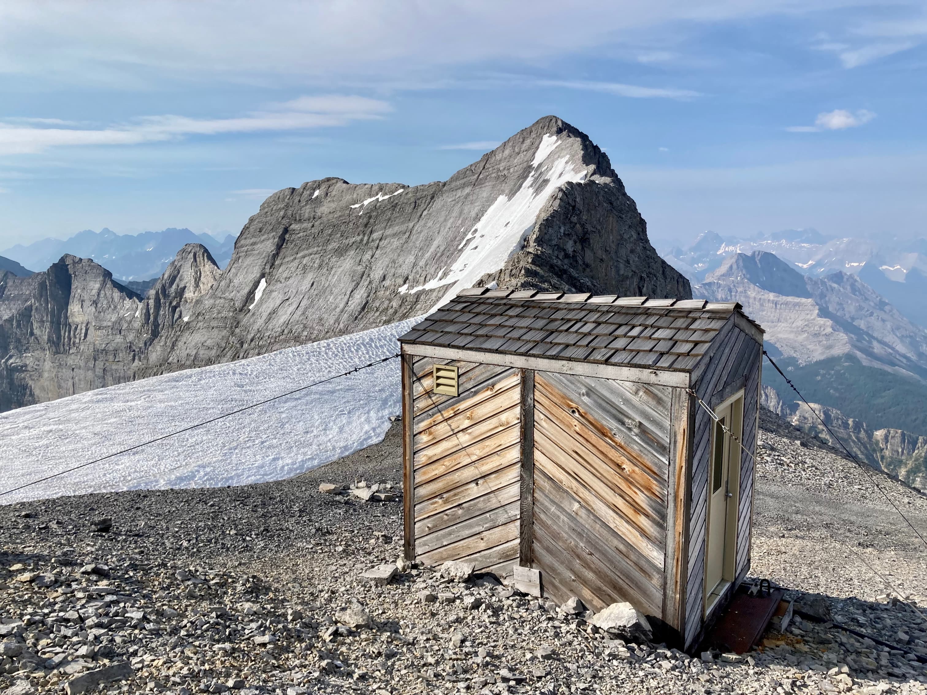
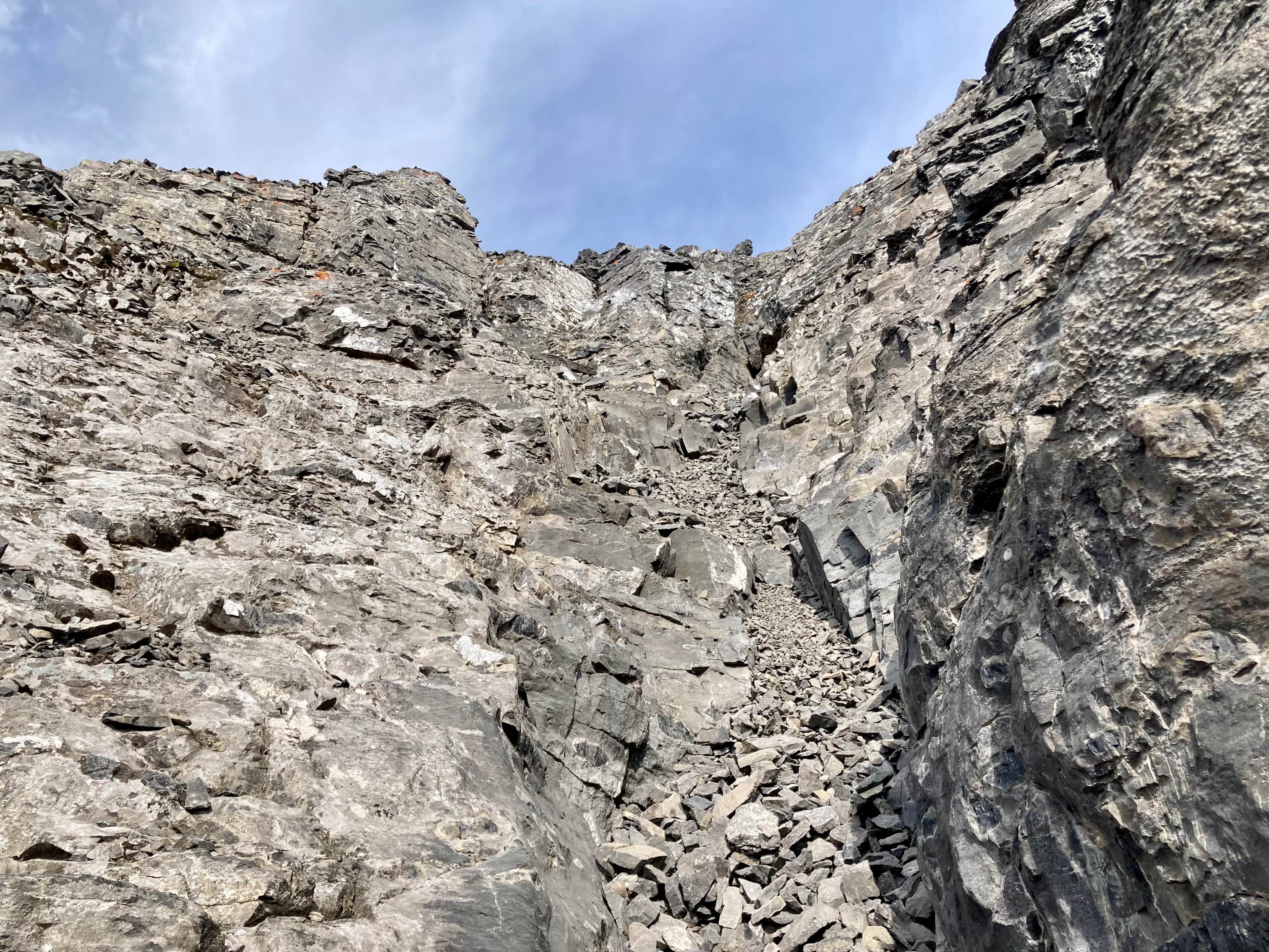
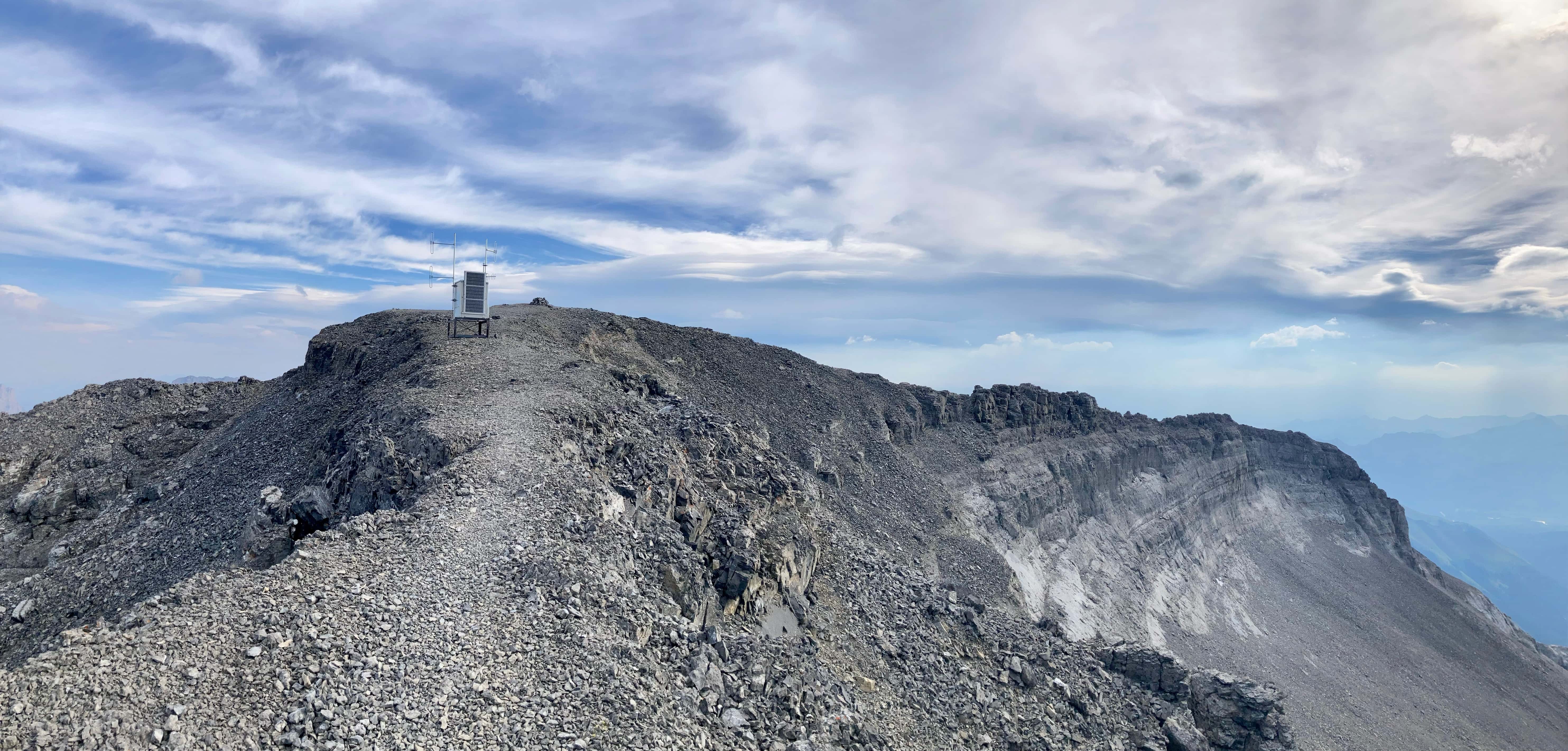
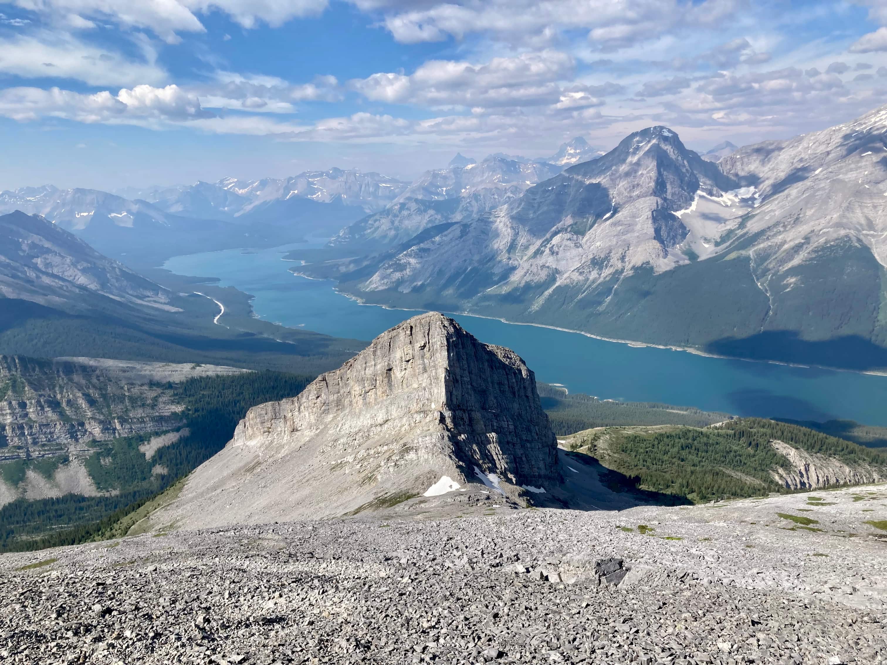
Carrying on, eventually Read’s Tower (a massive stone outcrop) and the summit of Mount Sparrowhawk came into view. Once onto a grassy rise near Read’s Tower, I followed a trail which descended a short way and bypassed Read’s Tower through a field of rubble on the left side. With a bit of climbing on the far side of the rubble field I was up on the huge southwest face of Mount Sparrowhawk. A defined trail marked with occasional cairns led to a col to the south of Sparrowhawk’s summit. A little hut and antennae sat there. From there I picked a route up through loose rocks towards the summit block. The south-southeast aspect has an obvious weakness and ascending required only a short segment of hands-on climbing. Another structure with antennae greeted me at the top of the scramble and I could see the summit cairn a short distance away.
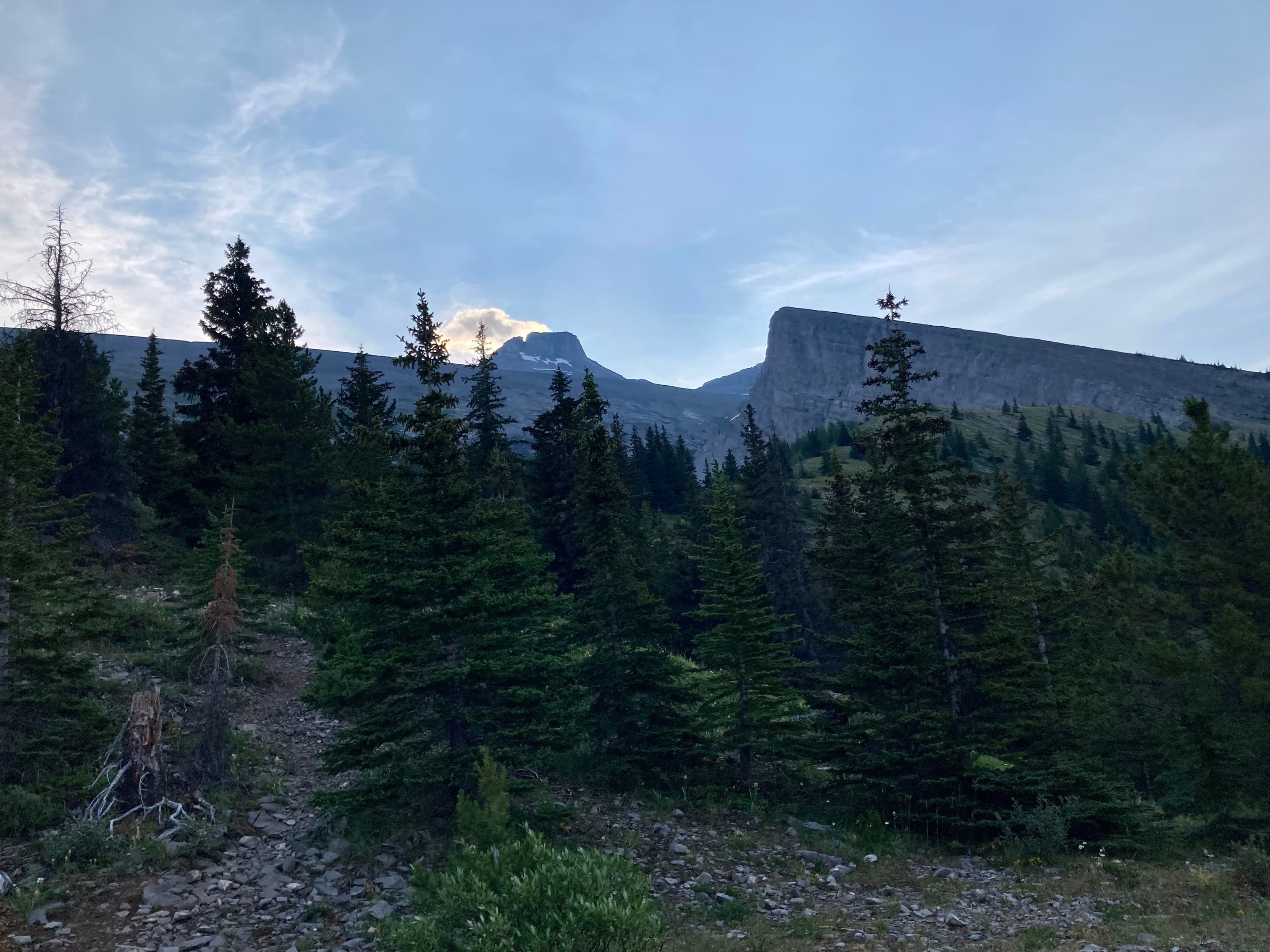
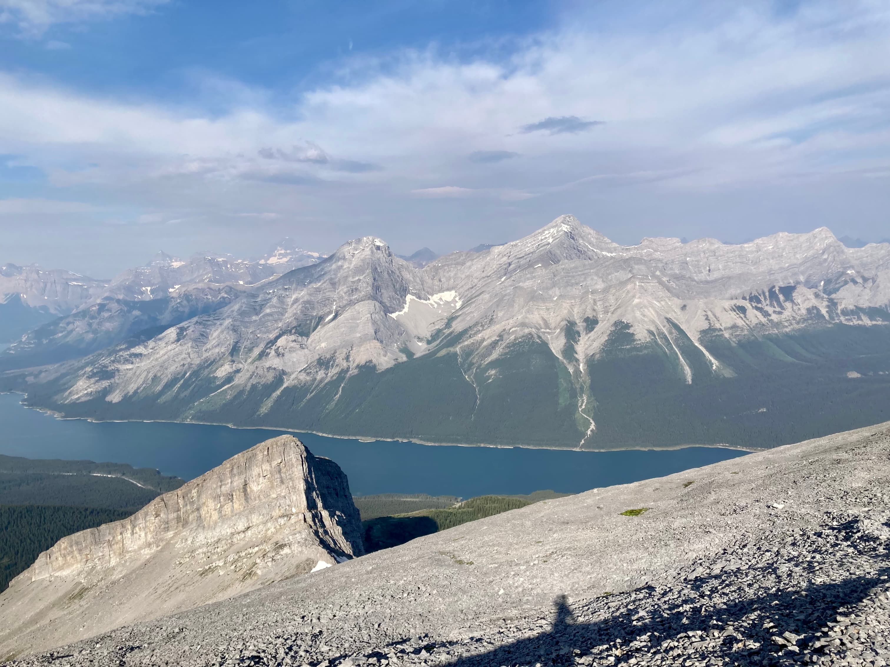
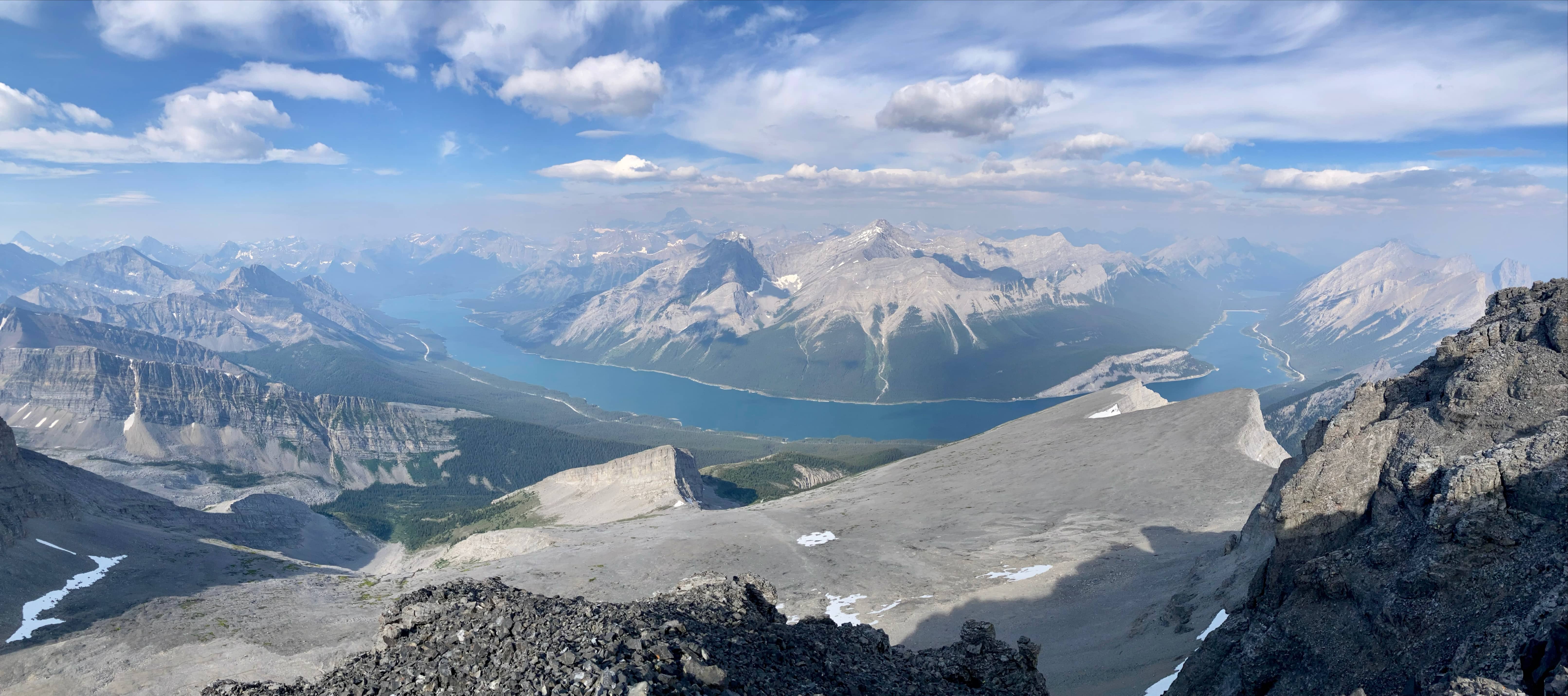
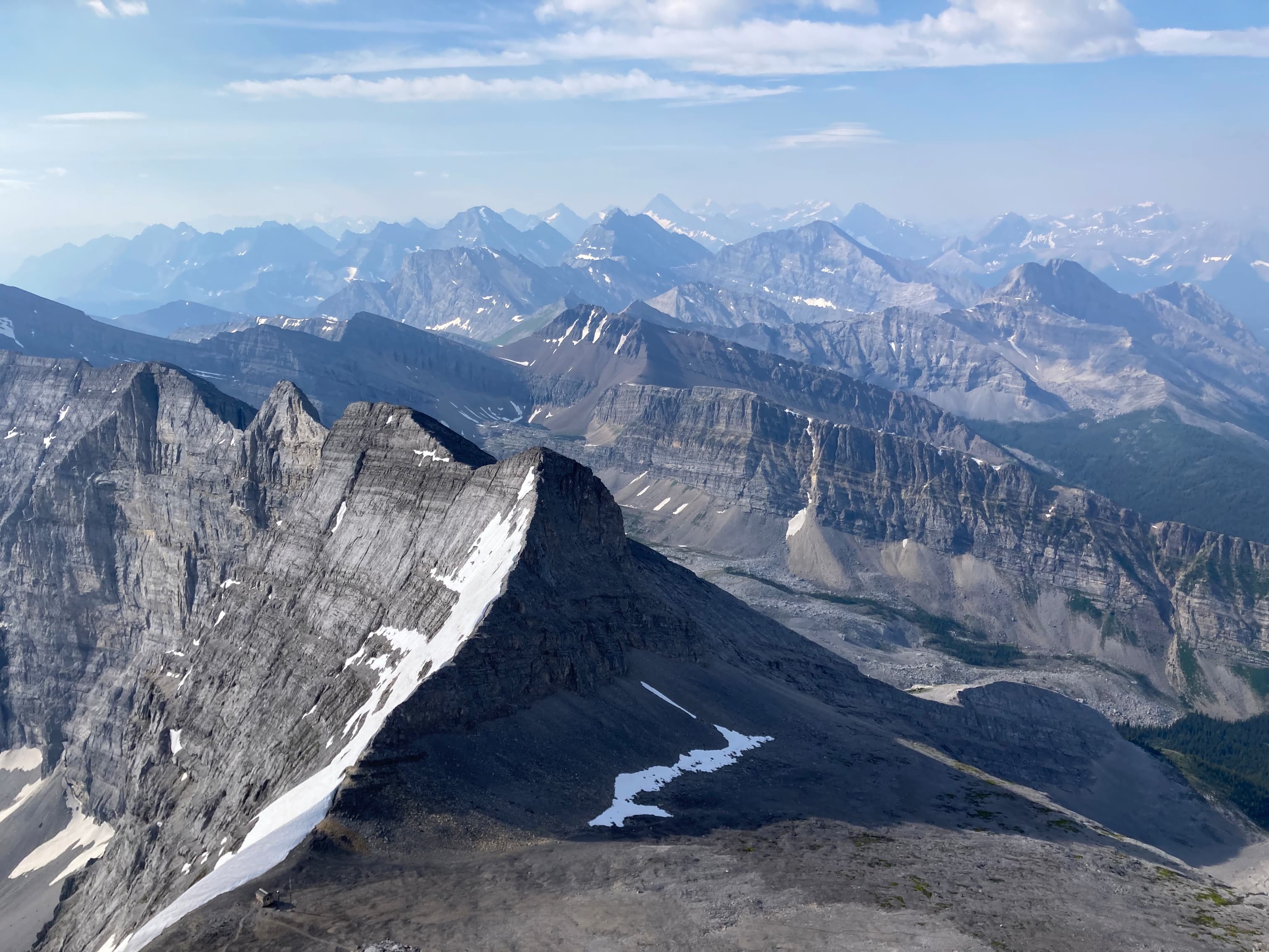
The views were satisfying, though I was a little disappointed by the smoke obscuring distant peaks. Nearby Wind Mountain and Mount Lougheed were very impressive, as were Mount Bogart and Ribbon Peak. I stayed for a while at the summit and the smoke did clear a little. By the time I was descending things were quite a bit clearer to the west. I encountered a party of two on their way up, and one gentleman pointed out that the smoke situation was still a lot better than in 2021 (which was true, but I was still little disappointed). I enjoyed the fine views in front of me as the smoke slowly cleared.
Click/tap on the pictures in the gallery below to access full-sized images.
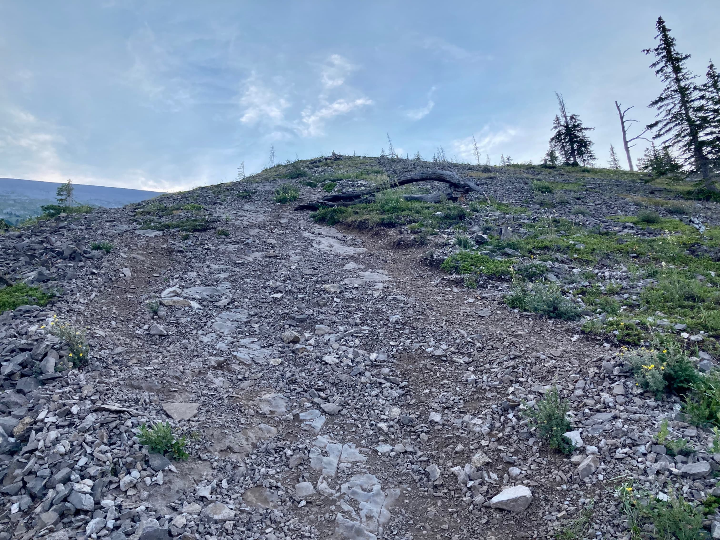
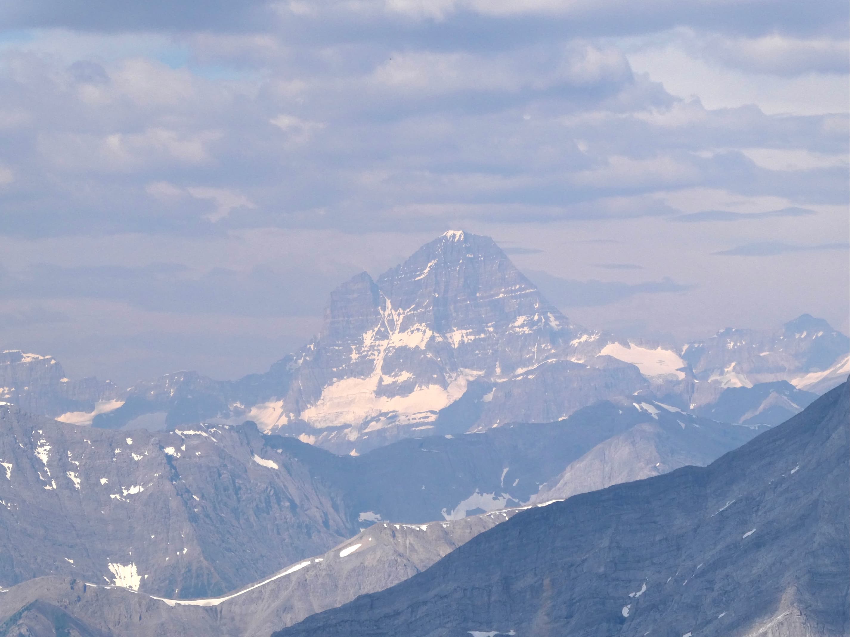
Route overview looking southeast.A trail from the parking lot at the Sparrowhawk Day Use Area comes back up to the main road. The trail continues on the other side of the road, ascending into the forest.I followed the left fork at these benches.Left at this cairn.The trail got a little more rough and steep beyond the cairn.The trail eventually came to the base of a rocky slope. There was an obvious path continuing straight as well as other ascending to the right. On my outbound leg up I went straight, discovering a flagged path that turned right and paralleled this rocky slope as it rose and became a ridge. On my return, I came down along the right-hand path, discovering it was a very direct path but with some areas of tricky footing because of smooth slabs and steep grade.An example of the terrain if you go right at the fork. It was steeper than this makes it look. Nothing too difficult provided it’s in dry conditions. I think the trail I ended up following on my ascent was an attempt to bypass this.I went straight ahead at the base of the rocky slope and I ended up following a flagged trail through the woods that swung right then paralleled a ridge as it started to rise away. The trail petered out and I climbed onto the ridge here.Back on the usual route and ascending.The summit (left) and Read’s Tower (right) come into view.On open grassy slopes heading towards Read’s Tower. The route to the summit involves leaving this trail and dropping into the gully adjacent to Read’s Tower.I followed this faint trail down into the gully. It soon became much more defined and was joined by another trail coming down from the ridge.Down in the gully next to Read’s Tower. The trail soon entered the debris field.Climbing out of the gully.Out of the gully. The summit is once again in sight. From here there was an obvious trail (or two) through the debris, marked occasionally with cairns.Looking back at Read’s Tower.Ascending with the sun in my eyes.Looking back after climbing for a while, now above the level of the top of Read’s Tower. Mount Nestor and Old Goat Mountain are on the other side of the lake.After more climbing the entire summit block was in view. From this side it looks unassailable, but there’s an easy way up around the right side.Nearing the col south of the summit.The little hut on the col. I don’t know what this is for. The northwest spur of Mount Bogard is on the other side of the col.Ascending towards the summit block from the col.Ribbon Peak and Mount Bogart were to the right as I ascended. Two of the Memorial Lakes were visible.Some scrambling just below the summit. Nothing tricky, but the grade was steep and the rocks were very prone to tumbling down with the slightest disturbance.Almost up, looking right.At the top of the scramble. The summit cairn is a short distance away.The summit cairn of Mount Sparrowhawk.Looking north. Mount Lougheed and Wind Mountain are across the valley. To the left the Three Sisters are visible. A fair amount of smoke obscures more distant peaks.Looking east to southeast. Ribbon Peak and Mount Bogart are across the valley. Mount Kidd is just beyond. Plenty of smoke to the east but clearer air southeast.A broad panorama looking west. In the foreground is Sparrowhawk’s broad southwest face. Read’s Tower is lower left of centre. Across the reservoir are Mount Nestor and Old Goat Mountain. Mount Assiniboine is in the distance just left of centre.Extending east from the summit is a narrow ridge. To the left is a long, precipitous drop. To the right is a shorter precipitous drop. I made it as far as the cairn.Another look over at Ribbon Peak and Mount Bogart. A lot more smoke to the left vs the right.From a slightly different position on the summit block I could see down to the hut on the col.Looking due south.DescendingAlmost back to Read’s Tower. The smoke was starting to thin. Mount Assiniboine is a little more clearly visible. Distinctive Mount Eon is to its left.Mount Assiniboine An Alpine AsterWalking out.